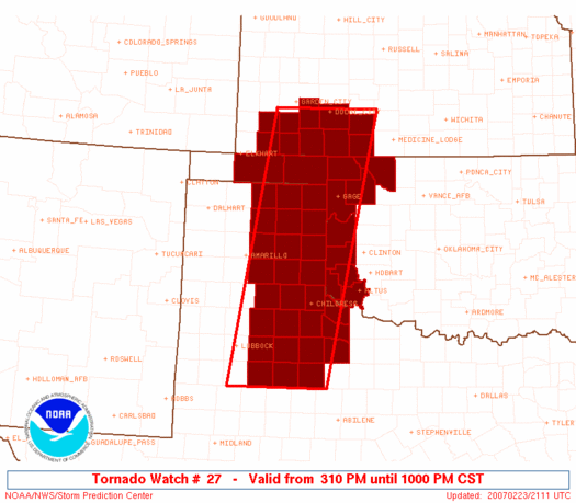
Early-season supercells develop in the Texas Panhandle, bringing us the first hail and lightning of the year.
What looked to be a very marginal early-season tease from several days out gradually grew more and more impressive, at least by February standards; as the day approached, models remained consistent with the synoptic evolution of strong lee cyclogenesis over Colorado and a resultant dryline setup over the Southern High Plains. The biggest question was simply whether convection could initiate before the early February sunset, as the best upper-level support was forecast to arrive during the evening and overnight hours. After a long, depressing Plains winter, myself and just about every other chaser in Tornado Alley was more than willing to get into position early just on the off chance that a pre-sunset supercell or two would explode the forecast favorable environment. A moderate risk on the SPC day 2 outlook Thursday afternoon was all the more motivation; seeing that over the High Plains during the winter months is simply unheard of.
By the morning of the event, daytime initiation was beginning to look more favorable, but concerns were growing over low-level moisture return and resultant instability. The 12z RUC showed dew points struggling to reach the mid 50s by late afternoon over most of the threat area - namely, the eastern TX Panhandle into W OK. By noon, dew points of 53-55 deg. F were appearing on the Oklahoma Mesonet in the southern half of the target area, leading to relative confidence as Brandon, Bryan, Aaron Gleason, and I departed from Norman in Brandon's car. We arrived in Elk City a bit after 2:00pm and stopped for data and lunch at Subway. After viewing the new SPC MD and a brief conversation via cell with other chasers, we decided to press westward on I-40 to Shamrock. My initial inclination had been to camp out in western Oklahoma and wait for any activity to scream eastward towards us, as storm motions were sure to be quite difficult for anyone who wound up behind a storm with the excessive mid-level winds. However, the short-range models had continued to pull the dryline farther west into the Texas Panhandle, shifting the core of the threat area with it.
Between Elk City and Shamrock, we broke out of the cool, stratus-covered sky that had plagued us all day, and noted significantly warmer temperatures with widespread cumulus. As we pulled into Shamrock to look at data again, conditions felt ripe for convection with dew points of 55-57 deg. F. Further communication with other chasers convinced us to head southward on US-83, with the thinking that daytime initiation was more likely near Childress. Well, little more than halfway to Wellington, Bryan noticed an anvil barely visibile through the junk clouds to our west; when we got to Wellington and refreshed the radar, we saw that a storm was indeed going up west-northwest of us and moving rapidly towards the northeast. This prompted a mad rush to head back north towards Shamrock; considering daytime initiation had been such a huge concern, we weren't about to let this early bloomer get away from us.
Unfortunately, this did not prove to be a great choice; by the time we returned to Shamrock about 15 minutes later, the storm was moving into cooler, more stable air north of I-40 and looked very disorganized on radar. At the same time, two new cells had quickly developed to its southwest. It was now time to decide which of those two to pursue with only an hour of daylight remaining. Drawing from our still-infantile knowledge of mesoscale meteorology, we figured the southernmost storm would be the best bet. Road options proved problematic, as we needed to reposition southwest to meet up with the storm before daylight left us, but paved roads were of little use in that regard. After some conflicting opinions within our group, we eventually jumped west on I-40 to get on TX-1547 southbound.
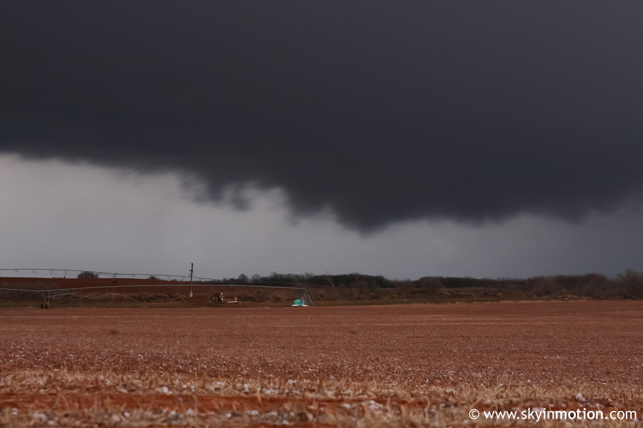
For the next hour or so, we meandered around the area near Quail as the southernmost storm passed just to our west and north. Identifying storm features was very difficult owing to copious stratus in the area - no surprise for a very-early-season chase. We did observe periods of intense rain and small hail, along with frequent lightning and gusty winds. Eventually, the updraft base came into view and we paralleled it to the south heading east towards Wellington. Some notches and plenty of scud, but certainly nothing all that ominous.
We checked data one final time in Wellington and saw that there were no additional promising storms, so we began the drive home, stopping in Erick for dinner with a large group of fellow OU chasers.
All things considered, it's tough to complain about a halfway legitimate chase in February, regardless of the outcome! Granted, the coverage and intensity of storms did not live up to its potential (especially for a moderate risk day), largely thanks to insufficient instability. But after several months of storm deprivation, getting under a borderline-severe cell and taking in the sights, sounds and smells of hail, lightning and thunder again was nothing less than thrilling.