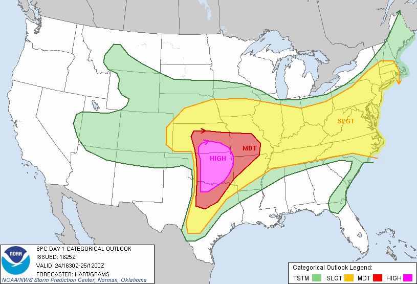
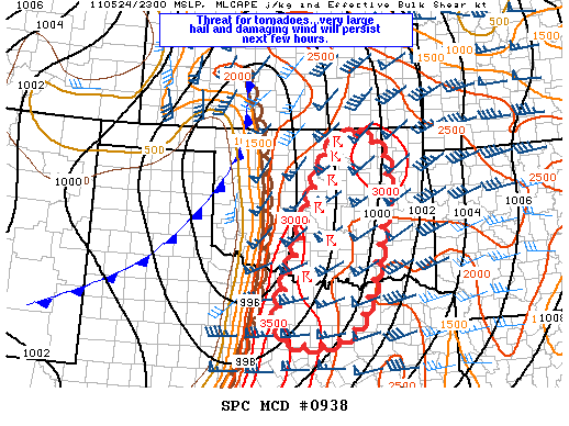
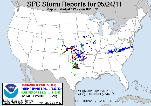
Every ounce of pain inflicted by Oklahoma and HIGH risk days over the last five years is redeemed in a matter of hours...
Observed 3 tornadoes.
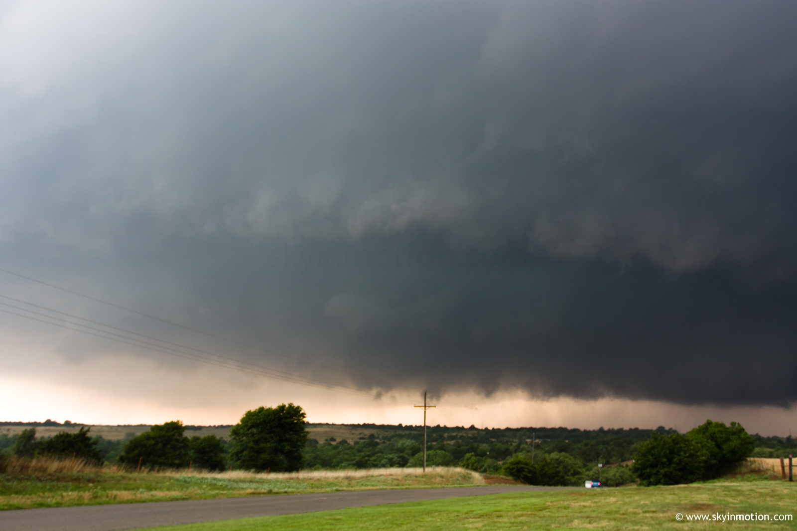
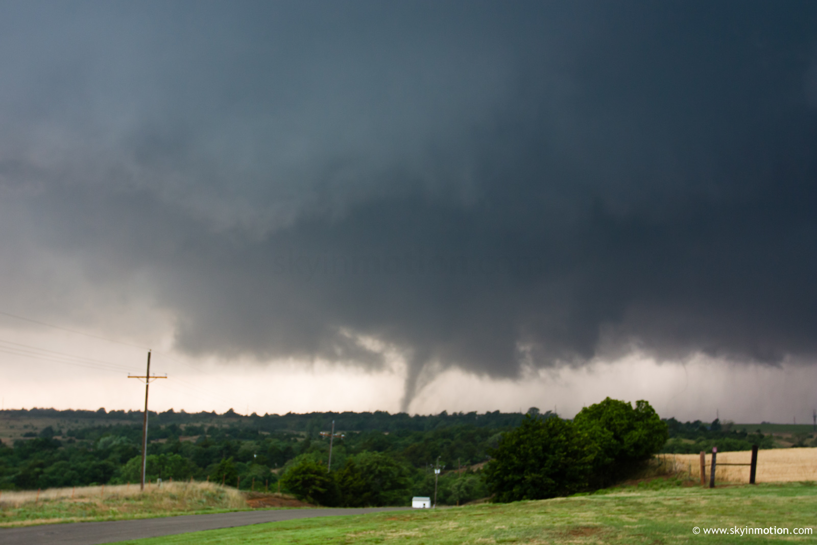
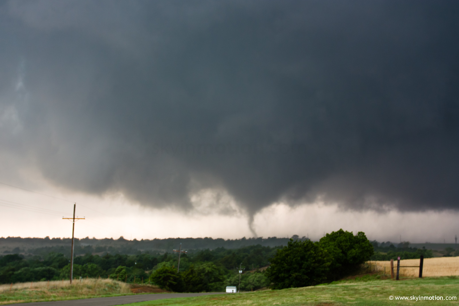
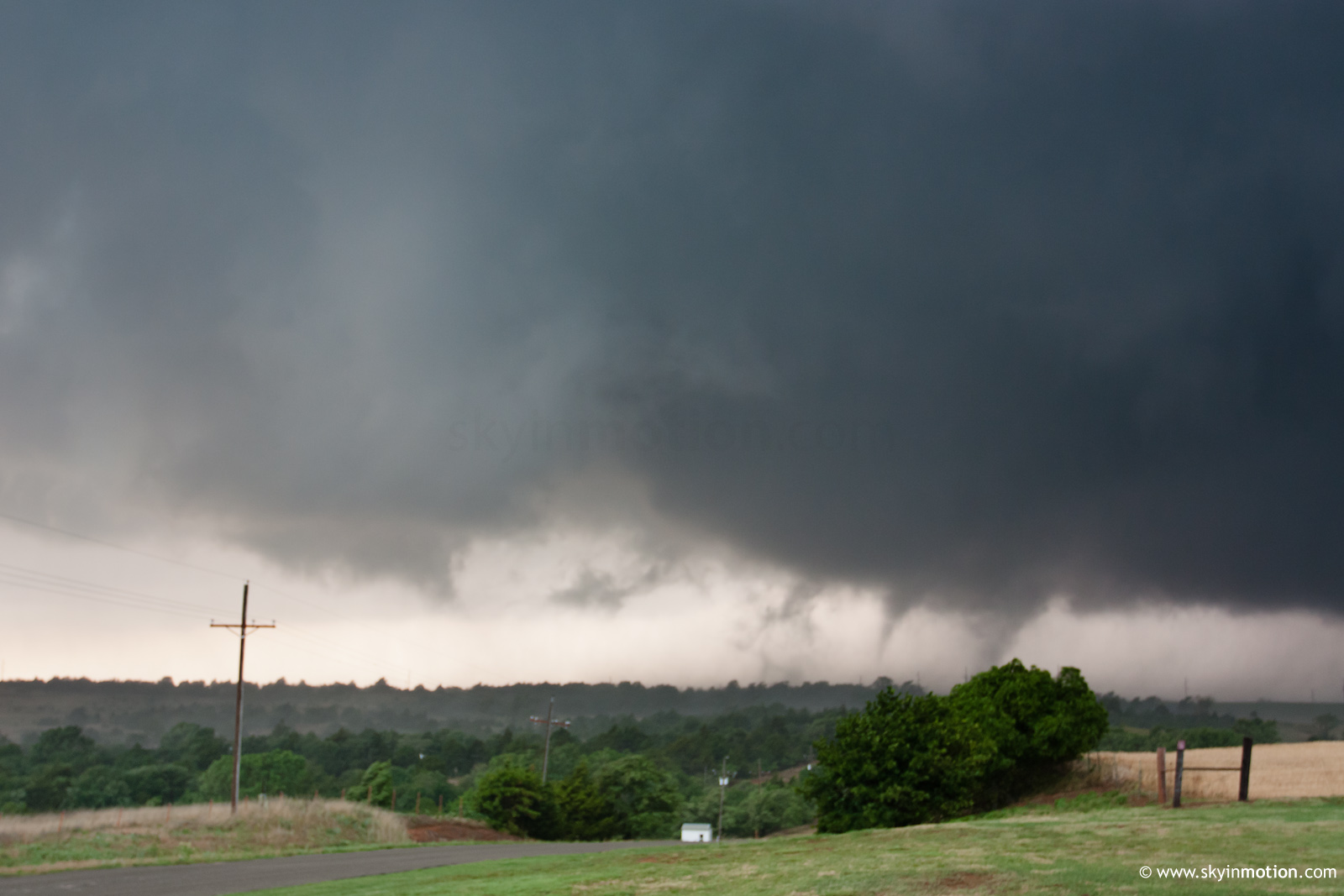
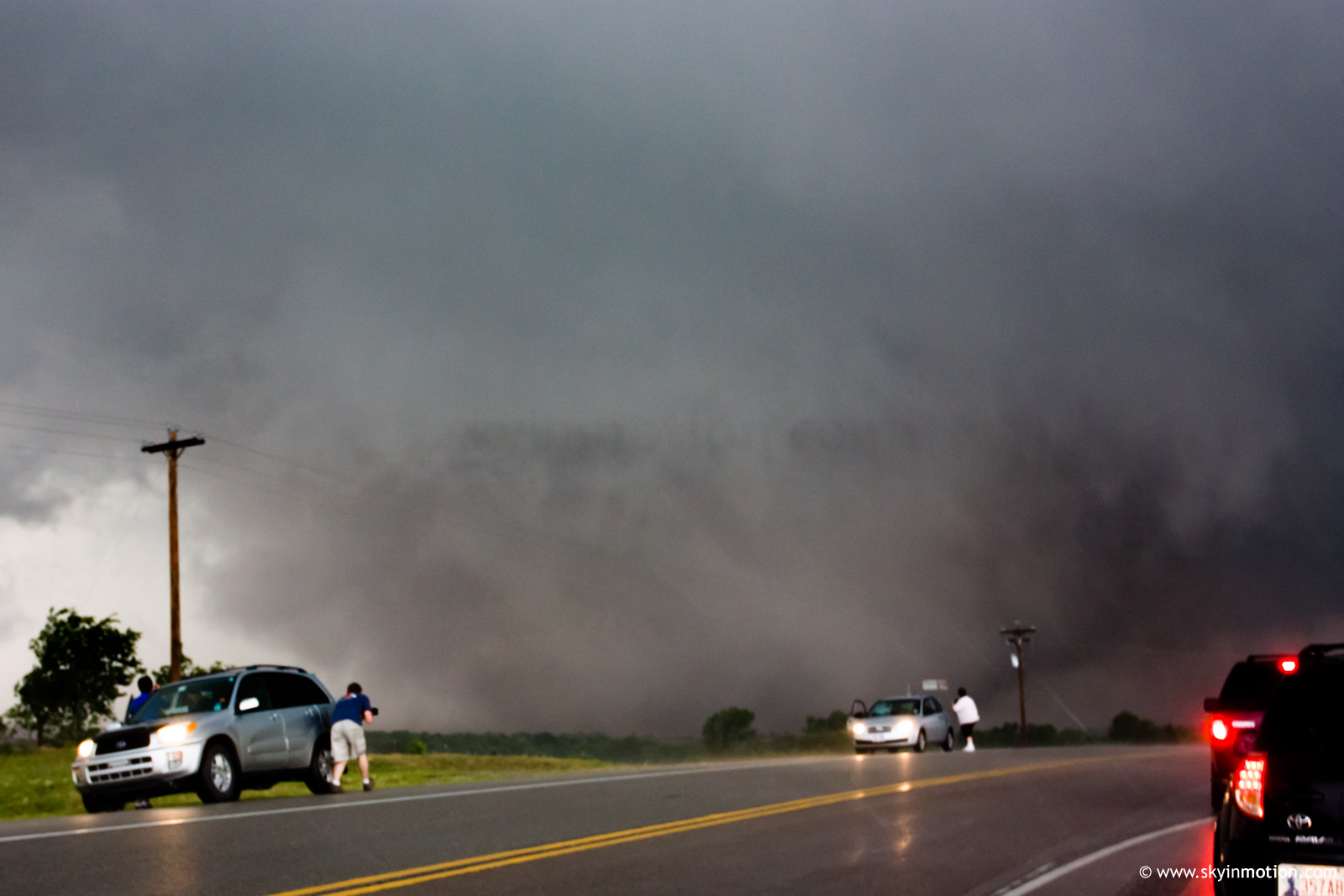

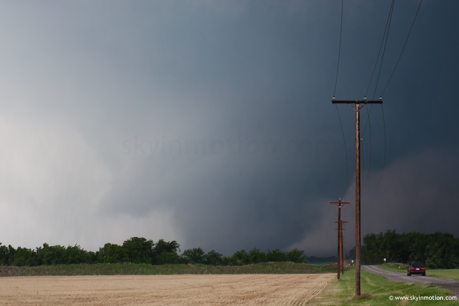
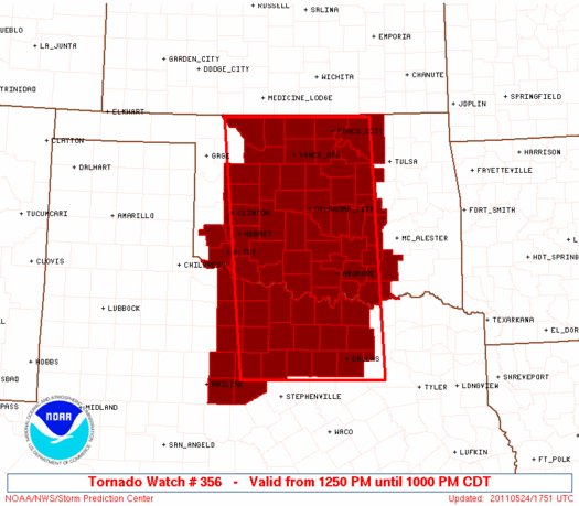
Brandon Lawson and I observed tornadoes on three supercells S of I-40. We initially targeted Blanchard-Chickasha, but moved W rather quickly after realizing initiation would occur earlier than expected. Around 2030 UTC, we arrived on the rapidly-intensifying cell near Binger and staked out a spot just W of Lookeba (in a ton of hills and trees) to watch the meso approach. As it did, it took on a carousel appearance, and it became clear that a multi-vortex tornado was imminent. After 30-60 seconds of sporadic but intense vortices dancing beneath it around 2035 UTC, it rapidly transitioned into a large wedge about 1/2 mi. to our W, forcing us to retreat back to US-281. In the process, we essentially missed the best view, as we were too close to make out its size and were also partially blocked by the surprisingly-awful terrain for W OK. Upon returning to US-281, we jaunted N maybe half a mile to watch it cross the road ahead of us.
This strong tornado quickly disappeared into the rain as it moved off to the E, and this along with extensive debris and downed powerlines blocking US-281 made it an easy choice to drop the storm for new ones to the S. Needless to say, it would go on to produce extensive damage through Canadian and Logan Co.
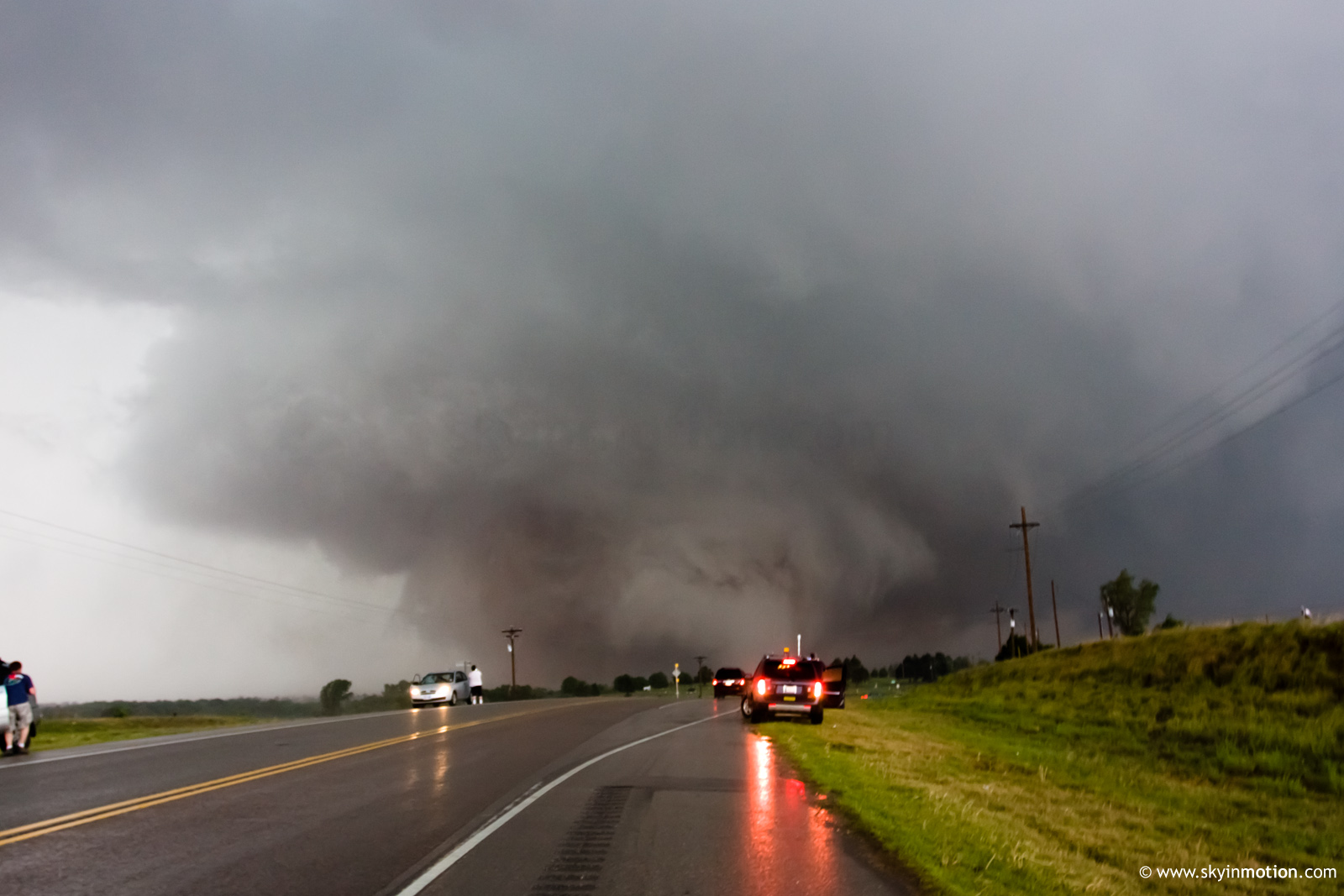
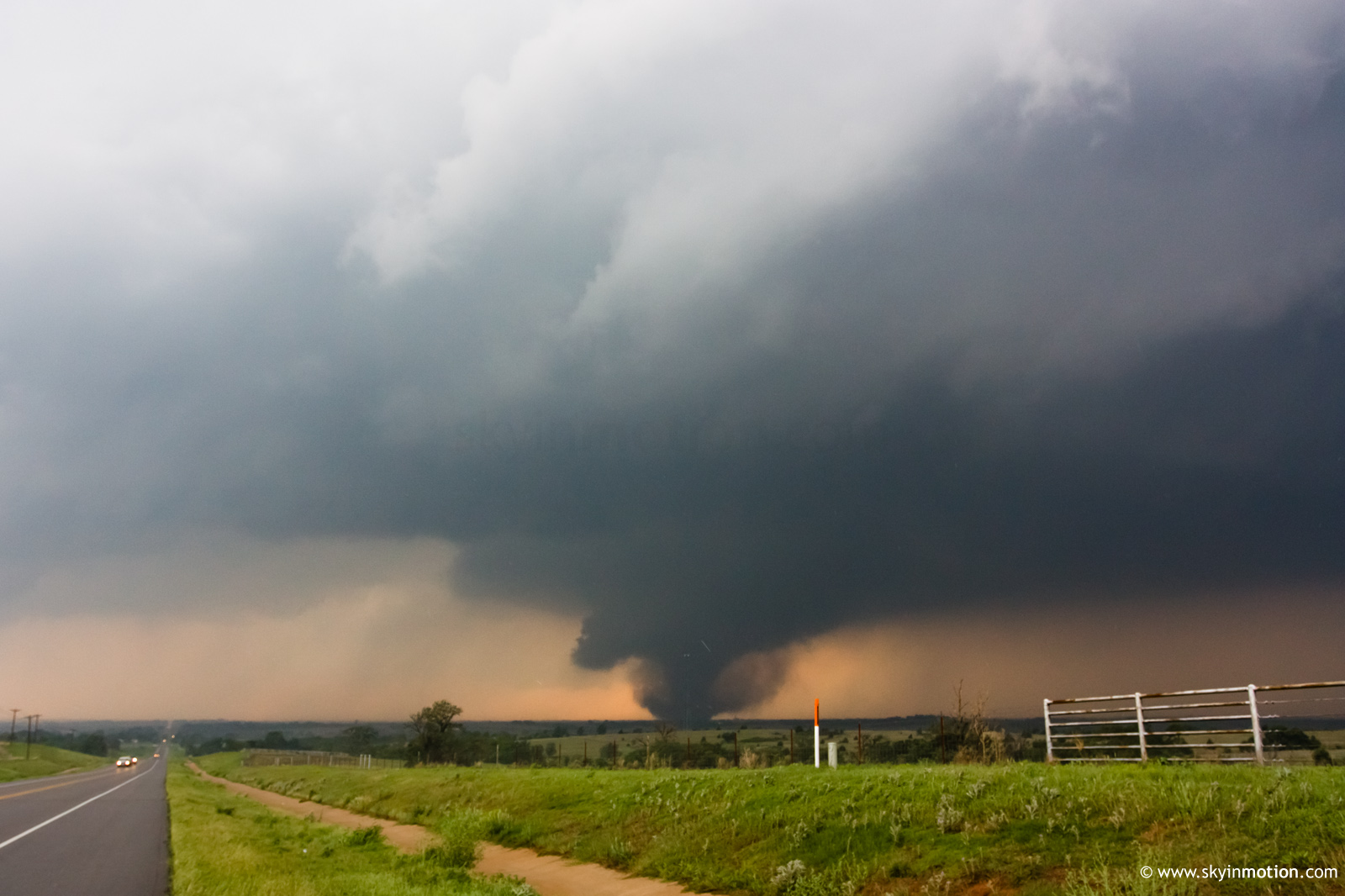
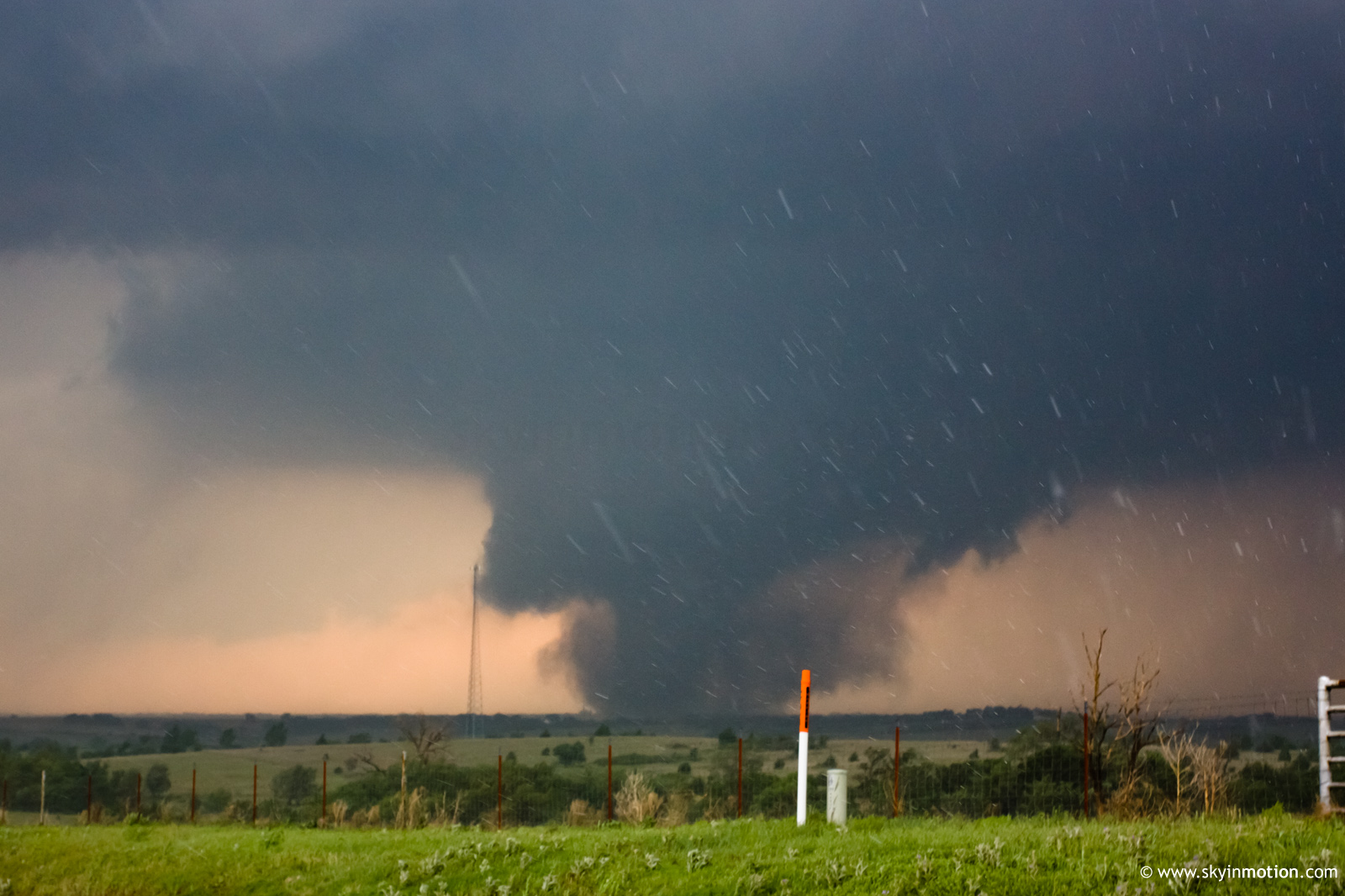
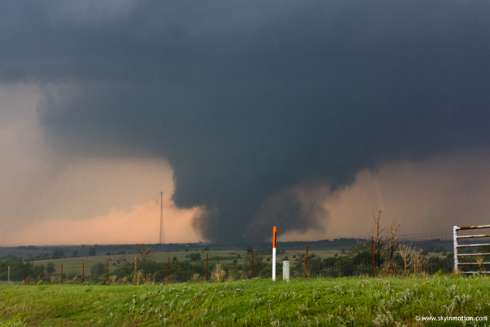
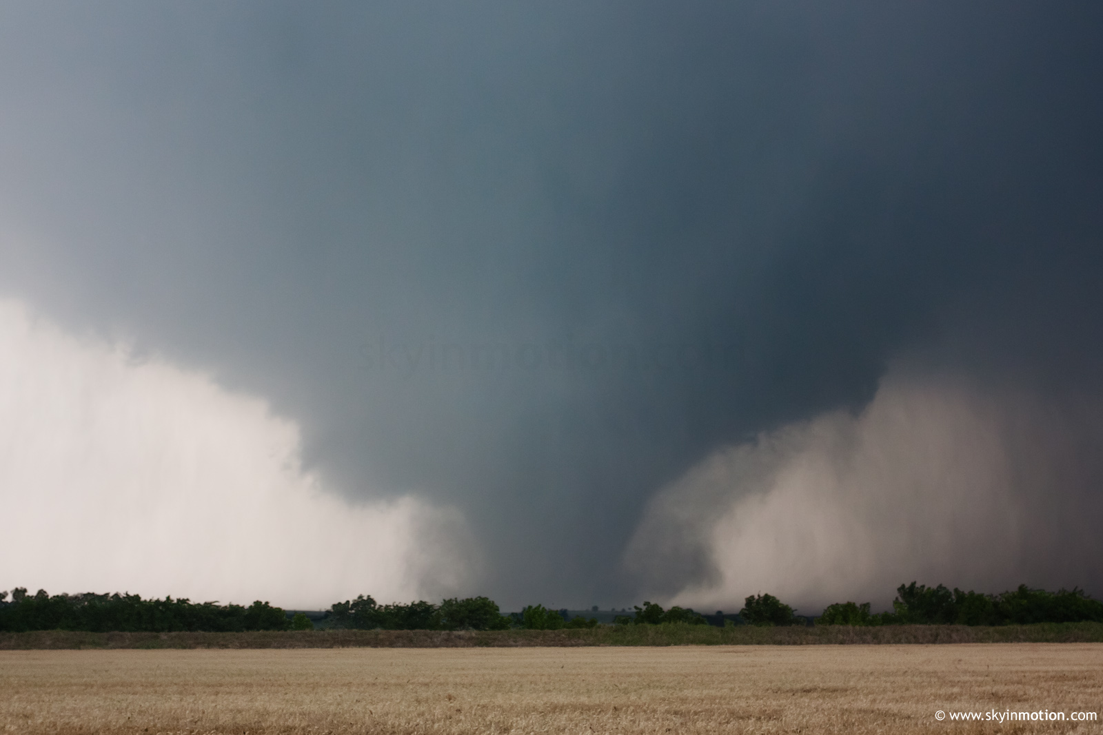
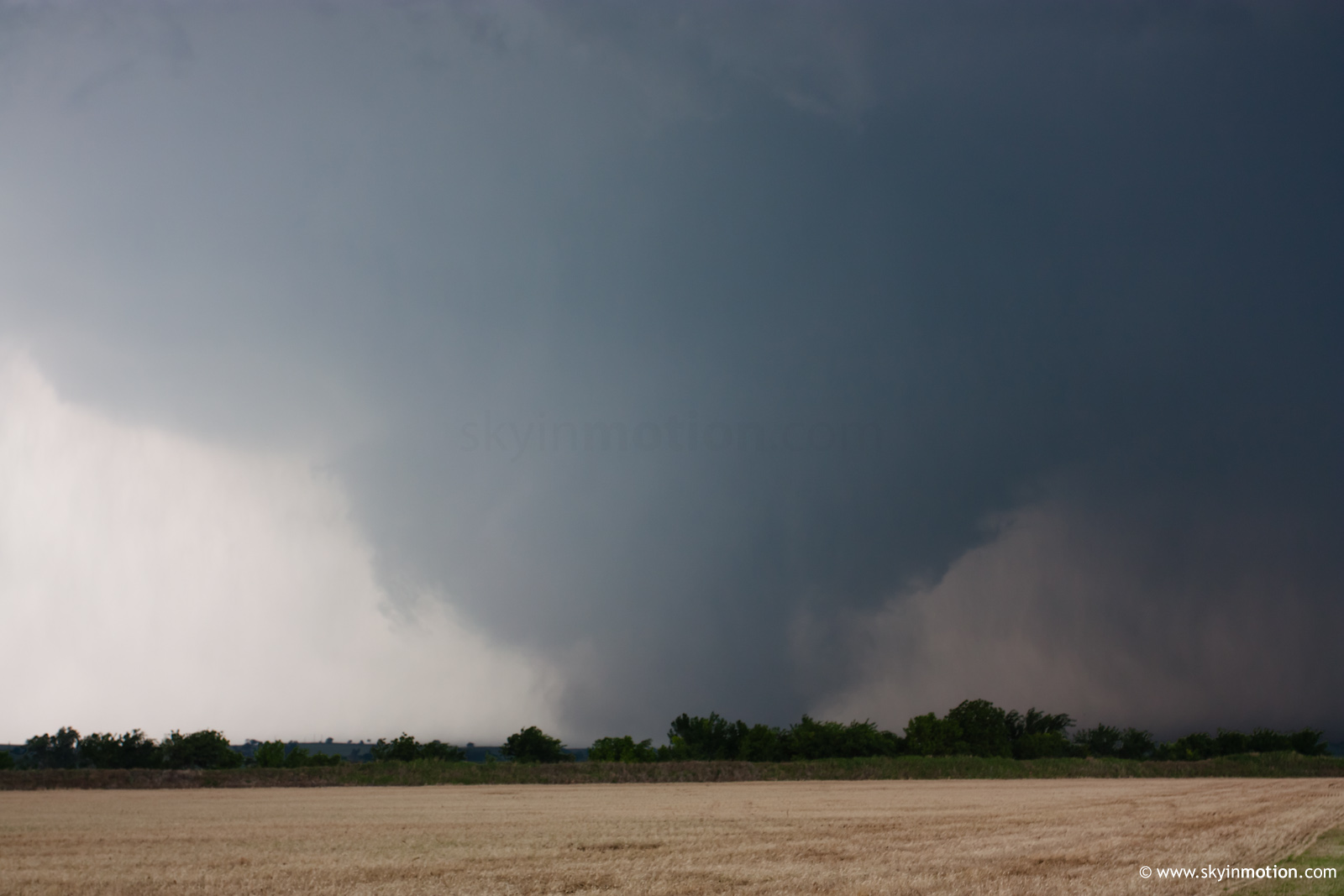
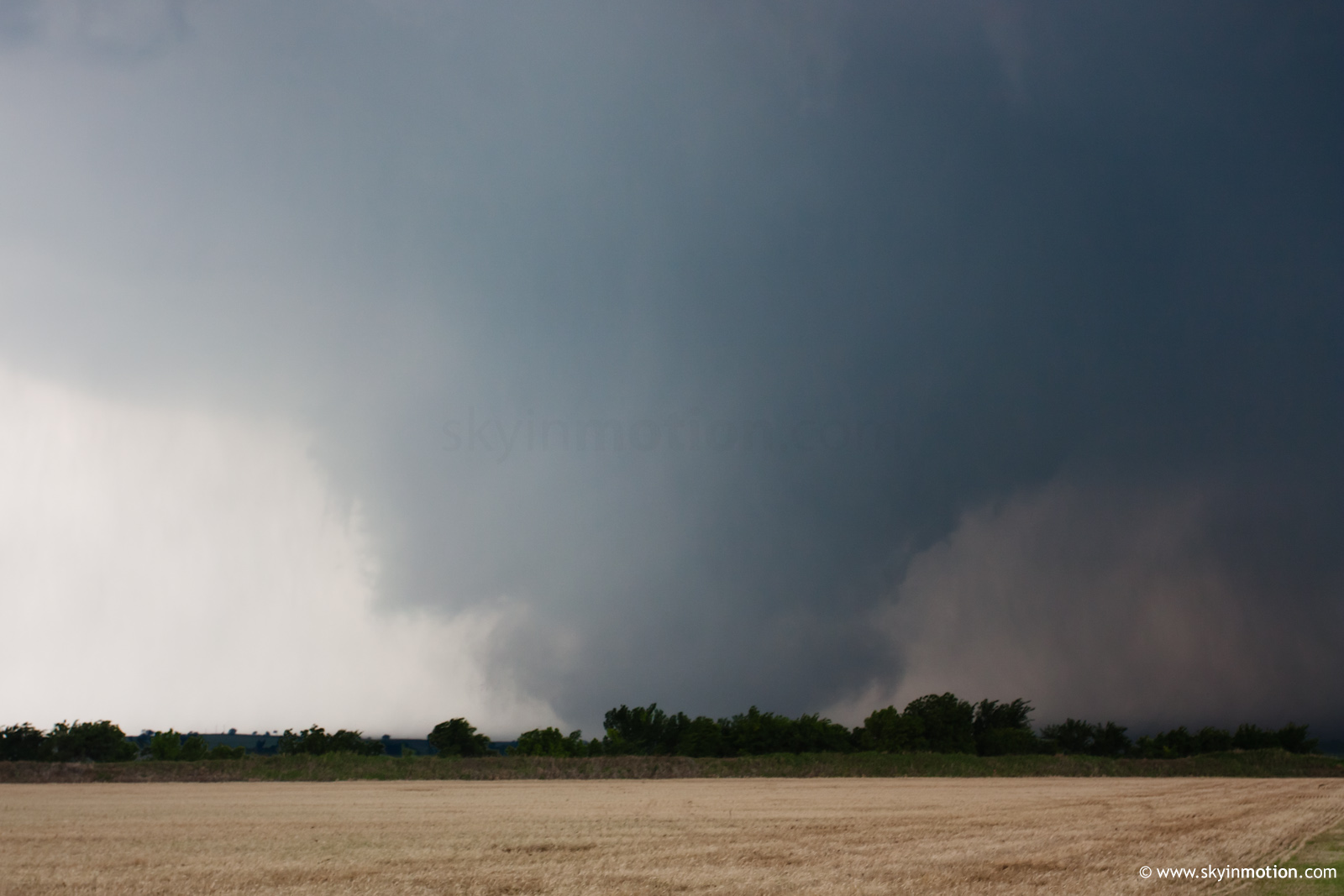
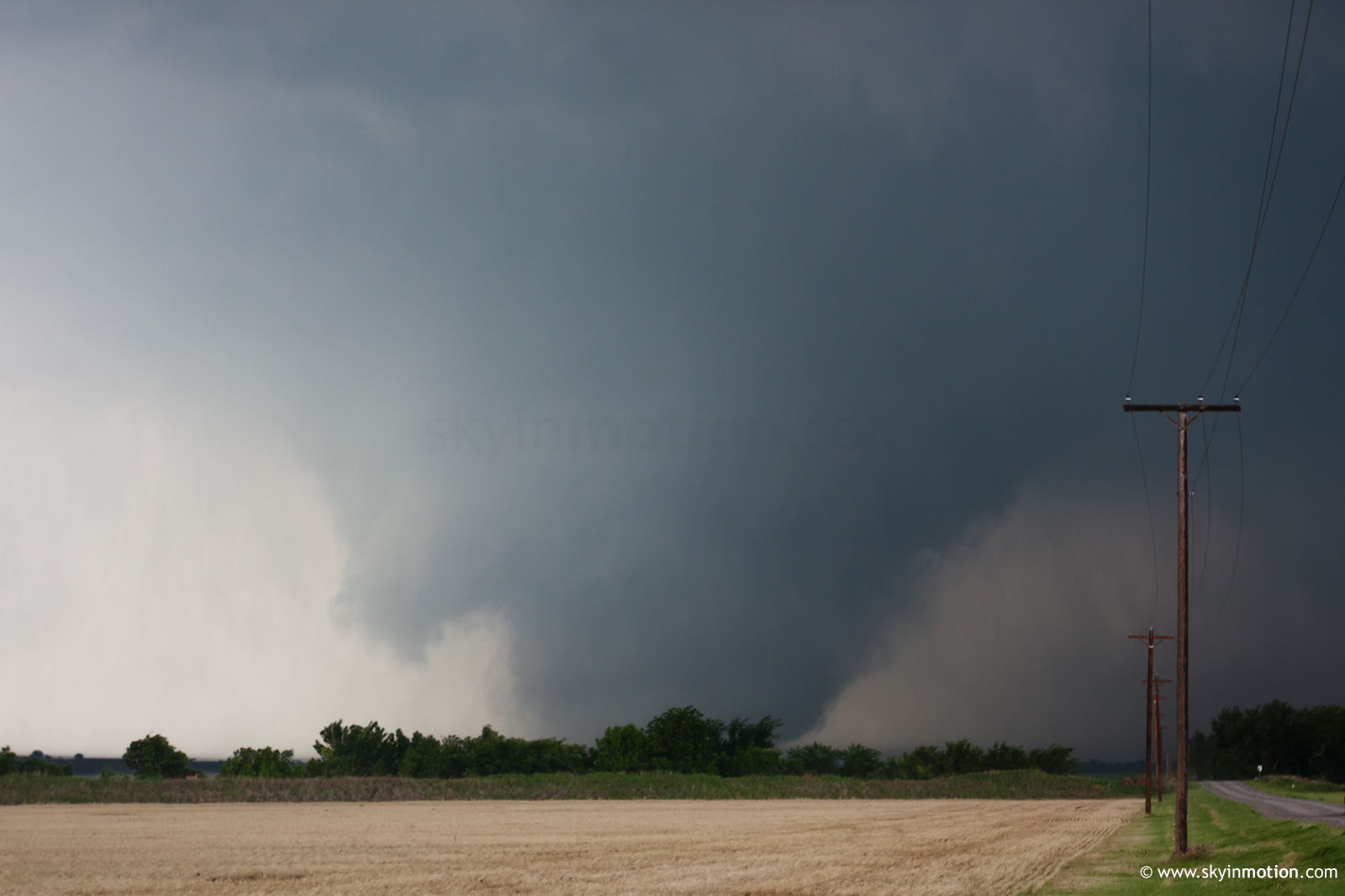
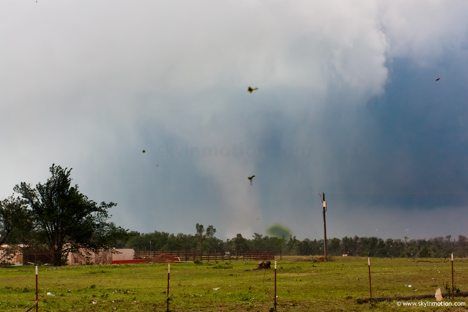
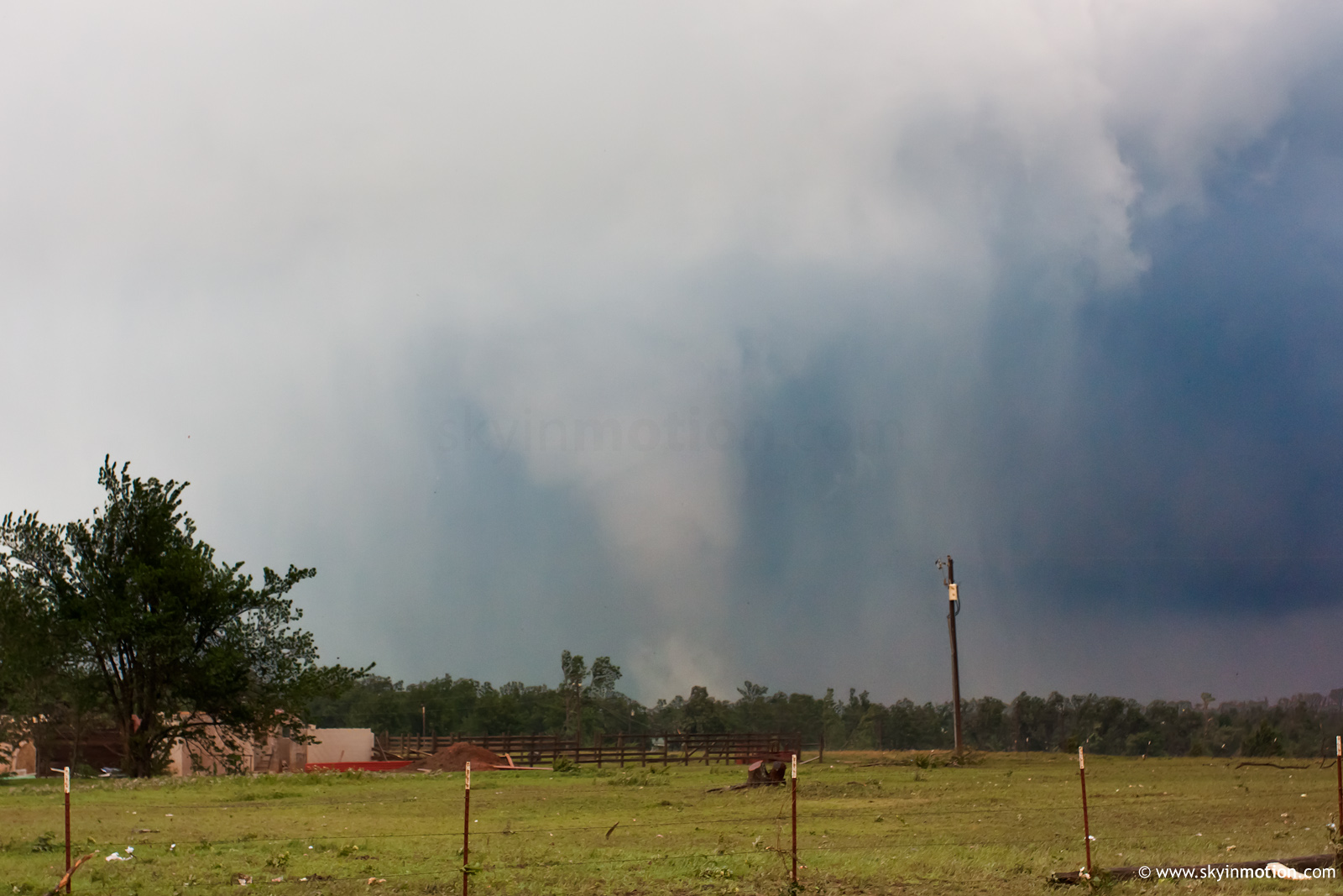
At this point, we returned to Chickasha to get in position for the new line of supercells approaching I-44. We sat E of town for a bit, struggling to decide between one going into town and the next one down the line between Fletcher and Rush Springs. When we heard reports on the radio of a tornado on the ground in Chickasha, we blasted N out of Alex and arrived near Tabler in time to watch a large, violent tornado churning between our position and I-44. Initially, around 2218-2220 UTC, it appeared as a large cone with an extensive debris cloud shrouding it somewhat:
After a few minutes, it transitioned into an appearance that varied from stovepipe to wedge for the remainder of our view.
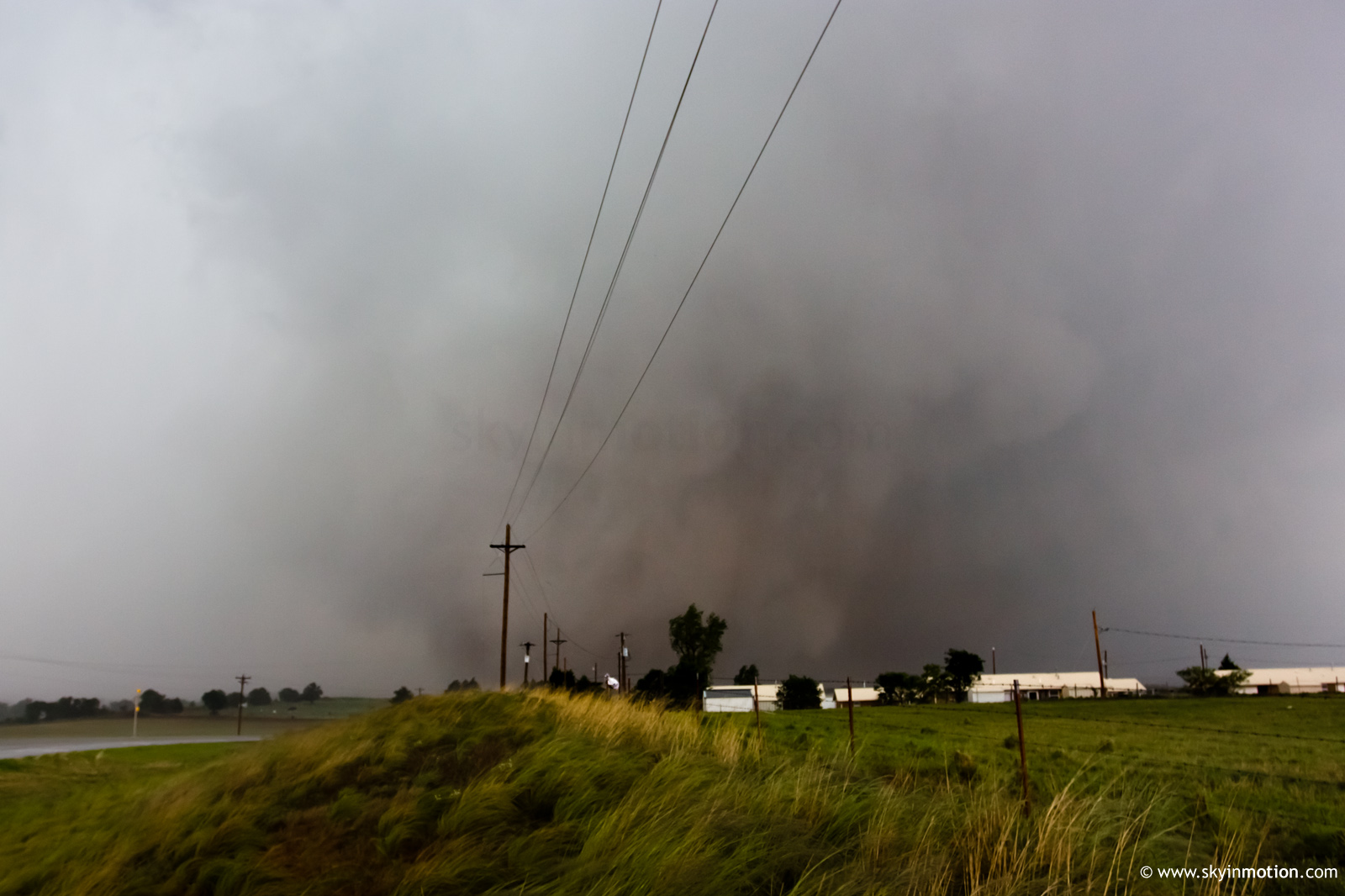
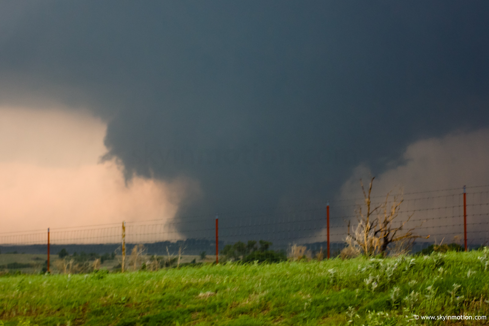
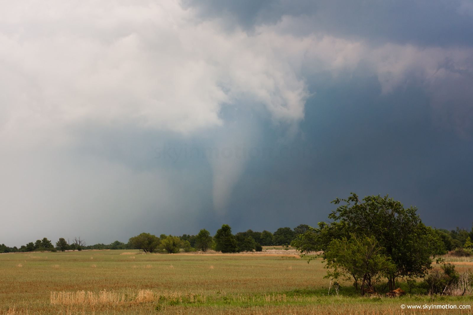
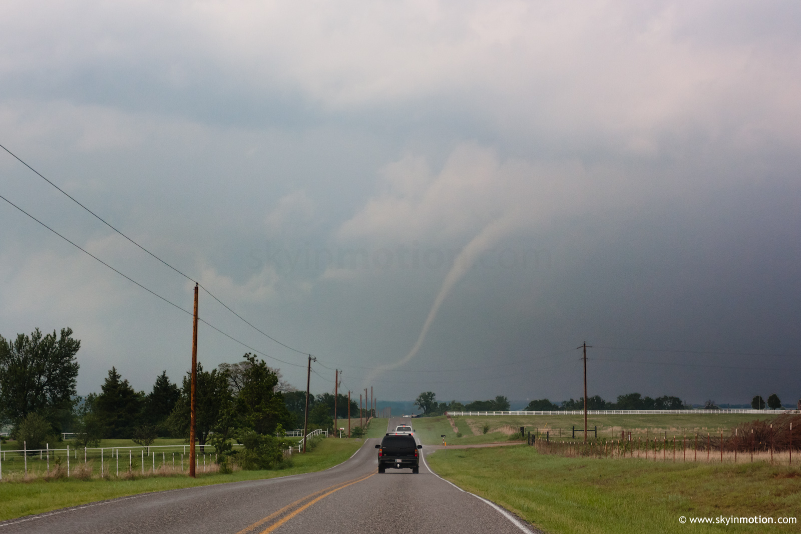
My initial idea to follow this right up US-62 toward Newcastle was spoiled when rain completely precluded a view from the S/SW, so we dropped S out of Blanchard to catch the Criner-Washington-Goldsby storm from the back side. Heading E out of Dibble on OK-39, we soon caught view of the tall stovepipe moving off to the N right as we reached its own damage path.
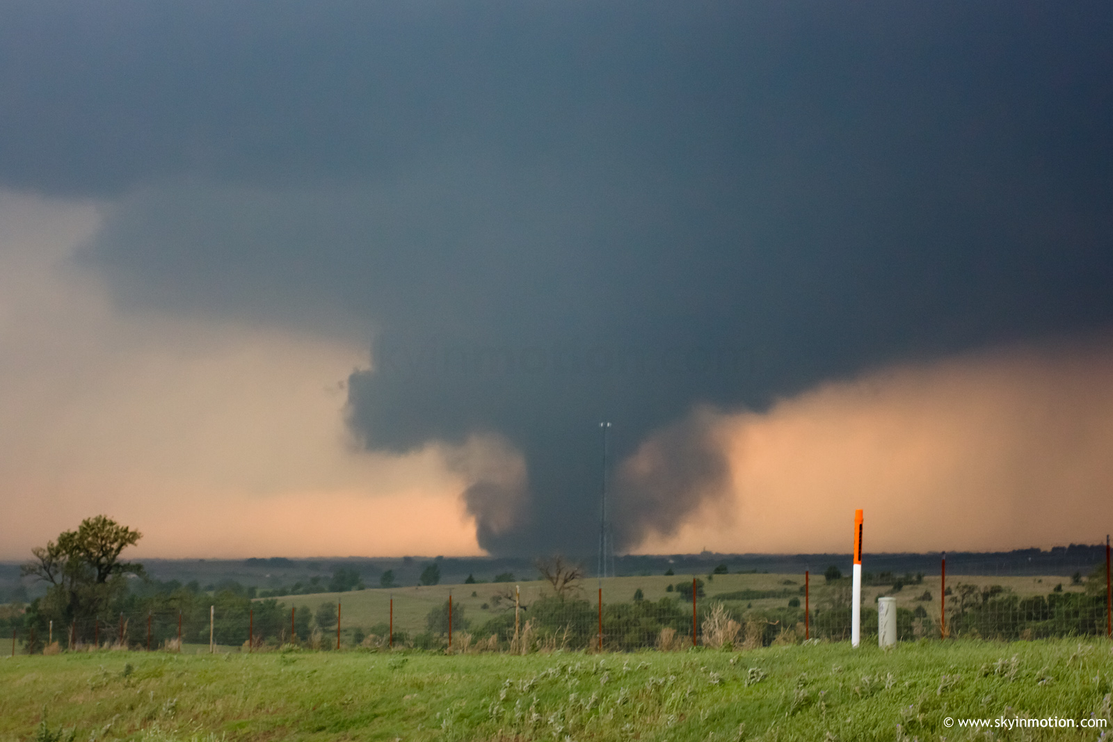
Some of the damage appeared quite substantial here (N of Criner, E of Dibble), but fortunately we did not see any destroyed residences along the highway. It was apparent that despite being much smaller than most of the day's other tornadoes, this one was nonetheless strong to violent, as we could make out nasty upward motion at ground level even from ~6-8 mi. away. The rope-out near Goldsby provided one of the more picturesque and less grungy scenes of the day.
As the Goldsby storm raced into the jungles, we made a quick pit stop in Purcell, then rocketed SE to Ada and dropped down toward Tishomingo, arriving only a few minutes too late to view the tornado reported near Madill. Nonetheless, we were able to eat dinner with friends in Ada and return home by 10pm, having witnessed three violent tornadoes close to home. No complaints, given how bleak the season looked not so long ago.