A single tornadic supercell redeems not only all my autumn chasing efforts, but western Oklahoma's years of dormancy.
Observed 4 tornadoes.
I was sick as a dog Monday and got about an hour of sleep the night prior, so I'm lucky I ever made it out the door. I departed OUN solo about 12:30pm and took I-44 to Chickasha, where I opted W on US-62 to hedge between the numerous developing supercells across SW OK. By the time I made it to the middle storm (at that point) near Hobart, I noted a very disorganized wall cloud to my SW around Lugert. One glance at the early reflectivity structure on the storm entering Tillman Co. was all it took to send me hauling S down US-183 at a frenzied pace. By the time I reached Snyder, a core punch (albeit a tame one through the eastern edge of the forward flank) was necessary to gain visual of the base. Fortunately, this entailed only quarter size hail, and within a mile of passing the US-62 juncture I was in the clear.
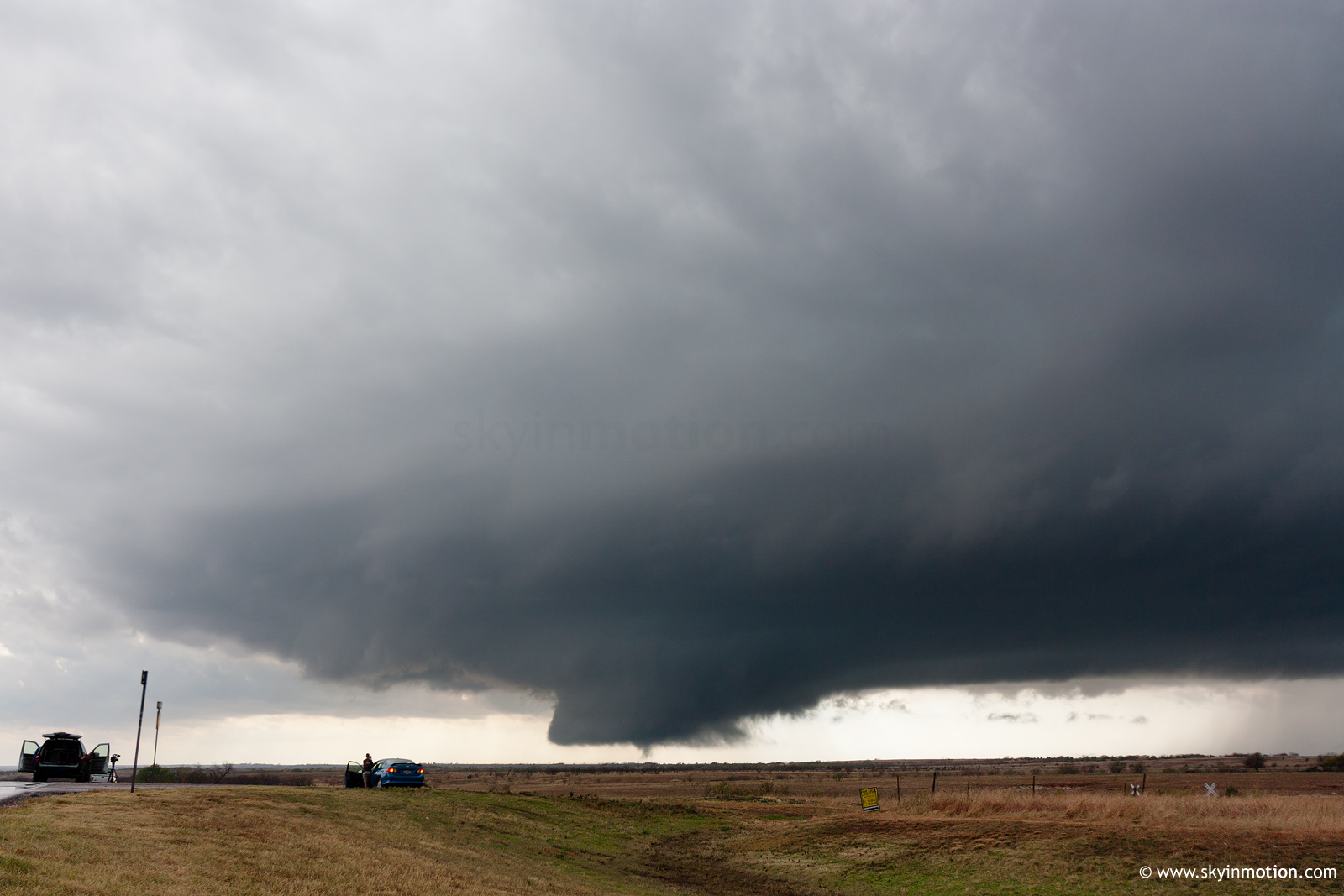
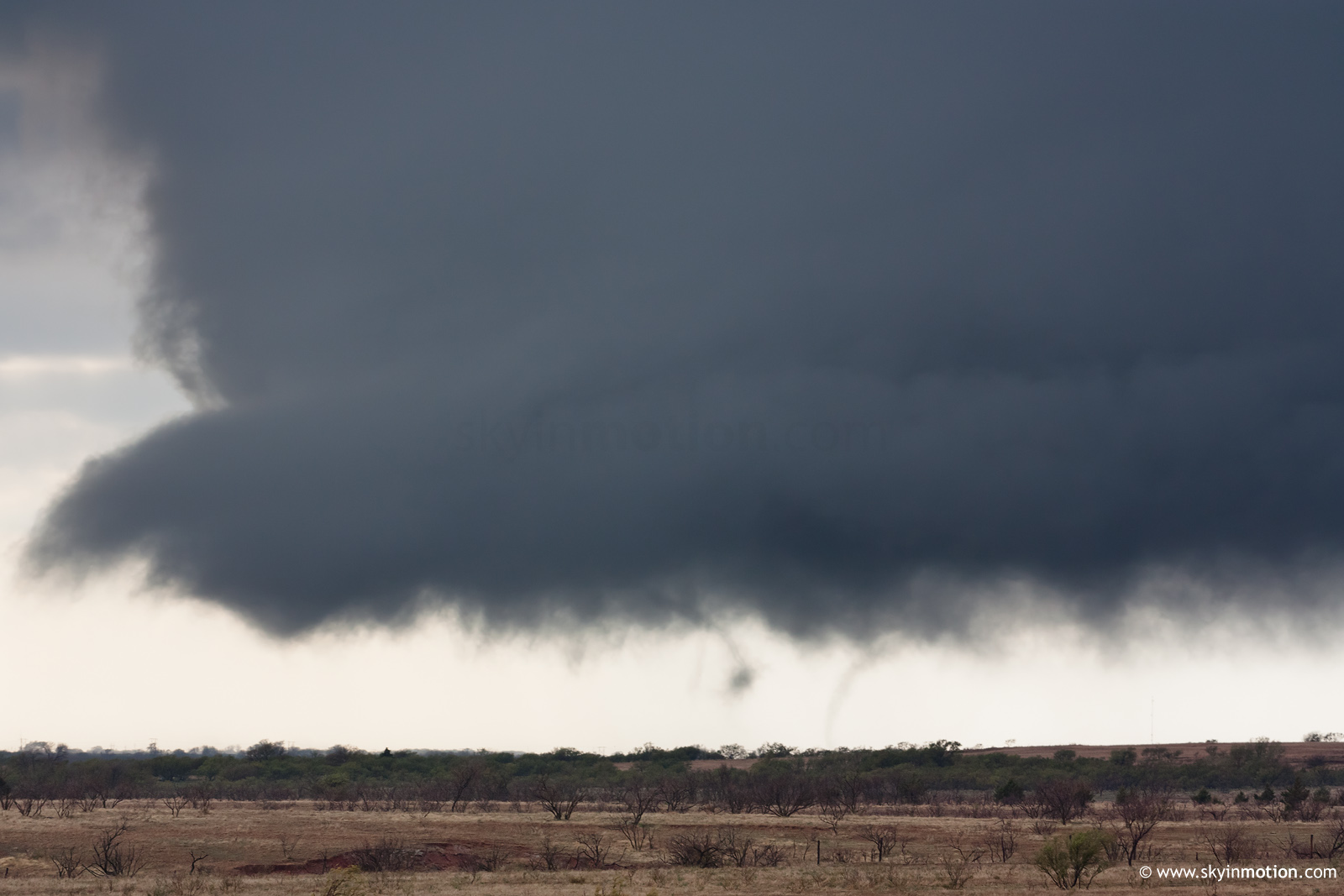
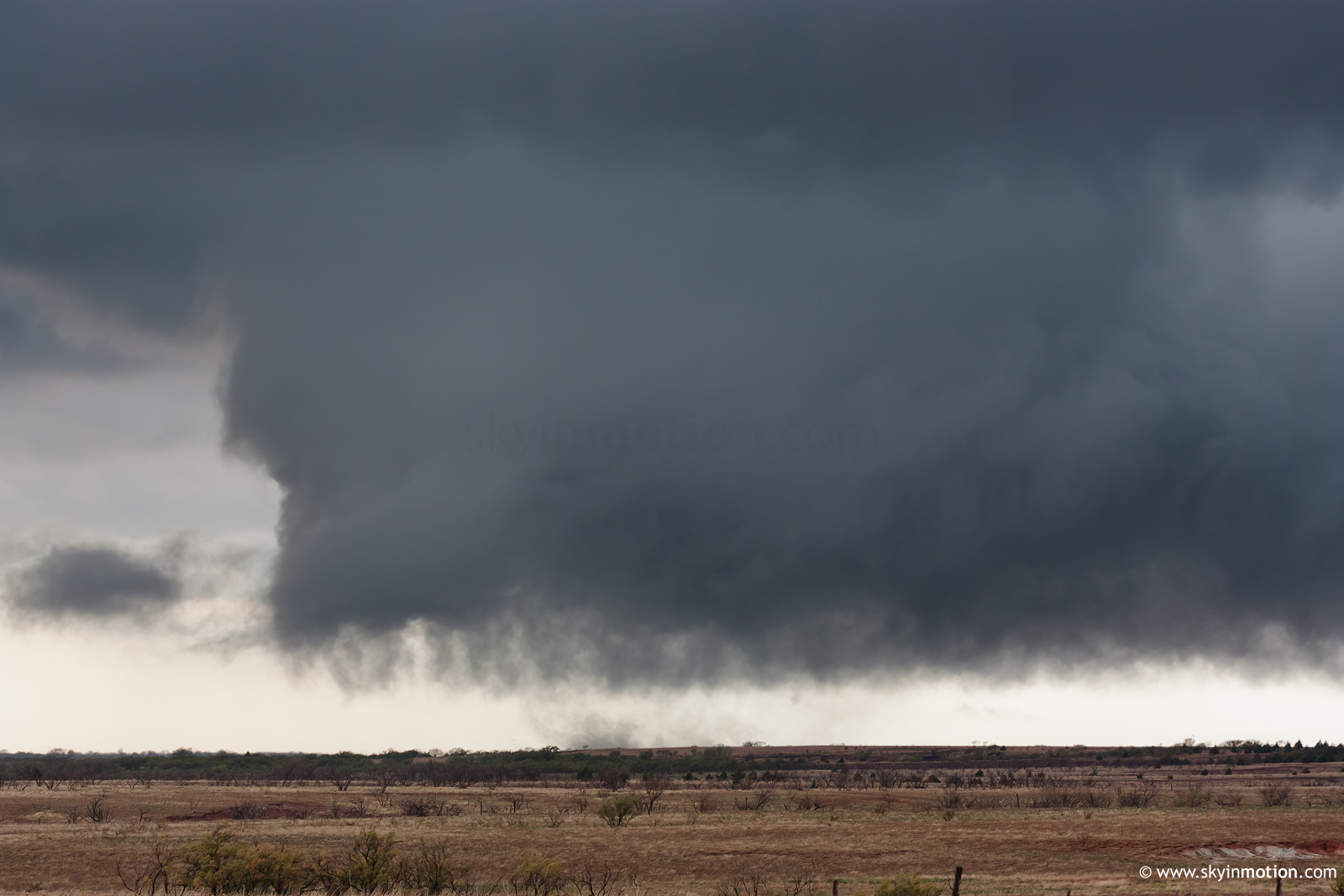
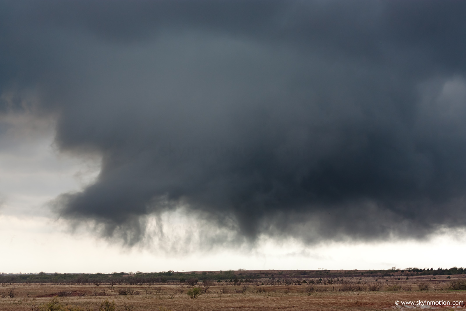
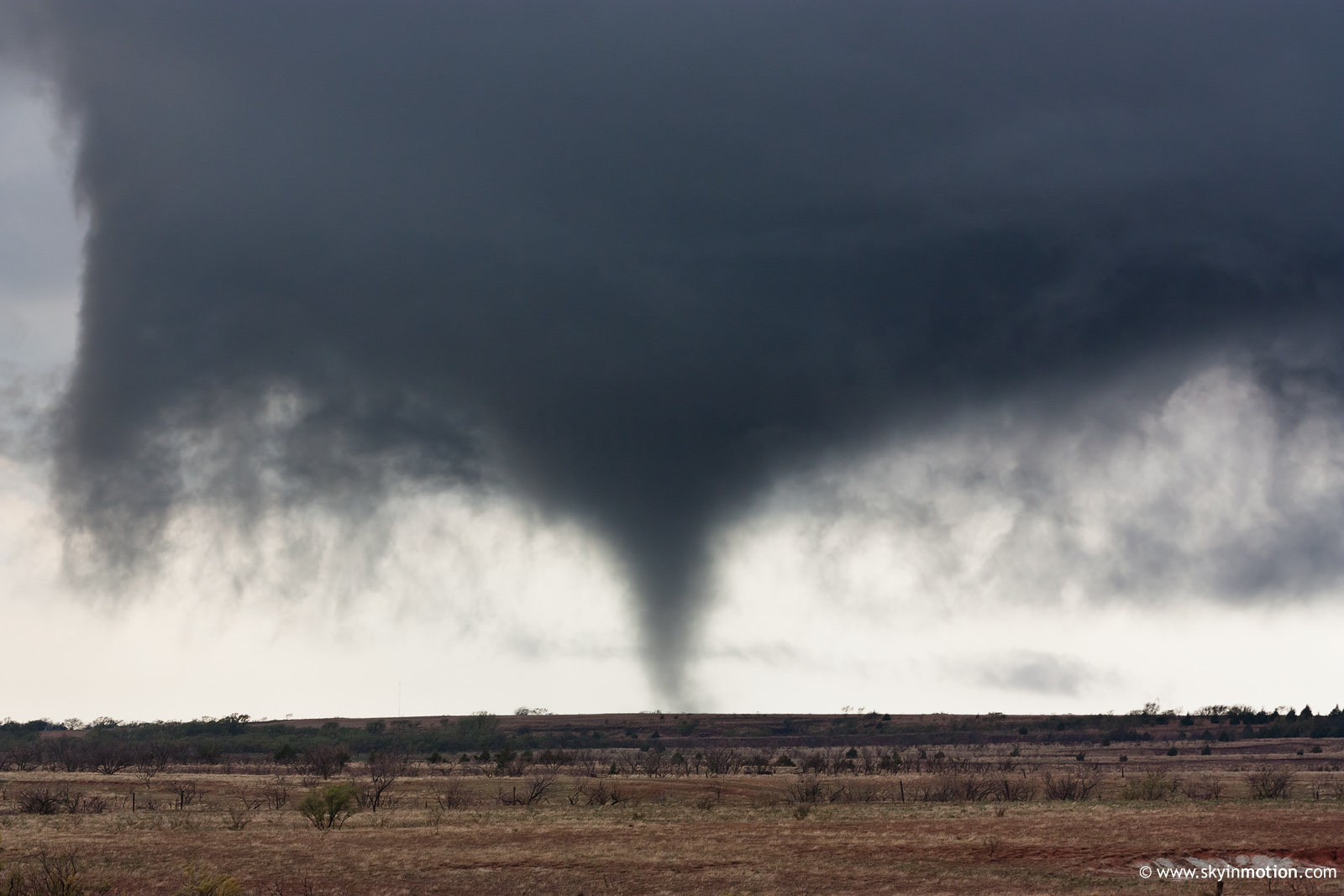
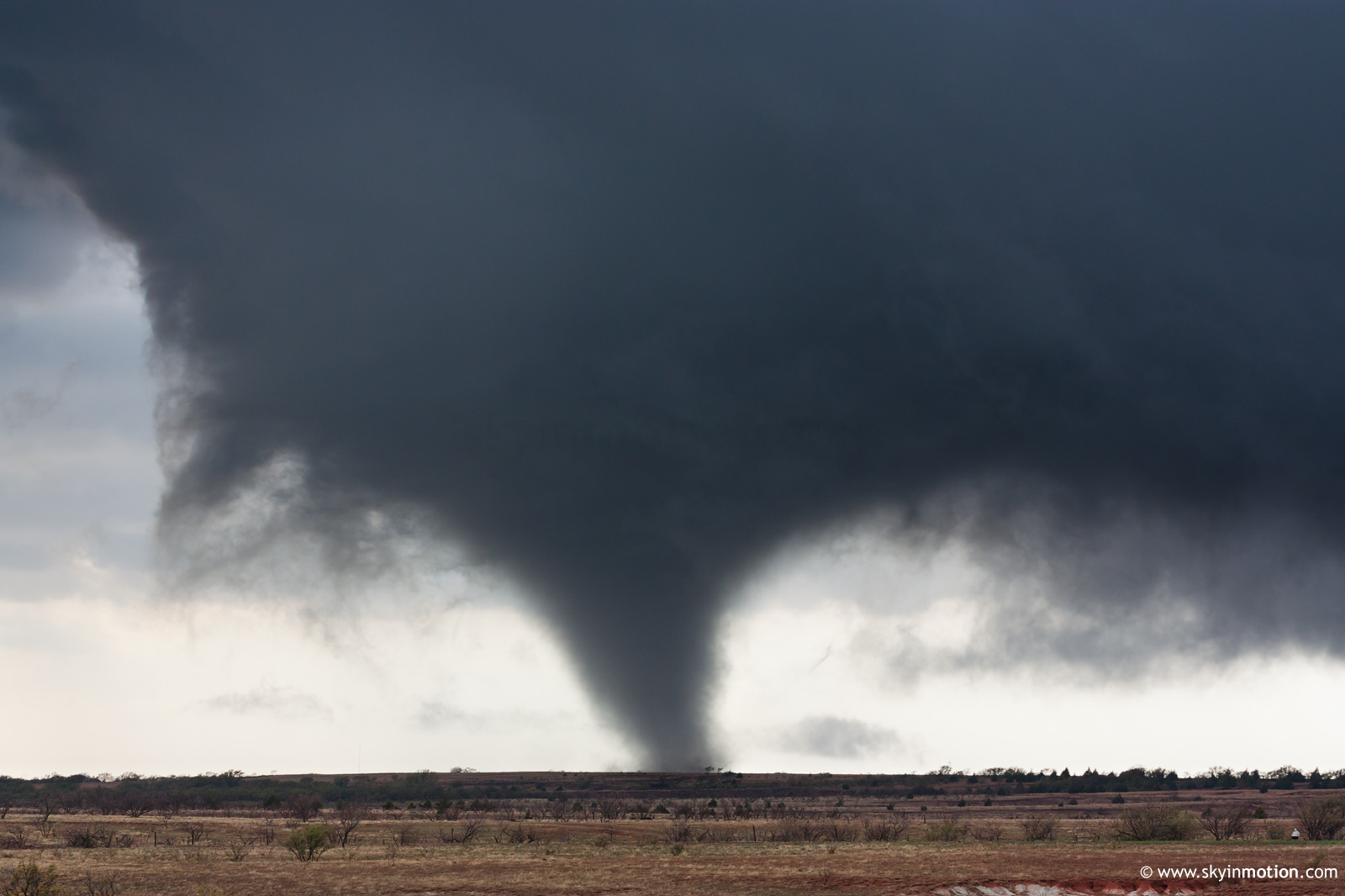
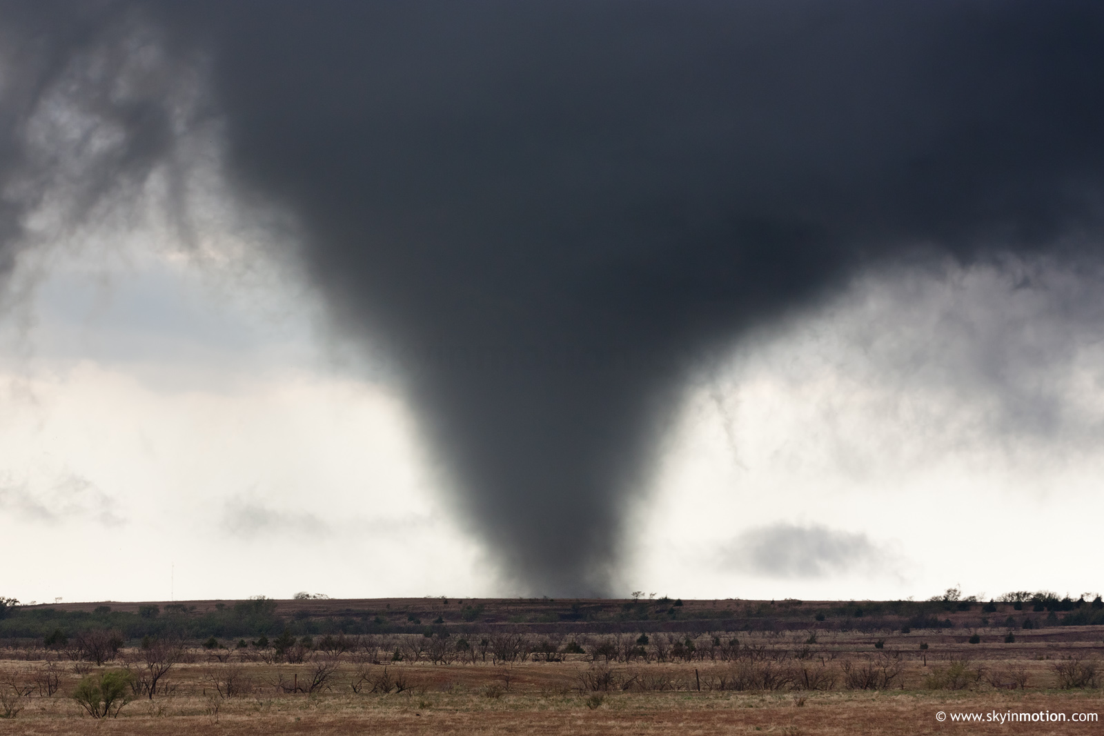
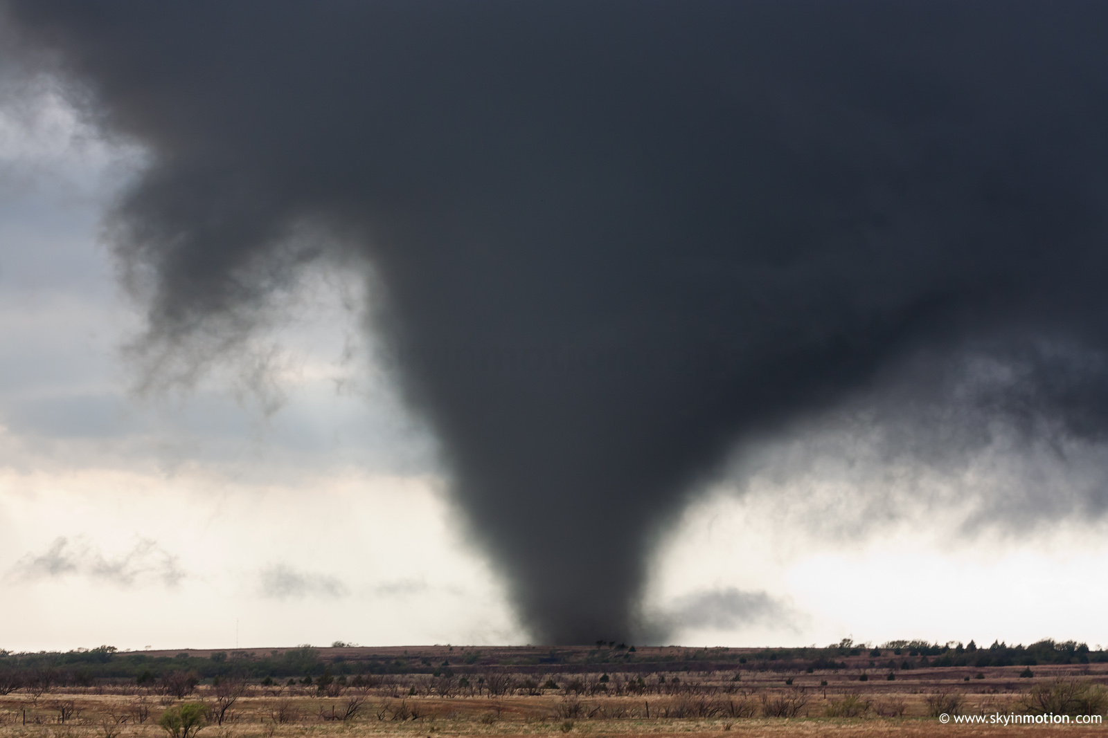
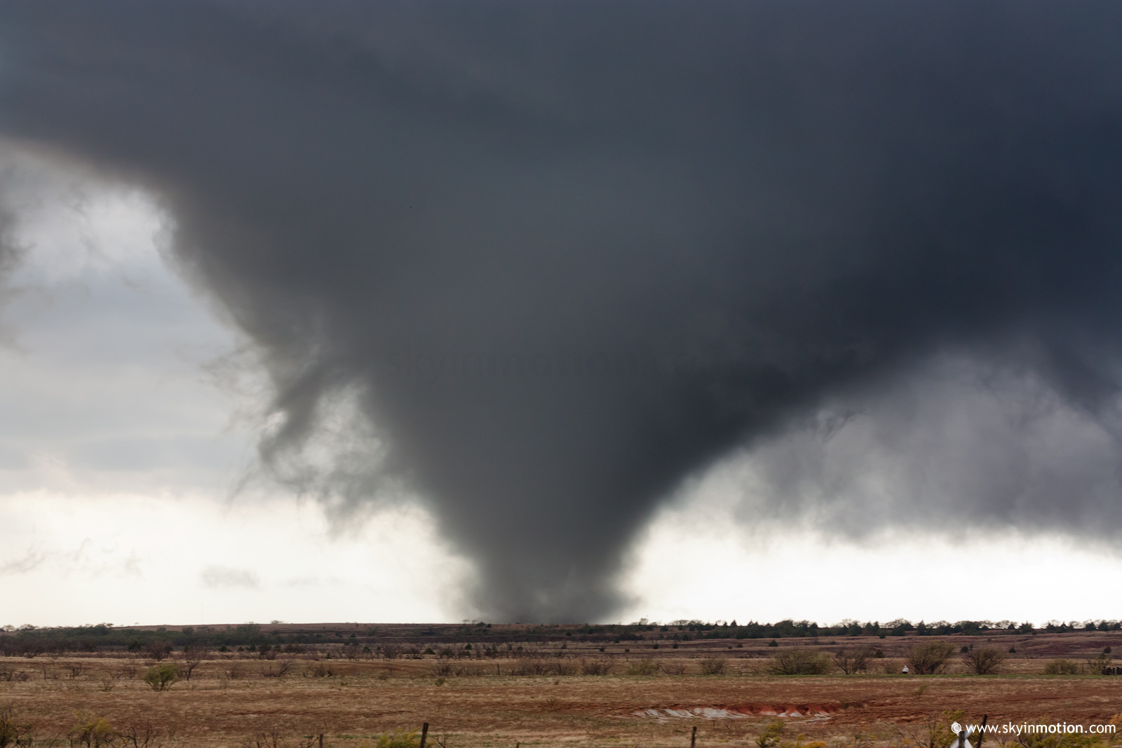
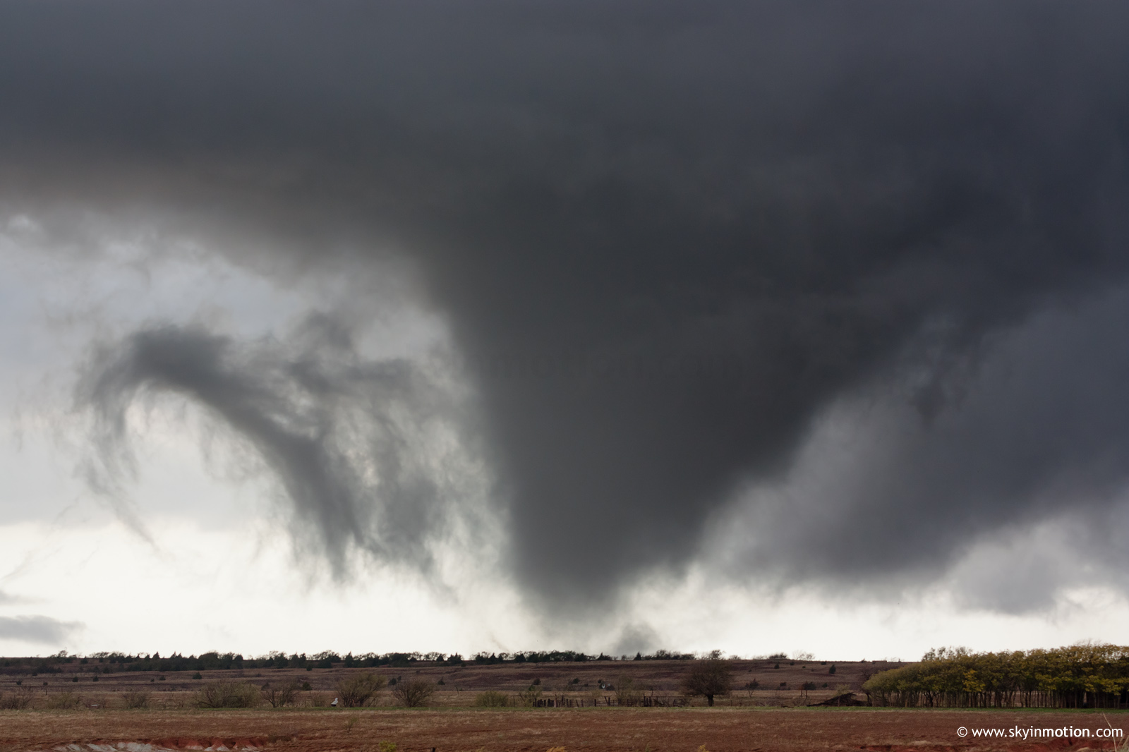
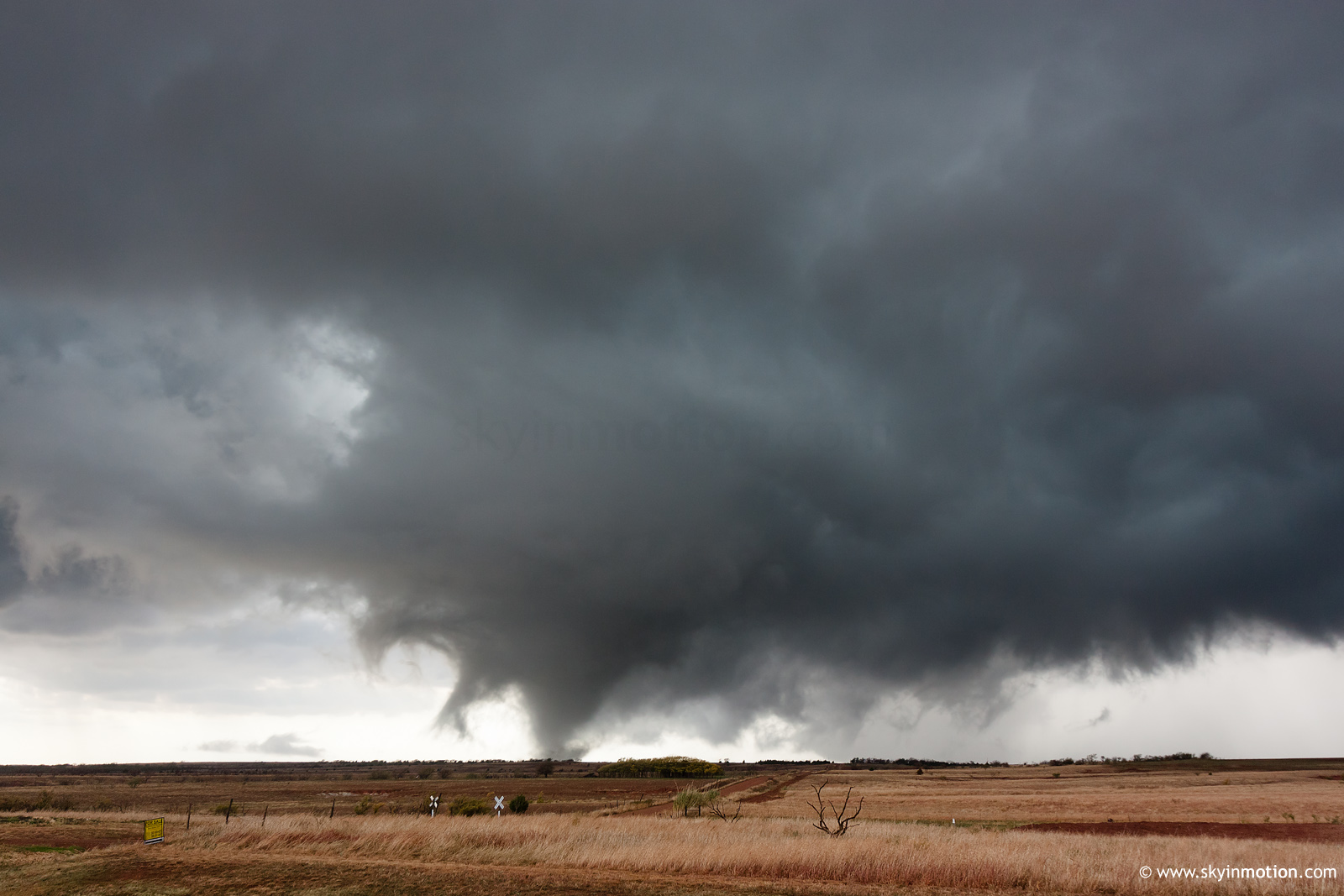
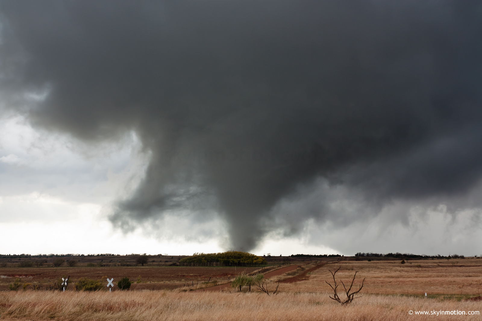
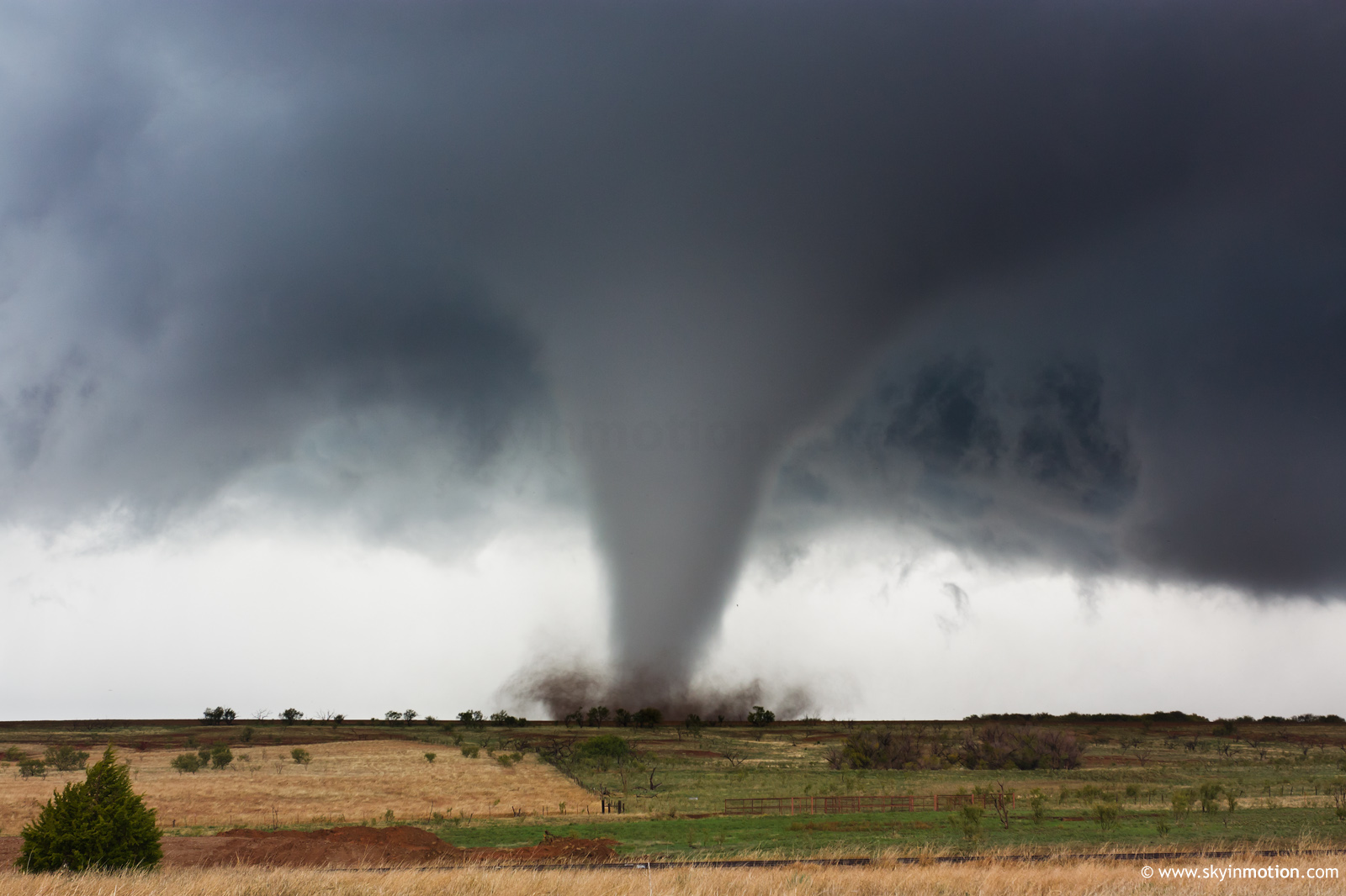
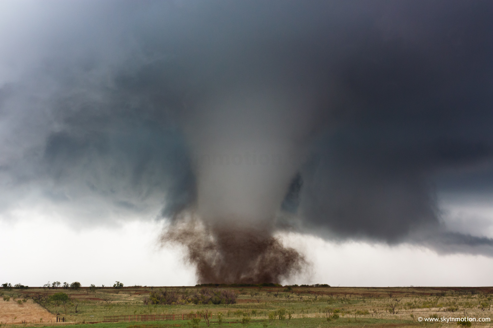
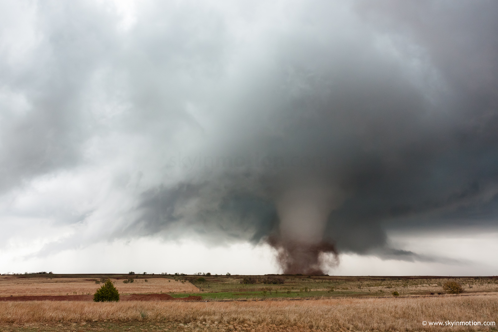
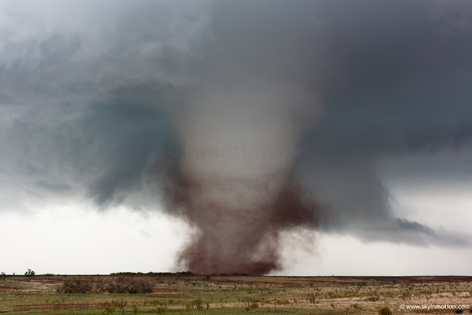
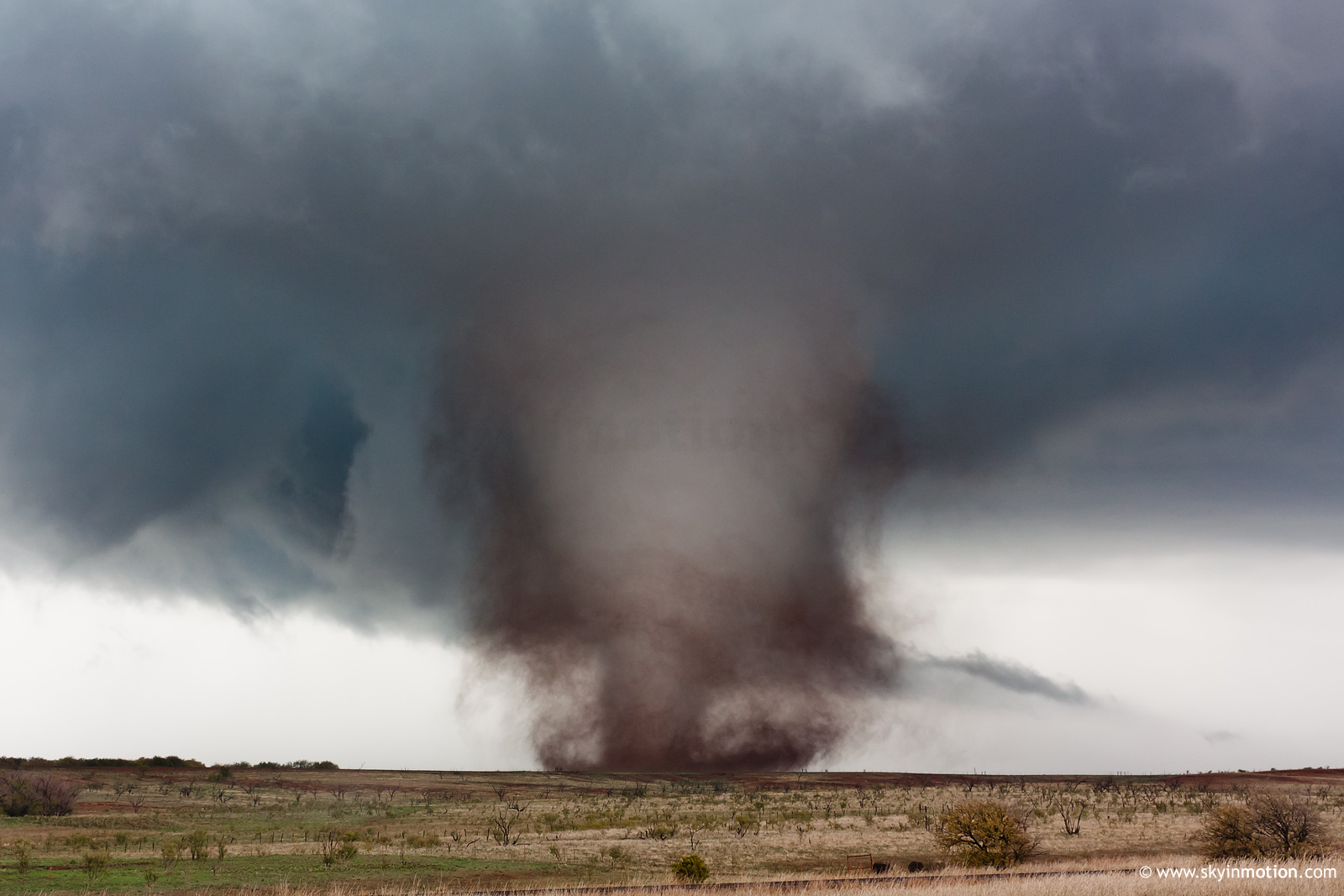
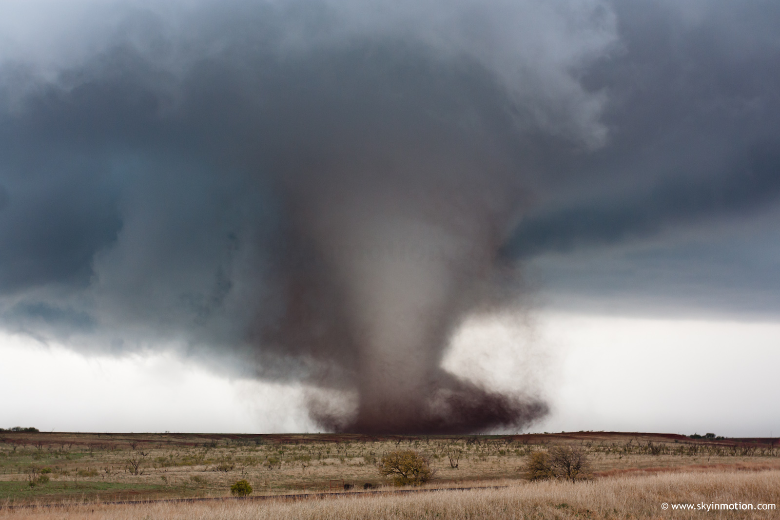
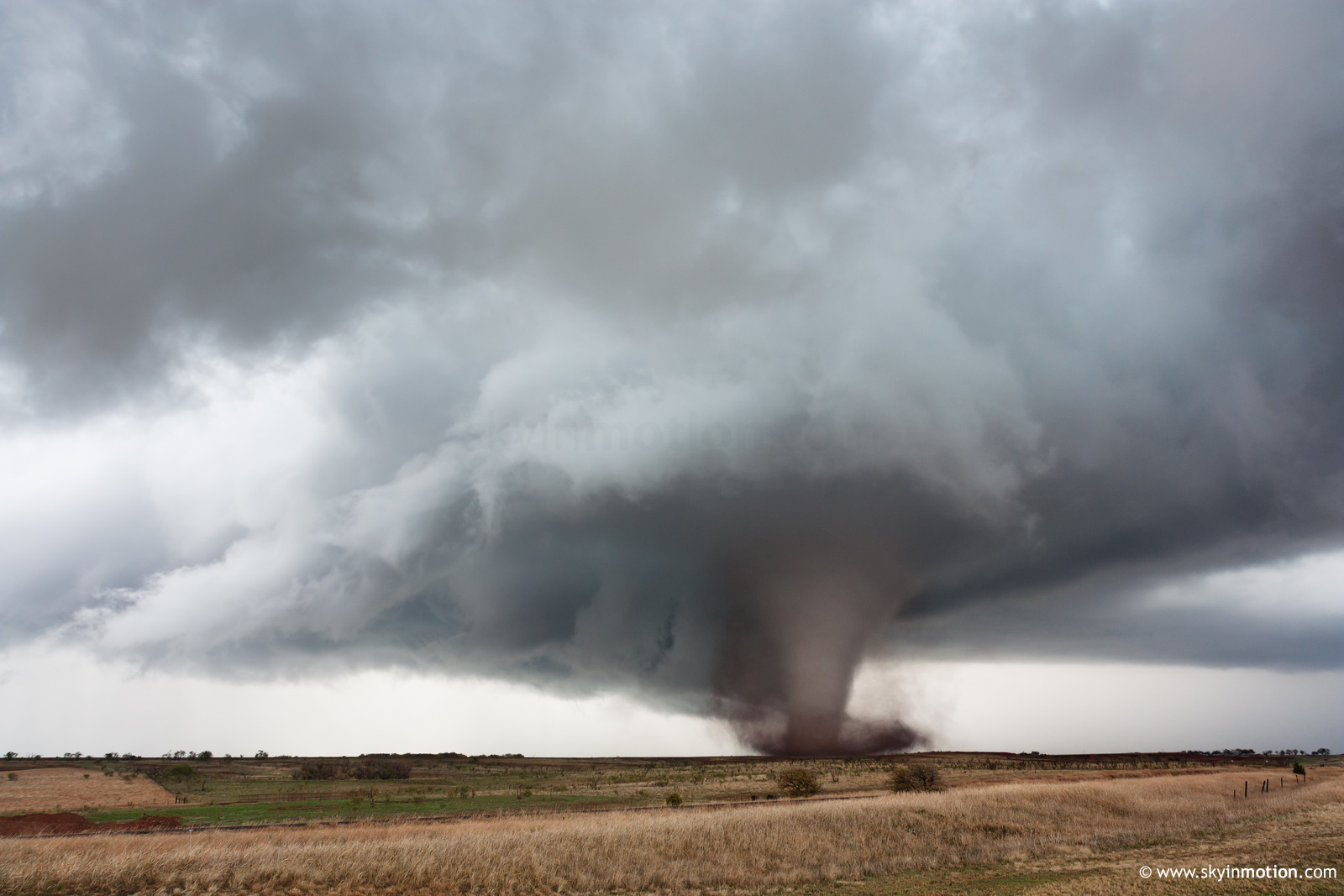
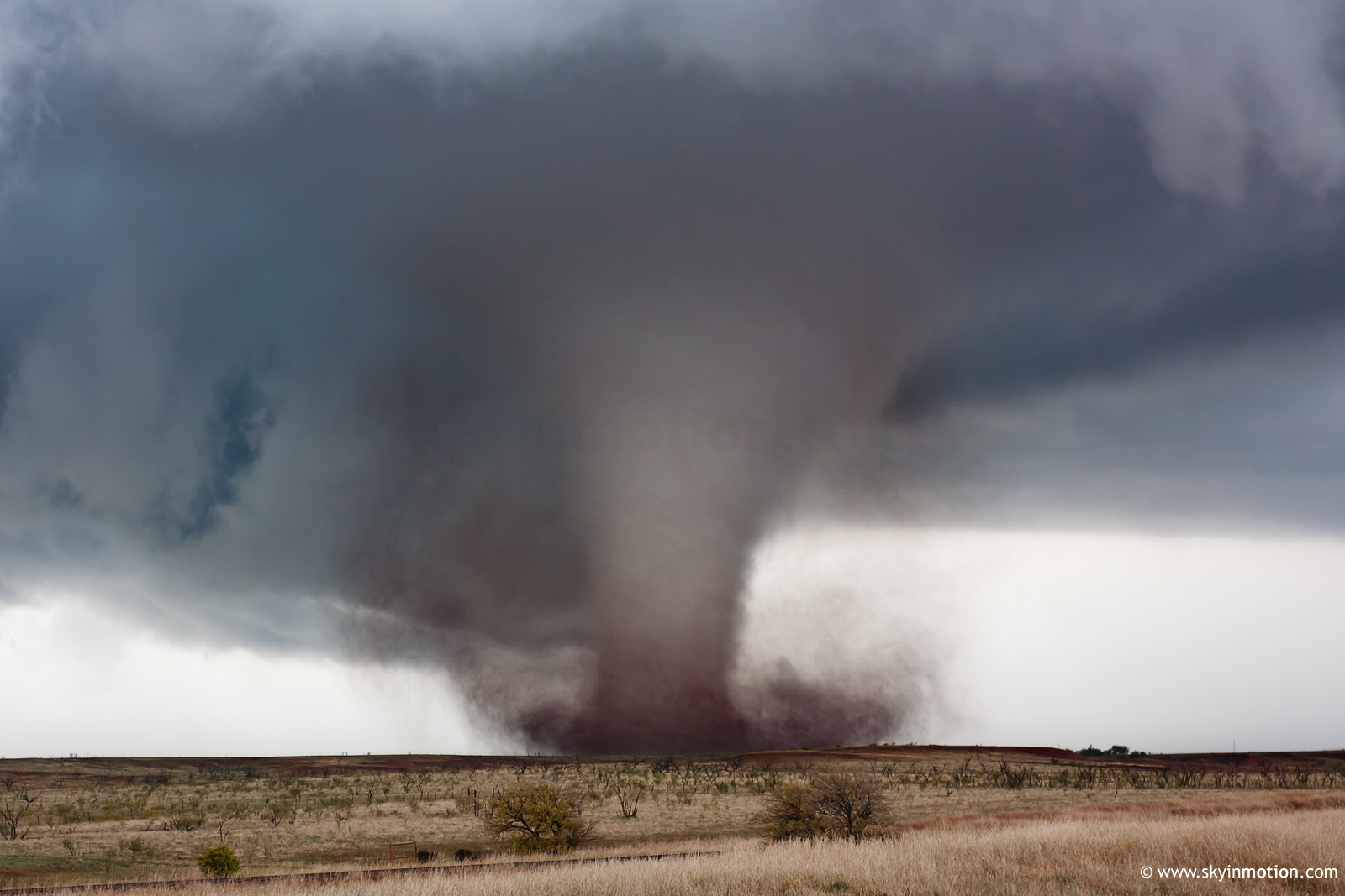
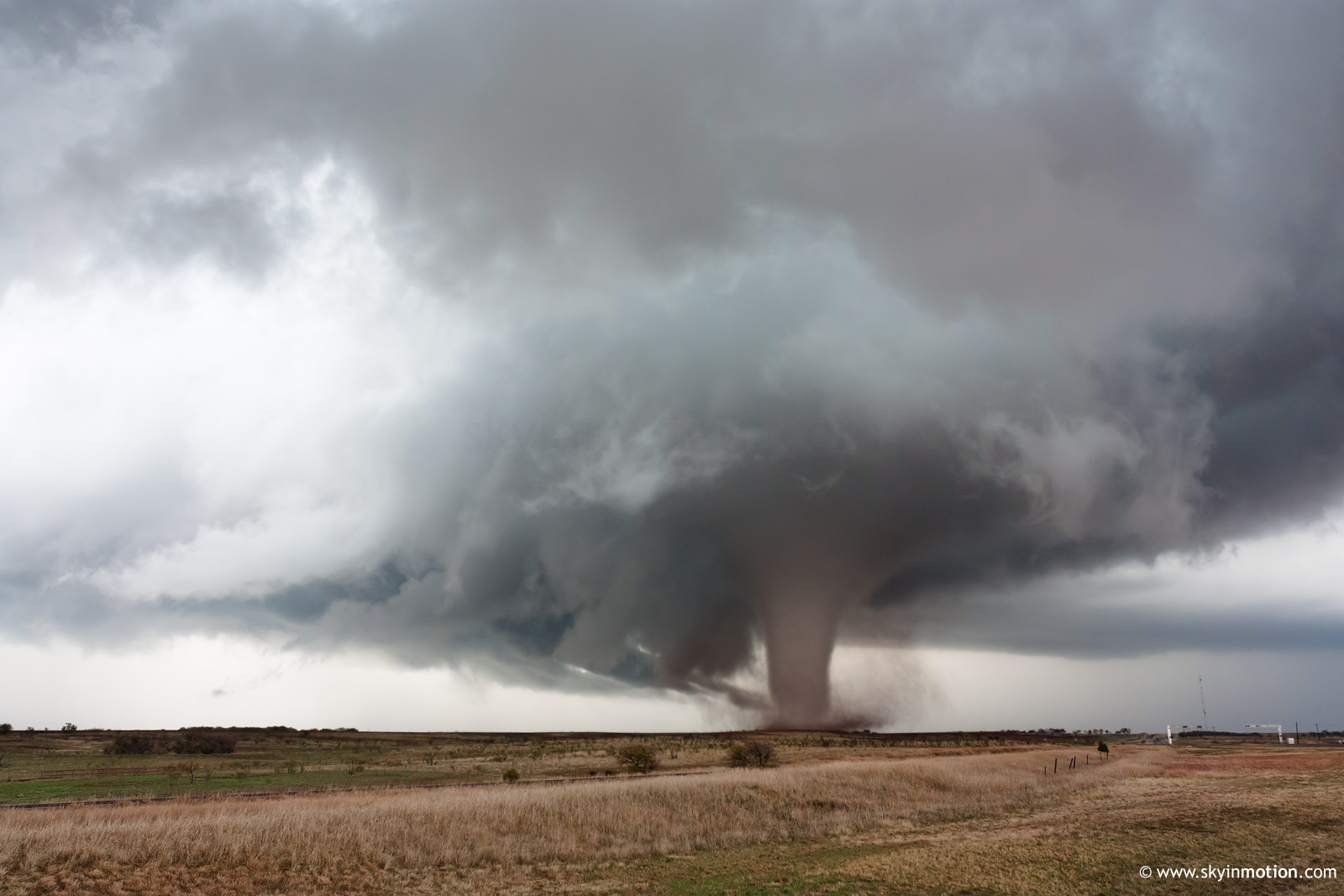
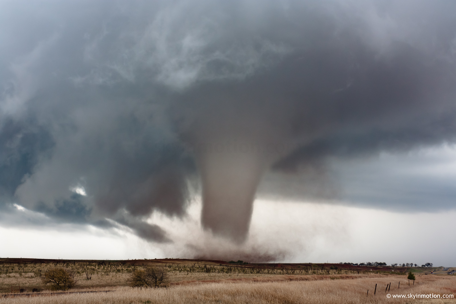
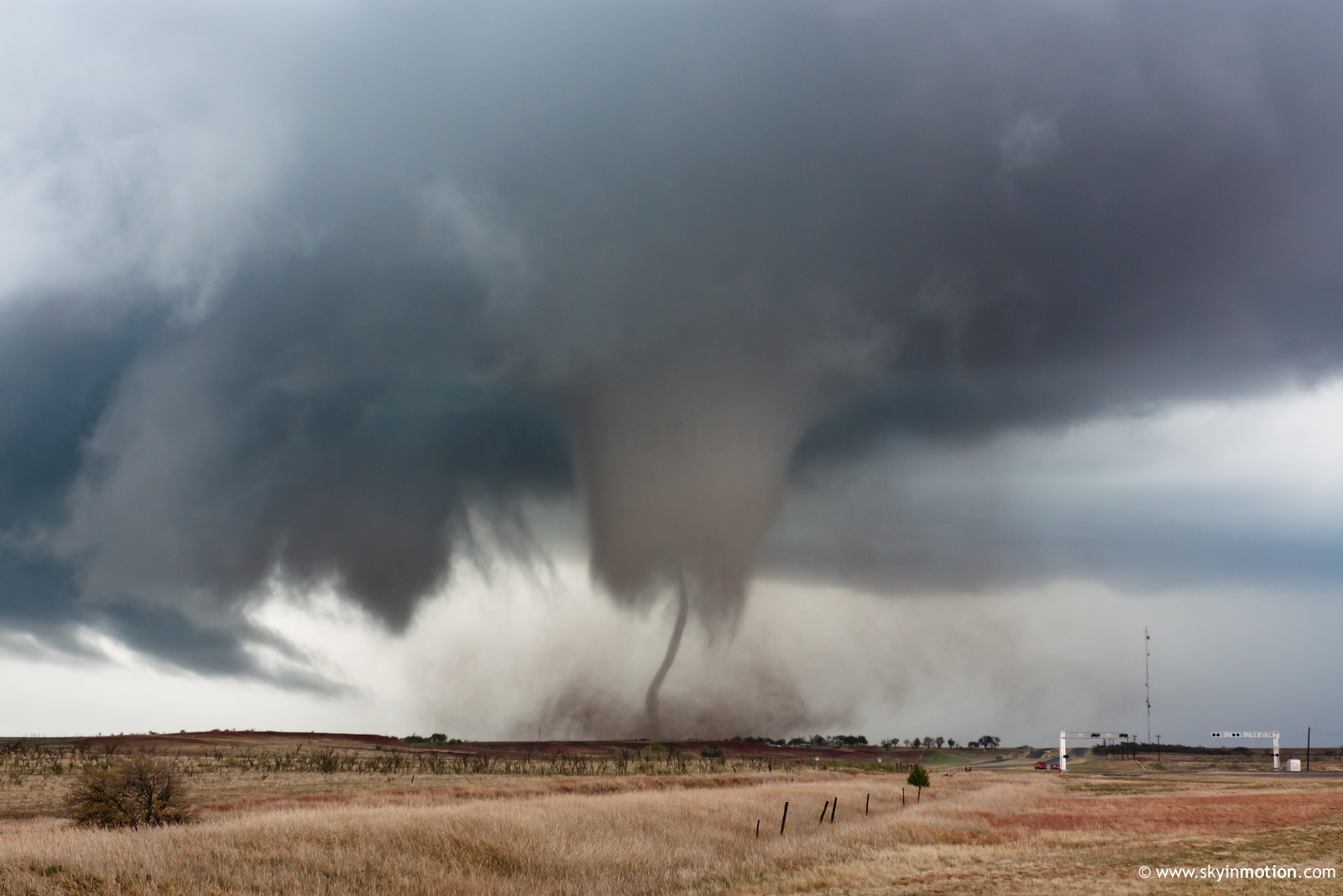
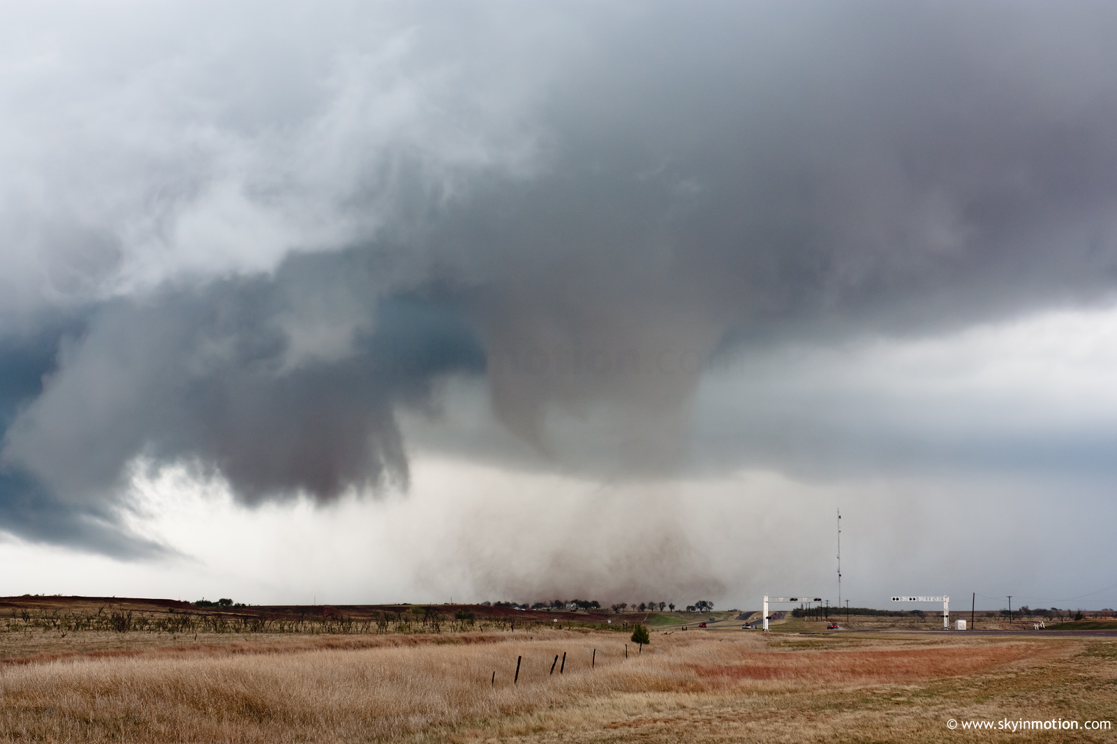
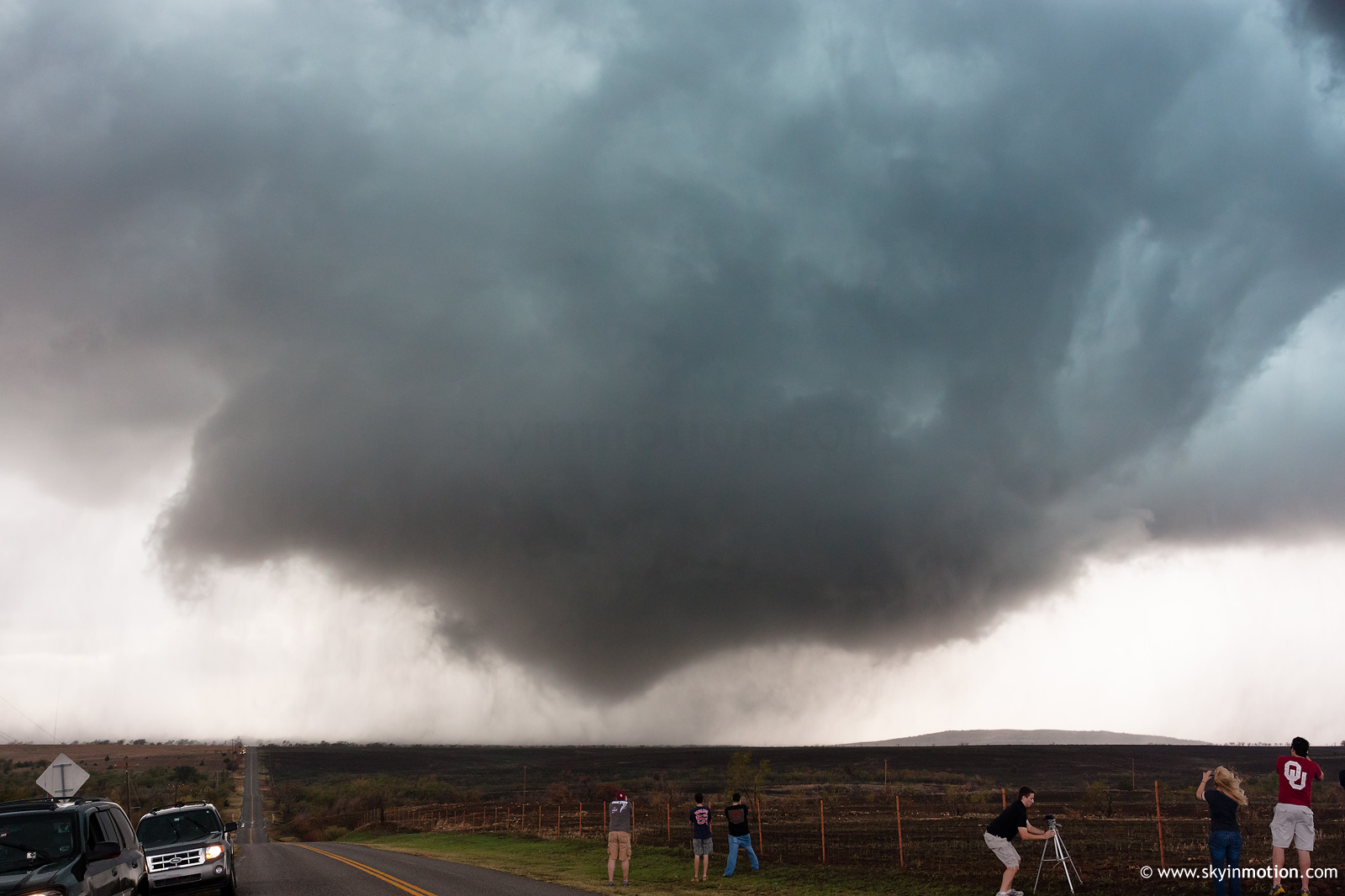
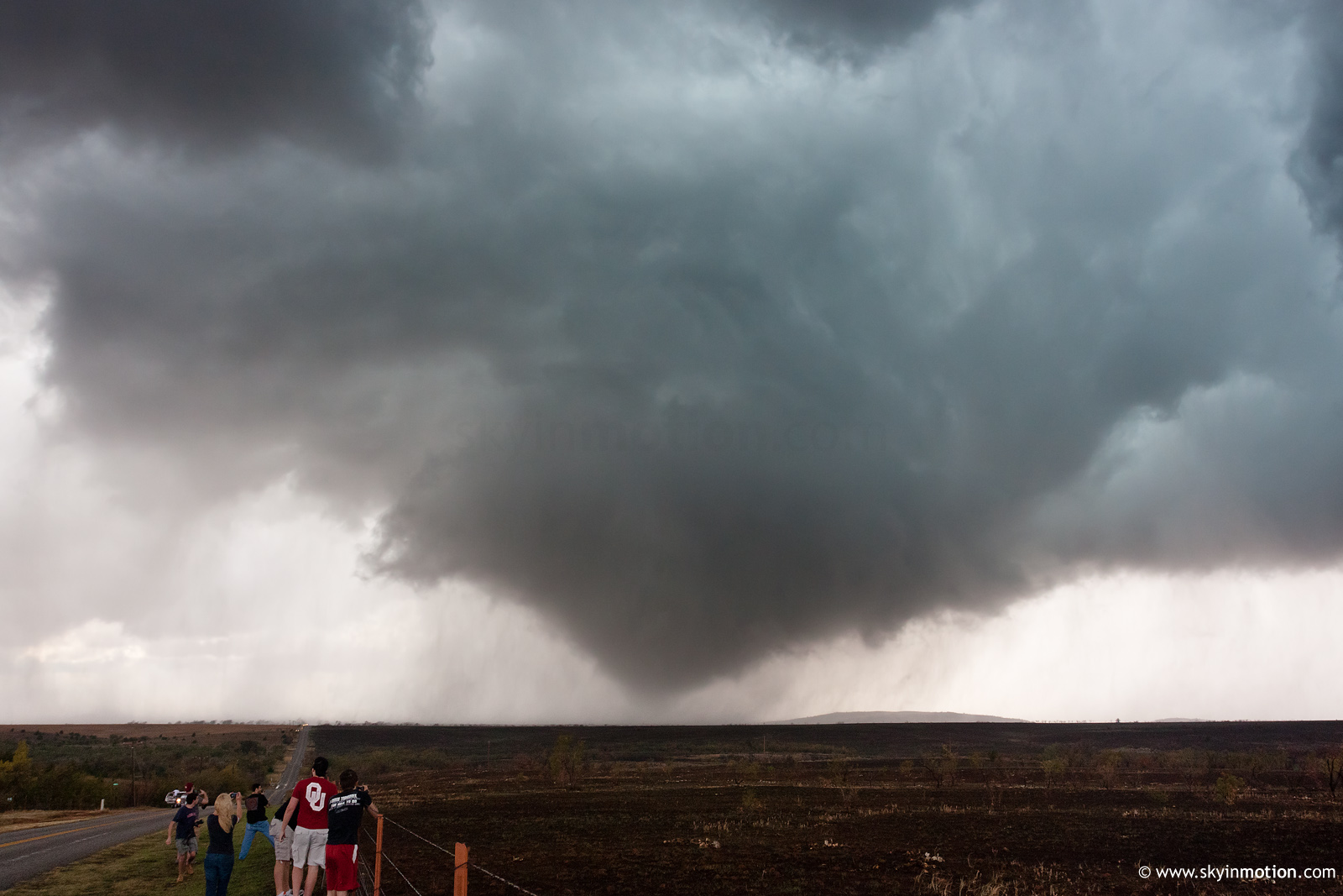
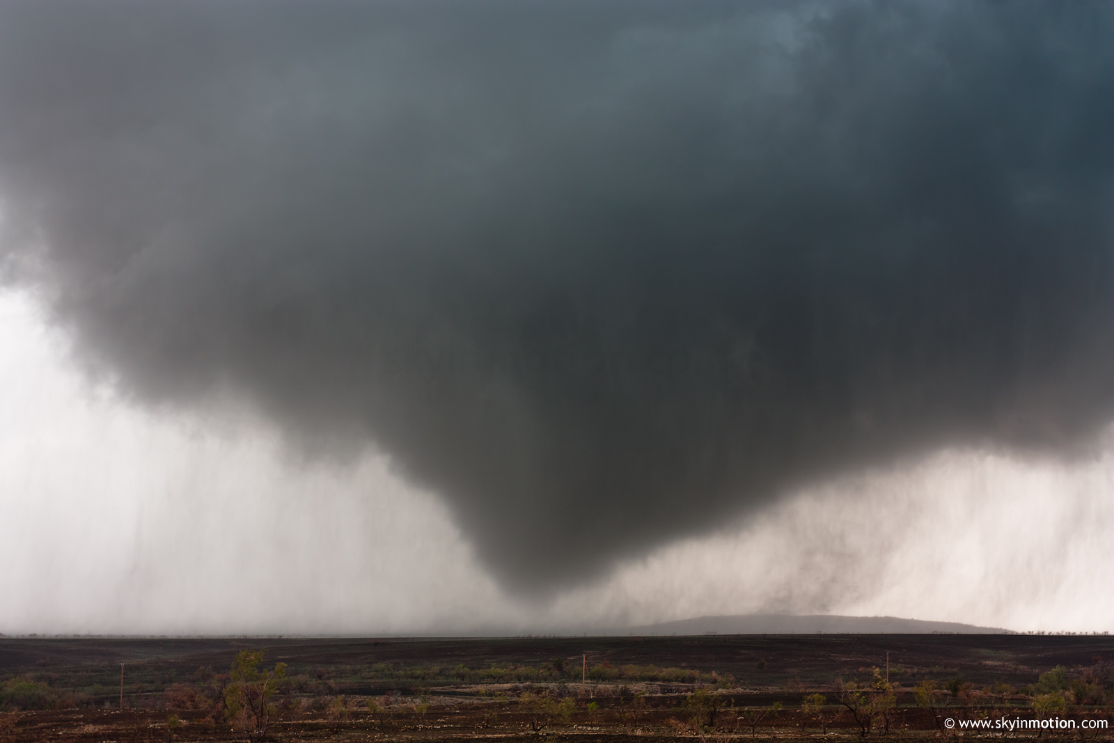
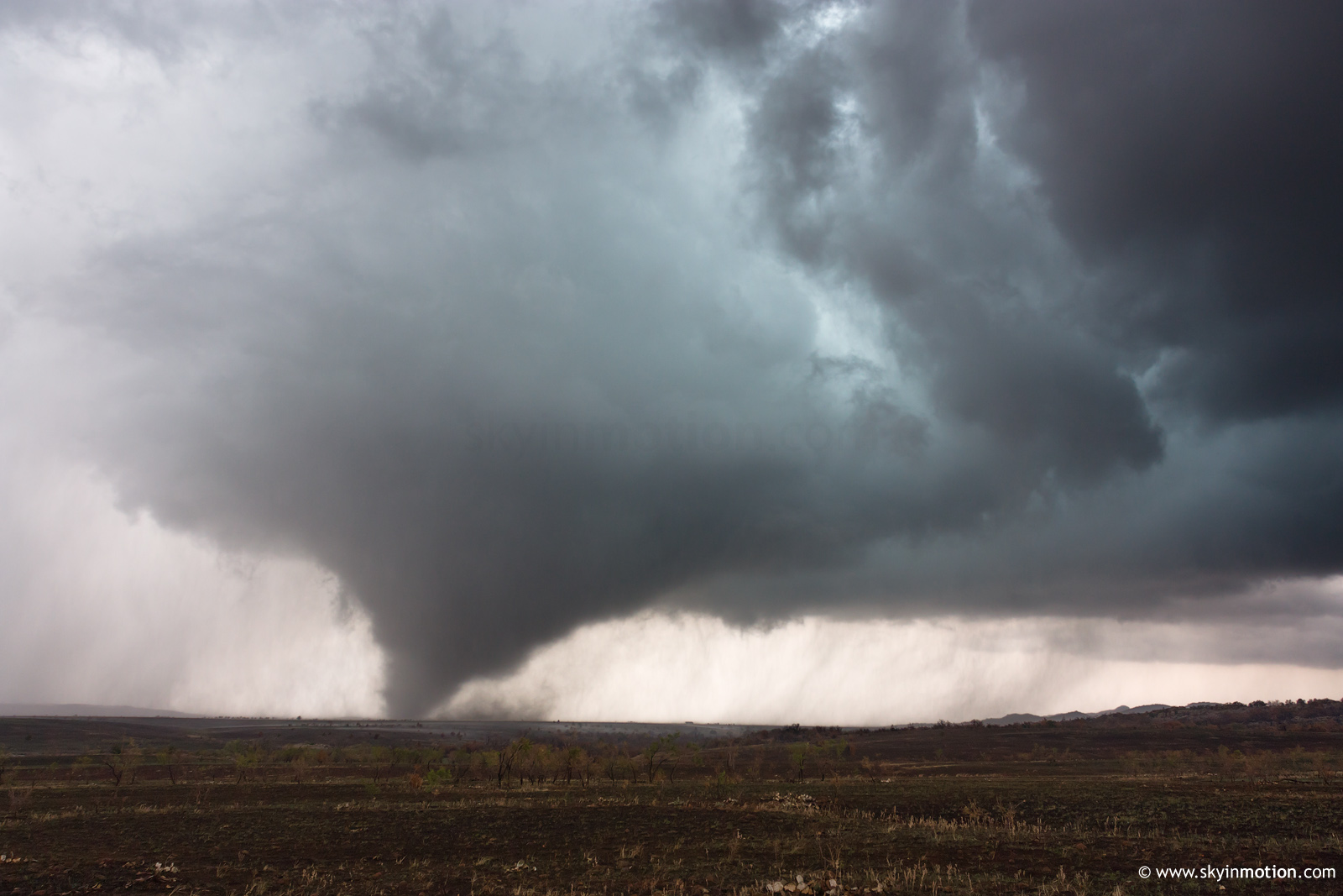
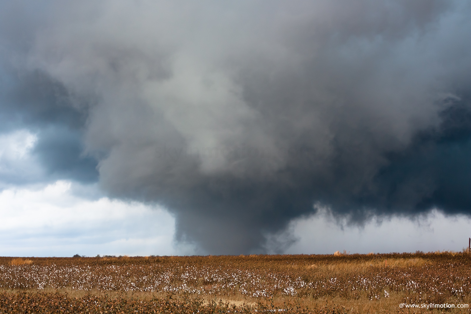
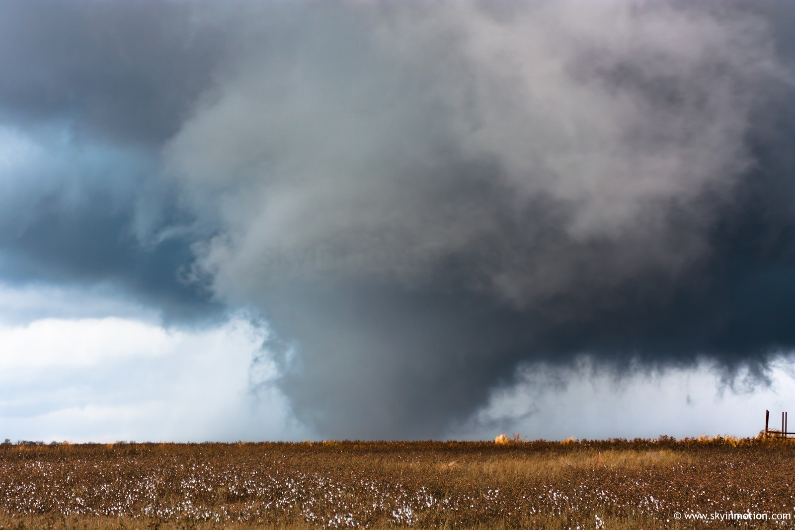
When I emerged from the rain, I was surprised to see an exceptionally ominous and rapidly-rotating wall cloud lurking to my SSW, probably just W of Manitou. This would soon give birth to the Snyder tornado; I wasn't aware at the time that the occluded Tipton beast was ongoing well to the W, out of view. From my vantage point (5 S Snyder), the Snyder tornado began as a backlit multi-vortex that persisted for a solid five minutes before transitioning to a large, powerful (possibly violent) cone that passed about a mile to my W. The very photogenic rope-out occurred just prior to it reaching US-183.


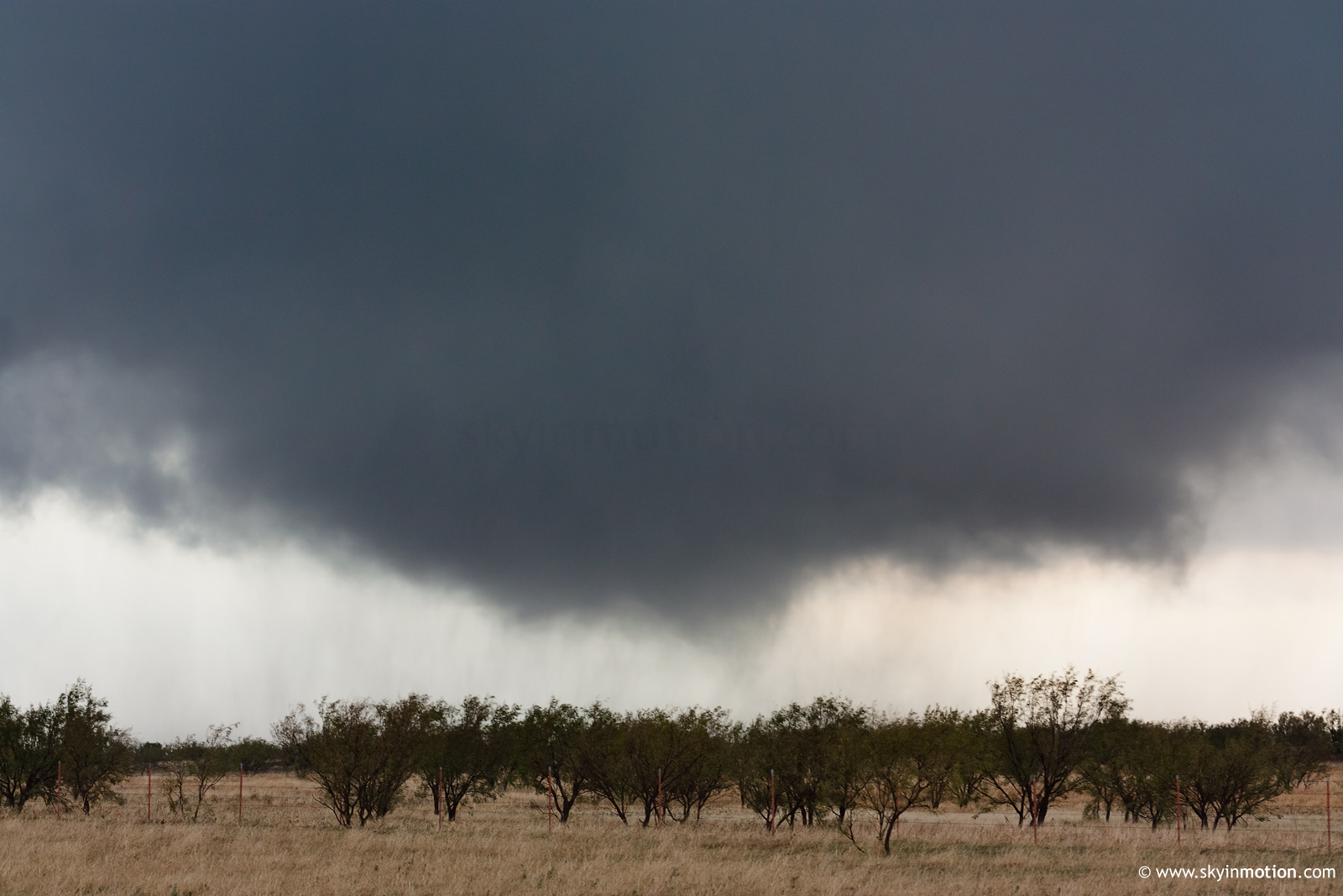
While attempting to get back ahead of the storm for its next cycle, I noted a brief rope tornado on the S side of US-62 about 2 E Snyder, but did not get pictures. This was while an apparent larger tornado was ongoing on the N side of the road, obscured by mountains from my position.
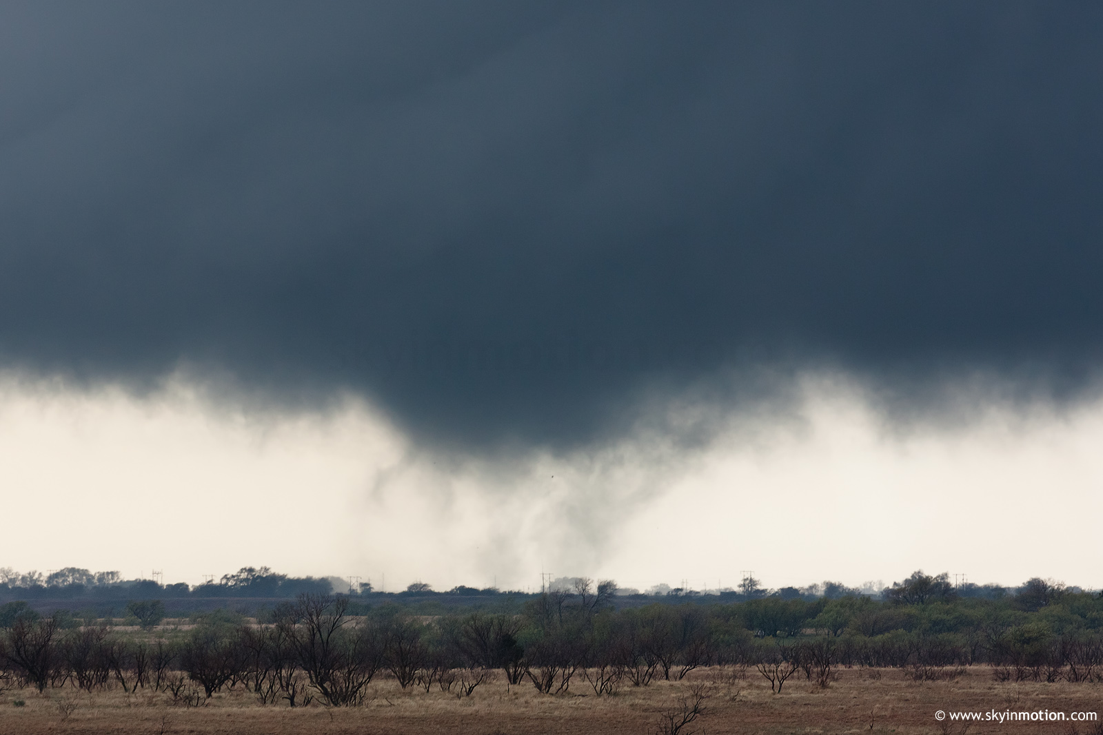
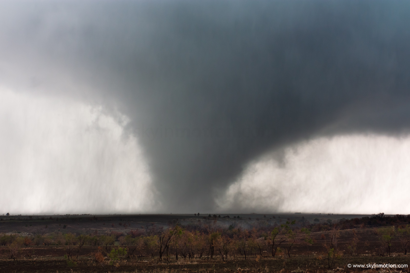
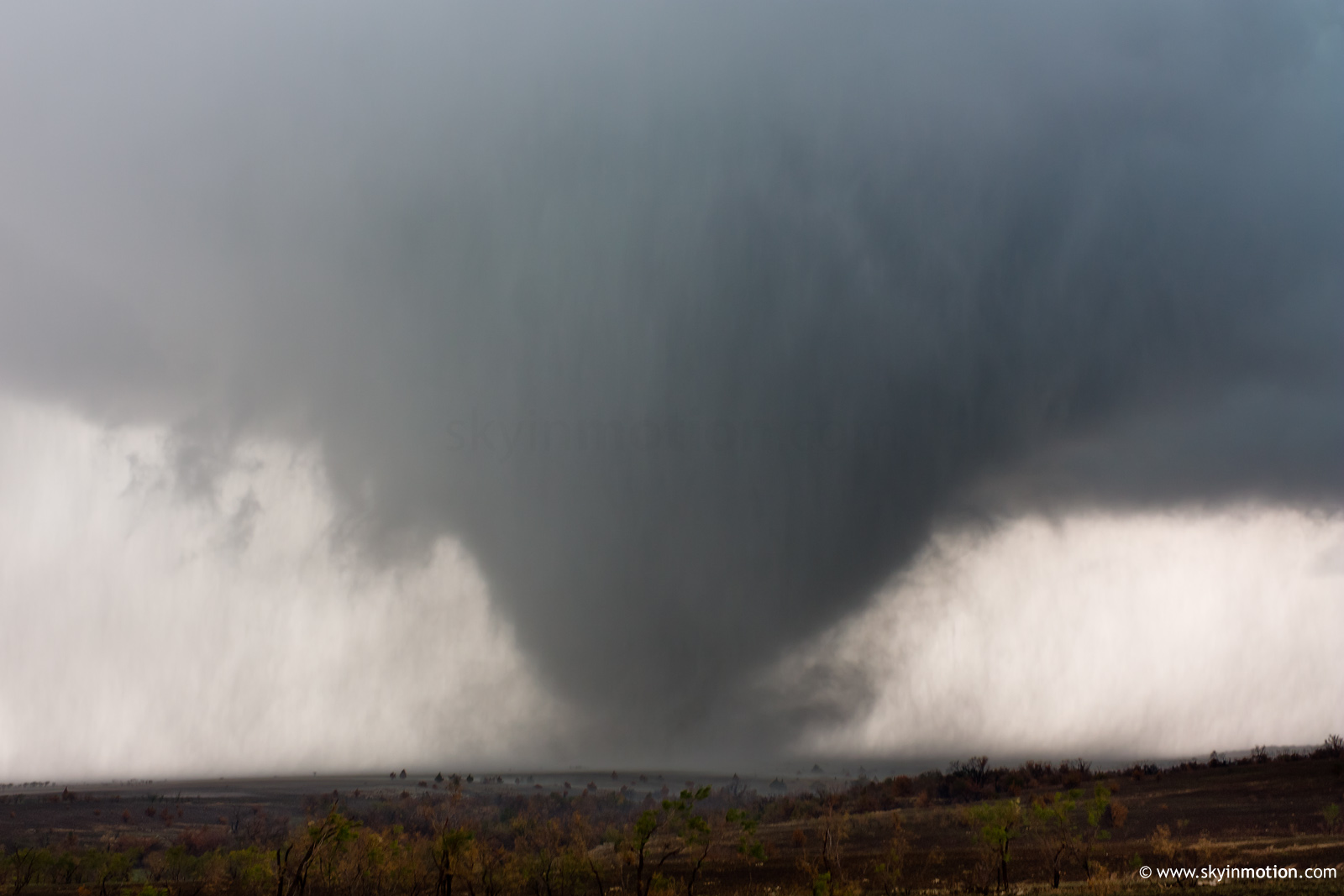
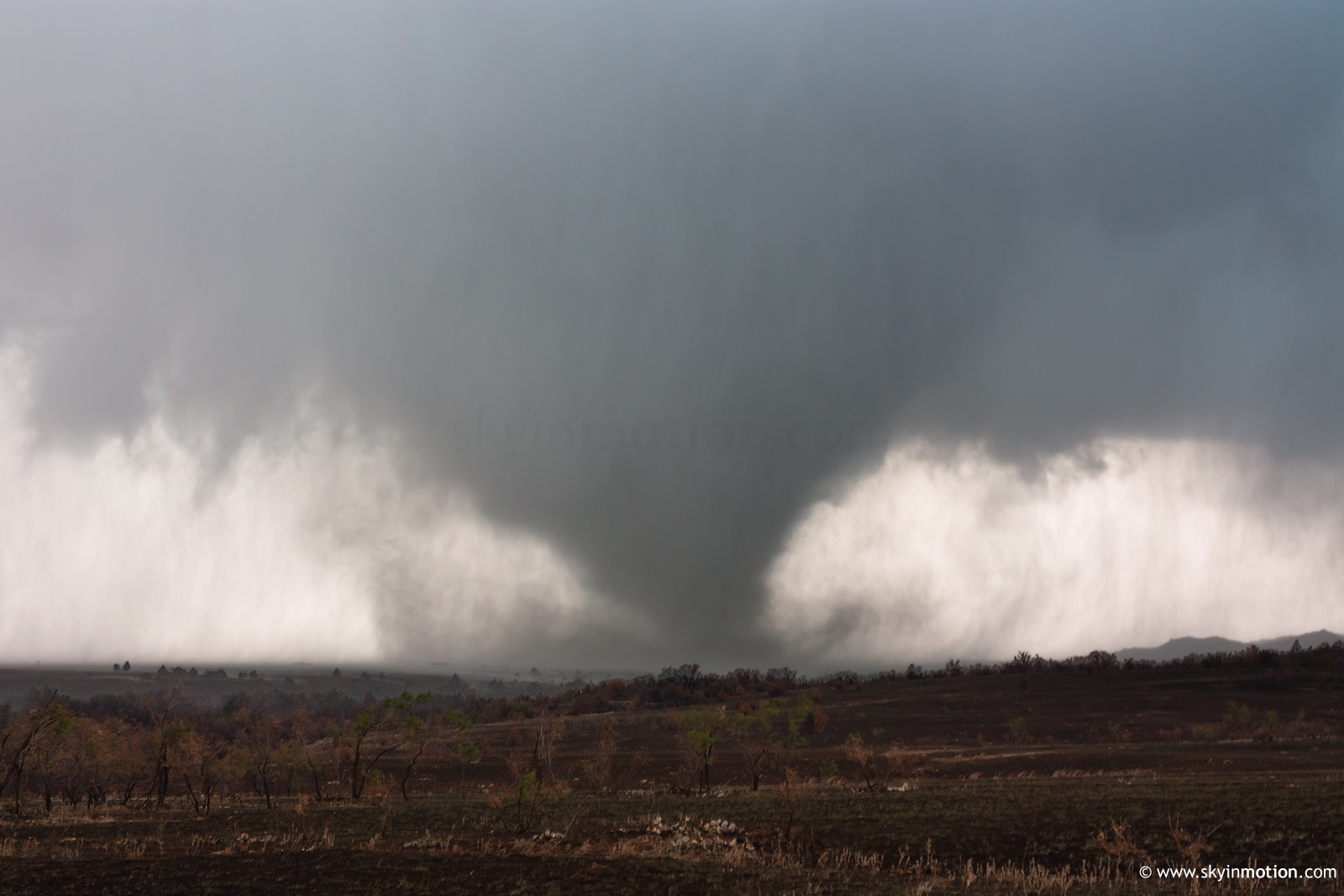
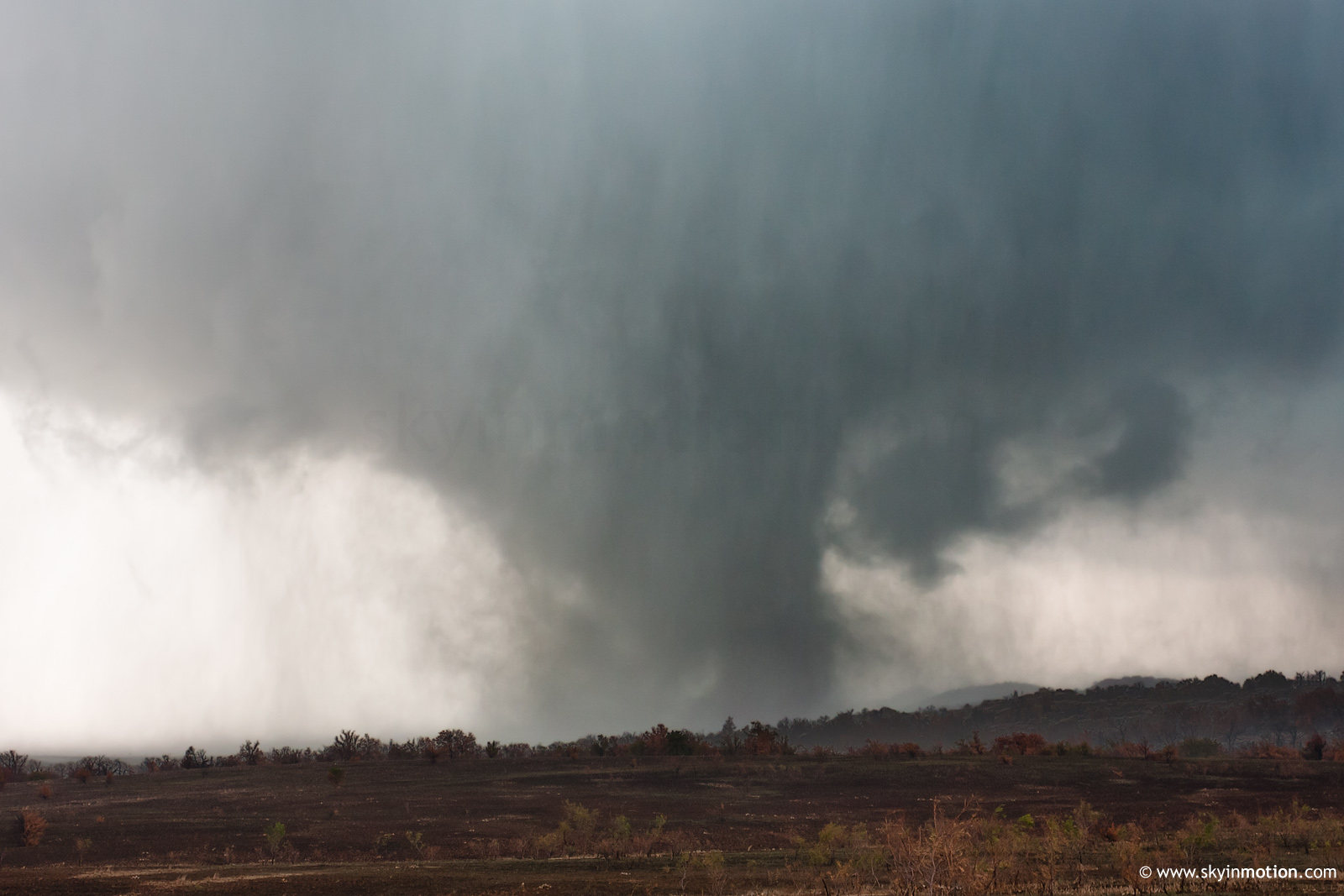
Along with everyone else and their dogs, I watched a new multi-vortex tornado develop to the S of OK-49 (just W of the western Refuge entrance) and then tear off into the mountains, transitioning into a wedge before disappearing into the rain.


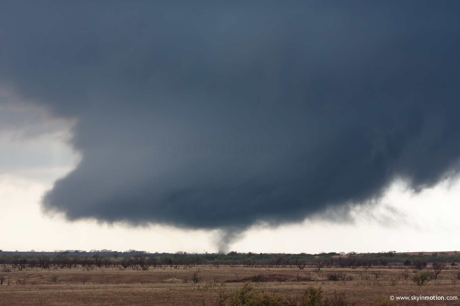
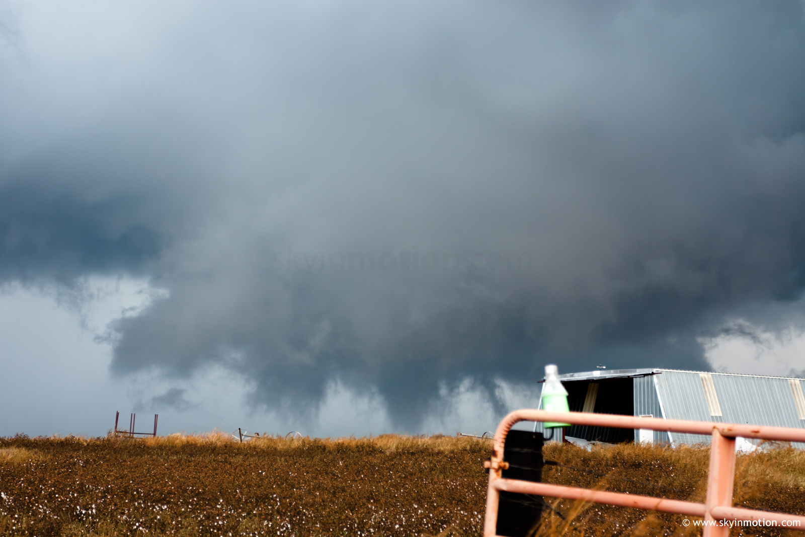
I made a blunder in continuing E through the Refuge to I-44, rather than turning N toward Meers (where some were able to catch the spectacular wind farm vortices). Eventually I caught back up around Ft. Cobb, just in time for the final tornadoes of the day. As I drove N through town on OK-9, I caught several glimpses of stout condensation funnels to my W under the large low-level meso, but could never stop in time for any shots. After exiting onto OK-146, I was finally able to stop and shoot the brief barrel/wedge stage of the tornado which moved onto the lake from about 3 NNW Ft. Cobb.