
Desperate for a spring break chase, we settle for a high-based storm at dusk along I-40.

A highly-anticipated trough was forecast to move into the Plains around this date from over a week in advance, stirring many dormant storm chasers who hadn't bitten on the questionable late-winter setups into a state of heightened early-season excitement. The week of this chase day was Spring Break at OU, so I knew ahead of time that for once, classes would not be a problem, regardless of the exact timing of the system. The timing smack in the middle of break was an annoyance, though, as I drove 670 miles home to AL the Friday before, only to come right back to the Plains on Tuesday after a mere three days at home visiting family.
As the major trough crashed ashore on the West Coast, some of the energy cut off and formed a closed low over Baja California that became cut off from the main jet, spelling doom for the earlier expectations of a major outbreak. Instead of a single, powerful system producing a day or two of widespread severe weather, we were now faced with a nearly-stationary upper-level system spitting out separate, less significant shortwaves throughout the week, beginning with this day.
I left Norman around 11:30 AM with Brandon (the driver), Bryan, and Ilya Neyman with an initial destination of Elk City. Widespread cumulus could already be seen at that time, and surface temperatures were rising through the 70s. Moisture was in question, as always for pre-April events, but a shallow layer of mid to upper 50s dew points was overspreading C and W OK during the morning. We checked wifi in Elk City and decided, based on data and a new SPC MD, to continue west to Shamrock, where we picked up lunch and watched radar for any signs of initiation. Instead, as shallow moisture began to mix out with daytime heating, the Cu field nearly disappeared during the mid-afternoon hours over the target area, although the dryline remained well to our northwest. After spending a couple hours in Shamrock, things were looking rather discouraging to say the least, and the only decent Cu in sight was located to our northeast over W OK where capping was forecast to be quite strong.
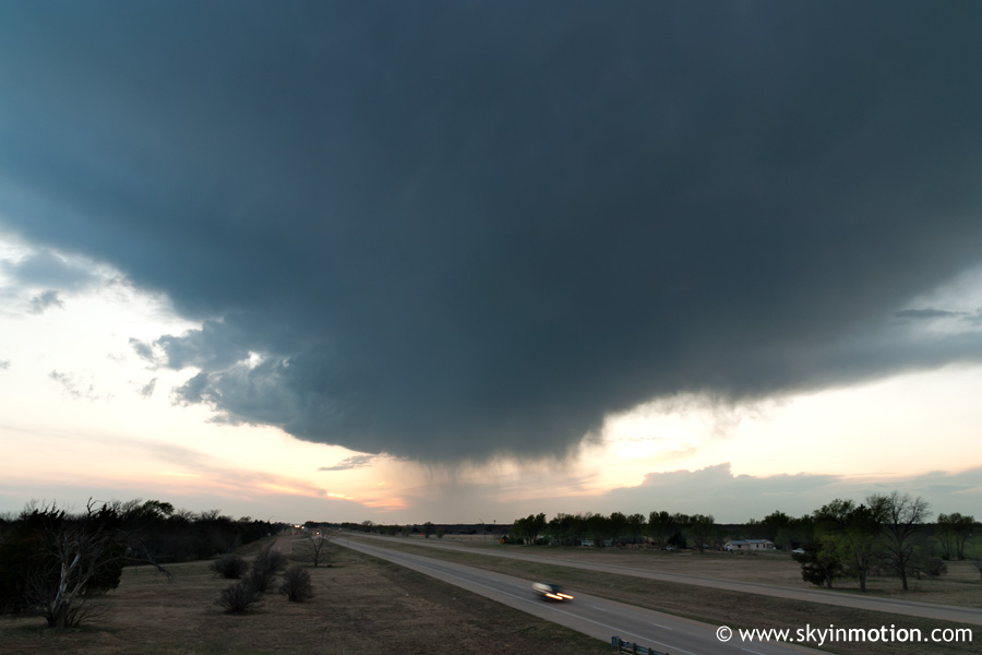
Eventually, we opted to head back east on I-40 despite the capping in that area just in case something managed to break through. We made it as far as Sayre before giving up on that, but checked data once more and saw a lone thunderstorm developing over the west-central TX Panhandle, moving east-northeast at about 35 mph. Though it obviously was not surface-based with the pitiful moisture (dew points in the mid 40s), and thus there was no tornado potential, we decided it was worth returning to the Panhandle for a look as it approached from the west - after all, we'd already spent all day driving, and some of us had driven 700 miles the day before just to be in position to chase this day! Sticking it out proved a wise decision, as the high-based storm was quite a beauty, especially in the evening light.
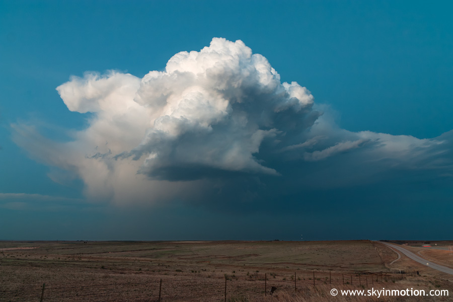
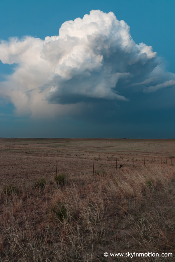
Heading west out of Shamrock, the dry appearance of the cell along with the evening light was too beautiful not to photograph, so we stopped briefly for that near the Wheeler/Hall county line.
As nice as it looked backlit, we soon realized we probably should've made a more hasty effort to get behind it, as it was breathtaking from the west.
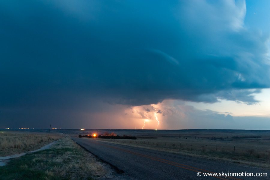
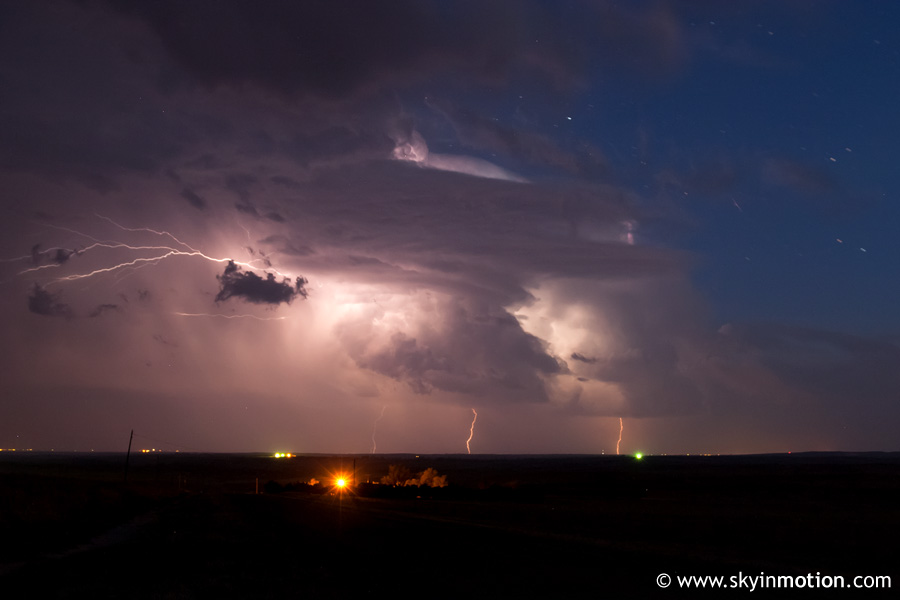
Just as we were wrapping up our video and photography, developing storms to our south became increasingly impressive, so we hung out just south of I-40 near McLean a bit longer to watch that. The last glimmer of sunlight from below the horizon had faded by this time, but with lightning strikes we could make out very impressive structure on the storm immediately south of us, which was fairly well-separated from the linear complex farther to the south. I snapped several long exposures of this before we took off to intercept the storm.
We ended up stopped near Quail in Collingsworth County as frequent lightning, torrential rain, and small hail battered us in the core. After enjoying (with some reservations from Bryan and I) the eerieness of sitting in the middle of an intense, discrete thunderstorm after dark with no radar data, we finally hopped back on I-40 and headed home. The storm parallelled us to the south of the interstate well into western Oklahoma, producing some nice lightning and strong winds before weakening in Washita County.


