Despite LCL issues, a late-firing supercell puts on a spectacular tornadofest at sunset for one of my best chases of all time.
Observed 2 tornadoes.
Pathetic as the 2012 Plains storm season had been, 2013 was by this point well on track to upstage it in suckiness and rival the likes of 1988/2006. So by May 18, this "day-before-the-day" setup that might seem ordinary for mid May in a year more... well, ordinary... felt like a godsend to chasers. Earlier model solutions had suggested some serious timing issues, with questions as to whether deep-layer shear sufficient for supercells would emerge from the Rockies in time for this Saturday setup. Trends during the final 48 hours proved quite favorable in this regard; however, moisture and LCLs remained an issue, especially with southward extent. Still, I felt unusually positive leaving home this morning, relative to the setup. More than likely, it was just the proverbial bar lowering into the abyss during a March, April, and early May with squat for good storms. Even so, the stars would align in a fashion even my good vibes never saw coming, and by 9pm I had a new candidate for all-time favorite chase day.
I left Norman sometime around 10am and headed to WWR for lunch, still unsure how far N I wanted to gamble. I didn't stick around for too long before continuing to Greensburg for another pit stop. Upon arriving there, I found the expected chaser hordes already in place. A look at the latest data and satellite trends sent me packing for a northbound road once again, and by the time I hit Kinsley, explosive convective initiation was underway to my W and NW. A familiar High Plains dryline chase scenario was unfolding with regard to moisture and LCLs: the higher moisture content to the S was offset by warmer temperatures, leading to near-uniform 18-25 degree T-Td spreads from WWR to HLC. However, I noted a slight bias toward lower spreads with northward extent, so I brazenly continued in that direction -- now well past both the center of SPC's 10% tornado risk area and the centroid of all chaser SN positions.
By LaCrosse, I decided it was time to enter my more typical hedging mode and chill out for a bit. A couple supercells were evolving over NW KS in an environment of what looked like prohibitively high LCLs, and the southernmost was just 25-30 mi. to my WNW near Ness City. I resisted pursuit for well over half an hour, but ultimately caved sometime around 5pm. The 30 minutes that followed saw me blasting furiously toward the storm, only to arrive and find the very high-based, junky appearance I should have expected. Another half hour was squandered photographing this unrewarding, HP beast until the hordes became so overwhelming as to hasten my exit from the area, back toward LaCrosse.
On my way back S from the Ness Co. storm I felt uncharacteristically relaxed, given the circumstances: several spaced-out dryline storms to choose from, sunset creeping into view, and no margin for error. I was not at all confident that any of the storms to my S would make my day, but I was fairly confident I wouldn't regret leaving the one I had to the N. I was eyeing new CI near the OK/KS state line, and aiming in that general direction. Soon, though, I took notice of the 82/68 observation at GBD and an isolated incipient cell heading in that direction, one which had emenated from a pronounced dryline bulge near DDC. This cell would go on to drop the most photogenic tornado of the season within the hour, while both the Ness. Co supercell and all convection S of the bulge would continue to stink it up. Even though my original choice of the Ness Co. storm had fallen through, and my next instinct to blast S toward the DDC-PTT corridor was also incorrect, splitting the difference gave the right answer. As always, it's better to be lucky than good in the unforgiving and chaotic world that is chasing convection.
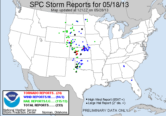
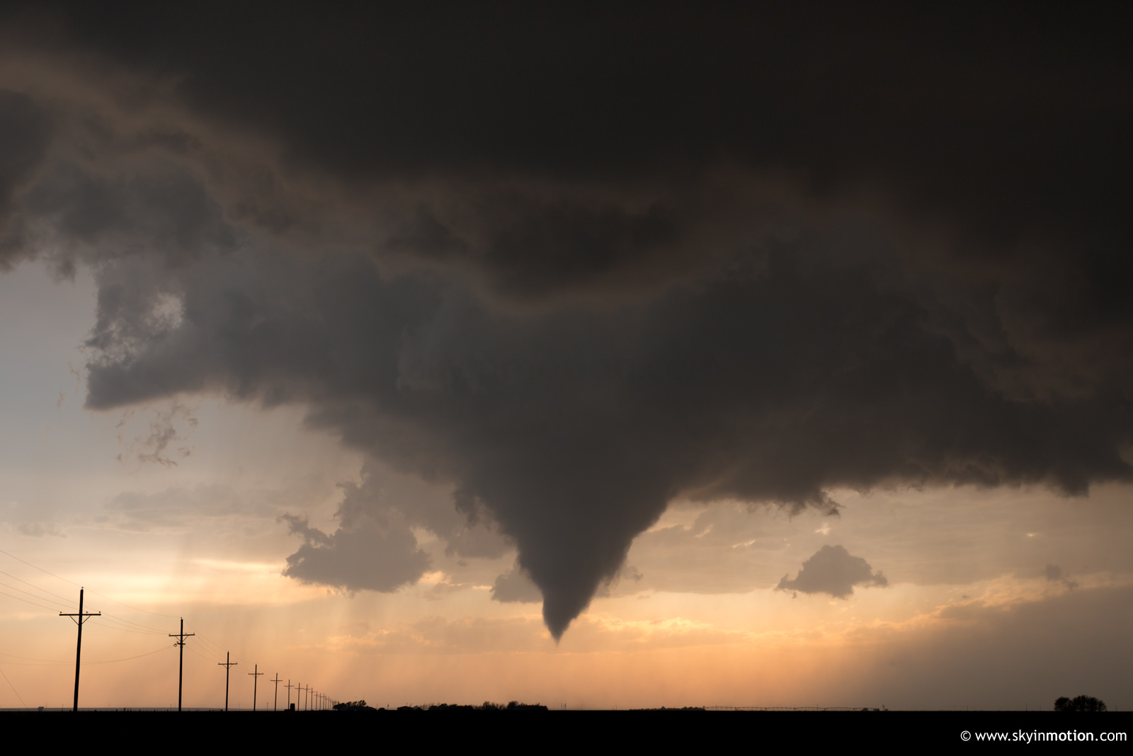
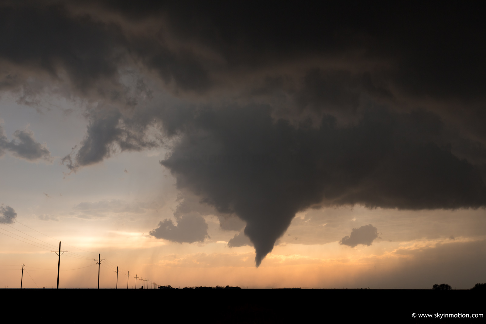
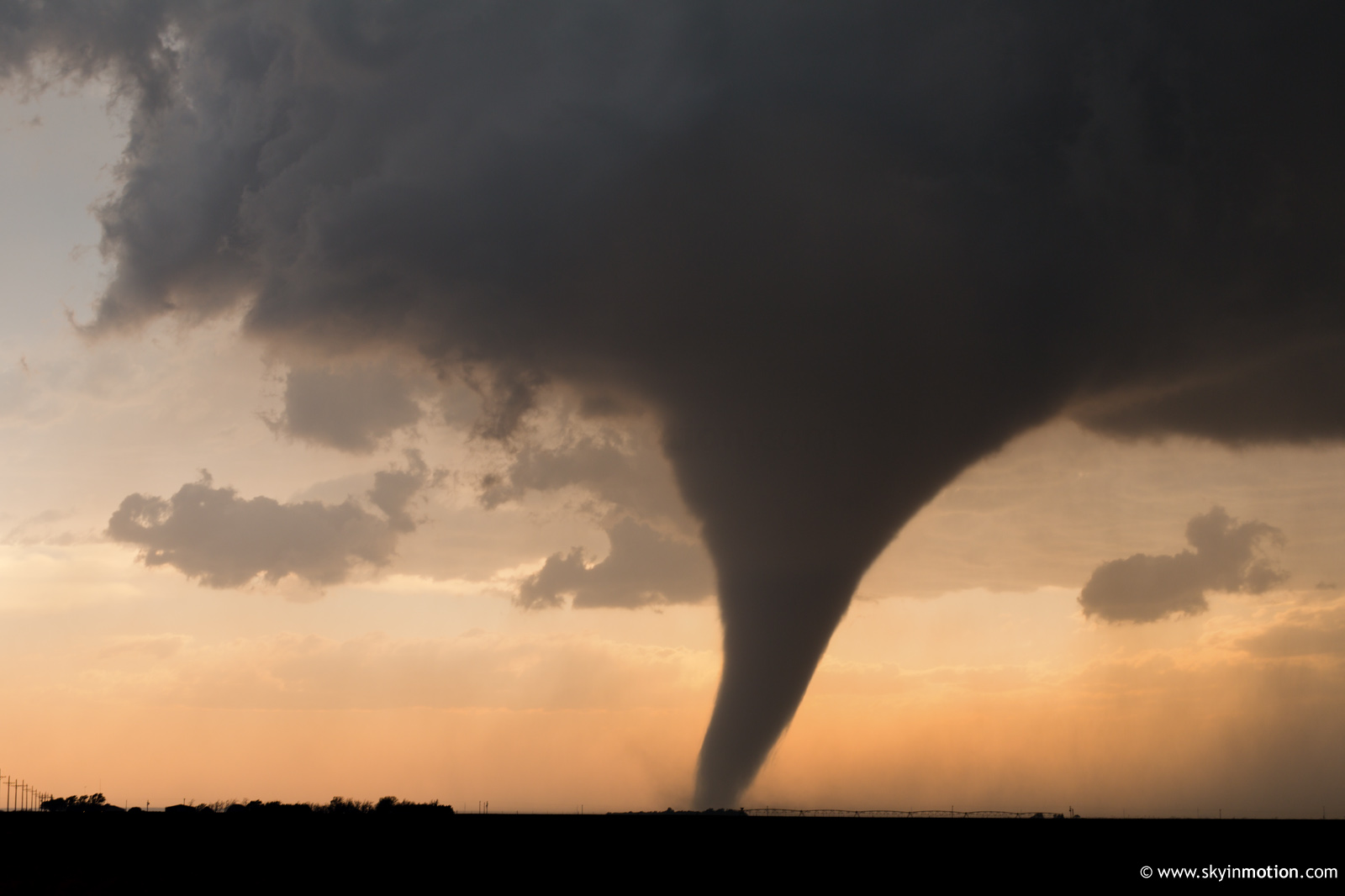
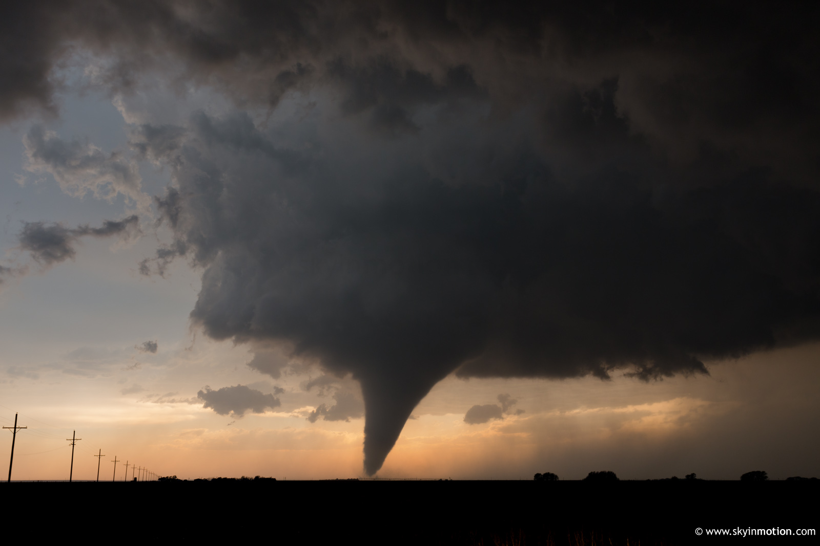
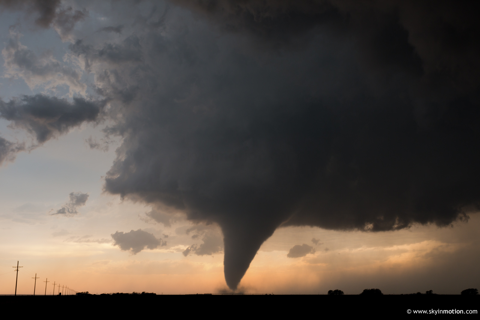
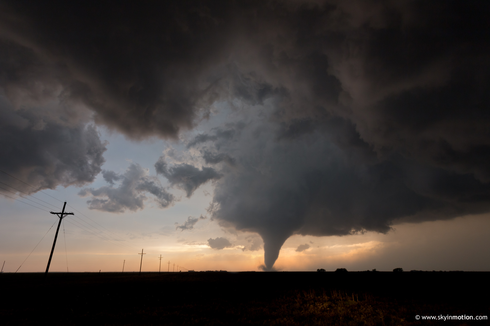
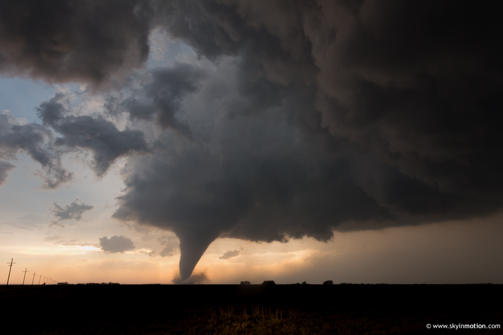
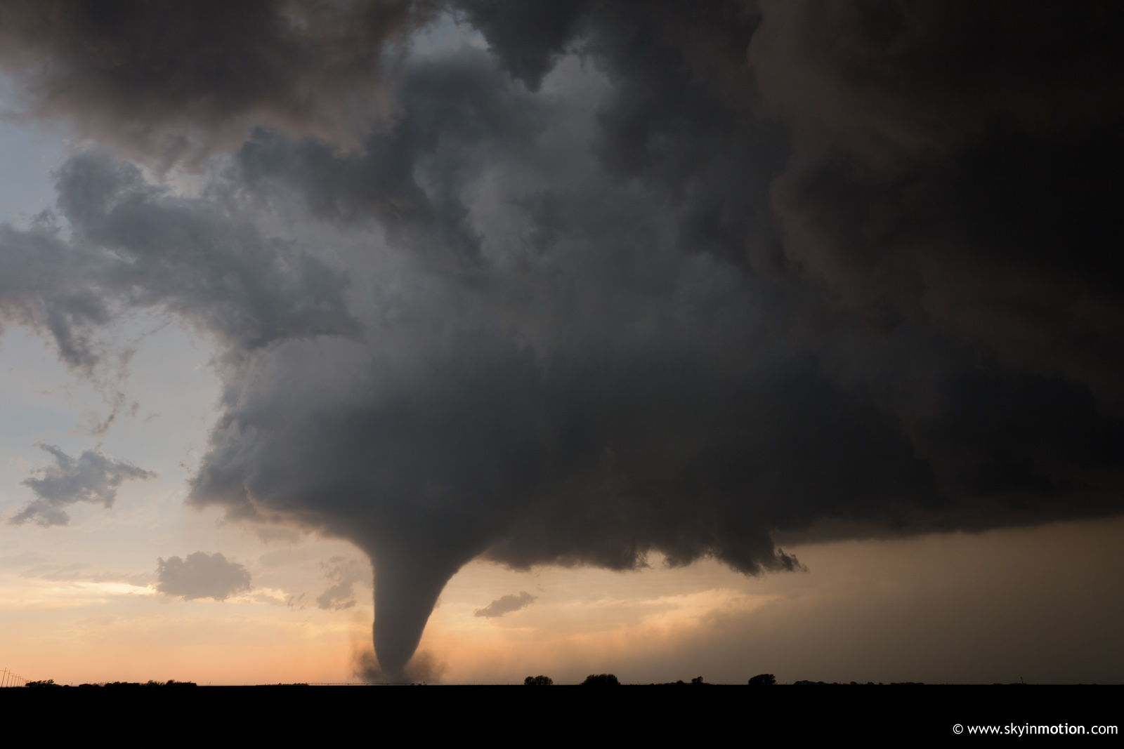
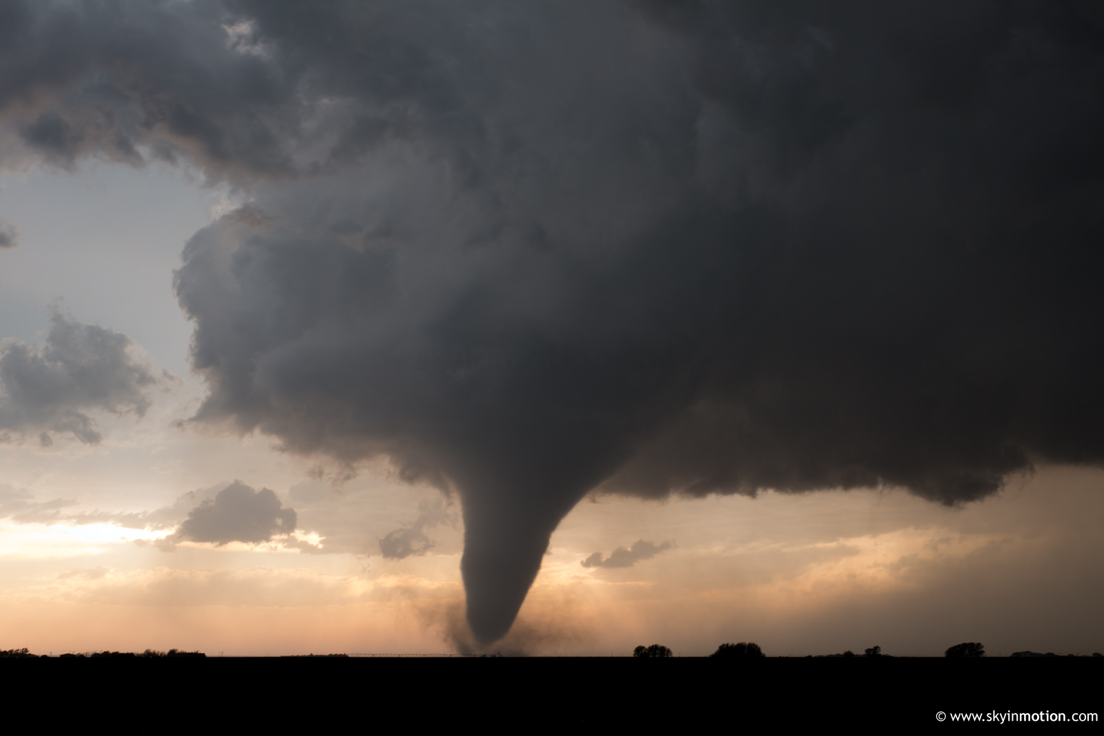
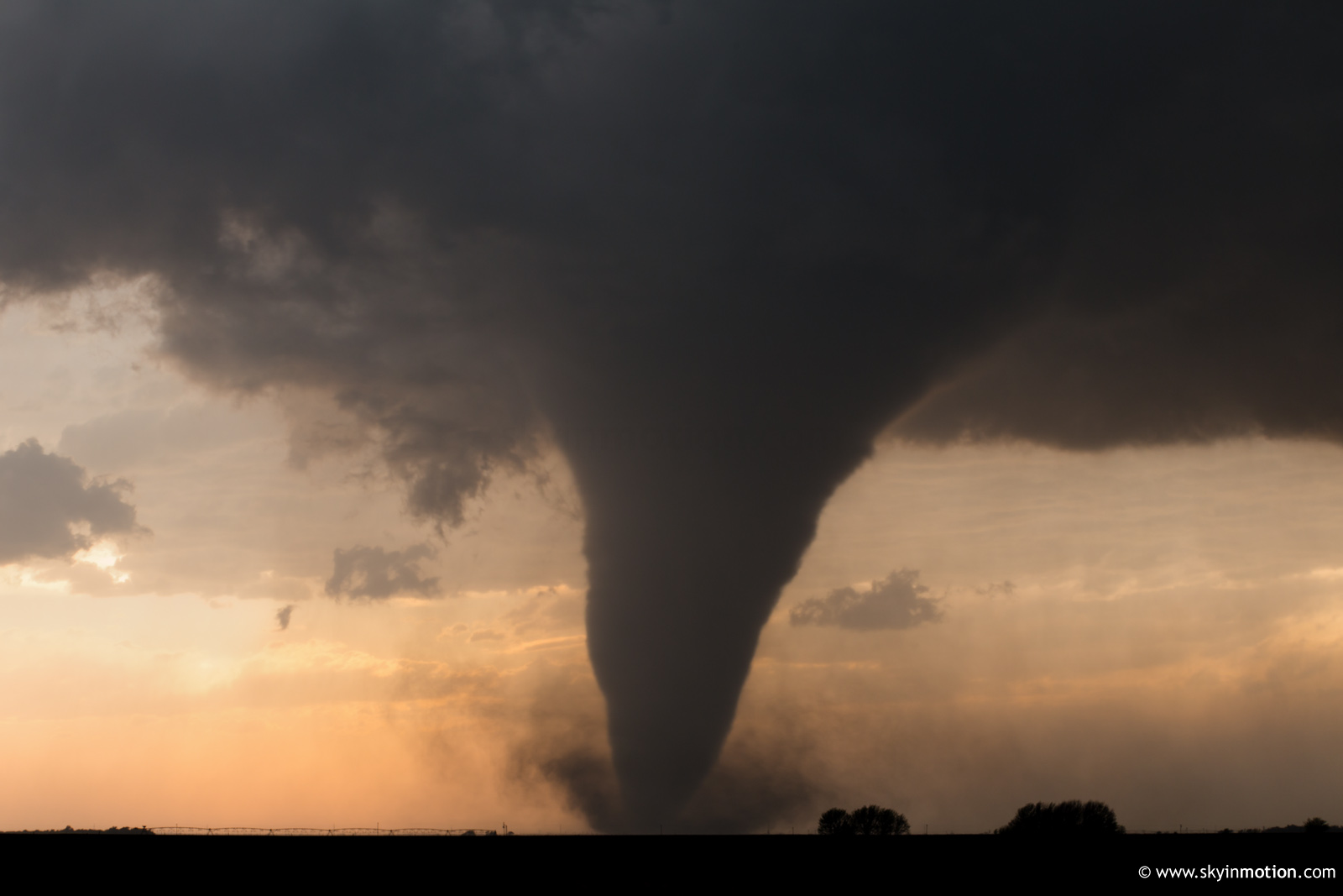
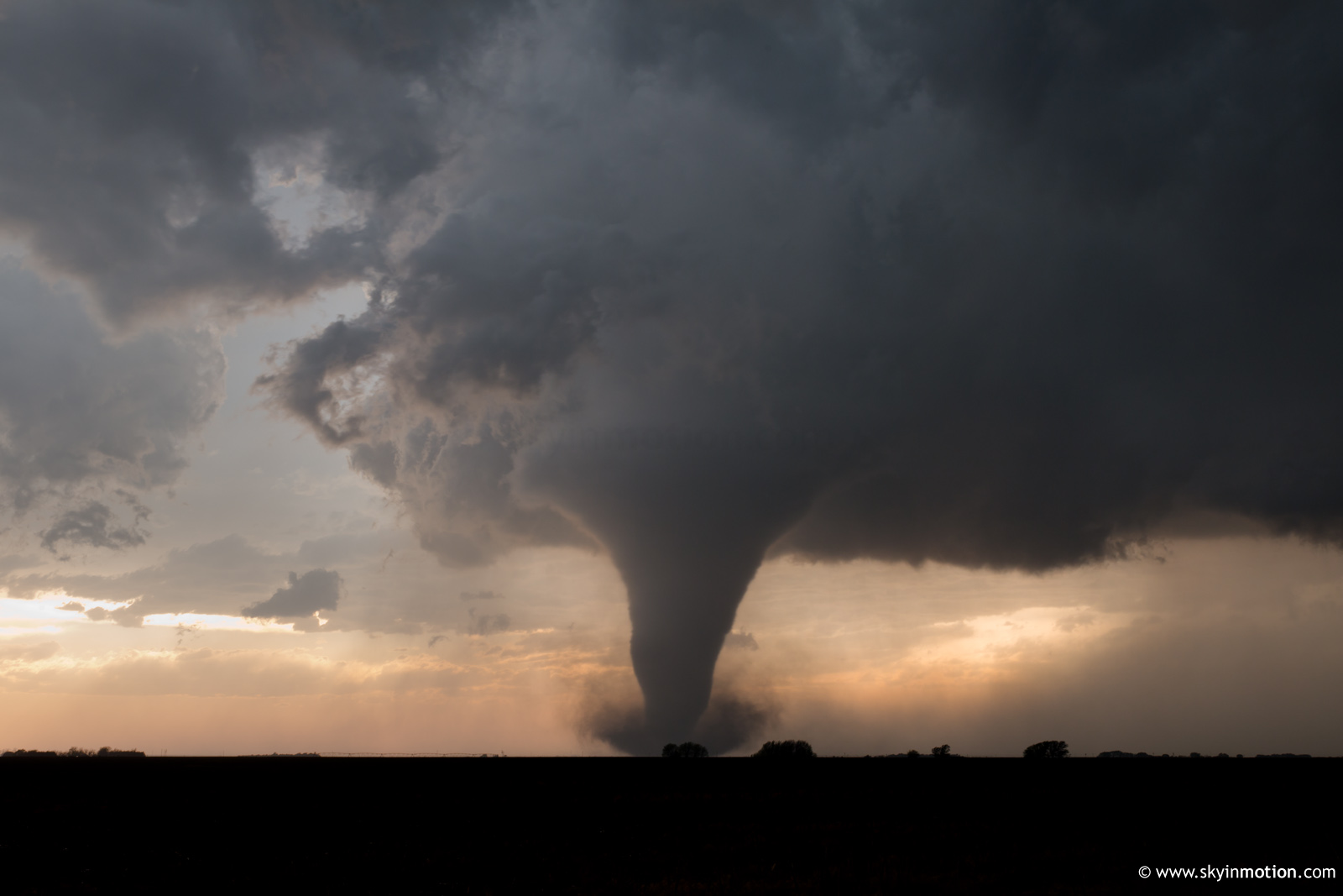
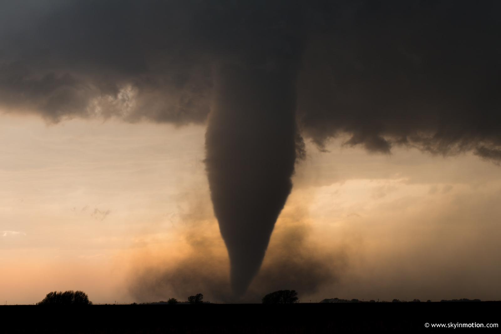
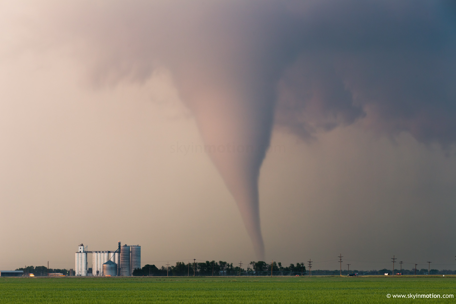
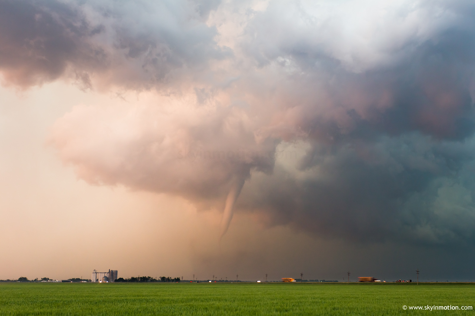
I arrived on the storm of the day just W of Larned and immediately observed a high-based funnel, highlighted at the beginning of the video. Boy, was this a sign of things to come. I stopped just W of US-183 and took a timelapse of structure that looked merely decent at first, but grew beefier with surprising haste.
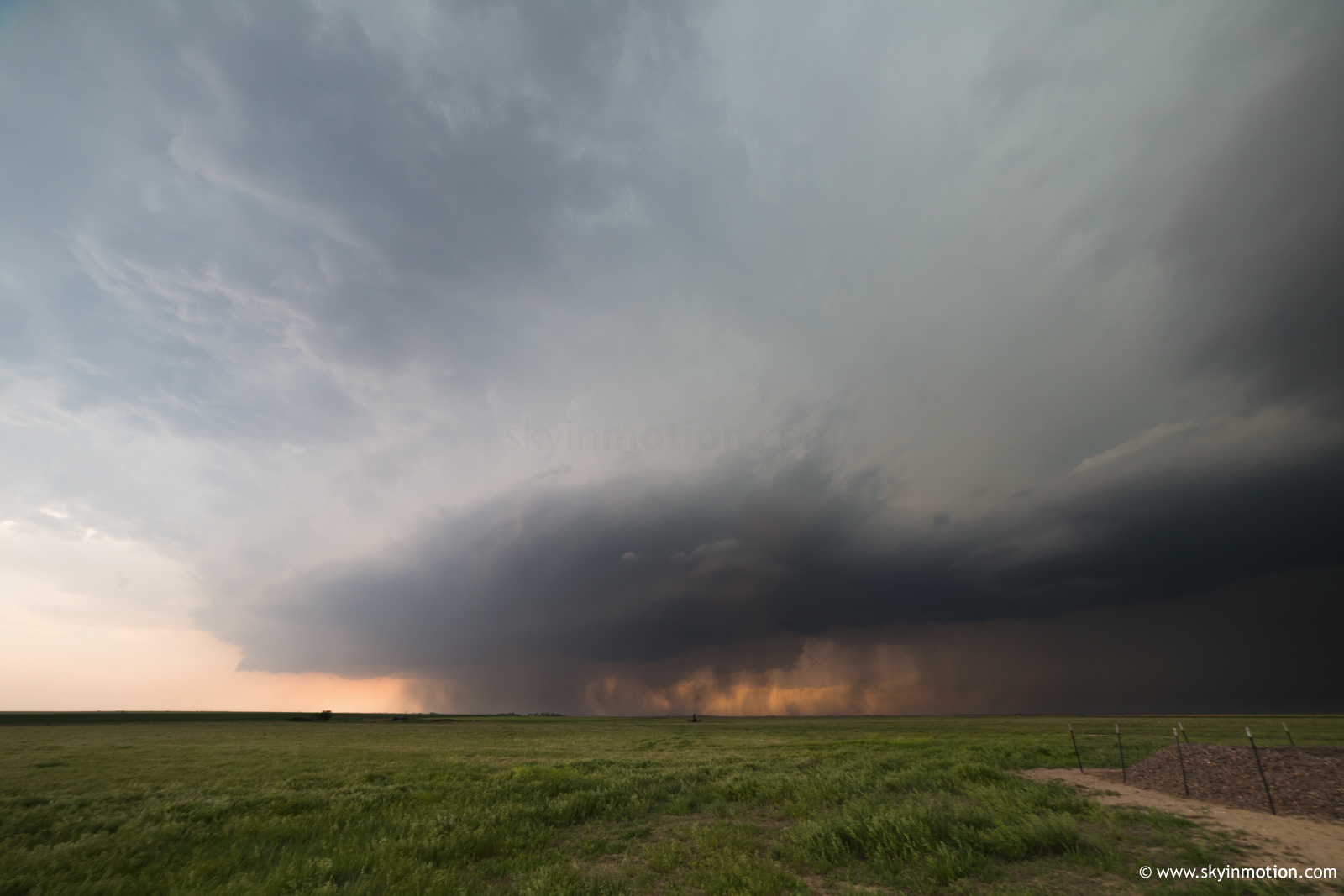
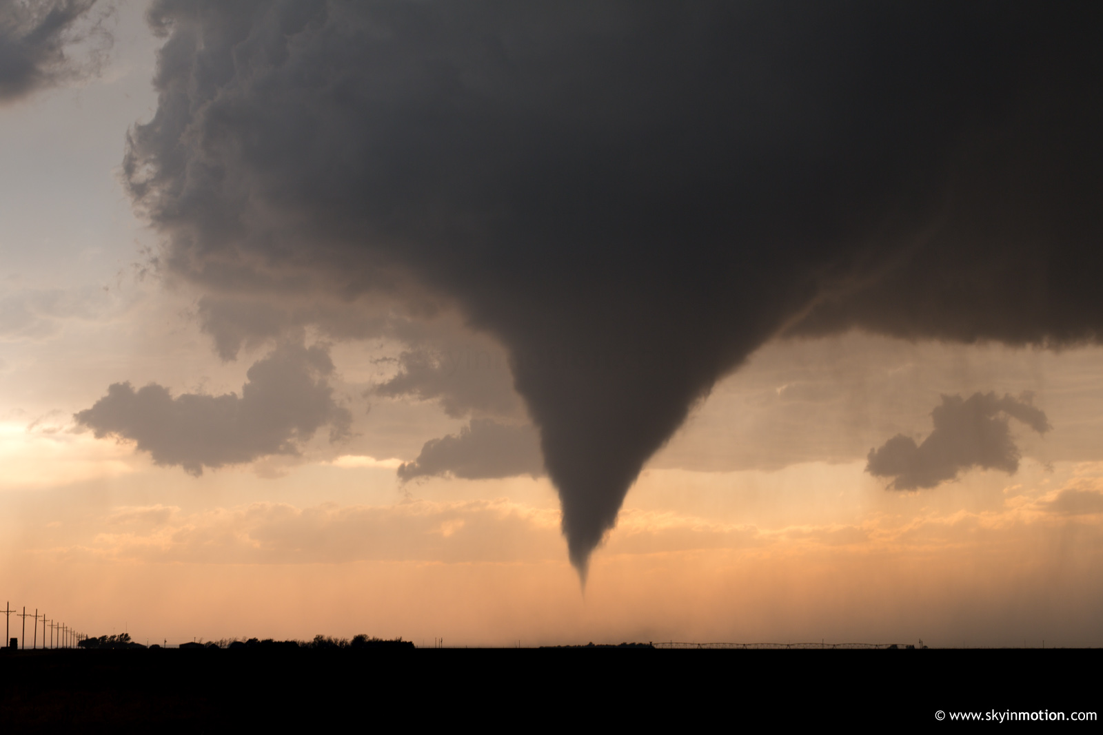
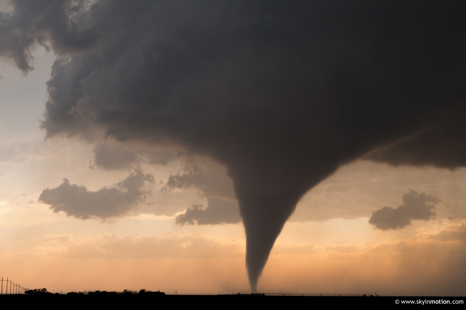
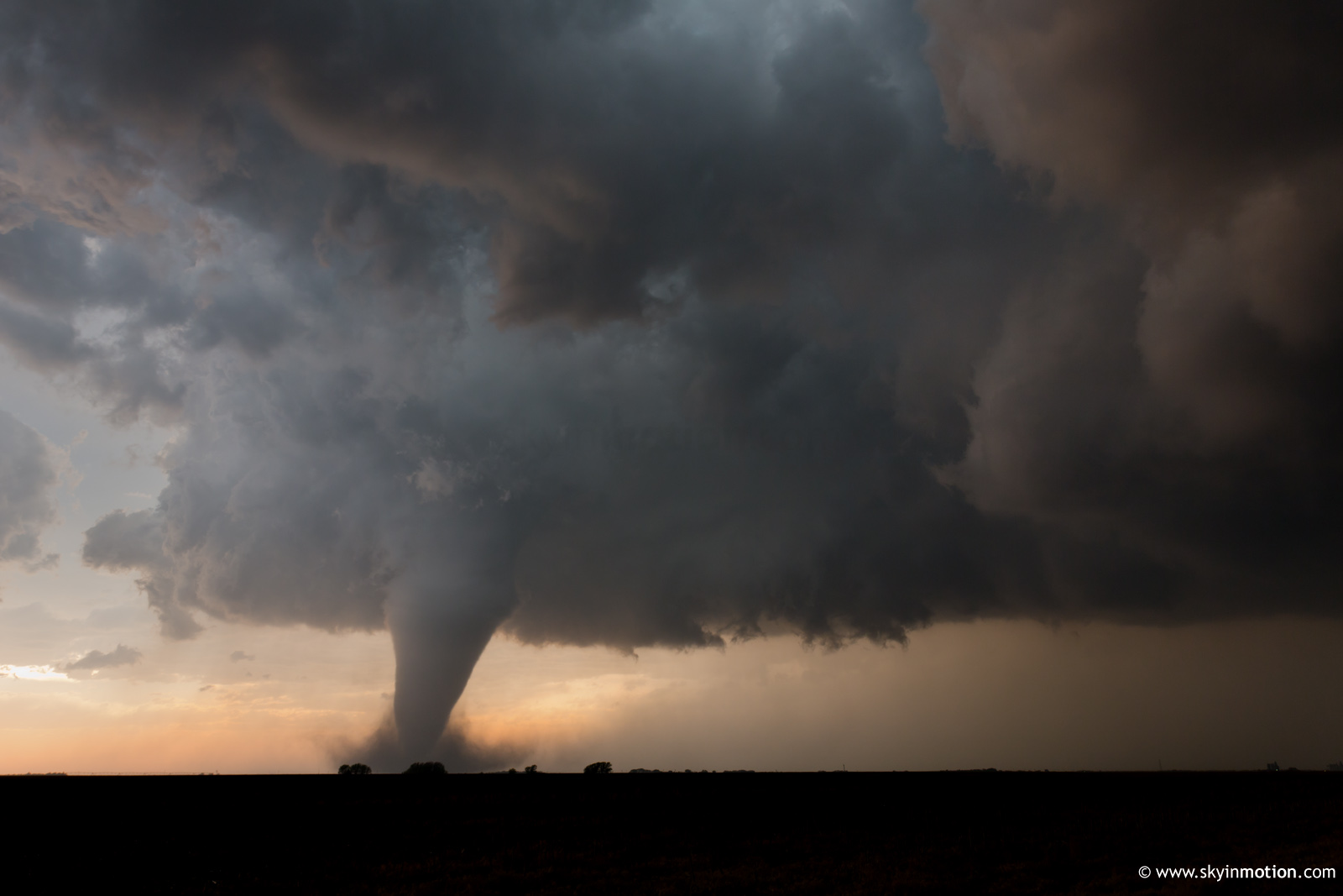
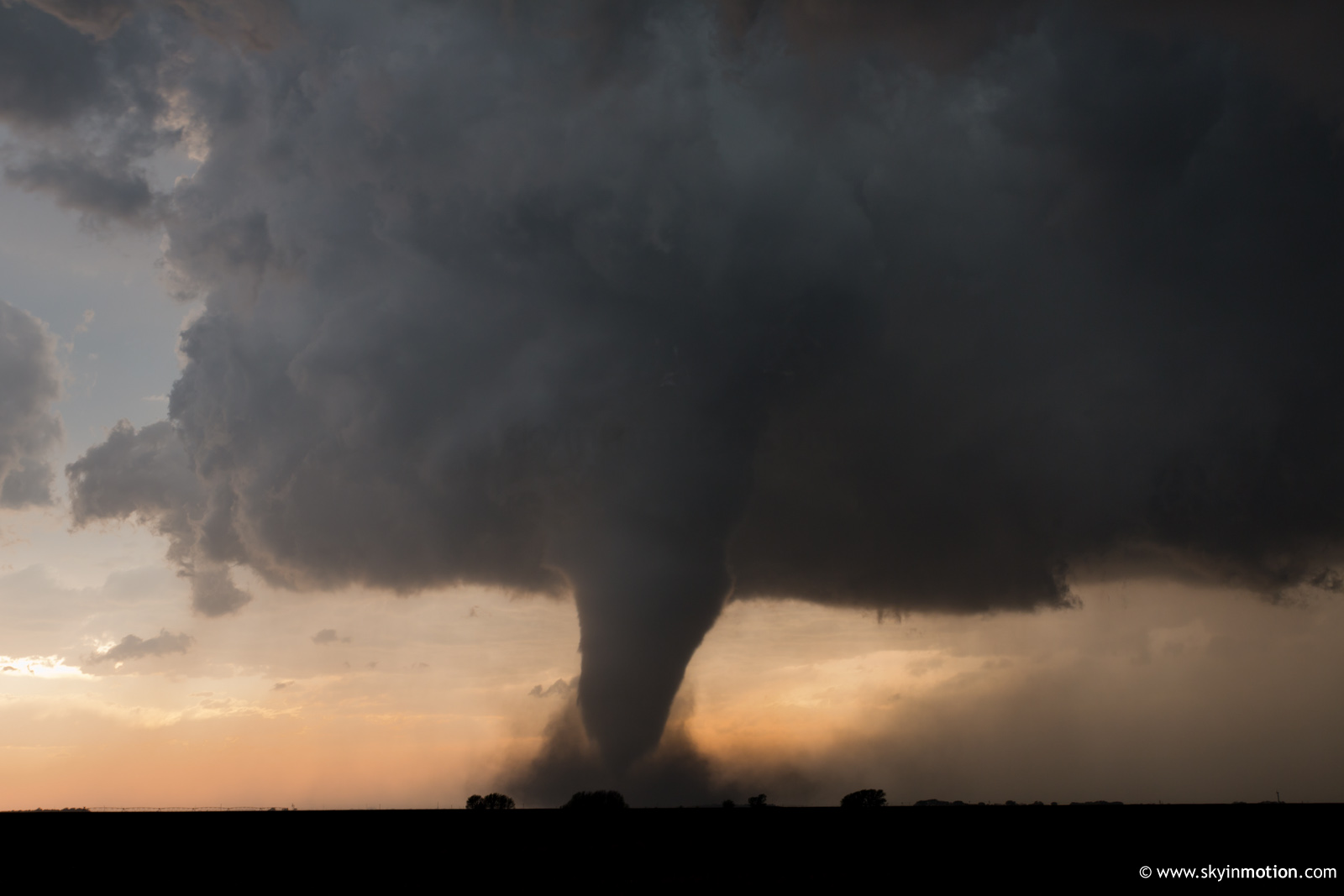
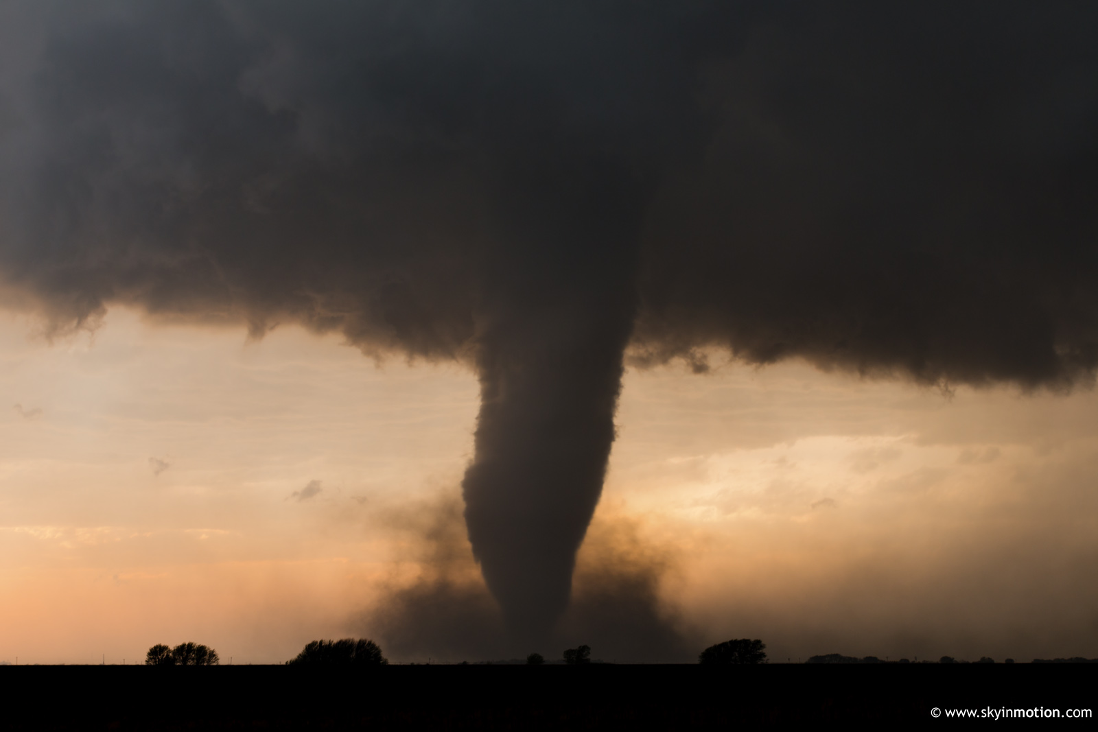
In hindsight, I probably ought to have abandoned this shot a little sooner. Once I came to my senses (coincident with noticing a pronounced clear slot under the base), I blasted W on the dirt grid as quickly as possible and watched the funnel descend. Once condensation reached the ground, I did what I seem programmed and destined to do in these situations: screeched to a halt and set up the tripod, sacrificing close proximity in favor of a steady shot. If I'd known what was coming, I certainly would have continued on for another minute or two, but I can hardly complain as it is. For the next 20 minutes I sat in absolute awe about 3 SSE Rozel, as this storm put on an exhibit defining why storm chasing is so beloved and claims so many "addicts."
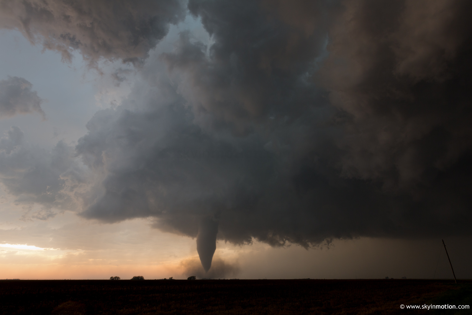
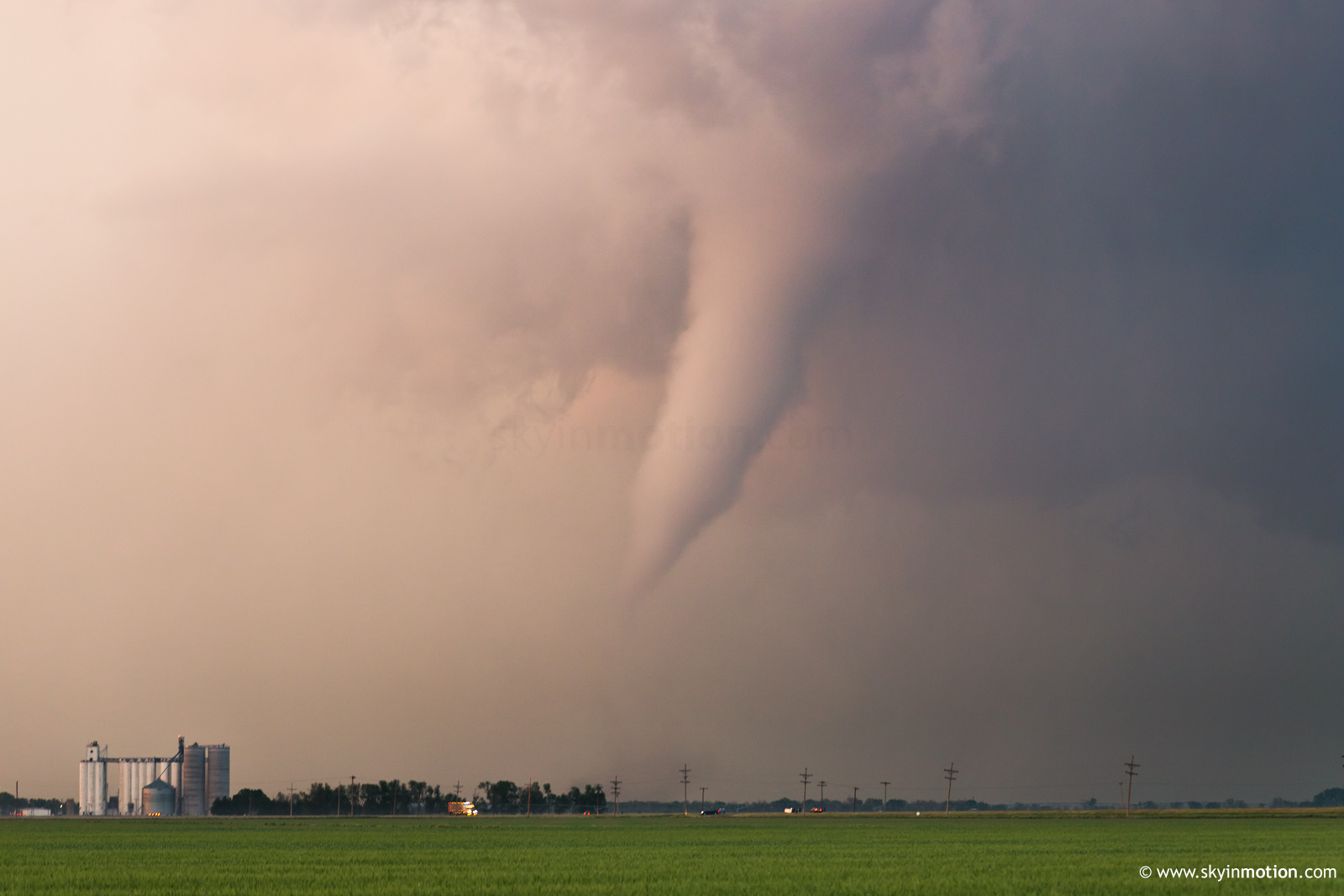
The English language comes up short in describing this experience, and I know the hundreds of fellow chasers who were transfixed at various spots within a few miles of me would agree. No one can understand until they see, hear and smell it for themselves; and I'm selfishly thankful that relatively few ever do, or Plains roads would surely be gridlocked from the Gulf Coast to the Canadian Prairies every spring. I've chased for eight years now, but the Rozel tornado left me in such a daze that I actually mishandled the remainder of the storm's discrete life cycle rather badly. I fortunately noticed the same circulation re-emerging for a couple minutes NE of the town and snapped a few telephoto shots.
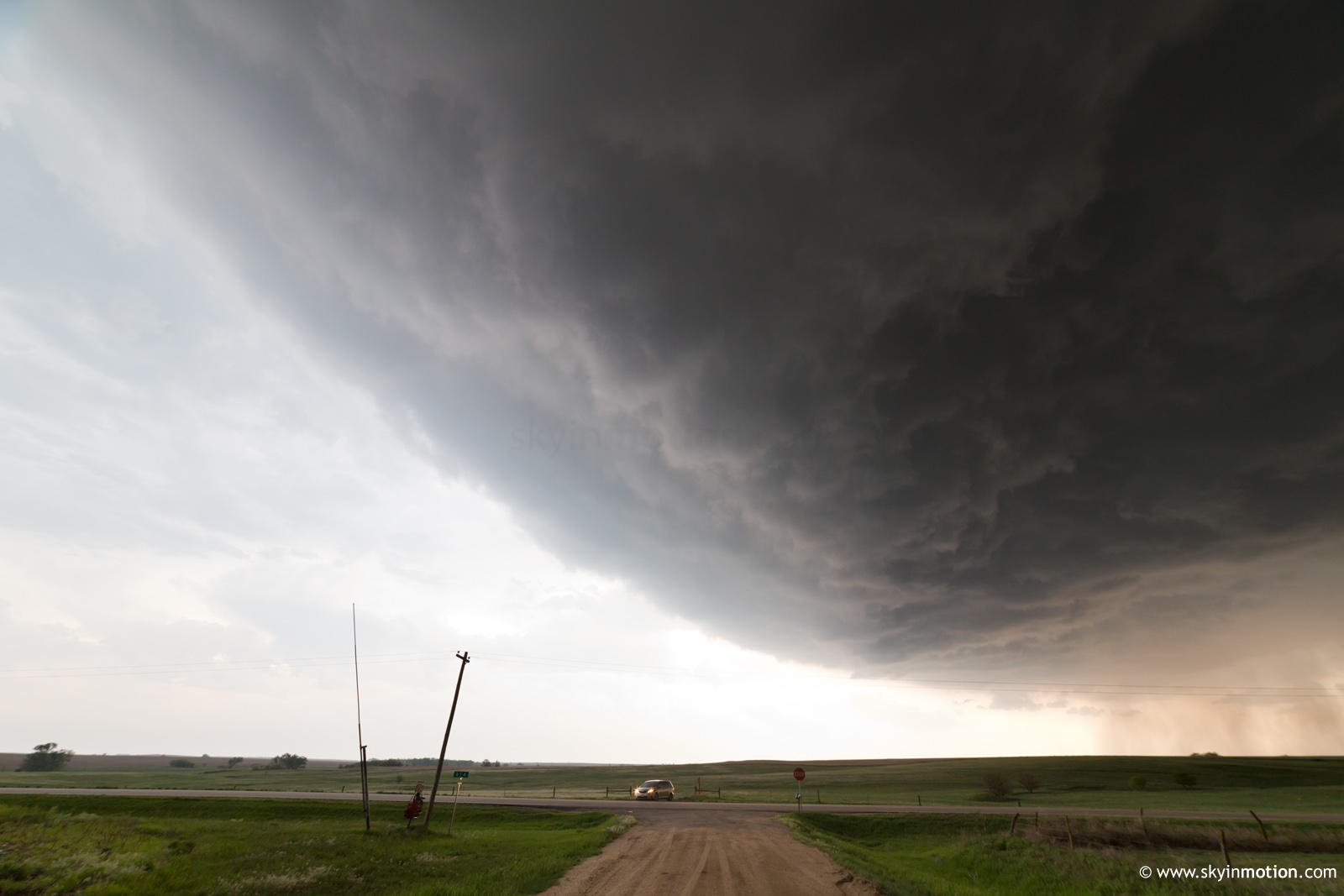
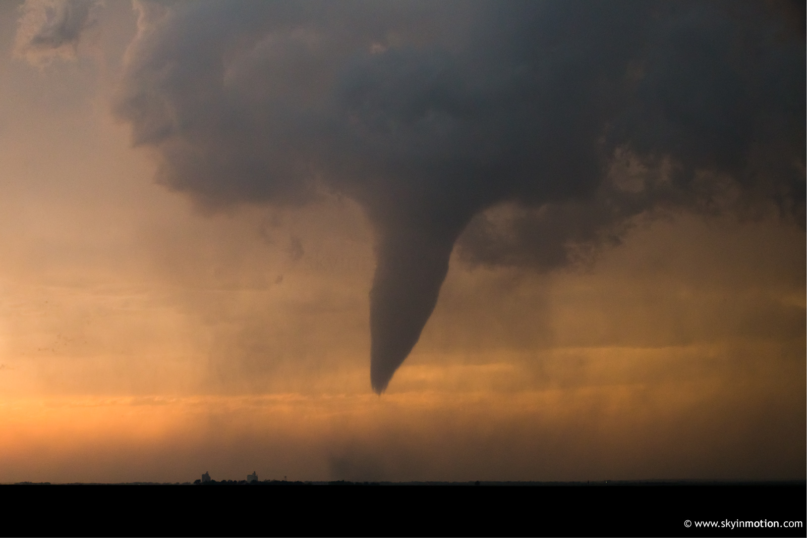
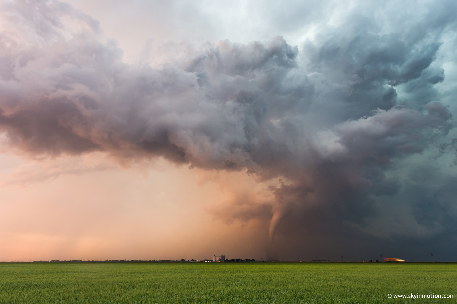
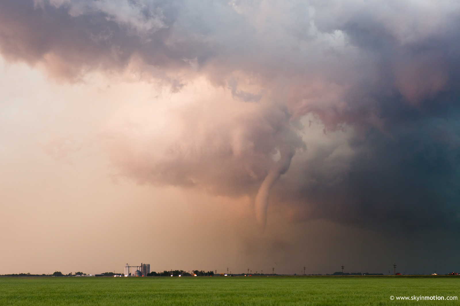
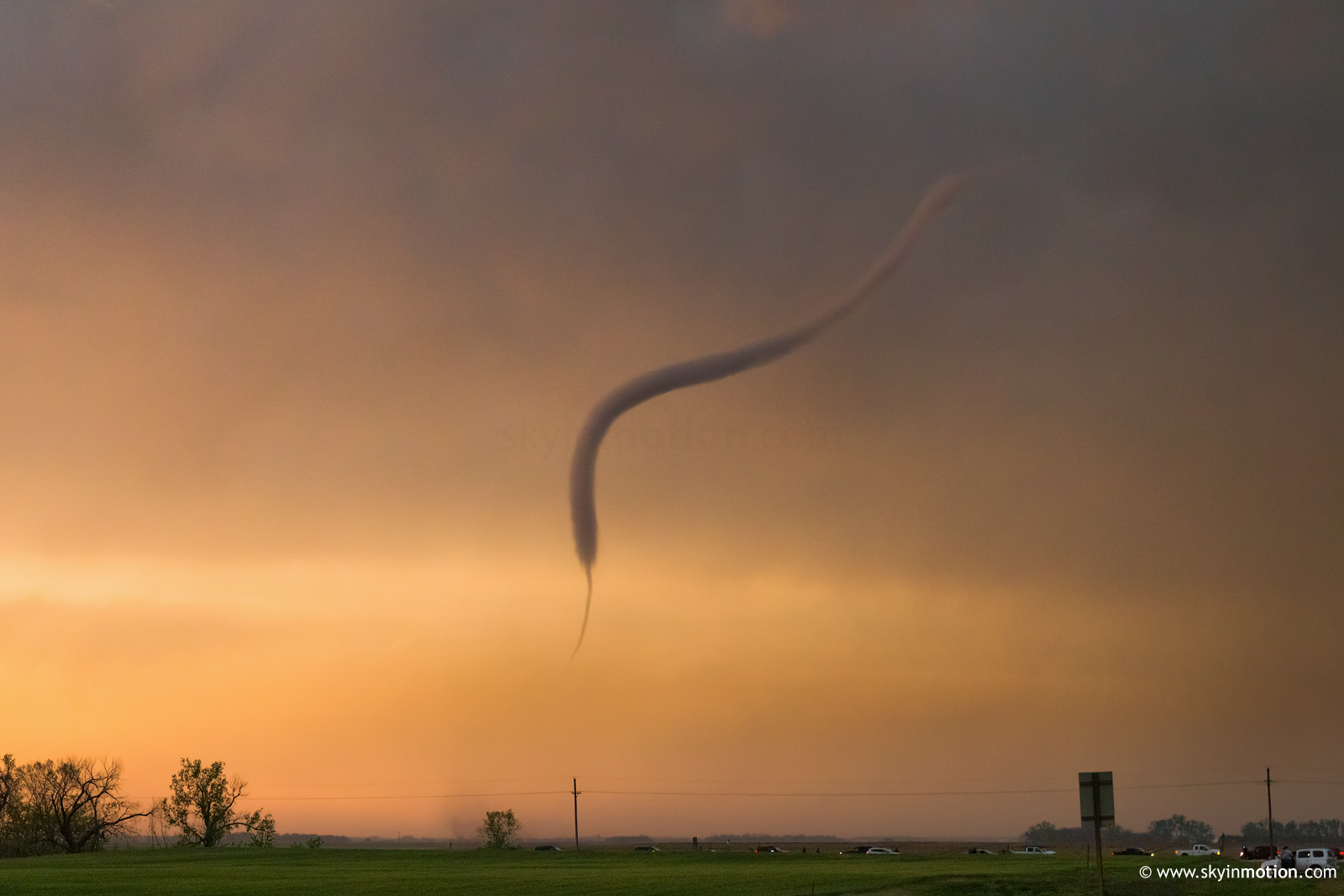
The cyclic supercell's second and final tornado near Sanford was almost as beautiful as the first, albeit shorter-lived. In the storm's brief tornadic lull I'd become preoccupied with trying (unsuccessfully) to photograph a major uptick in CGs; to that end, I'd decided to stop at a most unfortunate spot just SW of Sanford from which a farmstead obstructed my NE view. I therefore missed the first minute or two of the Sanford tornado, and even after correcting myself, I was once again shooting from a distance of 2-3 mi.
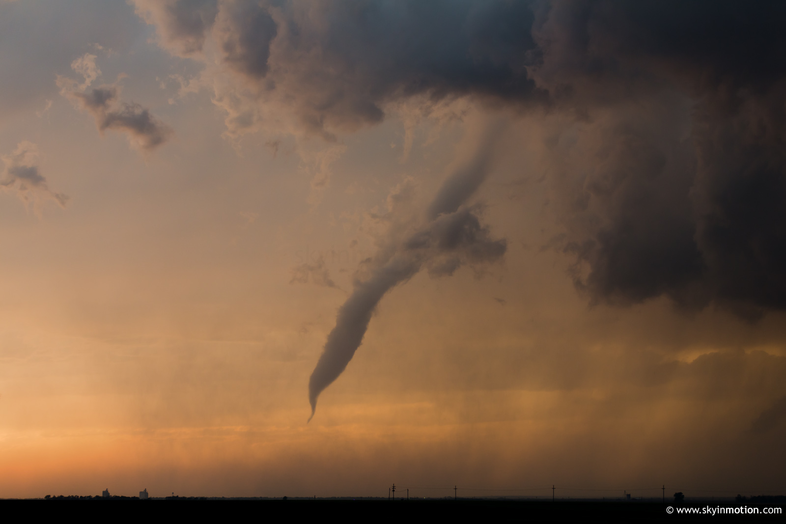
Without Rozel, this would have been a borderline-disaster. I certainly had the opportunity to position right next to Sanford had I been more situationally-aware. As it was, though, I hardly even cared, and still feel the same writing this months later. As it took on a more slender elephant trunk appearance and the magic-hour, gold-to-pink lighting began to subside, I attempted to close in using US-183, but rope-out was imminent. However, appropriate for a storm so generous to its awestruck observers, the condensation funnel associated with the Sanford tornado re-emerged momentarily as a truncated segment that touched neither cloud nor ground.
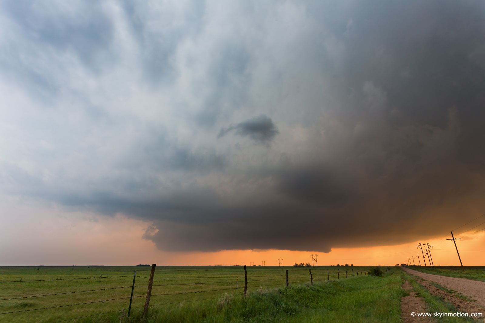
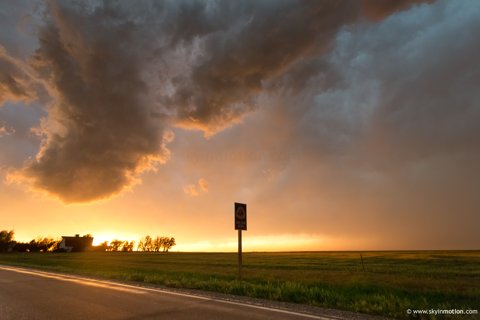
And just like that, less than an hour after this mediocre-looking storm transformed into my favorite in years, an increasingly-extensive squall line to the S overtook its inflow air; the show was over. The line of chaser traffic heading E toward Larned's sparse dining options was formidable, but the slow going allowed me to photograph this cherry-on-top sunset out the window.
I met up with Curtis, Matt and Charles at Pizza Hut where we enjoyed a classic, euphoric post-tornado dinner. With two more days of significant severe weather on tap, the relief of having already scored huge was palpable. And as the next 48 hours would reveal, it's a damn good thing I got Rozel (the others at the dinner table would fare much better, as has been typical). But, truth be told, I probably wouldn't trade it for all the other late May 2013 tornado days combined.