An unexpected supercell near the Arbuckle Mountains turns out to be one of the more beautiful of the year.
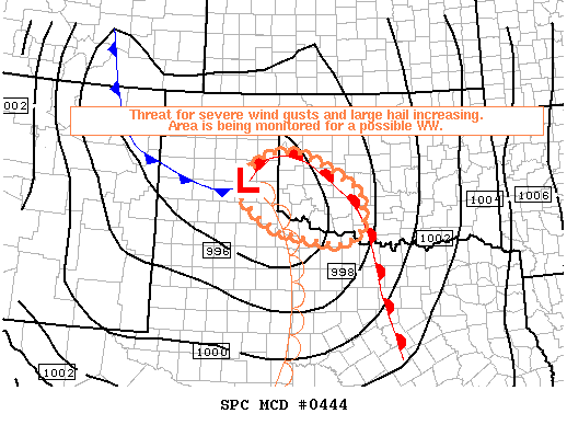
After a relatively quiet period to kick off April, it appeared another setup with good shear would be marginalized by lacking instability on April 10. It wasn't until the 2000 UTC outlook that SPC upgraded SW OK to a slight risk, as decent CAPE values associated with temperatures in the 70s and dew points in the 50s began showing up. None of us were paying too close attention to the weather, so unfortunately, we didn't realize that a supercell was exploding over Comanche County until about 6:30, when it had already intensified and was nearing I-44. We all scrambled to gather equipment and departed in Brandon's car by about 6:45.
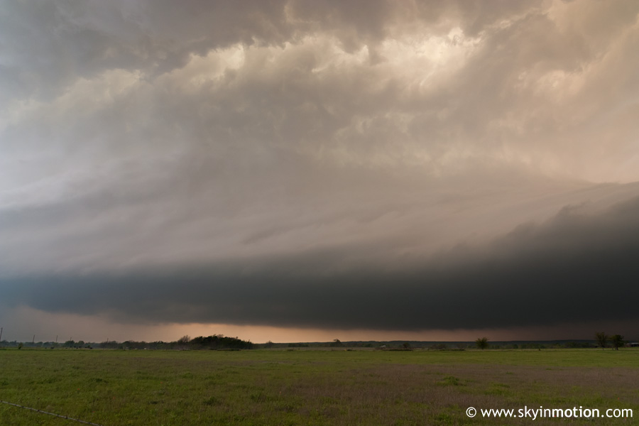
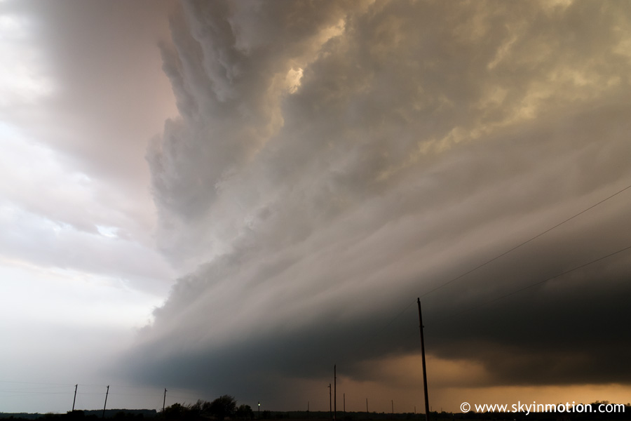
Listening to NOAA weather radio on the drive down I-35, we heard several tornado warnings issued for the storm as it tracked ESE through southern Caddo and northern Stephens counties. While we had planned on stopping at Pauls Valley for an intercept, we soon realized we'd need to go a little farther south. We exited the interstate at OK-7 on the Garvin-Murray county line to head west, and could already see the impressive supercell approaching from the WNW, although a newly developed storm going up just to its northeast was obscuring the view somewhat. Suddenly, after getting west about five miles from I-35, a spectcular view of the base and jaw-dropping striated structure emerged.
While stopped on the shoulder here, we observed impressive storm-scale rotation above us, along with rising motion to our southwest. We watched the base for signs of a wall cloud, but it did not appear the storm ever posed an imminent tornado threat despite the NWS warning, likely due to the low surface dew points. Eventually, it appeared intense precipitation in the RFD was about to affect us, so we quickly got back in the car.
Before I could even finish returning my tripod to the trunk, strong winds arrived, making it difficult to even close the passenger-side door after I got in. We decided to continue westward and then drop south to get a good look at the backside of the storm before dark; as it turns out, we never ran into torrential rain - it must have passed to our north. In any case, we should've known not to mess with backroads in the Arbuckle Mountains region; we got stuck behind some slow-moving vehicles, and even after we were able to pick up speed, the storm was racing away from us. Sadly, we didn't even get a good look at the storm from the west because of low clouds behind it. We crossed I-35 near Springer, gave it one last look, and determined that it had weakened too much to justify following it into increasingly wooded terrain after sunset, so we headed back. Not too bad for a surprise evening chase close to home given the awesome structure on this storm!