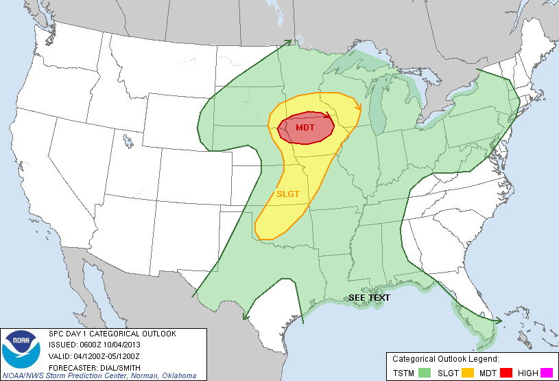
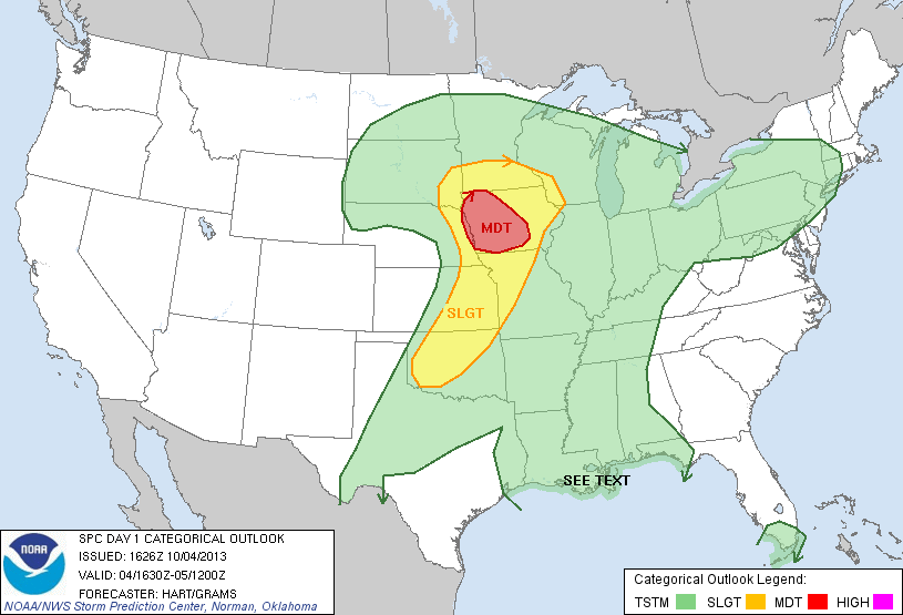
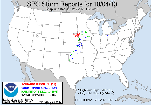
A localized but intense tornado outbreak sets the high water mark for autumn Plains setups over the past decade or so.
Observed 2 tornadoes.

Daniel Betten, Brandon Lawson and I chased both the Wayne and Moville supercells. As the former struggled to organize NW of Columbus, we struggled mightily to agree on whether pursuing it on the northwest fringe of our target zone was worthwhile. Eventually, several SN reports made it impossible to resist, and we rocketed NW from West Point. As if the extreme haze and murk weren't enough, the rolling hills of northeast NE proved to be some of the most frustrating terrain I've ever dealt with; deceptively unmerciful for a landscape so devoid of trees. We approached Wayne from the E on NE-35, but dropped S a few miles E of town when we realized the town proper was in imminent danger. From only a few miles E of the meso, we caught little more than fleeting glimpses of the 1.5-mile-wide beast, confirmed only by an obvious hard edge on its south side. After acquiring some throwaway video and stills, we immediately got back E to pavement on NE-16.
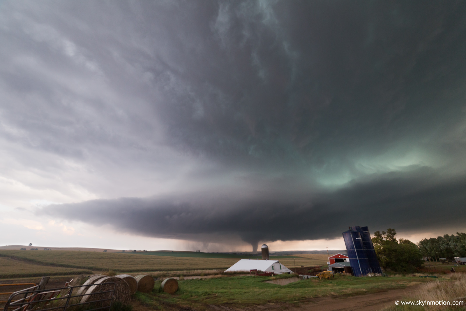
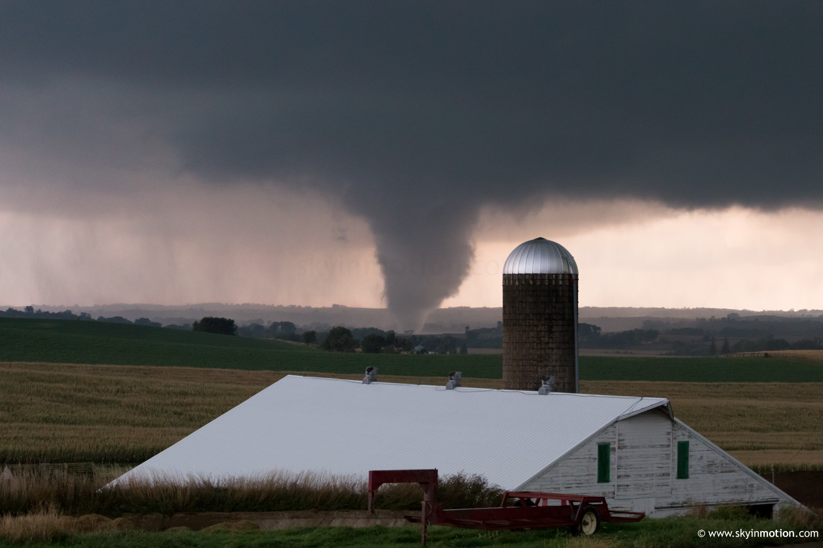
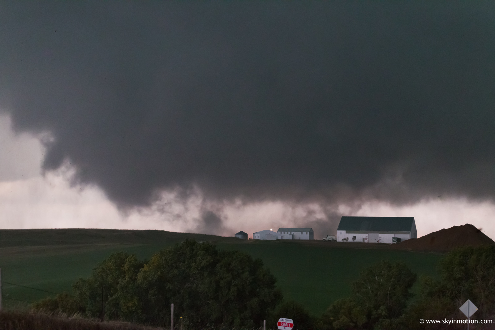
The Wayne storm was visually unappealing from the moment we laid eyes on it, and only continued to grow moreso with time. When several new updrafts appeared in the storm's immediate inflow, we decided it was time for a hail mary: hauling it to Sioux City, then hopefully scraping the northeastern outskirts of the southern supercell's FFD to get in position. By the time we decided to ditch the Wayne storm near Emerson, the southern cell's radar presentation -- then near Decatur -- already looked on the brink of producing something significant. I don't know that I've ever been so resigned to failure immediately before watching a spectacular tornado as I was at this point. We shot SE out of Sioux City to Bronson, then E on a paved road that continued all the way to Anthon. A couple miles into the trip down this road, we were relieved to break free from the FFD core and gain visual of fantastic updraft structure just to our S. Within minutes, we stopped 2 NE Climbing Hill as a cone tornado developed rapidly down near Sloan.
From this spot we watched the multiple-vortex tornado approach, occasionally exhibiting horizontal vortices. After the cone stage, it spent several minutes as a large ground circulation with only sporadic condensed vortices, perhaps comparable to the Wakita event on 2010-05-10.
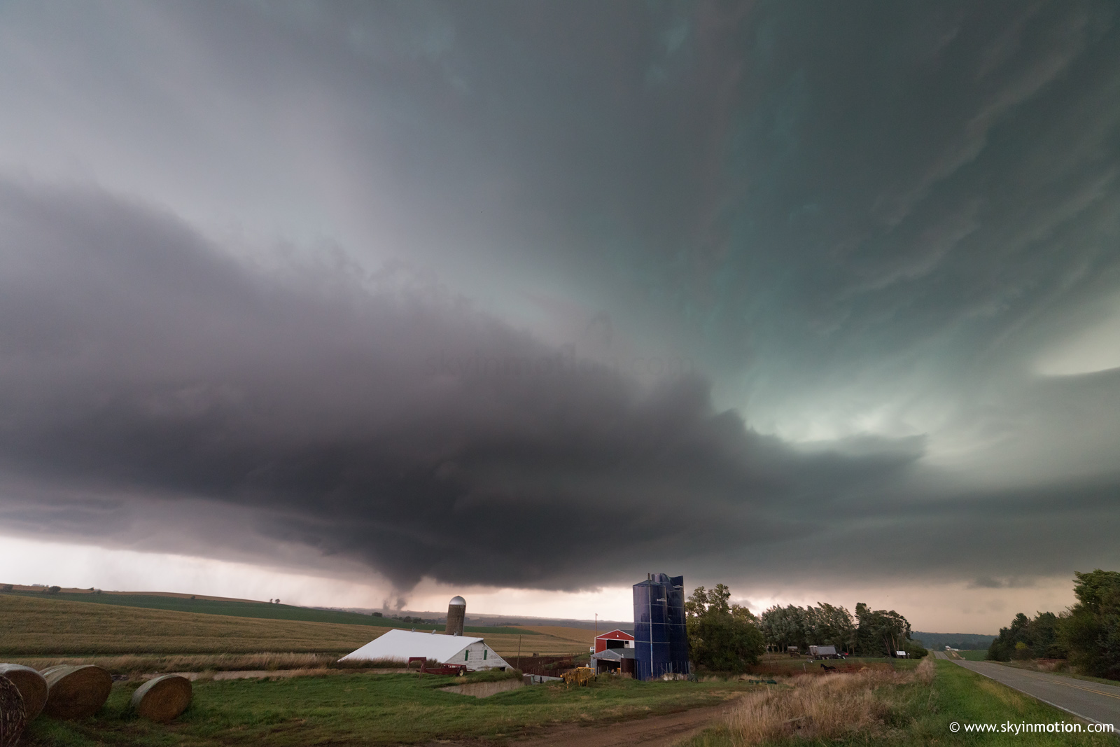
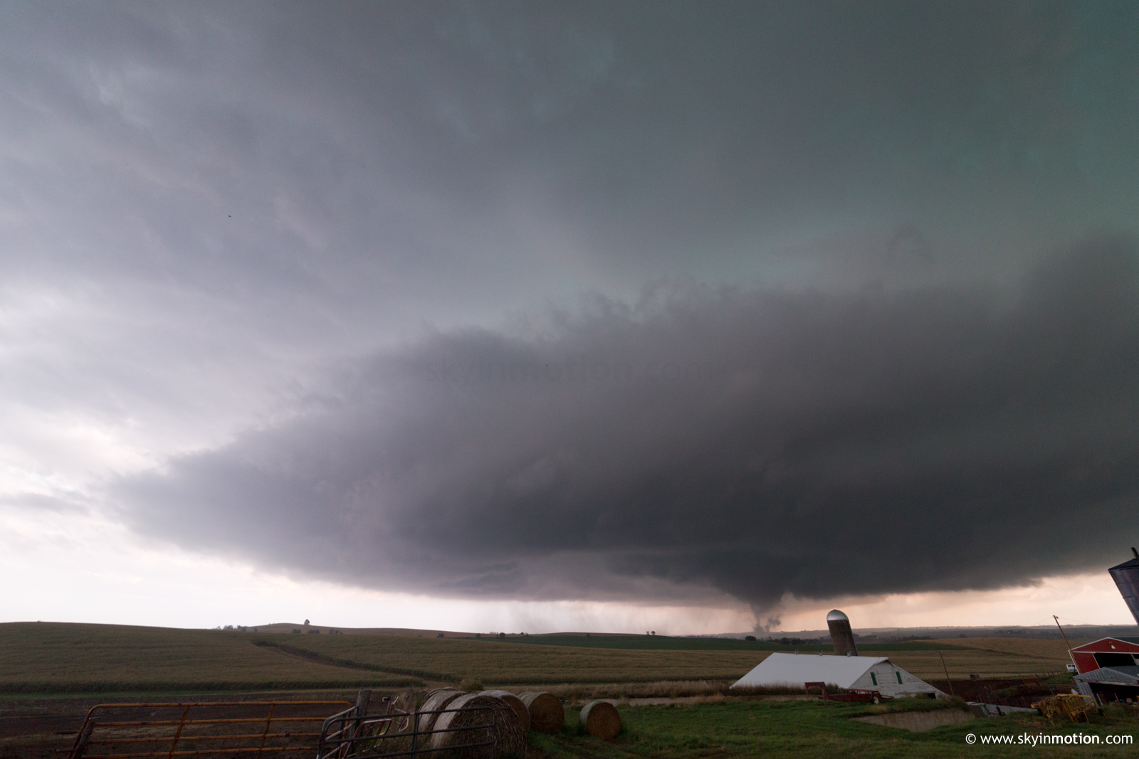
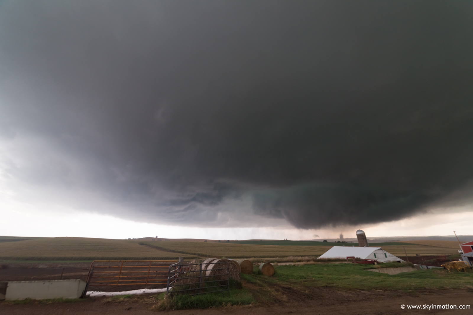
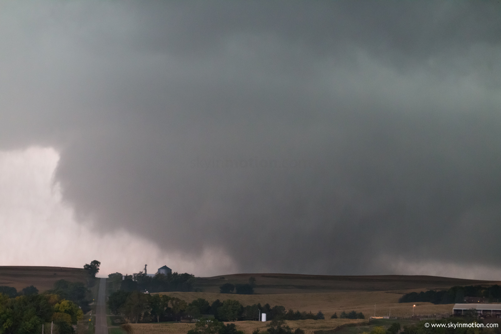
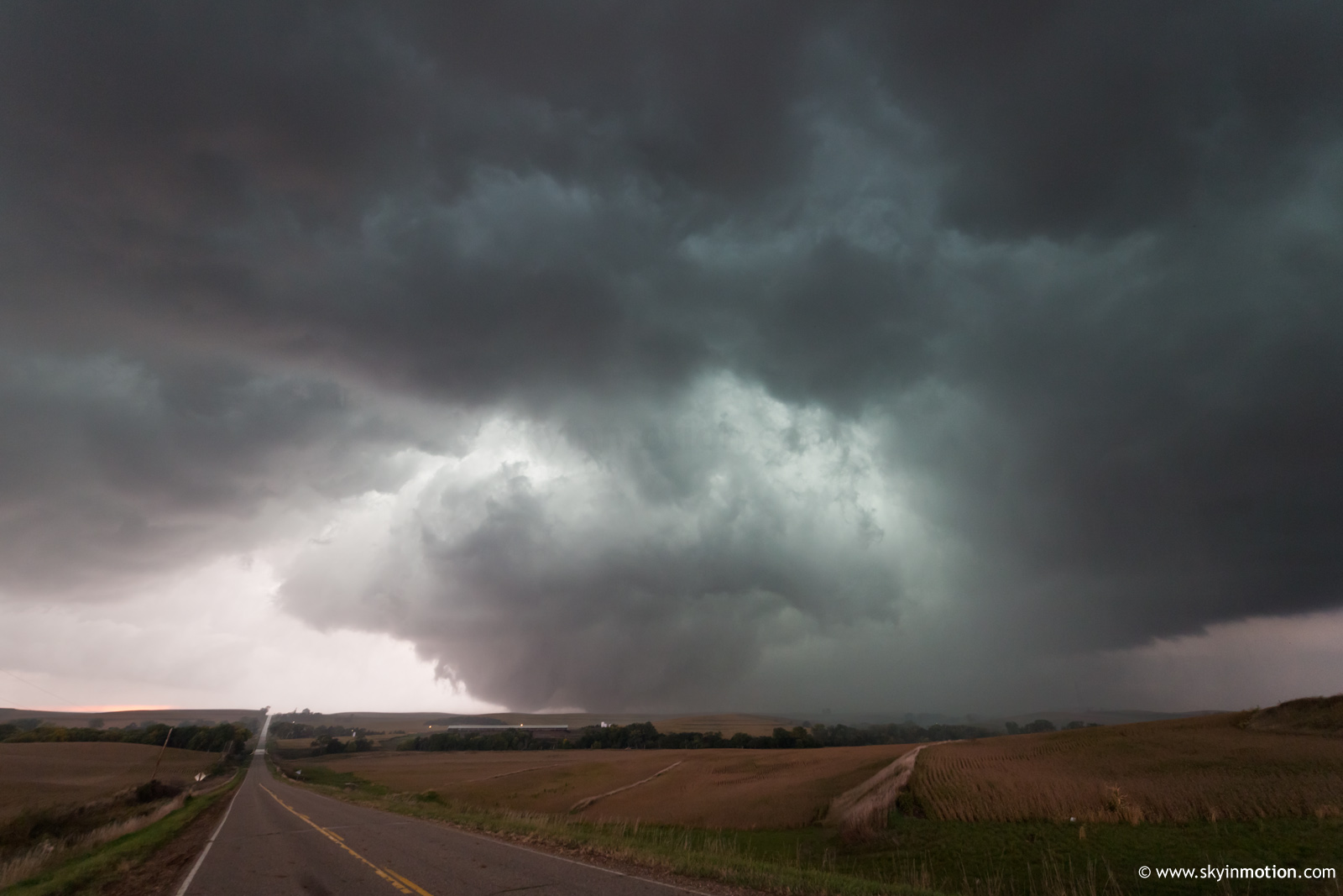
Unfortunately, we were compelled to continue E before it finally reached fully-condensed wedge status. This apparently occurred a touch NNE of Climbing Hill, and by this time we were hauling E in the car and shooting shaky video out the window. We finally stopped again closer to Anthon and were able to document the extremely large, but also frequently rain-wrapped, wedge as it plowed toward US-20 between Moville and Correctionville.
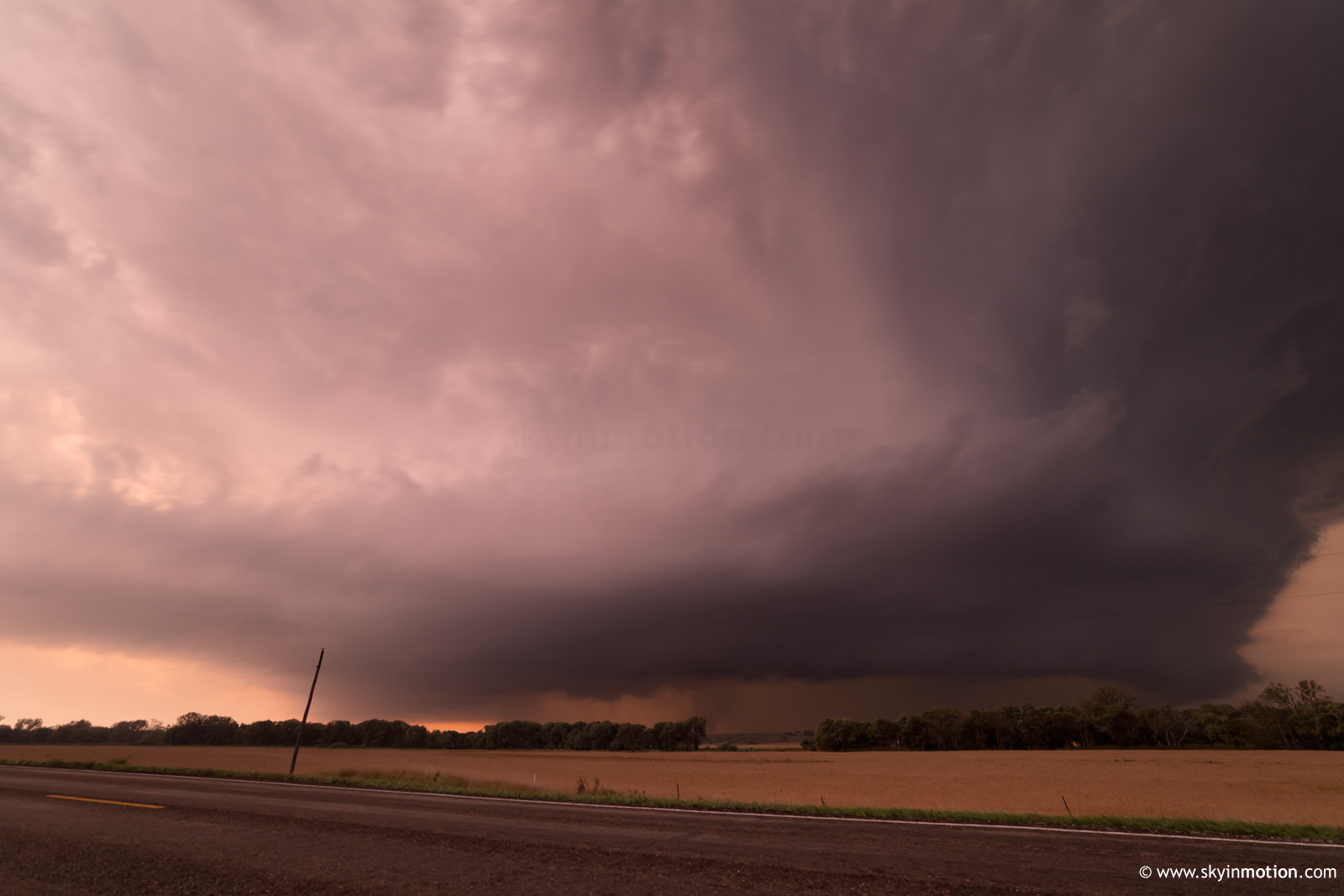
Finally, when it became clear any remaining tornado was hopelessly socked in by rain, we stopped NE of Correctionville for some nice HP structure at dusk.
It was a long drive in the dark to Topeka for a motel and yet another long drive the next day, but well worth it for this rare high-end October setup.