
A record-late first chase of the year yields nice, discrete supercells with passable structure.
The winter of 2013-14 was about as miserable as it gets in the Plains for storm chasers: frequently cold, sometimes brutally so, but also dreadfully dry with no favors done for the long-running severe drought. A high-amplitude pattern with ridging along the west coast allowed the now-infamous polar vortex to take residence across eastern North America all too often from November onward, completely squashing any chances for appreciable moisture return (or even nice outdoor weather, for the most part). This patten dominated all the way into March, resulting in an exceptionally quiet and cold (a.k.a., miserable) month much like that seen in 2013. At last, though, a respectable western CONUS trough was forecast to develop just in time for April Fools, with downstream troughing subsiding long enough in advance for seasonably good moisture return.
April 1 saw the main energy crash onshore in CA, with subtle lead shortwaves beginning to affect the southern Plains amidst decent WSW flow aloft. A cold front that had pushed past the Red River overnight began lifting back north by late morning, eventually reaching the I-40 corridor after dark. The warm front intersected a dryline N of ABI and continued ENE through the Red River Valley, providing two possible initiation zones: (1) near the dryline-warm front intersection in NW TX, where deeper mixing favored storms but also higher bases, and (2) from the surface low (near SPS) eastward along the warm front in S OK where storms looked less certain.
Daniel Betten, Derek Stratman and I headed down I-44 after lunch to hang around SPS and watch observations before making a choice. We sat awhile in Randlett on the OK side, then relocated to a gas station in Burkburnett. By about 5pm, it seemed unlikely that the bubbling Cu to our E along the warm front would amount to much, despite the HRRR hyping this region on several consecutive runs. To our SW, around Haskell and Throckmorton, an equally-impressive Cu field existed beneath a cirrus canopy streaming in from the WSW. It was in this region that both convection-allowing and large-scale models (HRRR, RGEM, GFS, ECMWF) agreed CI would occur by early evening. We nudged SW to Holliday and waited a bit longer for a firm sign that CI was imminent, which finally came around 6pm as a storm developed rapidly near Aspermont. At that point, we blasted SW to Seymour, then S through Throckmorton to meet up with the intensifying convection W of Ft. Griffin. By now, there existed two distinct supercells in close proximity, and yet another updraft was exploding farther SW.
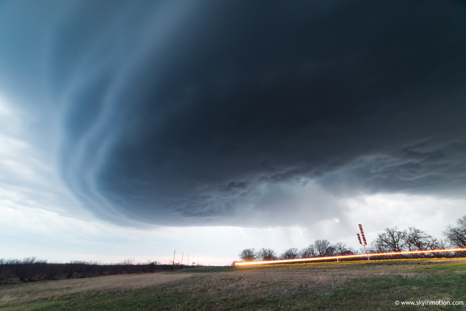
It had been six months since any of us had seen a decent supercell, but even so, the first hour watching these intense hailers was underwhelming from a visual standpoint. They resembled several other high-based, HP-tending beasts I've seen in W TX over the years, which is not really a compliment! Finally, sometime after 7pm, the southwestern of the two dominant storms developed more substantial mid-level rotation. It also began to exhibit striations associated with increased CINH and the loss of daytime heating. This visual transformation happened quickly, and we soon realized we were too close for good structure shots, even with my 14mm lens on full-frame! We blasted E toward Woodson, stopping several times when we thought we'd outpaced the storm just enough, but continually found we were still just an inch too close. As the last light began to fade, we salvaged what view we had from a few miles E of Woodson.
After this, we continued E on backroads toward South Bend and made some futile attempts at low-light structure shots, which allowed the mesocyclone to pass us just to the N. As we approached the town and closed in on the (clearly non-tornadic) meso, we were quickly reminded that L3 radar reflectivity can be deceptively low with regard to the hail threat in a hook echo. We went from dry to sporadic raindrops to wind-driven golfballs, which were wrapping around the hook several miles S of any threatening dBZ values, in a span of 10 or 15 seconds. Thankfully, backtracking a mile or two to the W saved all my auto glass from another mishap. After a few minutes, we returned to the area and enjoyed searching for the largest stones with flashlights, coming up with a 2.25" stone as our grand prize.
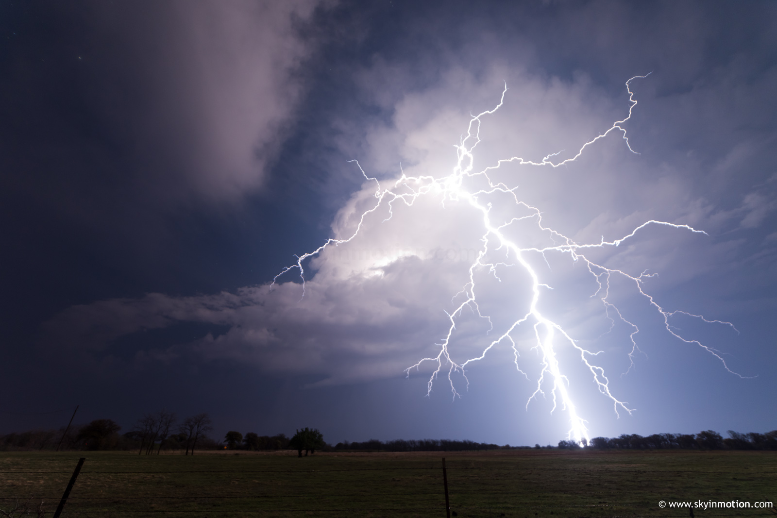
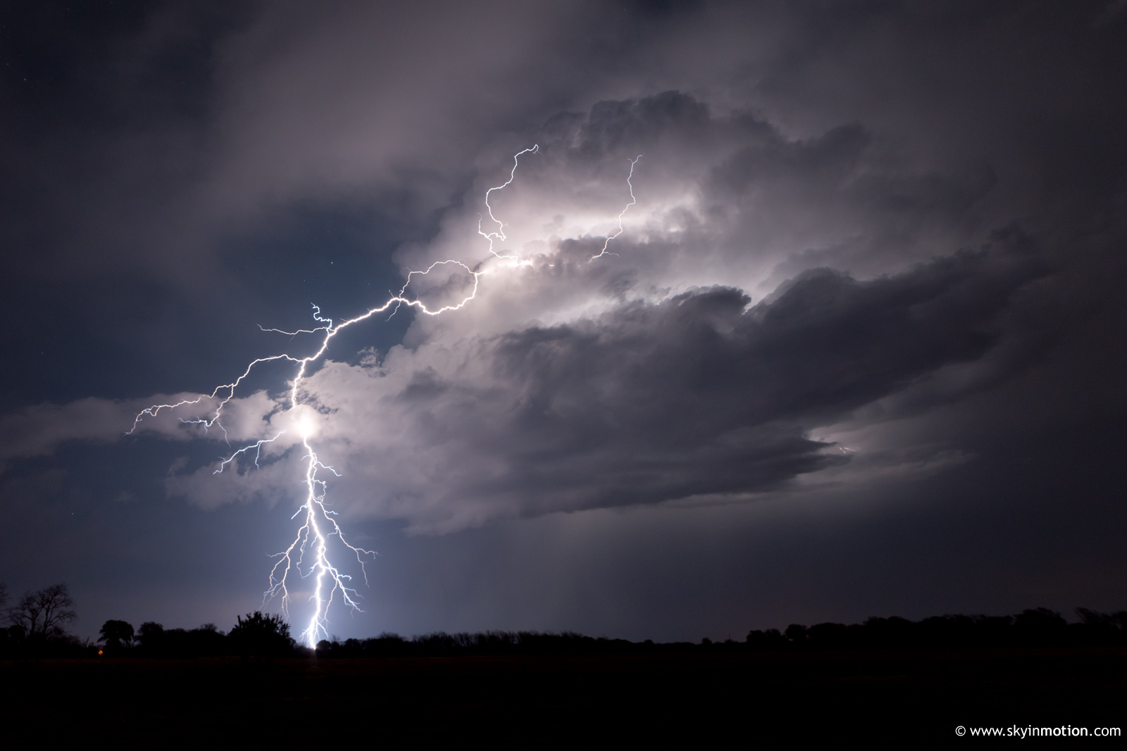
With the southern supercell (the one we'd been following) having escaped well to our E, we started heading back N toward SPS, but there was another, fairly intense supercell now ongoing near Olney. We stopped again near Loving and shot lightning as the cell passed to our N, scoring a few nice CGs shooting out the back of the storm.
With that, we called it a day and grabbed a very late dinner in SPS, arriving back in Norman by 1:30am. This was a fairly typical first chase of the year: decent structure, decent lightning, and some fun hail, but nothing particularly memorable. I'd have no complaints if it had come in early or mid March, rather than April, making it my latest first supercell day by a couple weeks!


