2014 takes chasers to the edge of the cliff as a potent mid-June setup is marginalized by a crashing cold front and poor moisture.
Observed 1 tornado.
The parade of early-season setups occurring in late-season 2014 marches on. Despite one of the most favorable large-scale June patterns for Plains chasing we'd seen for years, the combination of paltry moisture and an advancing cold front squashed what on paper should have been a classic late-season tornadic chase in the central Plains. It was particularly difficult to find motivation after somewhat-similar scenarios had trolled us mercilessly on 11 May and 3 June already. As a result, Daniel and I didn't even leave Norman until lunchtime; we'd seriously considered sitting the day out initially. We took the now-agonizing route up I-35 and I-135 to Salina for the umpteenth time since early May, noting the same ominously drought-tinged landscape in spite of recent rains.
We hoped for CI just northeast of the dryline/front intersection in NW KS, which ultimately occurred sometime after 4pm. The first cell developed explosively near Stockton; at that time we were near Lebanon, approximately 30 miles to the ENE. In keeping with our luck all year, this storm immediately stretched ambient vertical vorticity and produced a landspout tornado that we could barely see on the horizon. Realistically, this kind of scenario was by far the best chance for any tornadic activity with this embarrassing setup, and we shouldn't have treated the chase as a standard-issue dryline setup by keeping such an eastward buffer. After the spout dissipated I just rolled my eyes, knowing with a high degree of confidence that the only tornadic show of the day was over. (As it turns out, that wasn't true; a much more photogenic spout would occur S of Hastings a couple hours later, but very few chasers were anywhere nearby).
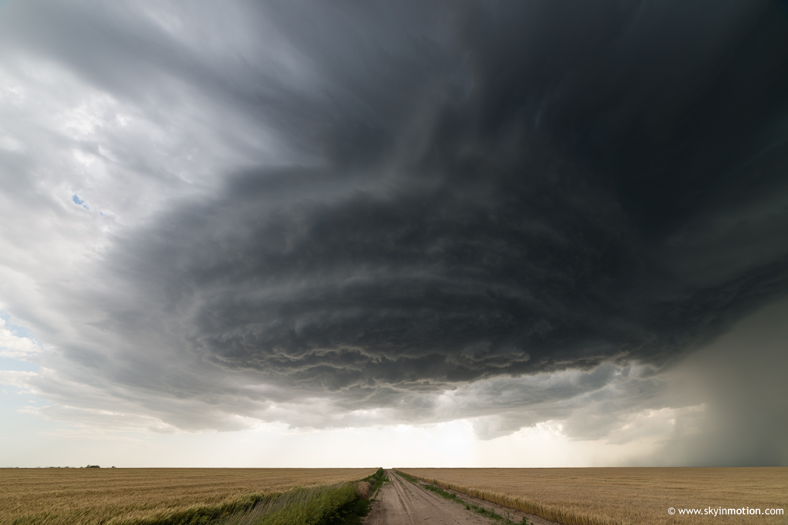
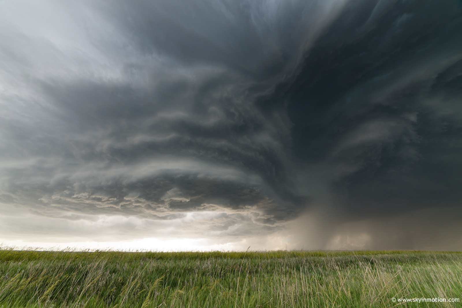
Again in keeping with 2014's theme, we quickly entered "cut-our-losses" mode and approached the updraft base of the initial storm as it neared Harlan. By now, though, a second cell to its immediate south was becoming dominant. It eventually offered some mediocre high-based structure.
Over the next couple hours, new updrafts would develop on the southwest flank of the dominant cell and become supercellular for 30-60 minutes before weakening. The final such cell developed just SW of Smith Center. We decided we'd had enough of the day's pedestrian structure and the chaser hordes, so we decided to blast N out of town to sample the hail. The best we could do was a little bigger than quarters, though the volume of it was copious. Around this time, the storm's radar and visual presentation as a supercell reached a high point for the day thus far, so we started heading E toward US-281 on dirt roads just S of the KS/NE border. It quickly became apparent by its northward acceleration, though, that this storm was struggling to stay surface-based. As a result, we were left to slide haplessly through the mud for quite a few miles with little reward. We finally reached US-281 near Northbranch a little before sunset, observing the pitifully high-based and shrinking storm blasting off into NE. It wasn't a tough decision to abandon it in favor of a late dinner in Beloit. Actually, the same cell somehow went on to produce a brief nocturnal tornado somewhere closer to I-80 well after dark, but we hardly regretted trading that in for a three-hour advantage on our return time home.