The most trying Plains chase season in decades finally unloads at the eleventh hour with an all-time classic for Nebraska.
Observed 5 tornadoes.
Can one day alone really make a whole chase season, even for someone like myself who tries way too hard and chases way too much? There may never be a better test case for me than June 16, 2014. I'd chased about a dozen times between April 1 and June 14, and only one of those days was really worth the drive. Even then, it was only for structure (May 10). Of the remaining disappointments, an alarming number were out-of-state, with more than one requiring motel stays. To summarize, 2014 had been the chase season of your worst nightmares up to this point. Its results had been as scarce as 2006, but it offered a lot more false hope in the form of several synoptically-favorable setups (which meant a lot of wasted miles and money).
One thing non-chasers may not understand is how difficult it can be to keep a level-headed perspective as chase season wears on; particularly a bad one. No matter how experienced and knowledgeable you may be, we're all human. We can only ward off fatigue, shattered confidence, and emotional burn-out for so long. By June 16, I was downright tired of trying. Everyone gets tired of it after a couple bad chases, but this was that more pressing feeling you get when you've already been reluctant for the past half-dozen trips; now, you're freaking tired of it, and you feel like a fool for digging the hole any deeper. So while there were a ton of things to like about the setup on the numerical guidance, I could only see the negatives during the preceding days. The same setup in a year like 2010 that gets on a good roll would probably have had everyone ecstatic in the 24-48 hour lead-up, myself included. But stretches like that were a distant memory by June 15, 2014. It had been years since a good Nebraska chase day, despite so many promising setups, including two over the previous month-and-a-half. Every chaser on the Plains had been schooled on failure modes all year, and it seemed as though forecasting had become a matter of choosing the most likely among them.
After dinner on June 15, I grudgingly perused the incoming 00z data. The NAM-12km continued to advertise a volatile environment for E NE and W IA coincident with QPF signals, but it seemed most impressive from 15z-21z, with a shortwave trough propagating past the dryline several hours earlier than preferable. Meanwhile, the NAM-4km depicted an entirely different evolution: convection would develop explosively early in the morning along the warm front in SD and MN, shoving the effective boundary S and pinching off the warm sector by afternoon. This was precisely what had happened on 3 June in the same region, and it scared me to death, since I'd have no chase partners this time to help cushion the financial blow of possible failure. Still, if morning convection could remain disorganized enough to leave most of the NE warm sector undisturbed, the environment would be of the likes we hadn't seen all year (especially in terms of moisture and LCLs). I squirmed and clenched my fists in indecision until past 10pm before finally committing to a cheap room in Salina, an insurance policy in the event that things lit up before mid-afternoon. I've been chasing long enough to know the diurnal distribution of photogenic daytime tornadoes tails way off as you go earlier than 3pm CDT. But as I poured over the data, I became convinced this could be the rare exception in which the early-afternoon environment might support major-league action. The mid-June calendar date and extremely rich forecast moisture went a long way in helping me to arrive at that conclusion. And so I set off with an ETA of 2:30am, feeling like a junkie in need of intervention for going all-in on another distant 2014 solo chase.
After about five hours of tossing and turning, I got up for good at 8am and noted that sure enough, elevated convection was evolving over SD and N IA/MN. Additional storms were developing across NE, but they were surprisingly isolated and showed no signs of congealing into an MCS anytime soon. This stood in contrast to 3 June, when the implications of morning convection looked (and were) far more ominous. After diving into the latest hi-res guidance, I decided that lunch in Grand Island was in order; this would allow me to target the dryline, but also keep any warm-sector storms associated with the early-arriving shortwave within reach. It was the latter scenario that verified, and I made it just in the nick of time. After lunch, I lounged around anxiously in GRI (even swiping Netflix off the best unprotected WiFi in range for a time). My excitement was finally building, given the environment in place, but CI remained a question. It was only by 2pm that showers bubbling to my NE near Columbus caught my interest enough to start moving in that direction.
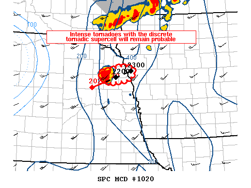
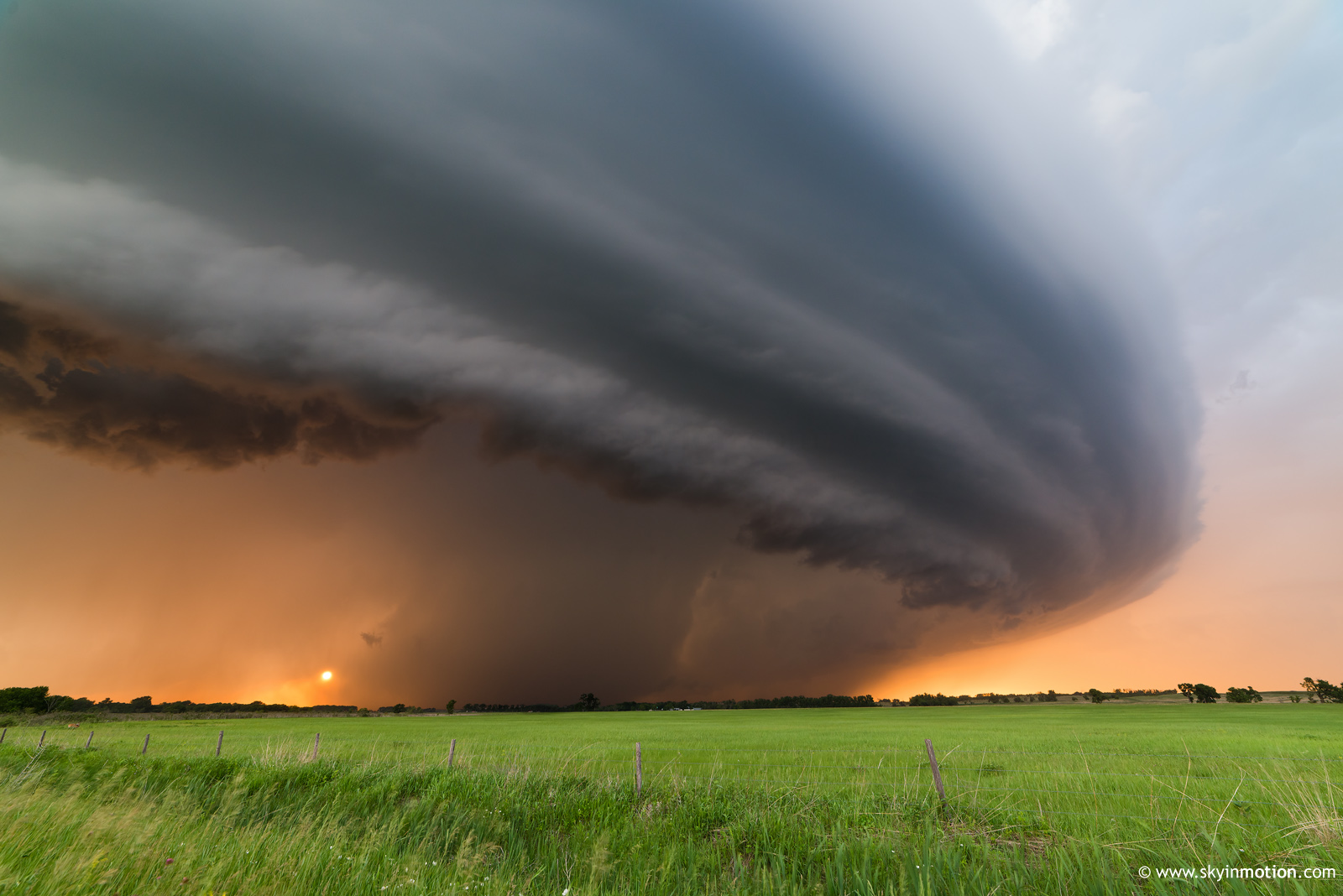
For the next hour, I drove briskly but calmly northeastward on US-30 toward Columbus, though I ultimately bypassed the town proper via Genoa and Platte Center. During this time, the 19z OMA sounding came in indicating over 5000 J/kg SBCAPE and 500 m2/s2 0-3 km SRH. This basically qualifies as "off-the-charts" in any EHI-based parameter space study of tornado environments. Only once in a blue moon is sustained, discrete surface-based convection realized in this caliber setting, as the results would soon bear out. Even as the cluster of shallow convection continued to struggle to my NE, I grew more certain with each passing minute that the 2014 chase season was about to break free from its shackles. My only regret was having wasted a bit of time and burned a bit of gas hedging W when I'd reached I-80 at York earlier in the day. That would quickly be forgotten, though, as I reached the incipient Stanton supercell just as it became surface-based and took off (around 3:15pm).
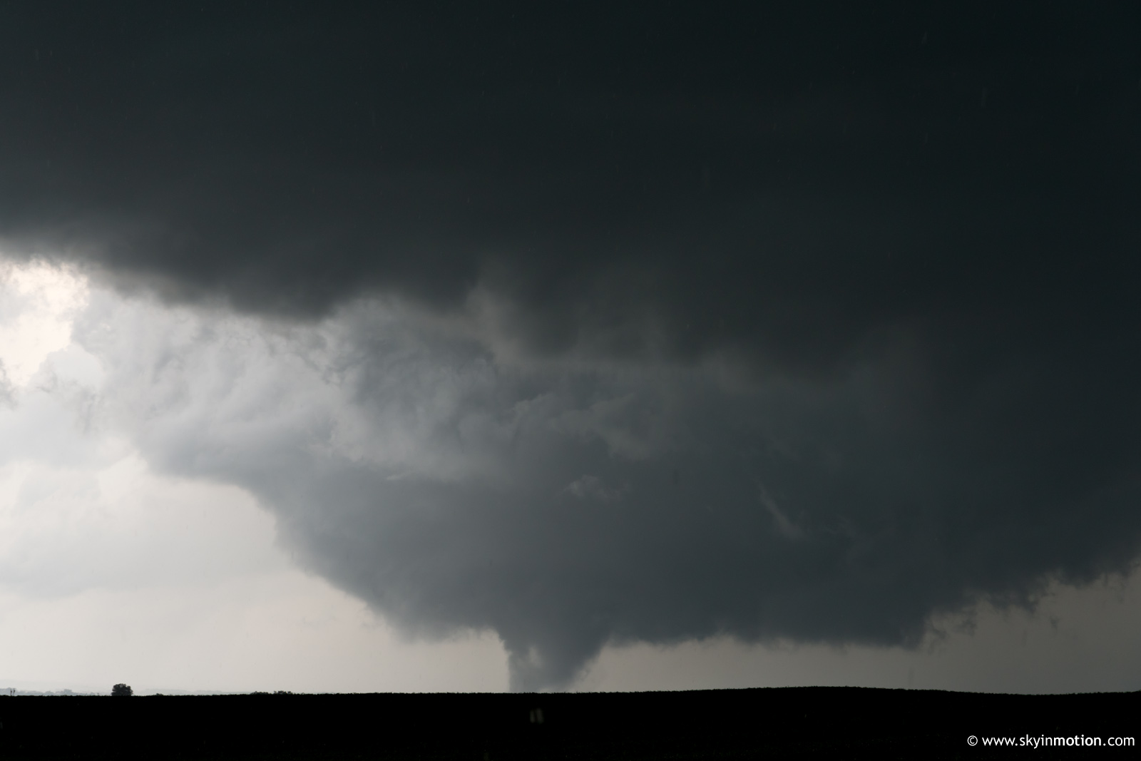
For the first half hour after my arrival, several distinct updrafts struggled for dominance in the area around Humphrey and Madison; despite the resultant lack of eye candy structure-wise, I nervously awaited the inevitable madness conveyed by the OMA sounding. The storm motion had a more northerly component than I had anticipated (a theme which continued to aggravate me throughout the day), and this in combination with the sparse network of paved roads resulted in my being well SSE of the Stanton tornado when it developed around 3:45pm.
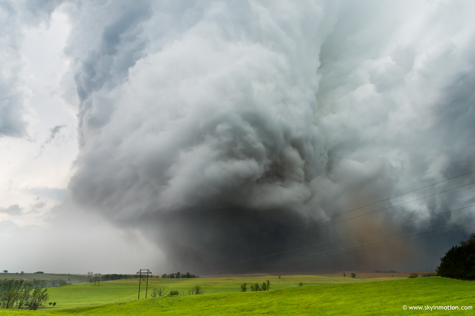
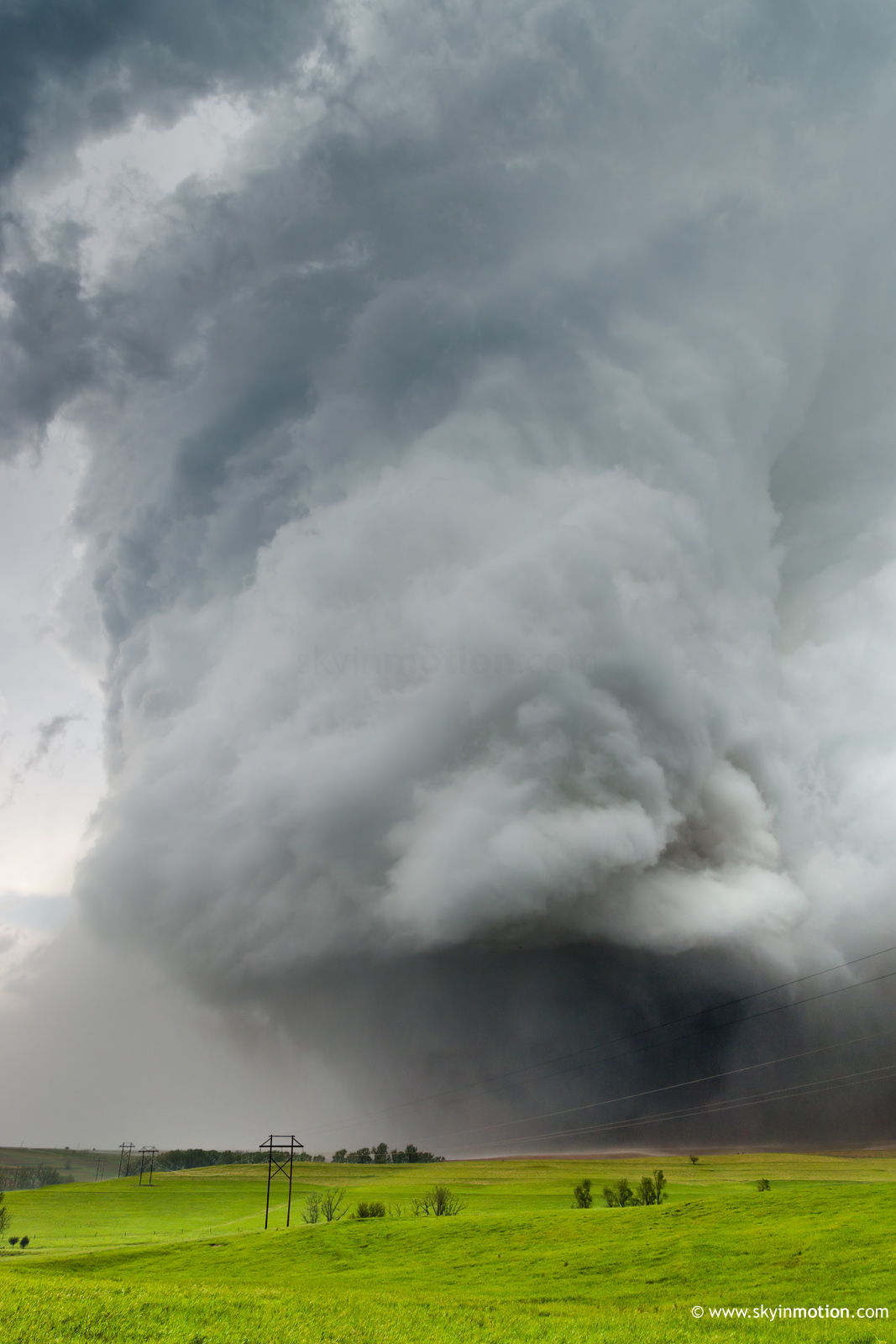
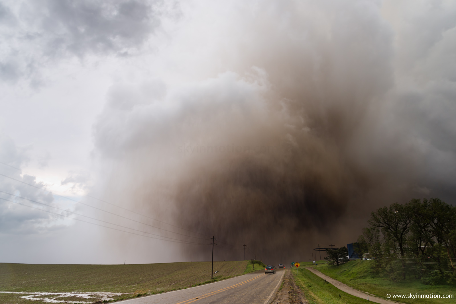
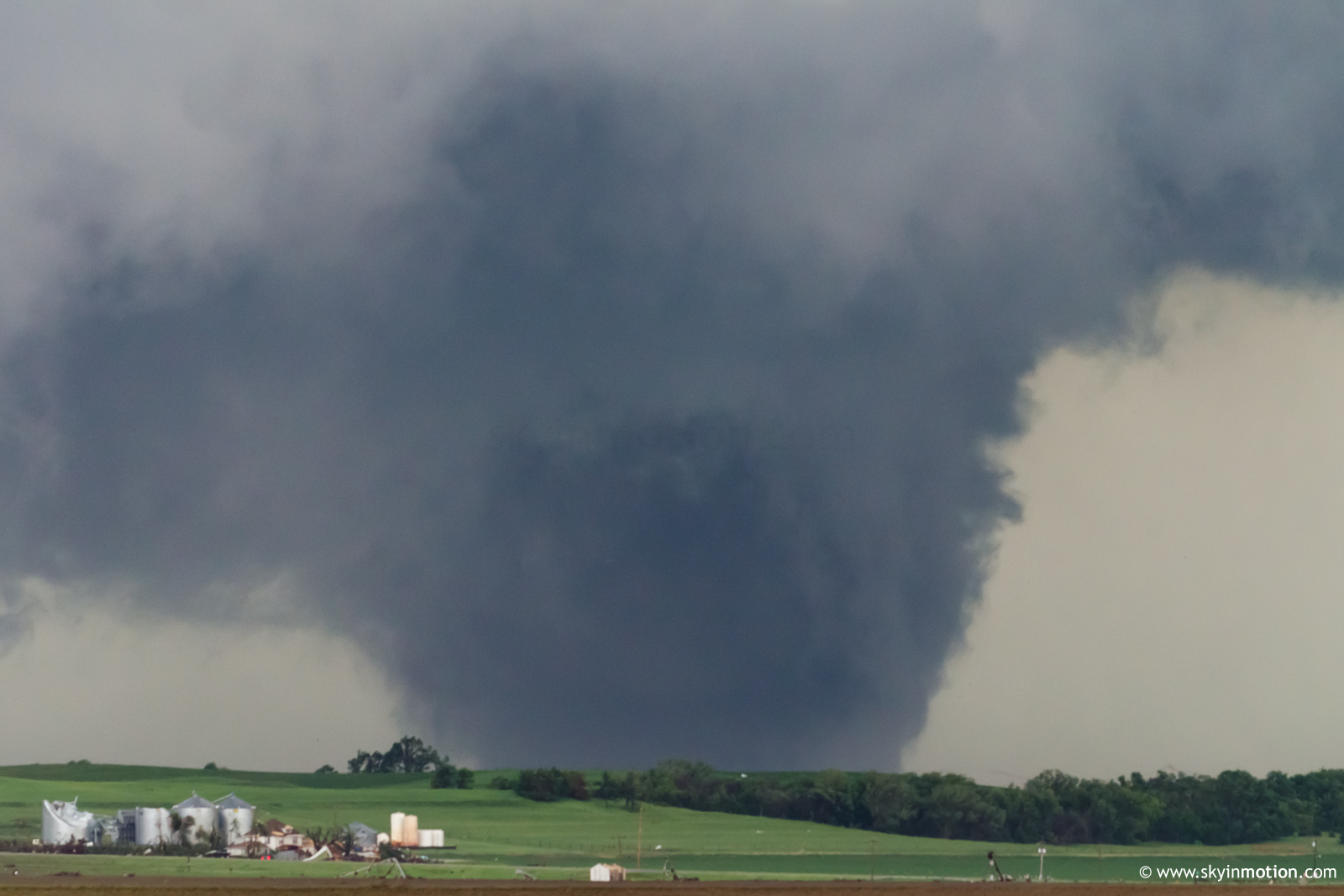
Unfortunately, it required nearly 15 minutes of questionable driving tactics to recover fully; the only consolation is that (a) it stayed on the ground for nearly half an hour, and (b) it was largely rain-wrapped anyway during the time I was playing catchup. The most frustrating portion of the catchup process was undoubtedly snaking my way through the town of Stanton, during which time I lost all visual of storm structure and could only picture a Manchester- or Columbus-like event unfolding immediately behind the curtain of hills, trees and homes to my north. This wasn't all that far from the truth, as I soon saw for myself -- except that rain-wrapping made this decidedly less photogenic than those classics, or the likes of Bowdle and (early) Bennington. Nonetheless, it was a prototypical late-season, northern Plains, extreme-instability wedge accompanied by a jaw-dropping RFD cut.
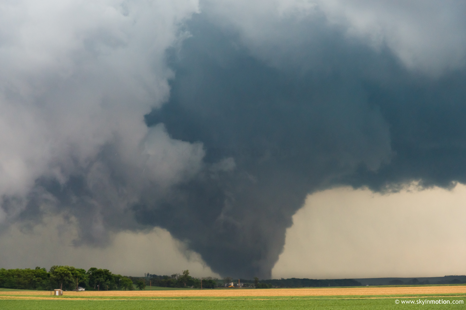
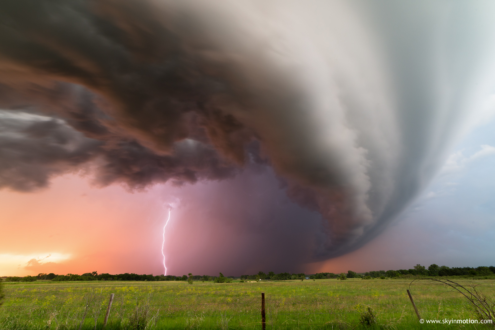
As the Stanton beast crossed just N of the NE-57/US-275 intersection, it became a dust bomb whose condensation was no longer clearly defined visually. While stopped in the road to witness this spectacle within a long line of vehicles, a fellow chaser nearby frantically pointed out an ongoing sig-tor about 5 mi. to our E that I'd failed to notice; this was the first of the Pilger EF-4 twins just after its genesis. In hindsight, abandoning the dust bomb right then and there to haul E may have paid dividends for photography and video; but, by this point in 2014, the prospect of leaving one EF-4 meat-grinder for the promise of a prettier one elsewhere didn't quite resonate with me.
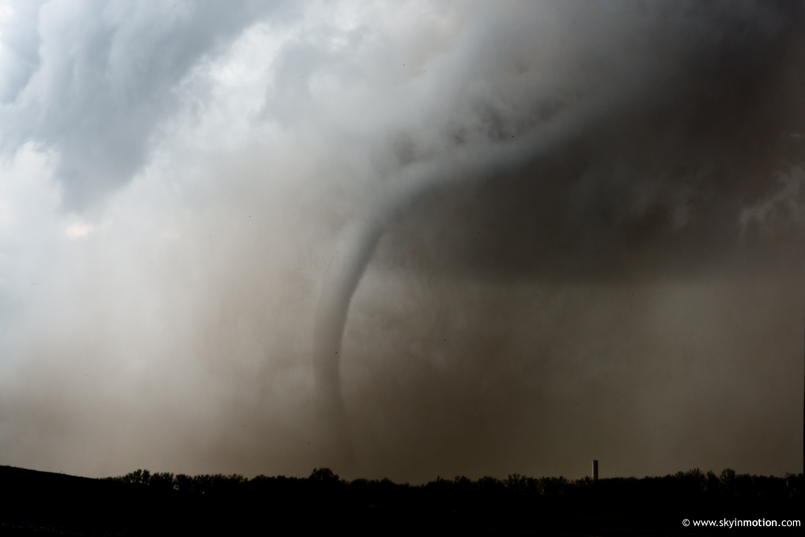
By the time a drier surge of RFD air finally wrapped around the S side at 4:11pm, all that remained was a snaky rope protruding out the back side of the storm.
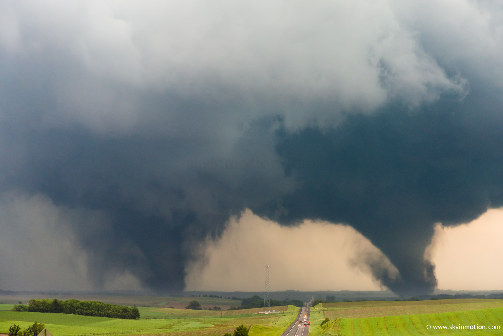
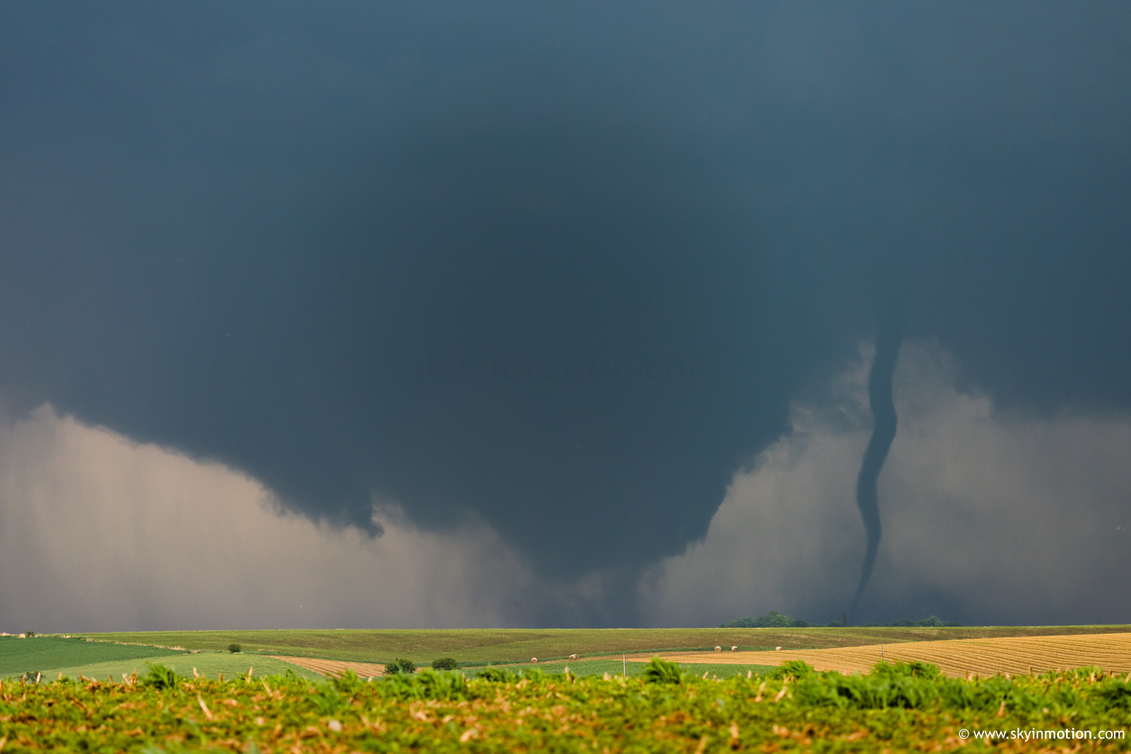
As the rope-out concluded, I finally wised up and blasted E on US-275, turning my attention to the surreal scene of twin violent cones straddling either side of the road a few miles ahead. I realized quickly that I'd never catch up for a close intercept, which justified stopping on the highest hilltop and securing one quality shot.
The 15 minutes which followed only heightened the surrealism. Many, many fellow chasers documented the Pilger twins from much closer range and with much better fidelity than I did, but it was a rare case where the sheer violence and meteorological rarity were enough to make up for my lack of quality photo ops. Trying my damndest to catch back up meant no stopping and therefore no stills; the handheld and dash-mount video I got just NW of Wisner was decent, but again falls short of many other perspectives. It's not often one can witness two highly-visible, violently-rotating, Andover-esque barrels within one's field of view -- and be within 3 miles of both.
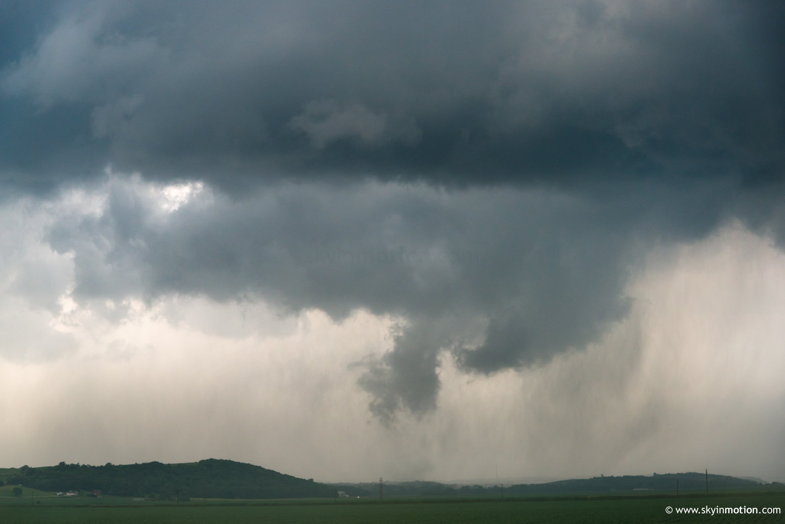
At some point on my drive E on US-51 out of Wisner, I again conceded defeat in the proximity battle and stopped for some telephoto ops looking N toward Pender. By this time, it appeared a satellite rope was rotating rapidly around one of the original Pilger EF-4s. In truth, I had lost track of which of the Pilger beasts I was watching, as the sensory overload threshold had been reached well before this point.
Supercells of this caliber rarely go quietly into the night upon encountering increased capping. Indeed, despite taking on a much "softer" appearance, frightening low-level mesocyclones remained the norm as it tracked NE toward Sioux City. The chaser hordes leapfrogged one another on the winding NE-35 heading out of Emerson toward Dakota City, waiting to see if there'd be a grand finale. Around 5:45pm, condensation briefly danced across the hills of Dakota Co. near Hubbard and Tornado #5 was in the books; its impotence was almost laughable, coming from its parent storm.
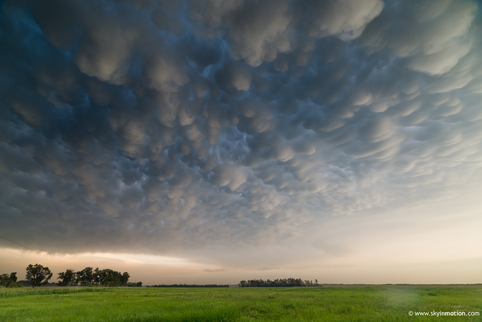
It was only as I pulled into the southwestern outskirts of Sioux City that I realized it was time to abandon ship for an ongoing tornadic supercell several counties to my WSW near Burwell, closer to my original target for the day. No route to the storm was anything near optimal, and after throwing in a necessary fuel stop, it was well over an hour later before I finally arrived. By this time, the Burwell-Bartlett storm had long since produced a cone tornado beneath mothership structure that arguably qualified as an instant classic chase scene, for the few chasers who'd opted for the western target. By my arrival around 7-7:30pm, the "clean" tornadic phase had given way to a more blob-like HP. I made the best of it, taking dirt roads W out of Petersburg to shoot mammatus as it ambled closer from the W.
Sunset approaching, I meandered back E toward pavement without much excitement. Incredibly, the day's "photographer's storm" had one last hurrah left in it, providing me with some of my best golden hour structure shots in a long while from just SW of Petersburg.
It's rather amazing how often my best tornado days are serendipitously followed by top shelf photo ops of structure, mammatus, lightning, or some combination thereof at sunset. When it rains, it pours; at least it works both ways in chasing, it seems!
With that, I grabbed Subway in town and momentarily pondered my return time to Norman, getting on the road at 9:30pm; about 10 seconds later, I started booking another night in Salina. I knew the following day had some potential in the Siouxland region, but deep layer shear had looked like a major weakness, and convective initiation wasn't certain. The 00z NAM did little to dissuade me from writing it off, but that might well have been attributable to some potent concoction of euphoria, fatigue, relief, and concern for my wallet (this was my third haul N of I-70 in two weeks, after all). About 24 hours later, this cavalier dismissal of subsequent chase opportunities would become one of my biggest chasing regrets; 17 June was simply an historic, spectacular chase day in NE owing to multiple storms, while 18 June was barely any less impressive just across the Missouri in SD. In fact, finishing this account two years later, I remain unconvinced that any three-day stretch in recorded chasing history can top 16-18 June 2014. The price of admission for me would've simply been another couple nights of lodging in my customary sleazy motels; after all, barely any gas would've been required to meander around Siouxland and watch every tornado morphology imaginable the following two days.
Instead, I continued happily back home from Salina the next morning, blissfully unaware of what was shortly to come. Watching it all unfold on live streams, knowing how simple and cheap it would've been to go beyond avenging 2014 (indeed, to pull off a hat trick whose quality might be untopptable for many years) stung. But it was the kind of sting that doesn't even approach despair; the kind I'd known as a fruitless 2009 season closed out for me with a final devastating body blow on 17 June, for instance. Rather, it was mere annoyance and disappointment that only detracted a bit from having fully salvaged the 2014 season at Pilger.