This wasn't a classic synoptic severe weather setup for the southern Plains, but supercell ingredients nonetheless were coming together in the TX Panhandle, with tornado potential given sufficient moisture return. It became painfully obvious in the final few days that the latter wouldn't happen, and by the night before, I wasn't sure I could justify chasing even given it was a Saturday. I awoke to forecasts of dew points of 48-53 F in the presumed storm environment, but still managed to get out the door given the classic strongly-veering wind profiles which almost inevitably favor good storm structure. Dan and I left a little after 11am and shot W on I-40 straight to AMA; when we arrived around 3:30pm, a cluster of updrafts on the TX/NM border was the clear precursor to any imminent supercell activity, as supported by the HRRR.
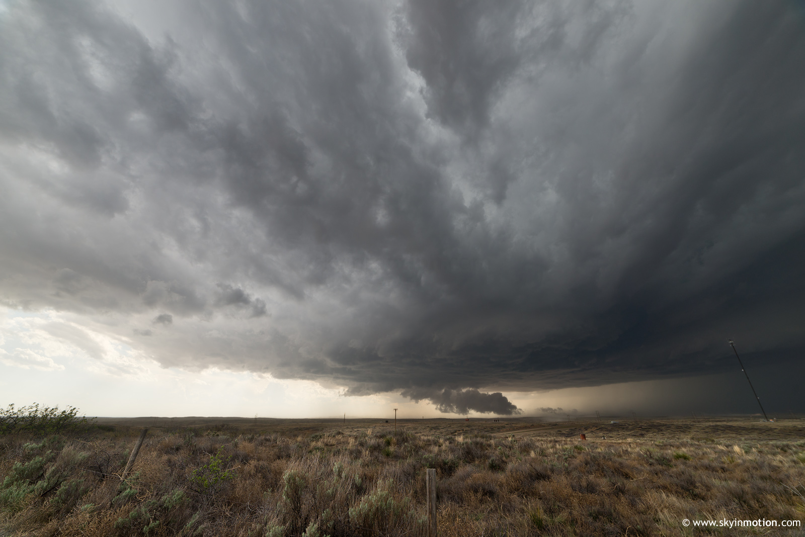
We meandered NW to Channing, but this cluster was not organizing in any hurry, no thanks to the mid 40s dew points. We briefly pondered darting N into southeast CO and southwest KS where additional moisture-starved storms were ticking up more quickly, but eventually one cell began to dominate in our cluster as it passed over Channing. We returned E on TX-354 toward Masterson, then dropped S on US-87 toward the Canadian as the supercell took a hard right turn and attained an ESE trajectory. For as high-based as it was, it produced some pretty impressive wall clouds, but ultimately you'd never peg it for any tornado potential during this phase.
For the second chase in a row, the Canadian threw a monkey wrench in chasers' plans to follow the storm. We let the updraft get just E of us along US-87 while pondering our next move.
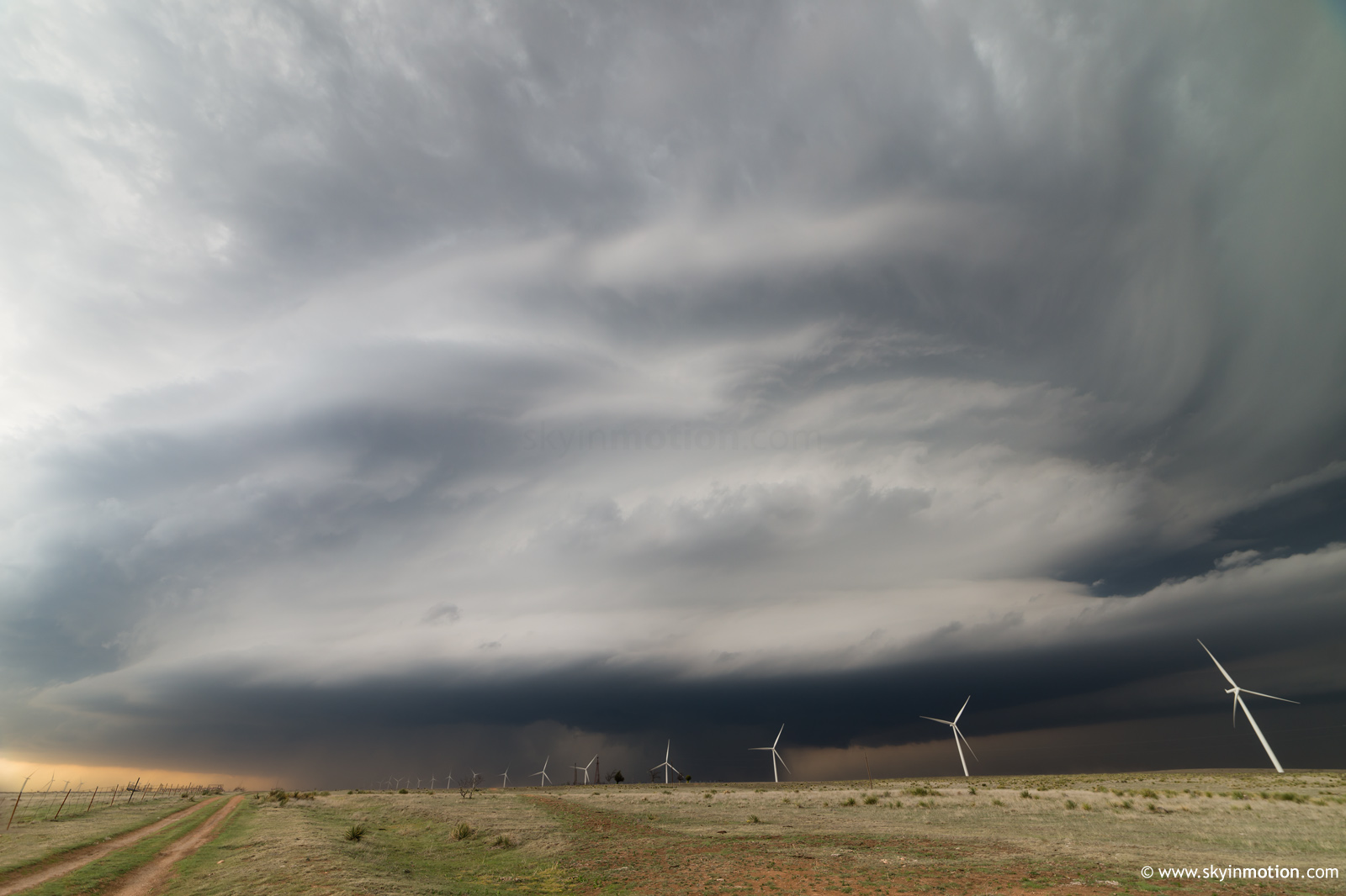
Lacking any better options, we then dashed S to the N side of AMA and took the loop around the NE side of town to US-60, where we continued NE to Panhandle. This process took at least 40 minutes, during which time the storm produced at least one apparent rain-wrapped tornado somewhere E of Lake Meredith. It was a relief to finally catch back up in a wind farm N of Panhandle, where we observed much better structure than before.
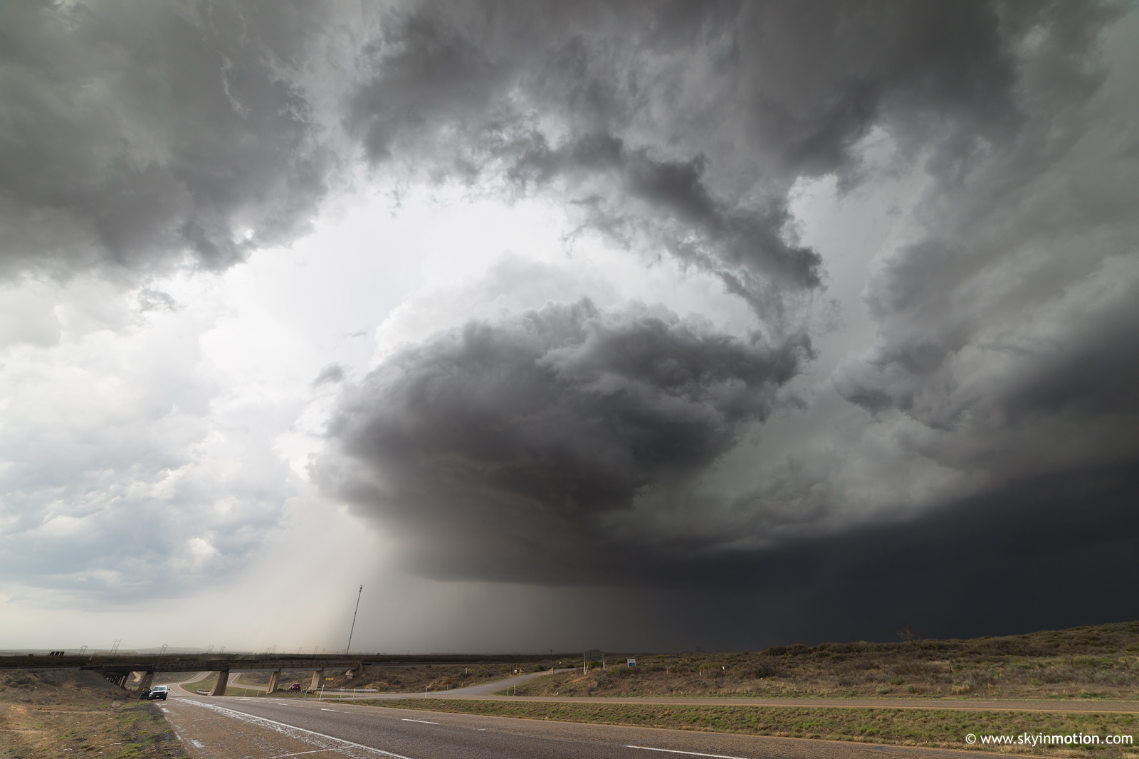
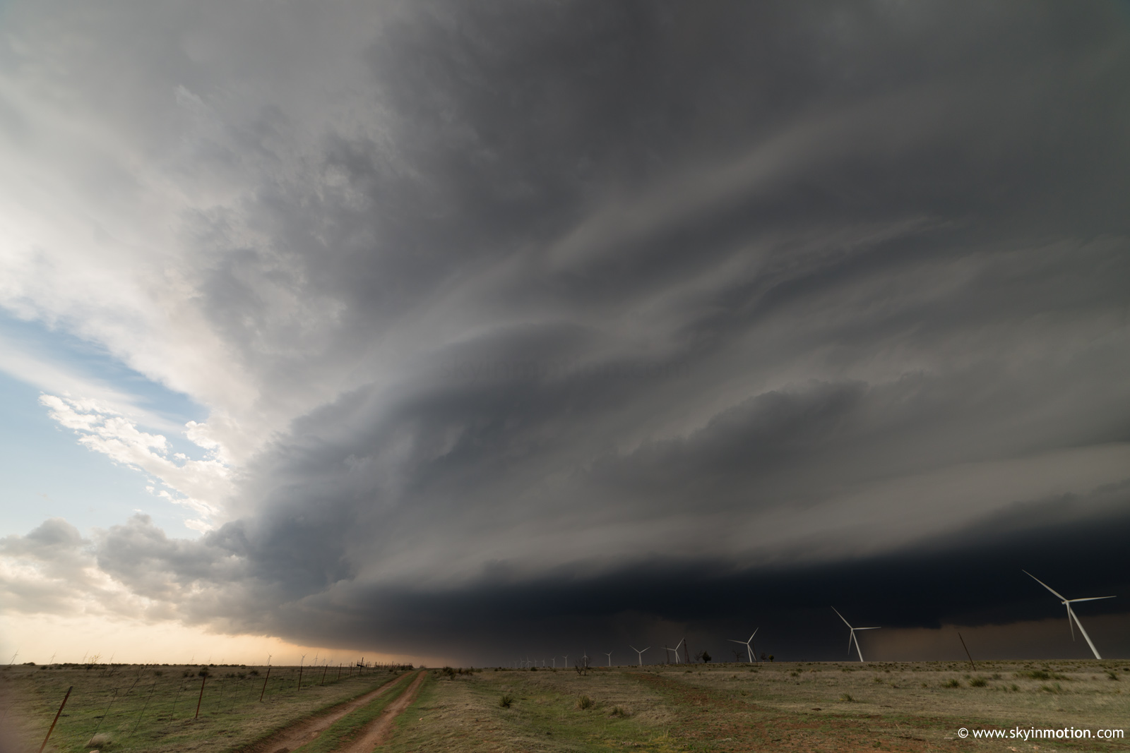
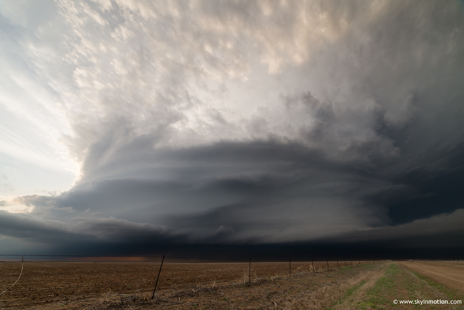
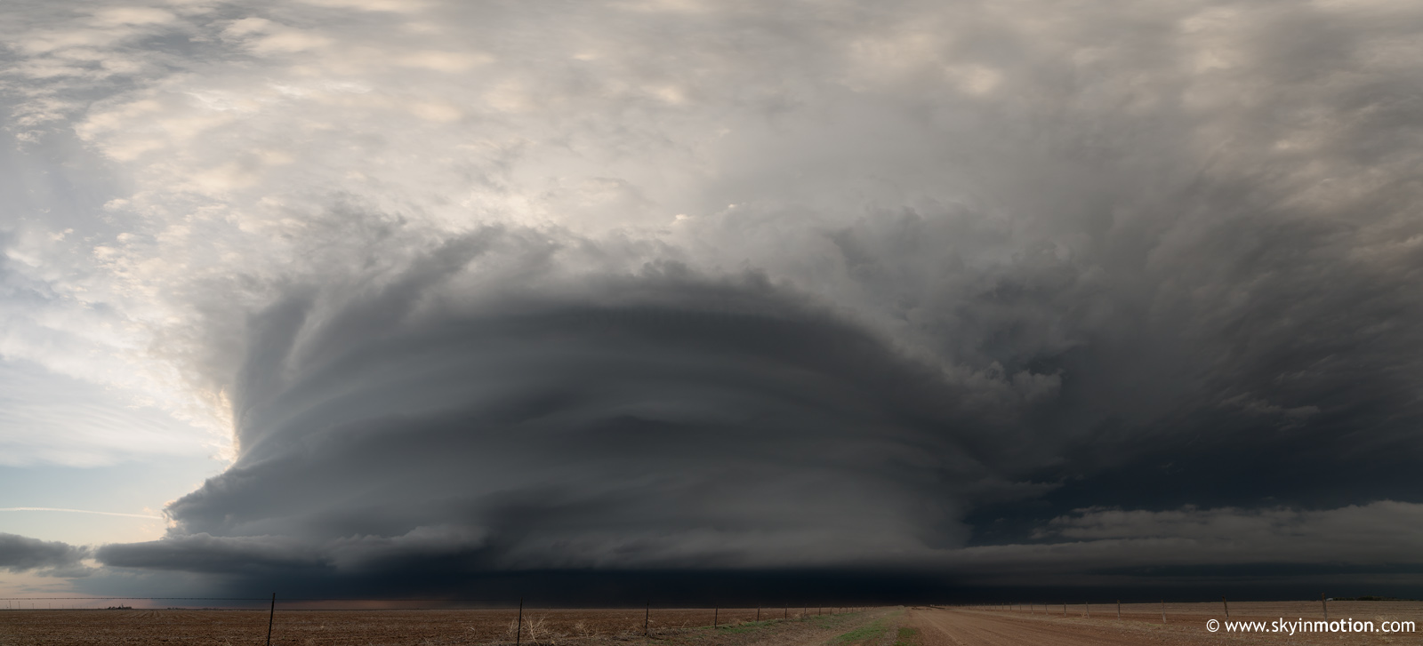
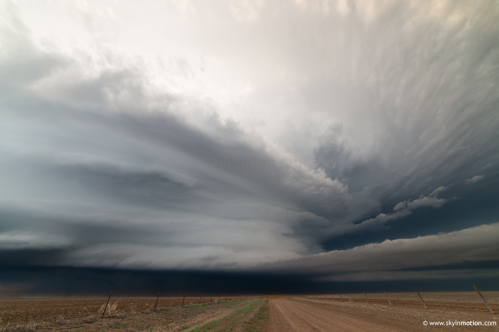
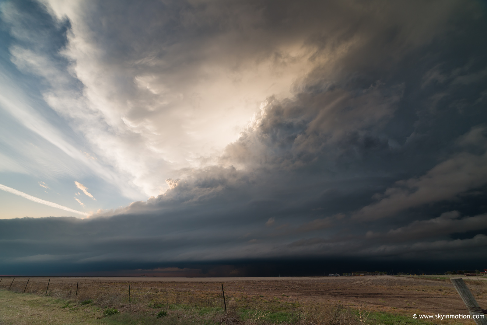
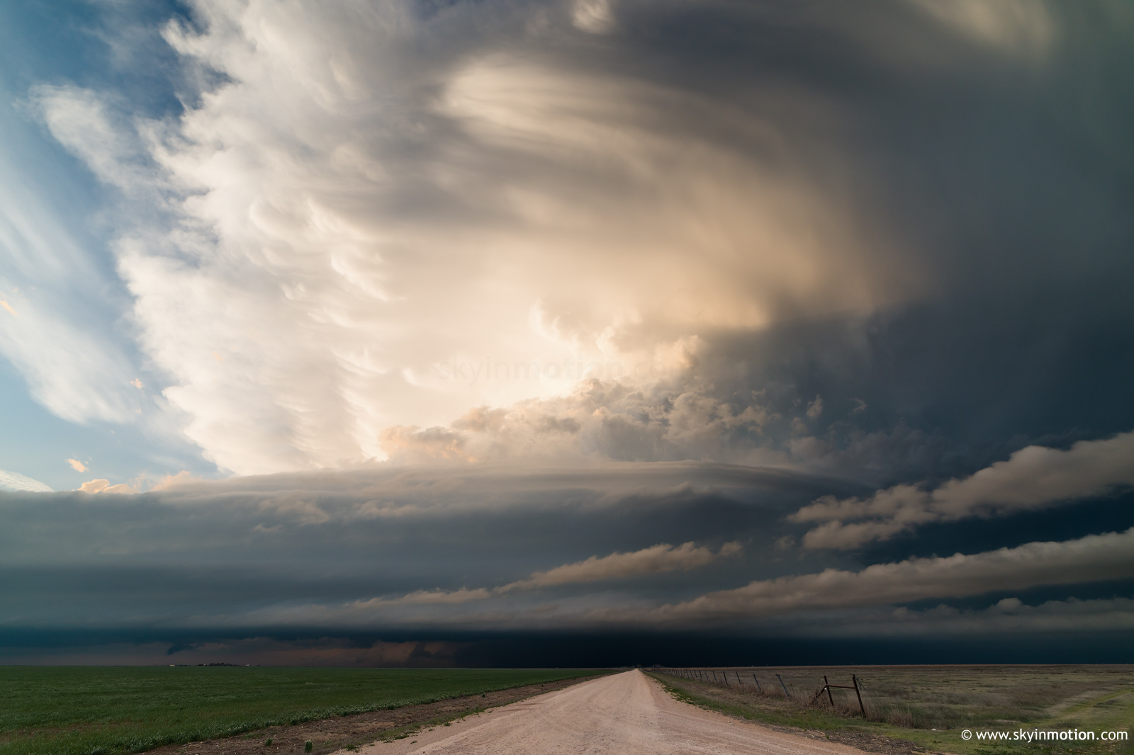
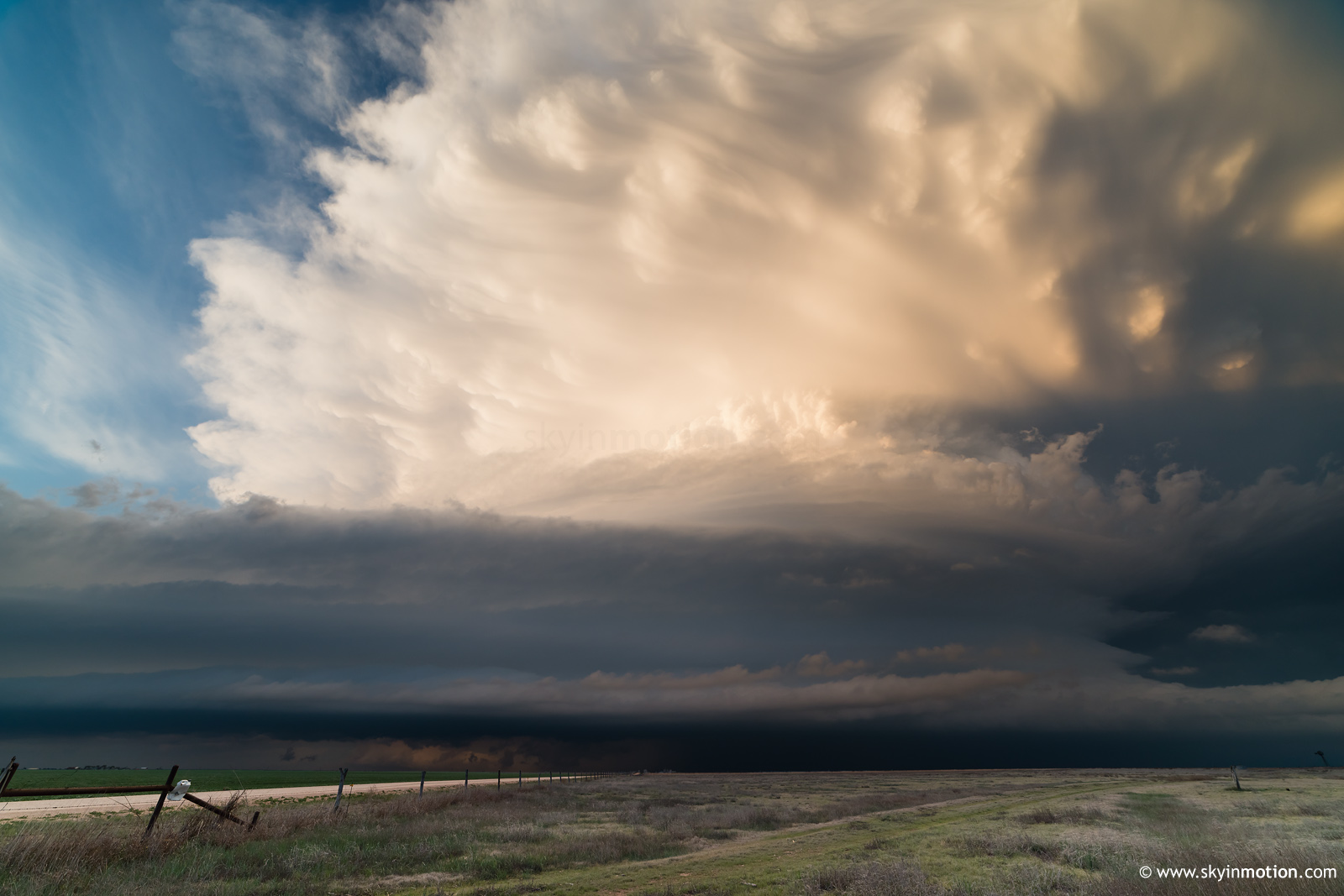
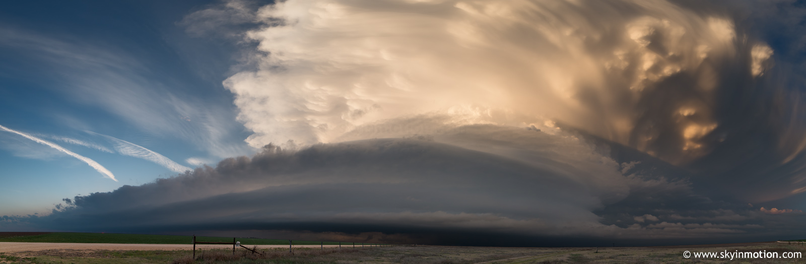
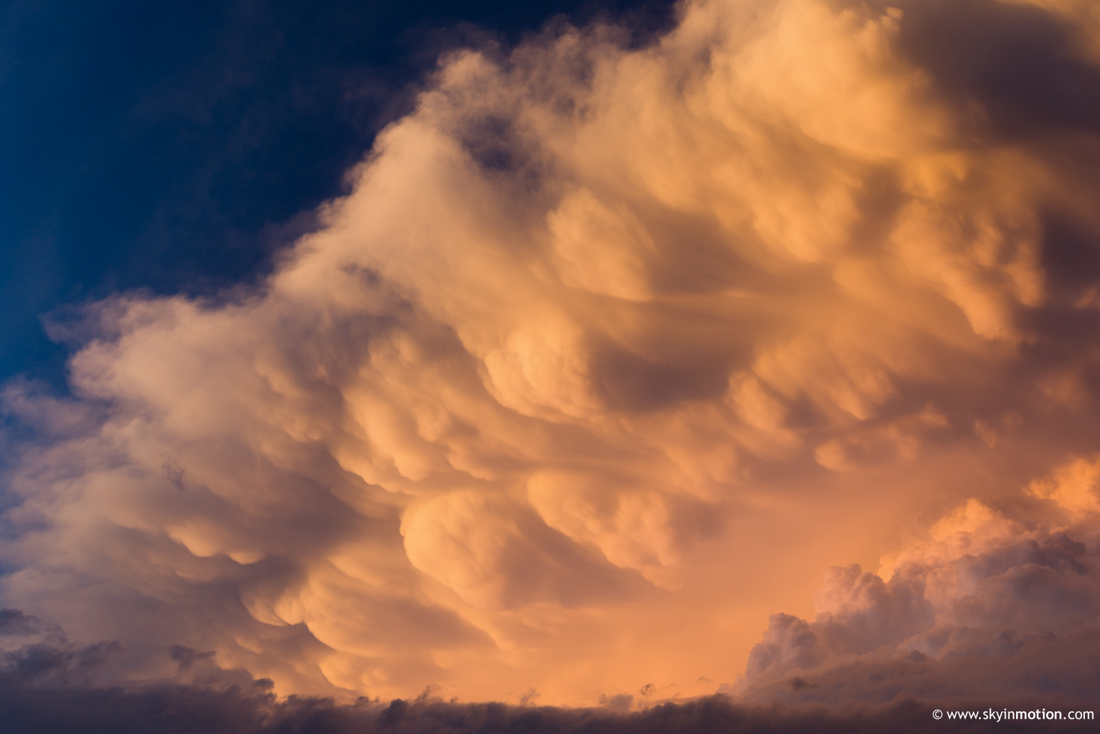
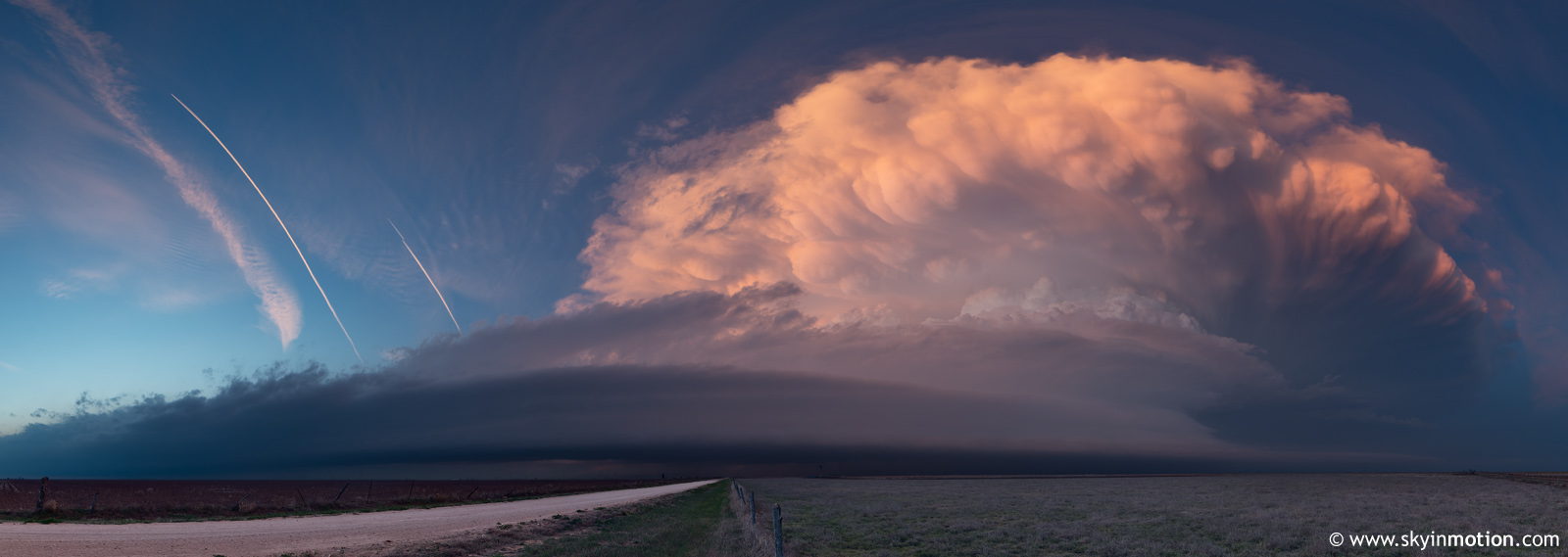
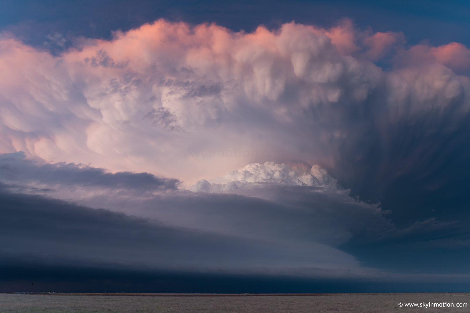
Not long after that shot, increasing low-level rotation on radar compelled us to take a trip into the bear's cage by creeping N along TX-207. By the time we concluded (shockingly) that any tornadic activity would be hopelessly hard to see, the consequences of our decision had already been rendered: we battled sporadic golfball to tennis ball hail during the mad dash back S. The only battle scar was a slight extension of an existing front windshield crack. Once back SE of the updraft base, it became plainly obvious that structure would rule the day for the remainder of the chase. Thankfully, it was pretty darn good. For the next hour or so up to dusk, we enjoyed the photo-op bonanza as we zig-zagged SE between White Deer and Groom, with magic hour coloration enhancing an already spectacular scene. It was very reminiscent of my surprise success on 2011-10-11 near the same area at sunset, another case with surface temperatures in the 60s and dew points hardly breaking 50 F. Panhandle Magic, folks.