
An LP supercell near Pampa, TX, gives us cool structure, but it's no consolation for missing many tornadoes in Kansas.
Thank goodness: another day that looked to offer a significant severe weather outbreak and make up for our bad experience two days earlier on Apr 21. Surely we couldn't manage to blow another one, right? Right?!
This was actually a "day before the day" chase, since a very major outbreak was expected over the I-35 corridor the following day. However, this day looked formidable itself, warranting a moderate risk on the day 2 outlook on Sunday. It appeared more chaser-friendly, as well, with capping ensuring any storms that did go up would remain discrete and easy to find. In model land, the same scene that had played out on Feb 23, Mar 28, and Apr 21 was about to repeat itself again: in the days leading up to the event, we looked to finally have our chance at a good outbreak in W and SW OK, by far the best chase country for those of us in Norman. Just as we had on Feb 23 and Mar 28, we were getting excited the day before over forecast soundings for places like Childress, Altus, and Clinton. But the 00z model runs the night before indicating stronger capping for the southern portion of that area and also shifted the dryline back west, which meant another Panhandle chase. Granted, not having to worry about terrain this year has been very nice after 2006, but at the same time, I don't think many of us would mind something happening within 200 miles of OUN for once!
We left for Shamrock right after our morning classes and arrived there by 1:30, staking our claim at the Best Western right off the interstate before the masses gathered. Quickly thereafter, a tower went up nearly overhead and drifted northeastward into NW OK. While it looked somewhat interesting, it didn't appear to be strengthening either visually or on radar, so we didn't pay much attention to it, despite the SPC mesoanalysis indicating better shear to our east at the time. We sat in the motel parking lot for what seemed like an eternity, during which time it filled up with other chase vehicles, predictably. During the mid-afternoon, various "blips" would show up on the AMA radar across the central Panhandle, but would never get their act together. Meanwhile, several storms to our north and northeast were evident, but seemed disorganized, looking like a multi-cell cluster on radar. By around 4:30, a handful of chasers at the motel decided to take off up US-183 after that convection, which was now over Lipscomb and Ellis counties. Brandon and I were very reluctant to follow them given that the storms were already 75 miles off and moving away from us, while Bryan was pushing for it since it was the only game in town at the time. After 20 minutes of hesitation, we decided we'd start heading north towards it, but hopefully something better would develop to the west and we'd go after it instead.
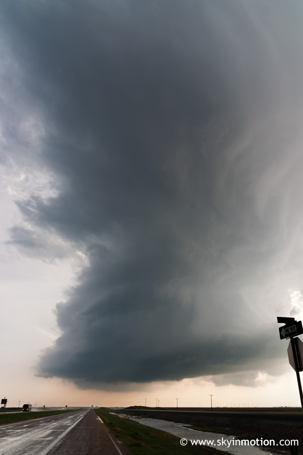
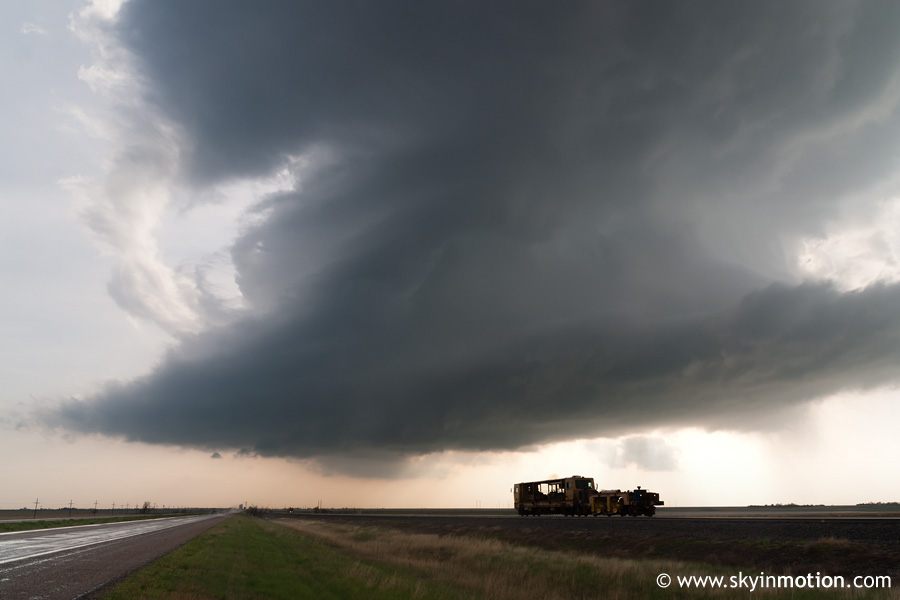
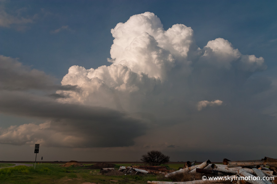
No more than five miles outside Shamrock, we hit road construction that was closing one lane of the highway, forcing us to sit in a line for several minutes waiting for our turn to go. Already very concerned about ever making up to the NW OK convection before dark, this little roadblock seemed like a bad omen, and Brandon and I decided we really ought to just hang out and wait for initiation on the Caprock. We briefly returned to the motel to take one more look at radar, then decided to head west on I-40 since there were still towers trying to go up on the Caprock. We stopped at McLean for another look at the radar, and saw that a cell to our west was rapidly strengthening as it neared Panhandle (the town). We blasted northwest towards Pampa for an intercept, and heard en route from a friend that it had become tornado-warned. Upon reaching Pampa, we moved southwest towards White Deer, and the storm quickly came into view, in its entirety: it was a very tall, slender LP with a completely rain-free base.
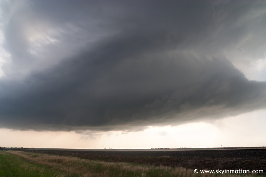
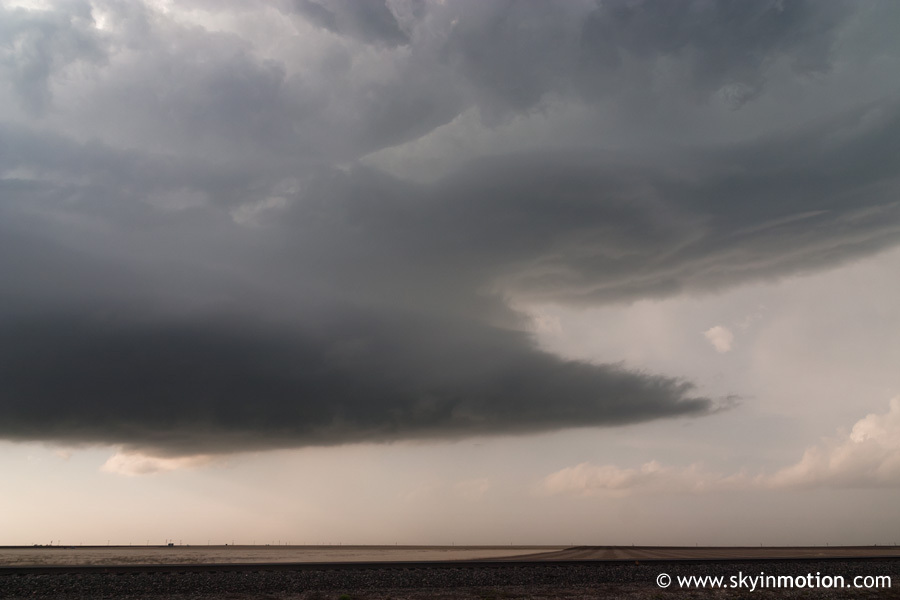
While the structure was pretty nice to look at for the first several minutes, I quickly became concerned that it was high-based and did not seem to be getting better-organized or developing a wall cloud. In fact, quite the opposite was happening, as it appeared to be shrinking, and the base becoming even higher.
I really enjoy good structure and particularly so with LP storms, but I wasn't exactly thrilled, as this thing was becoming absurdly small, both vertically and horizontally. Given that there was absolutely nothing else visible in any direction but partly cloudy skies, I got the sinking feeling as we headed back through Pampa to follow our dying LP that another good setup had just been put to waste for us. By the time we exited Pampa to the east, the "storm" was in laughable shape - indeed, it wasn't long before the entire thing simply vanished from the sky! I believe this is actually fairly typical when LP storms weaken, but I had never seen it before, so it was pretty enraging at the time. After checking radar again and seeing absolutely nothing in the TX Panhandle - the only activity was the cluster up in far NW OK, which now looked more intense but still disorganized, along with a lone supercell in the OK Panhandle - we decided to start heading home. While it sucked not to have seen a tornado or even a powerful supercell on a day with such potential, at least it felt like we weren't alone this time, as there were hordes of chasers around Pampa watching the same pathetic storm we'd latched onto. So we headed back in fairly good spirits given the potential the following day, stopping in Elk City for dinner at a brand-new KFC that was a lot nicer than most any fast food place in Norman! Then, about halfway home on I-40, our contentness came to an abrupt halt when we got a call from one of our friends that had flown after the NW OK convection from Shamrock. That "multicell cluster" ended up becoming well-organized around 7:00pm, eventually producing at least six tornadoes as it tracked from Laverne OK to Protection KS.
Yes, we'd blown it again. And what was about to happen the next day wouldn't help matters.


