Panhandle Magic shows what 2015 moisture is capable of in the right hands!
Observed 4 tornadoes.
I left Norman around 11:30am, took I-40 to Elk City and then OK-152/TX-152 to Wheeler, then shot N to Canadian and arrived on the storm just as its first low-level mesocyclone began ramping up.
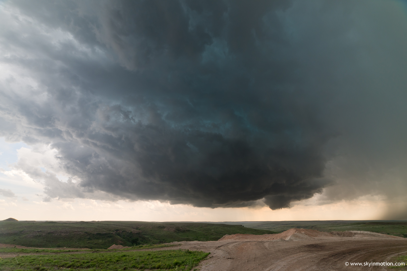
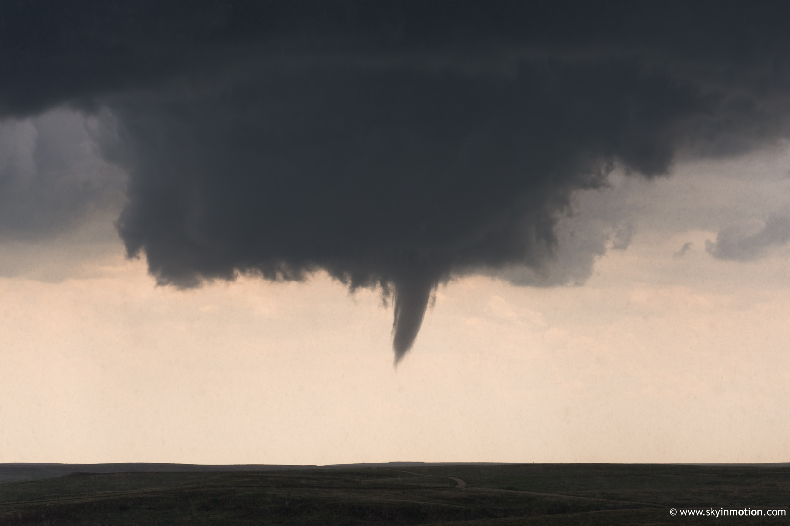
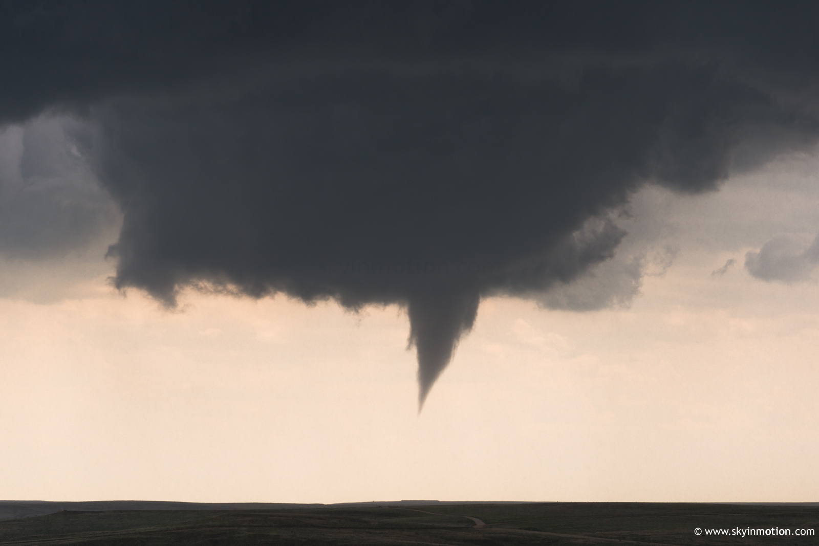
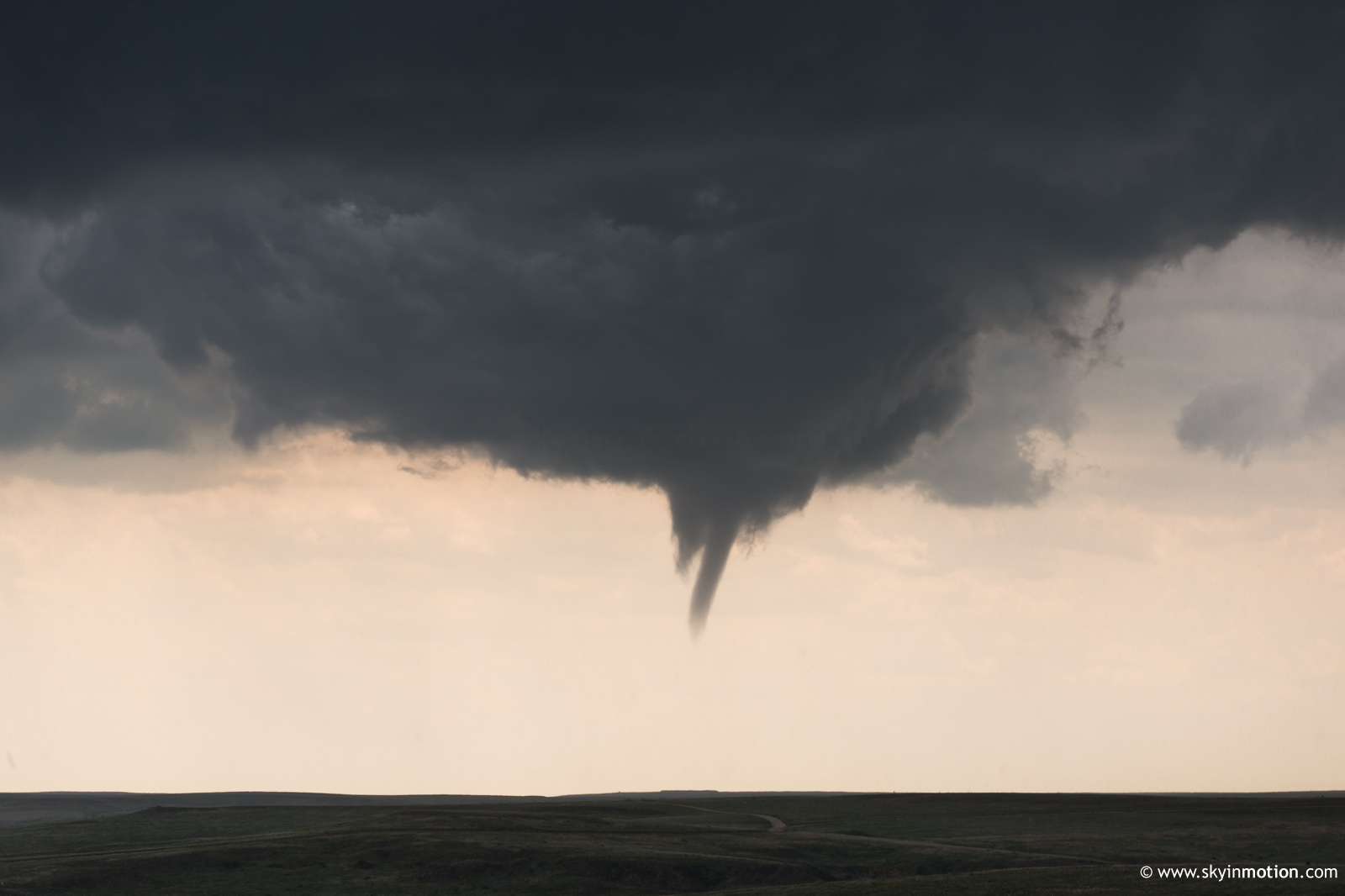
It wasn't long (~3:24pm CDT) before a gorgeous funnel descended beneath an absolutely textbook wall cloud and overall supercell structure; a far cry from the HPs we were all expecting, no doubt. This would've been one of the most photogenic tornadoes I've seen, had it been able to persist for several minutes and condense fully to the ground.
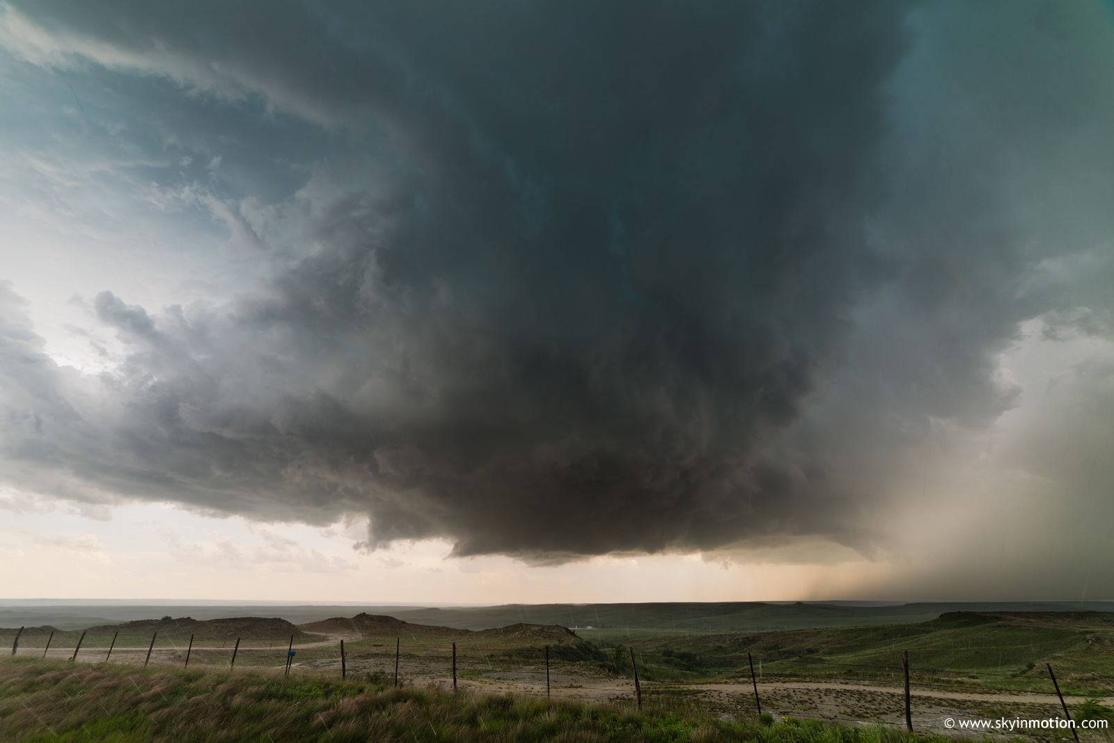
After this circulation wrapped in rain and occluded, the storm continued to look impressive for a short time.
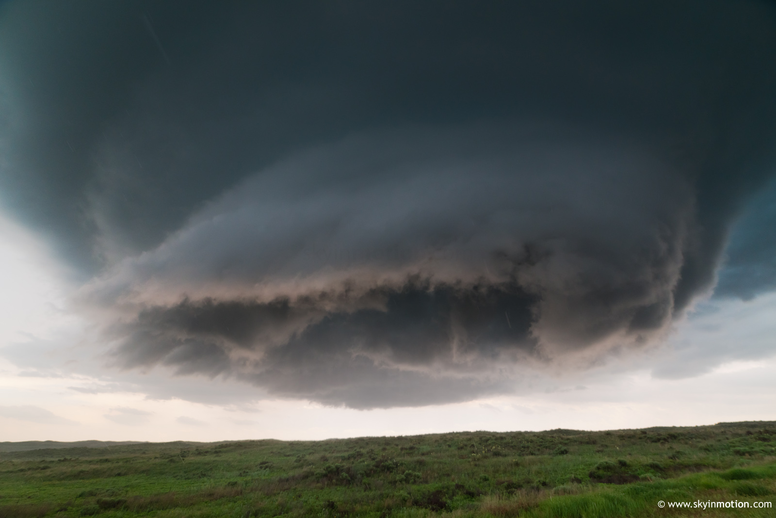
However, after 15 minutes or so, its appearance grew increasingly "cold" and failed to produce any more substantial wall clouds for well over an hour. At some point between 4-4:30pm, I started glancing at the Palo Duro area cells on radar and pondering my options, as the Canadian storm had seemingly become so outflow-dominant and decidedly unphotogenic. Thankfully, instead of bailing (a decision which no doubt would've been influenced by the suffocating hordes, slowing highway traffic under 40 mph for miles-long stretches), I simply repositioned from NW of town on US-83 to NE of town on US-60 for a more comprehensive view of structure -- and, by virtue of venturing into forward-flank hail, losing the crowd. It was around this time that I noticed a new low-level mesocyclone with impressive rotation, considering its broad appearance.
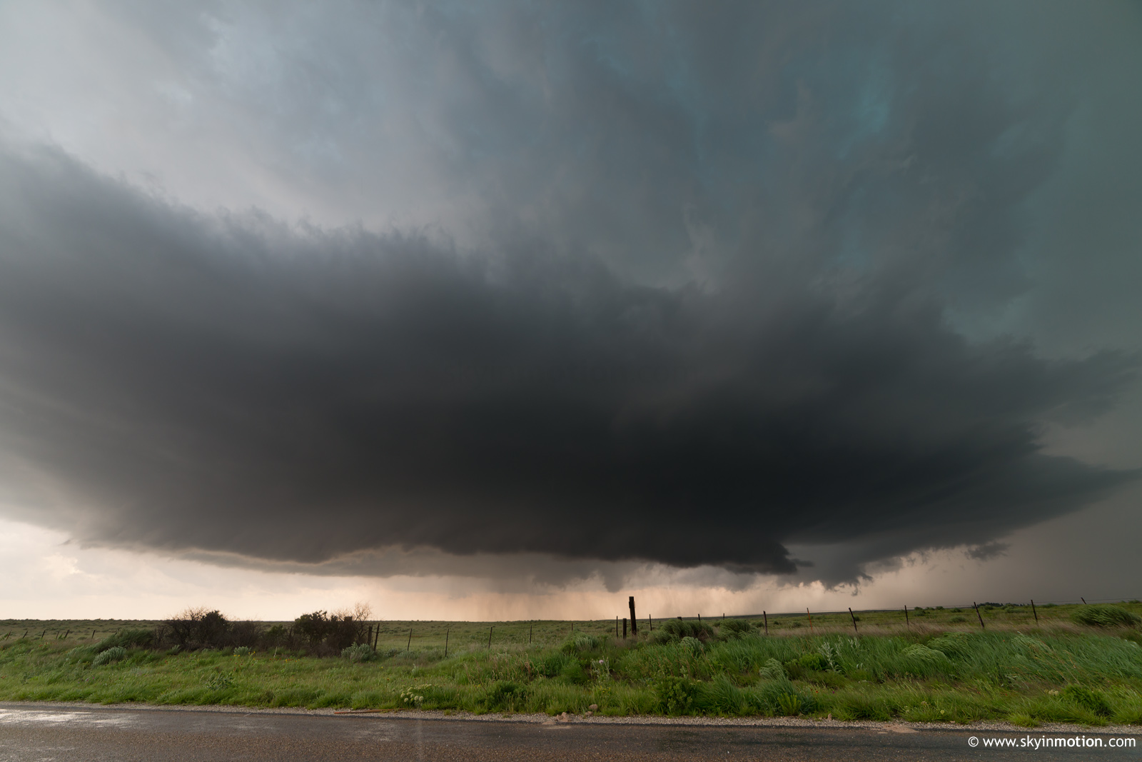
This should've been my cue to blast SW, but the storm still seemed a bit "cold" for much more than brief spinups -- and boy, the view from this high point away from the ungodly hordes was hard to give up. A few minutes later, while casually examining radar, I looked back and noted a large stovepipe ongoing with moderate rain and hail clouding my view.
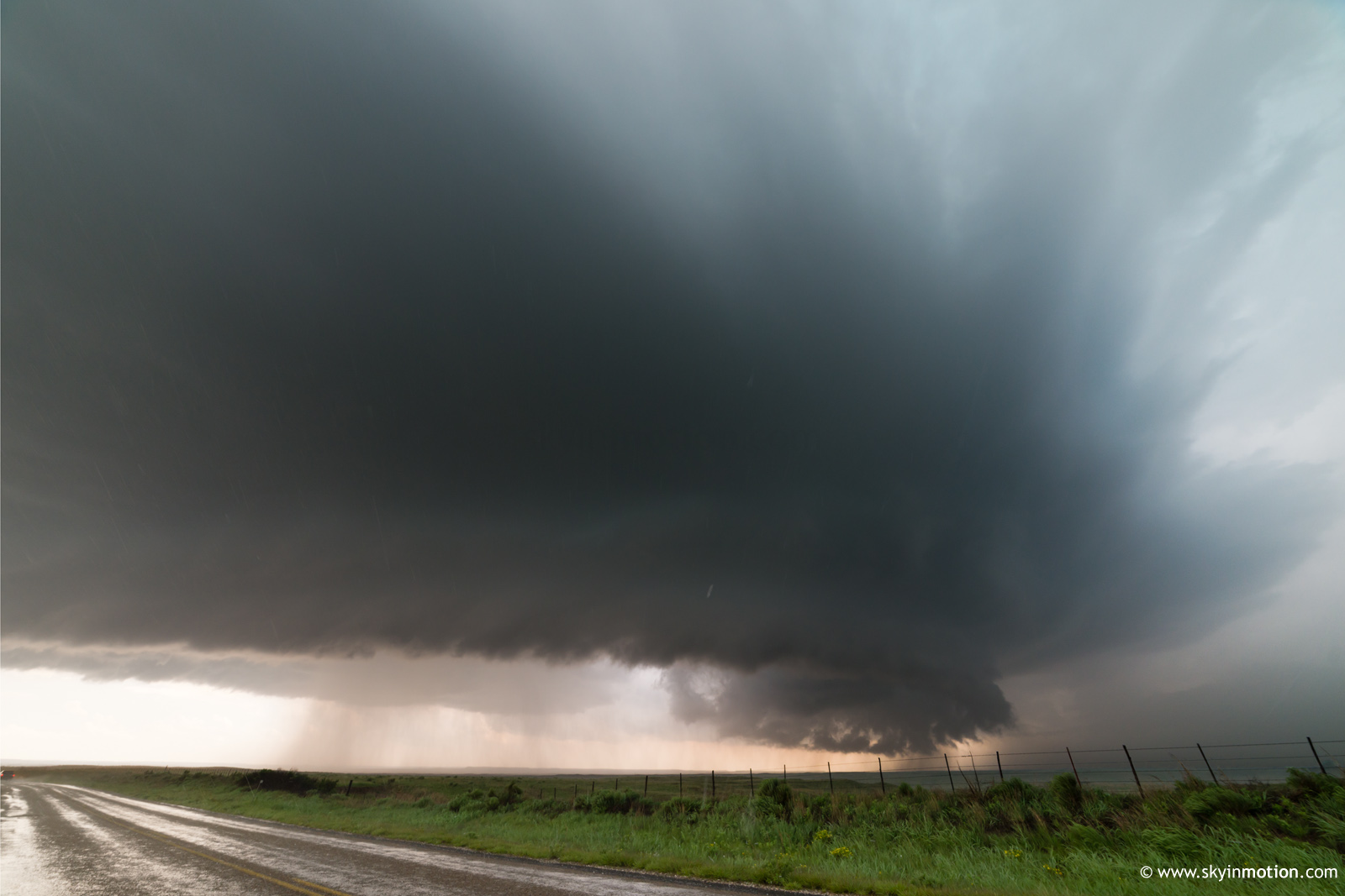
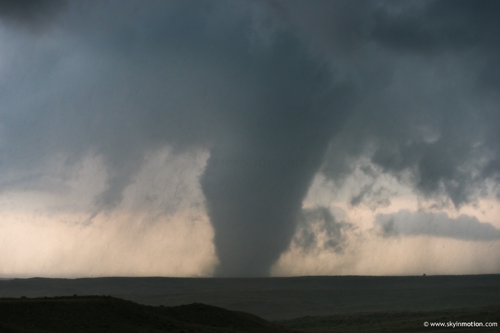
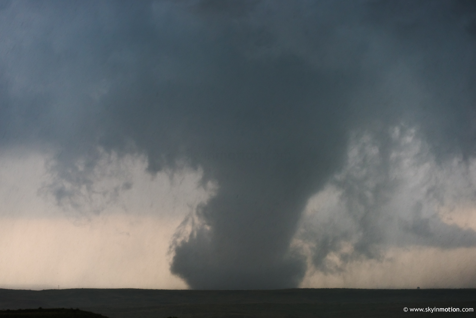
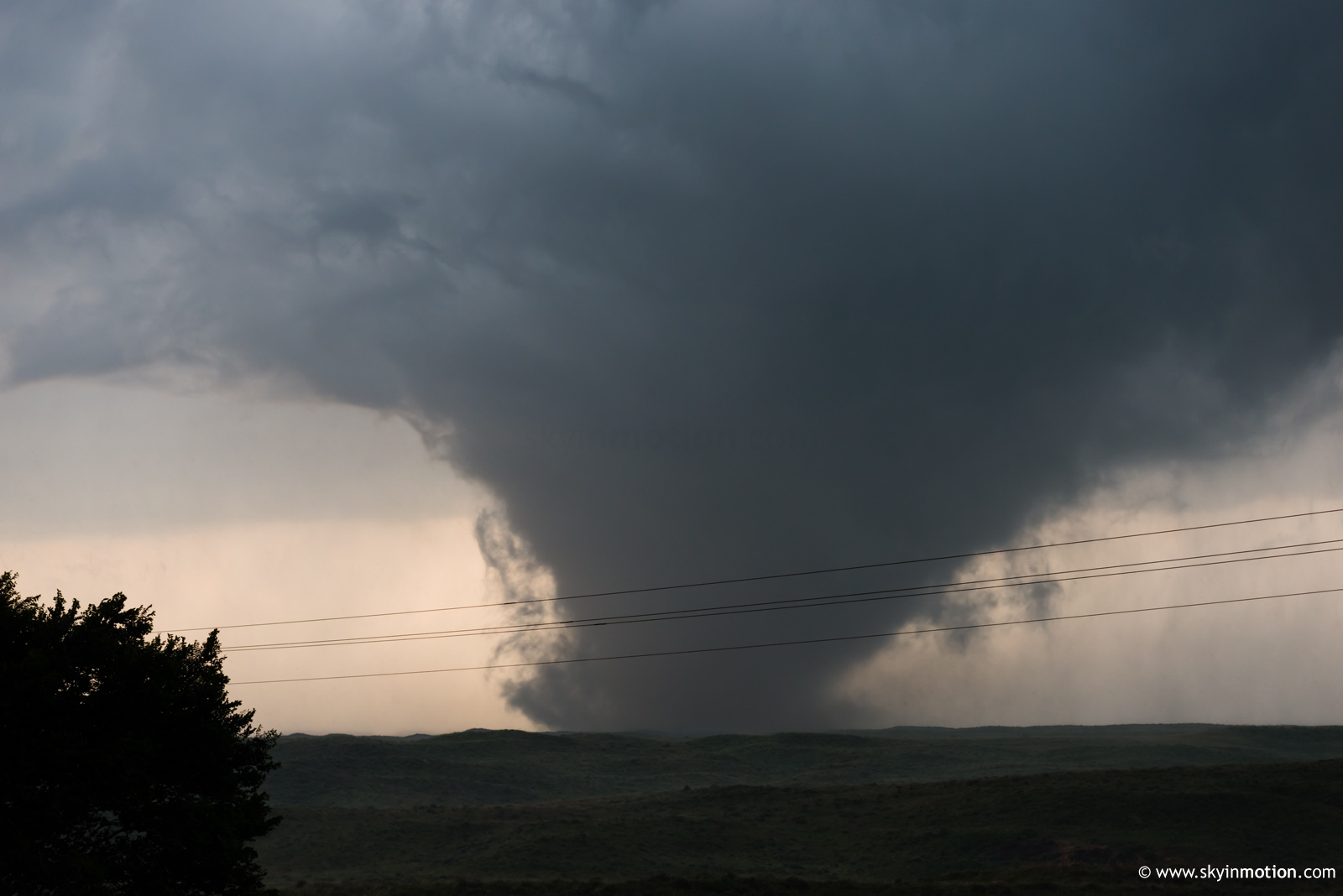
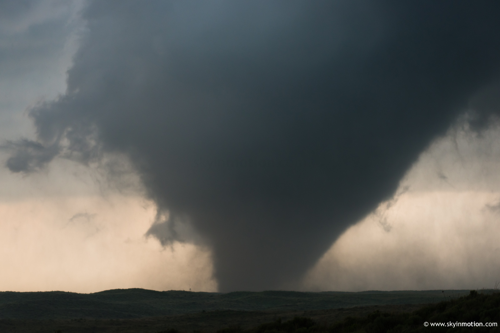
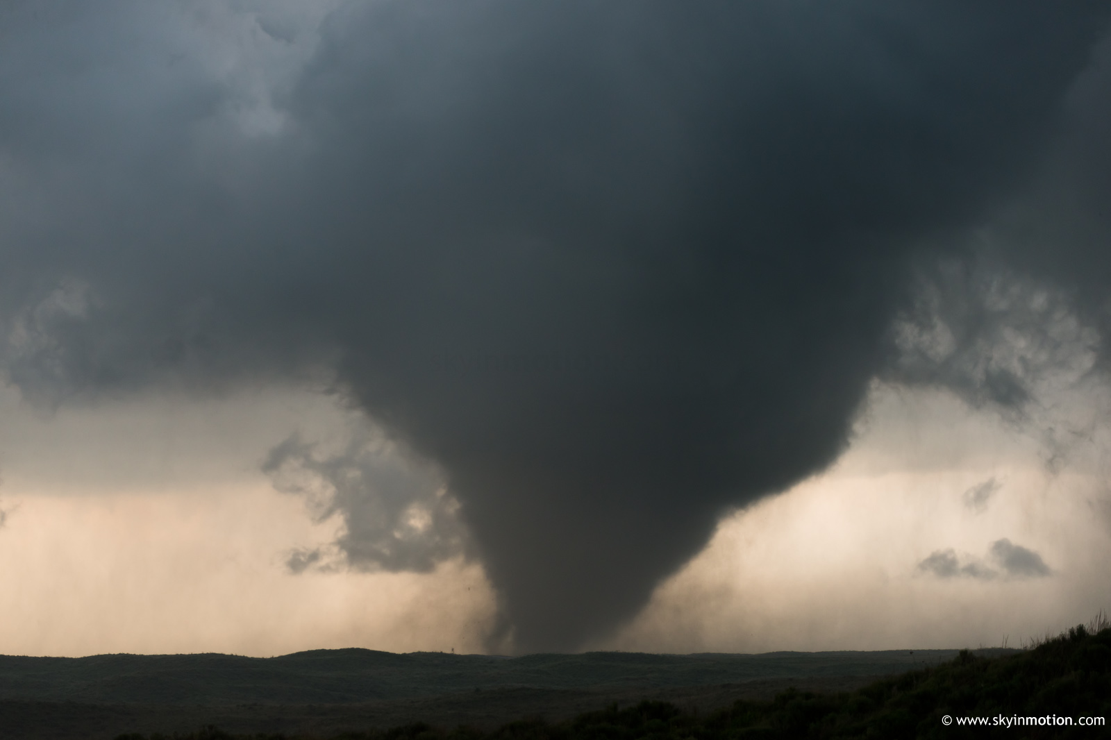
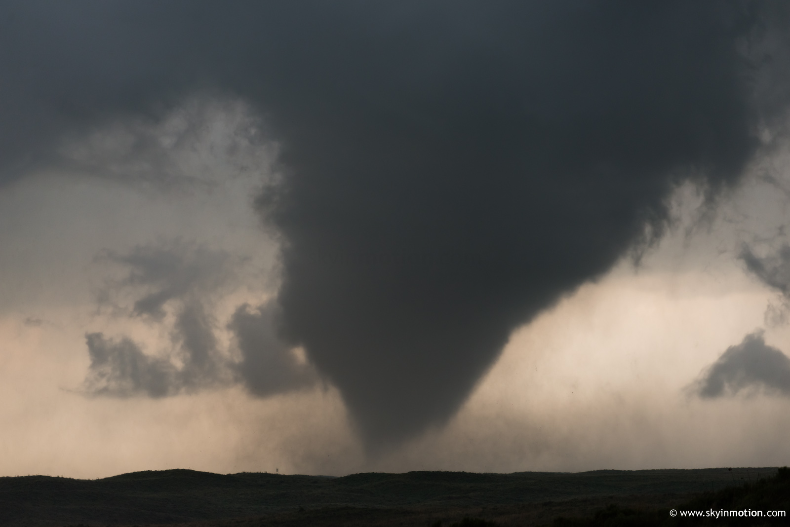
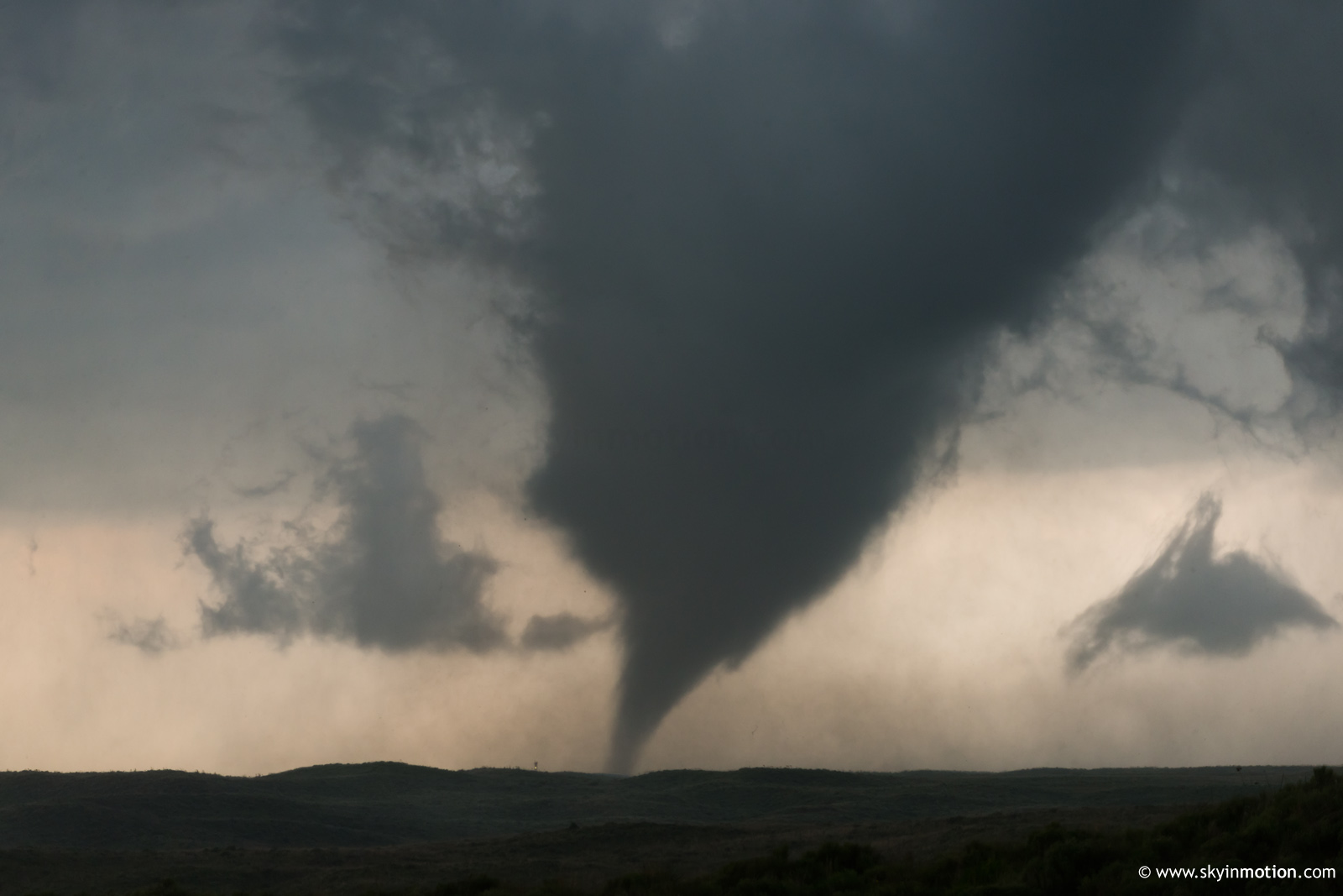
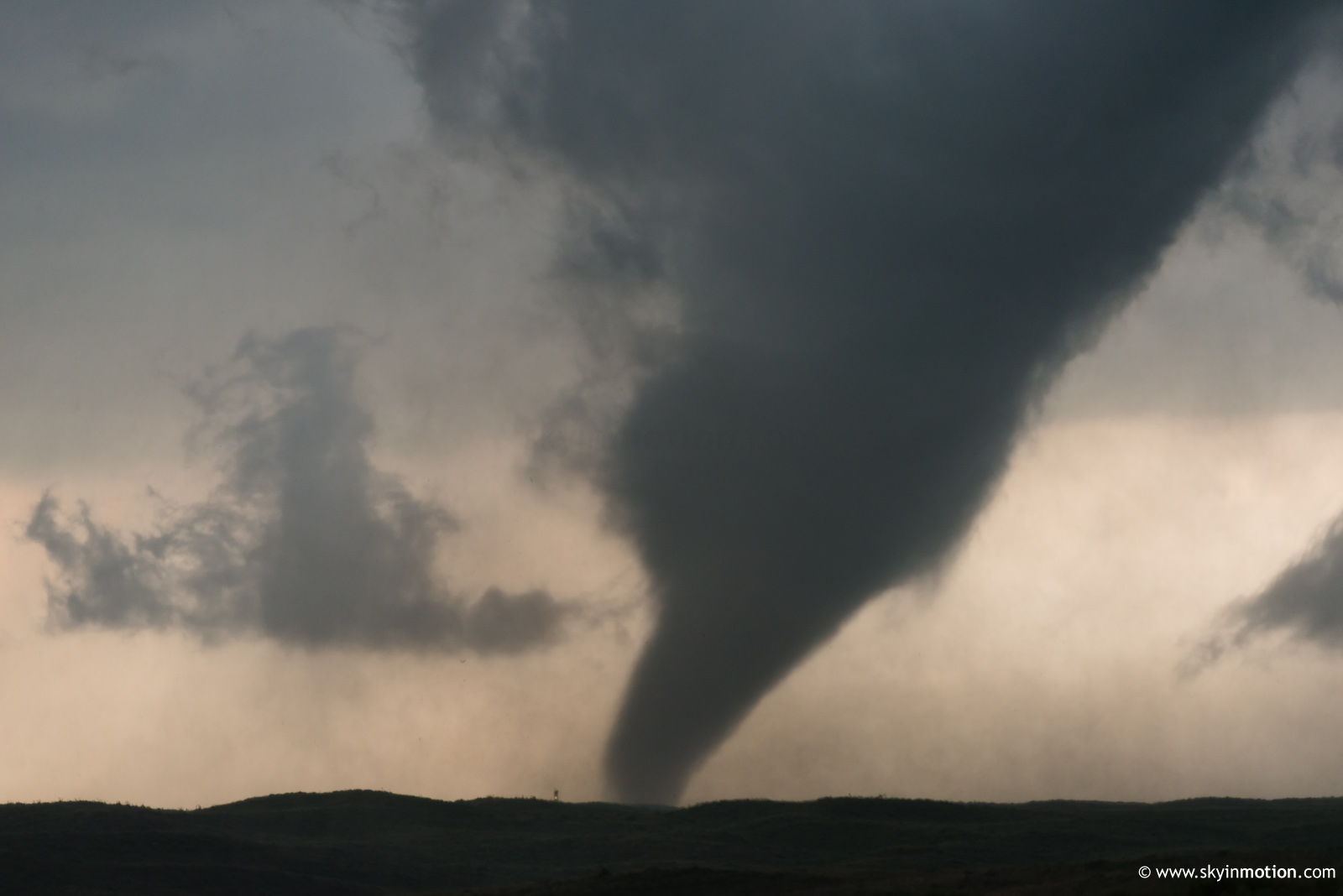
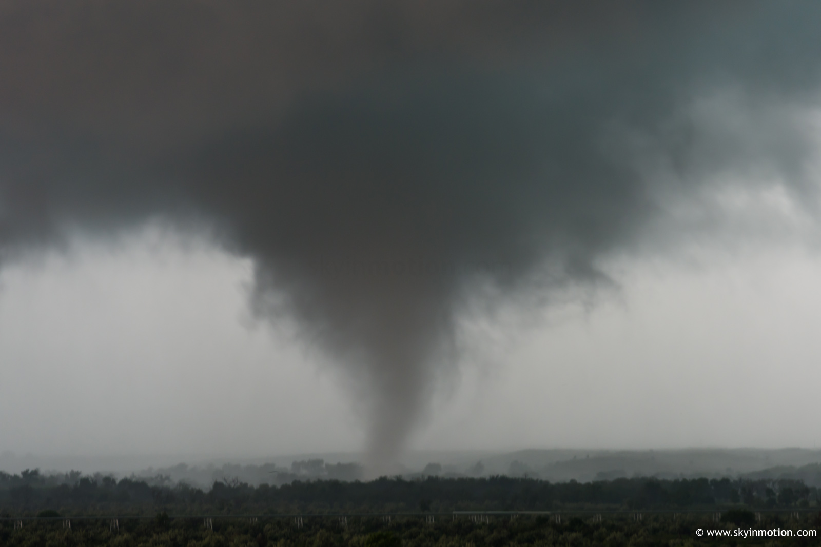
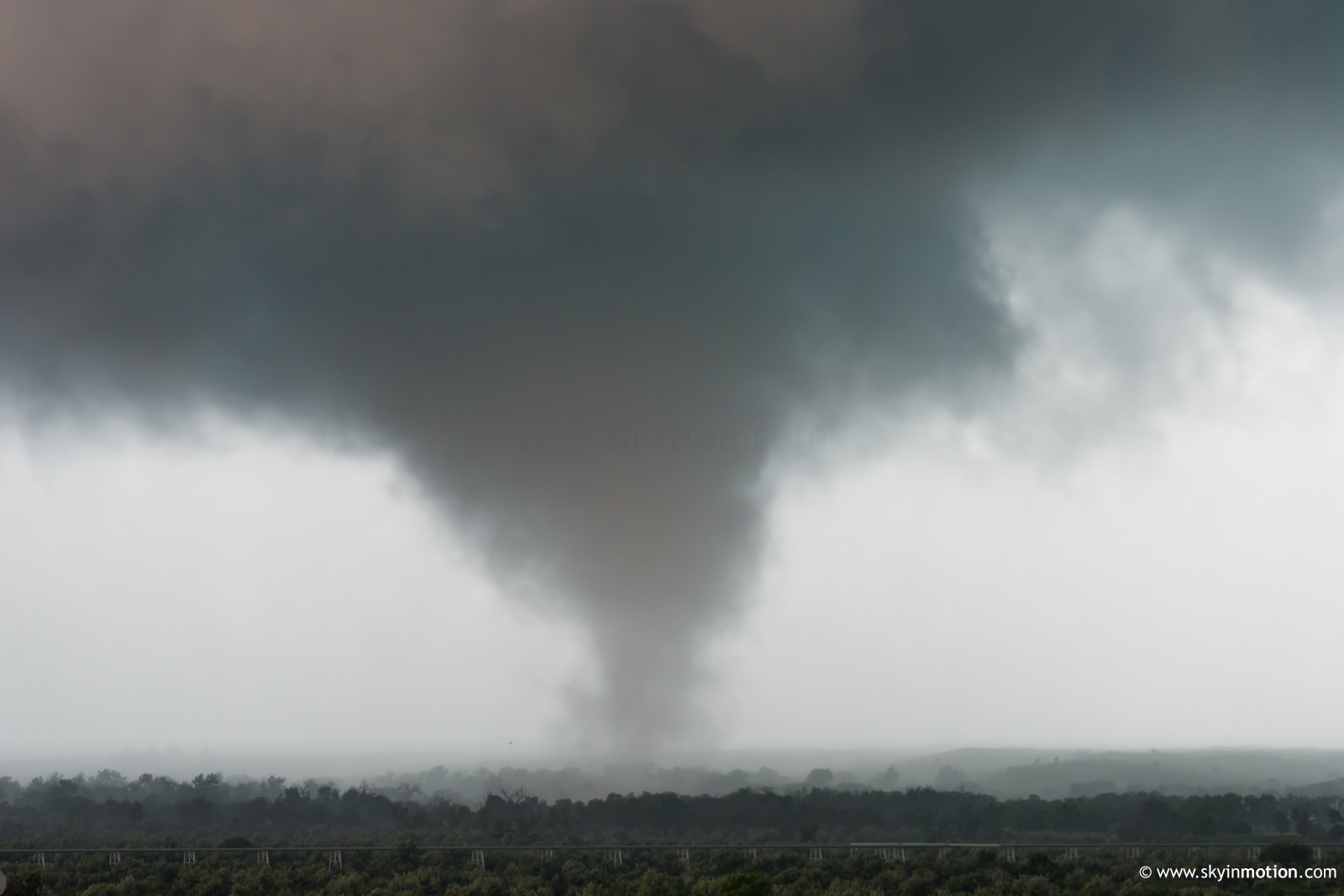
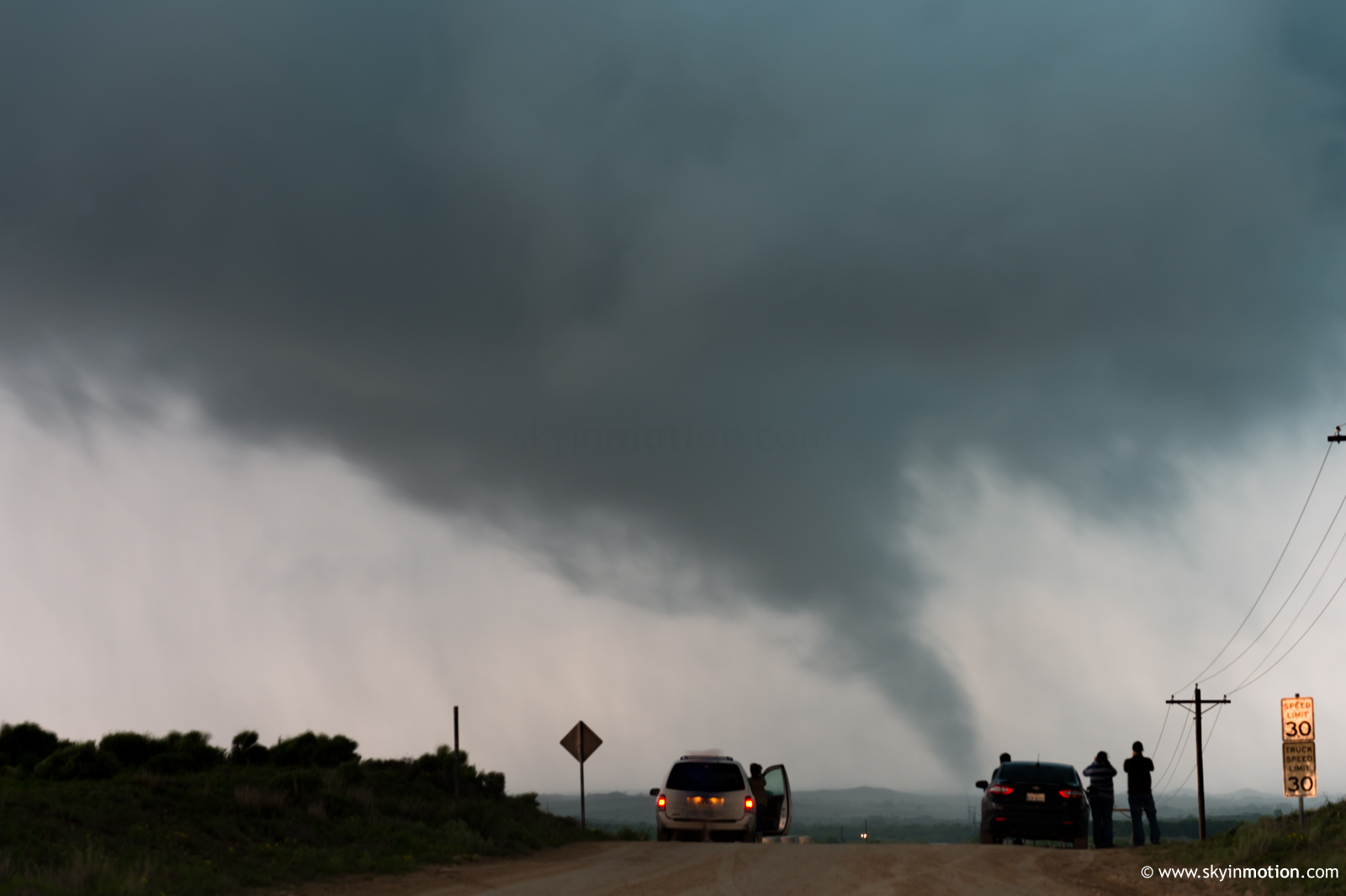
Disgusted, I blasted back to US-60 in search of a spot where powerlines weren't near-level with the road; I quickly gave that up and decided scrambling down the ravine to get below them was preferable in the circumstances. From there, I watched and photographed the final 6-7 minutes of the EF2's life cycle.
In a manner strikingly resembling the 28 March 2007 tornado near Brice, TX, I observed in a similar part of the Panhandle, the tornado cyclone well above the surrounding cloud base was eventually carved out by an all-encompassing clear slot. This led to the appearance of an incredibly "tall" tornado toward the end of the life cycle.
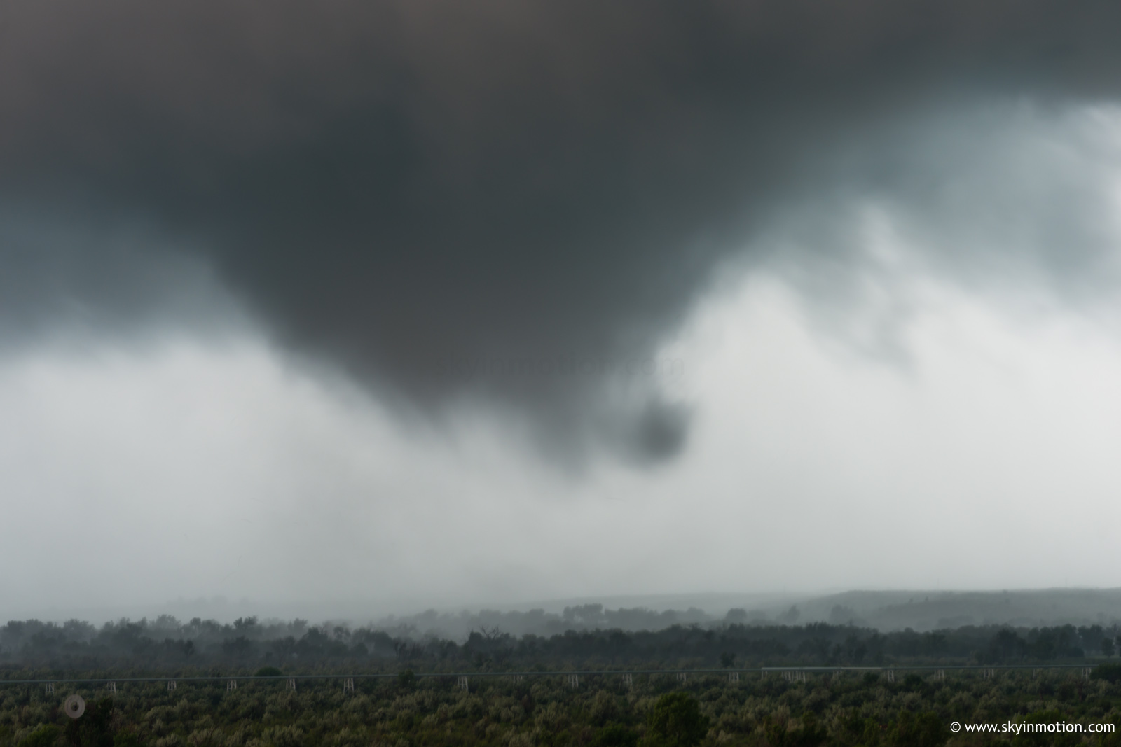
Immediately after the (spectacular) ropeout, I became awestruck by an ominous low-level mesocyclone nearly overhead along US-60. Given how much the previous tornado exceeded and reoriented my expectations for the day, I was ready for an Allison 1995 repeat to unfold less than a mile from me beneath this beast. While that didn't come to pass, it was quite a sight to behold in its own right.
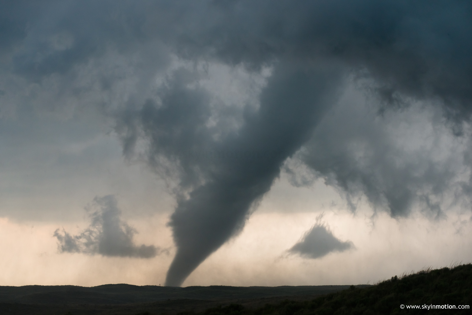
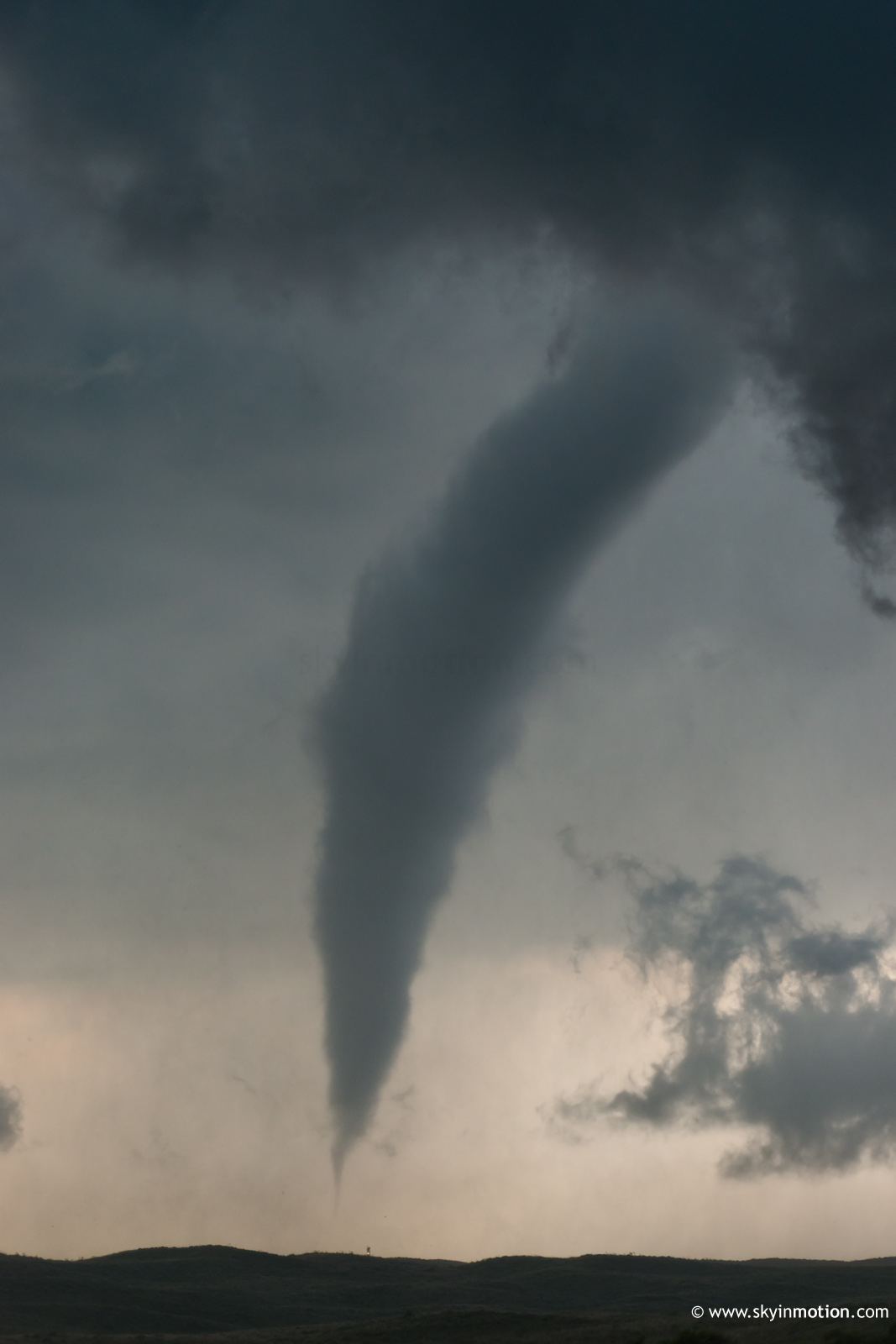
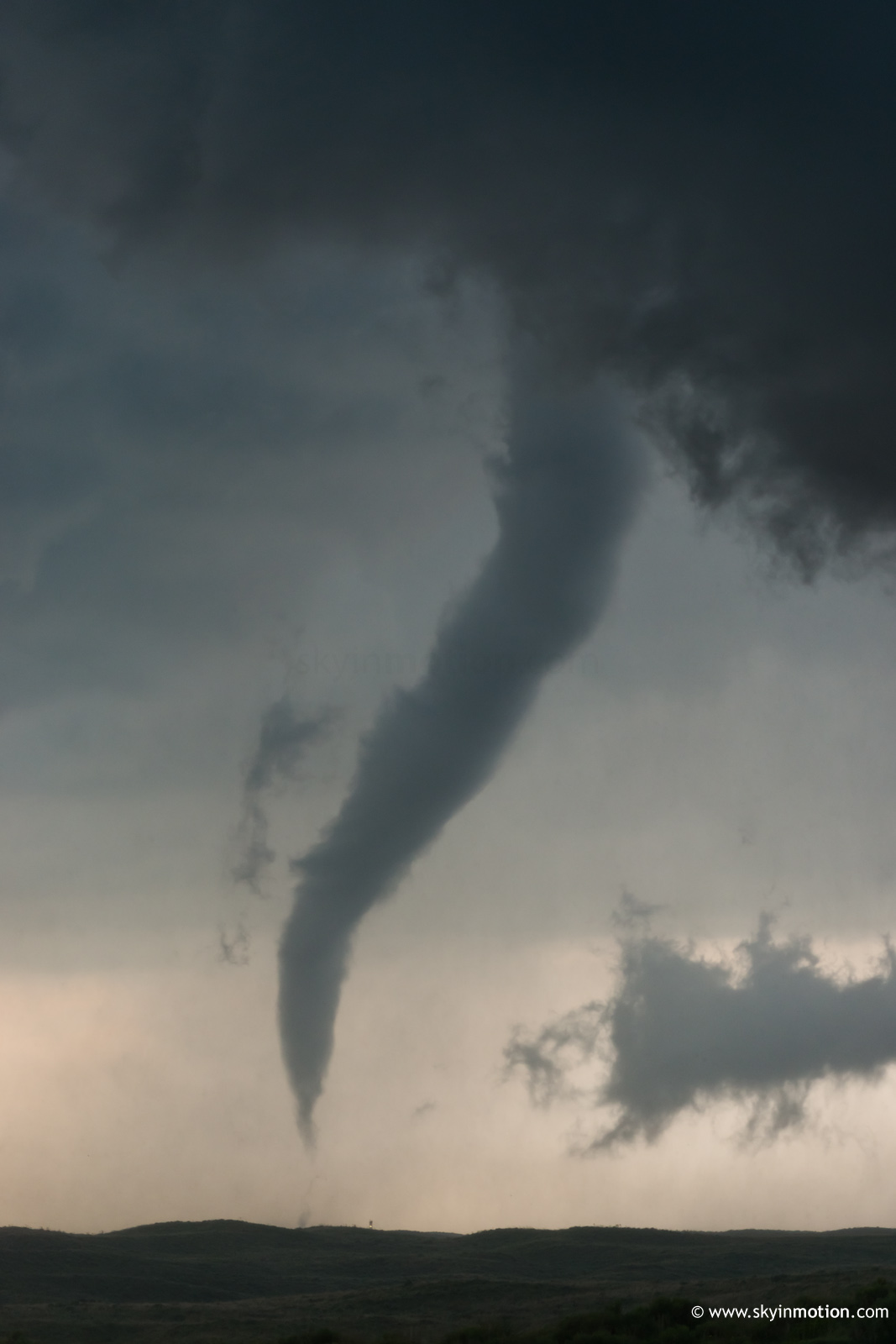
After this circulation weakened, I headed back W for yet another new one around the same area the first of the day had formed, well NW of town. For about half an hour, it continuously looked like tornadogenesis was plausible within a matter of minutes, but could never quite wrap up and get the job done. Eventually, I took the opportunity to get back through town and get W on Co. Rd. 1 for a higher view more removed from the precip. This paid off when I was able to photograph the intermittent cone around 6:01-6:05pm without any terrain obstructions, a first for the day.
Overall, a Panhandle Magical chase day that will easily be one of the best of the year. I will say it could've been an absolute career-making type of day had it occurred in areas only 15-20 mi. away with more manageable terrain and road options. I can't imagine a much better experience than safely intercepting the Canadian EF2 from close range on good roads, as it was almost stationary and (unlike even Bennington) not rain-wrapped at all for its duration. Alas, we'll have to settle for the still-awesome show we got.