A Kansas warm front setup becomes a photographer's delight at dusk, yet still pales to the concurrent Colorado show of the decade.
Departed Norman by 8:15am, meaning I technically could have made it to Simla, CO, by 4pm MDT -- a fact I may never let myself forget as long as I chase. That was easily one of the top 5 storms of the decade to-date, particularly for anyone who values photogenic over violent/destructive.
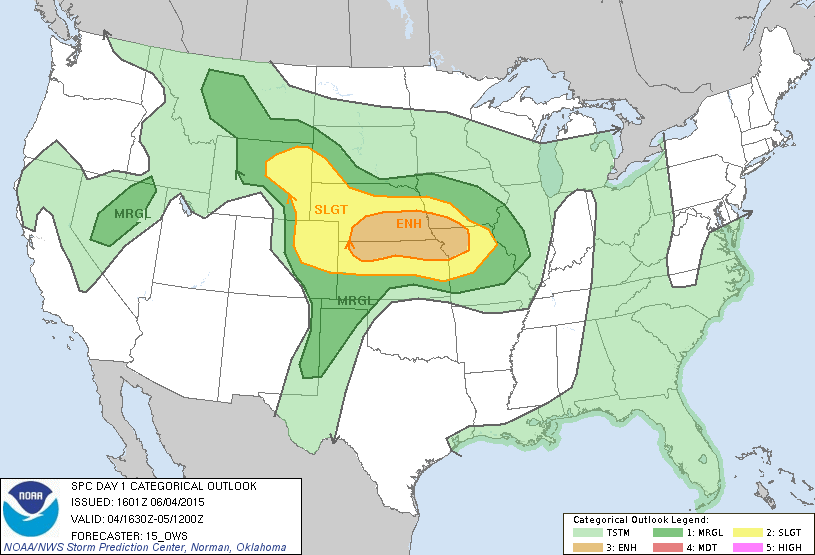
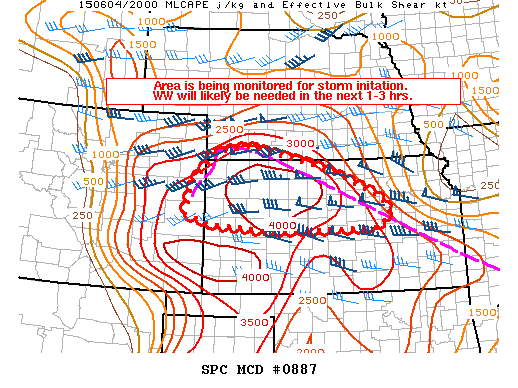
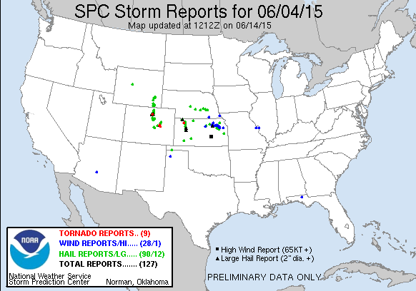
Realistically, I never even considered the CO play, though. I liked the NE/KS state line around and just W of US-81, as it seems the majority of chasers did on Thursday. It was a fairly typical late spring setup for this region -- the effective frontal boundary, largely modulated by the previous night's convection, would hopefully serve as a focus for supercells by late afternoon amidst strong low-level shear and marginal westerlies aloft. Ironically, I woke up and got on the road so early to make sure I wouldn't be caught with my pants down if the 2015 mantra of early initiation struck again. We all know how that turned out. After grabbing lunch in SLN, I spent over five hours sitting idly in various spots around north-central KS. I was relatively optimistic until I watched an explosive tower somewhere around Stockton go up to 40k+ ft., then immediately get shredded in half around 700 mb. When a storm finally developed in SW NE, I was one of many who blasted W on US-36 toward a less-impressive environment, relieved simply at the renewed possibility of observing convection.
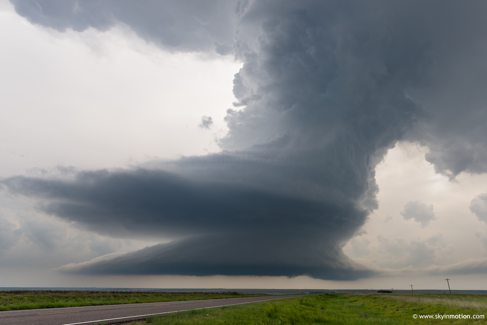
While darting W, I knew it would likely be sunset by the time I reached the evolving supercell between Imperial and McCook. In a stroke of luck that seemed unfitting for the day, that storm collapsed quickly while another took off right along our highway near Atwood. It was tornado-warned by the time I arrived, and one of the first true LP storms I've seen all year. Although it didn't amount to much before dissipating like its northern predecessor, the structure was photo-worthy for the first 20 or 30 minutes.
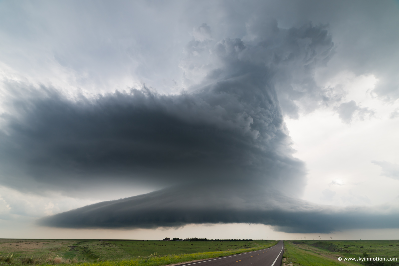
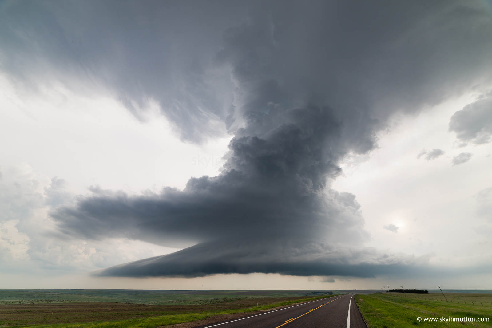
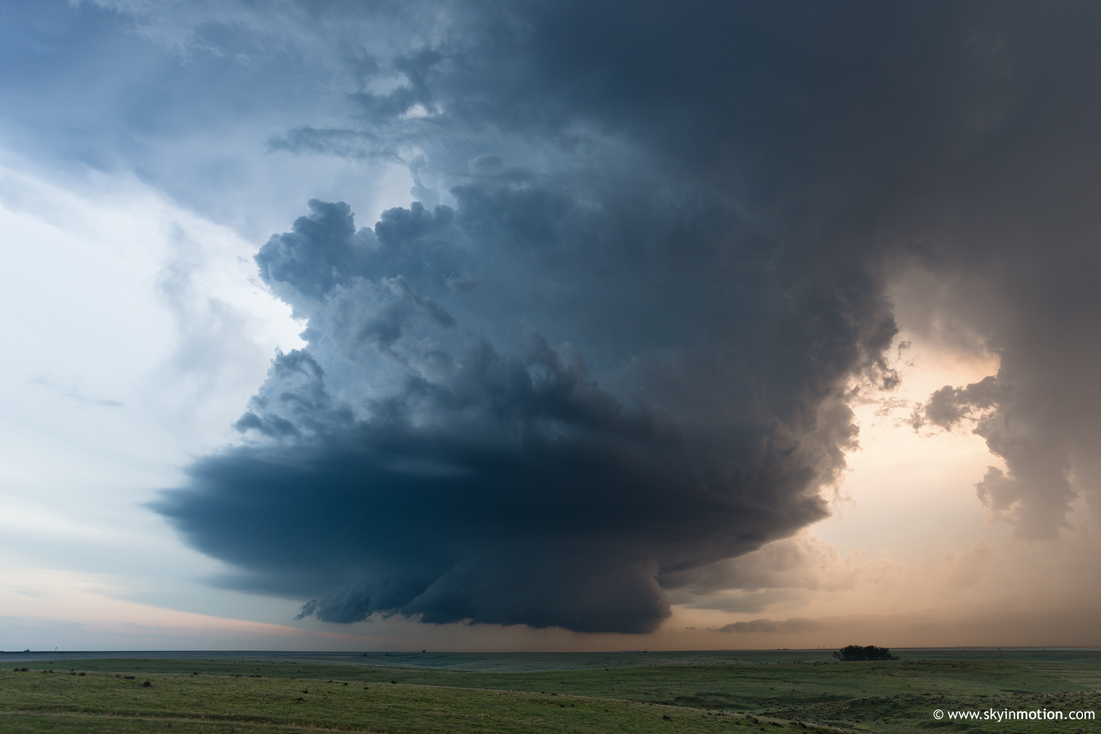
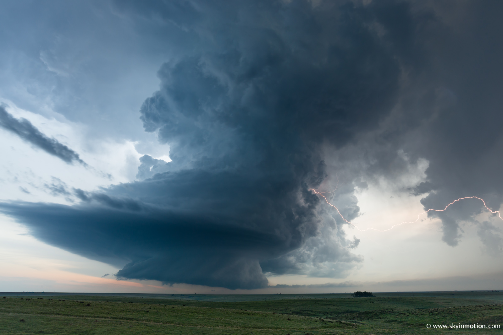
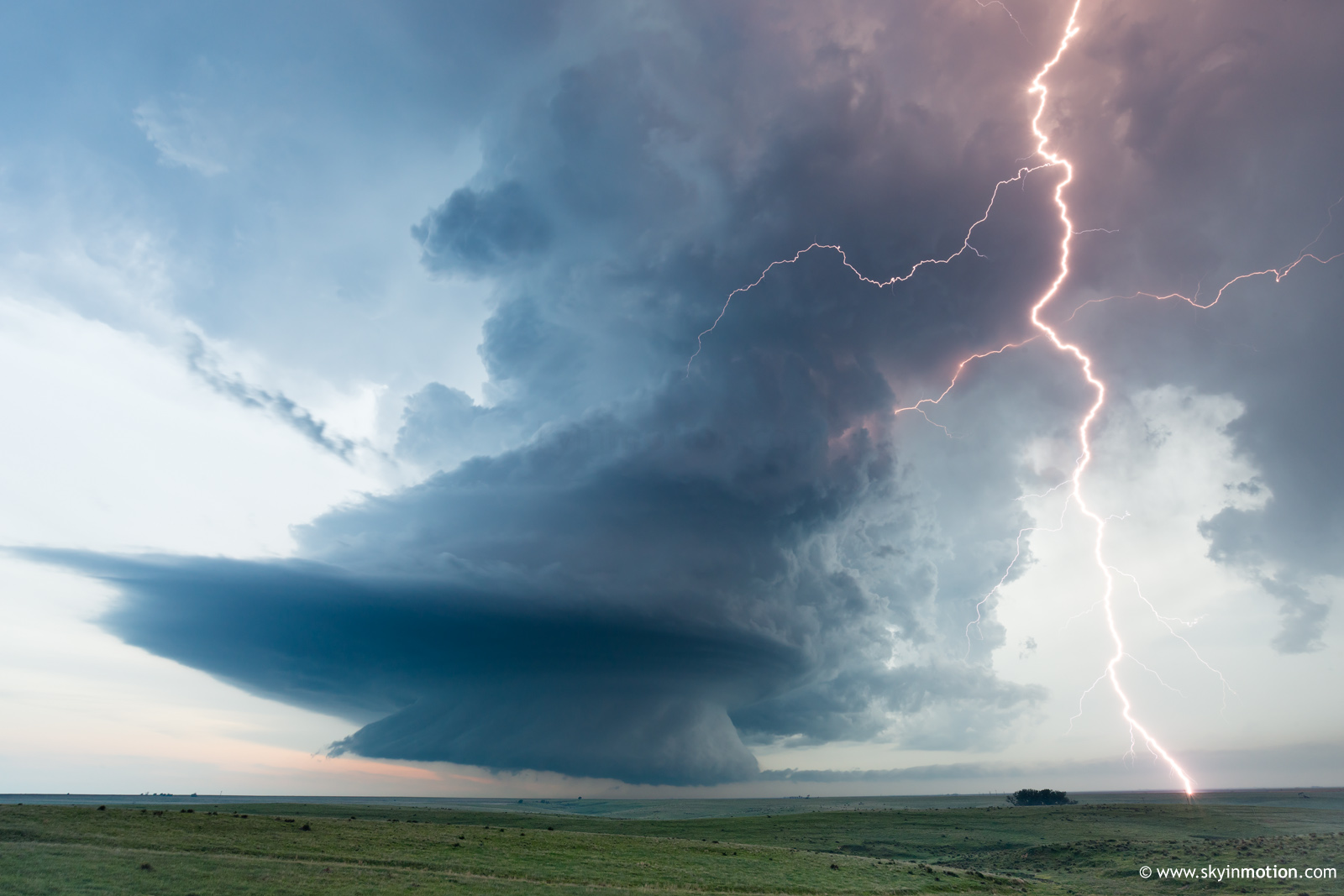
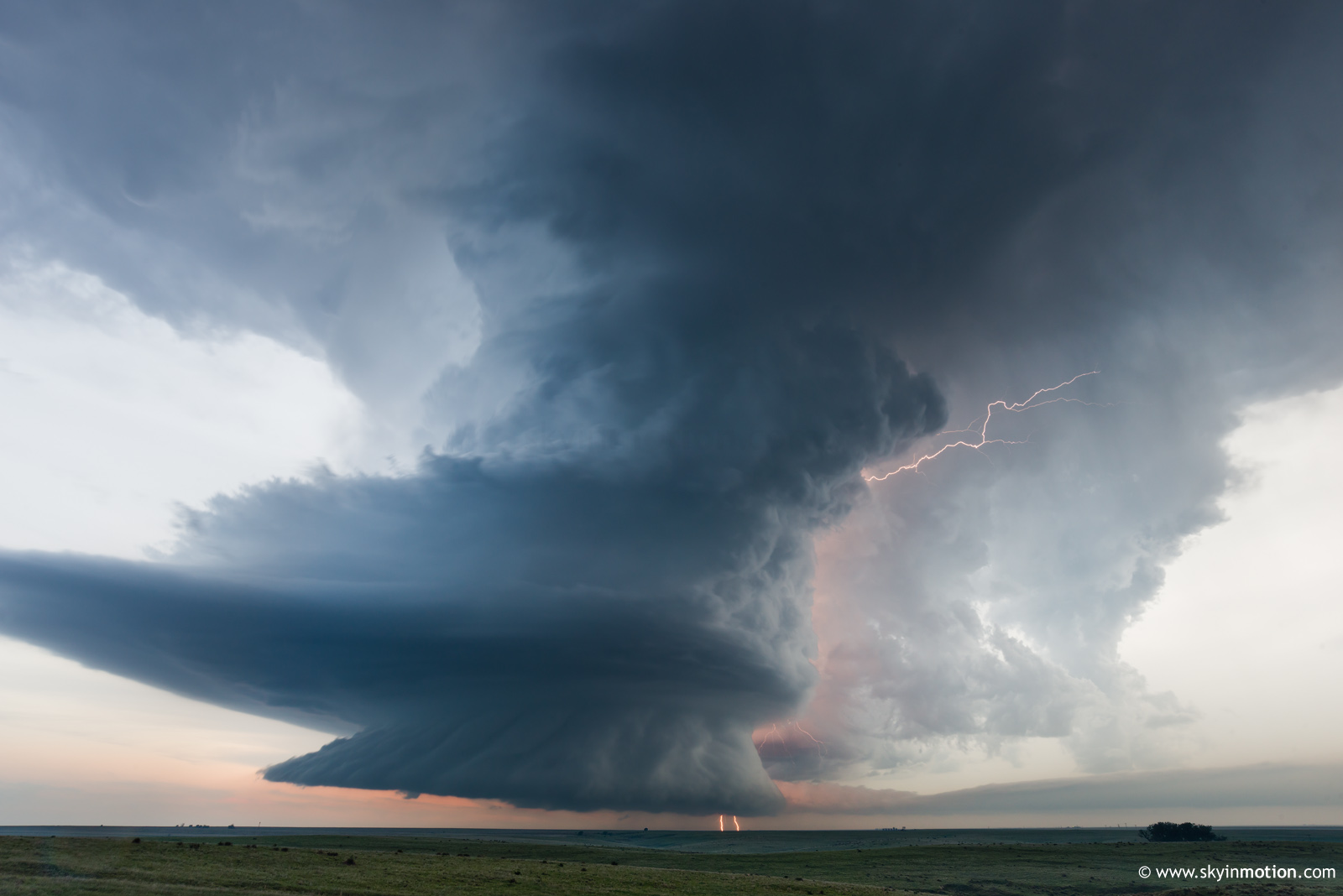
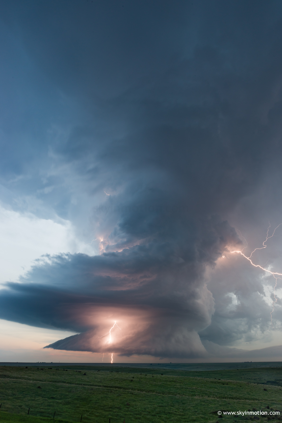
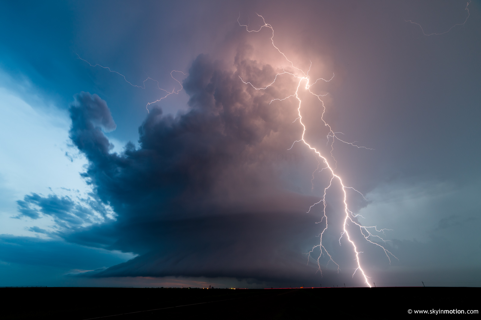
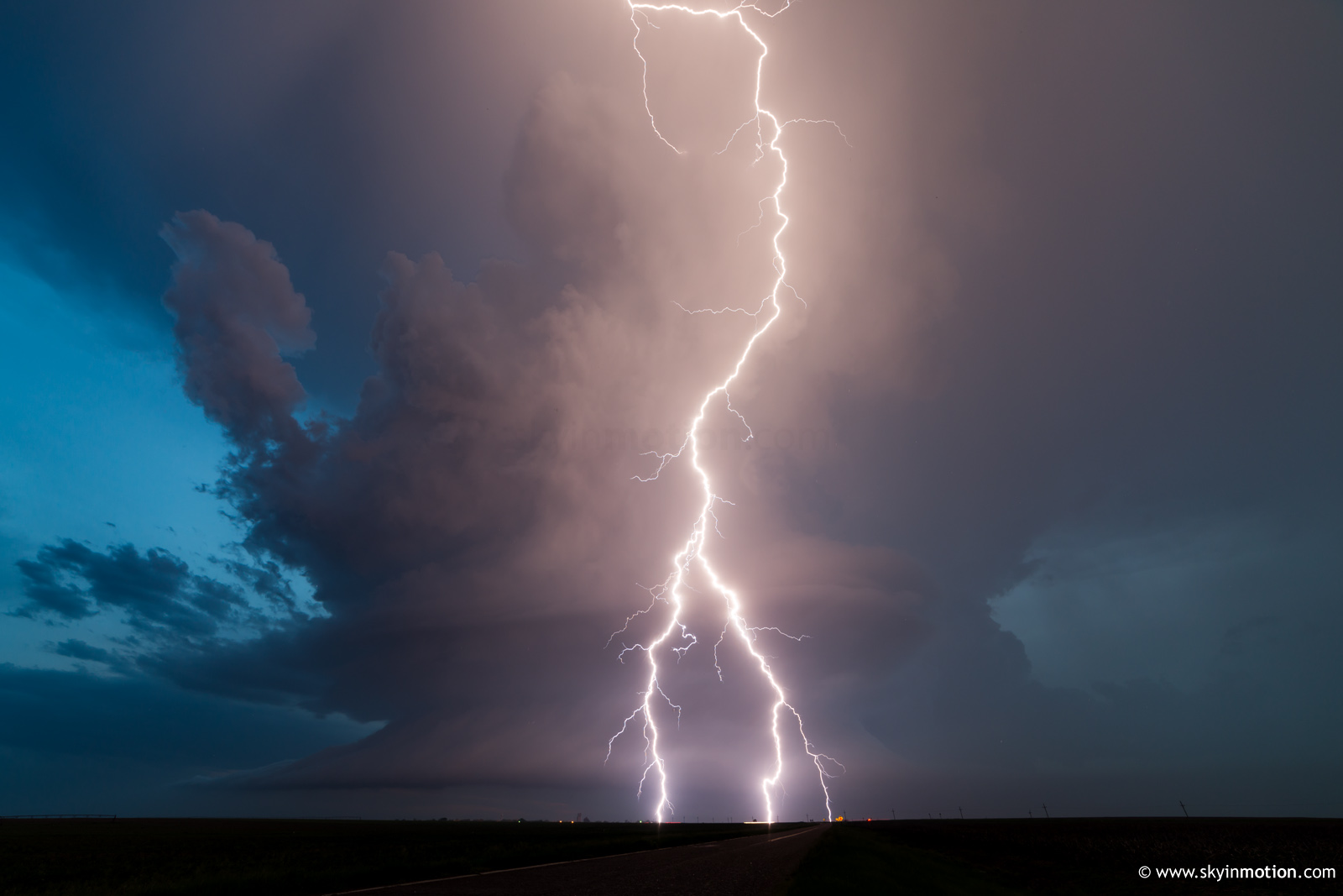
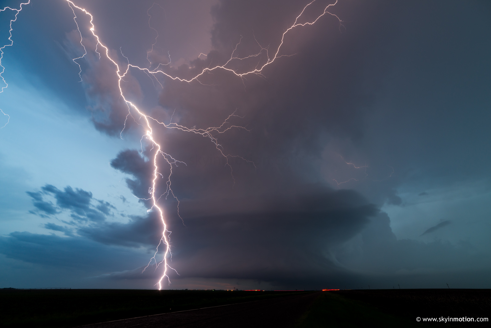
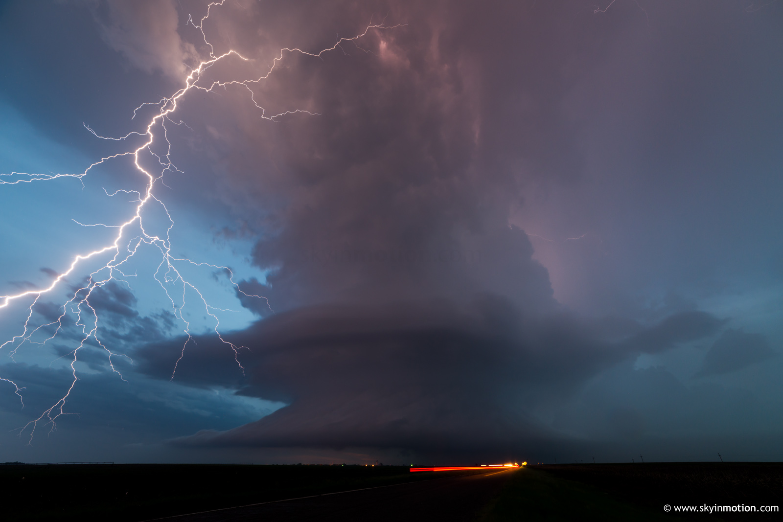
Again thinking I'd largely squandered a 400+ mile drive, the atmosphere graciously decided to prove me wrong for real at sunset. The borderline-LP storm which initiated SW of Oberlin showed off easily the best combination of CGs and structure I've witnessed. I was a bit later than most in leaving the decaying Atwood storm, but I think that worked out well; I was still dropping S on US-83 in the vault region as the Selden storm matured, so I stopped a few miles N of town, which offered a nearly-optimal structure viewpoint.
I photographed it for nearly an hour near and N of Selden, the constant thunder intermixed with distant cheers and screams of ecstatic chasers. If only nature could always be this kind to those who pick the wrong target.
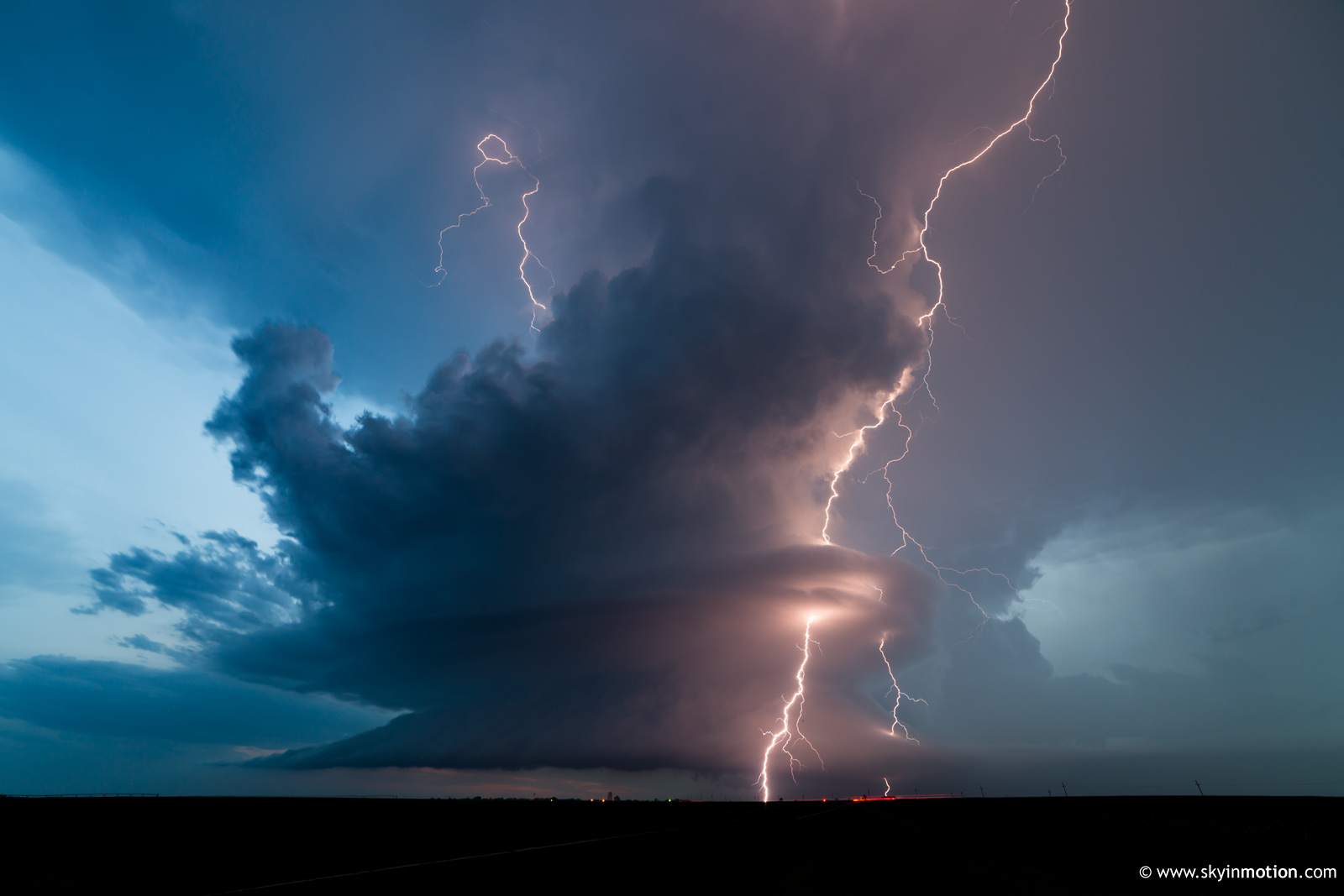
When I finally packed up the camera gear, it was only due to complete darkness; the storm would continue putting on a prolific lightning show amidst stacked plate structure well into the late evening. I ended the night in Colby with a very late dinner, then spent considerable time finding one of the few halfway-affordable motels with vacancies.