Observed 3 tornadoes.
After overnighting in Colby following Thursday's rewarding yet tainted chase, I woke up still undecided on the Palmer vs. the CO/KS border. I'm the master of hedging, so naturally lunch in Limon was in order. Had I raced west from there as soon as the upslope convection near Castle Rock started trending up on radar, I almost certainly could've made the Parker/Ponderosa Park area tornado(es?) that occurred around 1pm local time. Instead, I deservedly paid the hedger's price by waiting for a robust supercellular radar presentation before speeding W on CO-86. By the time I made it through Kiowa and started N on Co. Rd. 49, the show was ending. For the next 90 minutes I joined the hordes in driving aimlessly from one crapper cell to the next in the Larkspur-Bennett corridor, not holding any real hope that something on the order of that initial large tornado would be repeated (given widespread outflow-contaminated air, combined with the preceding low cloud cover all morning).
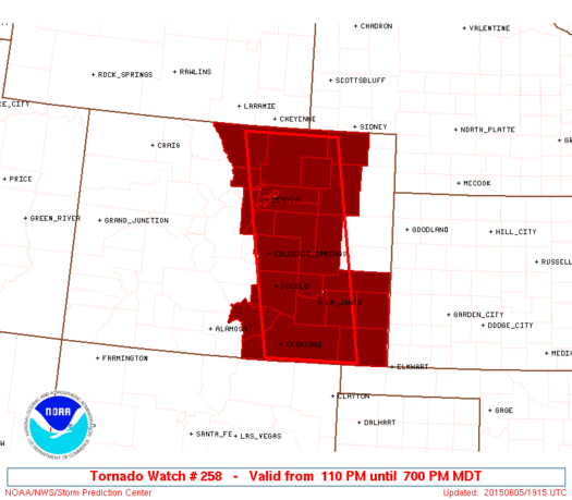
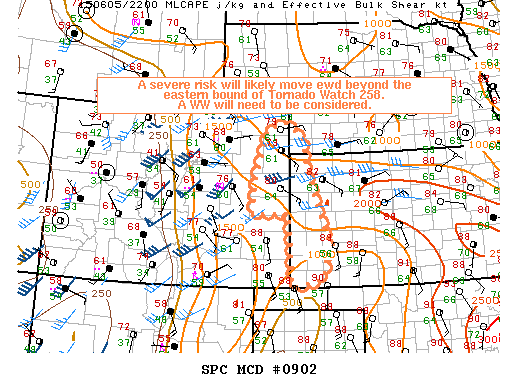
I guess it was around 2:30pm local when I said screw this, dropping back to Kiowa and then E to Limon once more. At the time, my thought was to put myself in position to blast all the way E to the GLD vicinity if vis sat began showing promise for warm front storms to develop later in the afternoon. I expected that failing that, I'd simply be driving E toward the next day's target. To my surprise, new discrete storms initiated near Limon before I even arrived. The first one looked impressive in terms of updraft intensity on radar and disrupted I-70 traffic with accumulating hail, but its visual appearance didn't keep me around for long. I pressed on, but the atmosphere decided to convect explosively over my head again as I neared Seibert. As most everyone out last week is aware, there was major construction between there and Stratton on I-70, closing the only intermediate exit (Vona) over that 15-mile stretch. I wasn't convinced enough that this cell was legit to exit at Seibert, so I committed to the 15-mile stretch eastbound. As it turned out, this wasn't a bad choice in itself; I exited at Stratton, refueled, and then began pursuing it from the E. It just figures that Vona was closed, because heading N out of that town would've been nearly ideal for a close intercept.
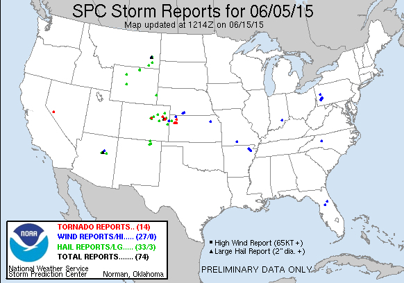
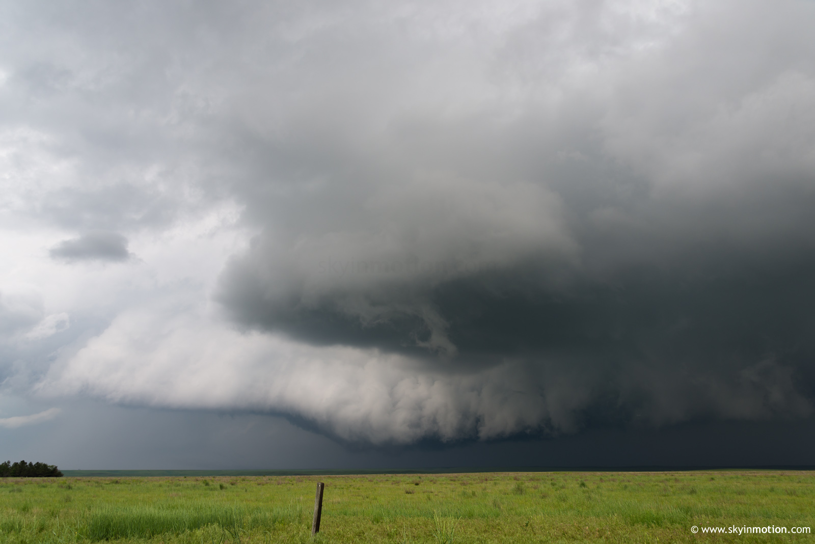
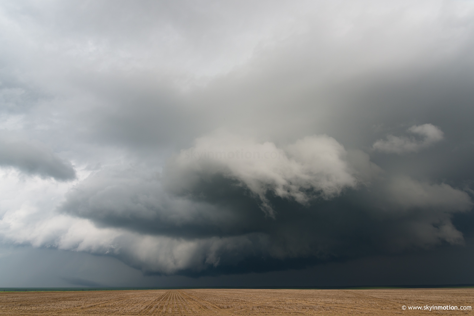
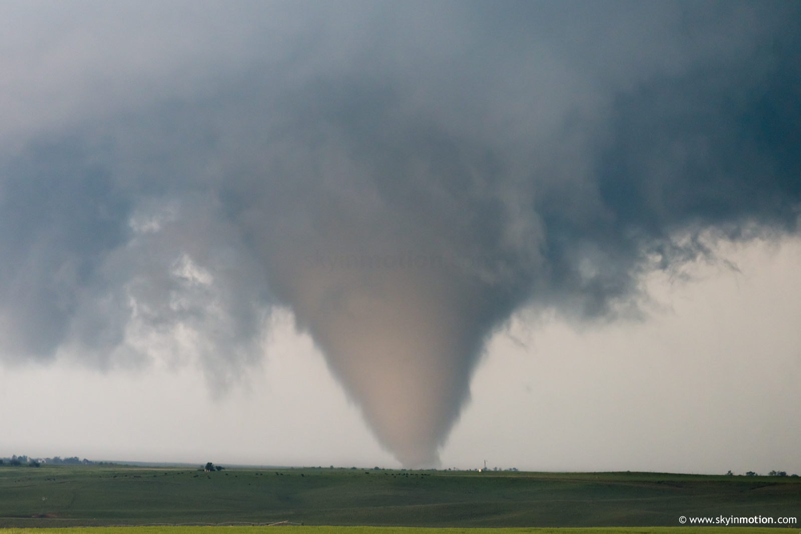
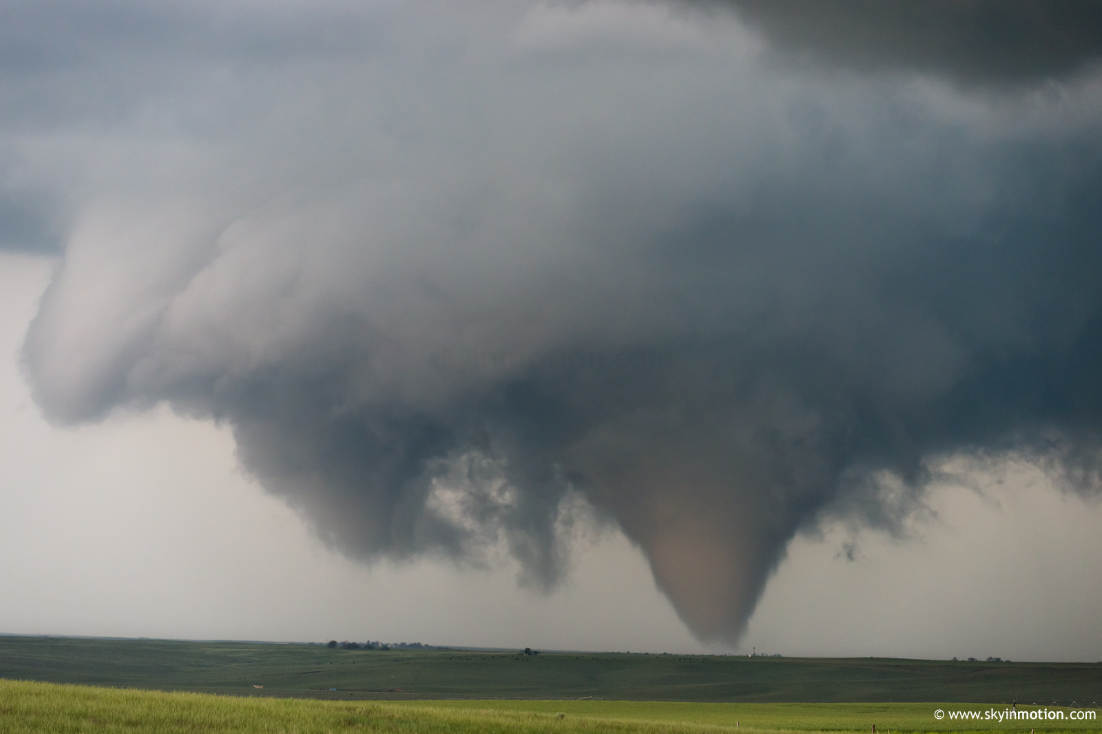
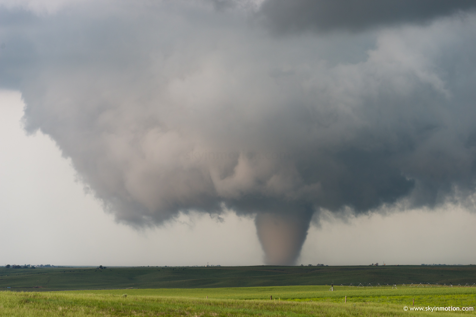
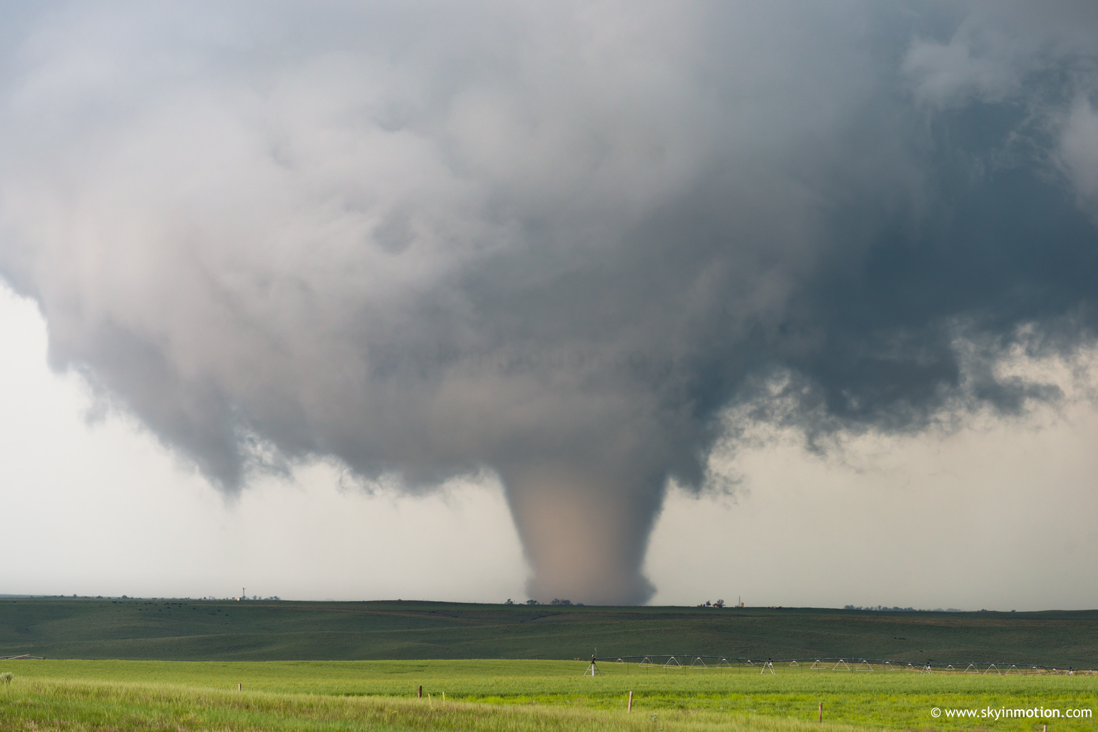
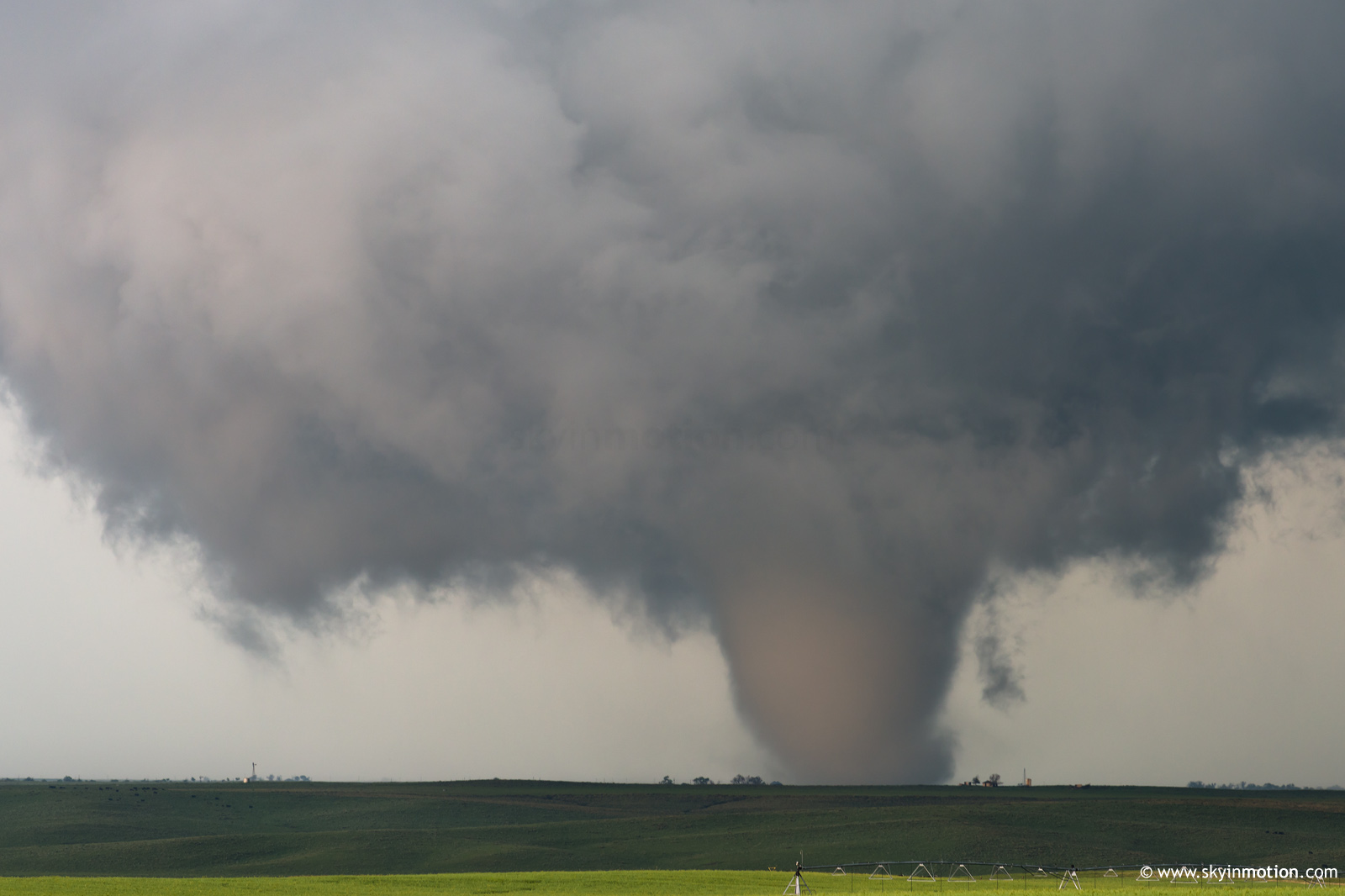
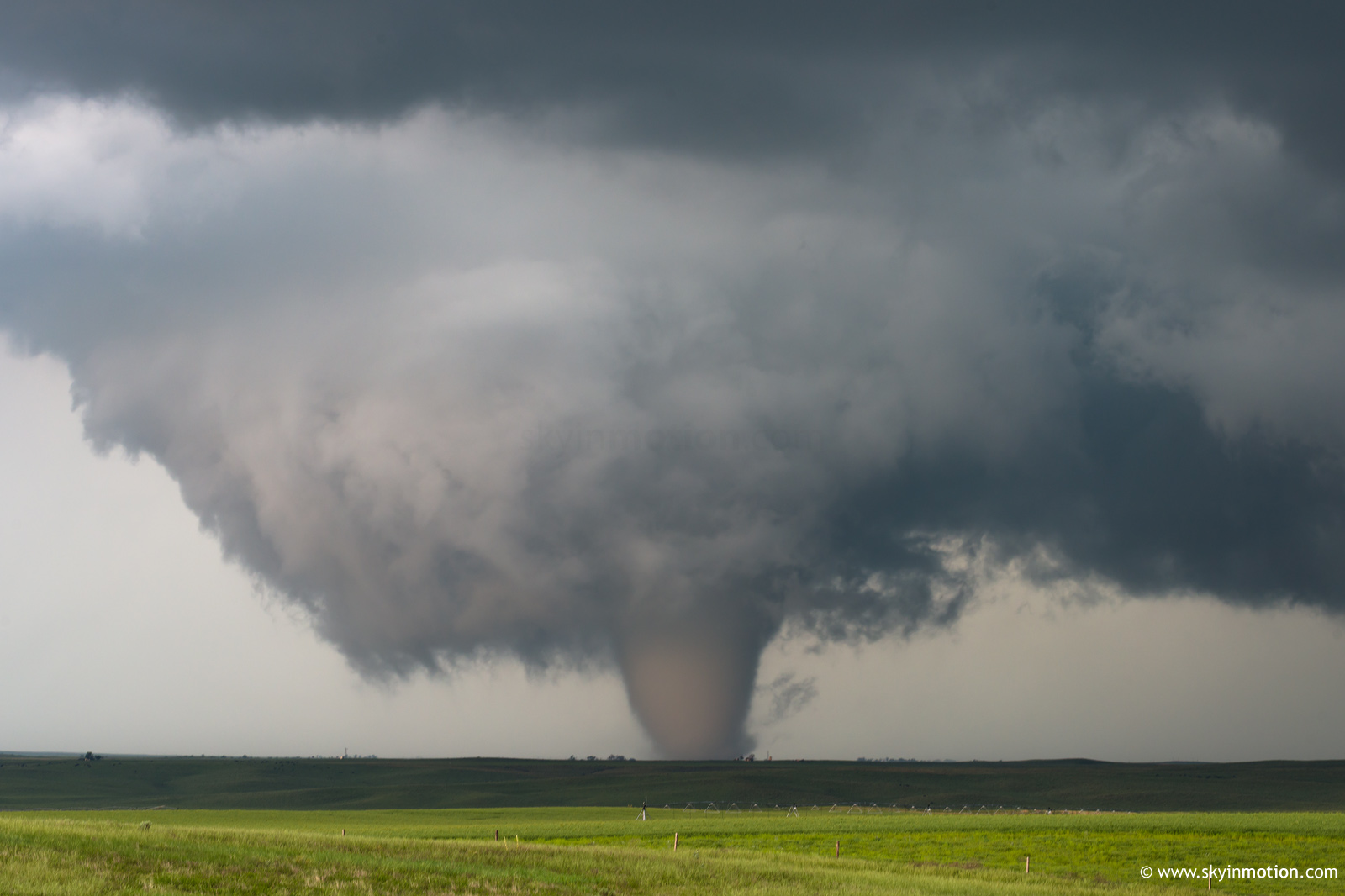
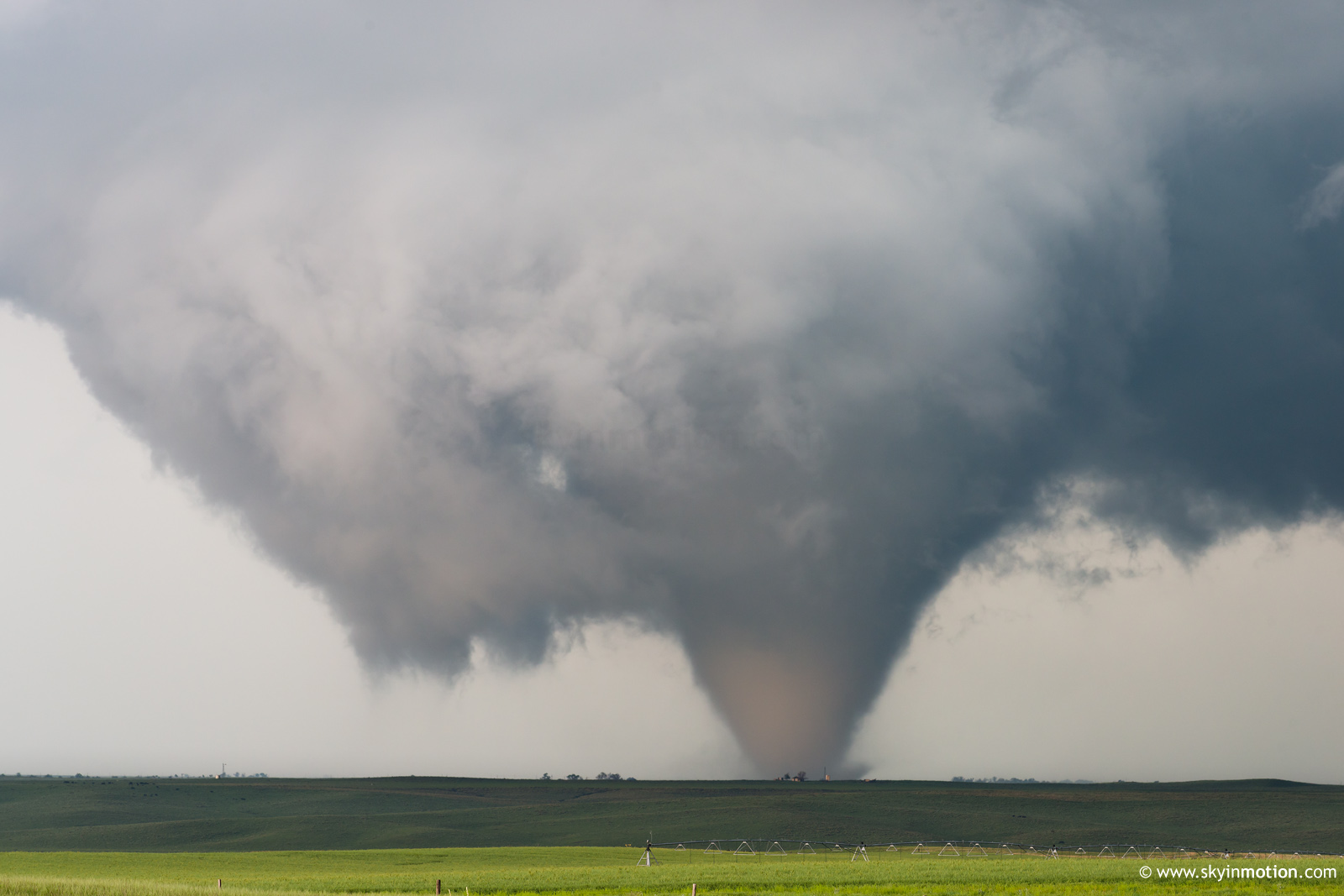
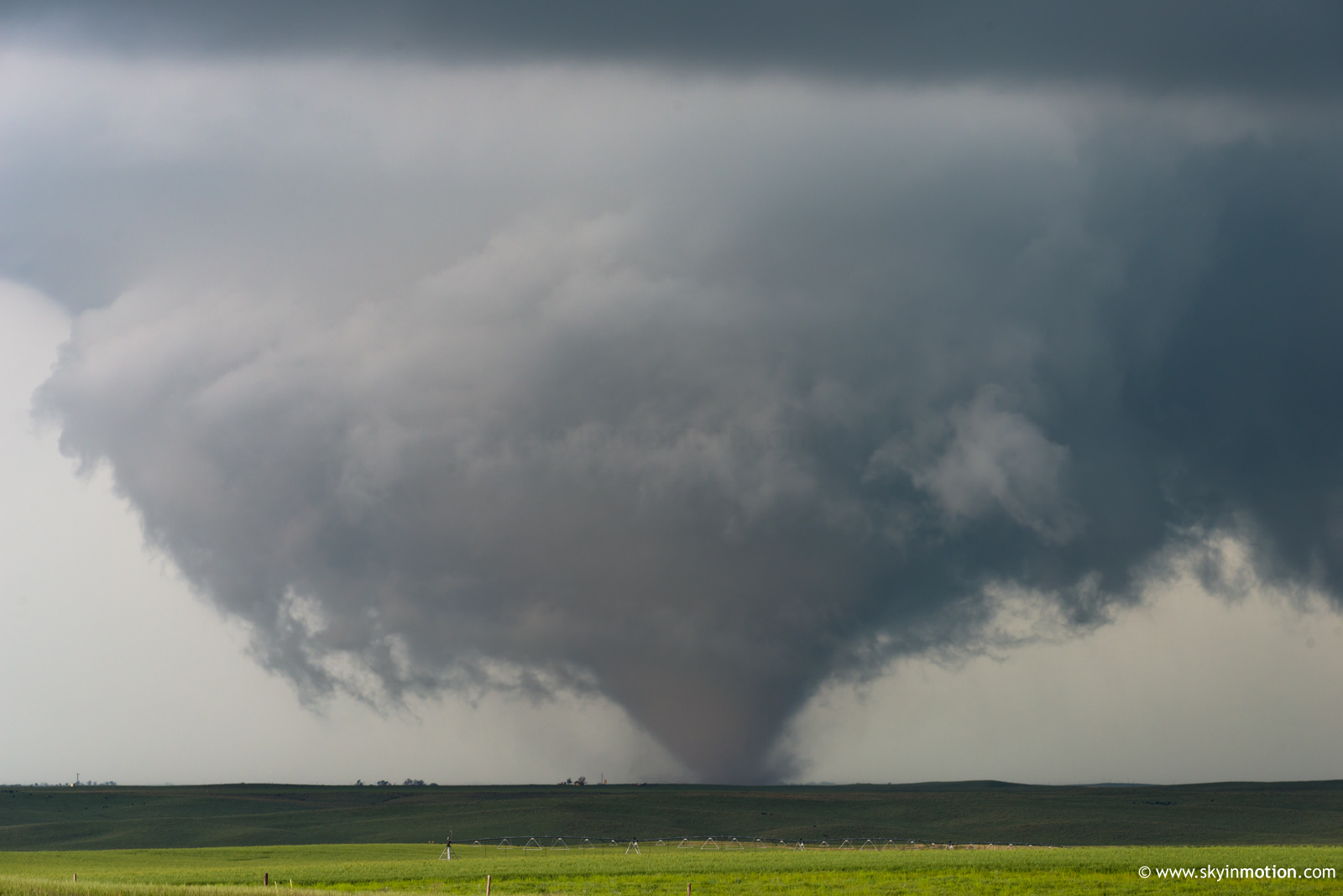
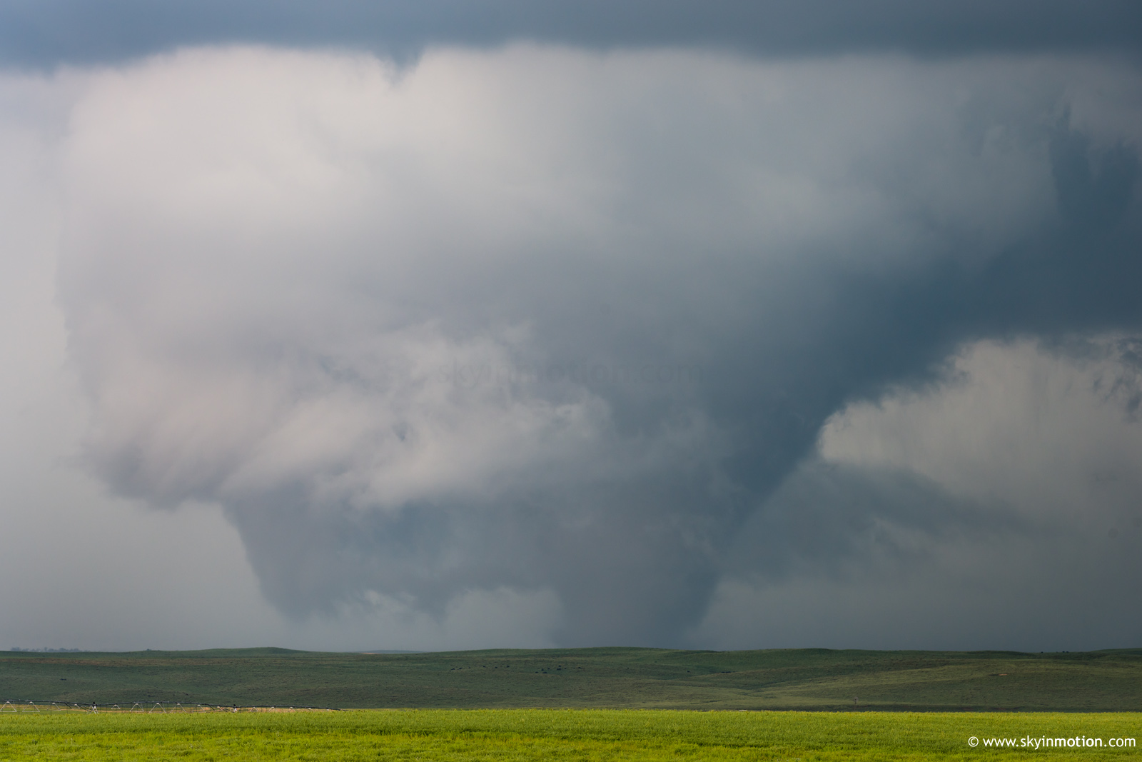
From 4:40-5:05pm MDT, I stair-stepped NW on questionable dirt roads in an attempt to get under the base of the rapidly-organizing supercell. After plenty of white-knuckle driving, I eventually found myself under the meso 7 N of Vona -- but almost immediately had to back off due to the mud (the storm was lifting nearly due N at the time, so the core had just impacted the best viewing area for the low-level mesocyclone). It figures that after a painstaking half-hour spent getting right under the meso, it then dropped a large, photogenic tornado 10 minutes later after I'd been left a few miles in the dust. Perhaps it's for the best; the RFD cut and tornado cyclone were completely rain free for the first 10 min of the Stratton tornado, making for great photo ops. As soon as it touched down, I stopped where I was for tripoded stills; these were from ~8 NNW of Stratton, and 4 W of the paved highway N out of that town.
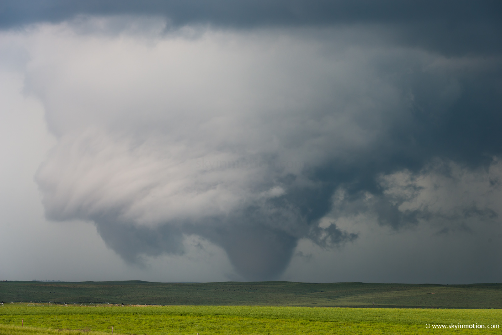
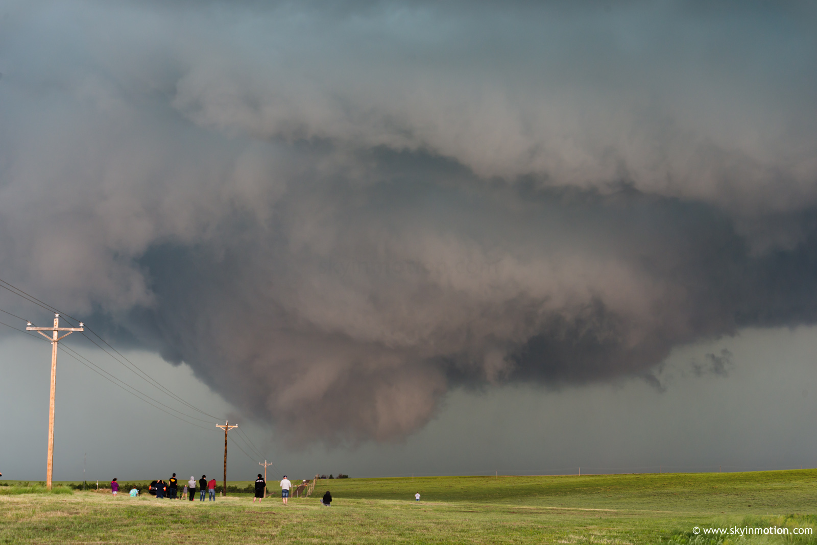
The Stratton tornado appeared to be on the ground for at least 15 minutes, but eventually became so low-contrast as it moved N and some rain wrapped around that I couldn't verify the end time. A new meso was already maturing to its E well before dissipation, and dropped an intermittent cone (seen in the video) which eventually touched down briefly as a stout tornado right along the road, giving chasers a nice photo op. Unfotunately, I stopped about 10 sec. too late to snag a quality still outside the vehicle.
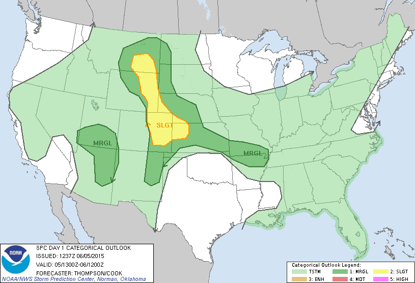
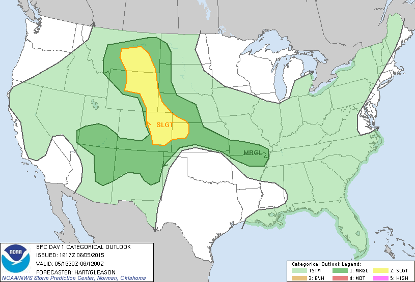
Great chase day that, despite not quite matching its predecessor in Colorado Magic, far exceeded my expectations. This is yet another day where storms struggled for hours and, in combination with significant weaknesses in the environment, gave me the impression that the day was probably over -- only for nice tornadoes to occur later on. It's amazing how many days like that I've had in recent years, and this year in particular.