Observed 2 tornadoes.
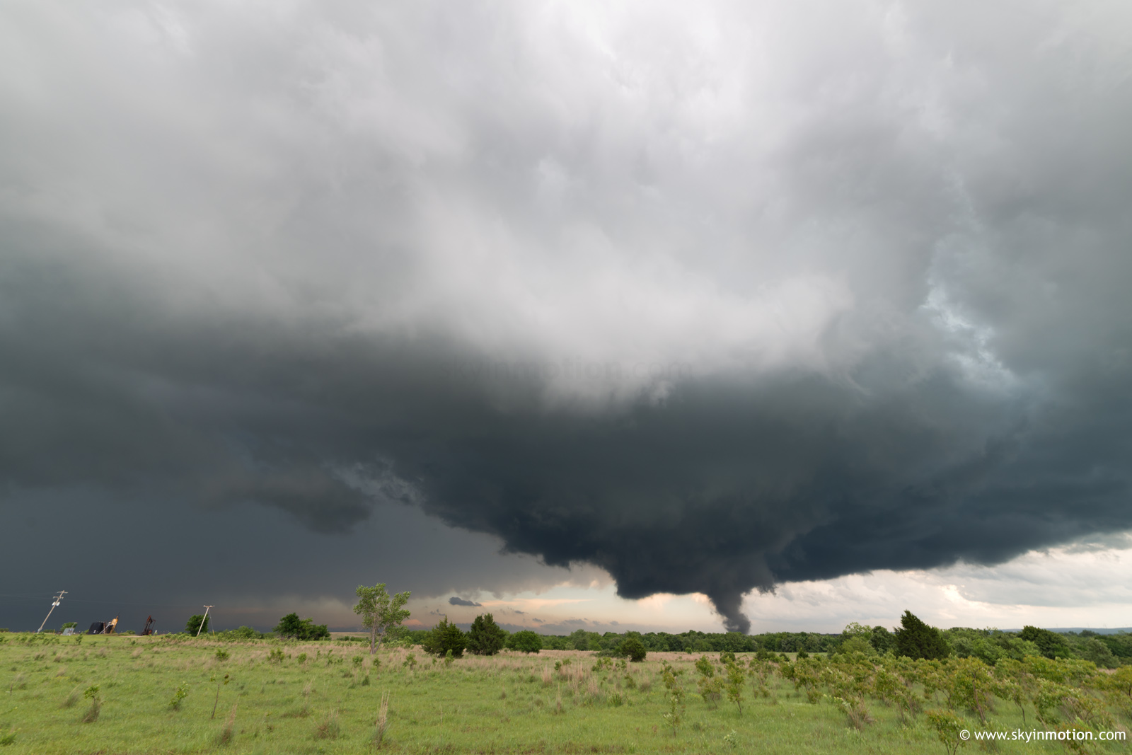
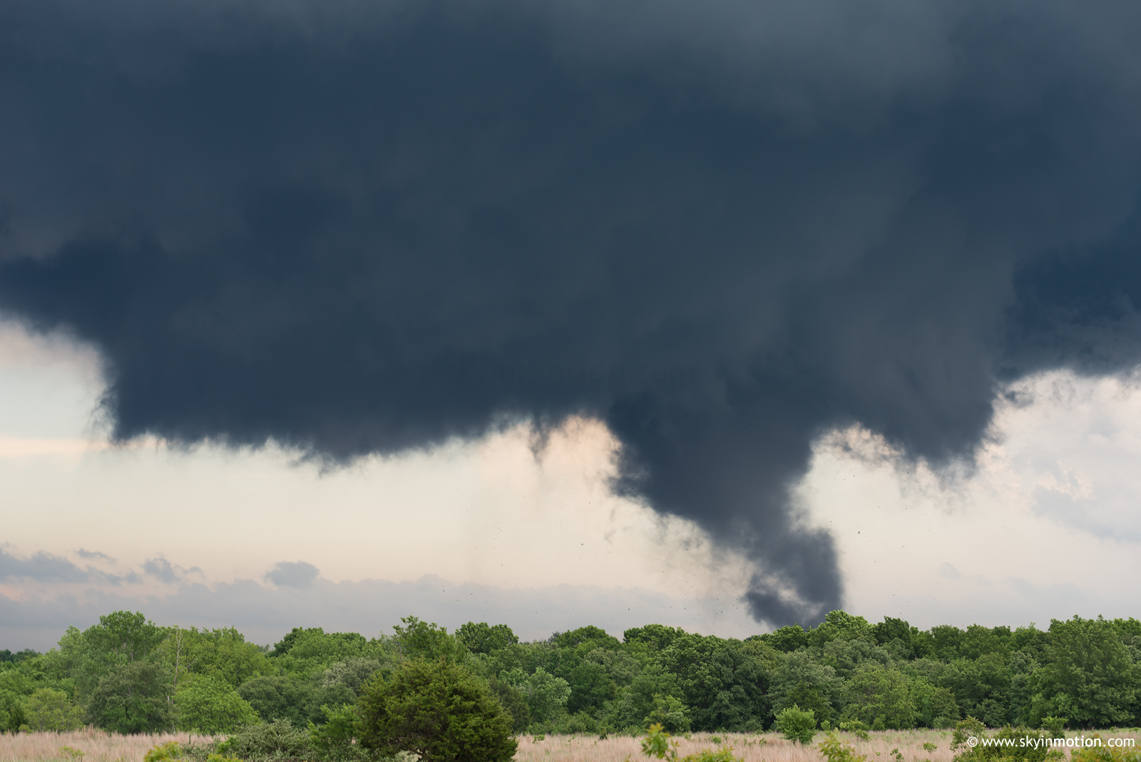
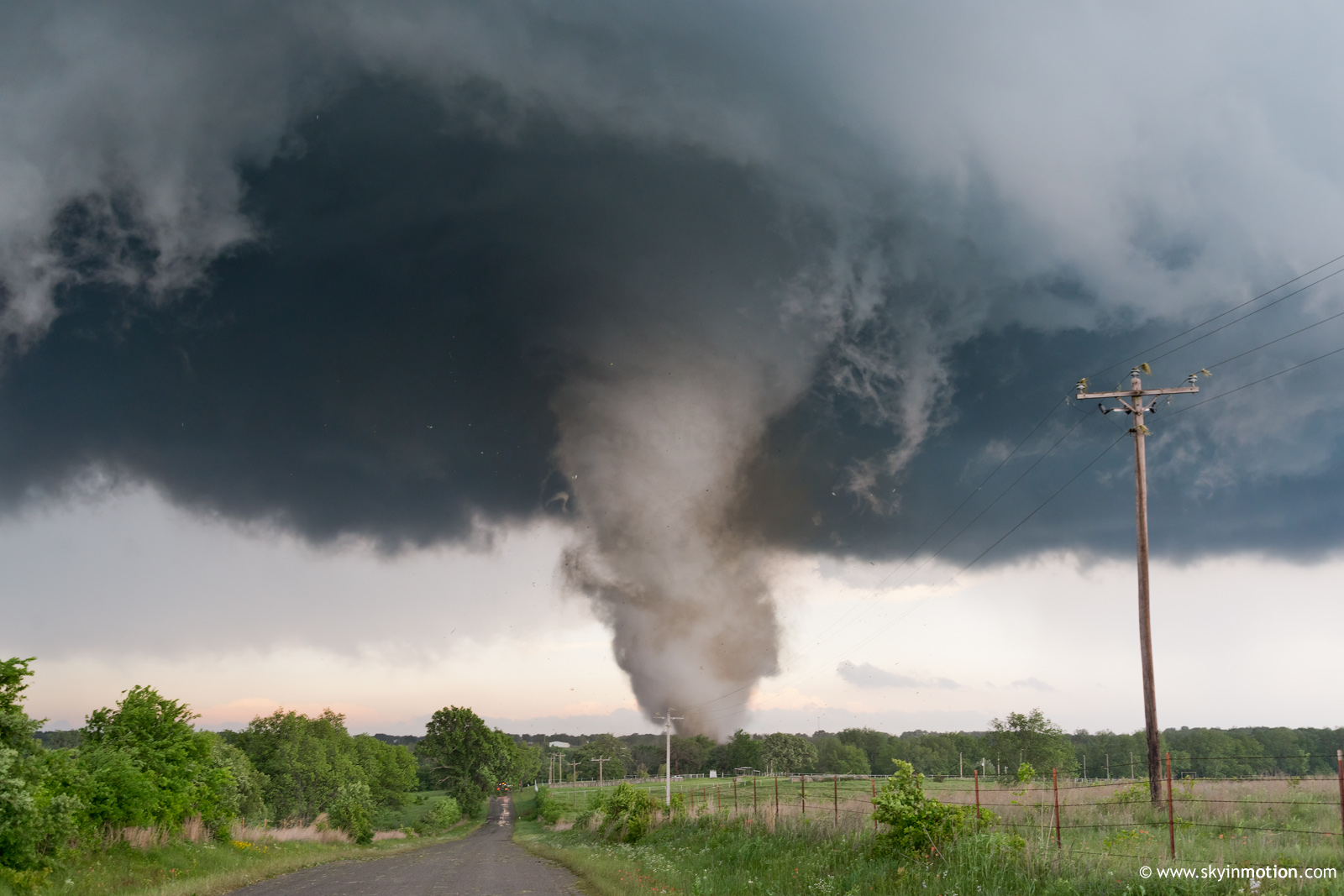
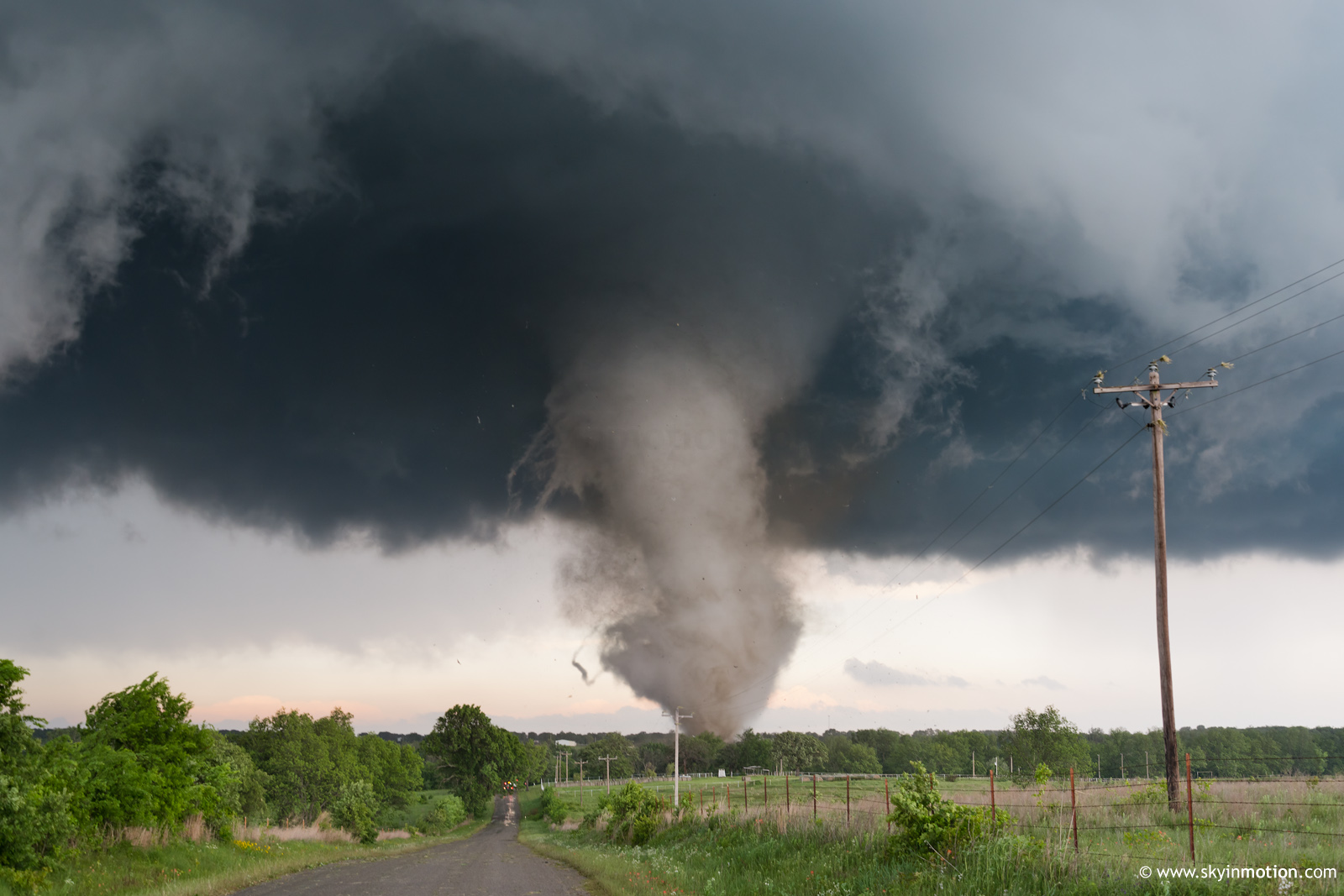
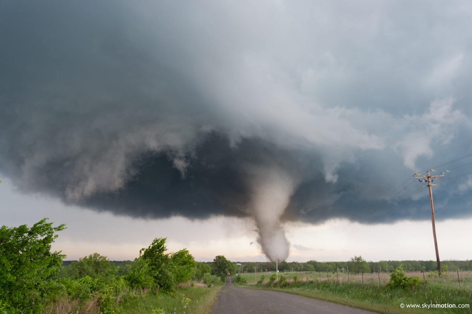
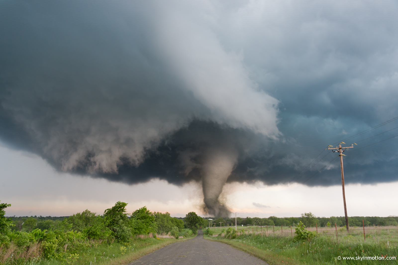
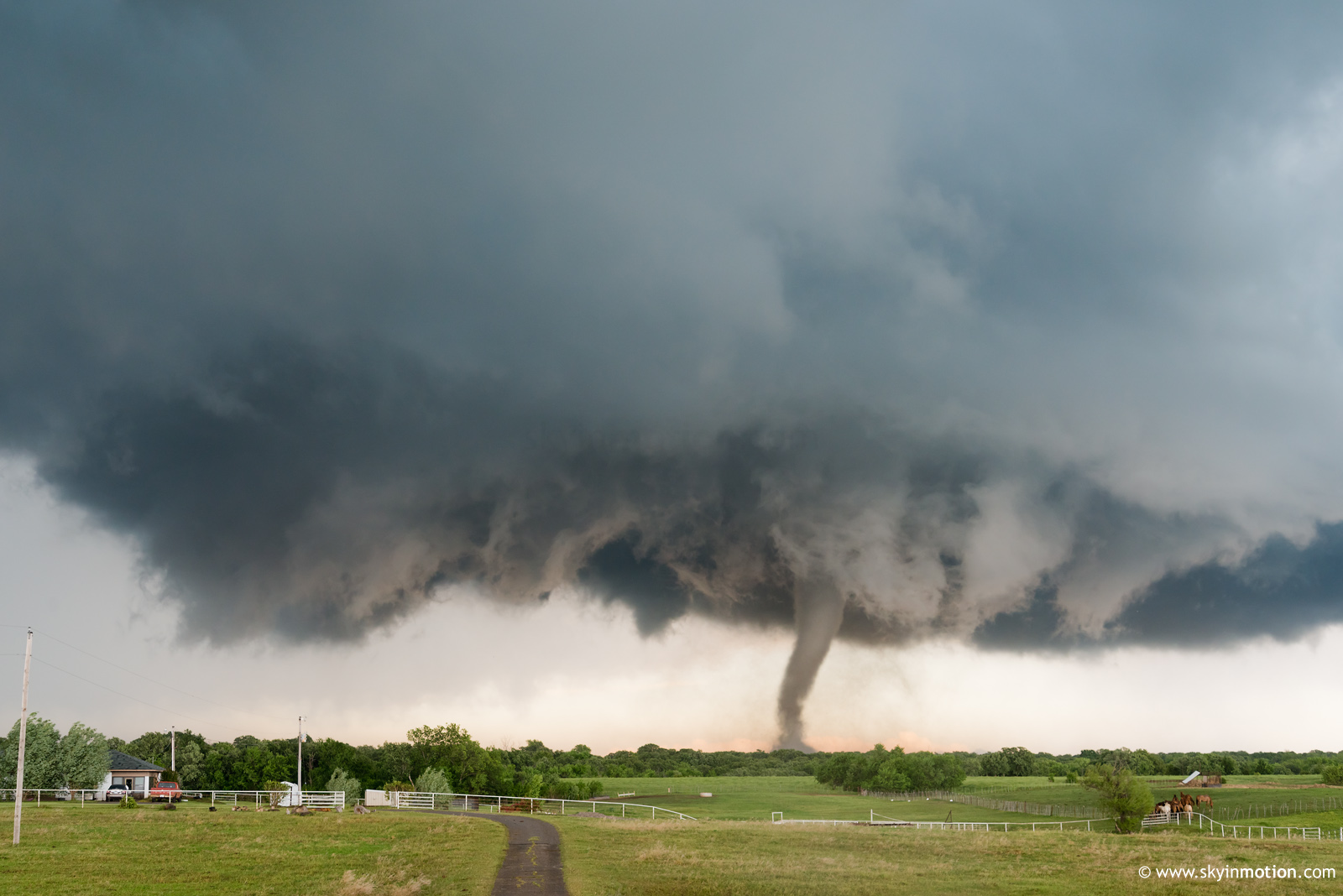
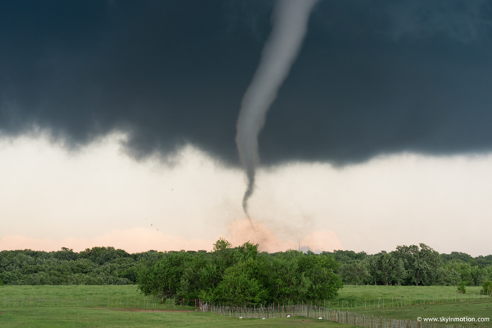
I left Norman around 2pm and made my way to the Wynnewood area, where the first persistent towers were growing on the dryline. The first supercell took shape just W of Elmore City, so I blasted W through town to get right underneath its base. No sooner had I done this than a new supercell developed explosively in its inflow region to the S, becoming dominant with jaw-dropping haste. I recognized this happening fairly quickly, but even so, the Katie-Davis tornado developed before I could get more than a mile E of Elmore City. For the next 15 minutes, I played catchup from the NW. In an all too familiar pattern for me on long-track significant tornado intercepts, I decided to stop for several minutes to shoot stills when I was still 4-5 mi. away, unwilling to risk the possibility of the tornado's life cycle ending before I could even get my camera out.

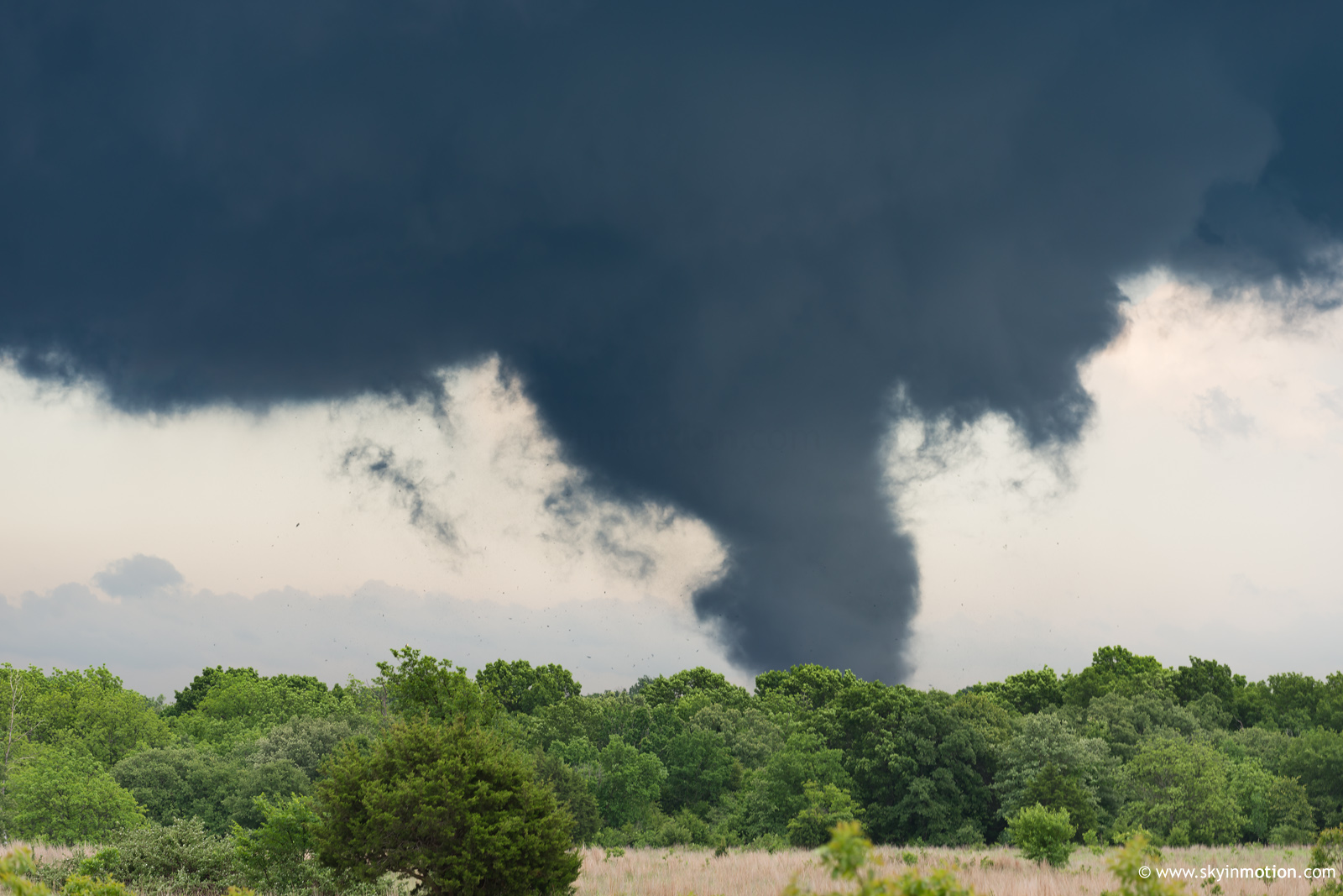
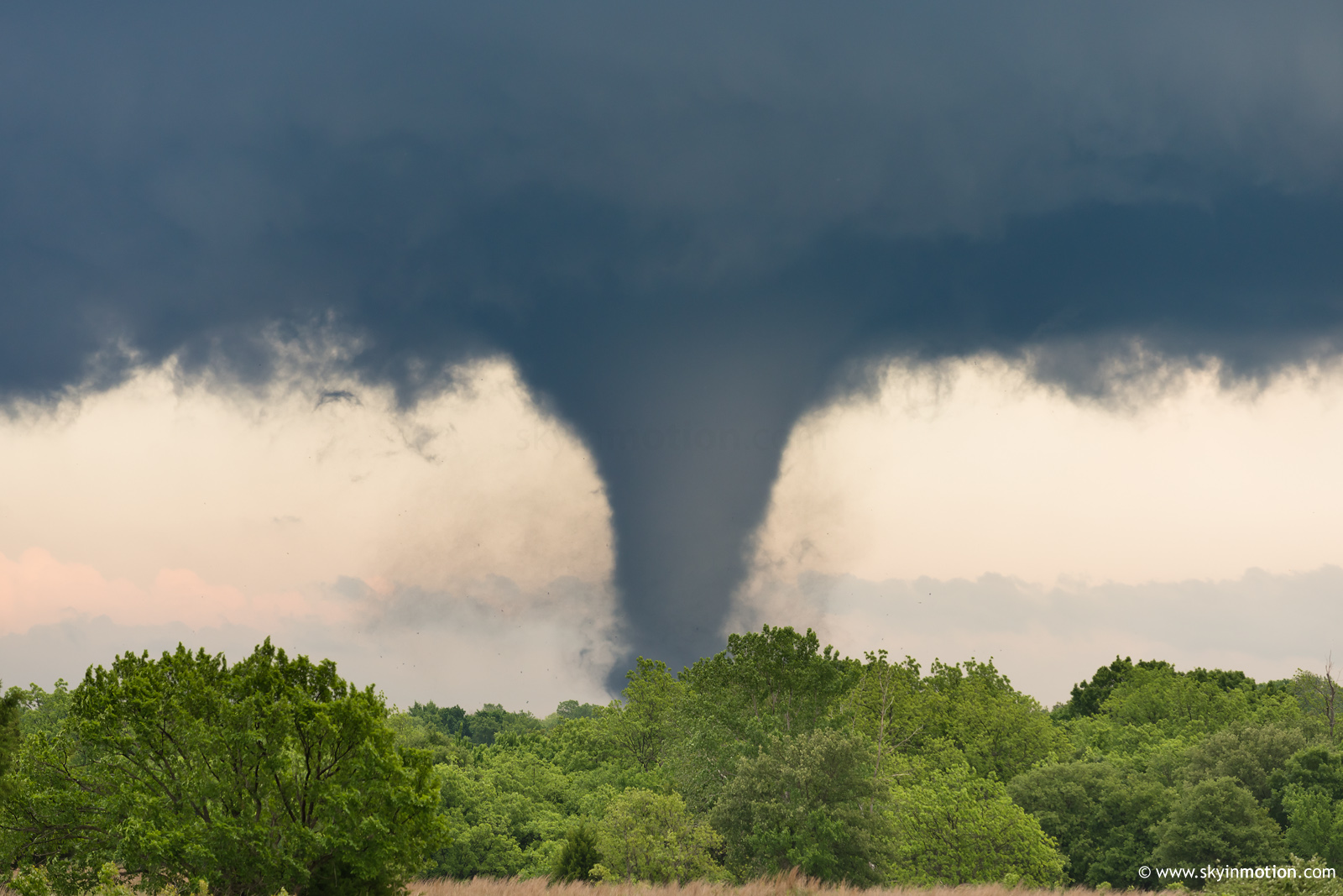
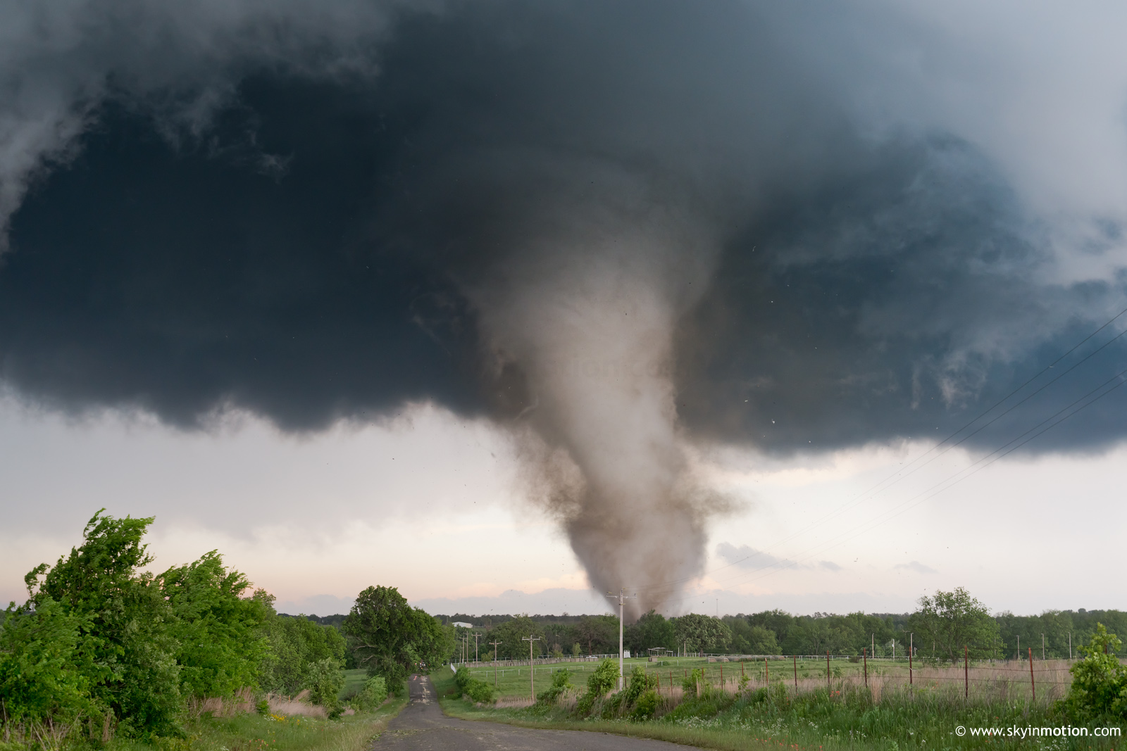
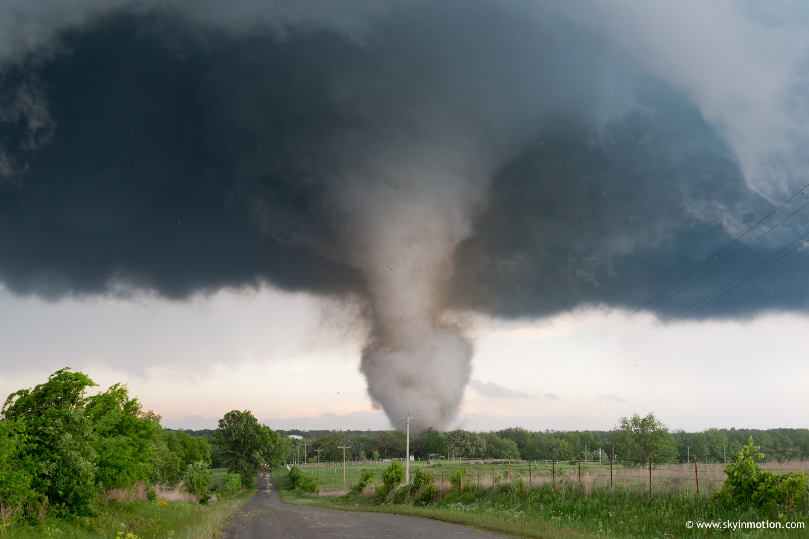
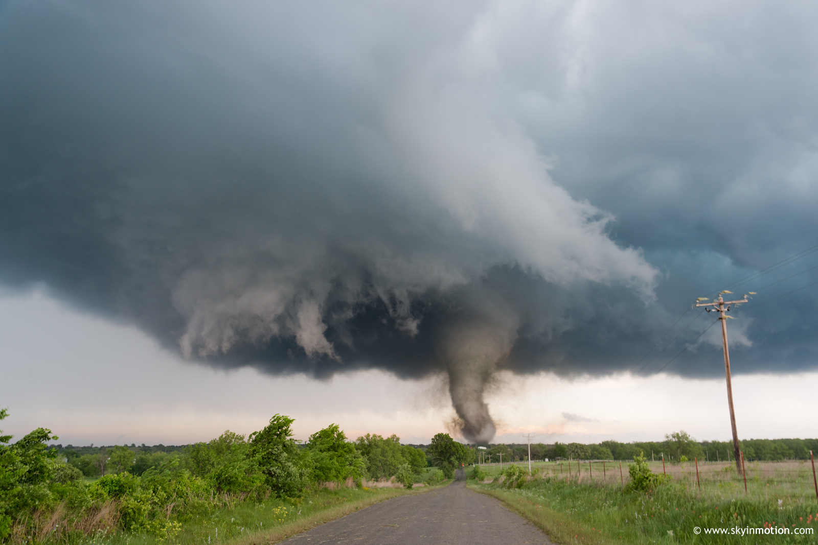
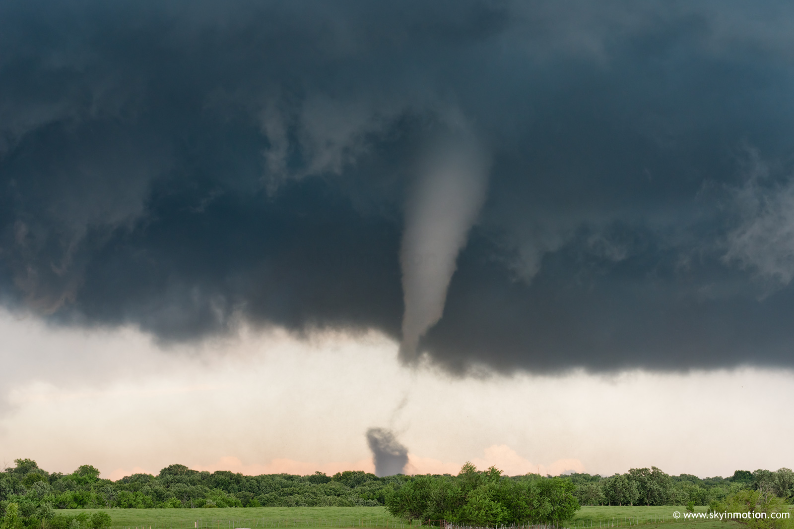
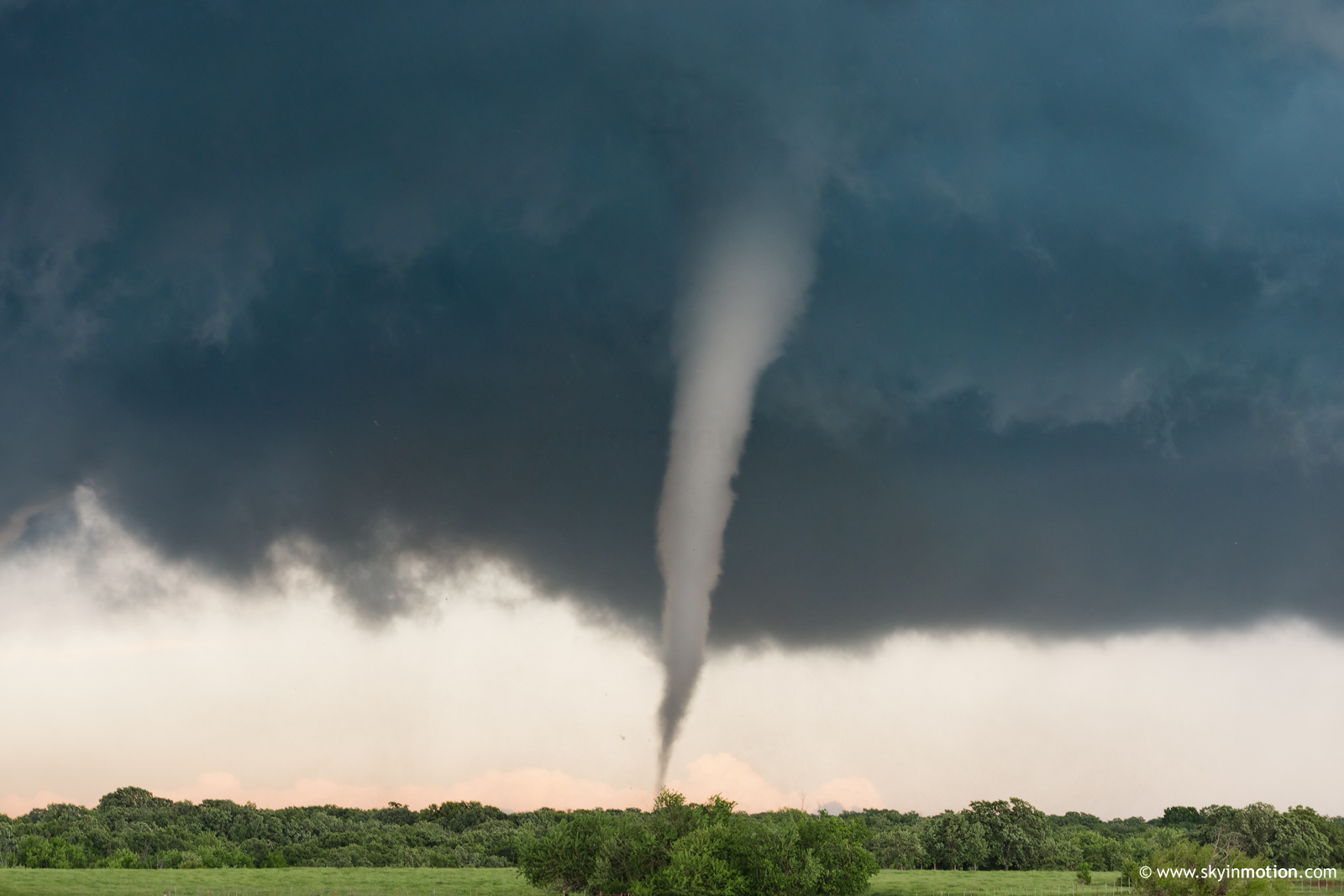
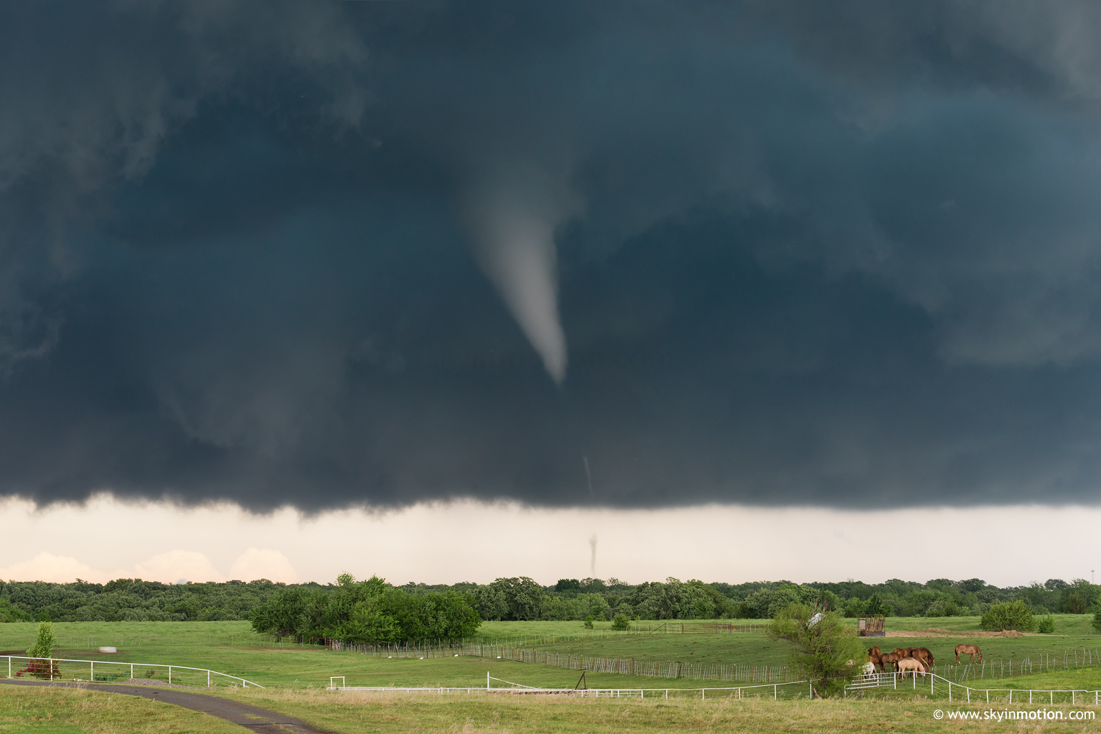
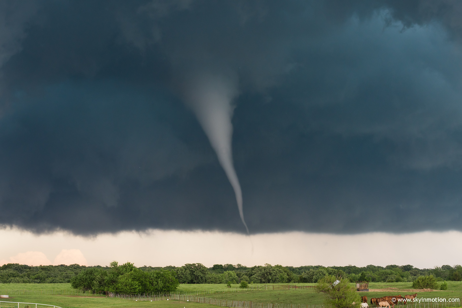
Eventually, it was beyond obvious that this tornado would not be roping out any time soon, so I hurried E through Katie to catch up. For 5 minutes or so, I clinched my fists as I watched an elephant trunk-to-stovepipe almost reminiscent of Pampa 1995 directly ahead of me, but couldn't stop for stills. The view when I finally caught up was about the best consolation prize one could ever get for initially positioning so poorly on a storm.
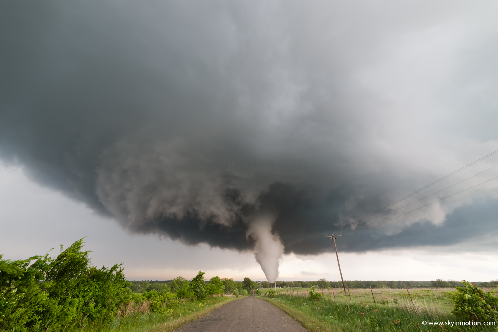
Continuing just a bit further for a true up-close intercept would have made for amazing video. But I can live with my decision to stop on a hilltop in the awful terrain and maintain a clear visual for stills, since others (Dick McGowan/Darin Brunin, Ben Holcomb, and others) ahead of me shot much better video than I would have anyway.
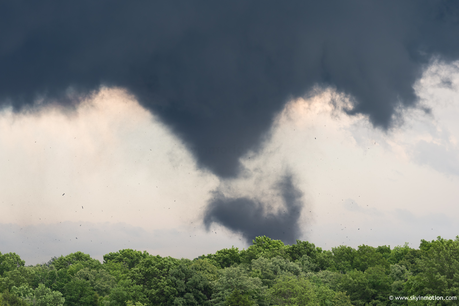
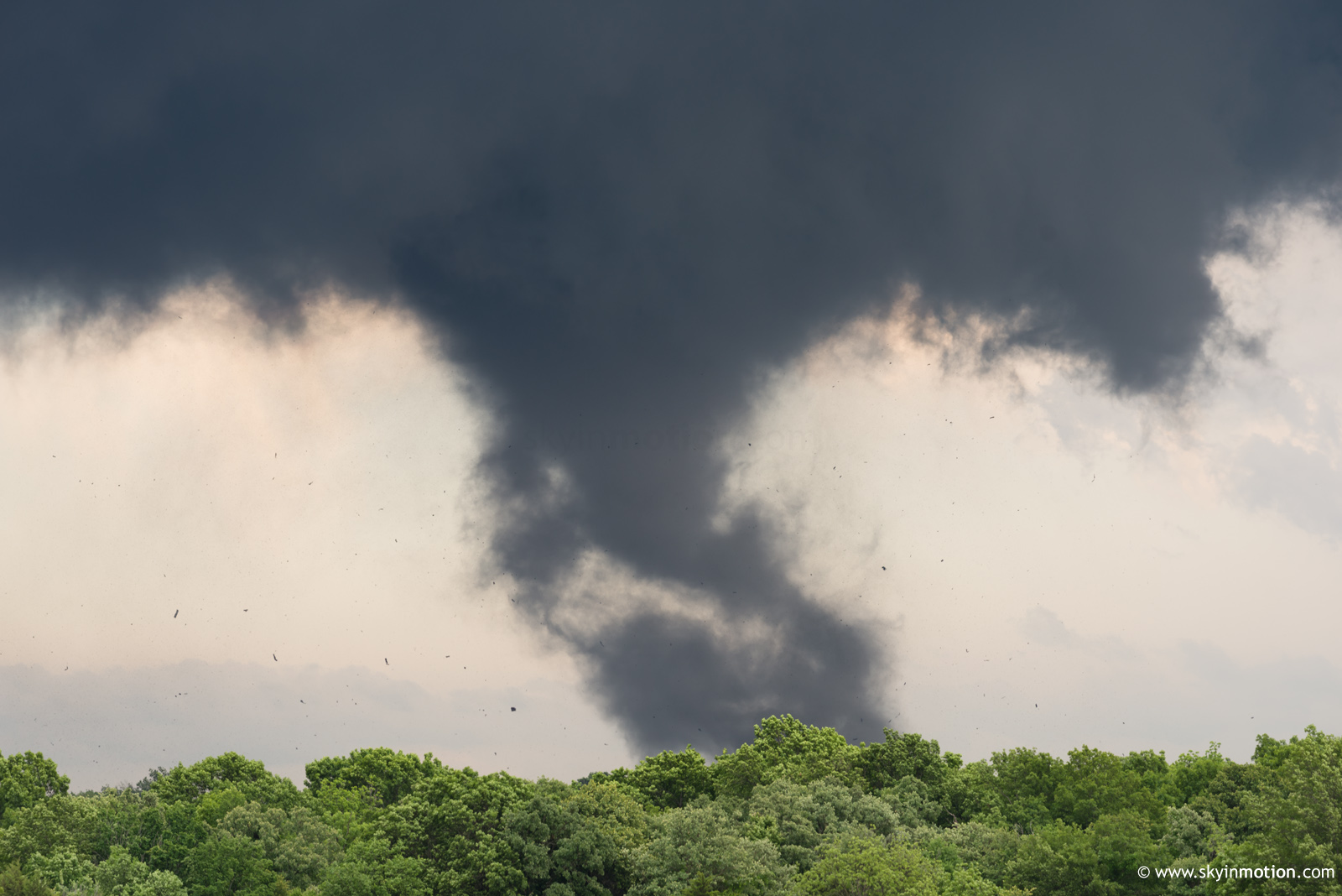
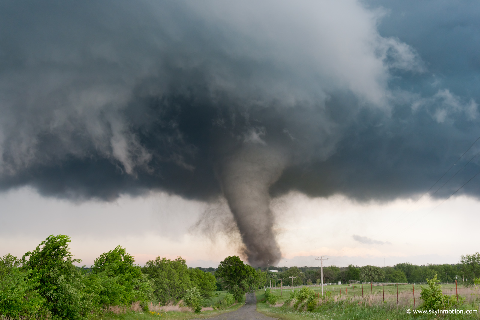
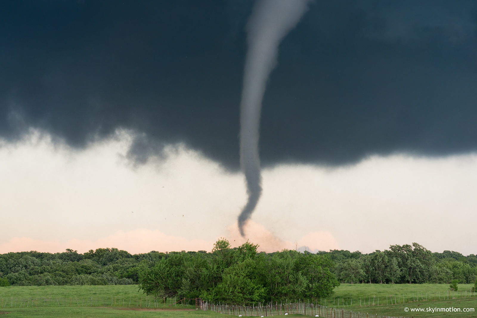
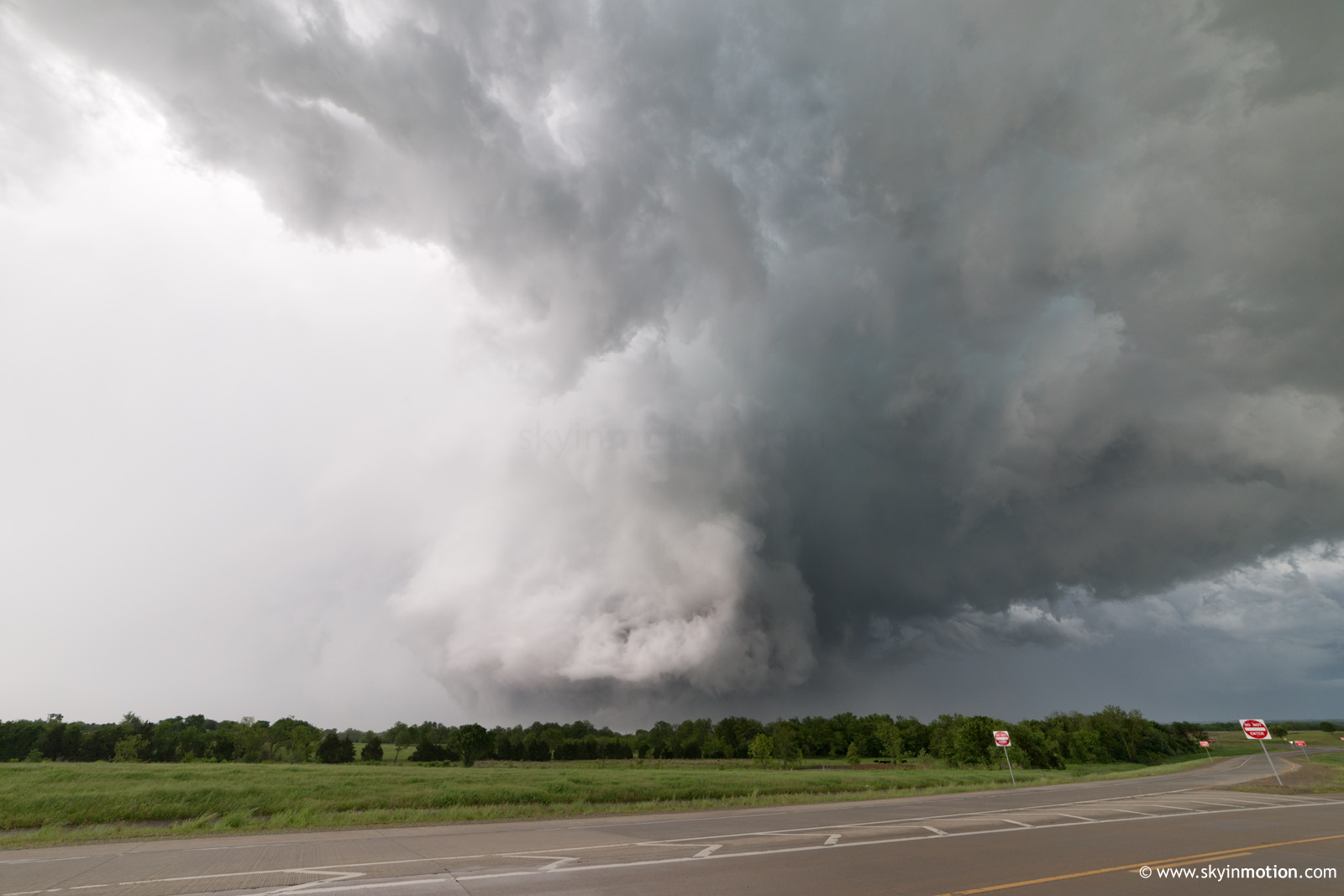
After getting cut off by debris and downed lines on my E-W road, I cut my losses and stopped at the nearest clear east view for more stills as the tornado contracted into an intermittent cone/rope.
The road options near and E of I-35 were a chaser's worst nightmare, and chasing solo, it quickly became a lost cause. I missed all the action that occurred from near Davis to near Sulphur, only finally catching back up in time to see the Sulphur wedge NE of town when it was partially rain-wrapped.
Overall, the Katie-Davis tornado is a strong candidate for the highest quality tornado I've ever observed, taking it in isolation. The terrain, my positioning, traffic/local yokel encounters, and of course the unfortunate loss of life put a bit of a damper on it, though. Even so, observing this storm throughout its life cycle was a jaw-dropping, humbling experience. Hopefully, we can study this event in detail to diagnose precisely why NWP and other conventional forecasting methods failed to highlight the threat for a significant outbreak day.