We arrive on the supercell which produced the Arnett, OK, tornado far too late, but still get structure and hail.
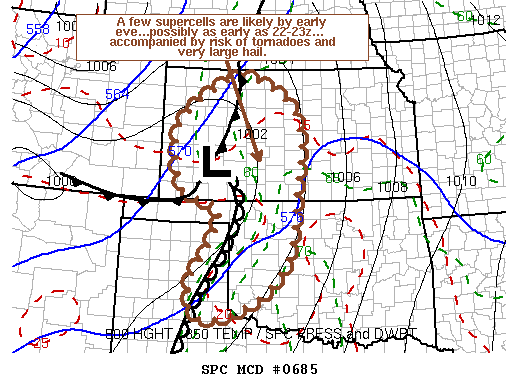
This day looked fairly benign from the medium-range thanks to an expected strong cap, but by mid-week there was growing evidence on the models that the cap might break, at least late in the day and farther north along the dryline in KS. Unfortunately, I was scheduled to go in to meet with the boss at my new job that afternoon to get some paperwork done, so as the prospects for significant severe weather ramped up, I began to stress out as usual - especially given my bad luck streak since Mar 28 despite numerous good setups. I think by this point, I was so down about screwing up several chases that my desire to go out again was akin to that of a compulsive gambler - it was more about redeeming myself than actually enjoying another chase. Thankfully, when I got back from class at 11:30, I had received an e-mail that the walk-through at work had been re-scheduled for another day - I was out the door within half an hour!
Aaron Gleason and I chased in my car, and our initial target was Woodward, where we arrived around 2:30. We intended to use it simply as a data check point and possibly to hang around until a more specific target became clear - turns out we would've been well served just sitting there all afternoon! Instead, I got concerned before we had even arrived because of the crystal-clear deep blue skies (indicating lack of moisture), and sure enough, the reading at WWR when we arrived was 90/53, indicating that moisture was mixing out big time in the area immediately ahead of the dryline. This was fairly surprising, considering every other event so far this season seemed to feature a dryline farther west than progged. Ultimately, we decided by 3:30 to press northeast to Medicine Lodge, admittedly in part because it seemed as if everyone and their brother had already made their way well into KS, and I sure didn't want to be the only one to miss the action up there, where a dryline bulge had been consistently showing up on models.
In Medicine Lodge, generally clear skies continued excepting some cirrus, but lower visibility and very muggy conditions ensured we were back in the soup. We hung around for over an hour alternating between using wifi and driving outside of town to watch the sky. A few decent patches of cumulus were visible to our east, but sure didn't look too promising.
When a lone storm appeared on radar in the NE TX Panhandle, we began thinking about heading back south for it, but I was still very hesitant because of all the hype given to the KS target (including by SPC). I checked the Mesoanalysis, which indicated that the storm was tracking into lower dew points and much higher LCL's near and just behind the dryline in Ellis County, OK - at least according to the RUC. Between that and the fact that the storm was already heading almost straight for us in Medicine Lodge, I just couldn't bring myself to drop south and put us out of play for the target north of the dryline bulge. Bad move.
As we continued watching the skies around us and waiting for the storm to draw nearer, I got a call from Bryan letting me know that they, along with apparently everyone else who'd been suckered into W KS, were flying south now towards the NW OK storm, as it appeared moisture was mixing out on the dryline bulge and initiation may not happen anytime soon. At that point, I decided we may as well start moving south towards the storm, but still didn't feel any real urgency since it was tracking towards us and surely had not had enough time to get organized yet - of course, if I'd known it was moving at only 25-30 mph and about to put down a strong tornado, I probably would've been more motivated. Alas, that is exactly what was unfolding, and we started hearing reports of a confirmed touchdown near Arnett on our way south through Woods County.
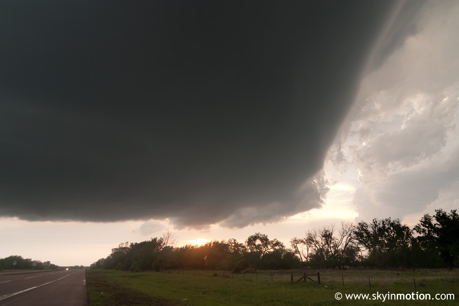
I still can't believe the irony of the whole situation. All morning, I had been nearly sick worrying about being late to the show if I couldn't leave until 2:00 (because of the walkthrough at work). In reality, had I left Norman a few hours later than I did, I probably would've been racing northwest and nearing Woodward right around the time that amazing supercell crossed the border into OK and began to produce a long-lived tornado. But instead, Aaron and I found ourselves in an uphill battle to get to the storm given how far north and east we'd drifted over the course of the afternoon. As we passed through Alva, the incredible beast of an LP supercell came into (hazy) view on the western horizon - the crisp updraft and massive anvil overspreading the entire sky to its east (including some awesome mammatus right over us which I didn't get a chance to photograph) got my adrenaline pumping even more, but we still had a ways to go.
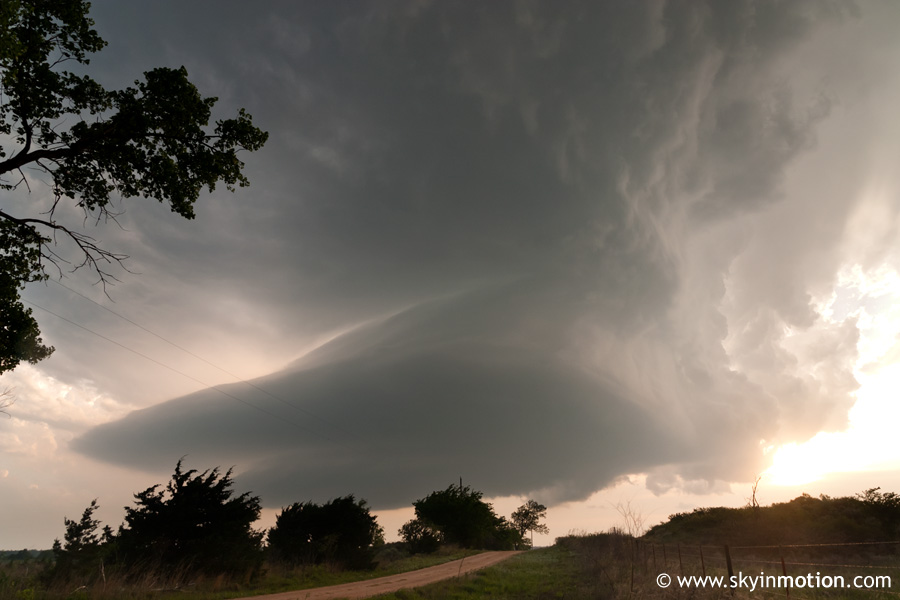
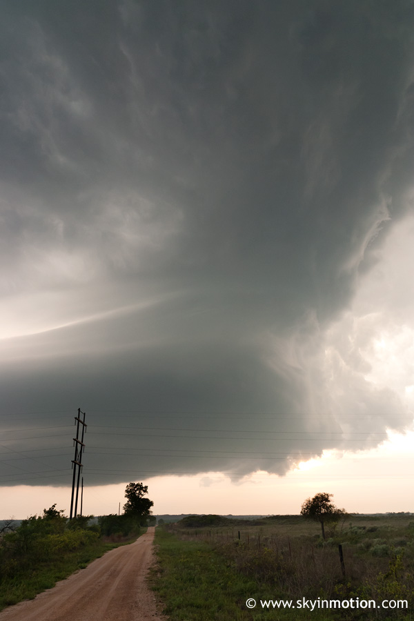
It wasn't until maybe 7:30 that we finally caught up with the storm near Mooreland. The structure was certainly the best I've seen thus far on an LP.
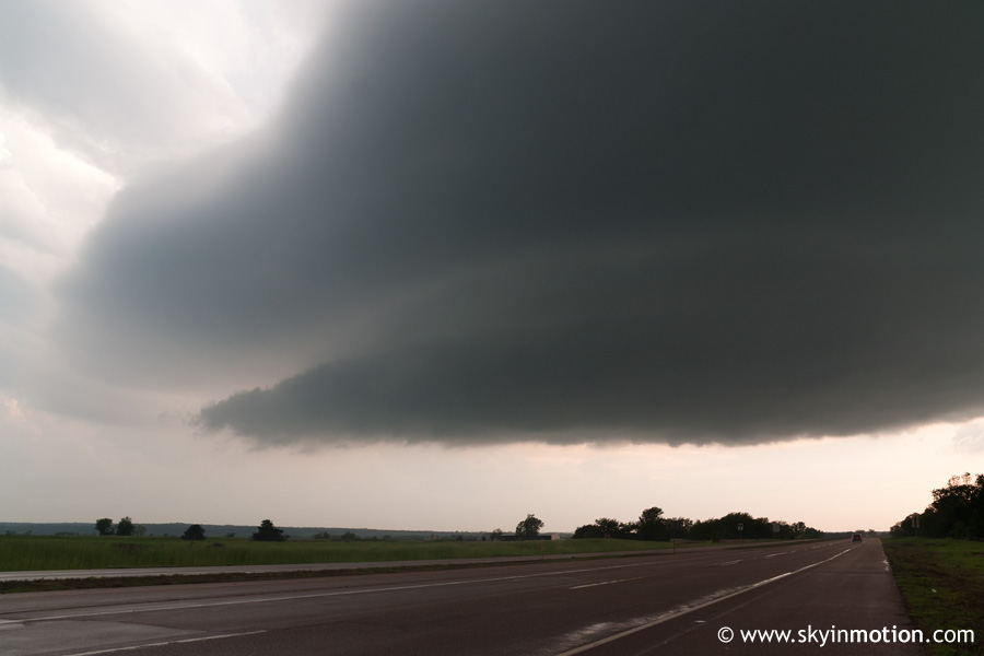
Of course, by this point the tornado was long gone, and it didn't take long to realize the storm was rapidly weakening as its structure declined. We pulled right underneath the "mothership" meso on US-412 west of Mooreland as it passed over, still holding onto one last hope that it might produce again just for us, but that was not to be.
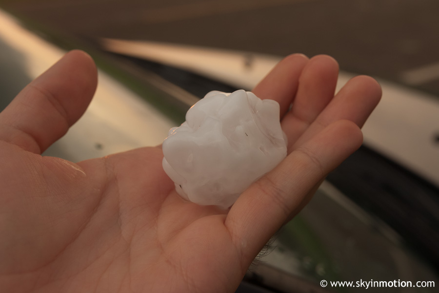
Afterwards, we followed it a few miles north on OK-50 and were greeted with sporadic large hail.
The stones, large as they were (a couple nearly tennis-ball size), were so few and far between on the ground that we at first thought they were leftover from a few minutes earlier. Then I suddenly noticed one bounce right ahead of us - sure enough, they were still coming down. Thankfully, not a single stone impacted my car.
We stopped to watch the storm depart/dissipate as the sun set, ignoring the left split to our north that was still intact, and eventually met up with Bryan and Brandon and decided to head to Woodward for Pizza Hut. We were in there quite awhile (long story), during which time several new supercells were getting their act together in a big way just to our north in SW KS. Just before we left, another group of OU chasers came over to our table in an uproar about the latest radar imagery - sure enough, a supercell with a phenomenal hook echo and velocity couplet was traversing Kiowa County, KS, about 70 miles to our north-northeast. Ordinarily, most of us wouldn't have cared much for chasing post-sunset activity (especially those of us without radar!), since waiting for lightning to give you occasional split-second, silhouetted views is typically less than enjoyable. But this time, history was in the making: a massive wedge tornado developed near US-183 north of Coldwater, then tracked northward and wiped out Greensburg, earning the first EF-5 rating ever (and the first 5-category rating since Moore 1999). It's probably a good thing we didn't make any foolish attempts to chase it without real-time data, though, because given its size and strength, it wasn't one to mess around with in the dark!