Mainly linear convection provides some decent photo ops in southwest Oklahoma.
Let's review here: it's Sunday of the weekend before final exams, I haven't studied a lick since I've been out chasing in Kansas all day Friday and Saturday, and I'm dead tired from doing that and getting back after midnight both days. So what better way to spend the day than... chasing again?
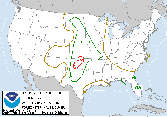
The previous two days had both been major outbreaks in the southern High Plains, but this one had not looked too interesting at all, since the dryline was supposed to advance into KS and OK, resulting in a linear mess. But progressive is one thing none of the spring systems have been this year, so after sleeping in until 11:00, I wake up to find a 15% hatched tornado threat on the day 1 outlook for W OK. Unbelievable. After our incredible bad-luck streak from Apr 21 through the day before this, I was downright sick of chasing, and almost felt disgusted when I saw that. It was too close and too high a threat to deny, though I knew I really needed to start studying for the two exams I had the next day. However, Brandon and Bryan were intent on heading out as soon as they saw the outlook, and quickly convinced me to come along and try to study in the car.
There was much concern over exactly where to head, since the road network in SW OK is less than ideal. Most people we knew were planning on setting up shop in Weatherford or Clinton on I-40 since storm motions would be nearly due north. However, a nasty mess of convection had already developed over NW OK by early afternon, and by far the best instability was gathering well to the south from NW TX to SW OK. Brandon was eyeing Lawton, while Bryan and I were still concerned about getting too far south and trying to keep up with stuff racing north. We settled on a compromise of Anadarko and set off in that direction a little after noon.
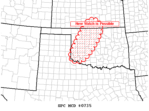
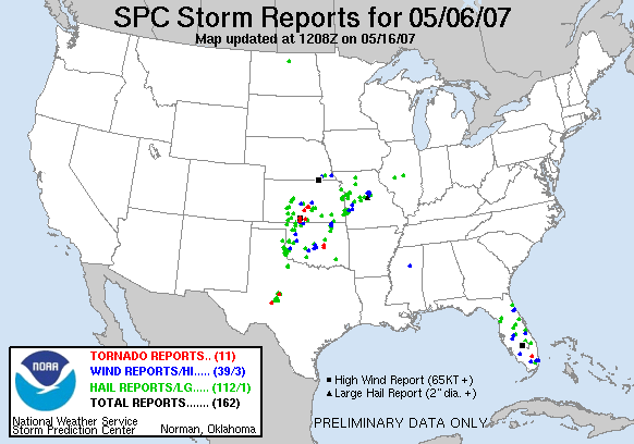
We stopped in Anadarko for data briefly, but didn't stay long after seeing numerous storms firing along the dryline from Abilene to Childress to Hollis, tracking north-northeast. We knew we needed to get farther west, and fast. While trucking out towards Hobart, we had nowcasting help from Gabe Garfield, who was tracking a tornado-warned storm in Harmon County. On its projected path, it was going to be a close call as to whether we could intercept it before it got north of us and forced us into an uphill battle to catch up. As we passed through Hobart, Gabe let us know that it looked very impressive on radar and was beginning to make a right turn - good news for us positioning-wise. We continued west and observed an increasingly dark western sky, but could never see the base. By the time we reached Reed, it had become apparent the storm was not well-organized, so we went south into Mangum for a data stop. The radar imagery was not encouraging: a continous line of convection was now apparent all the way from Woodward to east of Childress, and no one cell seemed discrete enough to become interesting. The meridional upper flow was winning out, it seemed, resulting in a squall line; this was really a shame, because conditions at the surface were about as ripe for tornadoes as you can get, with T/Td readings of about 80/68 and strongly backed surface winds throughout SW OK.
After screwing around in Mangum for awhile, we received another call that a new storm (or group of storms) to our southwest was exhibiting rotation on radar, and OKC news channels were showing a live video feed of a wall cloud. We quickly headed southwest out of town, fortunately exiting the mountainous terrain that begins around there and continues eastward, and upon cresting the last hill gained a nice view of a broad base. However, we were immediately confused as to where the real action was supposed to be, and this was a sign of things to come; nothing would become discrete enough to really get its act together.
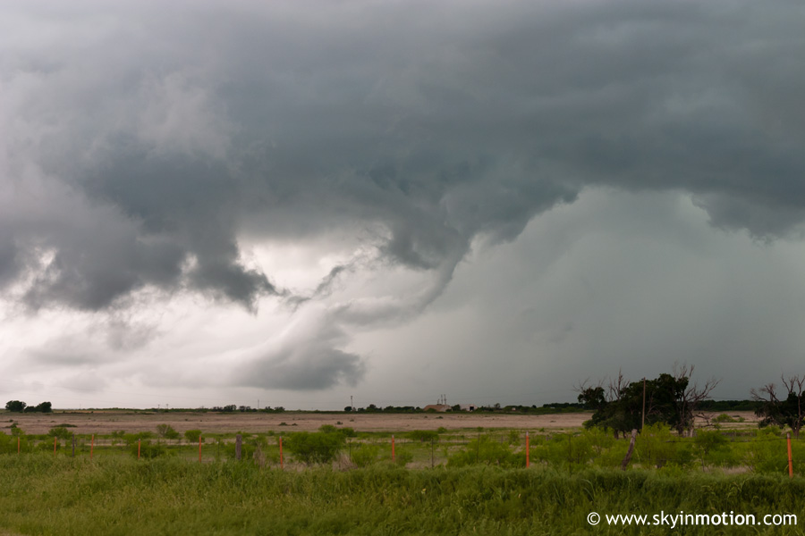
There was one interesting feature to our southwest:
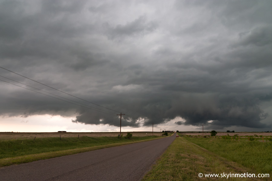
And another to our north. We kept an eye on both, but they remained fairly static in appearance, and were likely nothing more than outflow features. This was the scene to our southwest a few minutes later:
It wasn't long before any excitement faded, as this was simply a benign cluster of strong to severe thunderstorms, though mildly photogenic.
Eventually, we went back to Mangum to look at data again. Nothing looked too promising, other than the same storm we were watching, which continued to tease on radar with some rotation showing up. There were a few new storms developing southward into NW TX, but they looked weak, and in danger of quickly colliding with one another due to the NNE storm motions parallel to the dryline. Since there was nothing else worth going after, we moved southeast to Altus just in case one of those decided to become discrete and put on a show. We passed through town and stopped about 5 miles north of the Red River to view pitifully disorganized convection to our west; looking at the radar loop, it seems one of the NW TX storms had managed to stay discrete, but quickly diminished as it crossed into OK for no apparent reason (other than loss of daytime heating, as it was now about 7:30). So it was time to get on our way home - and for me to start studying! That didn't last long, as I was dying of hunger but no one else wanted to stop. We made it back to Norman around 9:00 and ate, then I started my studying-into-the-night fun. Oh, the things we do to chase. It's just too bad mother nature can't reward you more often!