
Nice HP supercells in the Panhandle, but they have a harder time producing tornadoes than expected.
After a nearly-sleepless night at the Motel 6 in Hays following the fiasco the evening before, we took our time getting ready and leaving in the morning. The latest SPC outlook maintainted a moderate risk centered over NW OK and the OK Panhandle, SW KS, and the northern half of the TX Panhandle. Personally, I was too tired and worried about missing another day at my new job to delve into the data too much, especially with no wi-fi at the motel. Brandon and I had met up with Bryan and several others at the motel, and were now planning to follow them for the day. We set off for Dodge City by late morning and enjoyed a fairly leisurely drive without worry of being late, for a change.
Though we planned to eat in downtown Dodge City, traffic looked problematic when we arrived, and the latest data appeared favorable for initiation farther south into the TX Panhandle. So we continued southwest to Liberal and stopped there for lunch around 2:00pm, with clear skies still predominating other than some benign cumulus to the north. After eating and looking over the latest forecasts and observations, it began to appear that the Perryton to Pampa corridor would provide good positioning for the initial storms. However, a warm front lay to our north over southern KS, so there was some disagreement over whether to aim for getting on storms at initiation or waiting for them to get closer to the boundary.
Eventually, we decided to head south on US-83 around 3:00; not long after, towers began exploding to our south and southeast. We stopped in southwest Beaver County OK to watch for a few minutes, and the chasers with cell Internet informed us that a PDS Tornado Watch had been issued for the area with some of the highest probabilities of the season.
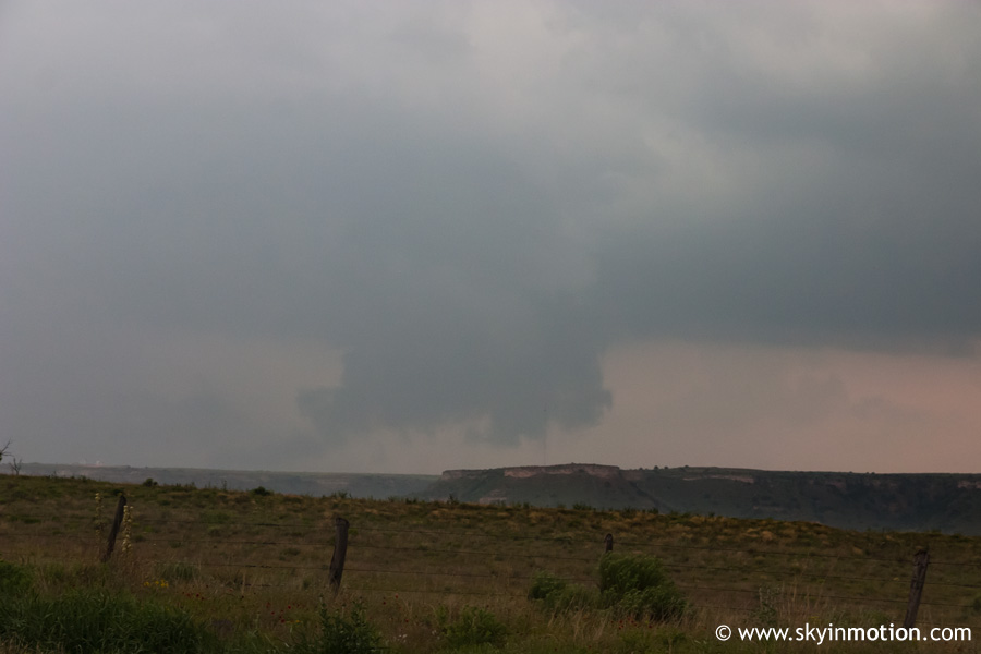
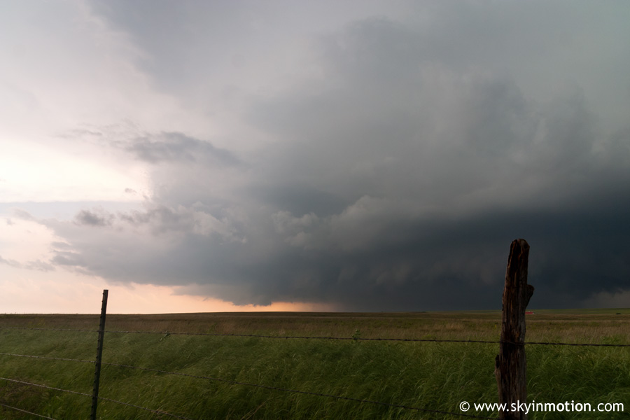
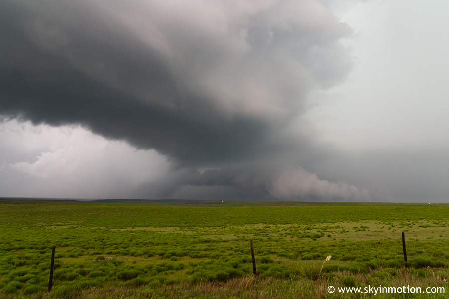
Watching the storm directly to our south continue to grow with a backsheared anvil appearing, we blasted south through Perryton and weaved between it and the core of a storm to its northeast. We split off US-83 at TX-71 and continued due south to near the Ochiltree-Roberts county border, where an impressive wall cloud came into view to the northeast with the storm moving away from us.
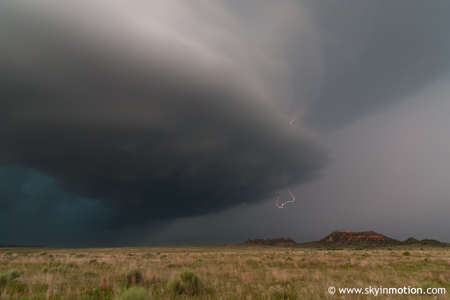
Meanwhile, the supercell approaching from our southwest looked nearly as impressive, with its wall cloud taking dead aim on us.
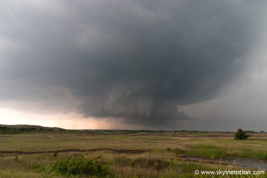
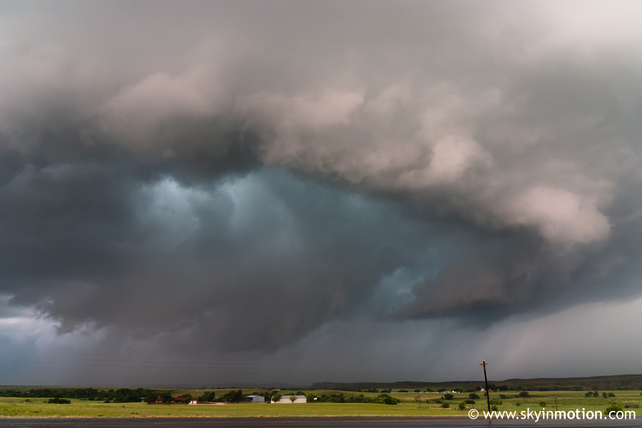
Unfortunately, we found it impossible to escape the rain in and around both cells, making photography efforts tedious and annoying; this was foretelling of the HP mode that would ultimately dominate (ruin?) the day. We stopped somewhere along TX-71 in northern Roberts County as the wall cloud drew quite close, eventually within a mile or so and still approaching us. We were sure a tornado was imminent; small-scale rotation and upward motion in the wall cloud was beyond impressive, almost becoming surreal as it churned over a field right in front of our eyes. It was quite an experience, but a tornado would not result - if it had, we probably would've needed to run away!
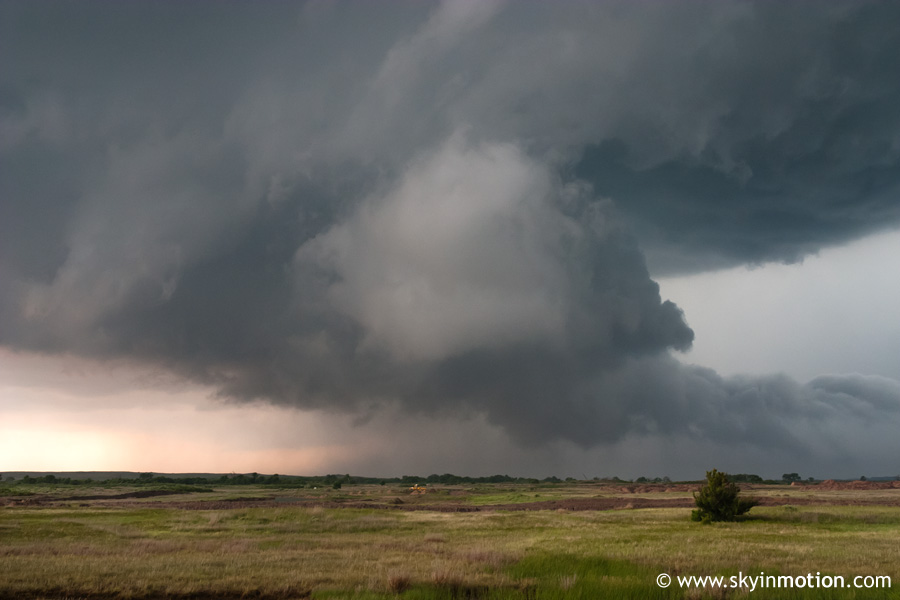
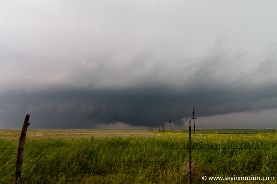
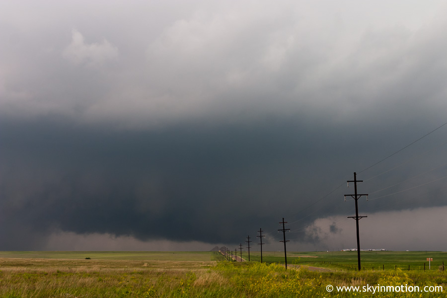
As the area of rotation neared the highway, the core did likewise, forcing us to zoom north in an attempt to avoid it. Too late: we spent the better part of the next 15-20 minutes in torrential rain and small hail, trying to get northeast as quickly as possible on the sparse paved road network. We finally got out ahead of the precipitation by hauling east on CR-281, and observed the increasingly "HP beast" structure back to our south and west.
Although we were still excited about the storm, it was clear visibility would be a problem if any tornado did occur. As it turned out, it would be a moot point, because none did during the daylight hours. We continued meandering east and north, eventually into southern Lipscomb County where we hit mass chaser convergence. With no radar all day, I had completely lost track of what was going on, so I'm not entirely sure the storm we observed come close to tornadogenesis in Lipscomb County was the same we had been on before, but it proved photogenic regardless.
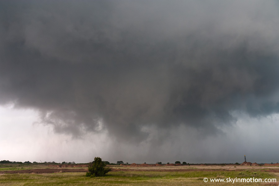
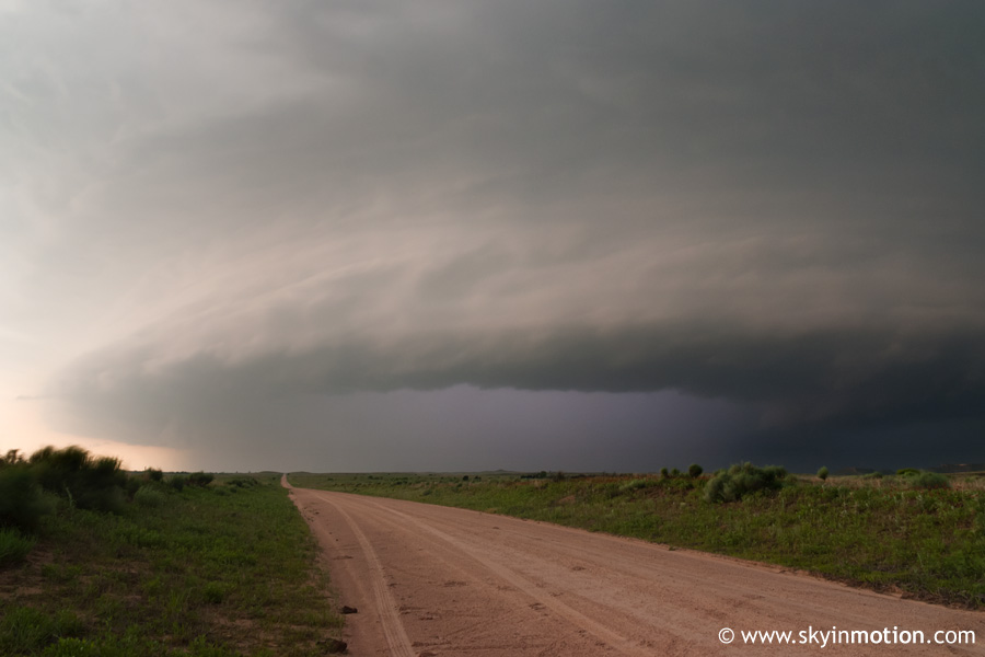
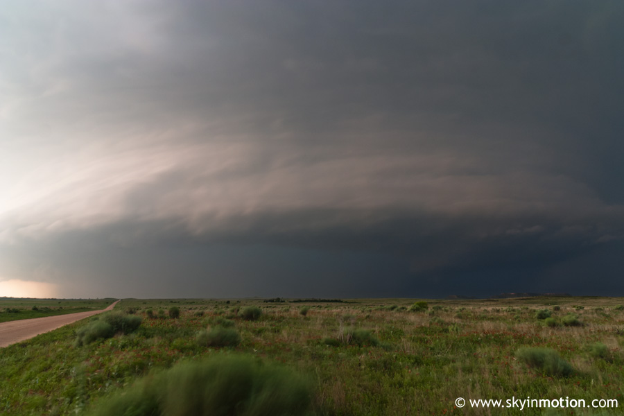
As this HP beast continued to amble slowly northeast but showed no signs of getting the job done, we made a desperate attempt to backtrack westward towards a new cell intensifying between Borger and Amarillo. Cold outflow from the initial storms made the drive westward feel futile, but radar (which Brandon and I had no access to) continued to show promise for the new cell. However, it was moving into the Canadian River Valley, an infamous Panhandle chaser trap with very few bridges. Sure enough, we opted to aim for an intercept north of the river, only to have it pass farther south and east than we anticipated and remain on the other side. By this time it was nearly 7:30pm, and we were in northern Hutchinson County needing to blast well east and then south to have any hope of an intercept. Brandon's tank was running dangerously low, so we relucantly made a short trip northward to Spearman to fill up while the others flew back east. This would separate us for the remainder of the evening.
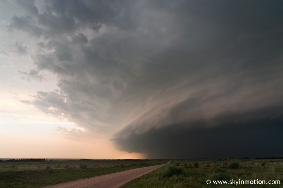
With sunset drawing near and us playing catchup, it was obvious seeing a daylight tornado was not in the cards, despite the incredible potential the setup had appeared to offer just four or five hours earlier. We reached TX-70 and turned south towards the river, increasingly in awe at the massive "UFO" to our west. As light began to wane, we turned onto North River Road right along the Canadian and headed west a couple miles, with several massive HP supercells visible in nearly all directions now. Though lighting was somewhat difficult, I shot quite a bit of the beast to the west until darkness fell.
As the clock neared 9:00pm, we called it a day and headed south to Pampa for a late dinner. As usual, it now appeared that some of the storms had better tornadic potential, but it didn't do us any good in the dark. We ate at Braums and then took US-152 east to Elk City and I-40, arriving home around 1:30am.


