Observed 1 tornado.
This is a day I'm not sure I would've bothered with had it not fallen on a Saturday, but am glad I did, given it turned into one of the better photo ops of my season. Given the ever-present 2019 likelihood of early CI, and the distance to a worst-case scenario of NE CO, this setup was also borderline for requiring an overnight stay to get in position. I decided to take my chances leaving at 7:30am from OUN. Frustratingly, this led to my being late and/or out of position for the series of landspouts along the frontal boundary from Burlington to St. Francis just after CI (3-4pm), and then there was a long gap before the robust supercellular activity ramped up around 8pm -- meaning I likely could've left home after an early lunch and netted the same result, minus hours of sulking around the CO/KS border area from 5-8pm!
After an unexpectedly leisurely lunch in GCK (my temptation to try a local BBQ joint in lieu of the tried-and-true fast food driveby routine backfired, as it usually seems to), I booked it NNW toward my initial target of Sharon Springs. There, CAM guidance was remarkably consistent spatially on the initial convective ramp-up. Of course, not only was CI a couple hours earlier than progged, but also toward the NW edge of my target zone. Velocity scans from KGLD put a pit in my stomach in short order, as mischief was afoot with the first big updraft pulse over Burlington, and I was still well over an hour out. Sure enough, this was the first of multiple landspouts I would whiff on -- and, in fairness, the final group near St. Francis would've been reachable with better decision making. On the plus side, I witnessed a 1-2 minute dust devil between Sharon Springs and GLD while en route and was able to intercept from a range of 10 yards!
Fast-forward to around 7pm: having circled around lame updrafts along the baroclinic zone without scoring any of the landspouts, I found myself sitting just outside St. Francis battling a strong temptation to race W toward the Front Range, where CAMs advertised a series of intense UH tracks by 01-02z; this would at least present mediocre photo ops, I thought, and avoid yet another 2019 multi-state trek without taking my DSLR out of its bag. To my SE, one of several nearby cells began to intensify just N of GLD, so I eventually dropped through the core to check it out (encountering quarters to slightly larger). The base looked encouraging right away; particularly its rain-free nature, relative to most this year. Still, I stopped in town to refuel and mulled over the more guaranteed upslope ops, even going as far as to start [i]west[/i] on I-70 toward the CO border! After noticing the zonal orientation of the composite front/OFB immediately ahead of the GLD storm, I quickly thought better of it and used an exit around Kanorado to whip it around back E, putting me on track to clear the big hail on I-70 and reach the Brewster exit [i]just[/i] in time. From there, it didn't take long to vindicate my decision:
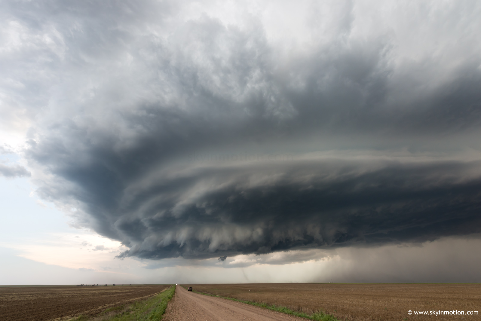
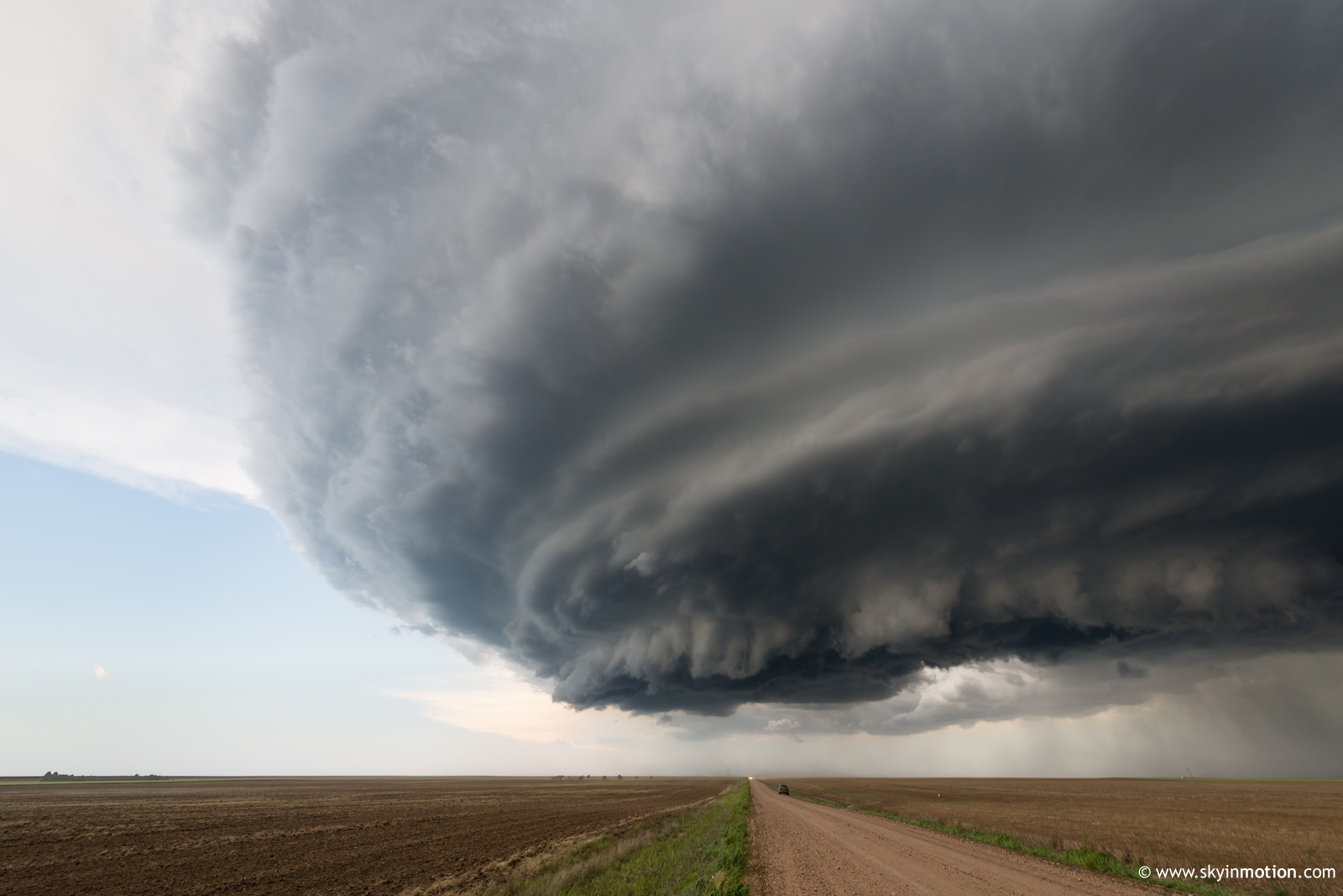
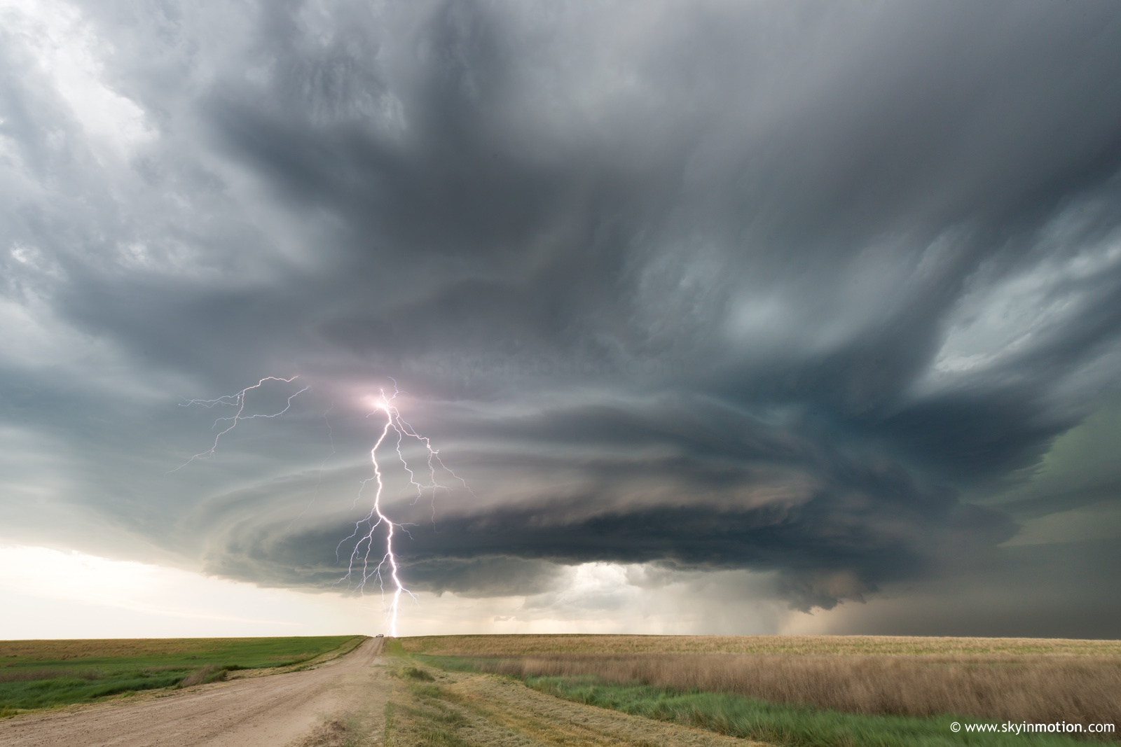
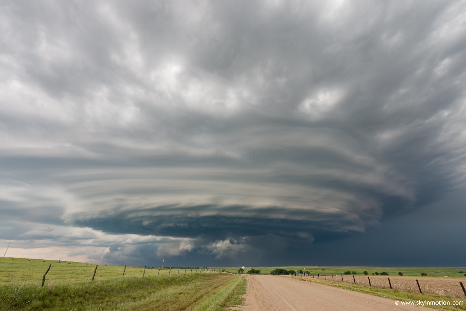
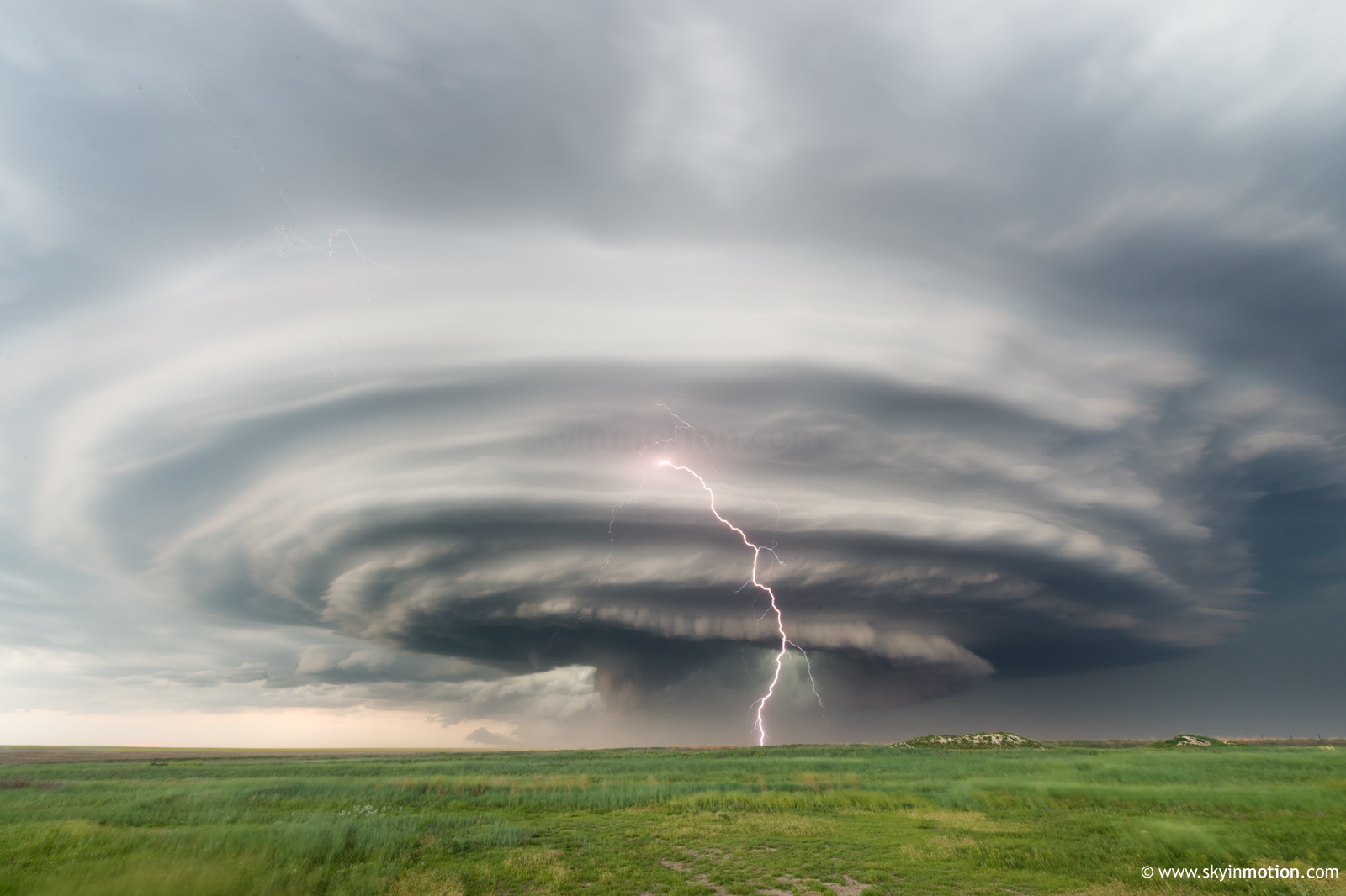
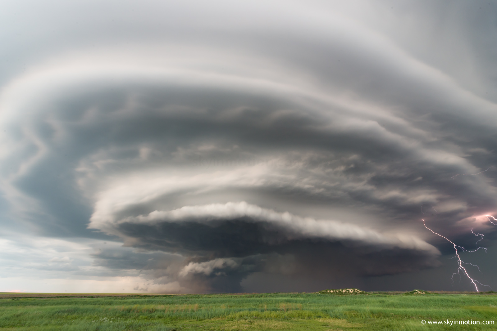
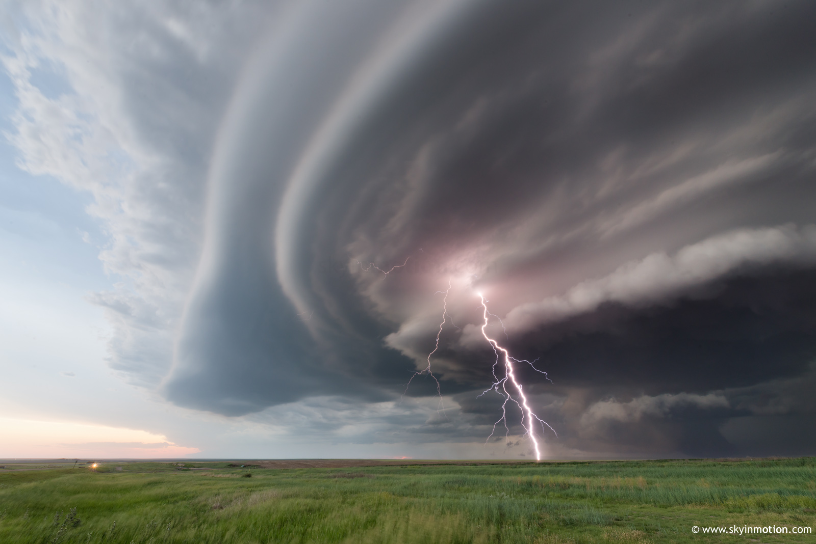
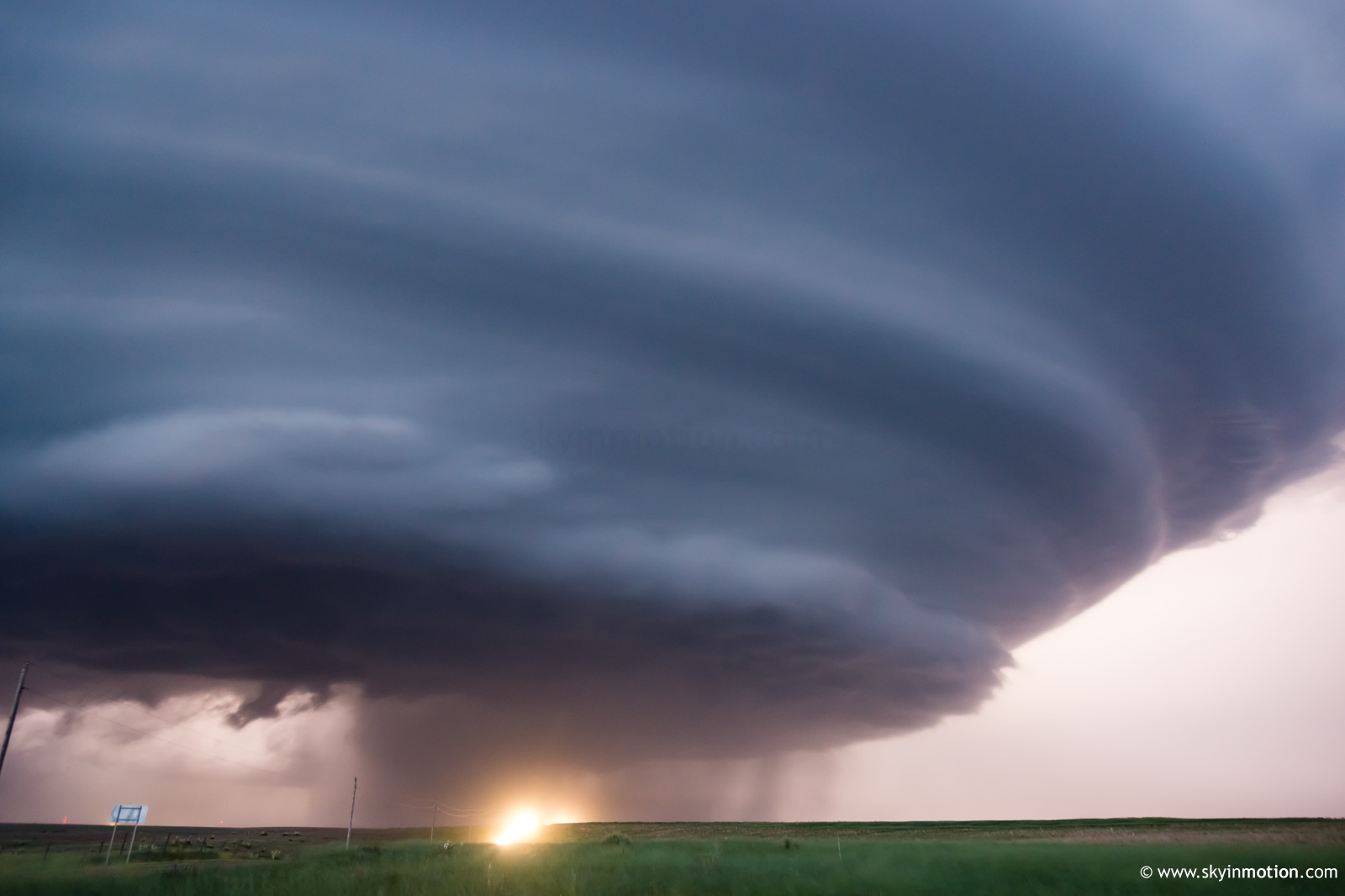
Just after 8pm, the first substantial wall cloud formed SW of Brewster and put down sporadic dusty whirls. The real story quickly became structure, followed closely by one of the more persistently intense CG barrages I can remember on an isolated supercell.
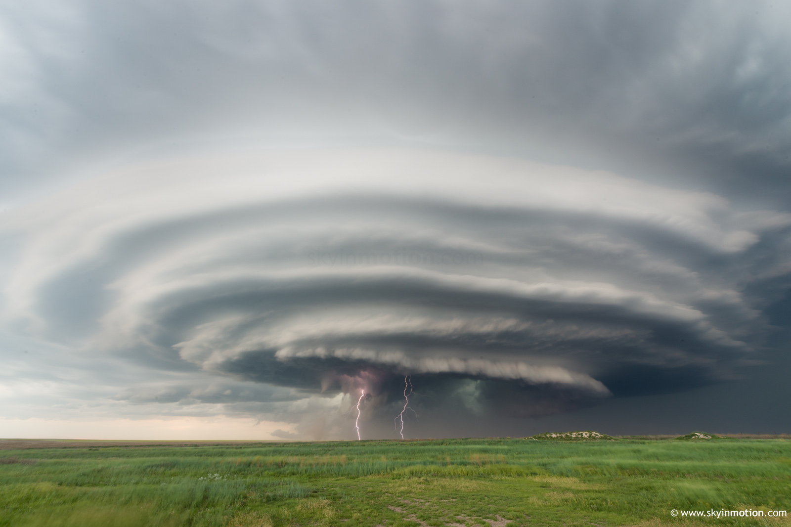
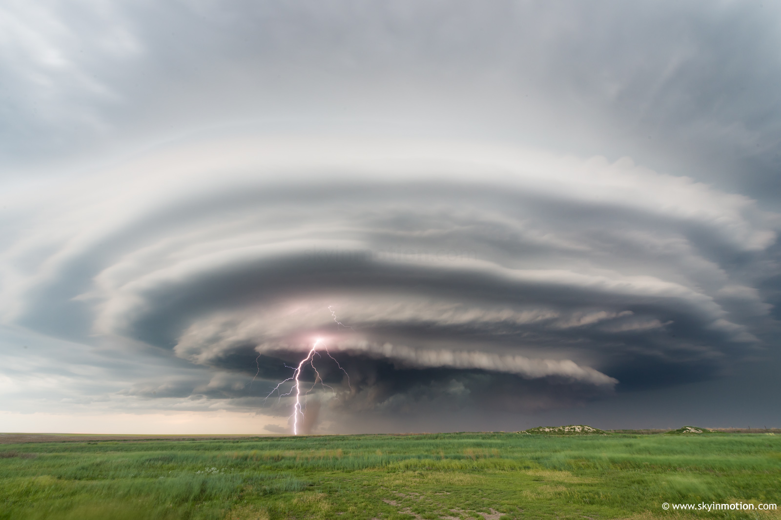
The slow march SE from I-70 to US-40 near Winona was moderately stressful, between crowds and lack of pavement, but the photo ops were adequate compensation. It was only after reaching the highway at sunset that things really ramped up, though. From 8:45-9:30pm, the Goodland-Russell Springs storm transitioned from your standard "6/10 structure; I guess this made the drive kinda worth it!" fare to a real highlight of the season, punctuated by textbook moderate-CIN stacked plates and even a brief anticyclonic spinup on the S flank of the meso.
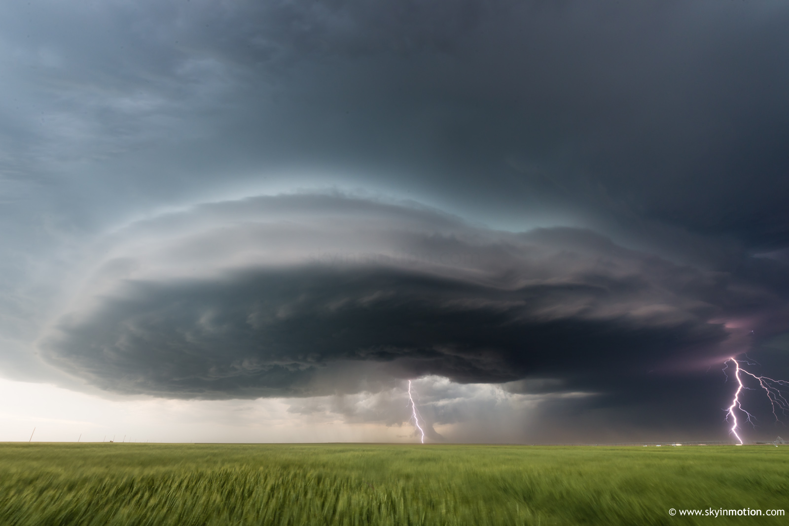
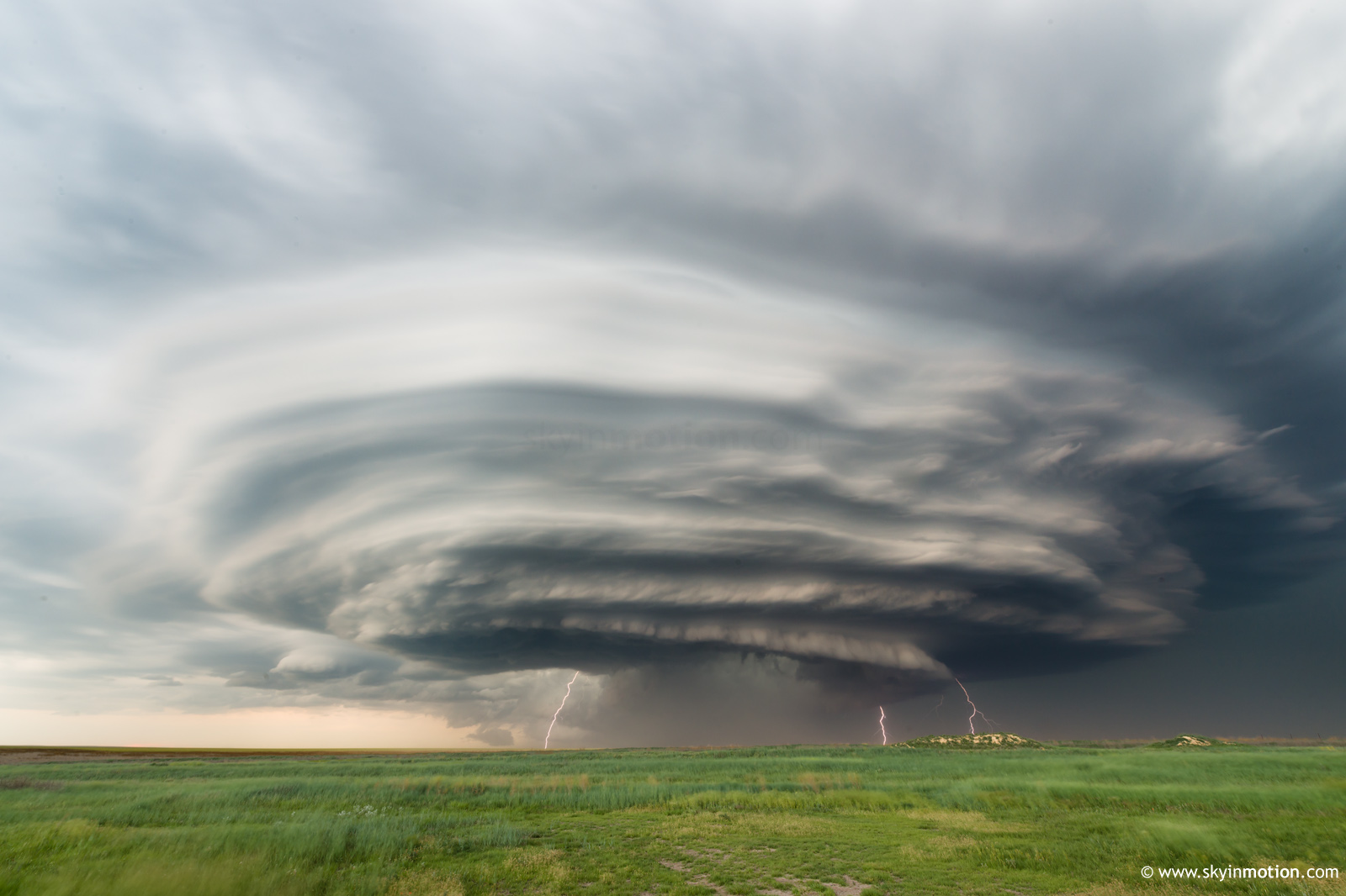
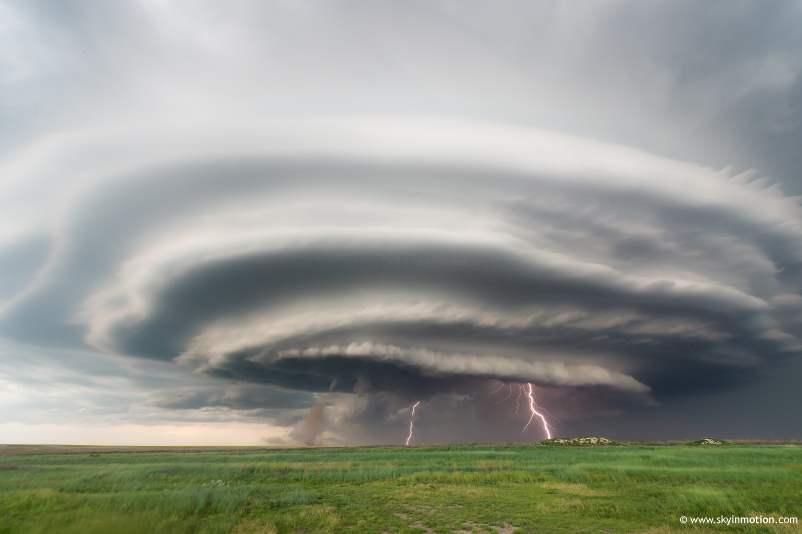
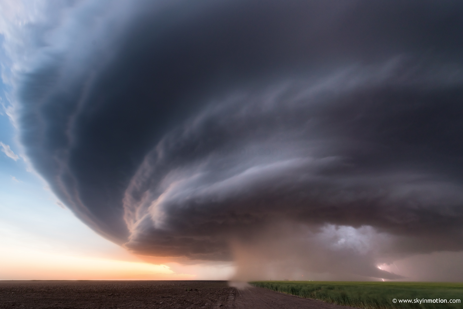
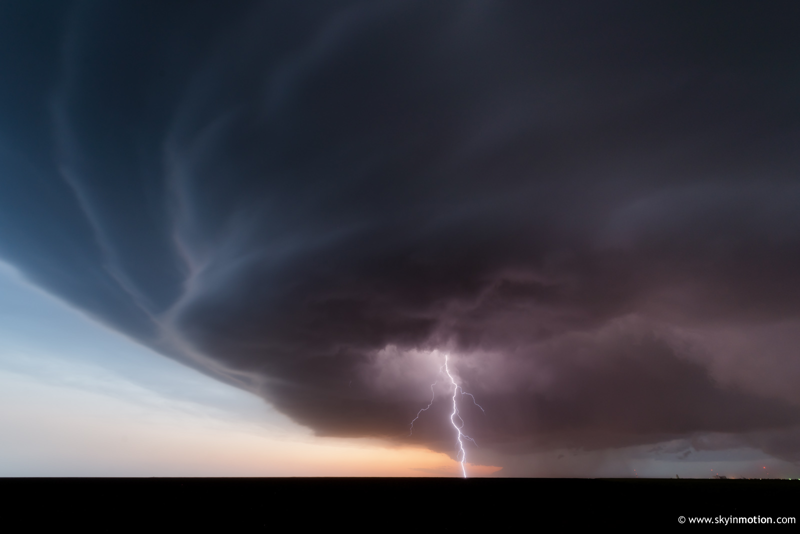
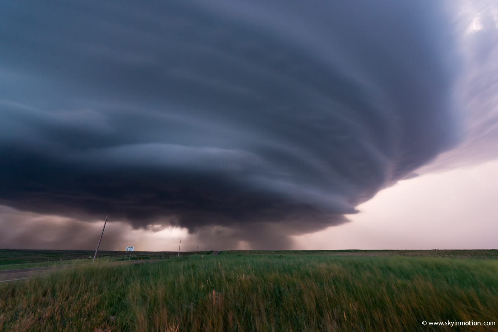
As dusk faded, navigation options led to some real consternation: not only were paved options directly ahead of the storm's path conspiciously absent, but even the least-bad short term route of K25 between Winona and Russell Springs was advertised as "closed ahead." From the US-40/K25 intersection, I was forced to bust S toward said closure, since I'd timed skirting the FFD hail threat too liberally to backtrack W. Now all but forced to stay right in the notch (I never seriously consider venturing far from pavement in a situation like this), I made what I could of the situation, shooting continually more menacing structure from a perspective that was certainly closer than optimal:
As those of us who'd taken the K25 leap of faith got squeezed into Russell Springs (where the closure existed due to a bridge repair), stacked plate structure continued unabated in the darkness to our N, but multiple reported tornadoes underneath seemed only to be observable by way of close calls on back roads just begging to go muddy at a moment's notice.
By 10pm, I took matters into my own hands and scurried around the dirt grid W of Russell Springs to find a way back to K25 past the closure, deciding to abandon ship before impending precip made the task any tougher. It was only later that the full cost of this navigational no-man's-land in eastern Logan Co. became apparent: the few hardy souls who'd committed to staying SE of the updraft at all costs (in this case, 20+ miles without pavement in the direct path of a prolific and slow-moving supercell, meaning the risk of an awfully long night given a bridge out or other unexpected obstacle) nabbed some of the best nocturnal storm photos of all time, to my mind. Meanwhile, I was well on my way to GCK in search of rest, comically concerned about making it back to C OK by mid-afternoon for whatever opportunities might present themselves along the surging CF (spoiler: none, after a robust sunrise MCS rocked the OKC metro). Despite this irritating turn of events, the Goodland-Russell Springs supercell was probably the most enjoyable single storm of the year for me, particularly in offering a nicer and broader array of still photo ops than anything I've seen the past couple years.