After missing tornadoes along an outflow boundary near Fairview, we head out in the evening to catch a supercell in Canadian County, OK.
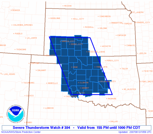
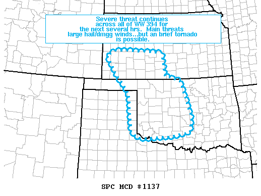
What seemed like just another stormy day under the June 2007 upper-level low from hell became the only of the year to produce tornadoes in close proximity to the Oklahoma City metro area, but lack of attention to the situation kept me from joining in on the fun. The SPC outlook showed a slight risk with 2% tornado probabilities over much of W OK, but this was nothing new in a late spring/summer season that featured a perpetual upper height field weakness over Oklahoma, and almost-daily marginal thunderstorms. I went to work in the morning as usual, occasionally looking at the latest weather-related developments, but didn't really consider leaving to chase until almost 3:00. After talking to Brandon and Bryan on the phone, I decided to head over to Brandon's and possibly head out. Unfortunately, once there, we wasted a ton of time watching the radar and hesitating; by 4:30 or 5:00, Brandon decided he wasn't interested in going, so I didn't really want to go either. It seemed that a nearly-stationary storm in Major County along an outflow boundary was continually developing impressive rotation; each time it would, we'd curse ourselves for not having left earlier to get there, but the irony is that it took so long to produce its eventual tornadoes that if we'd left when we were first watching it, we probably could've made it in time! We ended up watching the several brief tornadoes near Orienta and the Glass Mountains around 6:30-6:45 on live TV. Interestingly, these tornadoes occurred in an area covered only by a Severe Thunderstorm Watch (technically, a Tornado Watch is only required when a certain probability threshold is met for tornadoes, but it's still slightly unusual to see this happen in the Southern Plains).
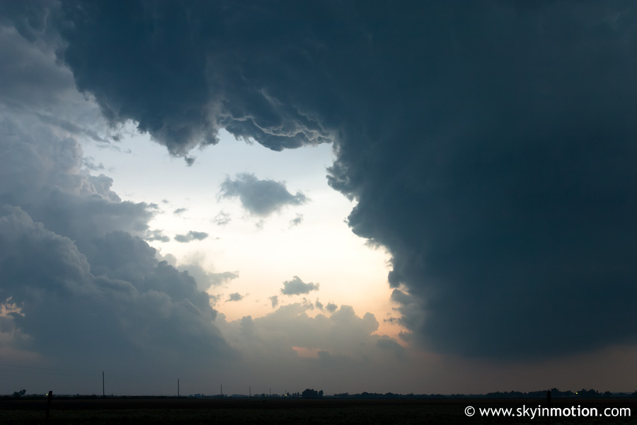
After the Orienta tornadoes, new discussions from NWS OUN and SPC indicated the potential for additional supercells to develop along the outflow boundary, which stretched roughly from Alva down towards Kingfisher and El Reno. Shortly thereafter, around 7:00, weak echoes began to appear around Minco and Union City on radar; looking out the window, I could see towers going up to the distant northwest. Bryan and I flew out the door and up I-35, then over to El Reno on I-40. By this time, a weak LP was looming just west of El Reno, while a more impressive supercell was located over NW Canadian County and drifting northward. We headed up US-81 towards Concho, then west on backroads towards Calumet. Extreme haze, which was all-too-common during this muggy, disgusting summer, prevented us from getting much of a view of the Geary/Greenfield supercell to our northwest.
As dusk approached, we headed west out of Calumet, through Geary, and north towards Greenfield in eastern Blaine County. By the time we were within striking distance, it was completely dark, and though we could see lowerings and scud to our north during lightning flashes, it was obvious we were late to whatever show the storm had put on. On our way back south towards I-40, we noticed what we at first thought to be a funnel and possible tornado to our northeast, so we stopped to watch for a few minutes; after awhile, it became apparent it was just scud playing a visual trick with us from our position, so we called it a night.