
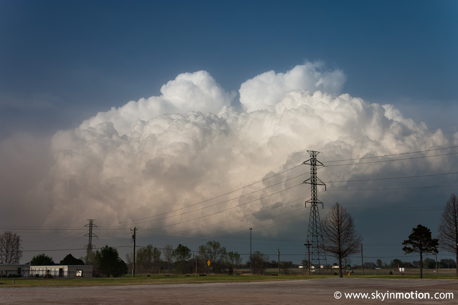
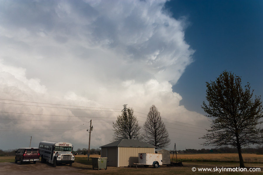
Supercells race east across the Tulsa area - at least they looked impressive from a distance!
Just what I needed: another Thursday chase, which meant not being able to leave until mid-afternoon thanks to Physics lab, just like the week before (March 30). And as with pretty much every 2006 event, that was a big problem, as the dryline was already sweeping east through the I-35 corridor by early afternoon. So, much like I had the week prior, I ran back to my dorm as soon as I got out of lab and gathered my stuff for departure. This time, my route was I-35 north, then I-40 east to exit at US-377 northbound in Seminole Co. By the time I got off the interstate, I had passed the dryline and watched decent Cu towers going up all around. I took US-377 north through Prague and up to Stroud, where I stopped for a look at the radar.
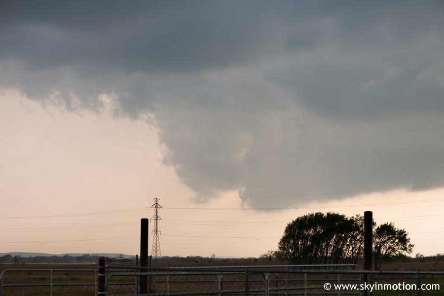
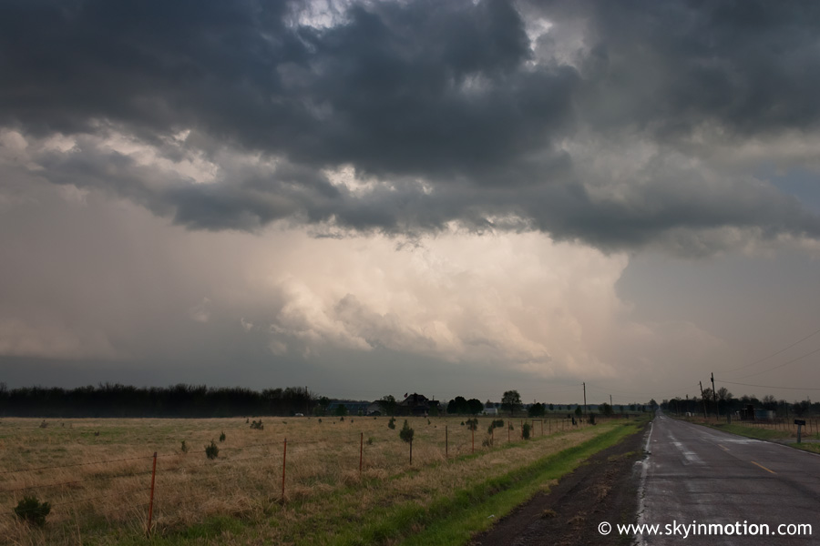
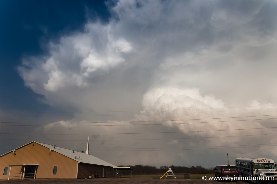
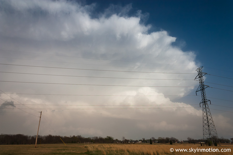
After 10 or 15 minutes, I was pleased to see a cell developing just barely to my southeast (both on radar and visually), so I got on the turnpike to head quickly northeast in hopes of keeping up with it. Storm motions were quite brisk, so even at 80 mph, I was not making much progress in getting ahead of the developing storm, which soon became severe-warned. Another storm to my north near Bartlesville was tornado-warned, but as much trouble as I was having just keeping up with my storm, I knew it would be foolish to go after something already so far north of me. Continuing northeast to Tulsa, the explosive mushroom-cloud appearance of the storm just south of me became impressive. Upon arriving in Tulsa, I took US-75 north about 10 miles to near Sperry, where I stopped to let the storm overtake me since it didn't appear there was much in the way of good structure to be photographed.
In the core, I experienced a period of torrential rain and fairly strong gusts. After it passed, I decided to stay put to view the back sides of numerous supercells along the dryline, which was now just to my east. Unfortunately, the photos I took had extremely poor contrast, and I'm not exactly sure why. I've enhanced the contrast even more than I usually do for these shots.
The drive back to Norman on I-44 was pretty unpleasant, as very strong southwest winds behind the dryline were advecting a lot of dust and dirt eastward out of the drought-stricken High Plains, enough to lower visibility substantially and even burn my eyes a bit!


