Extreme instability yields an impressive MCS with strong outflow.

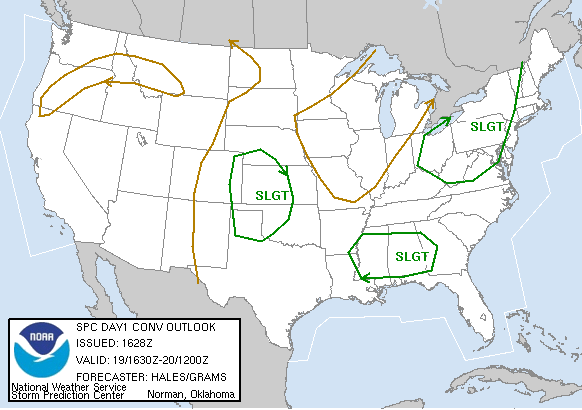
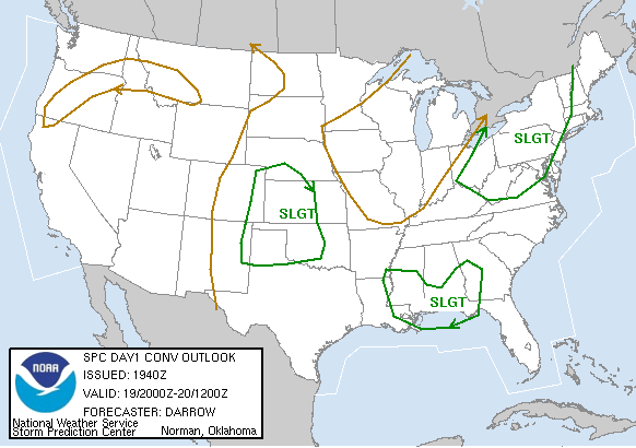
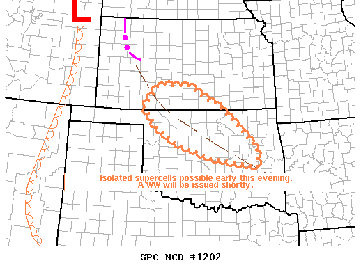
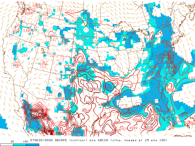
Another early-summer slight risk day with lackluster shear. However, CAPE was quite high (4000-6000 J/kg) due to very rich boundary-layer moisture. As a result, explosive thunderstorm development was expected by late afternoon when the cap became breakable, but the threat for tornadoes was not particularly high with weak flow. By mid-afternoon, it appeared initiation would be most likely over nothwestern into north-central OK, so Brandon, Bryan and I set off towards Enid, with a severe storm developing over Garfield and Grant counties at the time. After a drive up I-35, we took US-412 west towards Enid, already under the anvil, which included some decent mammatus.
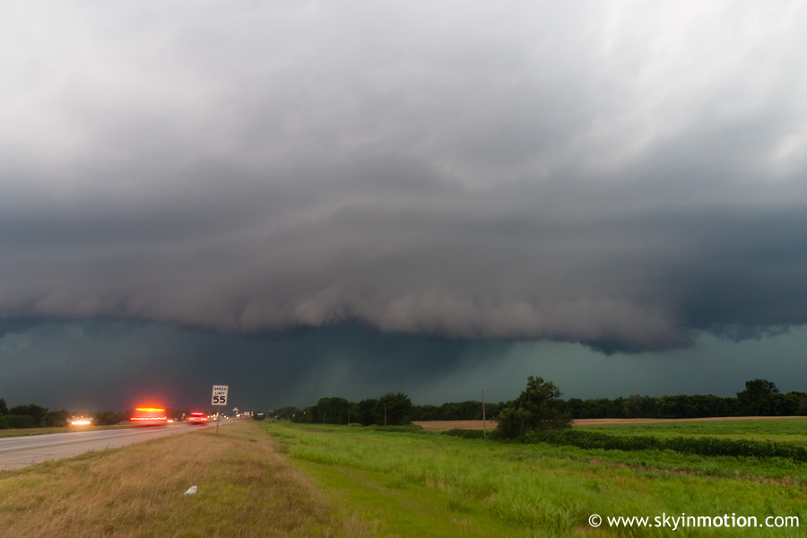
We got a quick radar update while heading west through town, and saw that the storm was essentially one big blob of convection (questionable multicell vs. supercell) without any clear indications of rotation. However, some rather large hail had been reported, and conditions remained favorable for hail up to softball size given the high instability. As we exited Enid and approached Lahoma, a nice shelf cloud (I believe) loomed just to our west, and lightning was extremely frequent/intense.
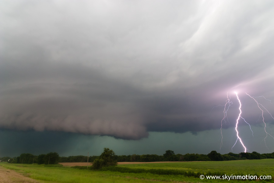
Sirens were sounding in Lahoma, so I assume the storm was tornado-warned at some point. We shot south towards Drummond, stopping again briefly several miles ahead for me to get a shot of the structure and lightning.
We then meandered southward through far southeastern Major County in an attempt to stay just ahead of the southeastward-moving storm/complex. At one point, we saw what appereared to be a very thin funnel cloud somewhere around Ames, but visibility was poor so this cannot be confirmed. Eventually, we pressed southward into Kingfisher County on OK-132. It was here that we encountered some very high winds on the leading edge of the MCS that was developing over much of northern OK. A few powerline sparks were observed, along with some light debris blowing across the road in what was likely 60-70 mph winds. Outflow had cooled temperatures from the ambient 80s to around 70, so when we got back ahead of the leading edge of said outflow heading east on US-52 towards Hennessey, we experienced an instant fog-up of the windows in Brandon's car. We gassed up in Hennsseey, then started heading home, stopping in Kingfisher to pick up dinner at KFC and get a last look at the advancing MCS.
Later in the evening, this southward-moving MCS collided with another southeastward-moving one that had formed over the TX Panhandle, and produced extremely damaging winds over parts of SW OK and NW TX. Wichita Falls recorded gusts well in excess of 90 mph!