Upslope convection meets top-tier moisture for a shocking spectacle on the mesas of north central New Mexico.
Observed 1 tornado.
Even living in the heart of the Plains, I had exactly zero outings under my belt for June until I decided to take an after-work jaunt up to Wichita on the 11th, the evening before this event. A marginal environment along a cold front managed to light up with a tornado-warned supercell that ground out a couple funnels and robust wall clouds, an omen for the 12th. Sliding into bed well after midnight, I was even less committed to the following day's murky, low shear, weakly forced upslope offerings >6 hours to my west than I'd been before. I didn't set an alarm, and it was only after seeing a consensus for >70 F Td well across the TX/NM border on the 12z guidance Saturday morning that I knew resistance (to another 2% prayer in a land far, far away) was futile.
I departed Norman around 10am, and by the time I hit AMA after lunchtime, it was impossible to ignore the pristine character of this airmass: up on the Caprock, approaching 4000 ft., it felt indistinguishable from the most oppressive days we see some years in OKC. Exiting I-40 at TCM, in what has to be a less-than-yearly occurrence historically, the local ASOS was reporting a Td of 70 F. From there, it was a sinuous two-hour jaunt with spotty cell service before I arrived E of Las Vegas, where a focused area of periodically rotating upslope convection had been back-building all afternoon. Like the Kim CO event a couple weekends prior, CAM guidance was simply flawless in pinpointing this evolution, proving its worth in weakly-forced upslope regimes where PBL flow favors initiation off specific terrain features in a predictable way.
Knowing the proclivities of Front Range upslope and how little its evolution seems to care about large-scale shear or the LLJ, it's purely by luck that nothing of consequence had happened before I scooted in underneath the newest updraft base just before 2300 UTC. Within 15 minutes, though, this convection had finally organized enough to start moving ESE off the terrain.
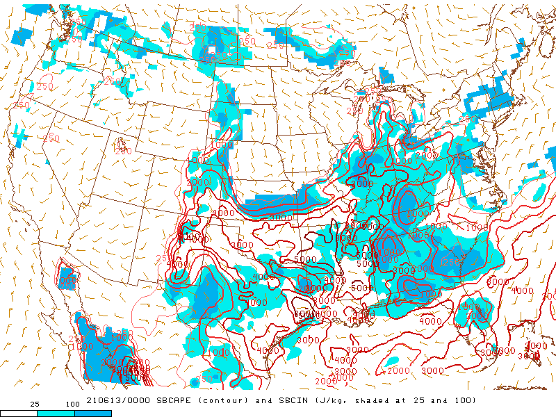
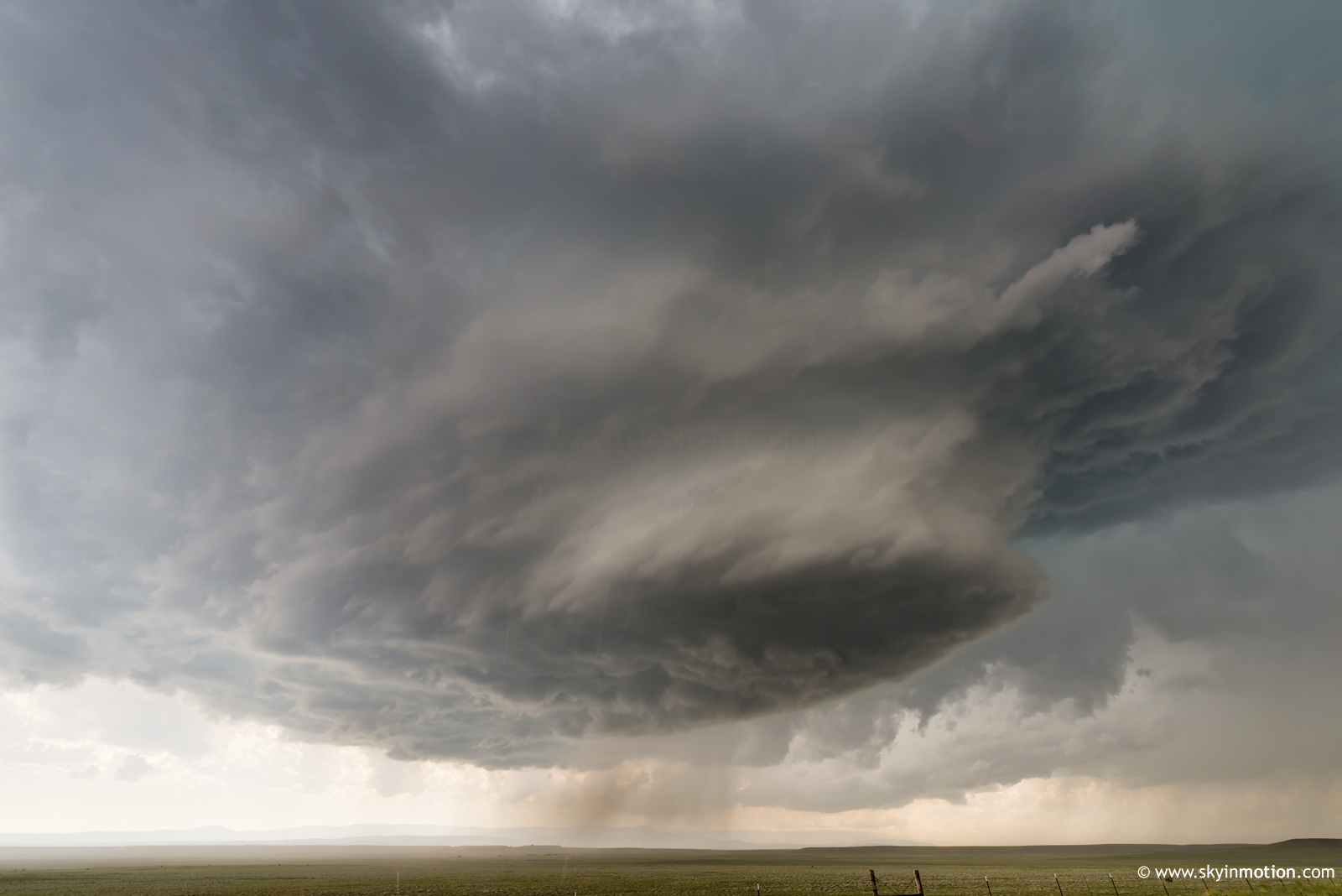
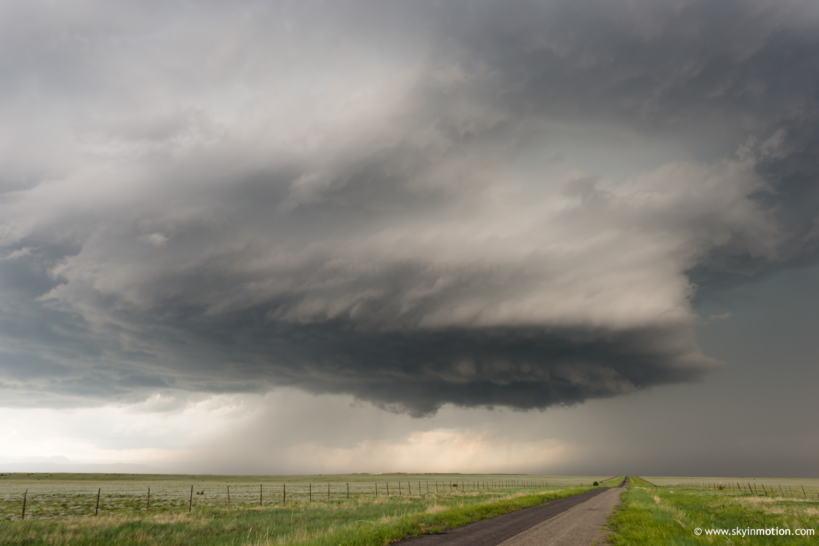
The town of Las Vegas sits near the S edge of elevated terrain that drops off precipitously (from ~7000 ft. to ~5500 ft.) into scrubby mesa-canyon territory. So, when the Las Vegas storm started cranking hard and turned due SE, it was "game over, man!" for palatable road options. Its initial position was perfect for observing from NM-104 looking N, where the hordes (the Land of Enchantment variety, mind you, so entirely manageable) had gathered. But its subsequent right turn put everyone in a pickle. I opted S on NM-67, where I knew I'd effectively be cut off within ~8 mi. and likely forced to backtrack.
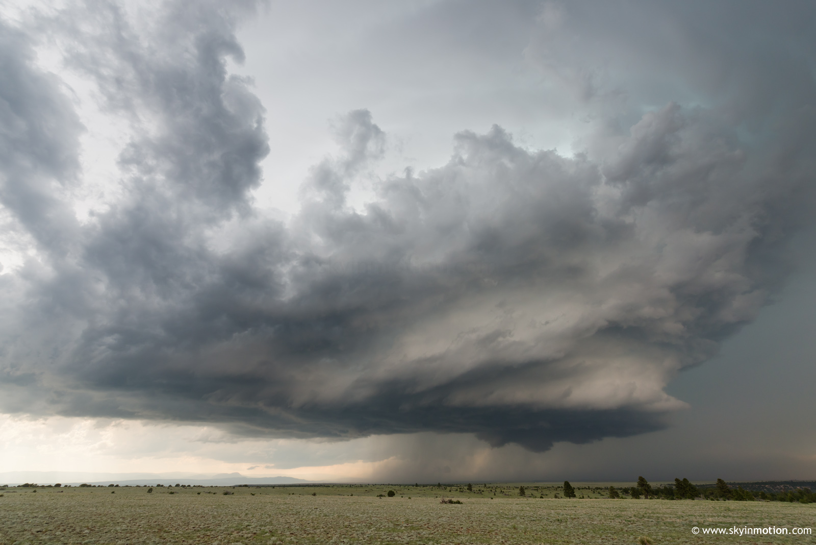
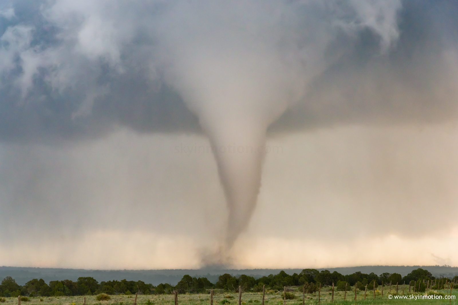
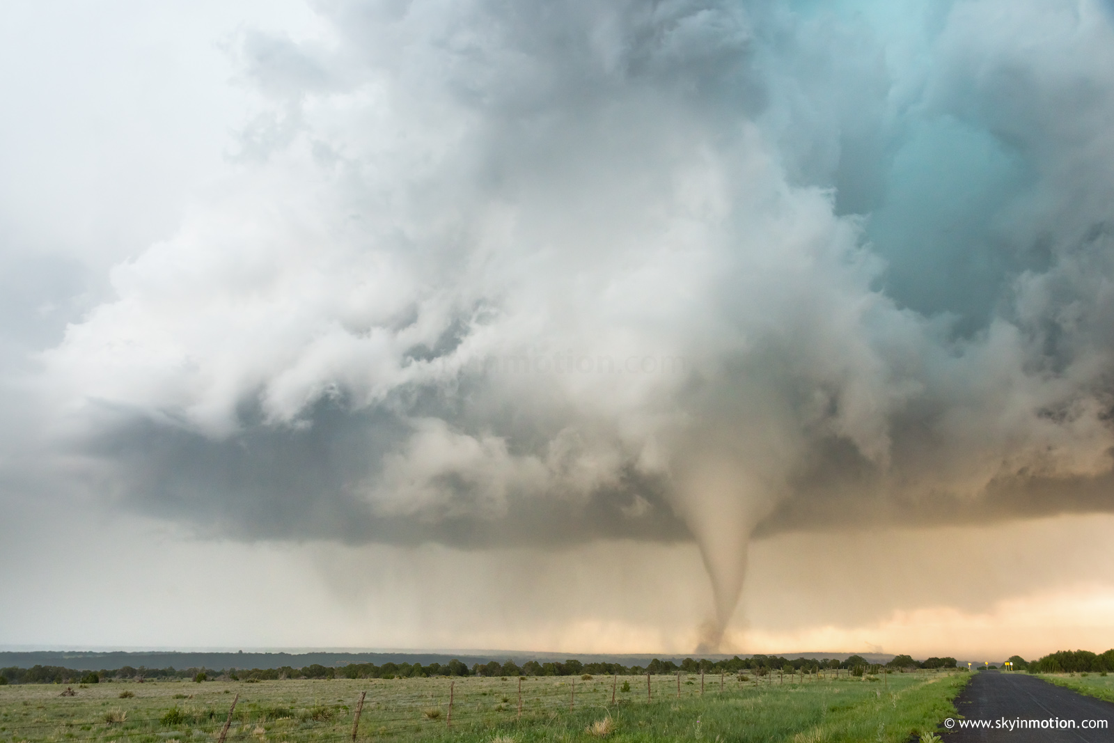
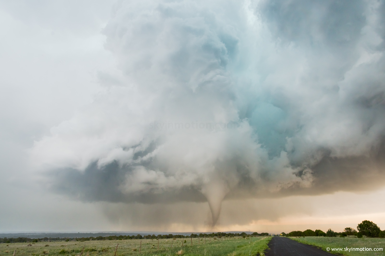
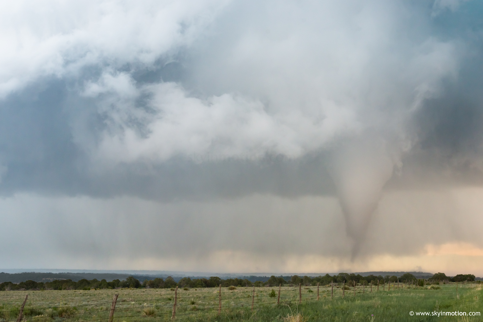
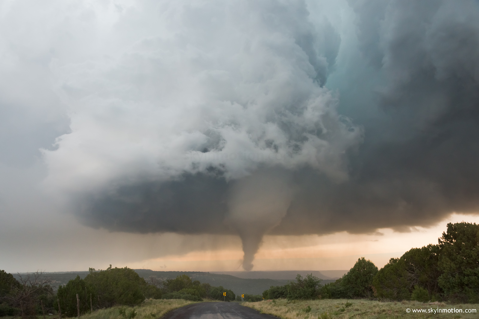
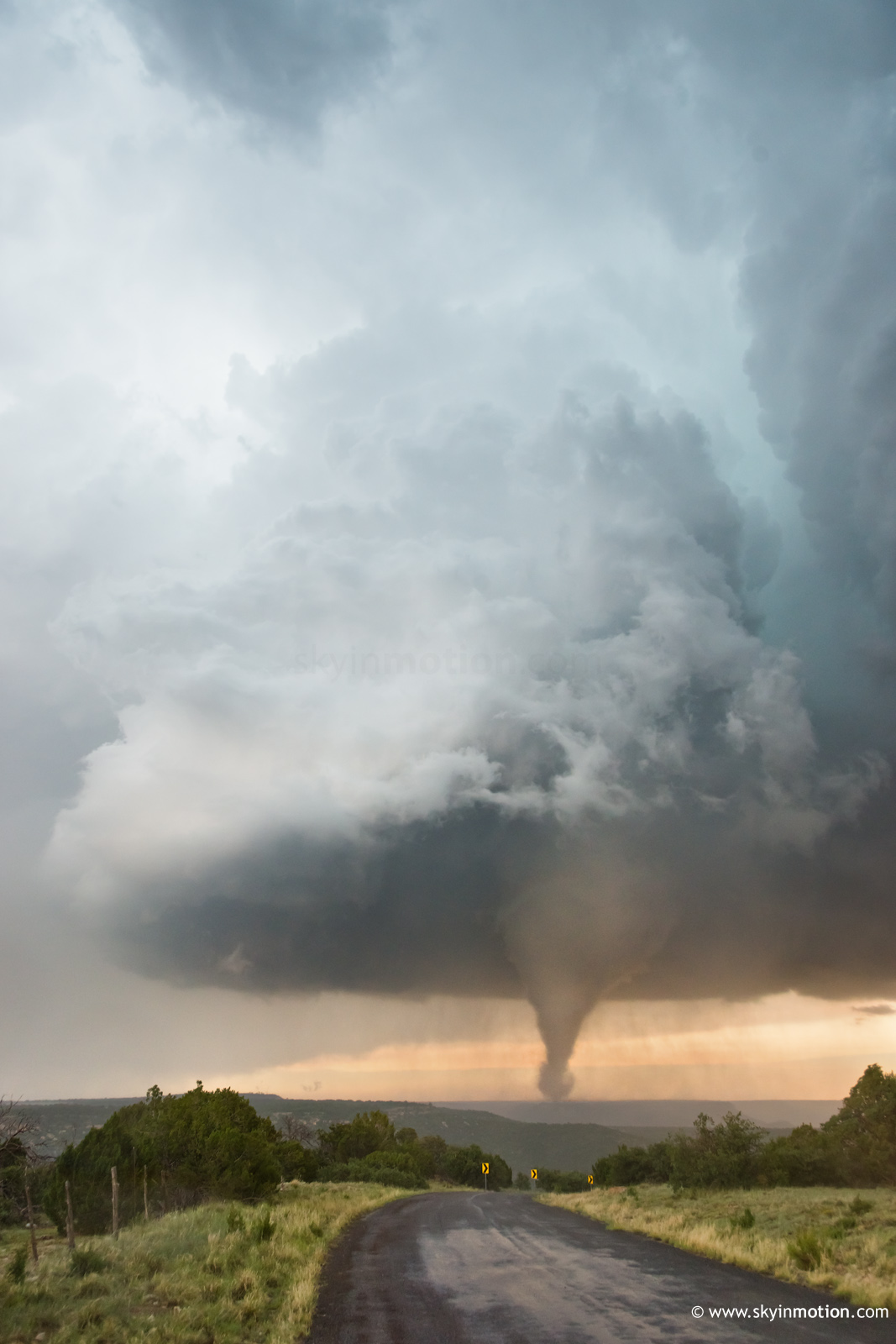
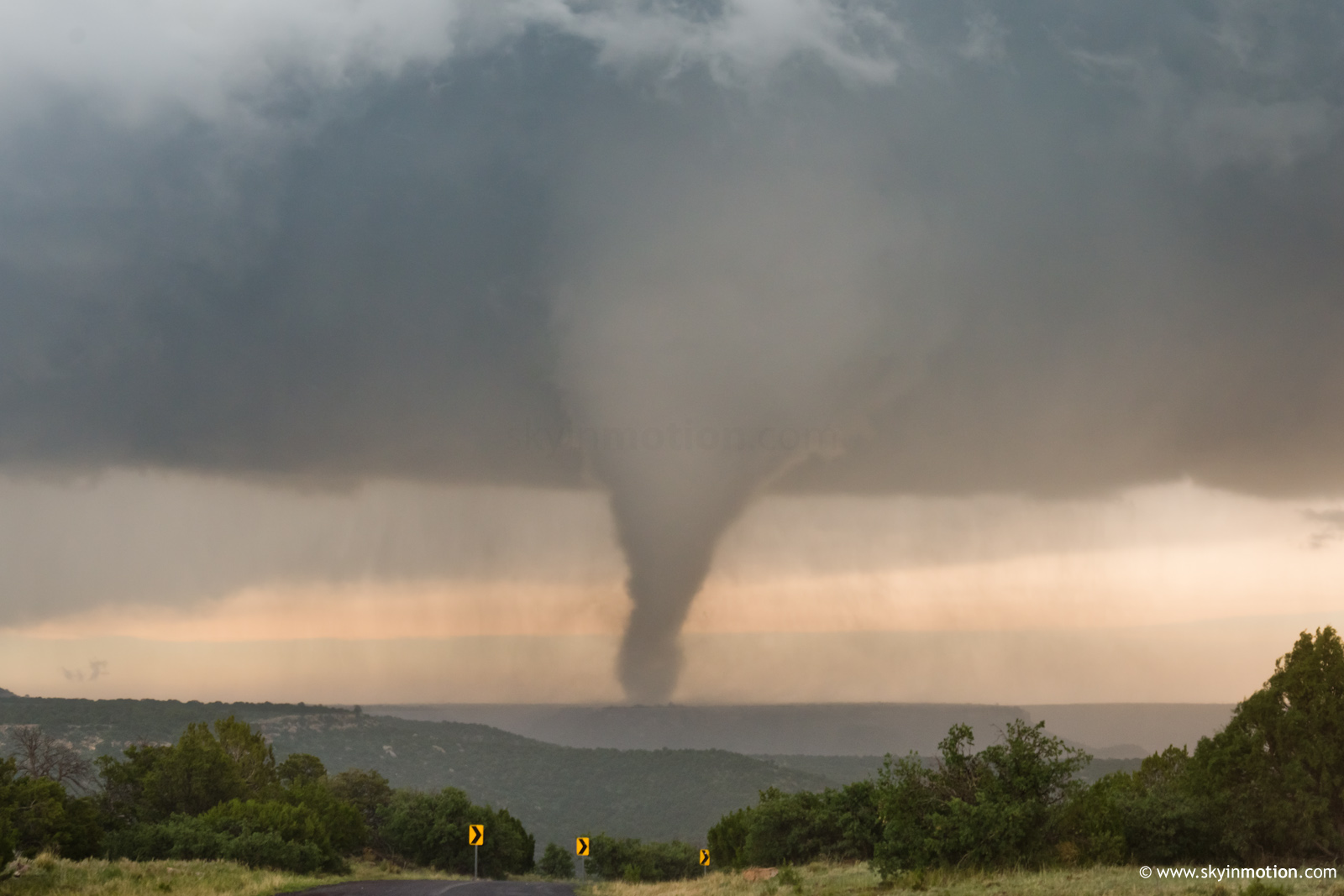
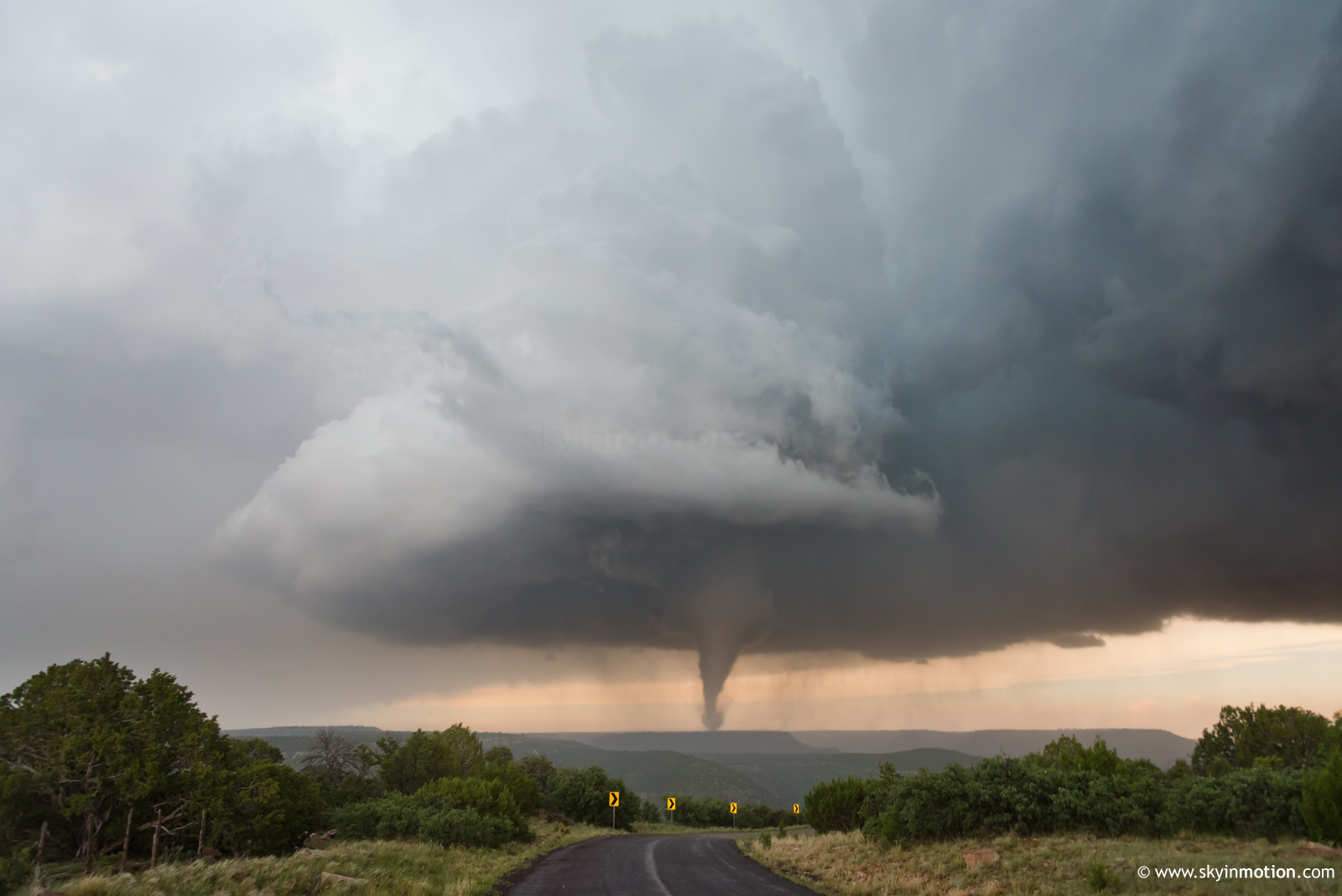
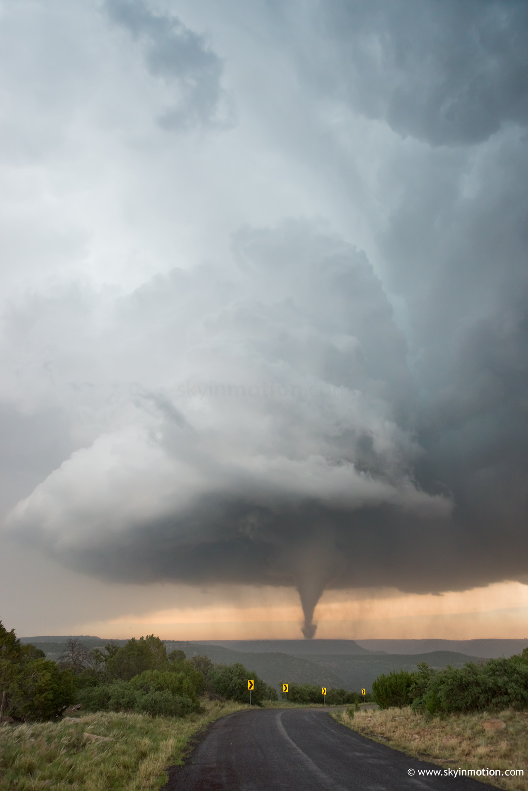
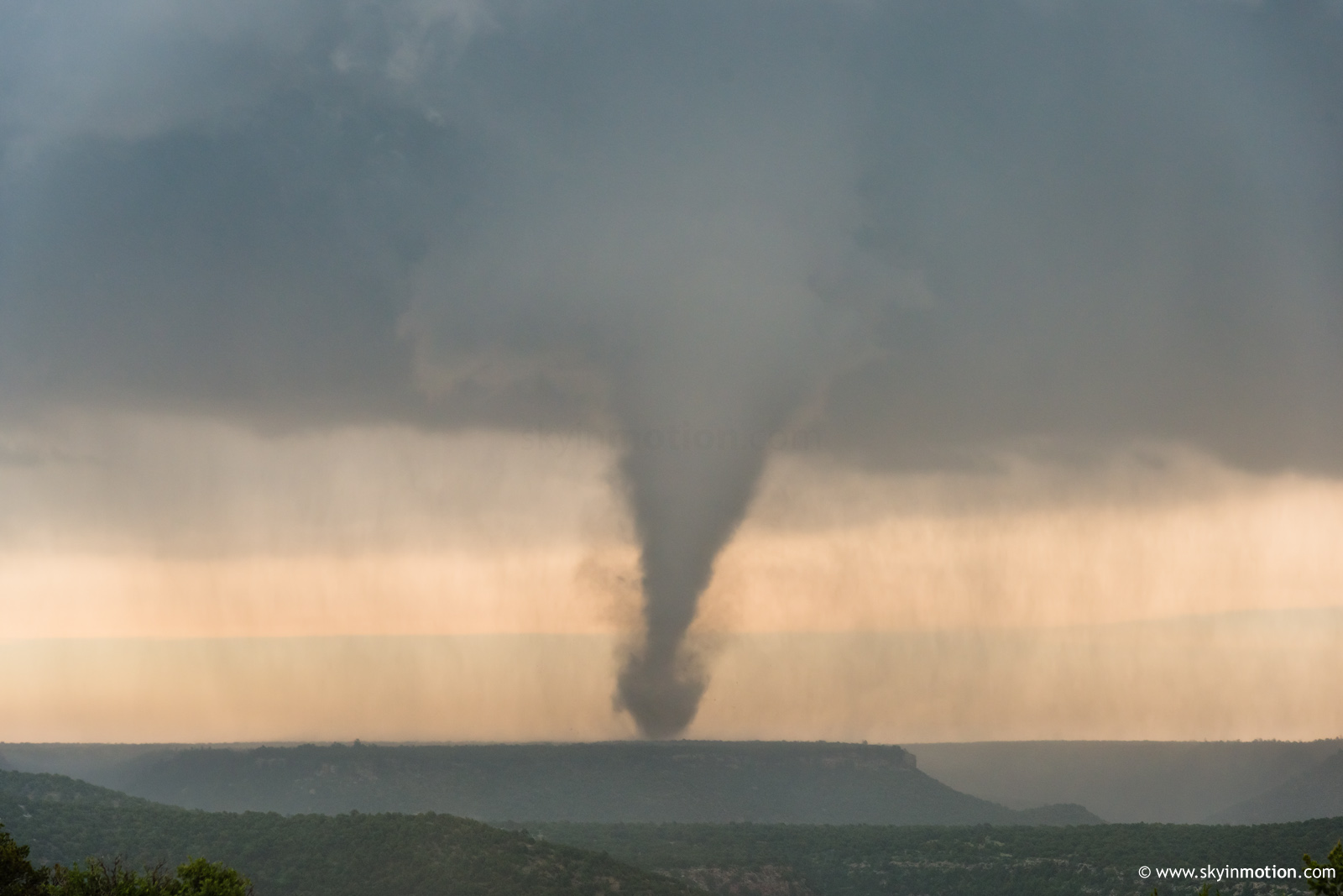
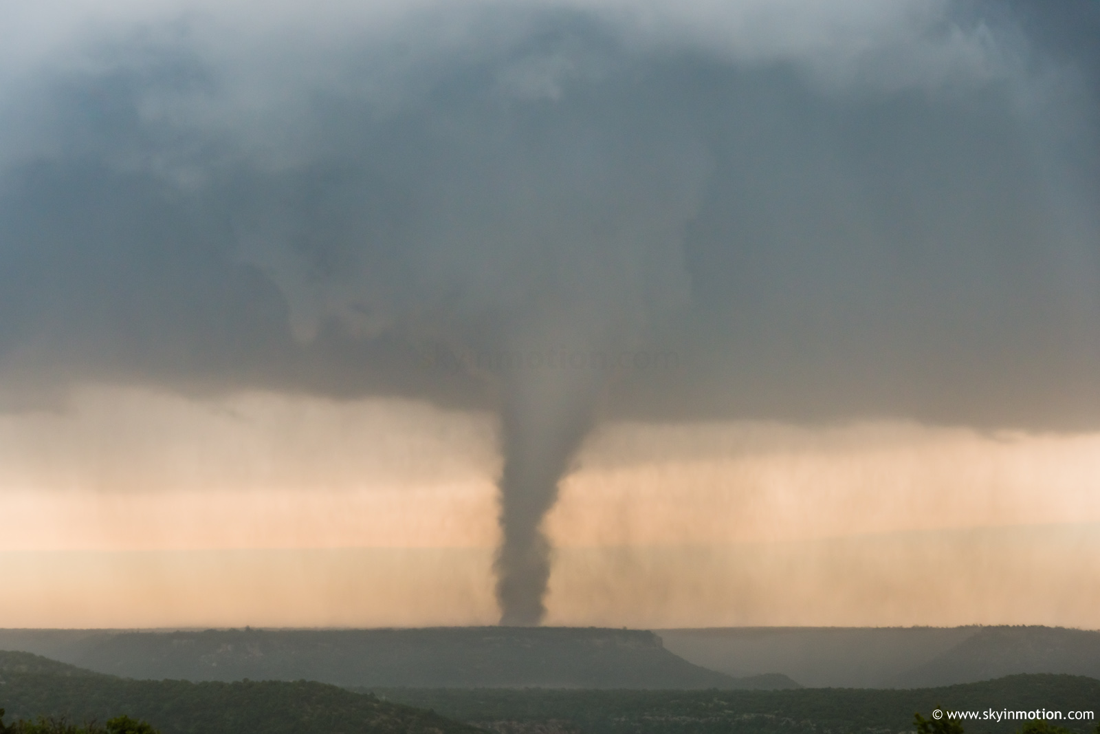
My motive for choosing this poorly-paved back road was little more than impulse, bolstered a bit by hail aversion and the hope of catching dry structure shots for 5 minutes longer than crowds to my N and NE. But you know what they say about broken clocks, and the god of low-skill chasing was unquestionably smiling down upon me on June 12. Right as I reached the E-W segment of NM-67, immediately beyond which the route plummeted into a canyon with no visibility, I was stunned to notice an imposing clear slot wrapping around the RFD a few miles to my NNE. Within seconds, a stout cone was on the ground.
Soon, it descended the escarpment into the scrublands, right down my line of sight from the most fortuitous overlook one could have drawn up at the bend in NM-67. During this timeframe I noticed shockingly strong upward motion, plainly visible even from >5 mi. distant and through considerable precipitation. The complex and steep terrain features underneath the mesocyclone no doubt played some role here, and I even wonder about the role of the escarpment and potential flow channeling on the broader storm dynamics around the time of tornadogenesis. Regardless of such speculation, the upward motion really bordered on violent in appearance at times, not unlike from my view of Wynnewood 2016 from a comparable distance.
For the third time this strange season, I found myself mentally struggling to process what had just happened in the minutes after the increasingly diffuse multi-vortex disappeared into the rainy distance. Half an hour earlier, I was just hoping for the high-based structure to improve enough that I'd capture a few RAW files worthy of looking at before summer. Weirder still, I'd seen no other vehicles for the entire 15-minute duration of this spectacle, nor did I have service to check in on what anyone else was saying or seeing. Another chaser vehicle finally approached right as I was losing visual, and quickly after that golfballs started raining down from an upstream cell I hadn't even noticed, which sent me scurrying back N toward NM-104.
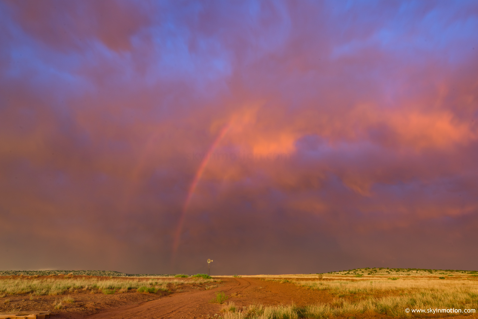
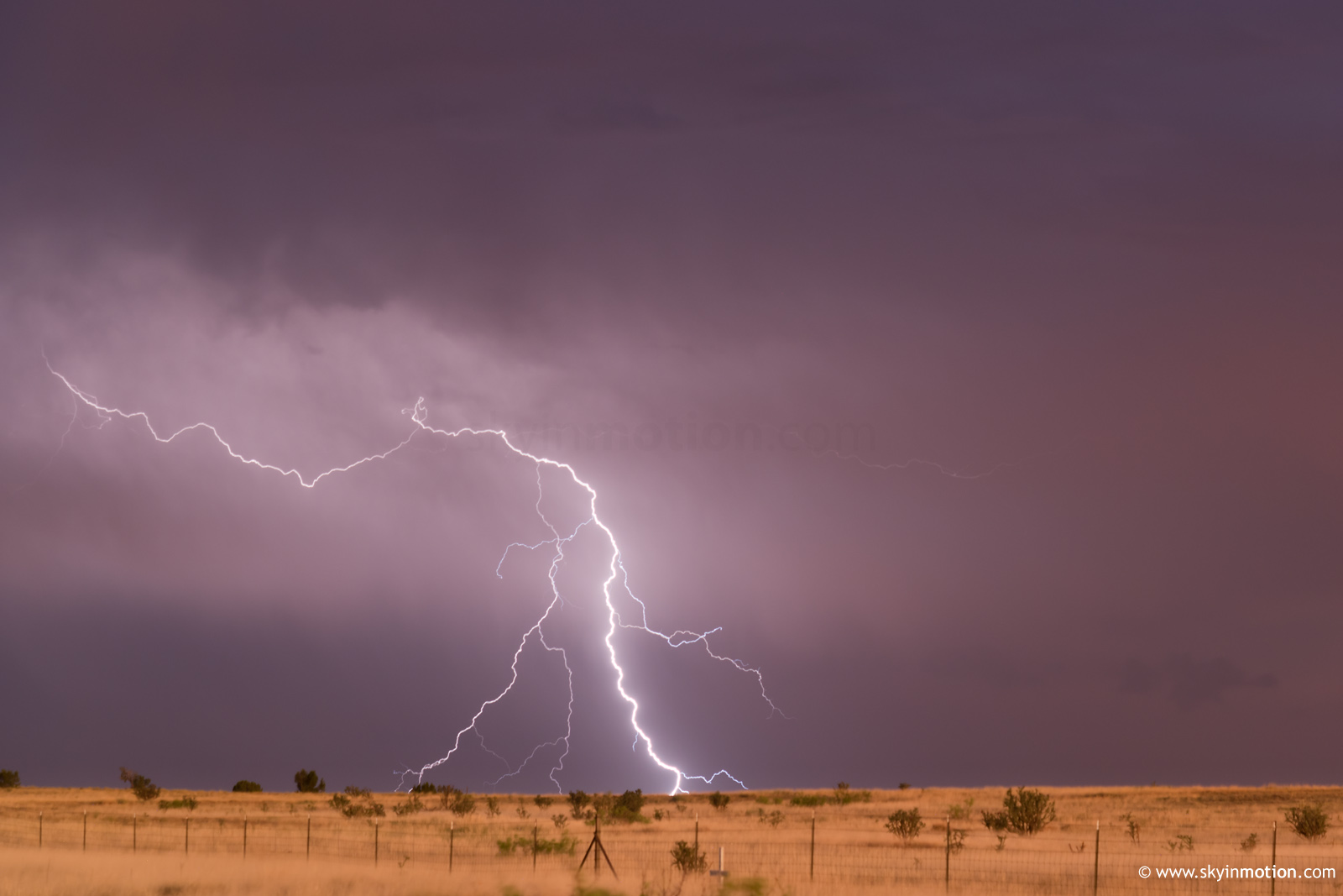
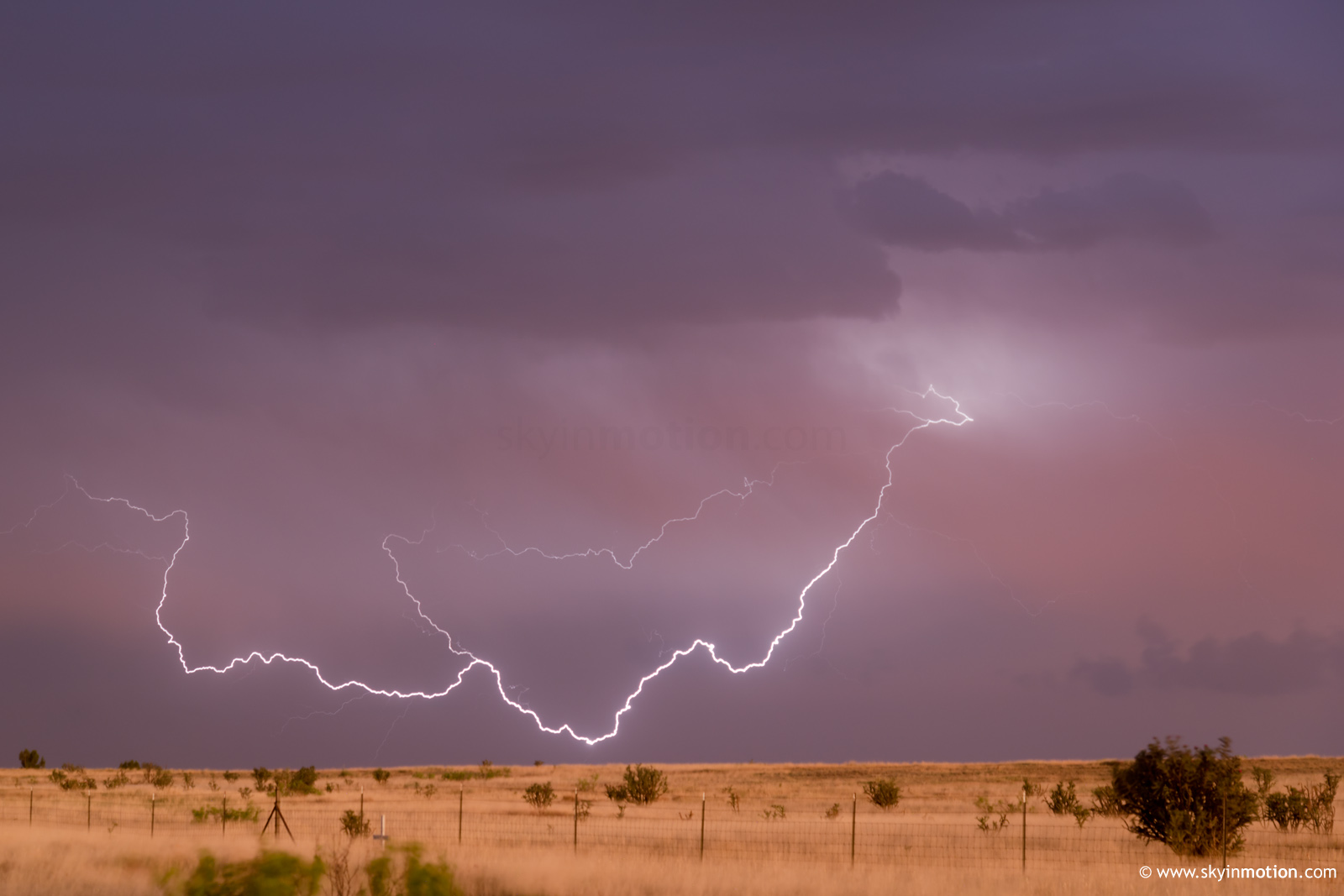
From there until dusk, I struggled and failed to latch onto any of the transient supercells that were popping all over the I-40 corridor to my S. One near Clines Corners looked especially daunting in the distance as I sped toward it, but the cap had its way in short order as I finally got in decent position near Pastura. This naturally led me toward I-40 at Santa Rosa, where a spectacular sunset unfolded -- the best of which I failed to capture because of an ill advised fuel stop.
As twilight faded and the lightning show pushed off to the E, I was ready to grab a room right in Santa Rosa and pore over the footage to make sure I hadn't hallucinated the events of two hours prior. What I quickly discovered is that when traveling the I-40 corridor E of ABQ on a summer weekend, decisiveness is a virtue when considering lodging accommodations: there was absolutely *nothing* available either there or in Tucumcari by 9pm local, no matter how far my standards dropped. I wound up hauling a full two hours E to Vega in the next timezone, where a locally-owned roadside inn was willing to check me in after hours. June 12 ended up being my last successful chase of the season by any measure, with some embarrassingly unproductive hauls to IA and NE KS coming a week or two later. I really don't know anymore how to judge or rank overperforming days, since they're the only ones I've scored on in quite a few years... but it's just about impossible to imagine this one ever getting bumped out of my top 5.