
Low-topped supercells close to home provide another fall chase day, but the expected tornado threat is not realized.
A strong mid-autumn trough was forecast to move into the Plains and induce deep cyclogenesis over western KS, resulting in a substantial severe weather threat due to very strong shear. Much as with early-spring setups, instability would be the limiting factor, with 1000-1500 J/kg SBCAPE appearing to be about the best we could hope for. With timing, moisture, and other factors greatly in question several days before the event, we tried to keep our hopes in check; by Monday (Oct. 15) night, a very strong SPC outlook and incredible 00z suite of model runs sent excitement in Norman through the roof. I quickly laid my doubts aside and joined in the premature celebration, despite some oddities about the setup and the simple fact that mid-October tornado outbreaks are exceedingly rare in central OK (the one exception in recent history, 1998-10-04, got by on the strength of 68-70 F dew points and 2000-3500 J/kg CAPE, which was not going to happen this time).
As Tuesday progressed, the threat for tornadoes appeared on the models to increase to our east over E OK/SW MO/AR. Model depictions of the dryline screaming eastward from the TX PH/OK border all the way east of I-35 during the afternoon hours Wednesday, with low-level flow veering severely, should have been glowing red flags to us as chasers, but the excitement continued on nearly uninhibited. Tuesday night, the SPC 4km WRF and 00z NAM indicated supercells firing along a dryline bulge from near OKC northwestward towards Alva and Medicine Lodge; with the fast storm motions, the obvious target appeared to be the El Reno-Enid-Wichita area to intercept these storms as they reached maturity.
Wednesday morning, low clouds prevailed for several horus after sunrise, but dew points were rising nicely into the 60s and visible satellite showed SW OK clearing out before noon ahead of the dryline. As the clearing approached the I-35 corridor around lunchtime, chaser excitement reached a new high, with some predicting an upgrade to high risk for C OK on the 2000 UTC SPC outlook. A broken line of storms had formed well ahead of the dryline just west of I-35, and quickly shot off to the east into unchaseable terrain, prompting a tornado watch to our east; our focus, of course, remained on the dryline which still lay over W OK.
By 1:30 or so, we were becoming too restless to sit around Norman and wait anymore. The best shear and instability combination was centered over Caddo County, but initiation appeared more likely to occur soon to the north over NW OK. Brandon, Bryan, Brett Wallace and I departed in Brandon's car and headed to El Reno, where we struggled to find wifi. Arriving between 2:00 and 2:30, we could already see several robust storms to our northwest, west, and southwest. When we finally found a weak connection, radar showed that ragged, low-topped supercells had fired in rapid succession from near Vici south-southeastward towards Minco and Chickasha. This matched the 4km WRF scenario well, if not for the storms initiating about three hours too early. Still, I felt encouraged since several hours of insolation had brought temperatures well into the 70s.
With multiple storms rapidly approaching from the west and southwest, I figured our best bet was to quickly get farther north and east so as not to let them overtake and pass us too early. The two best-looking storms were to our southwest and south; the one to the southwest quickly approached El Reno, eventually developing a nice rain-free base that would prove to be the closest thing to tornadic activity we'd see all day. I didn't bother taking any pictures since I figured the action was just getting started (ha) and we were experiencing moderate rain. We drove north on US-81 towards Okarche, still unsure which storm to pursue. As it turned out, we stayed nicely between the El Reno storm (which continued to show some signs of rotation and attempts at wall clouds as it screamed off to the north of us) and the southernmost storm moving over OKC, which most chasers were now pursuing. We stopped just south of Piedmont to take a quick look at the base of the OKC storm to our south-southeast.
Our contact with chasers closer to the storm indicated it was still relatively unimpressive, but we knew it was our only hope, as all the other storms were already to our north and hauling northeast at 50-60 mph. We manuevered north and east to Guthrie, then continued east as the cell (which seemed to be interacting with the one to its north in a negative fashion) passed just to our south and east. Finally, we caught up with the back side near Perkins, where we experienced torrential rain and dime-size hail, which forced us to seek shelter in town. After the hail stopped, we could see that our tail-end-charlie was, like the other storms, rapidly slipping through our fingers due to the ridiculous storm motions. Now only 5:30, it seemed our only option was to begin heading home and hope that something happened farther south along the dryline - it didn't, so we continued home and arrived before 7:00.
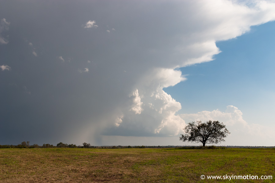
Overall, an extremely frustrating autumn setup gone to waste thanks to the usual culprit - poor instability. Even some chasers who have been in the area for many years have said they've never seen a high-shear/low-CAPE setup work out well in the Southern Plains, so I'm not sure why we get our hopes up time and time again. The worst part was that even with unexpected insolation after noon and temperatures reaching well into the 70s, we still struggled to attain more than 1000 J/kg CAPE. That's fall for you. The result was ragged, low-topped supercells (and I do mean low-topped, with the EL below 300 mb on forecast soundings) that produced little more than marginally severe hail. The dryline surging eastward during the mid-afternoon hours was not helpful, either, forcing storms into nearly-unchaseable terrain only an hour or so after initiation. In fact, as we drove home from Perkins, we could see that the dryline was already east of I-35 by 6:00-6:30! This was even faster than most model forecasts, which, incidentally, many had thought would be too fast with the dryline progression. Neither autumn nor central OK have been too kind to me so far in my young chasing career, so I should have expected no less than this from combining the two!


