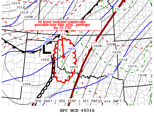
Dryline convection quickly forms a broken line, but an embedded supercell manages to produce a nice funnel cloud in southwest Oklahoma.
I'd been watching March 2 for over a week, as models had been showing a fairly low-amplitude trough moving through the Plains with sufficient but not overpowering dynamics, a welcome respite for this early in the season. The models flipped and flopped wildly over the preceding week, with the ECMWF far more optimistic while the GFS was weaker and faster, with a cold front plowing through the Southern Plains early in the day. Ultimately, the ECMWF won out, and a respectable early-season chase day was had in the heart of Chase Alley.
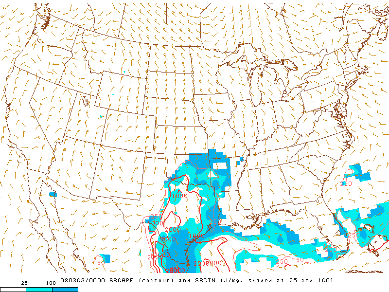
Brandon, Bryan and I left Norman at noon for Lawton, which appeared a good spot to wait for initiation on the dryline farther west. Short-term models had been wildly inconsistent with where and when convection would break out, so we didn't really want to put ourselves in a position to rule out anywhere in the strip of real estate from south of Wichita Falls and Vernon up to I-40 between Elk City and Weatherford. After picking up some lunch in Lawton, we monitored conditions for about half an hour before deciding to head west closer to the dryline, which seemed to be where everyone else was going too. On the drive west on US-62, we broke out of the stratus, with temperatures in the mid to upper 70s and dew points in the mid 50s. I had been pretty iffy about the chance for any decent-looking convection up until this point; we soon started seeing towers growing rapidly to our north, west, and southwest, and I couldn't help but breathe a sigh of relief that after several agnonizing months, real chase-worthy weather had finally retured to the Plains.
I had originally wanted to stop in Synder for its road options, but we continued to Altus upon seeing several storms initiate from Quanah and Vernon up towards Hobart. The most impressive was just west of Altus when we pulled into town, so we jumped north towards Blair to keep ahead of it, then east on OK-19. Once out of its rain, we stopped in northeast Jackson County to watch the slowly-organizing cell approach from the southwest. At this point, it was already apparent both visually and from radar that all the cells going up in this area were going to be close enough to each other to cause problems, but we still liked the one we were on the best since it was the slightest bit ahead of what seemed to be a broken line.
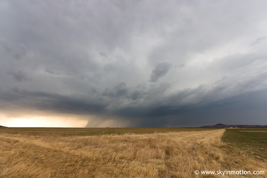
We casually meandered farther north and east on OK-19 towards Roosevelt, comfortably ahead of both the storm we had been following and another to its south (now nearing Altus) that also looked interesting. As we progressed closer to OK-54, a better rain-free base developed, and eventually a small wall cloud appeared. The structure at this point was pretty nice for early March, and gradually improved with time.
Watching radar, our cell, now nearly embedded in a string of competing cells throughout Kiowa and Washita County, seemed less appealing to me, while the one to its south coming out of Altus looked more promising. Brandon didn't want to give up on what we were already on, though, which proved to be a very good thing in the end. The embedded mesocyclone continued to look more and more impressive.
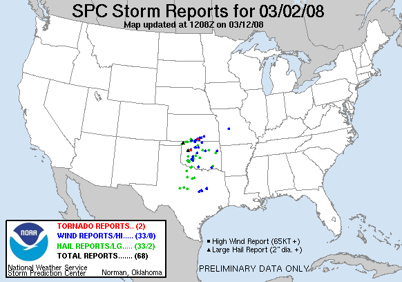
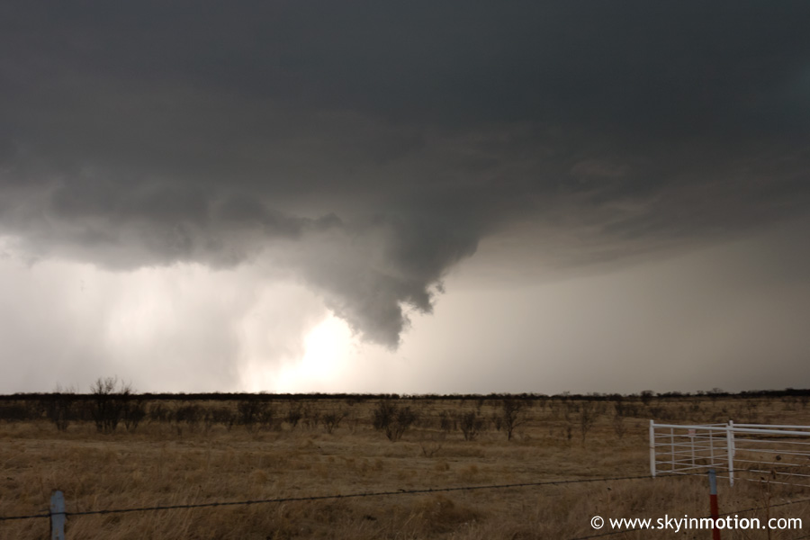
A few minutes after that shot, it began producing another, more formidable wall cloud, so we jumped on OK-54 northbound. Structure continued to improve, though I got no photos for awhile as we continued traveling. As we approached Gotebo, rotation was apparent, and it soon produced a beautiful funnel cloud with rain threatening to wrap around, but staying just to it south. It took me a couple minutes to set up my new tripod, so I missed shots of the funnel and wall cloud at their best, but still got off a few before it quickly dissipated. At the circulation's strongest, the funnel cloud was very visibly rotating and descended 70-80% of the way to the ground. This occurred about 2-4 miles WSW of Gotebo.
As the rain in the RFD overtook us, we flew east to Mountain View with a line of chasers now following. The old meso occluded and quickly fell apart, while a new one appeared to the south of the road, producing another wall cloud and possibly small funnel, but nothing substantial. We took OK-115 north out of town, but were soon overtaken by torrential rain and small hail, with the circulation now out of sight to our northwest. The next 15-20 minutes were full of frustration as we battled the intense precipitation, trying to get east and back ahead of the broken line as quickly as possible. We achived this by taking OK-152 east towards Binger, and stopped a few miles west of that town to head south on OK-146 in preparation to intercept what was now the best-looking circulation in the line around Ft. Cobb. Well, we only made it about a third of the way down before noticing our old circulation beginning to look more impressive again to our WNW, with a new wall cloud taking shape. We continued south, constantly shifting our attention between that and the distant HP structure to our southwest moving towards Ft. Cobb. We never really could make a decision, so we eventually stopped just north of Ft. Cobb and watched both for a few minutes. Finally, we decided the embedded cell to our southwest, while impressive on radar, was too wet to worry about in the waning light, so we backtracked northward. The wall cloud persisted as it approached Binger, but just before we caught up with it, rain wrapped around and effectively ended our chase, as we were now stuck firmly within the squall line with no hope of getting out before dusk.
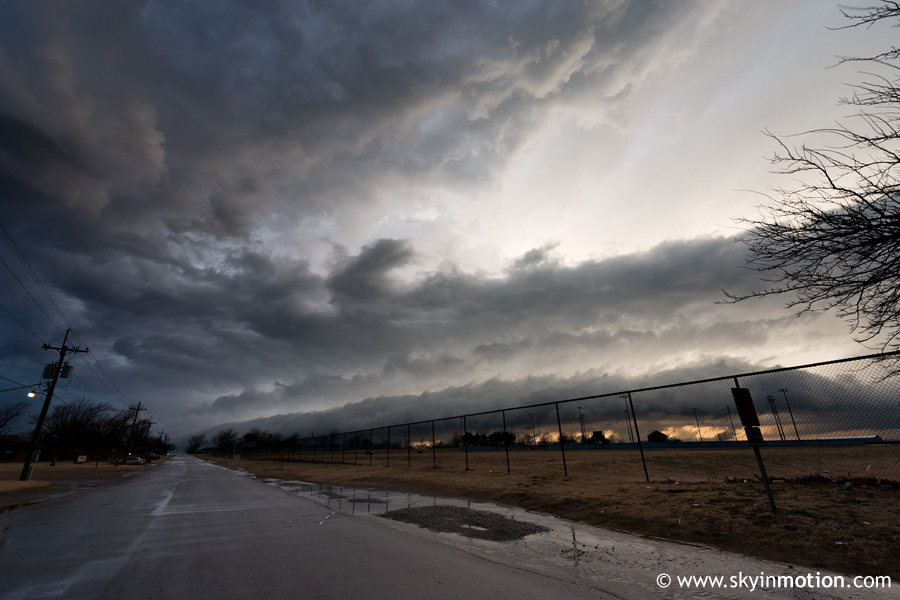
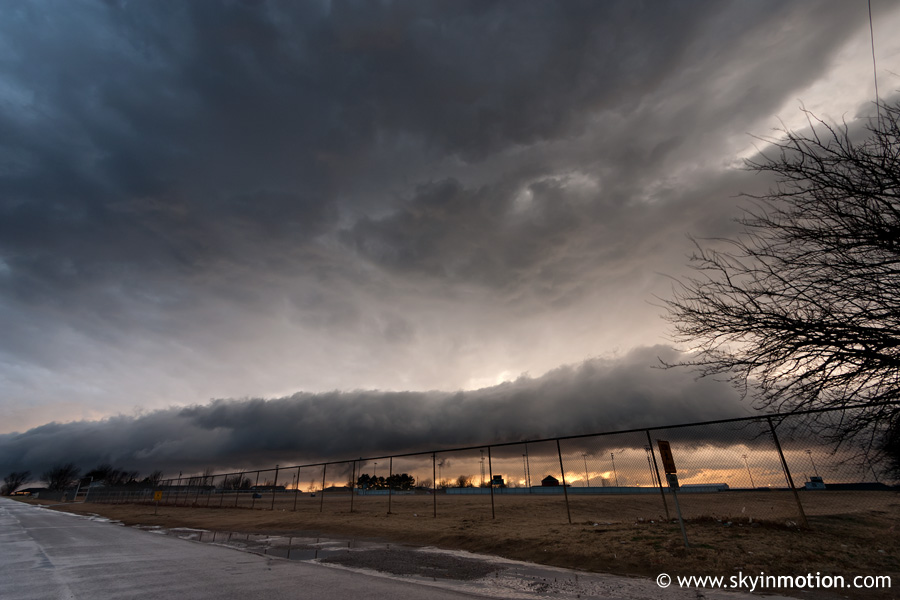
We headed through Binger and up US-281 towards I-40, enduring relentless rain, hail, and wind for awhile. When we finally broke out of the back side of the line near Hinton, we could see some photogenic albeit harmless convection to our north and west along the cold front. We stopped at a gas station in Hinton, and I grabbed a few last pictures while Brandon and Bryan hunted for dinner inside. I particularly liked the shelf cloud that was approaching in the third shot down.
After hopping on the interstate to head home, we went back into the squall line from hell south of Calumet, and noted various lowerings around El Reno where radar indicated more embedded mesos. We didn't make it out until near the Canadian/Oklahoma county line, partially thanks to hordes of bonehead drivers taking up the left lane while going 20 under the limit because of the rain. We arrived home just before 8, at which time a Tornado Warning was issued for Oklahoma City, and we thought we heard some sirens go off. It turned out to be nothing too interesting (there was definitely low-level rotation on the radar, but no funnels or tornadoes have been reported). As the front plowed through a couple hours later, our fantasy of being in the heart of chase season was ripped from underneath us, with temperatures tumbling from near 70 to the 40s in minutes on howling north winds, accompanied by some small hail with storms along the front!