
Half-expecting a cap bust, we're pleasantly surprised to see a couple very photogenic and intense supercells fairly close to home.


Medium-range model forecasts showed a very low-amplitude trough moving through the Southern Plains on March 30. Moisture return was forecast to be quite impressive for so early in the season. Directional shear was outstanding, while speed shear was slightly lacking due to borderline flow in the mid- and upper-levels.
By March 28, everything looked to be in place for a very solid early-season chase day in western Oklahoma. A triple point would set up somewhere between Shamrock and Medicine Lodge, with supercell potential maximized near there and along a warm front extending eastward through N OK. SPC forecasters ominously warned of analogs to "cluster tornado outbreaks." However, initiation was not a certainty, particularly prior to sunset. This concern was highlighted when the 00z model runs Saturday evening (March 29) largely failed to break out precipitation anywhere in the warm sector, including both the NSSL and SPC variants of the 4km WRF. Given those models' good performance throughout the 2007 chase season, I went to bed quite doubtful that this system's potential would be realized.
Sunday morning, RUC runs depicted higher CAPE, and precipitation output that restored a bit of confidence in the possibility of dryline initiation. Surface dew points over 60 deg. F were already streaming into much of Oklahoma, eliminating the most common flaw in setups this early in the season. However, a decent cap and the possibility of subsidence coinciding with maximum heating still made this chase a gamble, albeit one most Normanites (and even some out-of-staters) were willing to take given the location.
Brandon, Bryan and I departed after lunch, still unsure whether to play the triple-point in NW OK or the dryline farther south. We headed west on I-40, monitoring surface observations that showed the most backed winds in the Watonga-Enid area. However, instability was maximized over SW OK, just ahead of the dryline. We stopped in Weatherford and waited for over an hour, hedging out bets between the two potential areas of initiation. By the 2:00 hour, towering Cu were clearly visible to our W and SW. They would go up and come down in a matter of minutes, but showed an upward trend with time. A bit after 3pm, the largest tower to our SW seemed to reach a height that was beyond the "point of no return," so to speak, and corresponding echoes quickly appeared on radar over Greer Co.
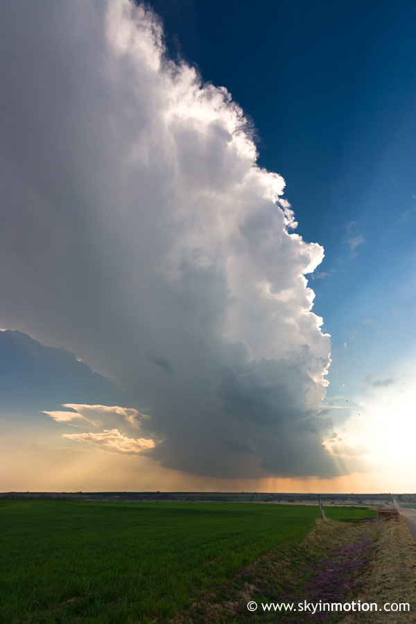
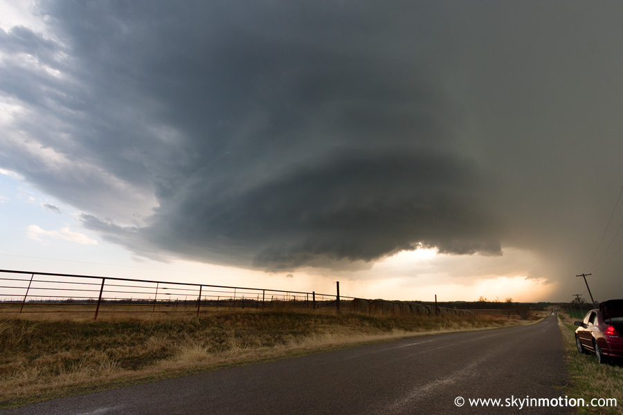
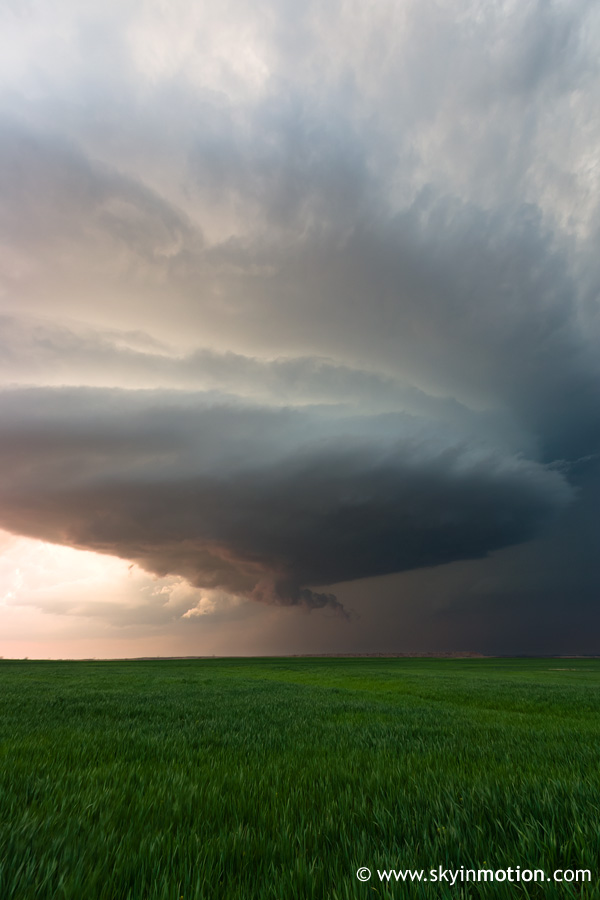
Realizing that the biggest question mark of the day - intiation - was no longer a concern, we raced to meet up with this cell as quickly as possible, even as an additional cell fired rapidly to the north along the dryline in Custer Co. Given the exceptional directional shear, a very quick evolution to impressive supercell structure was likely, at minimum. Sure enough, after dropping a short ways south on OK-54 and heading a few miles west on OK-69, the base of a gorgeous, slender updraft was sitting about 10 miles to our SW, with top of the strongly-tilted storm directly overhead.
After a few minutes of marveling at this scene, we continued SW towards Cordell. We arrived just in time to avoid large hail that passed north of town, and stopped west of the historic downtown area to watch as the laminar base drifted by in the unseasonably weak mid-level flow.
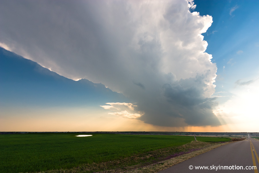
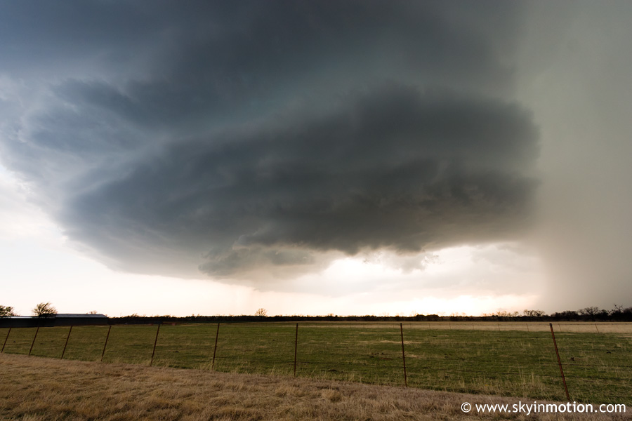
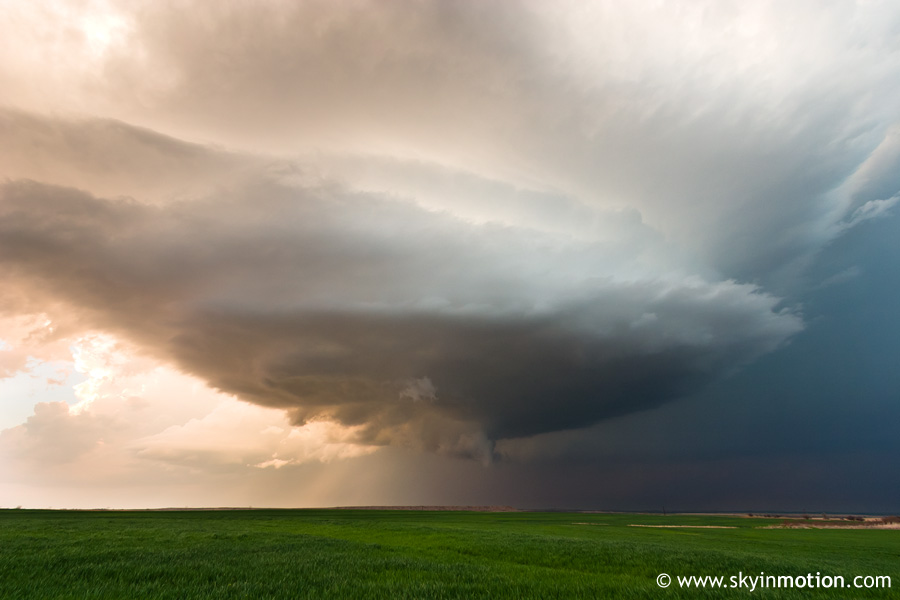
As luck would have it, we had a bad cell signal here, so we were oblivious to another rapidly strengthening supercell to our SW in Greer Co. After 15 minutes or so, we finally decided to proceed west on OK-152 until we could get a radar update; when we did, we saw a TVS on this new storm. Meanwhile, our storm was now a bit northeast of Cordell and lacked even a wall cloud, nevermind any signs of immediate tornado potential. So we hauled SW again, beating the southwesternmost storm to Sentinel by only a few minutes. For all its glory on radar, this supercell hardly looked any closer to producing a tornado than the first one, but structurally it was something to behold.
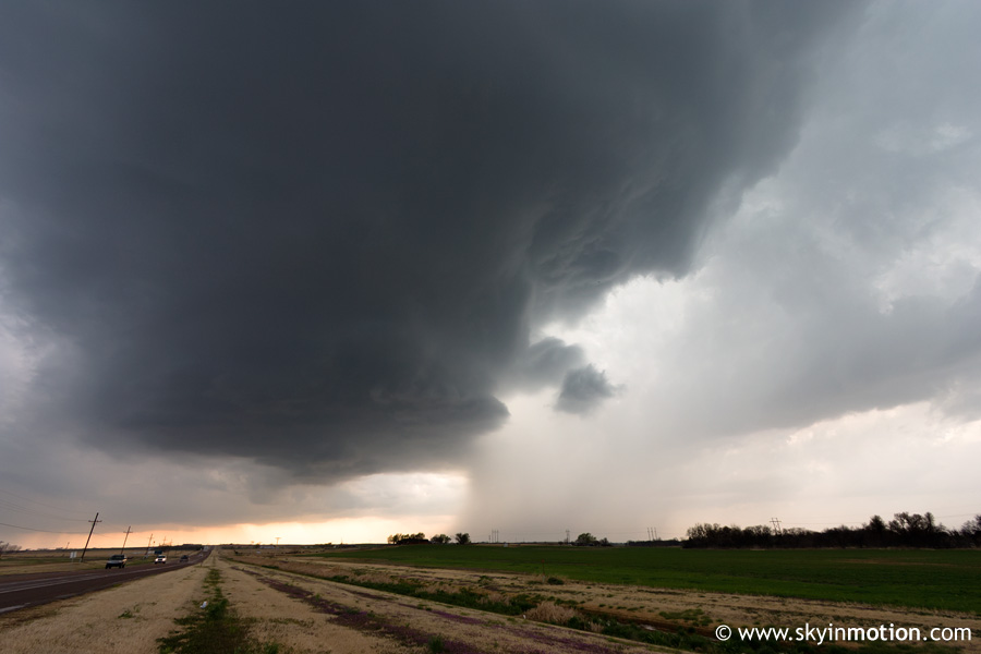
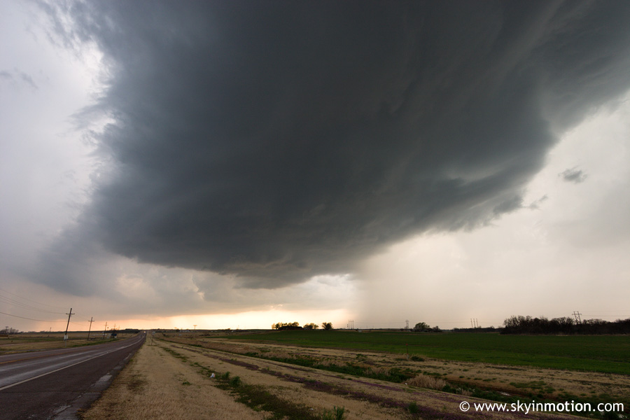
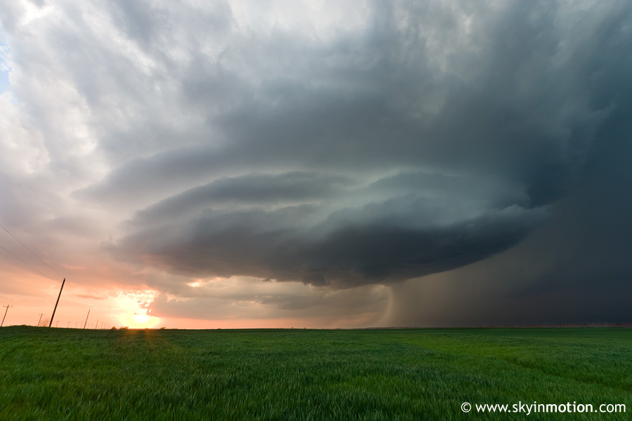
Right about now, the advantages of 20-25 kt. storm motions were really showing themselves. From our position just S of Sentinel, there were no paved roads to follow the storm E anywhere nearby, so we took our chances on some classic western Oklahoma stretches of red clay that the pickup-driving locals call "roads." Slow going. After a harrowing ride, we made it to the US-183/OK-9 intersection just north of Hobart, and were able to continue E on OK-9 at a more reasonable pace. Unfortunately, the sun was now peeking below the storm base, signaling under an hour until complete darkness. Looking back to our NW from near Gotebo, the supercell now appeared benign with its slightly high base and lack of lowerings, yet awe-inspiring in structure and coloration.
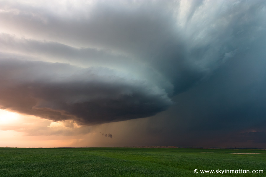
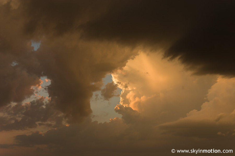
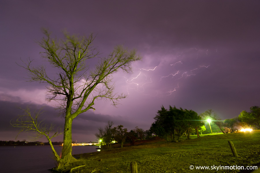
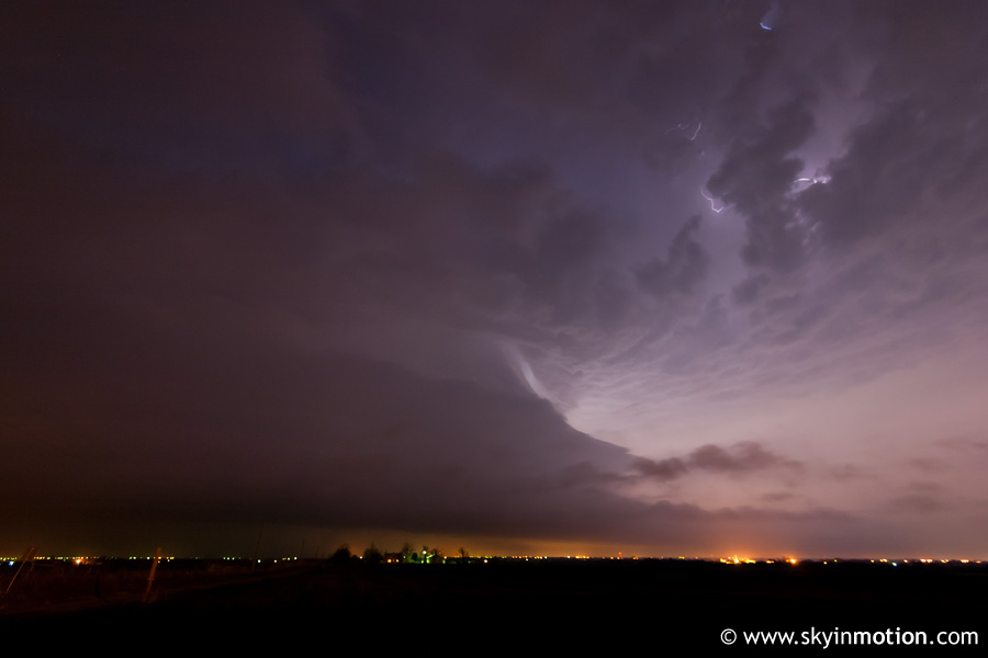
It wasn't long before twilight was upon us, and by this point the storm we'd intercepted at Cordell hours earlier was looking increasingly chase-worthy as it approached I-40 in Canadian Co. Our dilemma now was whether to stick with the Sentinel-Gotebo storm - in which case road options would require at least a brief foray into the core to stay in position - or blast east and north towards the interstate. Again hedging our bets, we took OK-152 east towards Binger to leave both options open. The excellent lightning-illuminated structure visible to our SW, plus a brief encounter with quarter-size hail being ejected ahead of the main precipitation core of the Gotebo storm, kicked off what would become an adrenaline-filled nighttime segment of the chase.
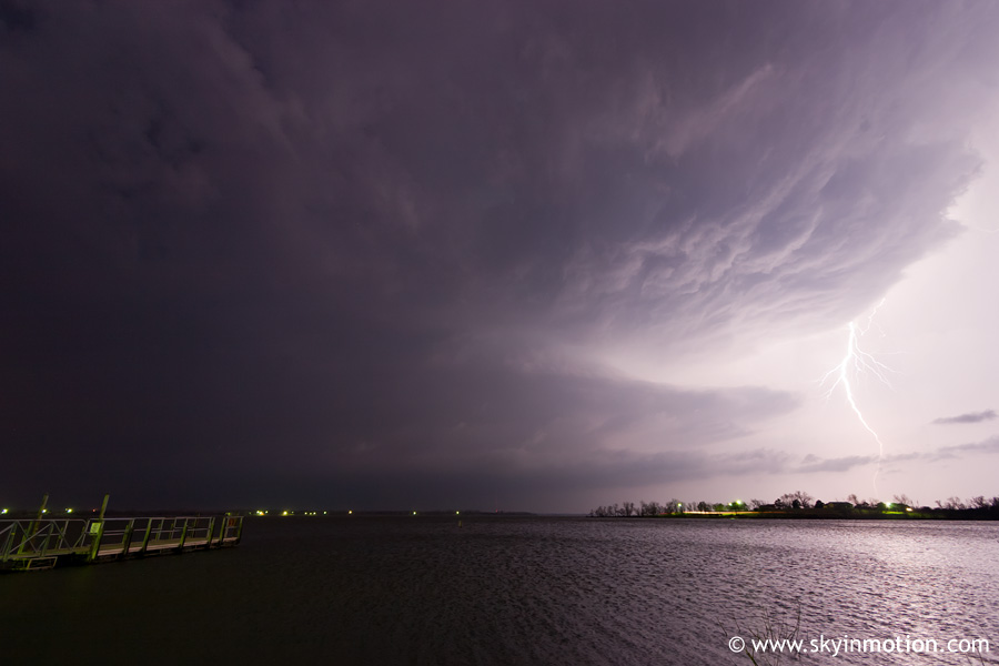
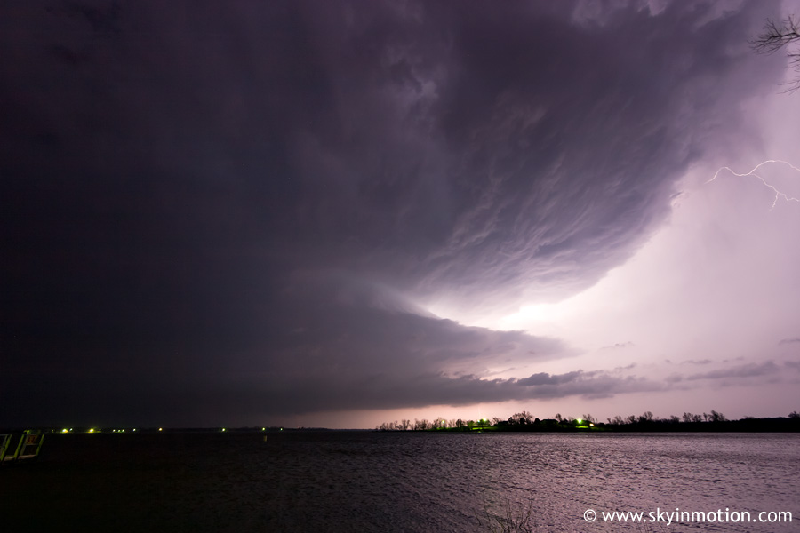
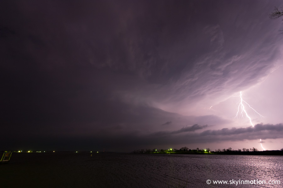
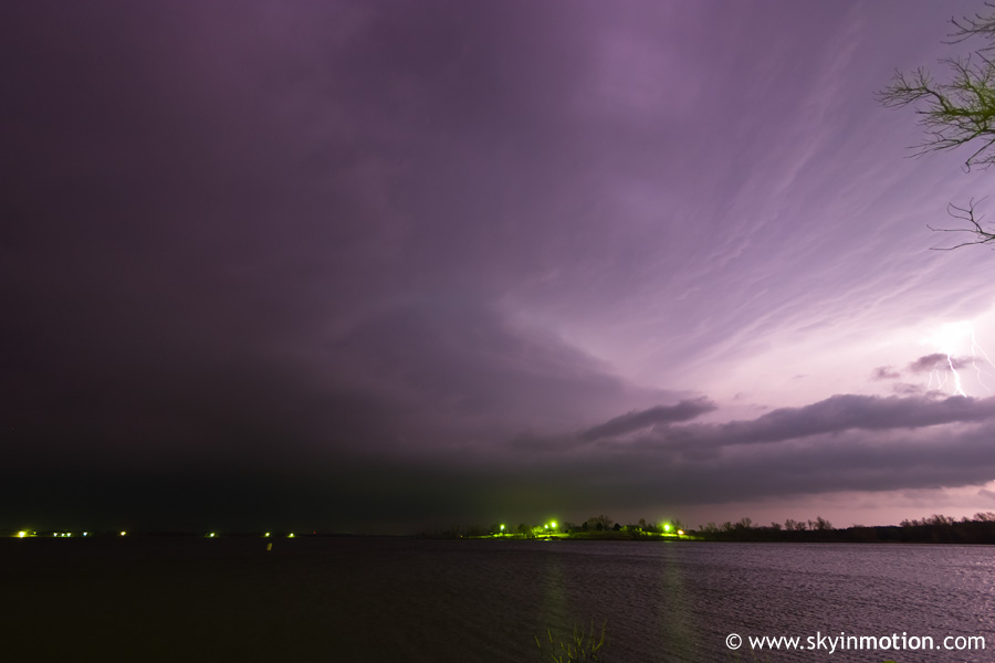
As we continued E, it became apparent that our best bet was to stick with the tail end storm to our S. We dropped S on OK-146 towards Ft. Cobb, traversing the same frustratingly forested terrain (for this part of OK) we'd encountered on March 2. Thankfully, it dawned on us quickly that the large Ft. Cobb Reservoir just NW of town would offer a perfect view as the supercell moved in from the WSW. We found a dock in Ft. Cobb State Park and enjoyed a crystal-clear view over the water, allowing me to snag several good shots of the monstrous structure, now accompanied by continuous lightning and roaring inflow.
Eventually, the base passed just to our N along OK-146, and we edged northward. The storm was now tornado-warned, and between the visible structure and velocity data on radar, we half-expected to see something big on the ground right in front of us. However, that was not to be. As our storm continued ENE, another to our NW near Hinton took on a more southeasterly trajectory, soon resulting in a storm merger. The product appeared on radar to be an MCV encompassing the better part of Canadian Co., with the typical broad yet intense couplet on velocity and very large inflow notch. Since it was heading directly into the metro area anyway, we followed this monstrosity further E and experienced fairly insane inflow as we paralleled it to its S, with sustained winds easily over 40 mph. With midnight approaching, we finally stopped near Tuttle for a parting view.
With the area of rotation now making a beeline for downtown OKC, it was time to call off the chase, but the storms were far from over. The "MCV" remained tornado-warned as it passed over the city, but we figured it was purely precautionary. Not so: as it lifted northward, it rapidly developed a massive hook over Edmond, where a tornado touched down and did moderate damage during the 1am hour. Though the tornado threat did not pan out during the chase thanks to lackluster low-level wind speeds, the structure on the Sentinel-Gotebo-Binger cell was some of the best I'd seen, a fact made even more impressive by the calendar date.


