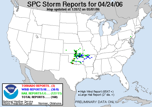
Amazingly good luck lands us on a tornadic supercell near El Reno, OK.
Observed 2 tornadoes.
This should easily be the longest chase summary of 2006, since it's the only day things seemed to fall into place for a great chase day! In hindsight, it's pretty remarkable how things unfolded on this date when you consider what an awful season it was otherwise. Not only did I witness my first tornadic supercell, but it was also less than an hour away from Norman, within the area of Central Oklahoma that hasn't been able to buy significant supercells for much of this decade, it seems.
Though I still knew very little about severe weather forecasting at the time, I was fairly excited to see a moderate risk on the late-morning SPC outlook. This would be the third moderate risk chase day for me, but this time, the target area was west of I-35, which promised much better terrain and viewing conditions than March 30 or April 6. Rather than allow another afternoon class to impede chasing, I skipped my afternoon physics class and departed Norman by 2:30 in my car with Kristina and Bryan Salsieder. We cluelessly meandered up into OKC and then northwest to Okarche, knowing that several other chasers from OU had targeted Kingfisher and were probably camped out there. However, we soon saw storms firing to our north near Enid, and blasted north through Kingfisher to Hennessey, where we stopped to check wifi since we still hadn't caught up to them. Although that activity had some high reflectivity on radar, we were advised by a nowcaster back in Norman that it was elevated and not worth following northward into Kansas. We also got in touch with Brandon, who was back in Kingfisher with several experienced chasers, so we decided to meet up with them.
The concept of patience while chasing, which I still struggle with, certainly hadn't hit me at this point; so I quickly grew restless in Kingfisher, where everyone was hanging out in a gas station parking lot shooting the breeze. Thank goodness for their wisdom, though, since the real potential for the day, unbeknownst to me, lay along the dryline advancing through western Oklahoma. Around 4:30, we headed a few miles outside of town to watch the towers going up, hoping to spot anything breaking through the cap ahead of time.
Well, we stood around on this dirt road outside Kingfisher long enough. It wasn't until about 6:00 that initiation occurred along the dryline, initially well to our southwest in SW OK. Additional supercells quickly fired northward along the dryline into Grady County, and by 6:45 or so, after some debate, the group decided to give up hope on initiation in the slightly more sheared environment north of I-40 and blast south on US-81. Now part of a six-car caravan, I followed them down, utterly oblivious of the conditions around us beyond the fact that we were pursuing something that had developed to our south. It was somewhat surprising that dark clouds and lightning quickly faced us driving south out of Kingfisher, and nickel-size hail began falling near Okarche. As it turns out, a new supercell was developing over western Canadian County (north of the activity we were pursuing), and we were now immediately ahead of it.
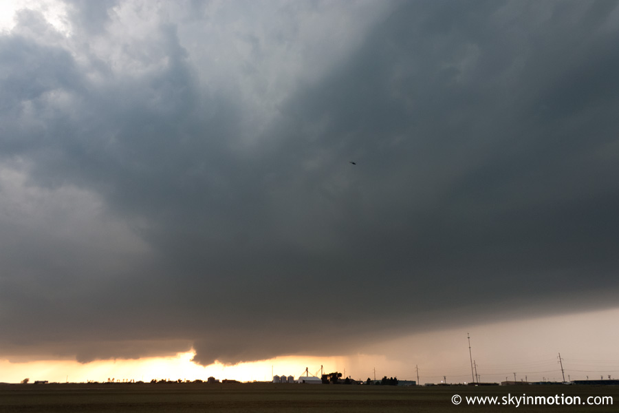
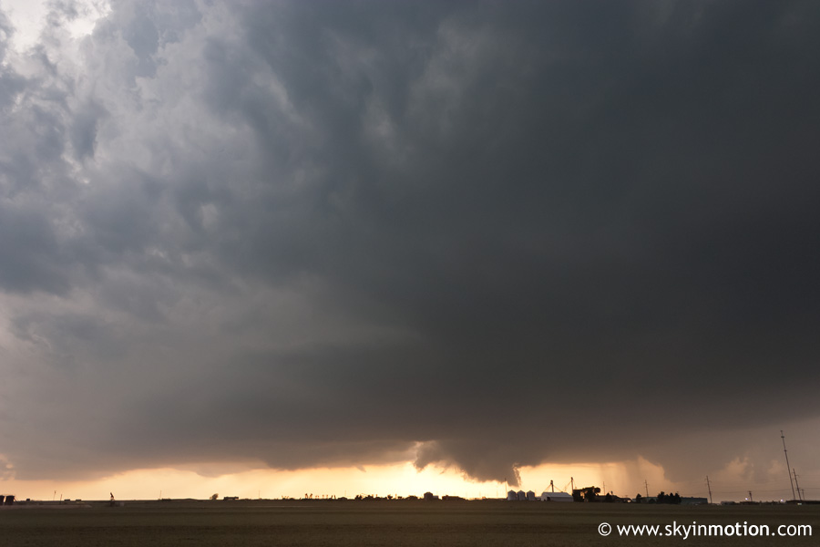
Heavy precipitation continued until we reached El Reno, where we got just south of town (near the I-40 exit for US-81) for a better look at the base of the maturing storm. At first, to my untrained eye, it looked like a fairly ordinary strong to severe storm: dark clouds, abundant lightning, but nothing too captivating. The graduate students we were following, however, quickly grew excited and decided to stay put and watch this storm approach rather than continue southwards to the more mature cells (which were still not producing tornadoes). Sure enough, by around 7:15, a wall cloud began taking shape just behind the precipitation core.
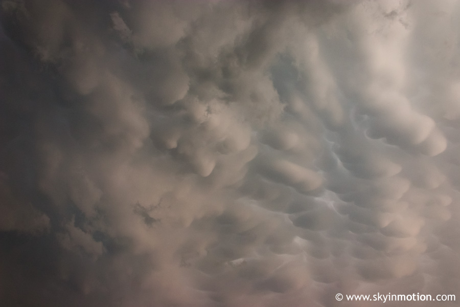
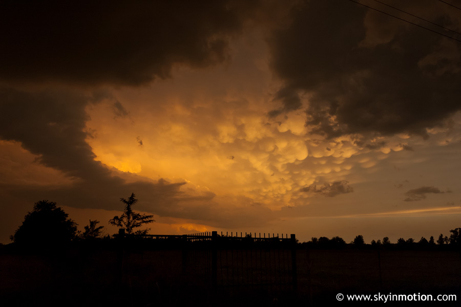
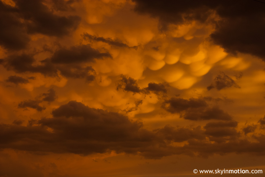
Meanwhile, an incredible mammatus display was taking shape right over our heads on the rapidly expanding anvil of the storm.
The wall cloud steadily became more defined, and rotation soon became visually apparent.
I think it was around this time one of the grad students declared that tornadogenesis was "inevitable" judging by the appearance of the wall cloud. I was excited, but not overly so, because I never really believed I would see one so soon in my career at OU. After all, this was only my third chase, and I was still naive enough to be blown away (no pun intended) by supercell structure and large hail; I didn't even need a tornado to be satisfied with this day, and I felt undeserving considering I was leeching off people who had put real work into picking a target and getting us in the right spot. But regardless of merit, my doubts were about to be silenced.
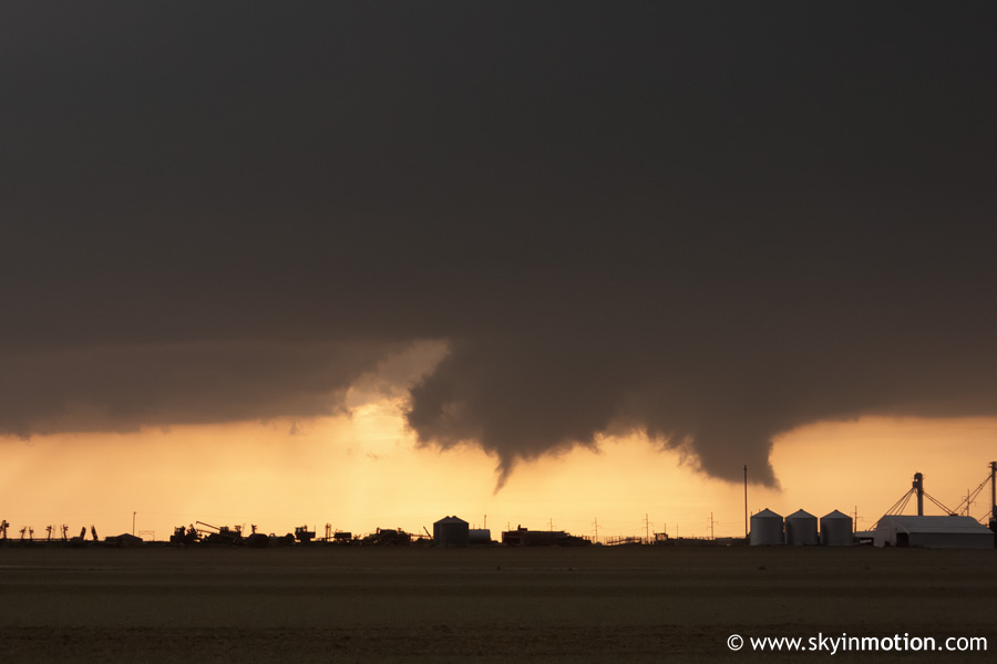
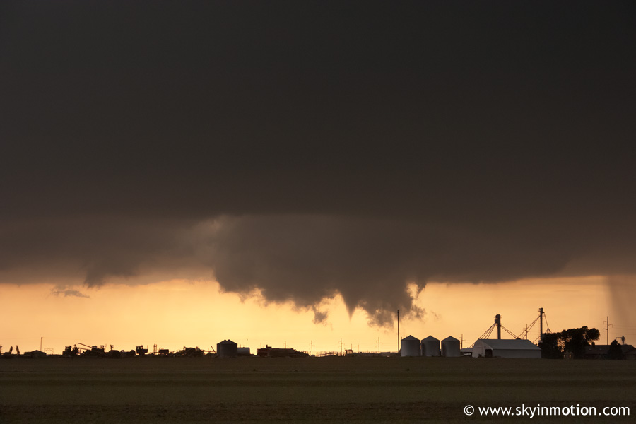
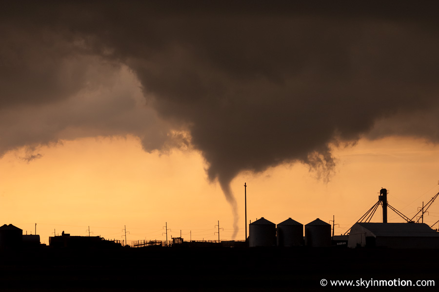
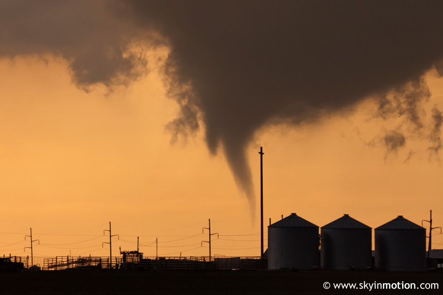
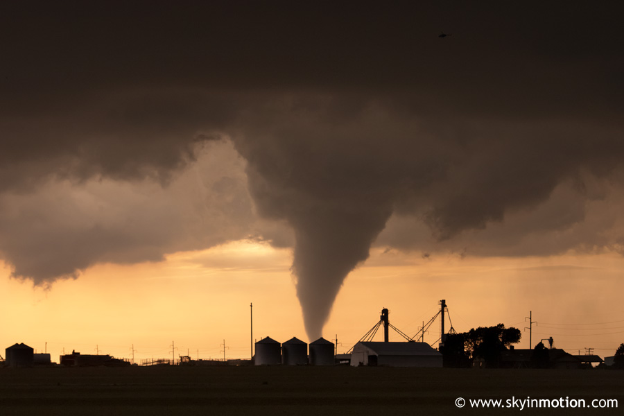
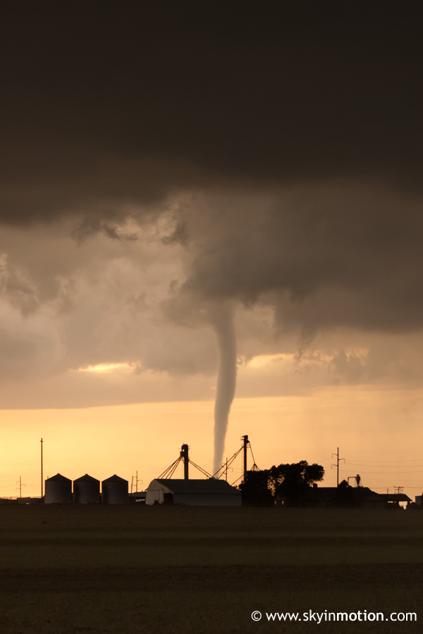
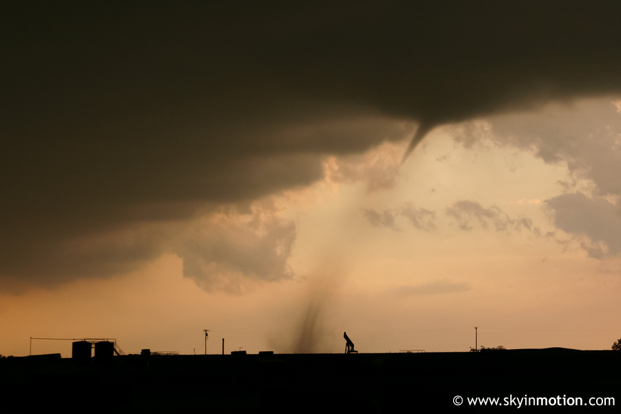
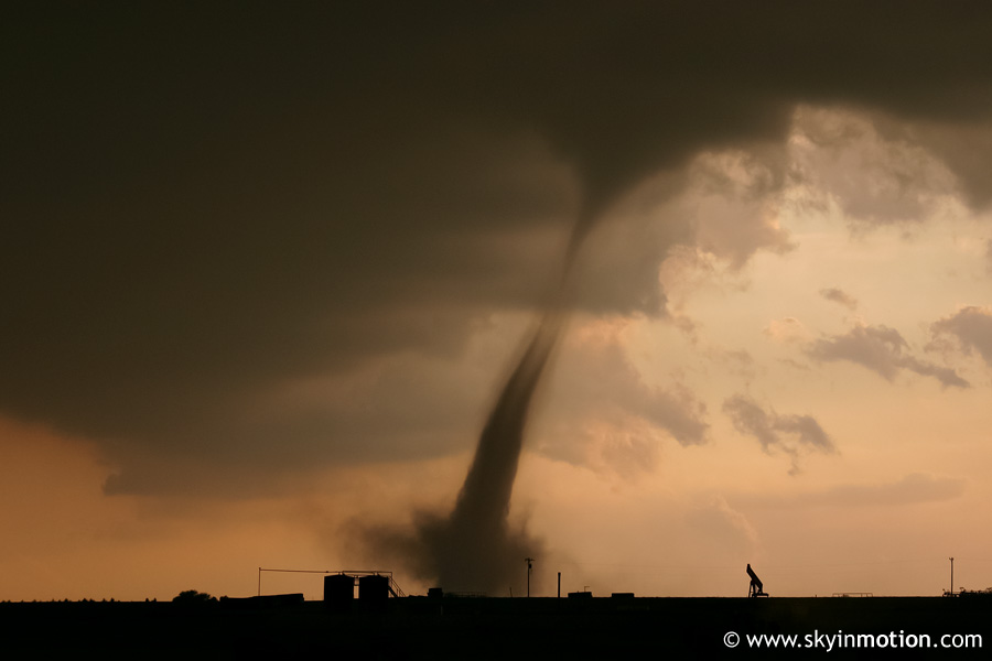
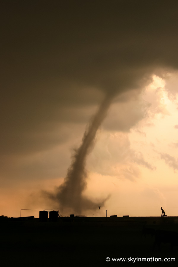
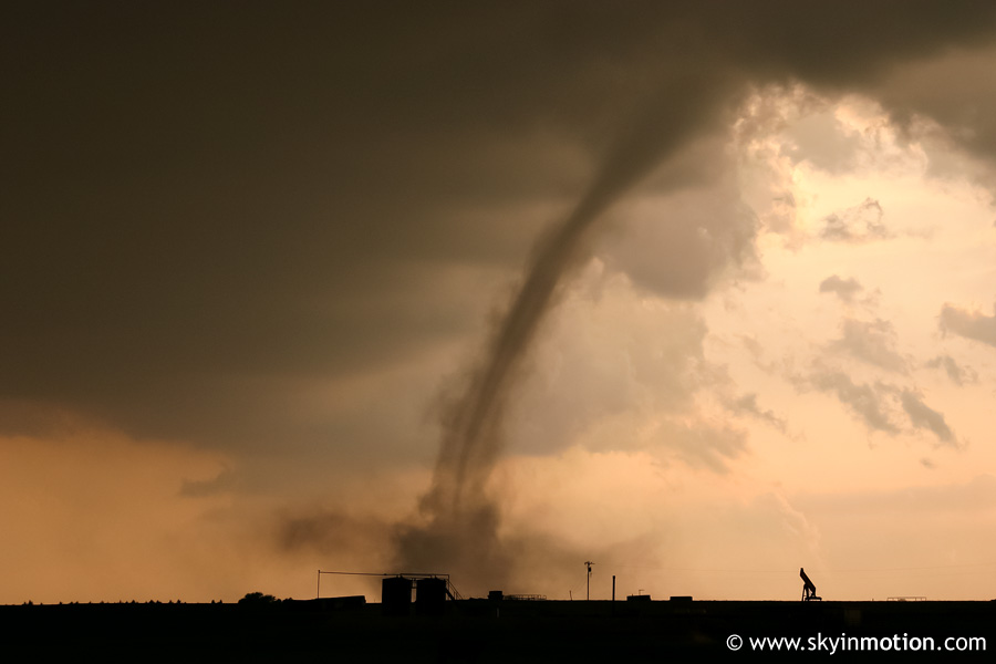
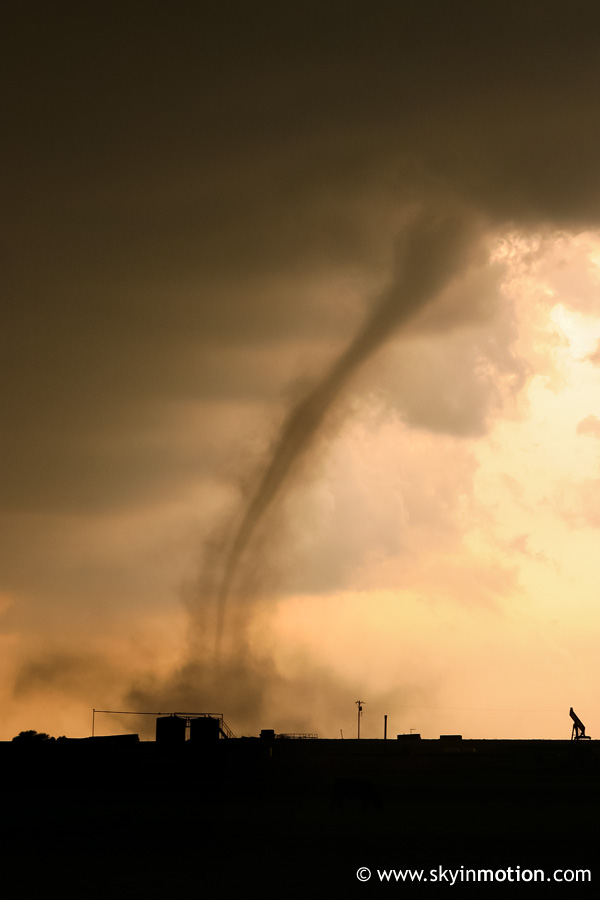
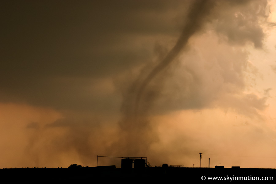
For several minutes, the low wall cloud, which extended down from what was now a very visible mesocyclone (although the backlighting makes it difficult to see in the photos), kept trying to produce funnel clouds. At approximately 7:27 PM, a tornado touched down about 6-7 miles west of our position (just south of I-40 on US-81).
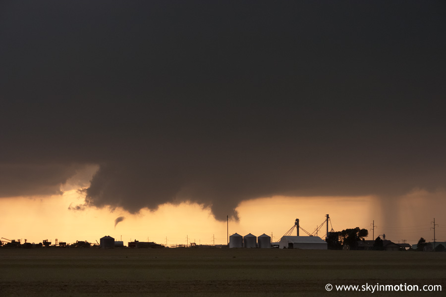
Though I was too excited and preoccuppied with photography at the time to pay much attention to details, video I later viewed of the tornado showed some pretty impressive rising motion with this vortex. However, it moved over open fields SW of El Reno for the duration of its 10-15 min. lifespan, resulting in an F-0 rating. Our position offered a photogenic backlit view, but if we had known it would dissipate before making much eastward progress, we might have attempted to get a little closer; needless to say, I was too ecstatic to be seeing it at all to care much about getting right up next to it.
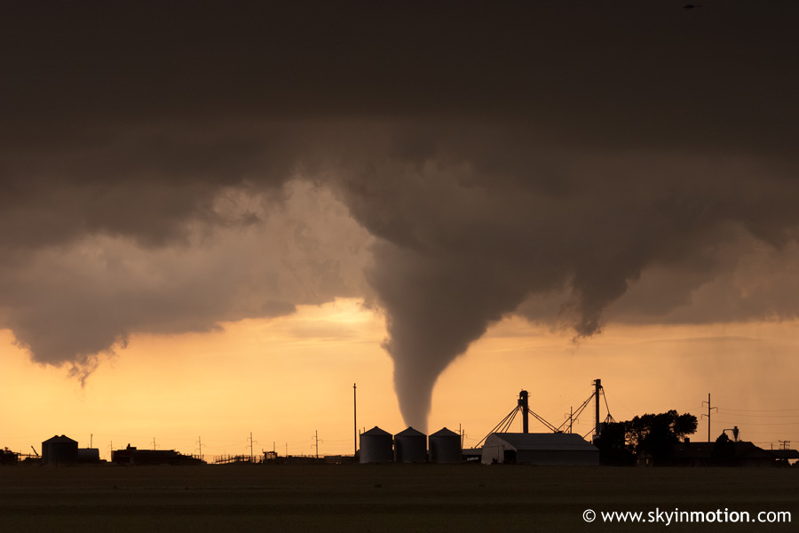
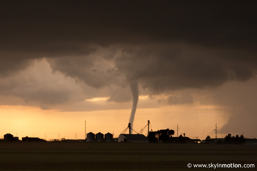
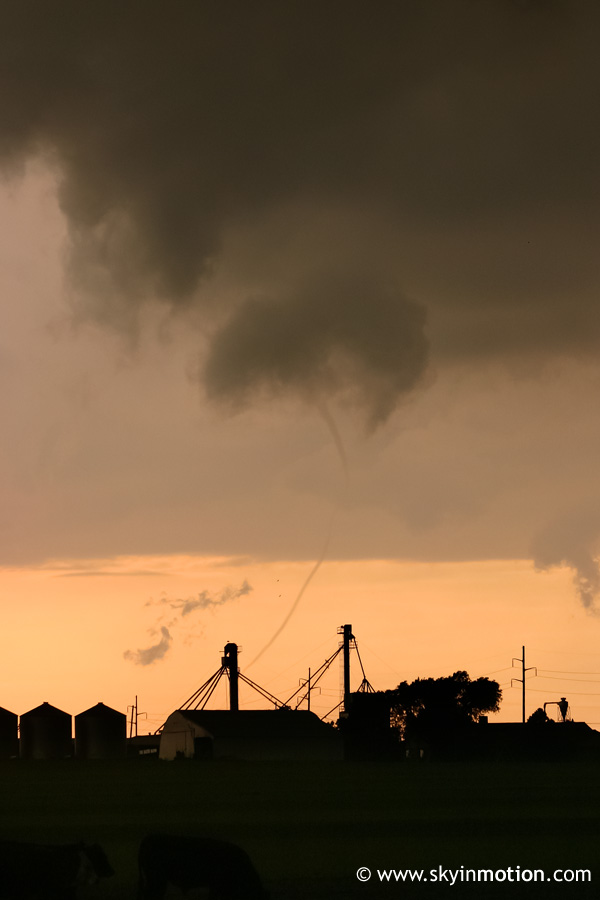
Incredibly, just as the tornado was waning from its maximum width, someone shouted something about a new tornado to its left. I looked over to see a funnel only a few miles south of the original tornado, disconnected from a small debris cloud on the ground.
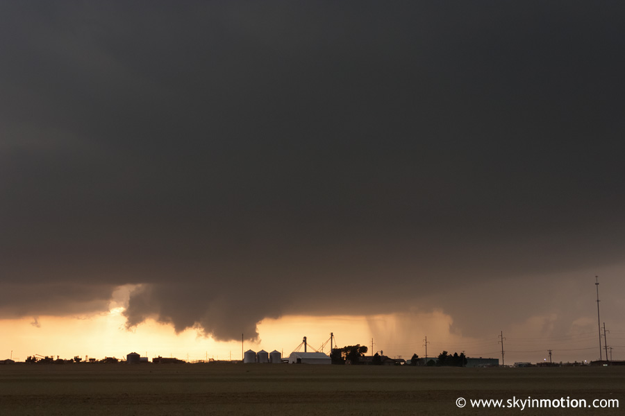
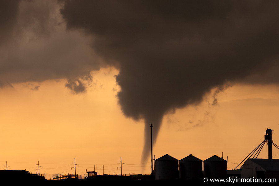
At first, the new tornado seemed comparitavely unimpressive, so I quickly turned my attention back to the first tornado, which was roping out beautifully near I-40 just west of El Reno.
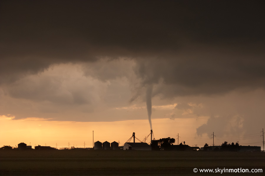
When I looked back at the new twister, its condensation funnel was now almost completely filled in from cloud to ground, and it was churning up an impressive amount of dirt. The grad students noted that it was rotating anticyclonically (clockwise); sure enough, the rotation in front of us was from right to left, the opposite of most tornadoes in the Northern Hemisphere.
Though this second, anticyclonic tornado was on the ground for only five minutes or so, it managed to strike hangars and aircraft at the El Reno Municipal Airport, inflicting moderate damage. It was rated F-1 by the NWS based upon this damage. From our vantage point 5-6 miles to the east, we were unaware at the time that it had affected any structures.
As the second tornado dissipated, we flew east towards Yukon on backroads, hoping to catch up with storm's mesocyclone (the anticyclonic tornado had formed south of the meso, as is common when they occur). We ended up barely within the core on several occasions, experiencing up to quarter-size hail, though we fortunately avoided the much larger, destructive hail that was reported mere miles to our north. The supercell quickly transitioned to HP characteristics, and I suspect its close proximity to the other storms which continued to fire all along the dryline didn't help either. We eventually called off the case near Yukon, but were treated to another spectacular mammatus show emenating from the cell to our south as the sun set.
Overall, this was a delightful exception to the generally dismal 2006 spring chasing season, and I couldn't have been more fortunate to see two tornadoes with one storm during my first spring at OU - and it didn't even require a marathon drive! Special thanks to everyone we followed this day (Gabe Garfield, Jeff Snyder, and others) for giving us a much-needed helping hand.