After a depressing afternoon cap bust, explosive supercells develop just SW of Norman at dusk with large hail and awesome structure.
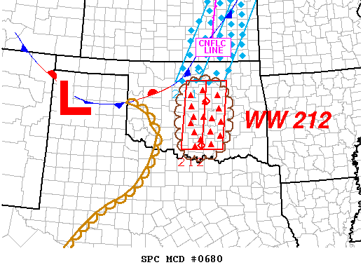
The first true high-CAPE setup of the year was compromised by lackluster wind fields, particularly in the low-levels. Short-range models forecasted a triple point to set up in W OK, with the severe threat maximized just to its east and south. Significant moisture return would yield 3000-4000 J/kg SBCAPE over a large swath of OK into NW TX. The night before, the NAM, GFS, and 4km WRF seemed to agree that the dryline would be located somewhere in W OK - perhaps as far west as the TX Panhandle border, or as far east as a Wichita Falls to Watonga line. But when I woke up the next morning, the RUC was adamant, run after run, that the dryline would blast east during the late morning and early afternoon hours, shifting the threat towards the I-35 corridor. This is never a good place for storms to initiate, since it means within an hour they will move off into the unchaseable woods to the east. Nonetheless, despite some concerns over whether initiation would occur, a decent chase day was expected.
I went to all my morning classes, since early initiation was not expected. Unfortunately, this turned out to be all too true: by around 4 PM, there was still little more than a modest Cu field in south-central OK. Brandon, Bryan and I drove down to Pauls Valley, thinking it couldn't be too much longer before the cap broke. After sitting around for half an hour and watching the Cu field subside even more, we thought again, and went straight back to Norman. For whatever reason, when I start seeing 3500 and 4000 J/kg CAPE, I get this idea that initiation is simply inevitable; that such instability cannot possibly be "wasted." This isn't the first time I've been proved wrong on that front.
I was almost too disgusted once we got back to keep watching radar and satellite trends, but my compulsive side wouldn't let me ignore it completely. Around 6:00 PM, I went outside and had a look to the SW, where radar showed two mesoscale boundaries in the process of colliding over McClain County. I saw a couple nice towers out that way, and thought "what a waste." Of course, I was right back outside 5 minutes later to check again, and this time I had a much different reaction: the tower to the SSW was going up like a mushroom cloud, with an anvil already spreading out atop the Cb less than 15 minutes after it had first appeared. I raced back inside to check radar again, and the sudden appearance of cellular-looking echoes over southern Grady County confirmed what I'd seen. About 10 minutes later, Brandon was back at our apartment to pick up Bryan and I and haul south.
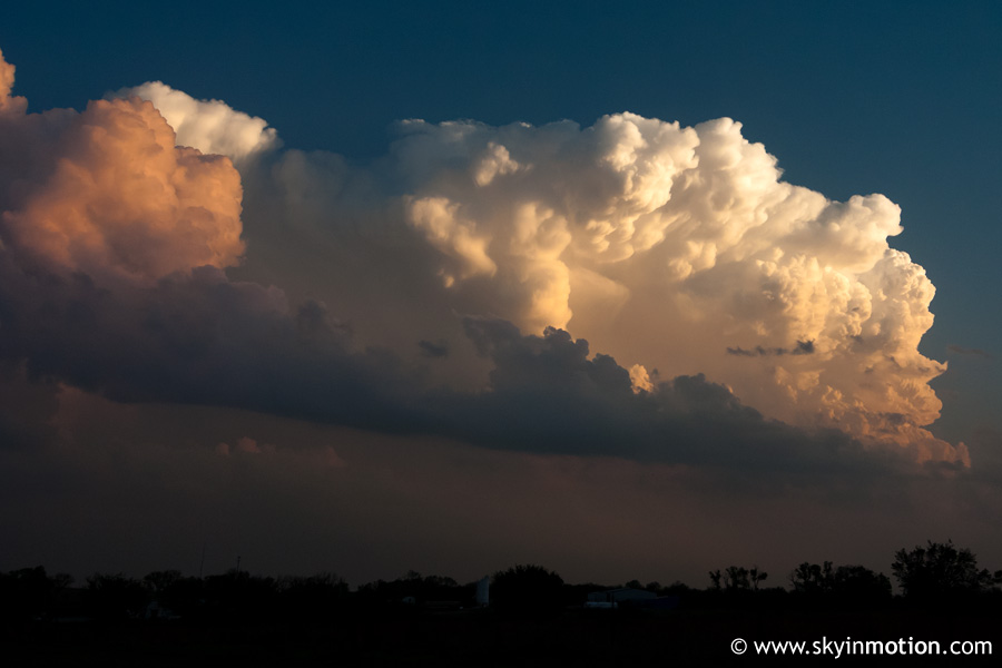
As we started down I-35, the coloration of the explosive supercell by the setting sun was unforgettable. These were taken between Norman and Purcell, in a (very fast-)moving car, looking SW.
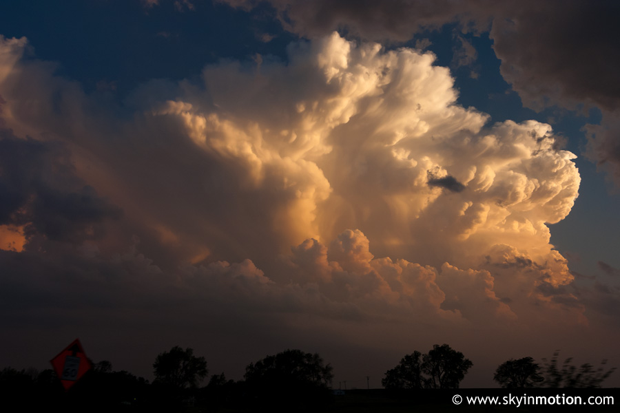
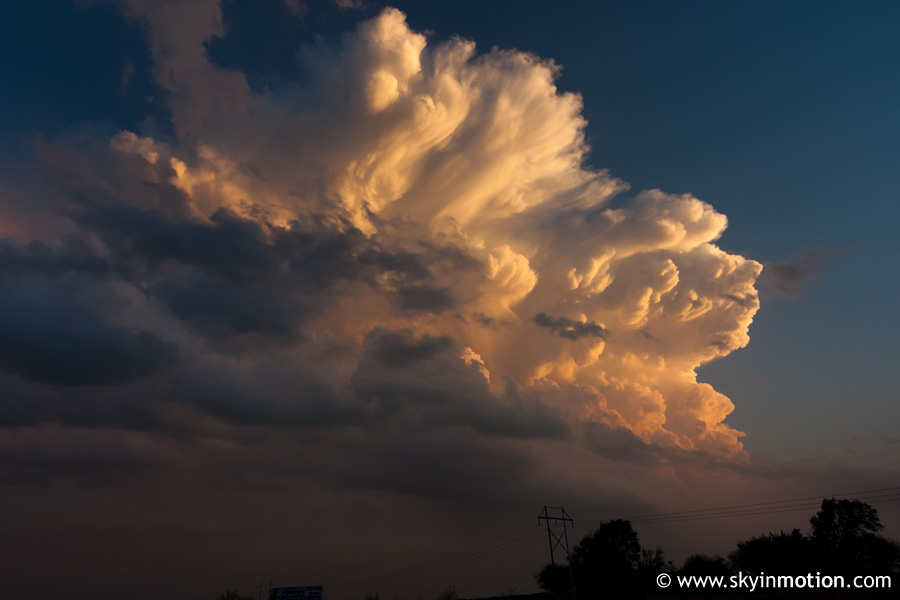
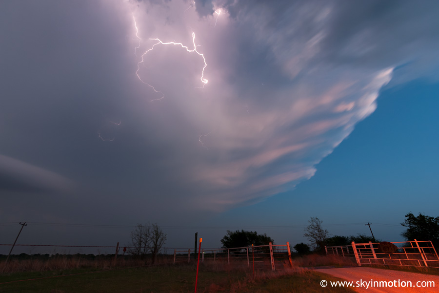
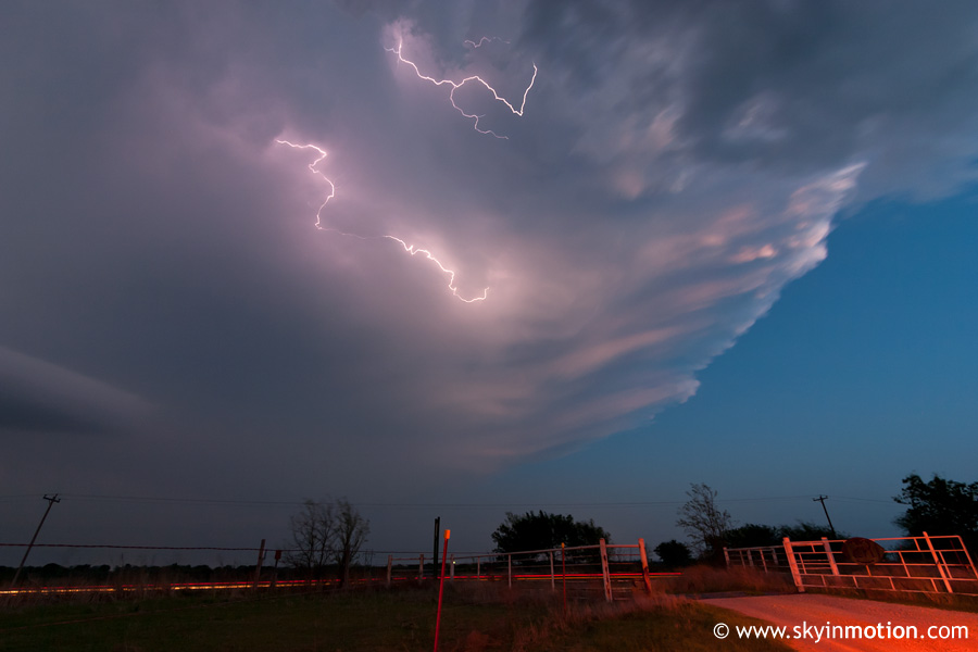
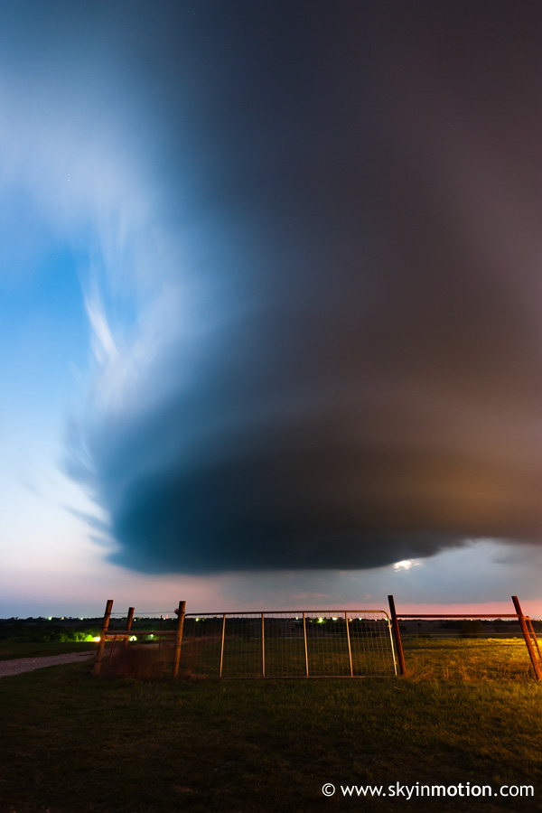
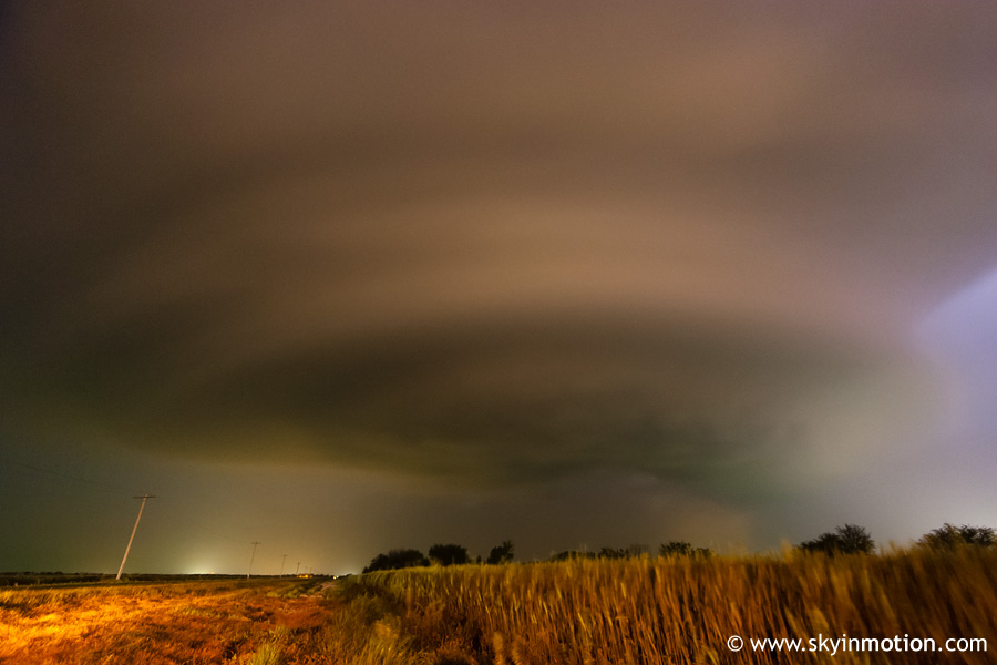
From the infamous I-35 Wayne/Payne exit just south of Purcell we headed west, then south on OK-74 toward Maysville. By now it was dusk, and the awesome updraft appeared to be maybe 10 miles to our WSW near Lindsay. Once in Maysville, we started west on OK-19 to get closer, but only a couple miles into the drive started getting hit with golfballs that were being shot out ahead of the updraft. After retreating back east and continuing to get some nasty (but sporadic) hail for a few minutes, we decided to set up a few miles south of Maysville on OK-74. From this spot, we enjoyed a gorgeous, precipitation-free view of the LP supercell as it drifted over and eventually east of town. The anvil crawlers overhead and to our east were easily the best I've seen:
Meanwhile, the updraft was also stunning; and while the soft light made for nice pictures, I think most chasers were gnashing their teeth and thinking "why not two hours ago?!"
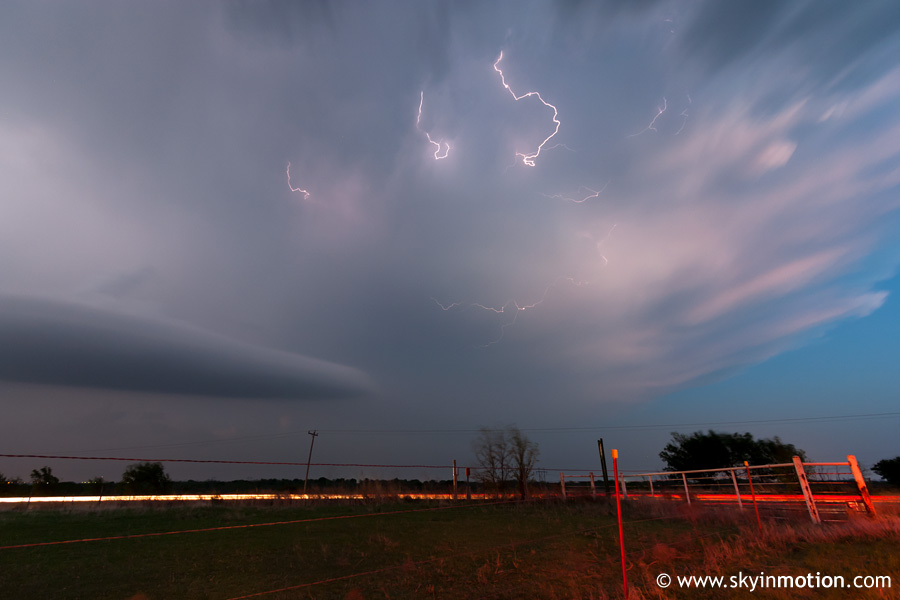
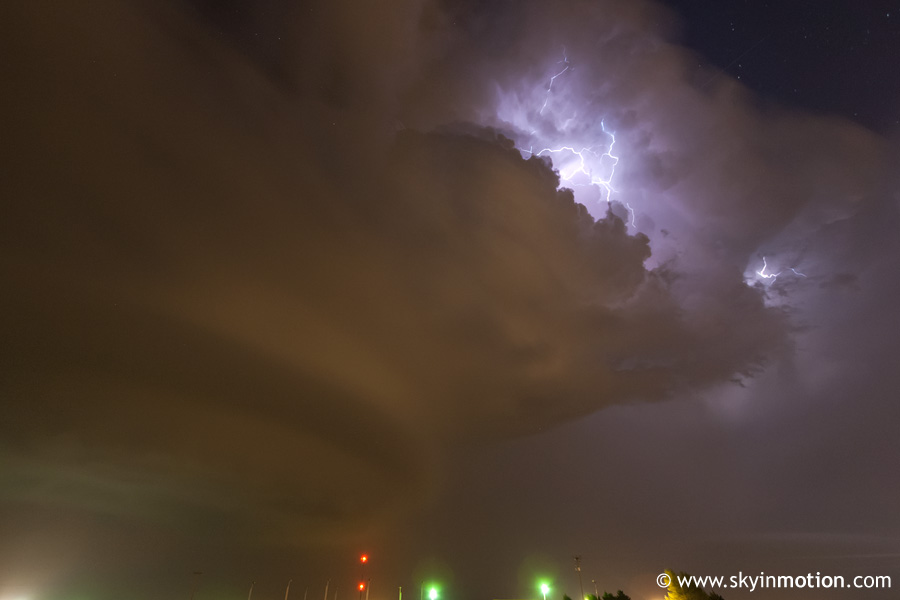
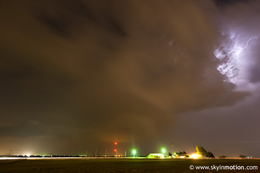
Once the hail core had passed east of Maysville, we returned north to town to find a decent accumulation of large hail. Other chasers nabbed some nice video of the hailstorm (it turned out there were some baseballs lurking in that core) by taking cover at local gas stations, though I was quite happy with our choice to watch the structure instead. We took OK-19 southeast out of town, stopping about halfway to Pauls Valley to try to get another view in total darkness. Unfortunately, the supercell was moving into a region of much higher CIN and weakening rapidly, so lightning was becoming rather infrequent. Still, a high-ISO long exposure yielded this cool view looking NW at the mothership meso located a few miles E of Maysville:
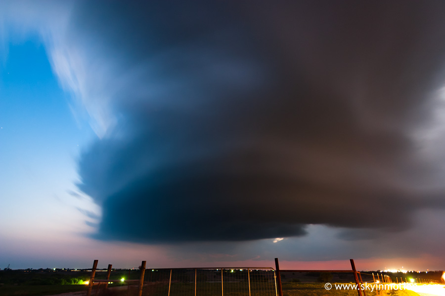
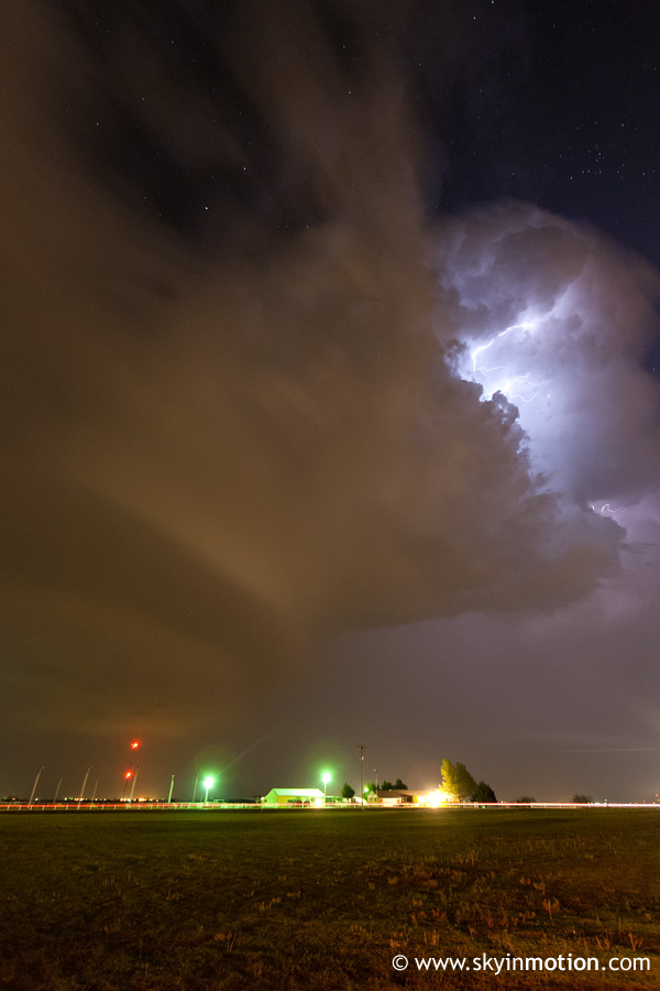
While not too impressive meteorologically, seeing as our "storm" was just about down the crapper at this point, the view we got a few minutes later looking N from near Pauls Valley as lightning from the anvil of a storm in Cleveland County illuminated the sky was rather cool.
Once the dying updraft crossed I-35, we headed back home, oddly satisfied despite the day not living up to its original potential. As mad as I'd been that initiation waited until just before sunset, the timing ultimately gave me some unique photo ops; plus, I can hardly ever complain about a chase that ends less than 50 miles from home.