Excruciating cap bust in a high-CAPE, high-shear environment over southern Kansas.
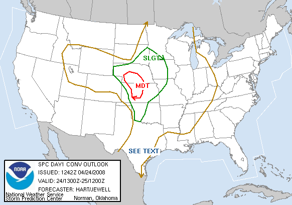
Cap bust of the century? Maybe not, but surely a candidate. It looked like the first classic Plains dryline setup for tornadic supercells in 2008, and warranted a Day 2 MDT risk from SPC on the 23rd. For the first time all year, both CAPE and deep-layer shear looked quite impressive over the same area (north-central OK and south-central KS), and low-level shear sufficient despite some veering.
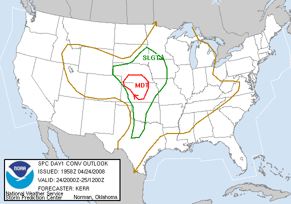
Brandon, Bryan, and I left Norman after lunch in one car, with Gabe Garfield and a few of his friends caravanning with us. Our initial target was Alva, with the possibility of heading a bit further north upon arrival. On the way, we also up with Wes Luginbyhl. We arrived in Alva around 3:30 PM and stopped to refuel and grab some snacks. While monitoring data on the way up, it had appeared the single weakness for the day's setup - veered 850 mb winds - was actually turning out less problematic than expected, as profiled indicated backing with time. Surface dew points in the mid 60s were widespread over N OK and S KS. The only thing standing in the way of mass chaos now was initiation. While the lack of a good Cu field anywhere nearby was rather concerning, as it should have been, each run of the RUC continued to insist on explosive convection developing along the OK/KS border by late afternoon. Since the dryline remained fairly far west, we decided to meander NW to Greensburg with the idea that we could always check out damage from the 2007 EF-5 wedge if initiation was further delayed. By about halfway there, it became obvious that our planned damage survey would not be a detour, but rather the highlight of the day. What Cu had existed in the region completely evaporated under subsidence aloft. When it's 5:00 PM and you have 100% crystal-clear skies on all horizons, you're in serious trouble. We spent well over an hour wandering the devastated remnants of a few Greensburg subdivisions; the damage was a sight to behold, even having seen the famous aerial shots taken the day after the disaster. It was difficult to comprehend that, in the year 2008, a town of several thousand could be left in this condition a full year after the event. Eventually we called it a day, headed to the Pizza Hut in Pratt, and had a leisurely drive home. A few supercells did occur over NW KS, but the parameters there were not sufficient for significant tornadoes, as they had been to the south. Several experienced chasers deemed the failed southern target for April 24, 2008, as one of the most painful cap busts in memory.