Suckered north to a cold front in Kansas for fear of a cap bust, we miss tornadic dryline supercells in Oklahoma but witness some cool structure.
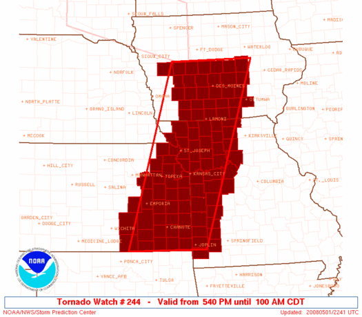
Thanks to a cold front intruding as far south as the Gulf Coast in late April, very rapid moisture return was needed to fulfill the potential this setup held. The primary concern, then, was whether moisture return into NE OK and SE KS would be deep and rich enough to overcome the cap before dark. Aside from that, low-level winds were forecast to be a bit weak and veered for my liking - but otherwise, ample instability and sufficient deep-layer shear made for a nice start to May. In the short range, models forecast a surface low to deepen as it moved into central or eastern NE; a cold front would trail to the SW, with a dryline intersecting it in NW OK or SW KS and continuing S. The best parameters looked to overlap in SE KS, which would see high CAPE values and a higher probability of initiation than areas to the S.
Brandon, Wes, and I departed Norman around 12:30 PM to target the Independence-Winfield corridor just N of the OK/KS state line. After reaching Tulsa, we took US-75 northbound, becoming slightly concerned at the sight of cirrus overspreading the area from the W. Just after crossing into KS, we stopped to refuel in Caney. Just during the time it took to pump the gas and get snacks inside the station, a few towers to our W seemed to grow rather rapidly, easing our fears. Sure enough, after hitting US-166 westbound to take a closer look, these towers exploded in the high-instability environment. Initiation, the biggest concern of the day, was no longer going to be a problem.
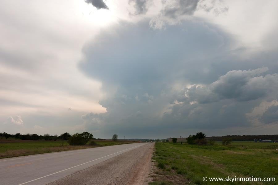
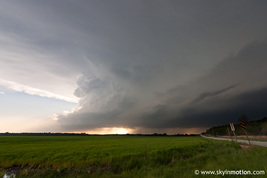
We continued W until stopping just SW of Sedan to watch the above storm pass by.
Needless to say, once this developing supercell passed by to our N, we pursued it. This led us down some hairy dirt roads in the hilly backcountry of Chautauqua County, until we finally hit Longton at US-166. The storm's updraft was now just to our S, so we took the highway SE to near Elk City, where we stopped to photograph and video the beautiful structure.
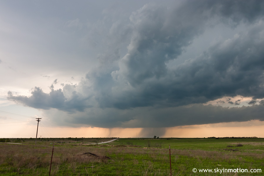
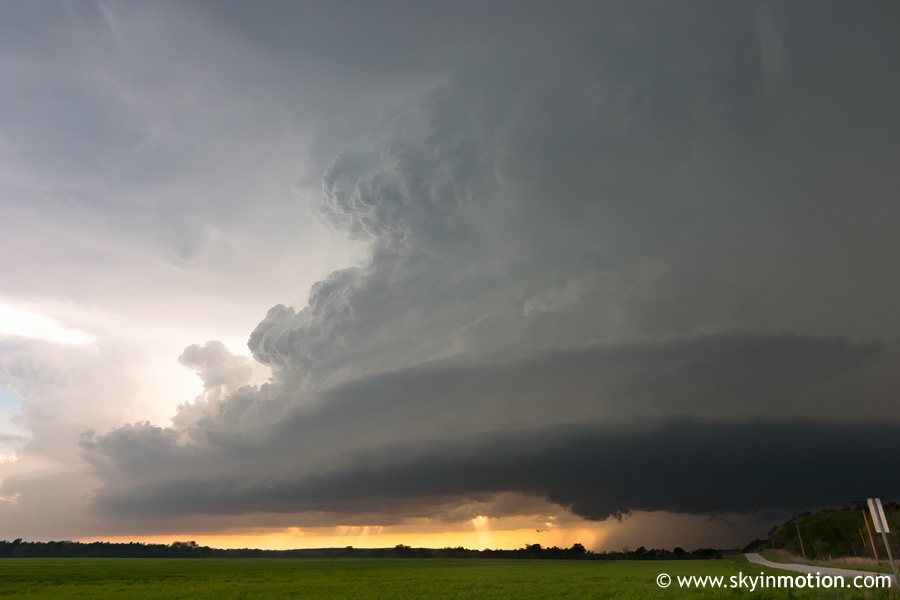
As can be seen in the second image above, a few wall clouds cycled, prompting a tornado warning for the storm. However, after 15 minutes or so, it became obvious that more convection was building on the southern flank of our storm. Radar confirmed that all the activity in SE KS was tending to congeal into a line with embedded mesocyclones. Funny how a couple hours can be the difference between fearing a cap bust and dealing with a QLCS. Still, multiple areas of rotation within this developing complex were tornado-warned, so we decided to continue NE. By this time, we could also see at least one explosive supercell with a massive anvil on the southern horizon. I felt slightly sick when I checked the KTLX radar and found that multiple discrete supercells were rapidly developing over the I-35 corridor from OKC northward. Secondary surface cyclogenesis in NW OK at the cold front-dryline intersection had backed the winds in that area and advected in rich low-level moisture, creating a suddenly-favorable environment for tornadoes in an area few had originally targeted. We knew this was probably the best game in town, but figured we had gone too far N into KS to consider dropping that far S; after all, it was now after 6:00 PM, leaving us with only two hours of daylight. Not a good choice.
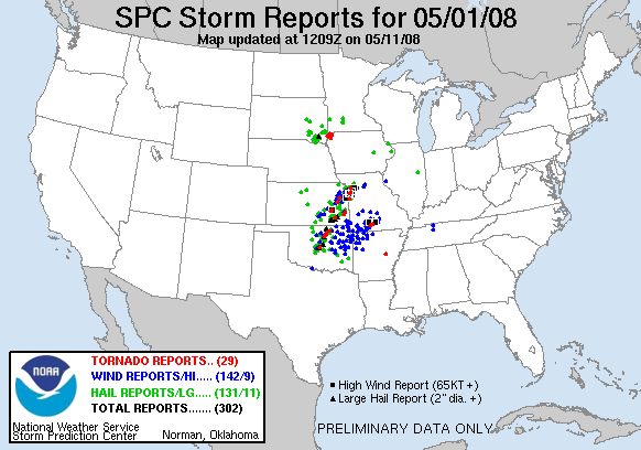
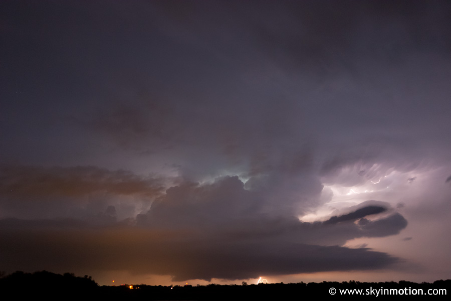
Bottom line: we wasted the next couple hours screwing around with the various "hooks" and "notches" along the expanding line in SE KS, eventually making it as far NE as Chanute before throwing in the towel. All the while, Oklahoma was going bonkers; but what else is new when I'm chasing in Kansas? As we started to make our way home, we saw exactly what had unfolded: the northernmost supercell in OK, which had looked beyond phenomenal on radar for quite awhile, had produced multiple very-visible tornadoes in Pawnee and Osage County; meanwhile, a stunning LP supercell had developed just SW of Norman, producing easily the best structure seen in the OKC metro area in years. And for our timely departure and willingness to drive four hours into SE KS, we'd been granted a plethora of embedded, rain-wrapped mesocyclones with lots of scud. Frustrated to the point of just laughing, we began dropping S towards Bartlesville to see if we could catch the tornado machine coming out of Osage County in the dark, but within a few radar scans it became clear it would fizzle as the dryline began its nocturnal retreat westward. So instead, we stopped near Independence to shoot a bit of lightning (pictured below) before completing a rather miserable drive home.