A dryline in central Oklahoma fires off very messy and non-threatening convection in the evening.
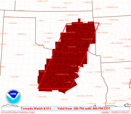
Total bust. Since I don't have a GPS log and the SPC didn't archive maps (due to the lack of anything of note happening), I'll have to go purely by memory here, and there isn't much to remember. Brandon, Bryan and I left sometime in the late afternoon to head S towards the area between Duncan and Pauls Valley, hoping for dryline storms to initiate just to the W of there. Instead, storms steadily built down the cold front from SE KS into C OK; by the time the dryline lit up during the early evening, the updrafts quickly congealed into another squall line with embedded areas of weak rotation. Having been sitting around waiting somewhere around Elmore City, we got back on I-35 and headed N. We followed one embedded (possible) supercell E from Purcell into Pottawatomie County, but it looked like utter garbage, so we quickly abandoned it and headed home.