Big warm front tornado day in northwest Kansas, but I stay south on the dryline and am left with a short-lived LP.
With an unseasonably deep and nearly-stationary trough anchoring over the Rockies, it was time for Chase Season 2008 to redeem itself with a multi-day extravaganza on the High Plains. The only weakness for the setup was very meridional mid- and upper-level flow, but strongly backed surface winds (ranging from SE in Oklahoma to nearly E along I-70 in Kansas) would compensate. I had already been rabidly anticipating the outbreak sequence for more than a week, so I'd gotten off work both the 22nd and 23rd to ensure distance would not be a limiting factor for me.
As I poured over model data the night before the chase (along with every other self-respecting storm chaser and weather enthusiast in the U.S.), I had a tough choice to make: did I go for maximized low-level shear along the warm front in northern KS, or higher instability with lower storm coverage down the dryline in southwest KS and northwest OK? Despite some of the most impressive late-season hodographs I'd ever seen being forecast for the warm front target, I quickly decided on the latter, pining for an isolated, wedge-producing cyclic supercell free of all the problems that plagued the northern target (such as 45 kt. northerly storm motions and poor visibility). If you've read many of my other chase accounts already, you probably know how this will turn out!
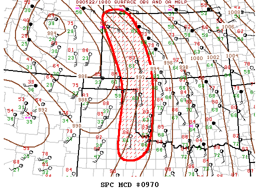
My original target as I went to bed was Dodge City to Ness City, a slight hedge to make sure I didn't completely blow it if nothing happened down south. I got on the road around 9am and took the Northwest Passage to Woodward, arriving by noon. By chance, I decided to stop at an Arby's where Wes Luginbyhl was already set up in the parking lot monitoring the latest data. I grabbed lunch and we talked about our mutual interest in staying south of the huge crowds and March-like storm motions on the warm front. Eventually, we hopped on OK-34 northbound out of town, only to stop upon reaching US-64 at the Woods/Harper county line. After a bit of hesitation on where we should be longitudinally, we headed west to Buffalo, refueled, then continued to near Rosston (near the Harper/Beaver county line). By now, numerous storms had initiated in a nearly N-S line along and just W of US-283 in KS. They looked so strung out on radar that I hardly regretted being to the S as they screamed N at 40-50 mph. Of course, the parameters in place (2500-3500 J/kg SBCAPE and 300-700 0-3 km SRH) were supportive of tornadic supercells regardless of radar appearance, as many chasers up there would soon see for themselves.
For our part, we spent the better part of a few hours camped out at the very NW corner of the body of OK around Rosston. Towers were going up to our W and SW, but they looked like garbage, as dew points on the dryline were mixing out a bit more than we wanted. When the sinking feeling became compelling enough, we flew N on US-283 into KS to follow a developing storm. We didn't even make it to Minneola before turning around, since the "storm" we were struggling mightily to keep up with was looking like a pile of mush. In the end, it didn't matter much, since the best storm of the day was north of I-70 and the only other decent storm was only a bit to the S of there. My target had busted, plain and simple. I guess that's easier to take than some of the other laughably stupid reasons I've missed things in the past.
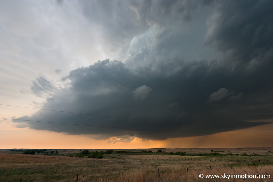
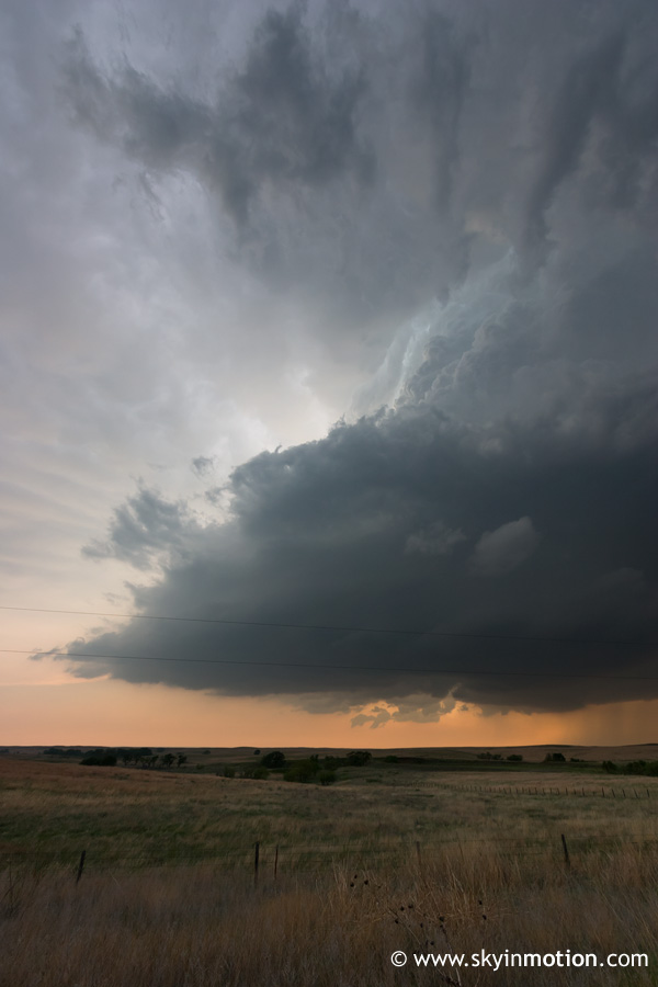
Just as it seemed the day might end in complete despair, a couple LP supercells fired to our S. We dropped down to the US-270/US-283 intersection S of Laverne to get on the northernmost one, then followed it northeastward to Buffalo as it exhibited decent structure and some wall cloud attempts. Overall, though, the lower 60s dew points were not going to cut it for anything spectacular. Wes and I got separated somewhere E of Buffalo, as he opted to get right under the base along the Cimmaron River while I stayed on main roads.
I was able to parallel the storm just to its SE by taking US-64 to OK-34/KS-1 northbound towards Coldwater. Structure remained decent, but distinctly moisture-starved.
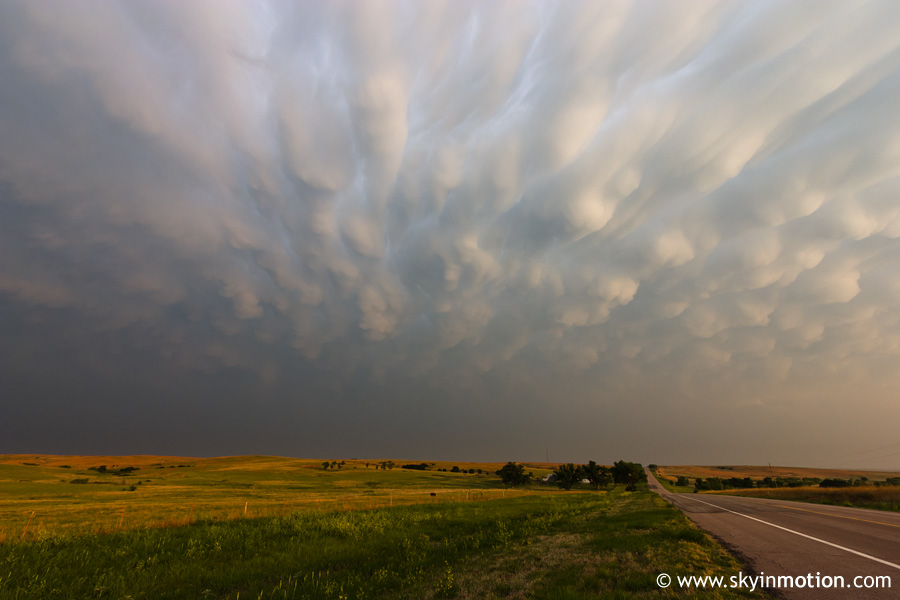
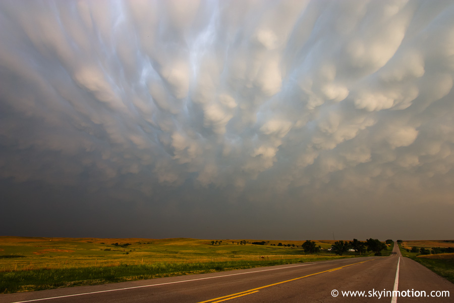
I made what briefly seemed like a fatal mistake in completely giving up on the storm's tornadic potential and dropping south a bit to photograph the stunning mammatus seen below, only to have the weather radio promptly blare a tornado warning once I had let it get 10-15 mi. ahead of me. These shots were taken near the KS/OK border on KS-1 facing S.
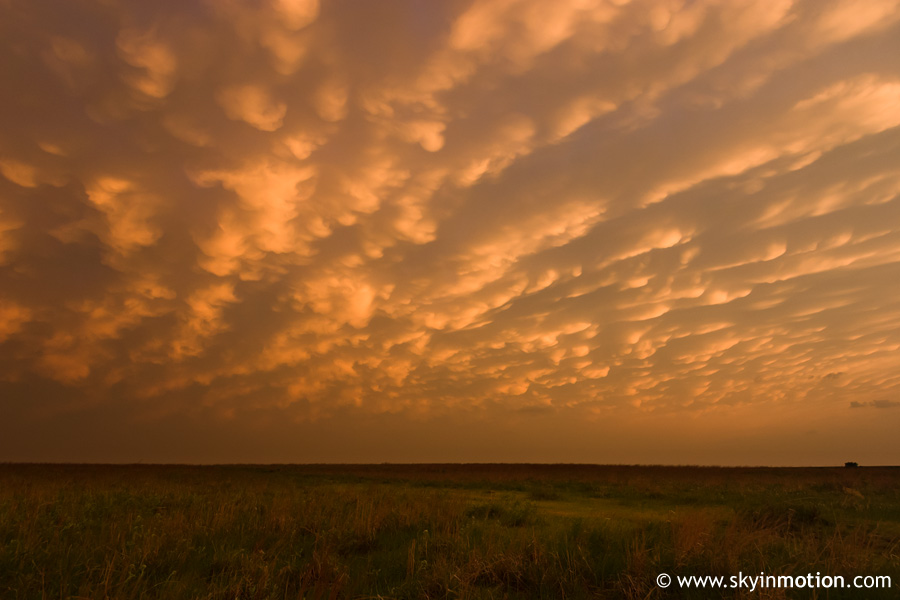
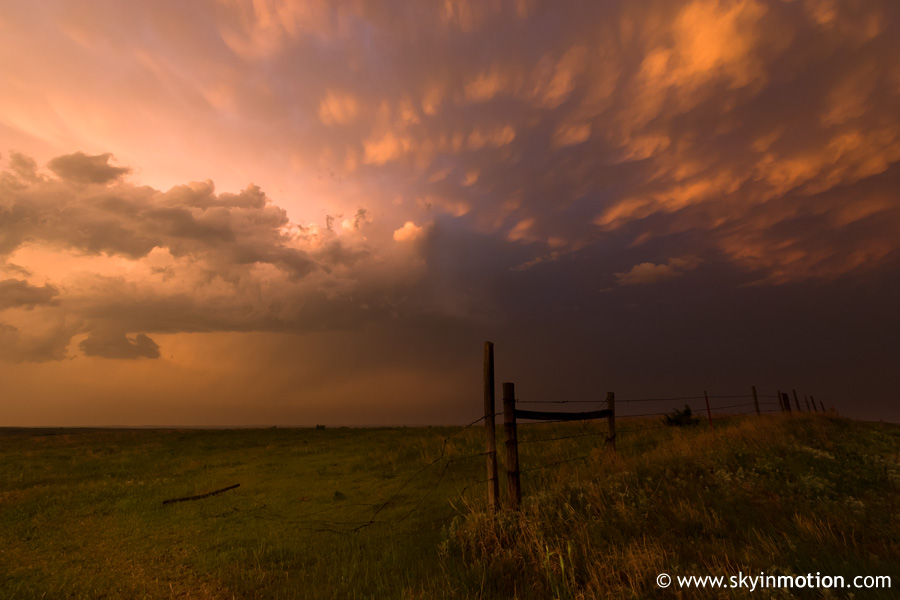
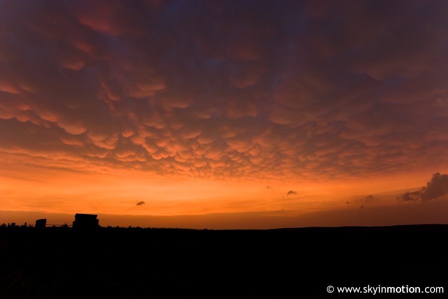
Disgusted, I jumped back in the car and flew north at slightly unlawful speeds until reaching Coldwater. By the time I got there, precipitation obscured my view to the east, and I feared I was missing the prize I'd stayed south for all day. Ha. A few minutes later, as I sped east on US-160 (on the indescribably desolate stretch between Coldwater and Medicine Lodge), my weather radio warned me that the evaporating LP storm just N of the road was "capable of producing strong tornadoes." Within 15 minutes, it was completely gone, leaving a sky full of mammatus from surrounding (nontornadic) storms.
After the last hint of daylight was gone, I continued E to Medicine Lodge in need of both fuel and food now that it was nearly 9:30pm. I picked up Subway and ate it in the car, reflecting on my latest high risk bust. Since my Internet was acting up as always, I called a couple friends to see how the next day was looking on the models - and more importantly, where geographically the epicenter of the madness would unveil itself. After finding out that Curtis McDonald, Matt Chatelain, and Matt Van Every already had a room in Hays, I decided I'd join them rather than get a $50 room for myself in Pratt - if I could even find a vacancy. I headed up that way and arrived in Hays by 1:30am, where we'd begin a much more fulfilling pursuit the next morning.