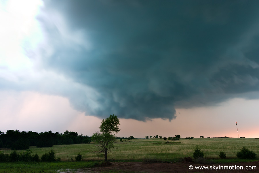
I arrive far too late for the tornadofest in central Oklahoma, but get some nice lightning and a wall cloud at dusk.
It's the Oklahoma Curse, Episode IV! I've already missed three awesome tornadic events in OK by being too far north in KS (May 4 and May 5 in 2007, and then May 1 this year), and this day was about to top them all. I woke up at the Motel 6 in Hays, where I'd shared a room with several others for the second night in a row, after finishing up a crazy chase after dark the previous day. The morning SPC outlook continued to highlight SE NE with the highest tornado probabilities, though they weren't all that high. My only predicament was whether to follow the others up that way for a third day of chasing, or opt to head back home to cut already-mounting costs for this mini-chasecation. Because my data cable had broken a couple days earlier, I didn't have much chance to look at things for myself, so I started out following them rather blindly east to Salina. Around noon, midway to our intermediate destination, Curtis called to let me know about a supercell that had gone up near Enid OK along an outflow boundary and become tornado-warned. I didn't think much of it, as all I knew about the day's setup was that the SPC outlook had cut off the 2% tornado contour near the OK-KS line.
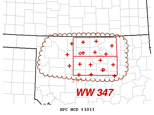
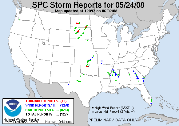
At Salina, I decided to part ways with Curtis, Matt and Matt, while Bryan stopped with me to get lunch. After that, I hit up the local Wal-Mart for some rubber bands to jimmy rig my data cable, which involved the inevitable fiasco in the self-checkout line, in this case because one nearly-handicapped elderly woman was in charge of putting out the proverbial fires at all four stations (and there were indeed fires at each one). By the time all that was done, it had been over an hour since we first exited the interstate. I did a quick data check, and saw that our only hope was to head north towards Concodria, as a Cu field extended from west of there up into NE. It wasn't until another hour later, when we finally got up to Concordia, that I realized the scope of what was happening down in OK, a mere hour's drive from Norman. The supercell, which many had assumed to be elevated at the time of its birth, had latched onto an outflow boundary and become a prolific tornado producer across Kingfisher, Logan and Payne County. Just about everything a chaser could ask for was an attribute of this beast: very slow-moving (under 15 kts), classic structure (rather than the HP mode so prevalent elsewhere in 2008), and cyclic in its tornadogenesis. So over a span of four to six hours, OKC area chasers were able to witness as many as 10 to 12 tornadoes, several photogenic, very close to home on a day in which no significant severe was expected south of the KS border. But where were most serious chasers, myself included? Hundreds of miles to the north, wasting our time with what would become a crapfest in NE and a cap bust in KS.
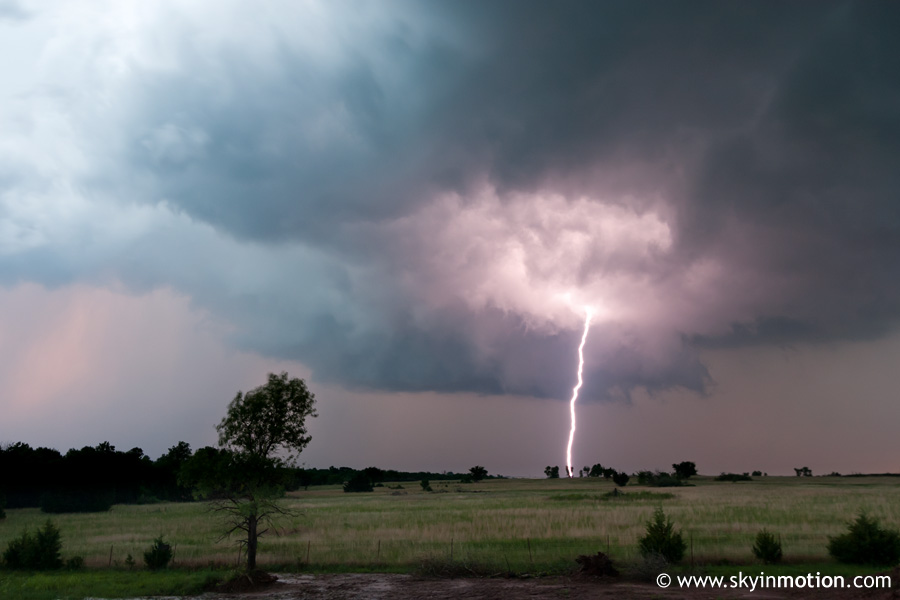
By 4:30 PM, I sped out of the Holliday Inn parking lot in Concordia in utter disgust, realizing there was no point in wasting my time with the northern target. A part of me held out hope that I could race back into OK with enough time before sunset to catch some last-minute action along the OFB; hell, if it had already been tornado-ing for several hours, what was to stop it from continuing into the evening? As a result, I had a bit of a lead foot as I snaked my way down central KS on US-81/I-135/I-35. Long story short, I was finally approaching the long-lived cyclic supercell around 7:30 PM as it was just southeast of Perry. Unfortunately, it was a well-documented HP mess by this point, and heavy precipitation was still located over I-35 right where I needed to exit. However, a new cell was rapidly developing to its west very near Enid, so I dubbed that one my hope for the day and took off after it. But as much as the "beast" now looked HP, this Enid storm appearead a bit high-based and lacking in a good precipitation core. I wasted some time sliding around dirt roads just west of I-35 between Billings and Lucien, keeping the occasional wall clouds from the Enid storm in my sights, but its appearance never really improved. By 8:30 or so, I was darn near ready to give up and go home even with another half hour of low light left; just as I started to, it began to produce a more formidable-looking wall cloud immediately NW of the I-35 exit at uS-412, right where I was sitting. Despite the rapidly increasing CG's, I whipped out the tripod for a few shots of the wall cloud before total darkness fell. During only my third shot, a bolt shot down less than a mile in front of me, sending me back into the car in a big hurry - but not without a pretty cool shot!
As the wall cloud drifted over and then east of the interstate, I made the rather stupid choice of getting on the northbound lanes to "follow" it, not really considering the fact that the next exit up was 10 miles off. That decision led to a good 15 or 20 minutes of sitting on the shoulder, waiting for the massive hail core to pass over to the north. At least I maintained a good view of the wall and increasingly frequent lightning during that time, though it was too dark for pictures. Eventually, I was able to head up to the Billings exit, where I determined the combination of darkness and the storm moving into poor terrain was good enough reason to end the pseudo-chase, so I finally resumed the path home and arrived around 11.