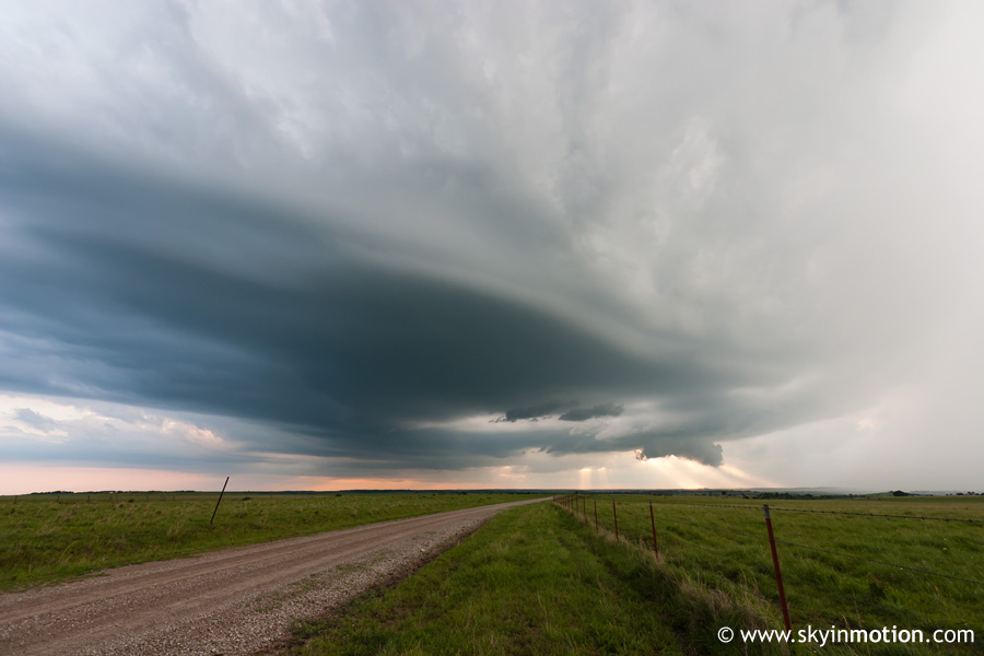
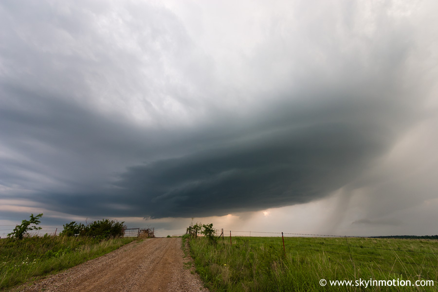
Nice structure with storms in Osage County, OK.
Another marginal weekend chase in OK. I chased with Curtis McDonald, Matt Van Every, and Bryan Putnam, with an initial target of Perry to Ponca City. We left Norman around 2:00 P.M., and on our way up I-35, the Cu field looked very nice for mid-afternoon. By the time we made it to US-412, we decided to exit westbound for Enid, since the dryline was still in W OK and the Cu field stretched at least a couple counties west of the interstate. After refueling there, we headed back east towards I-35, since the latest satellite showed more robust development to our northeast. Just as we were nearing the interstate, it became clear that towers rapidly shooting up over Osage Co. into SE KS were breaking the cap, and would likely be the show of the day given the warmer mid-level temperatures with westward extent.
We continued east past I-35 onto the Cimmaron Turnpike, aiming to get into the eastern part of Osage Co. as quickly as possible. We missed our exit at US-177, but fortunately, the storms were moving quite slowly given the weak upper flow. We took the next exit, US-64 east to Pawnee, and then headed northeast on OK-18 through Ralston and Fairfax, finally meeting up with US-60 in west-central Osage Co. By that time, a storm about 15 miles to our east was tornado-warned; meanwhile, a separate updraft behind it was right overhead, and appeared to be a low-topped supercell, exhibiting a meager but rotating wall cloud. We watched it with interest for a minute or two, but as the weather radio began relaying reports of a confirmed touchdown with the more mature storm, we blasted east towards Pawhuska for an intercept. As we approached town from the west, a shockingly large and ominous wall cloud (given our low expectations for the day and lackluster wind fields) came into view to our northeast. Unfortunately, I was not able to photograph it as we continued driving eastward to get closer; after a minute or two, it rapidly shrunk and began to dissipate, though rotation was still evident.
We dropped south out of Pawhuska only a couple miles before stopping on a backroad with a clear view to the north, where we watched the now-meager wall cloud and RFD. After about 10 minutes, we decided to hedge back west to get a better view of the storm we'd left behind earlier, since the one over Pawhuska was rapidly becoming HP. We found a nice spot about three miles southwest of town from which we could easily watch both storms, and remained there for a good half hour; these things were crawling at best, so there wasn't much need to move around! After an interesting encounter getting past several dozen cows standing in and near the dirt road we pulled off on, we got out and I photographed the mildly photogenic structure of the high-based and non-threatening western storm, which eventually exhibited a small, benign wall cloud.
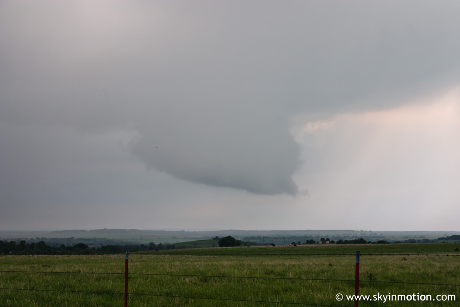
Meanwhile, the eastern storm would occasionally get a decent wall cloud, but never came close to appearing as imminent to doing something worthwhile as it had when we first saw it.
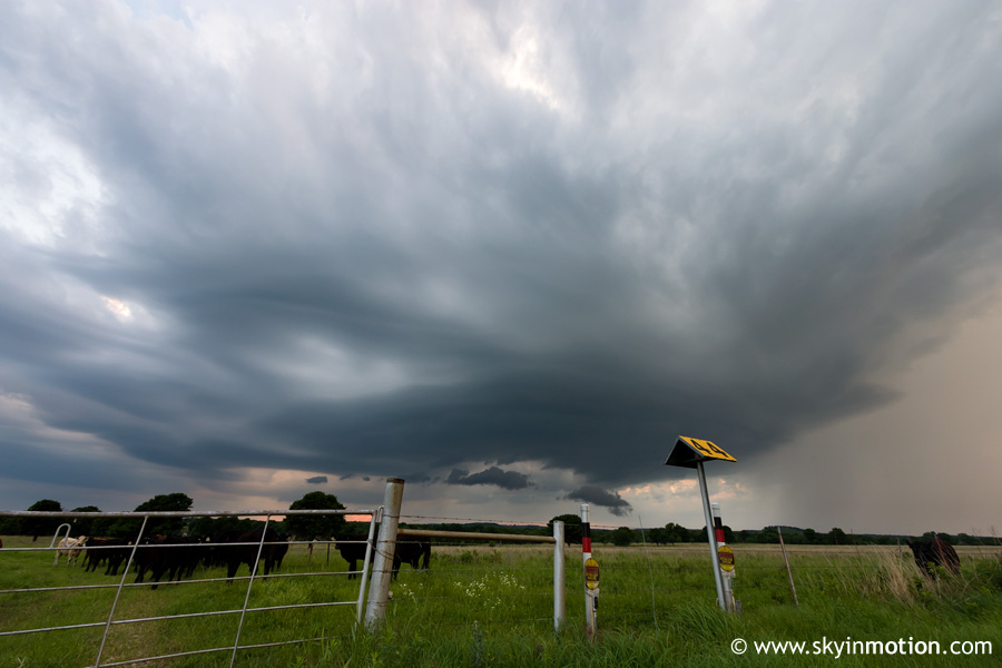
Eventually, when the western storm showed further weakening trends, we started back east to get one last look at the eastern one before giving up. By this time, the western storm had a beautiful, laminar base, even though it was crapping out.
When we returned to OK-99 just south of Pawhuska, the eastern storm was in as bad a shape as the other. I snapped some more shots of the western updraft (hard to even call it a storm by this point) with the warm mid-evening light.
We headed back home, stopping for dinner in Stillwater. When we came out from eating, we saw that an intense supercell had exploded over west-central OK, and thrown off a left-split that was actually on track to come over us on our way down I-35. Of course, the split died out quickly, but the original storm continued to intensify, with radar indicating some gorilla hail over Custer Co. Frequent lightning under the anvil was plainly visible from our position 60-80 miles away driving south on I-35 towards OKC. We wanted to intercept it, but feared it would likely succumb to death by capping before we could. Unsurprisingly, that's basically what happened. We headed southwest on I-44 out of OKC, and eventually met up with the storm west of Chickasha, hoping to pick up some large hail in the core. But despite having produced golfball to baseball size hail only 30 minutes before our arrival, we could barely manage dimes and pennies out of it, and within an hour of our leaving it it had completely dissipated.