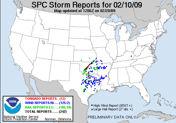
A wintertime outbreak of supercells between I-44 and I-35 defies climatology, but the only daytime tornado strikes in suburban OKC away from most chasers.
Much of the first half of winter 2008-2009 featured a longwave pattern with an eastern U.S. trough and western ridge, leaving the Plains under dry northwest flow. A pattern shift finally arrived by early February, with several systems moving across the central U.S. in succession. The first in this series occurred about two days prior to the chase, and while it produced only a weak squall line, it pulled Gulf moisture well inland in preparation for the trough on its heels.
By the morning of the chase, surface dew points were 55-60 deg. F southeast of I-44 in OK, and 60-64 deg. F across north TX. These are values we could hardly complain about in late March, nevermind early February. Several experienced chasers in the online community proclaimed it the best February setup in the Plains they'd ever seen, and it was easy to see why, with a potent shortwave in NM resulting in strong shear over much of the warm sector, where an axis of 1500-2500 J/kg SBCAPE was expected as a result of the unseasonable moisture. A surface low began taking shape in NW OK by around lunchtime, backing winds over central OK and north TX. On average, short-range models had indicated the dryline staying near or only slightly west of I-35 during the mid-to-late afternoon hours, but morning RUC runs began to indicate it would actually remain a bit farther west (near an Abilene-Altus-Enid line). This was a huge relief, given concerns over storms quickly moving into unchaseable terrain in southeast OK and northeast TX given the farther east solutions.
With moisture return slightly more robust and farther north than anticipated, our plans of targeting Gainesville from the previous night were thrown out the window. Brandon, Bryan, Trey and I left Norman around noon and headed SW on I-44 towards Chickasha, unsure on how to proceed from there. By the time we arrived, a couple cells were already forming along the dryline just to the NW and SW. They quickly became more numerous, and one passing very near Chickasha looked rather impressive on radar. We headed a couple miles south from town on US-81 to get a better view, torn on whether to pursue it northward into the OKC metro area or wait for activity developing farther SW to move into what looked like a more favorable environment (SBCAPE >2500 J/kg and SRH >150 m^2/s^2) in the Grady/Caddo/Comanche/Stephens County region. After a few minutes, we decided against racing north into more questionable moisture and dealing with big-city congestion, so we began dropping south toward Rush Springs. To say this was a poor choice would be an understatement.
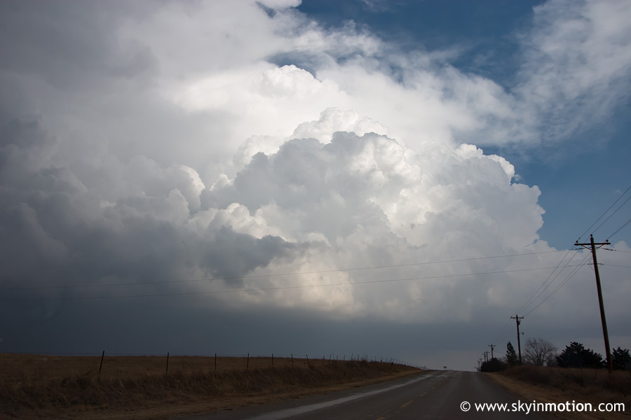
From Rush Springs, we shot west on OK-17. There were now several updrafts within sight, and all of them looked amazingly robust for February.
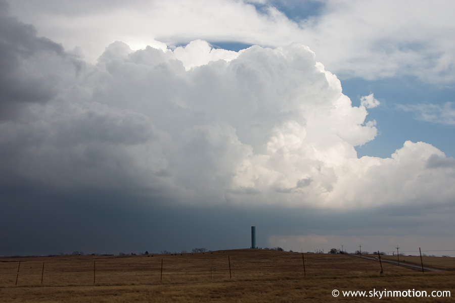
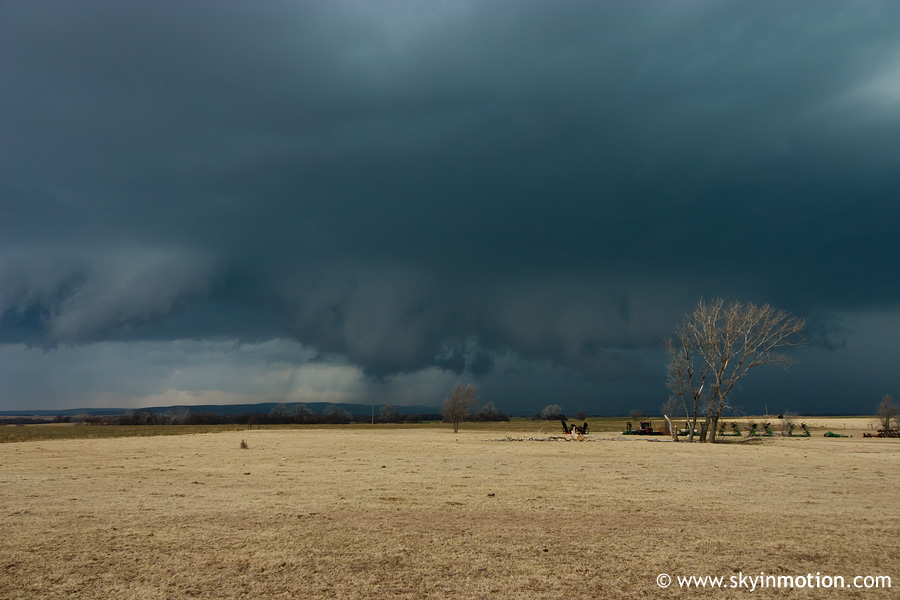
We continued west from Elgin on backroads, watching a developing supercell over the Wichita Mountains to our SW. Visibility was not great, so we jotted back east to Porter Hill, then started north on US-62. From near Lake Ellsworth, we had another cool view of a strengthening cell to our east.
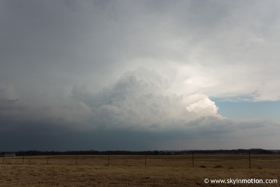
Of more concern to us was a splitting supercell immediately to our W between Medicine Park and Boone. Given its NNE motion, it was gradually nearing US-62, and began exhibiting a possible wall cloud. We stopped just south of Apache to get some pictures and video looking to the W.
Our excitement was tempered when we learned of a tornado warning for the storm we had abandoned in Chickasha, which was now on the west side of Oklahoma City. Its radar presentation was impressive, to say the least. We turned on the radio to hear Gary England and his underlings screaming about a large tornado on the ground near Edmond, which was captured on video by news helicopters. Over the next hour, a series of three supercells training just NW of I-44 would track over this same area of eastern Canadian and western Oklahoma County, exhibiting strong hook echoes. We had the pleasure of being on the fourth and southernmost supercell in this line, apparently outside the environment which was capable of supporting significant low-level rotation. We followed it up to Anadarko, receiving up to golfball size hail in the process. From there, we shot east to Chickasha, then north up US-81 to Union City. All the while, the storm periodically produced wall clouds and signs of small-scale rotation, but never a funnel cloud. By the time we reached Minco, a significant accumulation of hail covered the ground, presumably from the cells which had passed through earlier. The result was a ton of hail fog, reducing both visibility and local temperatures and dew points. Needless to say, this was the last thing we needed if we wanted our storm to have a chance at producing. When I checked the Mesonet and saw Union City reporting something like 57/52, I pretty much knew how our day would end.
We followed the now-embedded supercell up to I-40 at El Reno, then northeast into Edmond and up to the Logan County border on I-35 before calling it a day. We made it back home around 6:00pm. But in classic fashion, a day we already wanted to forget was about to get just a little worse. All the cells in OK had congealed into a solid squall line (which was now moving through Norman), but a discrete supercell developed in Montague County, TX, around dusk, and quickly showed signs of going tornadic. This wasn't so bad at first, since we never intended on going into Texas anyway. But by 7:30pm, this supercell was nearing Ardmore still intact, and exhibited some of the most impressive velocity signatures seen anywhere in the U.S. since last severe weather season. A large, strong tornado crossed I-35 just north of Ardmore, giving quite a show to the lucky few who had elected to pursue the storm despite the darkness.
As frustrating as the outcome of the chase was, it was fairly nice to get out and see some solid convection after such a long period of the late fall/winter doldrums. I would have been perfectly happy with the half-decent structure we saw had it not been for the fact that significant tornadoes did occur, close to home no less, and we missed them. The major downside of a rare very-early-season chase day like this is that the already excruciating wait for the "real" season to begin is now just a little harder...