A typical early-season low-CAPE/high-shear bust; our warm front target produces weak, elevated convection.
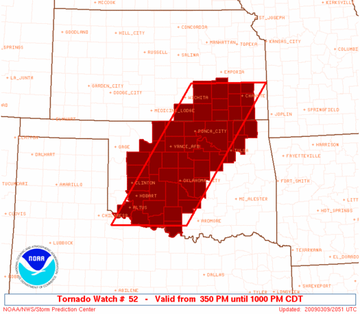
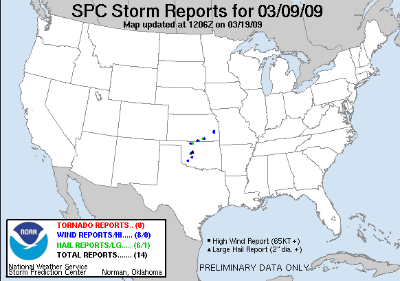
Very marginal instability was expected to develop over northern OK and southern KS, with a warm front extending from around WWR to ICT. Given the surprising productivity of supercells which had tracked along the warm front two days earlier in KS with similarly lacking instability, we decided not to make the mistake of staying home again, so we headed up to Hennessey by mid-afternoon to await initiation. The waiting went on and on, and we started to become concerned when the radar was still clear by 5pm. Finally, numerous storms developed from southwest OK northeastward into extreme south-central KS. We headed north towards a small but increasingly-intense cell developing just north of Enid, and followed it from near Medford across the KS state line to South Haven. While it had marginally decent structure early on, widespread cloudcover near the warm front made the scene far from photogenic. Despite SW flow at 500 mb, this cell continued racing north-northeastward (likely due to its low-topped nature combined with the southerly LLJ), eventually crossing into stable air near Wichita. All the convection to the southwest in OK continued to struggle, so we dropped back south into OK with very low expectations. One cell moving into Grant Co. began to intensify just prior to sunset, so we jogged west from I-35 to get a quick look at it around dusk as it moved just northwest of Medford, then returned home.