A conditional-threat chase finally comes through when storms break the cap near the dryline-warm front intersection; the result is a nice supercell with lots of large hail and a brief tornado.
Observed 1 tornado.
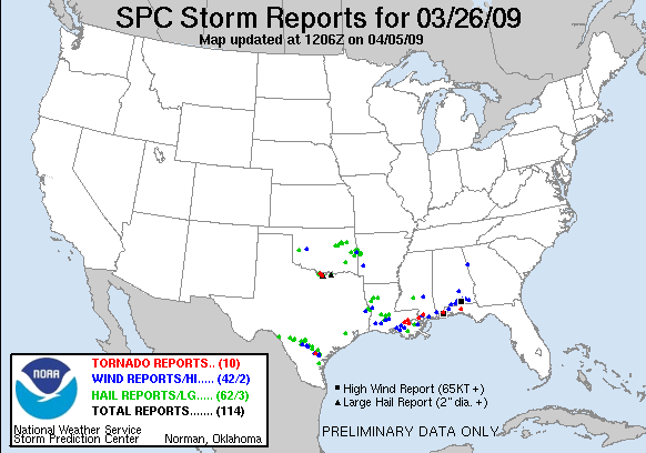
The focal points for this severe weather setup were a warm front along the Red River, and a dryline which intercepted it NW of DFW and extended S into TX. The warm front lifted north from near I-20 through the course of the afternoon, and while stratus was widespread in the moist sector, a narrow band of clearing developed immediately ahead of the dryline by mid-afternoon. Despite serious capping concerns and somewhat weak low-level winds expected in N TX, this was a rare opportunity this season to actually chase in >60 F Td's and >2000 J/kg SBCAPE, so Brandon was able to convince me it was worth the drive down I-35.
Brandon and I rode with Kiel Ortega and Tiffany Meyer; Sam Dienst and Brandon McClung were caravaning with us in a separate vehicle for much of the chase as well. We left the National Weather Center around 3pm and headed towards Gainesville as a starting point. Along the way, we noticed the zone of clearing ahead of the dryline was a couple counties west of I-35, so we abandoned the interstate at Marietta and headed W on OK-32 to Courtney, then crossed the Red and headed for Nocona. On our way, we saw a few convective towers going up to our W and NW, but they were far from impressive and were poised to cross the warm front into stable air.
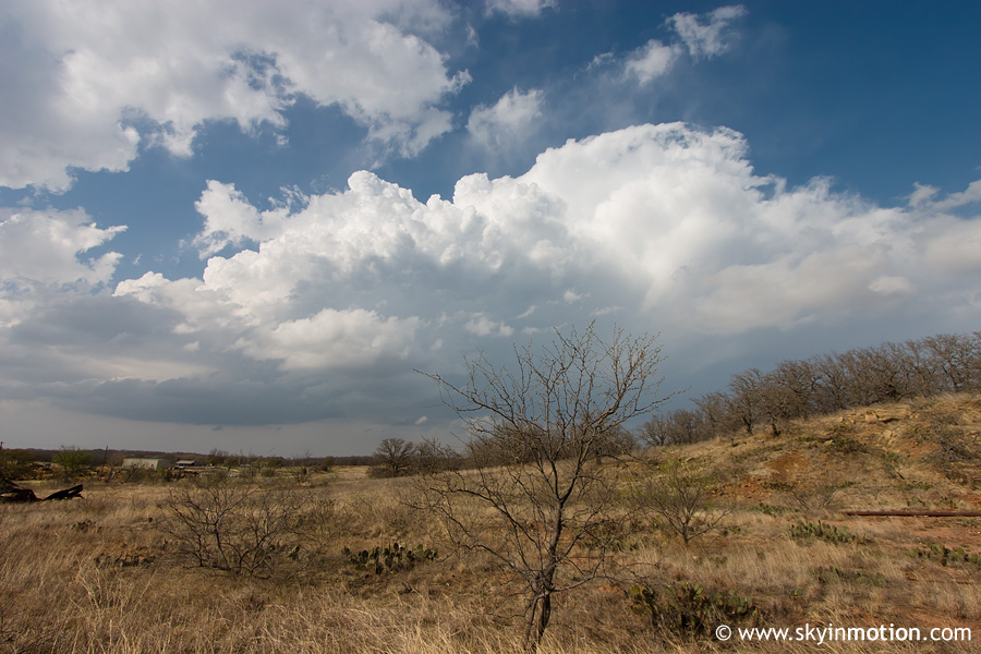
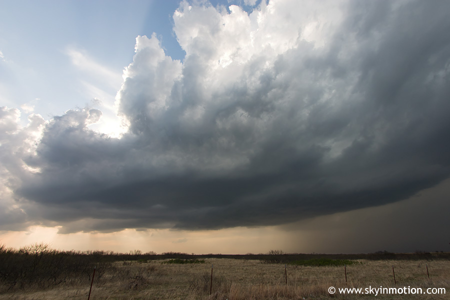
We stopped in Nocona to refuel, then meandered around the area for a good half hour while more towers went up to the W and eventually SW. Finally, by 6pm, one cell to our WSW looked as if it was becoming dominant, with tops significantly higher than anything else we'd seen. It began anviling out directly overhead, with a modest base looming to our W.
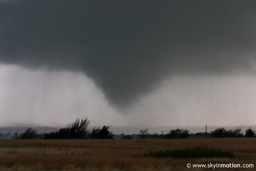
We began following this storm E from Nocona, and while it was slow to organize at first, it eventually began exhibiting high reflectivity on radar and took on a more easterly motion. Somewhere in rural northeast Montague County, we decided to sample the hail core since the storm seemed to have pulsed down a bit; to our surprise, we were eventually hammered with tons of golfballs, and perhaps a few stones in the 2" range. Following this, we quickly tried to reposition ourselves E of the updraft base in case the storm wanted to do anything interesting. We headed S towards St. Jo; almost immediately after gaining sight of the base (after the view having been blocked by the ominous precipitation core), we noticed a nice wall cloud, much to my surprise. Within a couple minutes, a funnel emerged, and briefly touched down as a tornado around 0021 UTC.
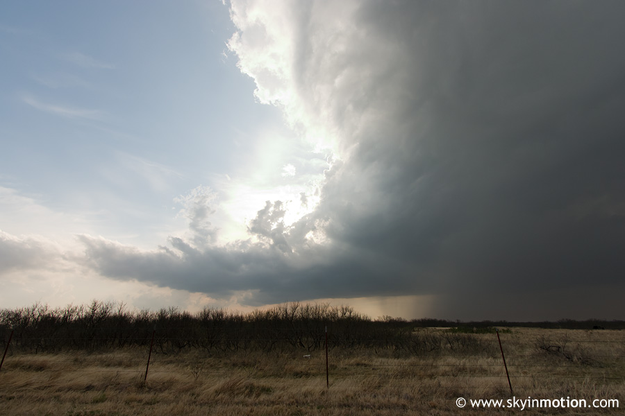
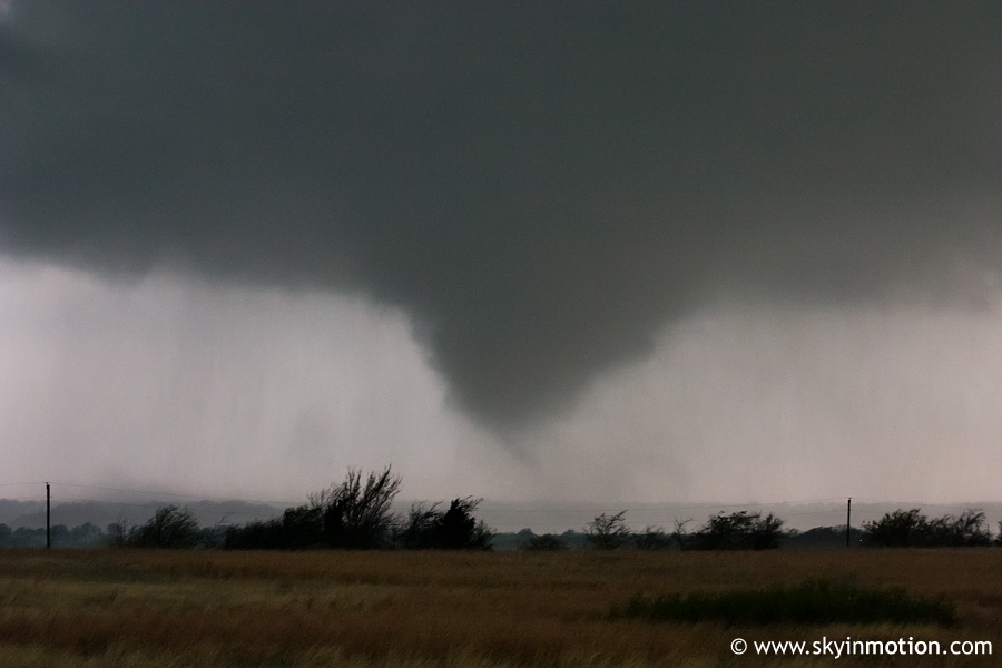
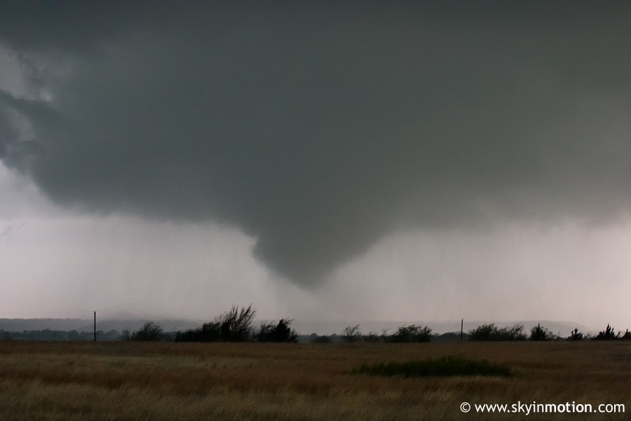
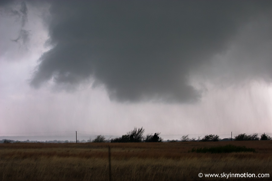
Though I was too focused on the funnel (specifically, trying to figure out whether it was even a tornado, since the brief touchdown was almost impossible to see from our location and was only confirmed later via others' video) to pay much attention at the time, the wall cloud associated with this tornado was really quite nice, as was the RFD clear slot to its south. Below is an image showing the wall cloud immediately after the tornado dissipated at 0023 UTC. I wish I'd had time to switch to the wide-angle lens in order to show the classic-looking RFD!
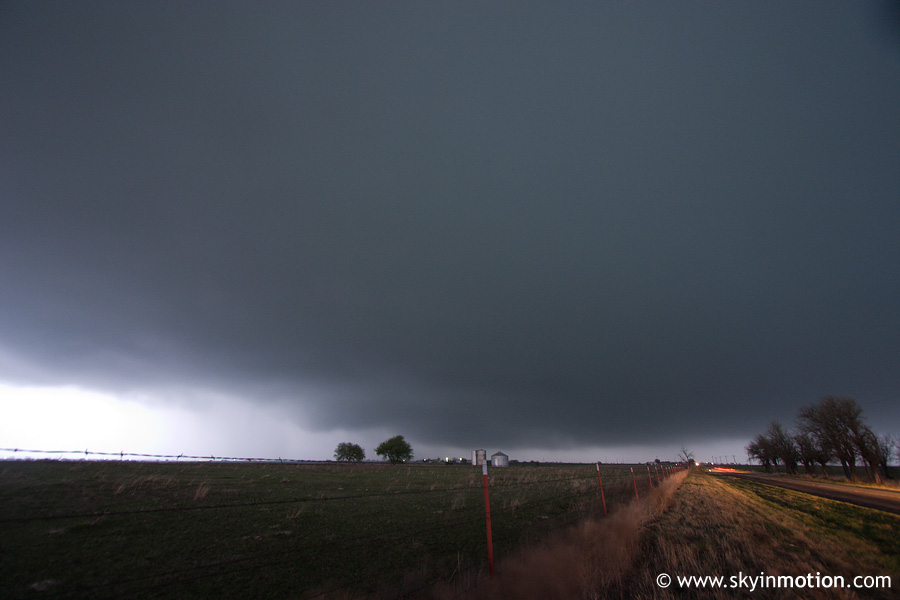
Once this wall cloud dissipated, the storm showed little sign of producing again in the near future. We hit US-82 and headed E towards Gainesville, paralelling the supercell to its S. Of course, being March, daylight was quickly becoming an issue. We stopped somewhere near the Montague/Cooke county line and got one last view of the base before complete darkness set in. By now, nocturnal cooling had set in, so lowered T/Td spreads were contributing to LCL's so low that it was next to impossible to see much.
We refueled a second time in Gainesville as the storm approached from the WNW, along with another to its S which had a more easterly heading. We decided not to mess with sampling hail in either storm, given their relatively slow movement (meaning it would be awhile before they arrived at Gainseville). With that, we called it a day and returned home on I-35, arriving by 10:45pm. The next day, I had a big test in my Partial Differential Equations course which I should have been studying for, and my score showed that! (As luck would have it, the rest of the class didn't fare any better, so we ended up having a retest - yet another near-miss with my prioritizing chasing above things I shouldn't!)