An expected high-CAPE triple point chase goes sour when boundary-layer moisture mixes out and too much convection fires too early.
April 25 marked a significant transition in the 2009 chase season. The first phase in March and early April had been dominated by perpetual eastern CONUS troughing, resulting in continual Gulf frontal intrusions and an absolute lack of quality moisture over the Plains. Following the previous chase on April 16, a major pattern shift had taken place, with significant upper-level ridging dominating the central CONUS for over a week. This provided a much-needed period of recovery for the Gulf, and by the time April 25 arrived, sufficient boundary-layer moisture for >2000 J/kg CAPE north of the Red River was anticipated for the first time since Feb 10.
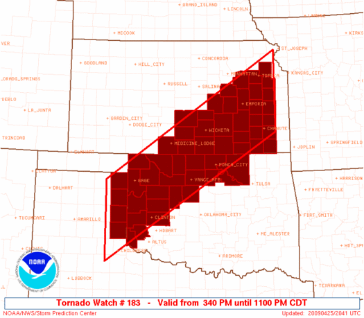
Short-range models indicated that a triple point would be in place somewhere in the southern High Plains by late afternoon. While the GFS and other global models were insistent on a dryline-warm front intersection in southwest KS for several days, the NAM presented a rogue solution in which the baroclinic zone pushed south throughout much of the day, then stalled over west-central OK before retreating after dark. Though easily dismissed from a few days out, the NAM only trended more aggressive with the cold front over time, and eventually it became clear that the surface boundary would indeed push into OK. Hey, at least that meant a chase closer to home! (Anymore, I have to put a positive spin on anything chase-related I possibly can in order to stay sane.)
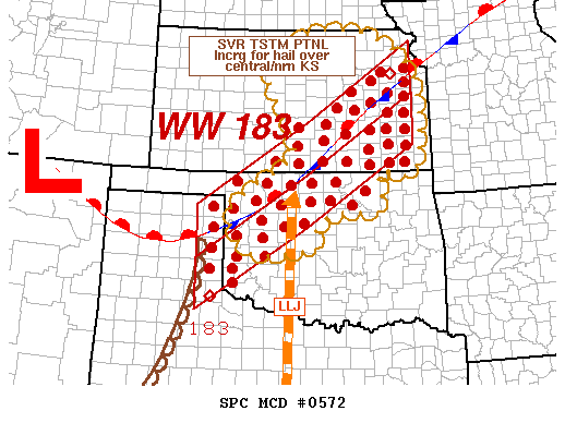
Brandon, Bryan, Vivek and I left Norman around 1pm with a target bounded by Elk City, Shamrock, Canadian, and Arnett. Through the course of the morning the cold front had pushed into northwest OK, but had at least stalled a county or two N of I-40. Capping issues were expected to preclude significant convection down the dryline, so everyone and their mother was converging upon Elk City and Shamrock, waiting for the seemingly-inevitable isolated beast that would form just N of there by early evening (both the SPC and NSSL 4km WRF runs had indicated this scenario, increasing confidence). Low-level wind fields were forecast to be a bit shoddy during the mid-late afternoon timeframe, but a significant tornado threat was anticipated around and after sunset once LLJ magic kicked in.
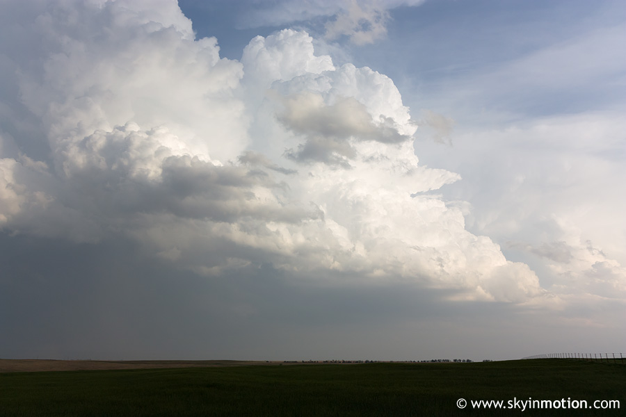
We made it to Elk City by 3:30pm and stopped at the Love's gas station on the east side of town, where a large chaser convergence had already formed. As soon as I began checking the latest data, I could tell we had a problem, at least if we were to expect a significant tornado threat: surface dew points over western OK and the eastern TX Panhandle had dropped into the 57-61 deg. F range owing to vertical mixing. Although CAPE was still in the moderate-high range due to warm temperatures, relatively high LCL heights and all their associated problems were back in the picture now yet again. Given the capping concerns, I began to worry whether we would even get a storm as we waited, waited, and waited some more in Elk City. But by 5:15pm, the first updrafts of the day were on the rise to our W... and SW... and NW... yeah, pretty much everywhere. Instead of a cap bust, we would soon be dealing with a plethora of intermittently-supercellular storms across the entirety of western OK.
None of the updrafts looked enticing enough to becon us, so we waited until one came to us. A cell that had developed to the SW moved over the heart of Elk City by 5:45pm, dumping most of its rain and moderate-size hail just miles to our W. Its structure was only marginally photo-worthy, showing few signs of supercellular organization.
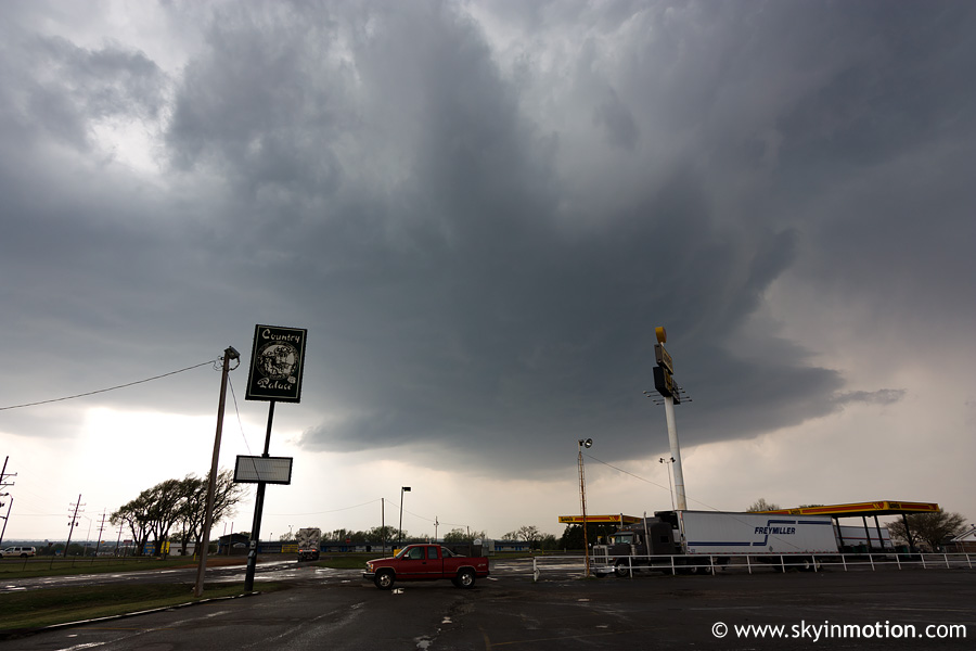
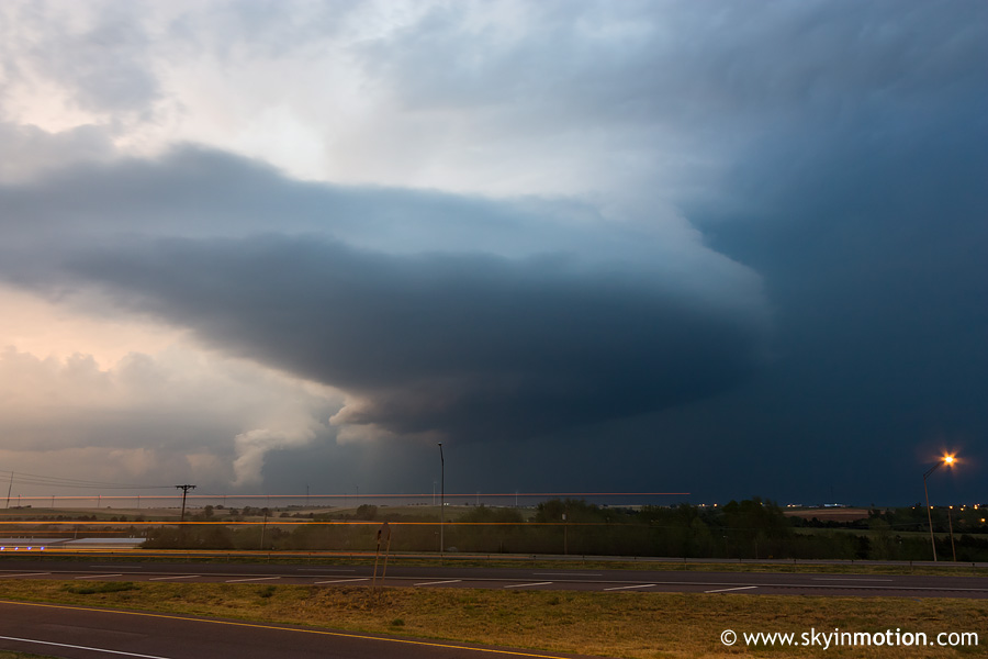
As the cell passed by to our NW it showed a bit more promise, both visually and on radar, and we saw little reason not to follow it for a bit. A few miles N of Elk City, we gained a nice view of a pronounced RFD clear slot, and perhaps even a small high-based funnel just to its E.
The problem, as should be obvious from the above photo, was an almost laughably high storm base; no surprise, given the aforementioned moisture issues we were experiencing. We continued following this E for some time on OK-73 through Custer Co., and eventually encountered significant hail up to 2" in diameter in its wake around the S side of Foss Reservoir.
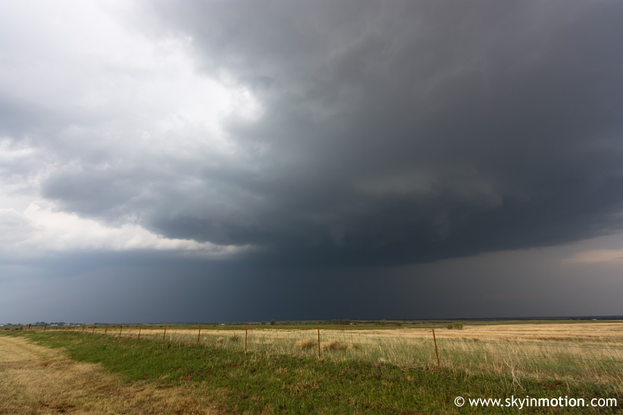
The remainder of the daylight segment of the chase was filled with stress and confusion, as so many cells were active in such close proximity to one another. We ended up doing a circle around the entirety of Foss Reservoir: initially, we dropped the cell we had been following and navigated around the E and N sides of the reservoir to pursue a tornado-warned storm in western Roger Mills Co. By the time we got to Hammon, it was on the decline and seemed too far out of reach anyway. We stopped briefly on the N side of the reservoir where I shot this looking S at a cell in Washita Co.:
We eventually elected to pursue the above-pictured storm, and ended up right back on OK-73 eastbound, where we'd started out after leaving Elk City hours earlier. Here I'm looking E (out the windshield) at the bubbling updraft, which still had yet to anvil out. We followed this thing E to Clinton, where we hopped on I-40 for a speedier route to stay up with it. It was dusk by the time we reached Weatherford, so we stopped to get some shots before nightfall.
Frustrating as the day had become, we decided to push on and drop SW towards two fairly intense supercells coming out of southwest OK. Needless to say, they began croaking before we arrived. Below is a shot from somewhere near Corn looking N at the northern of the two cells.
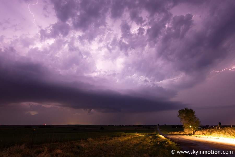
With the time nearing 10:00pm, Brandon needed to start heading towards OUN for a midnight shift, so Bryan and Vivek swapped into my car at Weatherford after a late dinner at Subway. We hit some construction on I-40 near Hinton, and around that time, a couple new cells were developing to our N and NW. One storm/complex near Enid was already exhibiting significant mesocyclones on radar, and given the obscenely strong low-level shear now in place, we soon became tempted to resume chasing despite the late hour. We exited I-40 and took the Northwest Passage up through Geary to Watonga, by which point we were just S of the increasingly-robust supercell. Radar indicated a fairly respectable couplet, so we meandered N out of town towards the southern entrance to Roman Nose State Park. At one point, we observed a large, low wall cloud which appeared to be over the park, but quickly lost view due to trees. Afterwards, we continued to N of Hitchcock on OK-8 before calling it a night due to a downward trend of our storm on radar. We got home sometime after 1am, just in time to watch live coverage of the large nocturnal tornadoes near and N of Enid.