Another long drive, only to miss tornadoes by 15-20 minutes thanks to a lack of data.
Brandon and I ventured out around 2pm after I finished a Mesoscale exam. We hit I-44 to head SW and ended up in Vernon, as it appeared storms would be likely both along the dryline in the western Panhandle and near an outflow boundary from N of LBB to S of SPS. As would become the theme for the rest of the season, convection was already beginning to break out all over the place by mid-afternoon. A few supercells developed to our W and SW, including one which put down a tornado near Caprock Canyons. Due to our late start, we had no hope of catching these storms immediately upon their initiation, and by the time we arrived they were already an HP mess owing to weak upper-level flow.
Having originally hoped for some OFB magic in the region just S of Vernon and Wichita Falls, we were now forced significantly farther W just to get intense convection of any type. We headed W of out Childress and ended up in southeast Hall Co., where we could see a very HP supercell (with plenty of junk convection surrounding it) off to the W.
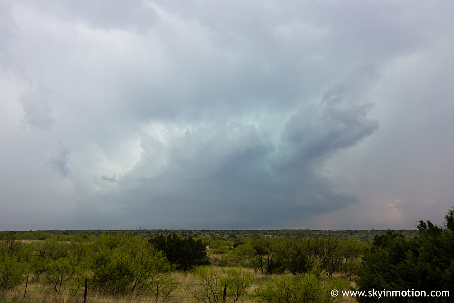
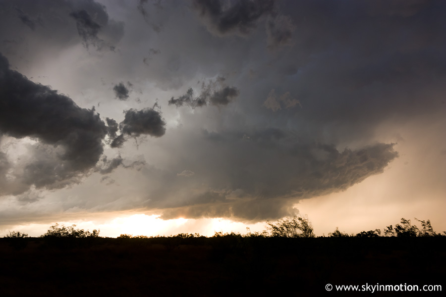
Unfortunately, but also unsurprisingly, we were completely without AT&T data in this area. We attempted to use NOAA Weather Radio as a backup, but could barely even hear it due to weak signals from all the "nearby" towers. When we finally did get a brief data signal on the computer, the latest radar image showed that we were in the midst of a complex of merging HP supercells (as if we didn't know, given the photo above), but that another supercell a couple counties W of us was more isolated, albeit still HP. It looked like it was very outflow dominant, and encompassed a very large area with heavy precipitation, but velocities still indicated decent rotation in the area one would expect. We started meandering W towards Turkey, figuring we could intercept that storm if its appearance improved, or just call it a day if not. Midway there, we saw a fairly ominous lowering off to our N in association with the cell we'd been watching (pictured above). Of course, it was raining at our location and visibility was poor at best, but we ended up spending 10-15 minutes watching it just in case. By the time we abandoned it and continued S out of Turkey, the supercell moving out of Floyd Co. into Motley Co. was already tornado-warned, and tornado reports were soon to follow. We would be too late for all of them.
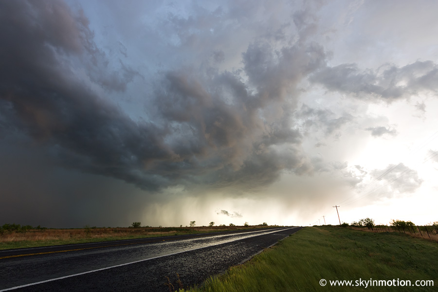
We arrived in Matador probably 10-15 minutes after the last of the tornadoes had ended, and by that point there were two supercells exhibiting significant rotation on radar: the one which had produced the twisters just to our W, and another just to our E. We headed NE out of Matador on a backroad and ended up right under the circulation of the latter, but yet again, it was a true HP beast and visibility was just pitiful anywhere near the "area of interest." Depressed, we let this monstrous mass of blinding rain and hail drift E away from us before attempting to begin the drive home. Once it had moved off a ways, we started heading E towards Paducah. As we were approaching that town, the storm was still over them and reports were coming in of baseball size hail and 70-80 mph winds, so we held up again. I shot these looking back W at a couple new storms that had developed to our SW and NW, respectively.
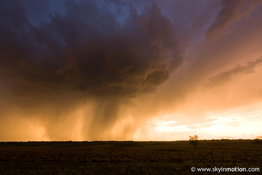
When we resumed the drive and pulled into Paduach just behind the storm, we found quite a mess: massive street flooding and more downed tree limbs from extreme straight-line winds than I've ever seen before! We then headed N towards Childress to stop for food, and along the way, the precipitation shaft under the second of the two storms pictured above provided a nice backdrop for the sunset looking W.