An extreme-CAPE environment south of a cold front produces a nice HP supercell for a few hours before widespread subsidence ends the show early.
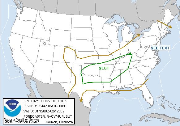
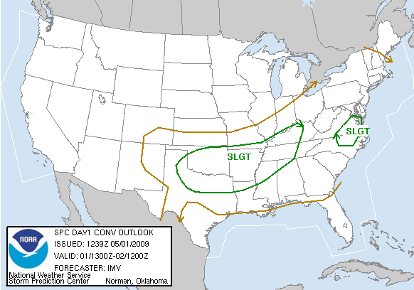
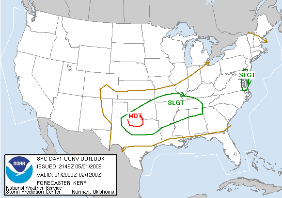
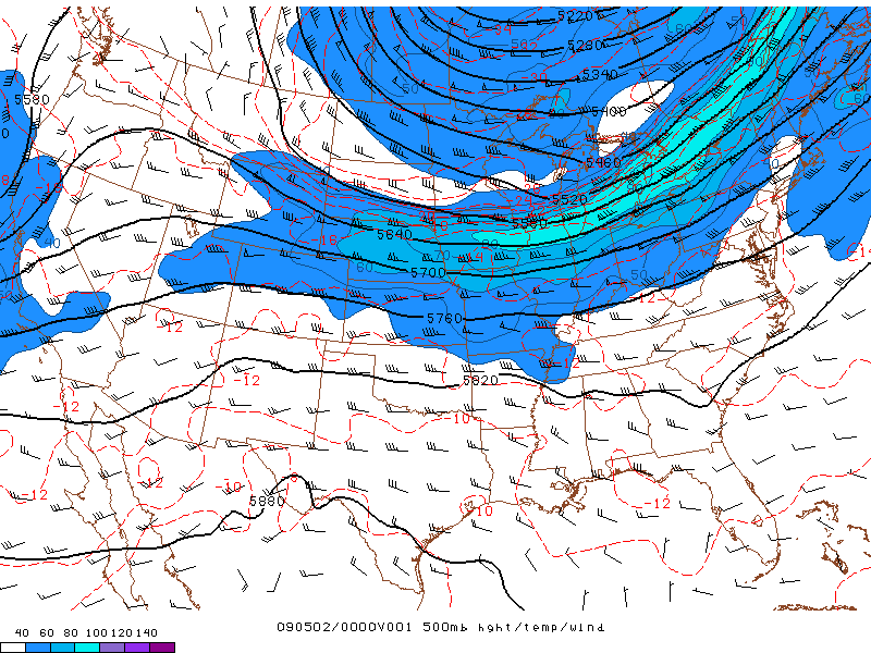
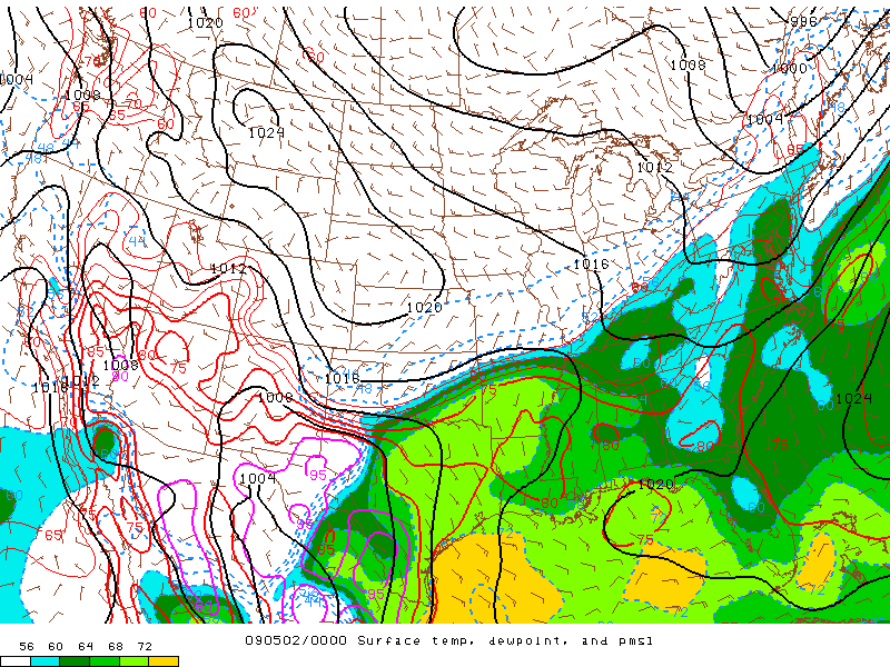
An E-W oriented outflow boundary stretched over north TX made the day a lot more interesting than it otherwise might have been, given 500 mb winds under 30 kts. It seemed we had suddenly progressed to the late-season mode of marginal, high-instability, boundary-dependent days. (Little did we know, the apparent jump from April to June would continue its natural progression for several more weeks, with the remainder of May offering very little in the way of Plains convection.) The rule of thumb for such late-season days is to get on the initial convection as soon as it materializes, as boundaries can only fend off the HP characteristics favored by weak upper flow for so long. With that in mind, Bryan, Vivek and I took off just after noon for an initial target near Seymour, ditching our Mesoscale lecture in favor of a more direct learning approach.
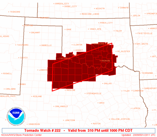
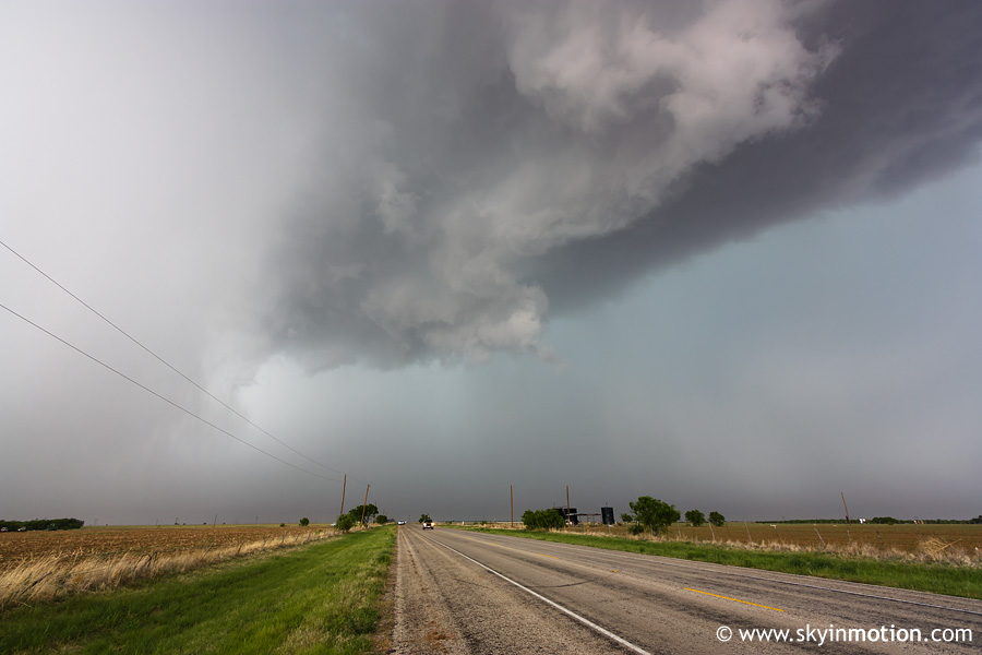
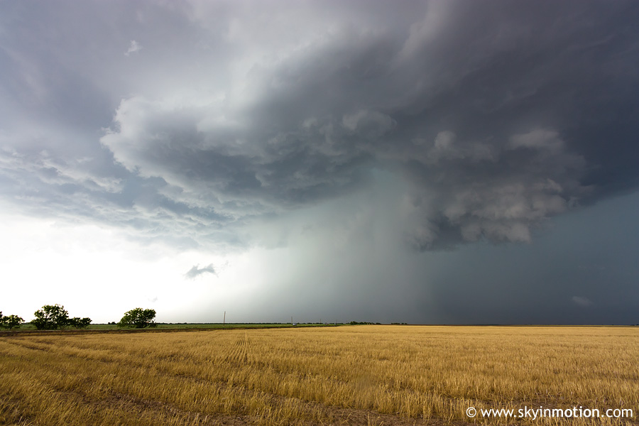
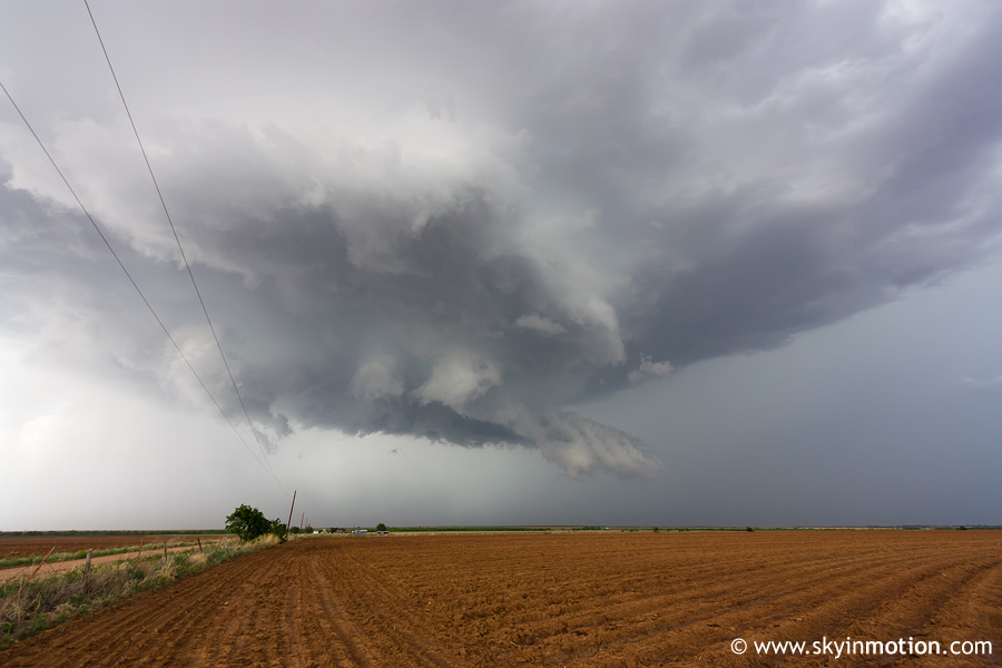
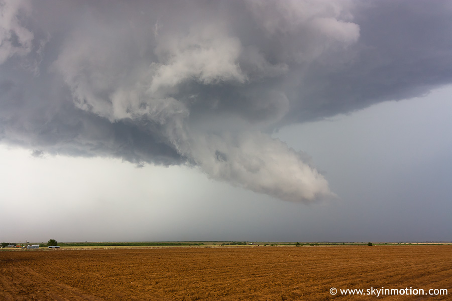
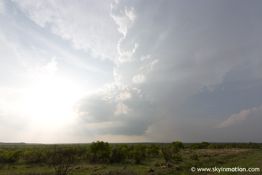
Unfortunately, our relatively early departure was not quite sufficient for the explosive-convective-vomit-crazy 2009 chase season. By the time we reached SPS, two supercells were already developing well to our WSW in Knox Co. We raced directly towards them on US-277, but were already seeing reports of what would be the only tornado of the day before we reached Seymour. It was spawned by a supercell south of Benjamin, which had clearly become the dominant storm in an increasingly messy cluster of convection. We turned S on US-277 at Munday, and finally gained a good view of the updraft base (with an attendant wall cloud, and possible brief funnel) as we pulled into Haskell. Once there, we raced W on US-380, banking that we could reach a suitable road to drop S before getting munched by what appeared on radar to be a prolific hail core. Miraculously, we made it all the way to Rule without incident, then turned S on TX-6. For the next 45 minutes, we were able to meander down this road towards Stamford with a great view of this slow-moving HP.
At one point, a decent-looking wall cloud took shape under the base, but nothing came of it. There was plenty of red Texas dirt getting kicked up by strong inflow, however.
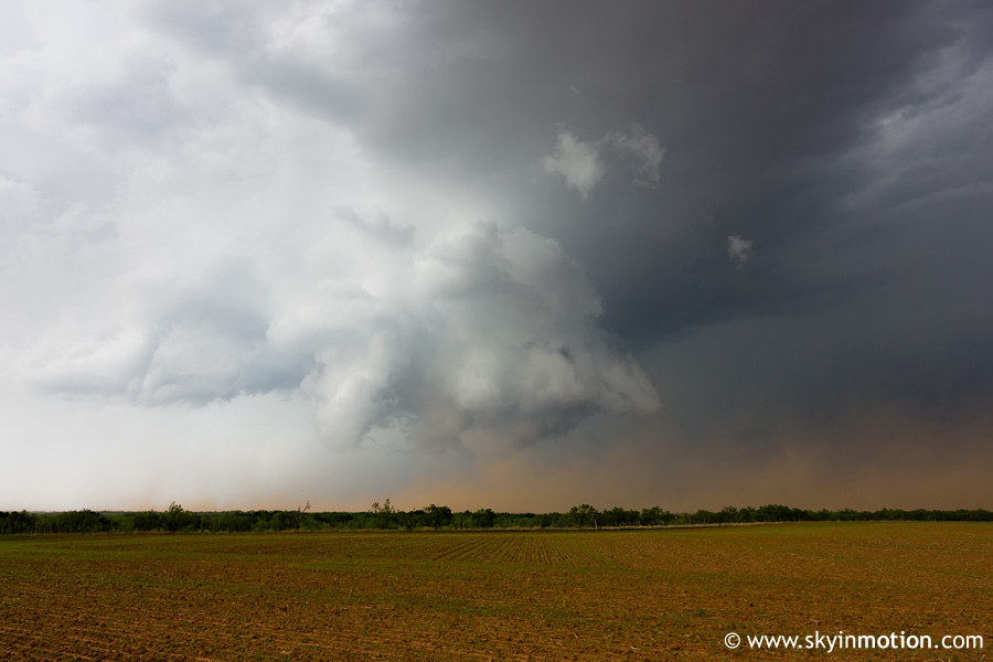
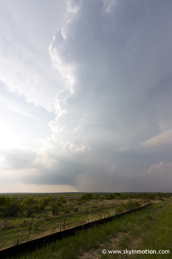
Right on cue, our storm began rapidly deteriorating as we reached US-277 at Stamford. Despite having been unquestionably HP for a few hours, it quickly transitioned into a pathetic, shriveling LP and quickly vanished as it moved east of the highway. Radar now indicated another supercell to our NE, near Seymour, was the best show in the area. Seeing as it was over 40 mi. distant and moving away from us, pursuit seemed a bit futile, but it was in the direction of home so there wasn't much excuse not to. However, it wasn't long at all before the Seymour storm met the same fate as the Haskell Co. storm, being eaten from the bottom up by increased capping. I'm still not sure whether the culprit was undercutting by the cold front, as some suggested (it appeared to me on surface analyses that the front was still up near the Red River at the time our storms began dying), or simply subsidence from shortwave ridging. Either way, the show was completely over by 6:30pm, which I don't think anyone was expecting. As we traveled US-183 between Throckmorton and Seymour, we were treated to a nice view of the skeletal remains of the Baylor Co. storm.
There was literally no cloud matter remaining from this storm by the time we approached Seymour, but we still received some light rain under the 100% clear skies. Just goes to show how depressingly fast storms can decay when capping kicks in! After blowing a good half hour scouring SPS for local BBQ joints still open (now after 8pm), we settled for IHOP, then headed back to Norman and arrived around midnight.