Just when the cap appears to be winning, an isolated, classic supercell explodes west of DFW, giving us windshield-cracking hail and great structure.
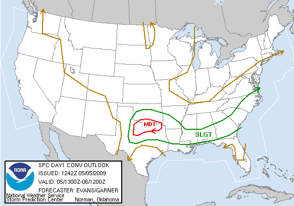
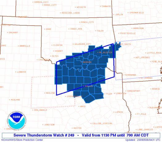
Ingredients appeared to be in place for significant supercells along and S of a warm front in north TX, so Brandon, Bryan and I headed out towards SPS after lunch. After some debate, we dropped S from there to Olney, but ultimately ended up with the hordes awaiting initiation in Throckmorton by mid-afternoon. I became concerned when we approached the 5:00 hour with absolutely no convection to speak of, but just when hope appeared to be fading, a lone supercell developed just SE of town. We flew SE to Breckenridge to get on the S side of it, and figured we'd have a great route to follow it E in US-180. Unfortunately, that plan didn't last long, as the storm began weakening rather quickly. We made it as far E as the Possum Kingdom area in Palo Pinto Co. before stopping to consider abandoning the chase, since it appeared the capping responsible for our storm's lack of intensification would probably keep things quiet throughout the area, especially with solar heating on the decline.
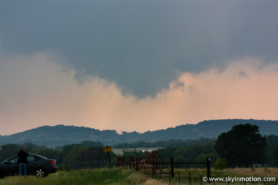
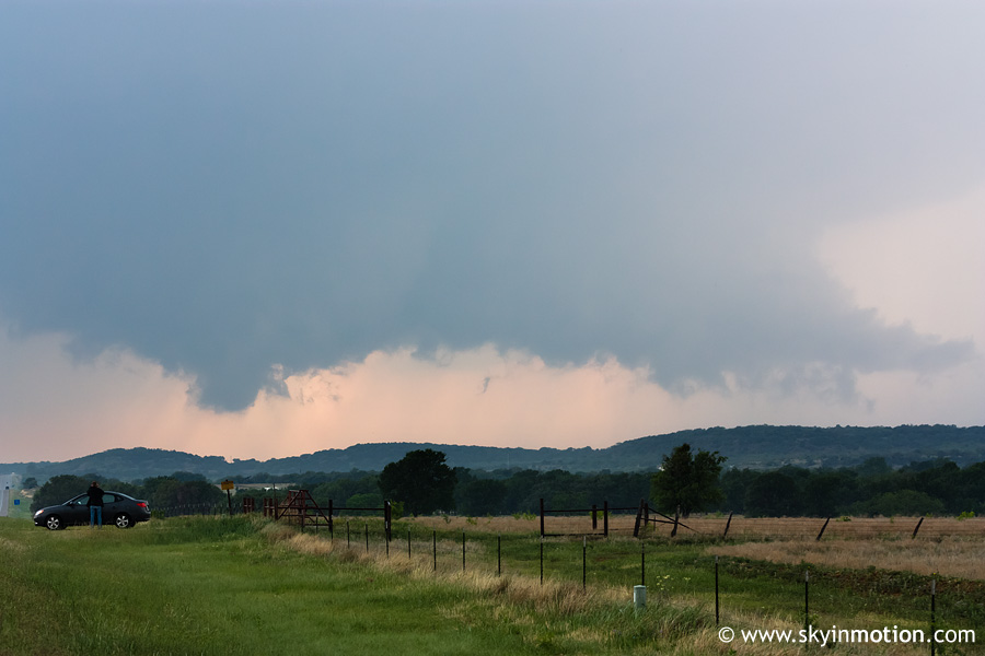
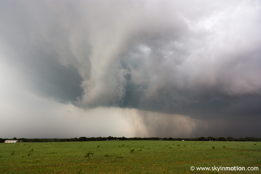
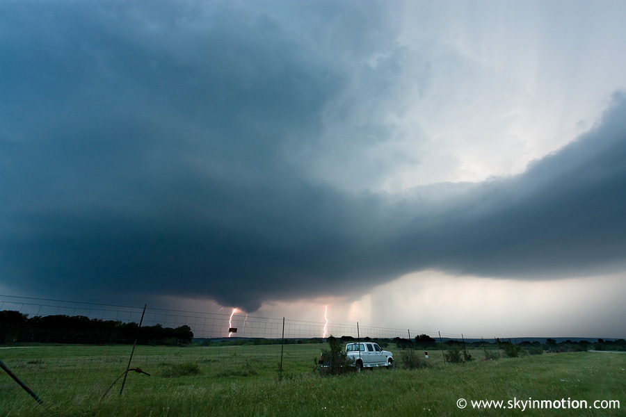
After half an hour of chatting with some other chasers along the side of the road, we were about to call it a day, but just then another storm rapidly exploded back W near Breckenridge. We ventured back on US-180 for a look, and were surprised to see a nice wall cloud as we approached.
Unlike the afternoon storm which had developed in this same area, the evening one would go on to become an intense, classic supercell as it dove SSE towards I-20. We exited US-180 a few miles E of Breckenridge to begin our journey down the farm roads of southeast Stephens Co., and were immediately greeted by this lowering to our E.
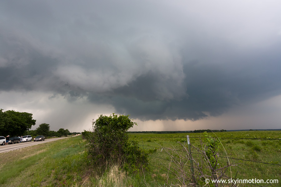
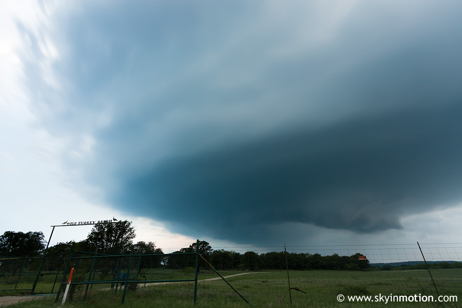
While keeping up with the storm wasn't much of a problem, finding suitable viewing points in the Cross Timbers terrain was. It wasn't until we were close to the Stephens/Eastland Co. line N of Ranger that we pulled over long enough for more pictures. At that point, a nice wall cloud had again developed, this time just to our NE. Unfortunately, it became socked in with rain rather quickly.
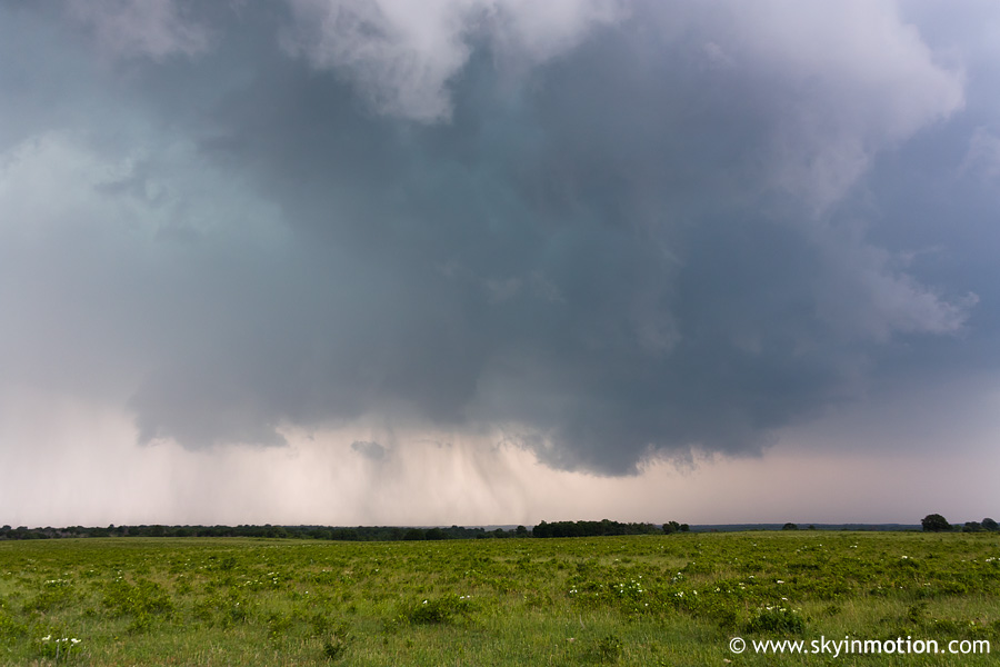
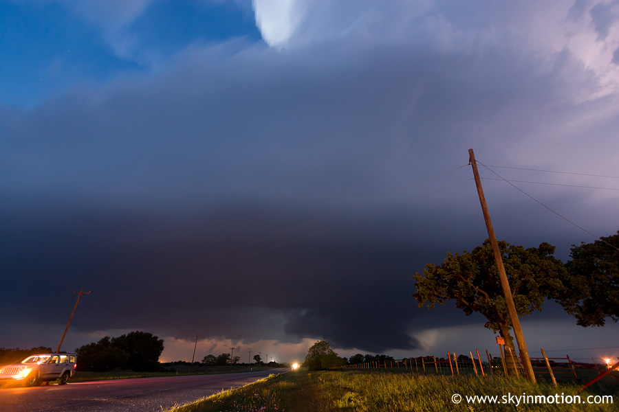
The real fun was just beginning, though. We reached I-20 at Ranger and were eager to finally regain some speed and, hopefully, views unencumbered by trees along the road. The only problem was that the core was poised to cross the interstate a good 10-15 mi. to our E, and it wouldn't be long until that happened. What to do? Well, along with dozens of other fools, we gunned it in the hopes of getting on the SE side of the updraft base before trouble struck. Ten minutes later, I was reading reports of cars being totaled by softball-size hail to our N as we watched the core close in on us, the next exit some 5-6 mi. ahead. When the you-know-what hit the fan a few minutes later, we didn't see anything close to softballs, but even the golfballs we were pummeled by proved dense enough to leave Brandon's windshield with a nice circular crack pattern about a foot in diameter. All in all, we were luckier than quite a few other chasers in the area, though!
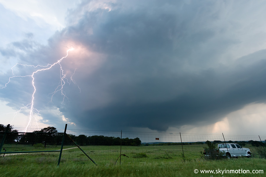
We finally escaped the commotion by exiting I-20 onto TX-108. A few miles into the drive S towards Huckabay, we reaped the rewards of staying ahead of the storm: the structure was probably the best I'd seen so far in the year, and CG activity was ramping up just in time for sunset. These were shot looking W from about 5 mi. S of I-20 on TX-108 in northern Erath Co.
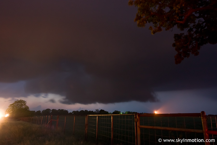
Much to our dismay, it seemed part of the reason for the nice structure was increased capping with nightfall, which did not bode well for tornado chances. Sure enough, our storm rapidly went through the whole "dying LP" phase once the sun went down, after which time we started the fairly long haul home.
I can't decide whether to count this day as a success or not. On the one hand, it's rare for a day to look as bad as this one did at 6:30pm and recover at all. But -- yes, there's pretty much always a but when I say something positive about a chase day -- the inability of this long-lived, classic supercell to even come close to producing a tornado was quite a letdown given the environmental conditions. It's one of those days where the lack of tornadoes doesn't seem so bad when taken individually, yet at the end of the season when I think about how I screwed up the few good tornado days but made good decisions on so many others -- like this one -- which "could have" produced and didn't, it really gets me down. This was also the last legitimate chase setup for a full month, which didn't help.