
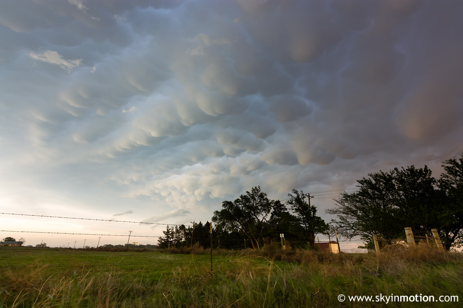
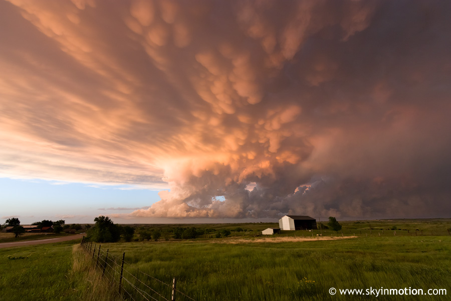
Panhandle Magic to the rescue again - despite crappy storms, a stunning shelf cloud and mammatus salvage an otherwise uneventful chase.
Marginal day with weak upper support and a boundary layer a bit on the dry side. Brandon and I left after lunch for the TX Panhandle, initially eyeing the Childress area but prepared to haul farther west if necessary. In classic 2009 fashion, concerns over a possible cap bust were rapidly replaced by displeasure over the abundance and mode of convection by mid-afternoon. Numerous storms were developing along the I-27 corridor, so we headed W out of Childress and eventually met up with the most robust-looking cell near Silverton. Unfortunately, it was high-based and not good for much beyond dusty, cool outflow.
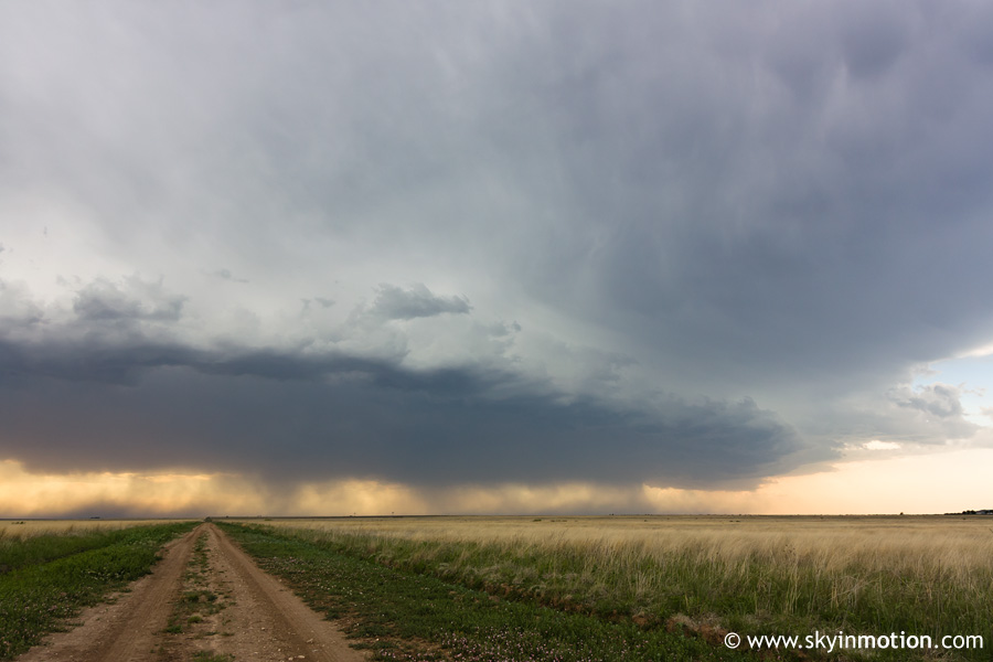
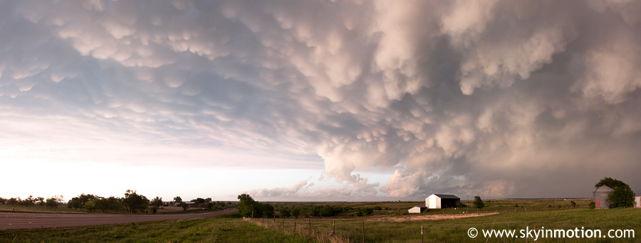
After watching it approach Silverton from the W for a bit, we started back E to get ahead of a couple other cells moving NE into Hall Co. After stopping in Caprock Canyons SP to chat with Wes for a few minutes, we continued on towards Brice, still longing for a 2009 tornado intercept that even halfway compared to the 2007-03-28 monster we witnessed there. By the 7:00 hour, it was obvious all convection in the region was trending towards a linear mode, so it was time to make the best of it and get some shelf cloud shots. This was somewhere between Brice and Memphis on TX-256:
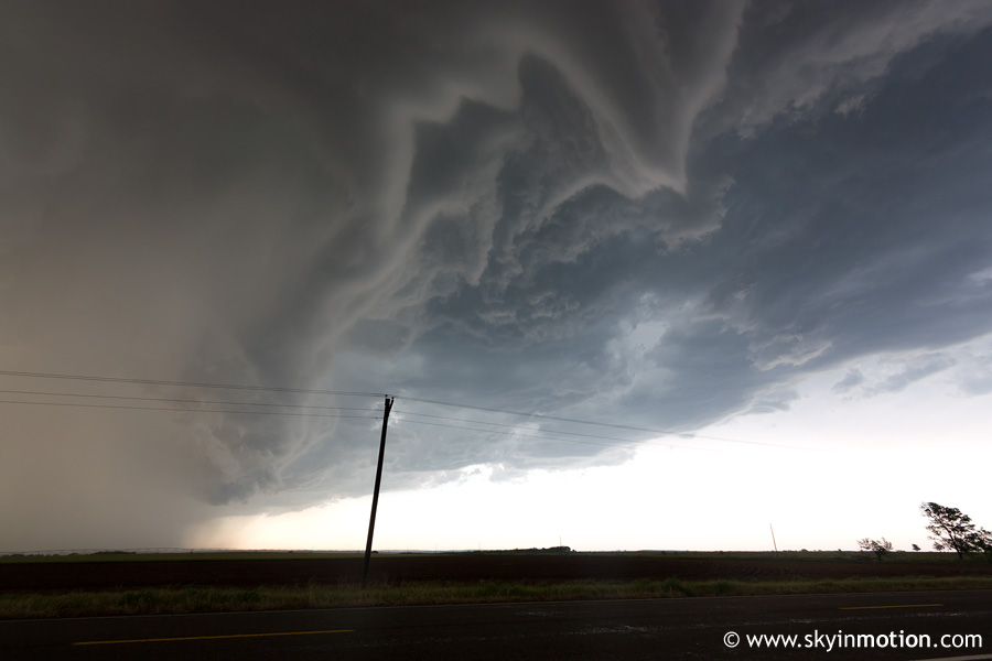
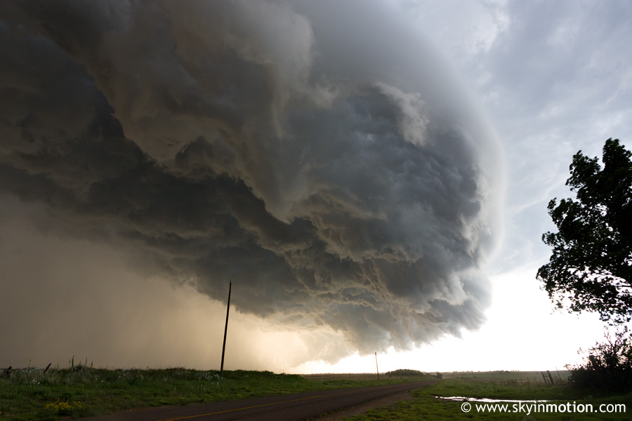
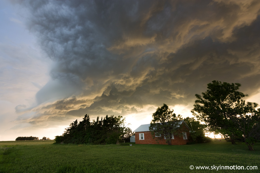
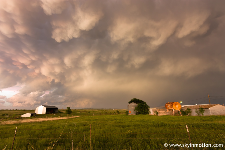
As we continued E, the shelf cloud associated with the line segment racing up on us gradually transformed into the most impressive I've witnessed to date. Its forward speed was every bit as impressive as its visual appearance; even at 75 mph, we could hardly stay ahead of it! Finally, somewhere just S of Quail in Collingsworth Co., I decided it was a lost cause and jumped out of the car for a few quick shots before it began to overtake us.
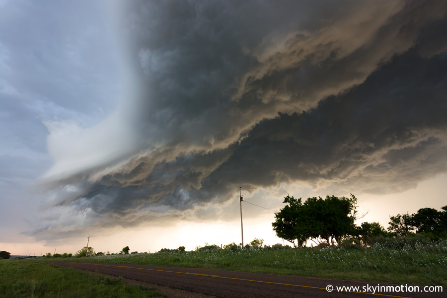
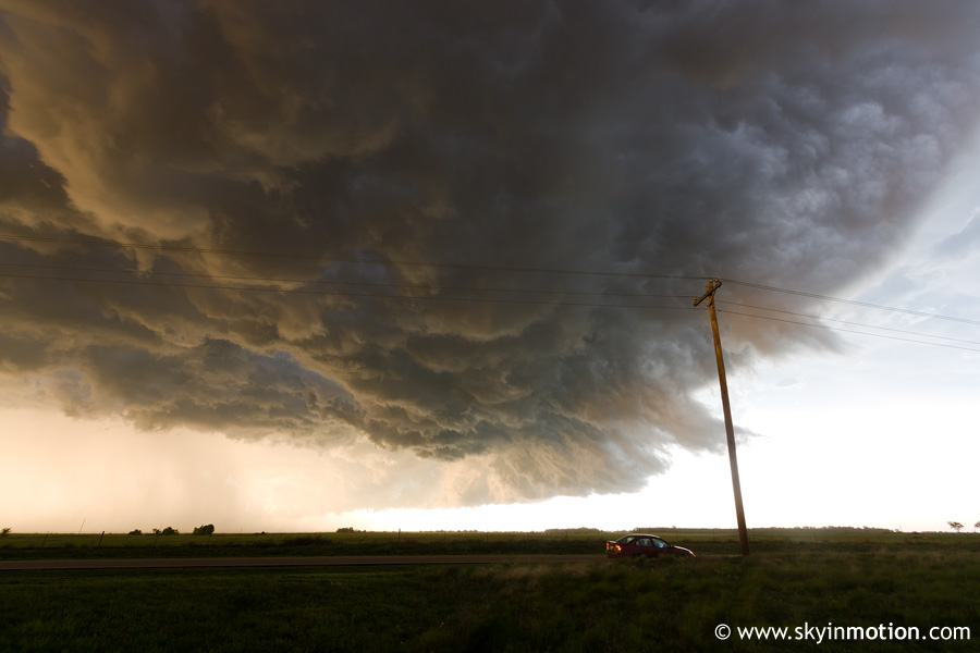
We jumped on TX-203 going E out of Quail and somehow managed to stay ahead of the shelf for another 10-15 minutes, allowing for some more shots W of Wellington.
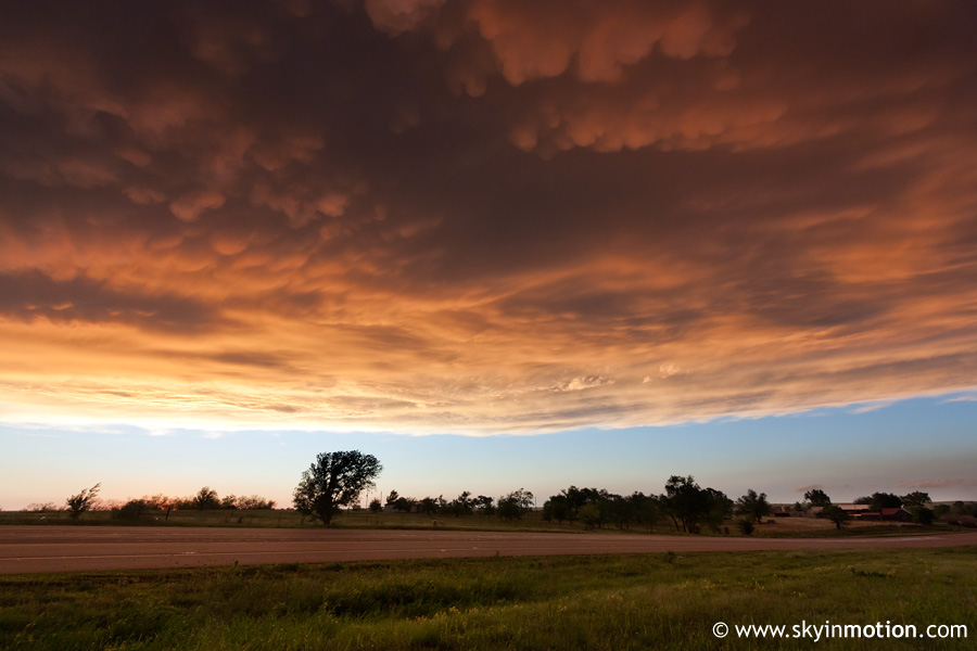
Once we reached Wellington and US-83, we had to decide between pursuing stronger (albeit non-supercellular) convection either to our N or to our S, with the latter exhibiting more intense reflectivity on radar. Given the late hour and distance from home, it didn't take long to opt for the northern option, which would allow us to take I-40 home. As we cruised N towards Shamrock, the heavy rain and strong winds behind the shelf cloud finally raced over us; once we escaped to the N, we were treated to an exceptional sunset in Shamrock as another cell to our E crossed into OK.


