Yet another late-to-the-party chase for 2009; a photogenic supercell in southwest NE later in the evening is a small consolation prize.
Bryan and I left Norman the evening before and stayed the night in Hays in preparation for a morning drive to eastern CO. We awoke early enough to get back on the road (specifically, I-70 westbound) by 10am, a departure time that seemingly gave us a comfortable margin of error even if storms formed early and/or right along the Front Range of N CO. At the time, based on model guidance, late-afternoon initiation around Ft. Collins seemed like a worst-case scenario for us. Too bad we still hadn't picked up on 2009's M.O.: initiation early and often! In the end, it wasn't the early initiation that really killed us so much as the drastic last-minute change in target area.
After a quick lunch in Colby, we continued leisurely W until hitting US-385 northbound at Burlington. Between there and Wray, data was hard to come by even on my new Alltel aircard, giving us a proper introduction to chasing on the CO eastern plains. Once in Wray, we met up with Wes at the local 7-11 and took our time filling up the tank and buying snacks. Bad move. We eventually pressed on to Holyoke, then turned W on US-6. Around this time we could see on radar some disorganized upslope storms rolling off the mountains to our NW, all of them N of the CO-WY border. With higher instability and better model signals for initiation (at least on the morning runs) across north-central and northeast CO, we were at first tempted to chuckle at the increasing chaser convergence in Cheyenne. Half an hour later, it wasn't so funny, as one of the cells well N of CYS (of all places) was undergoing a meteoric increase in intensity and exhibiting rotation on radar. As we blasted W towards Sterling, it was plainly obvious what was about to unfold, simply because it's happened to us so many times already this year: a lone storm we have no hope of reaching goes tornadic early in the day, then everything else afterwards is junk. Sure enough, this storm produced the relatively long-lived and infamous LaGrange tornado shortly thereafter, a photogenic prize caught not only by hundreds of recreational chasers, but the media and scientific armada of VORTEX-2.
For our part, we were putting forth a noble effort to correct our error by flying N out of Sterling (possibly above the posted speed limit). Just to add salt to the wound, the storm of the day managed to stay tornadic for so long that it was only as we finally pulled into Kimball, NE, with an apocalyptic-looking wall cloud visible on the horizon about 30-35 mi. to the NW, that the circulation finally lifted off the ground. I mean, it's one thing to be late and miss the show, but for it to last nearly half an hour and end just minutes before your arrival? Okay, not exactly surprising for me anymore, but come on.
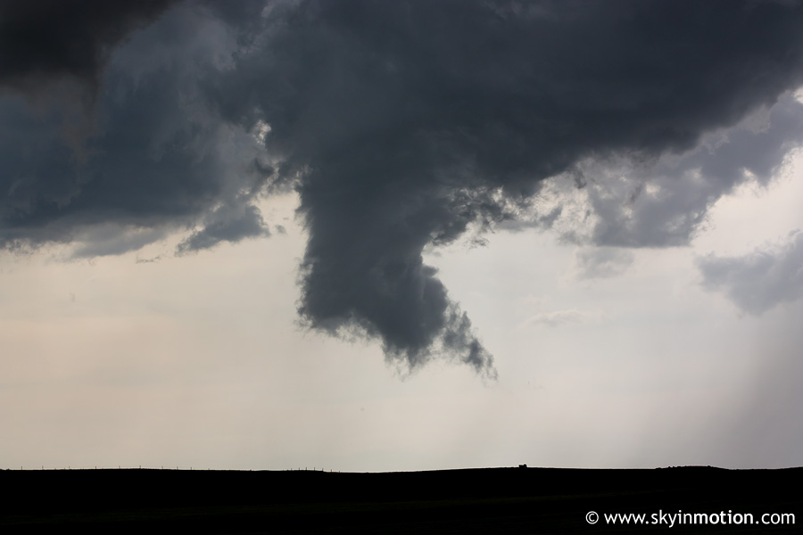
We flew N out of Kimball on NE-71, and finally found ourselves within clear view of the storm base as we neared Harrisburg. By this time, the monstrous wall cloud had all but vanished, and the entire storm looked outflow-ish. After a good while, it spit out a funnel W of the highway near the Banner-Kimball Co. line, but let's just say no one was too concerned about an imminent tornado.
The funnel quickly retreated, and as the base moved over the highway, our prospects appeared quite bleak.
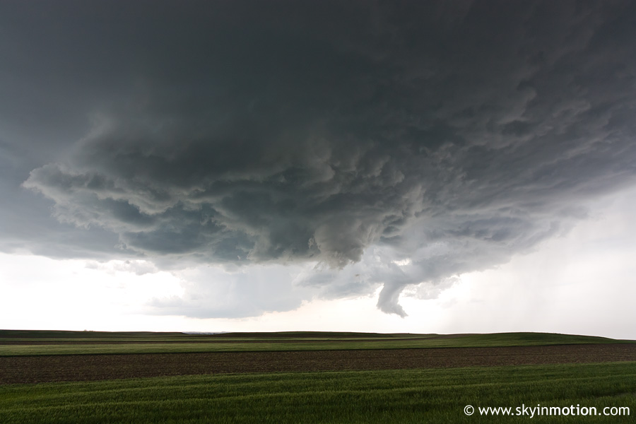
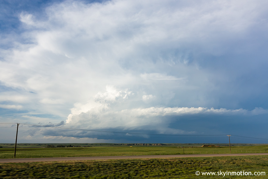
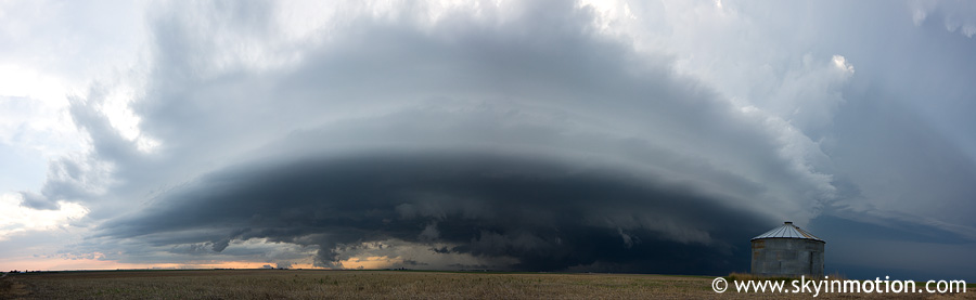
We dropped back down to I-80 at Kimball to begin cruising E and hope for a miracle with this storm; even when/if it didn't happen, we'd still be on our way to a good stopping point en route to the next day's chase in eastern NE. I wouldn't exactly call what followed a miracle, but the LaGrange cell did become fairly photogenic, which was surprising enough considering how it looked in the image above. Here was the view from I-80 near Kimball looking back N:
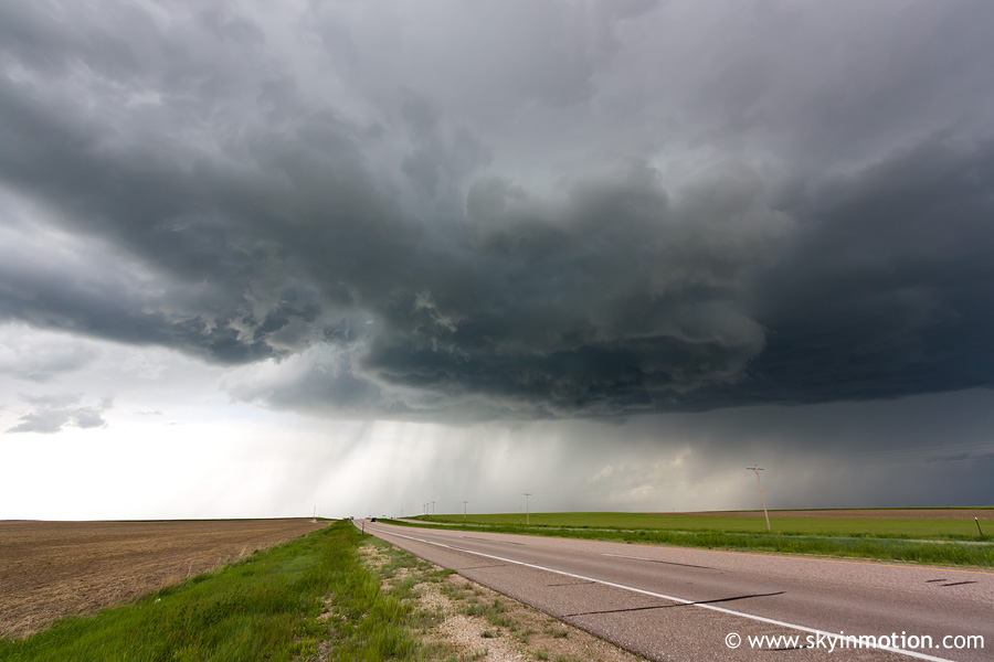
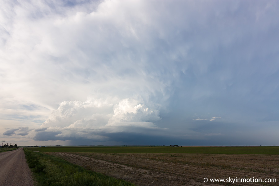
By the time we crossed the Kimball-Cheyenne Co. line, we decided we might as well (re-)commit to this storm given the hour or so of daylight remaining. We exited at Potter and hauled N on some decent gravel roads, attempting to catch back up with the storm from the SW.
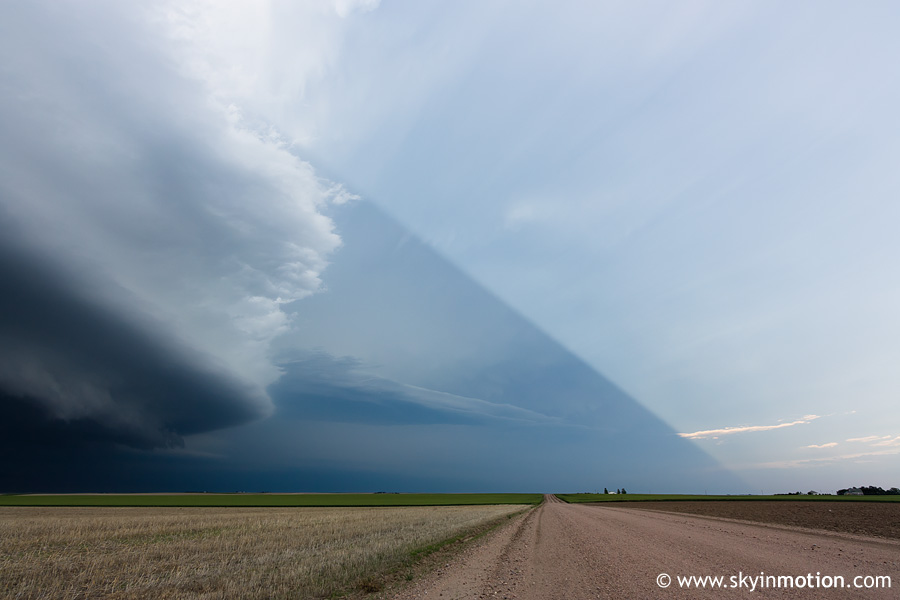
The catching up part required some white-knuckle driving, especially once we turned E and headed towards US-385 at Gurley. The northern view we obtained once we arrived was well worth it, though.
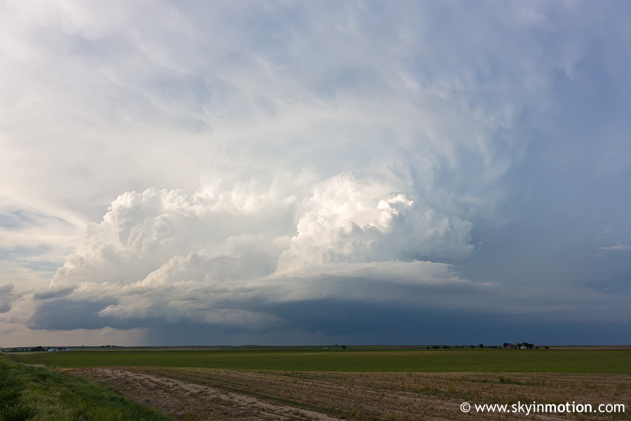
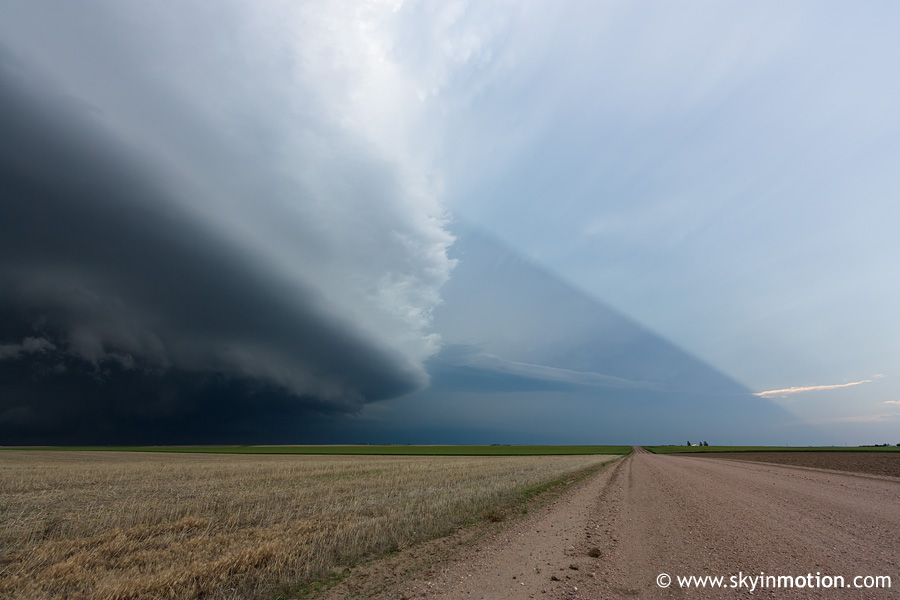
If you didn't know my chasing history, you might be tempted to think that's a Greensburg-caliber wedge in the center of this next shot. Sadly, the possibility crossed our minds at the time, for a few seconds anyway.
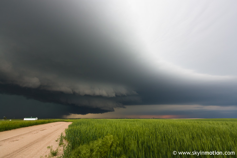
To top off the impressive view looking N towards Dalton, the entire supercell was casting a well-defined shadow off to our E.
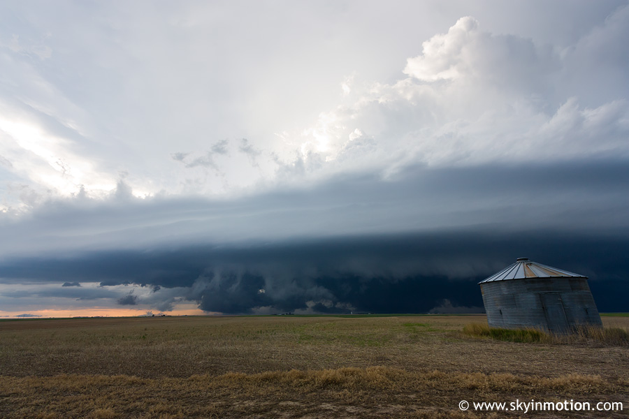
As the southward component of the storm motion eventually forced us to continue E on more dirt roads, more signs of outflow dominance appeared, but it at least made for a photogenic scene in the soft twilight.
And with that, we called it a chase and snaked our way down to I-80. After stopping in Ogallala for chow, we opted to front-load our long drive to the next day's target along the NE/IA border by hauling it all the way to Kearney in the dark. The mean MCS that was born out of our daytime supercells didn't exactly help make that process smooth sailing, but at least the hail never got too big.
June 5, 2009, will always be remembered for the upslope-storm-on-steroids in Goshen Co., WY, which, in a matter of 30 minutes, became the most sampled tornadic supercell in human history. What won't be remembered is the failure of convective initiation throughout CO, where higher instability, less cloud cover, and comparable wind shear existed when compared with the WY environment. Just the way it goes, I suppose.