Like the last chase, but worse: veered low-level flow and a southward-moving boundary yield a mess of merging HP cells instead of classic, tornado-producing sups.
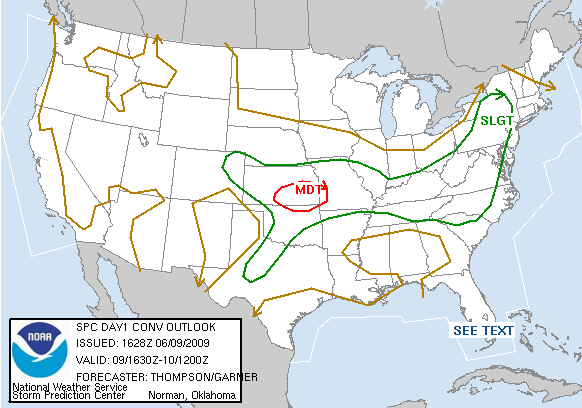
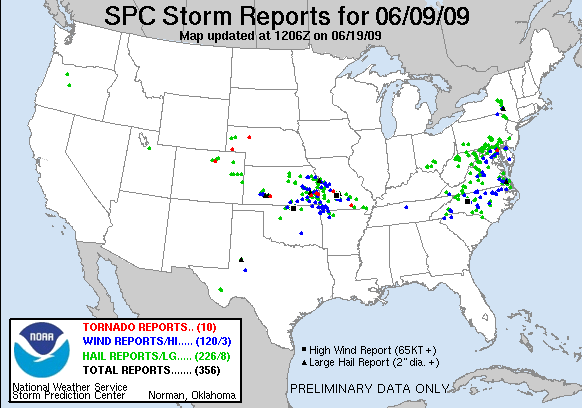
Bryan and I chased south-central KS with very poor results, given the 15% hatched tornado outlook. We meandered all over the Wichita metro area during the mid-afternoon following cells that would fire along an E-W oriented outflow boundary; the cells would no sooner develop than end up on the cool side of the boundary, since it was moving S, while storm motion was primarily E. Of course, at the risk of sounding like a broken record (if you've read the earlier 2009 accounts), the sheer number of storms and the way they all initiated at about the same time -- around 3-4pm -- was far from helpful, other factors aside. Because low-level winds were forecast to veer rather badly near and W of I-35 as the afternoon wore on, we ended up shifting into southeast KS by early evening, but the situation there was much the same: a conglomeration of disorganized HP garbage. By the time we drove into Independence, the sky looked more tropical than chase-worthy, so we gassed up and dropped S towards Tulsa to begin the trip home.
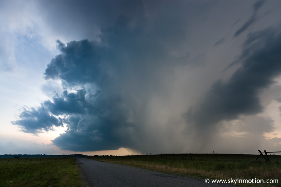
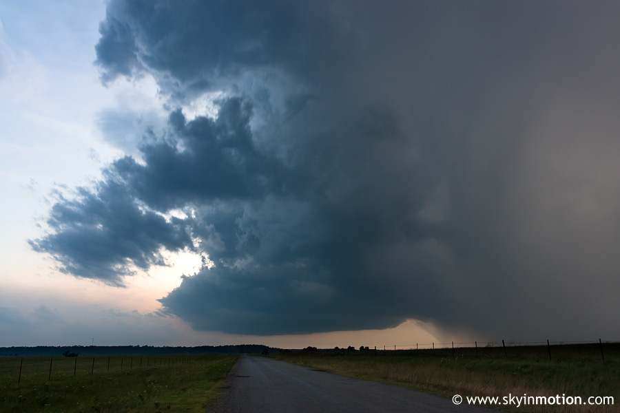
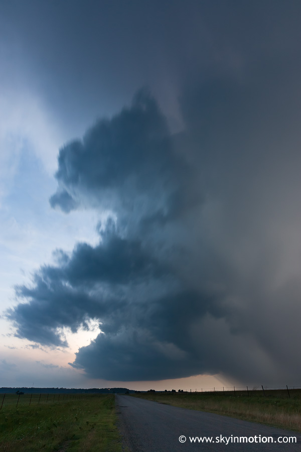
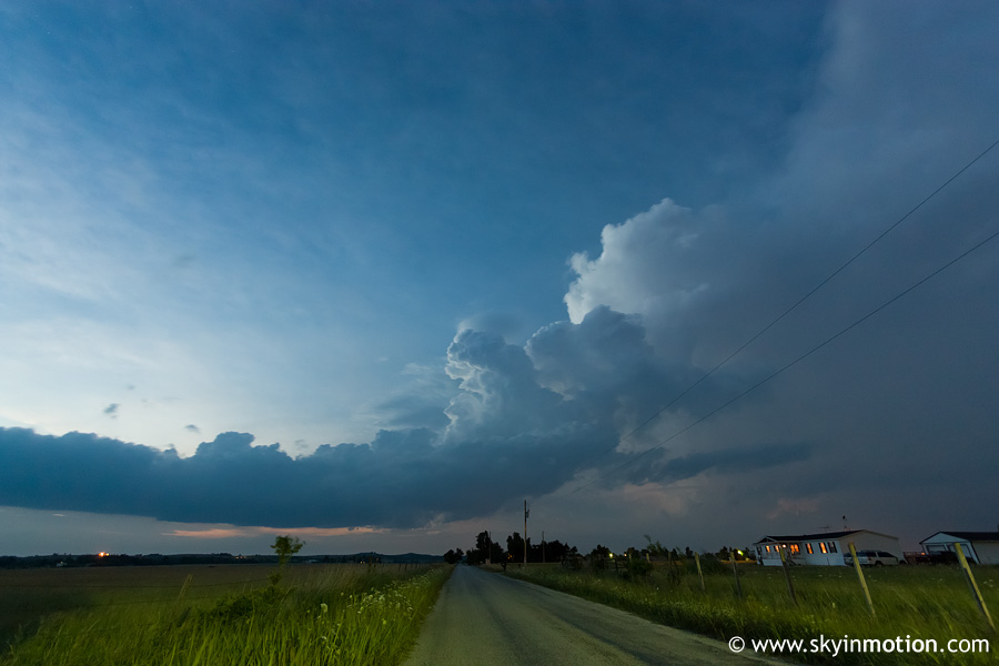
It's amazing how after several years, I've yet to learn my lesson about being persistent until darkness falls on a chase day, no matter how dreadful and messy everything looks earlier on (cough... May 29, 2008... cough). Looking back now, dumb as it sounds, hunger is almost always the reason I fail to stick with that plan. And today was no different, though luckily not much was at stake. We stopped at KFC in Bartlesville about half an hour before sunset, and I didn't even bother glancing at the radar before we went in. About a third of the way through our meal, Wes calls me and lets me know of an a-bomb supercell over Osage Co. he's watching from I-35. Being in Bartlesville, we're closer than he is to it and almost directly in its path. I shoved down as much food down as I could in a matter of 30 seconds, chucked the rest, and we ran back to the car to fly S out of town. The base of the Osage Co. storm came into view off to our W somewhere near the Washington-Tulsa Co. line, and though it was obviously on the decline with loss of heating, the structure and lighting conditions at least gave me the first reason all day to whip the camera out.