Underperforming moisture and 1pm initiation? If I didn't know any better, I'd say it's 2009 all over again...
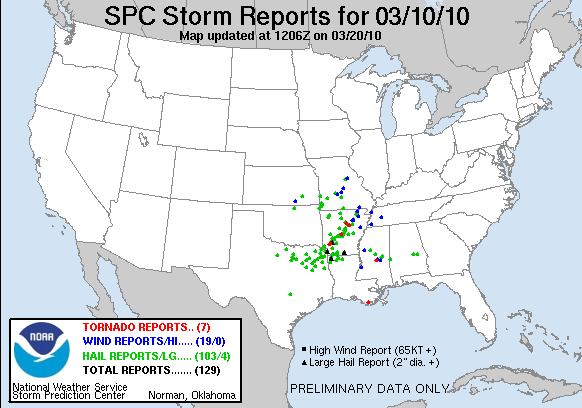
The second of two shortwaves was forecast to eject into OK out of the mean western CONUS trough during the course of the day, providing very cold mid-level temperatures atop modest dew points in the warm sector and near the surface low. Seeing as the first shortwave two days prior had spawned a strong, long-track tornado in an environment with surface T/Td observations of about 60/52, it was going to be hard to sit this one out -- nevermind that it had been nine months since my last legitimate chase.
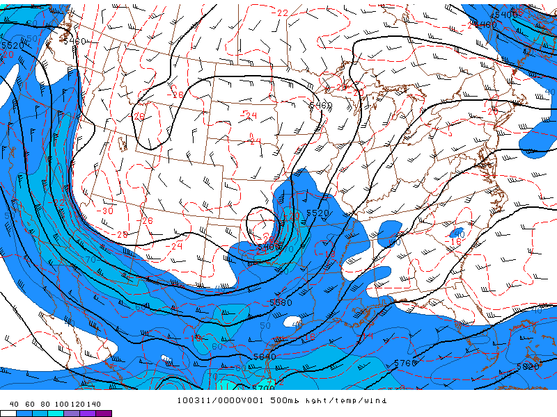
Alas, not much about this chase looked as desirable as Monday's, which I had to sit out to study for an exam worth 50% of my grade in Advanced Synoptic. The surface low over the TX Panhandle in the morning was forecast to redevelop along the I-35 corridor in central OK, then track NE into southeast KS by evening. While significant severe weather appeared probable along the dryline/cold front in the true warm sector, it would occur deep into the Ozarks of western AR, which we ruled out as a chase target. Instead, we focused on two other areas: first, the zone immediately E of the surface low and extending NE along the warm front over extreme southeast KS into southwest MO; and second, the cold core play in north-central OK and south-central KS.
I woke up at 9am to find a very impressive surge of moisture underway across eastern OK, with many Mesonet sites reporting three-hour dewpoint rises of 13-17 deg. F. Upon seeing this, and the 12z RUC's depiction of a 991 mb surface low evolving by 23z with 1500-2000 J/kg CAPE in southeast KS, I was quite a bit more optimistic than I'd been the night before.
By the time Brandon and I left around 11:30am, the new RUC runs were looking markedly less appealing, with a weaker and faster-moving surface low and less moisture wrapping around the N side for cold core. We headed for Tulsa on I-44, and by the time we arrived, a line of weak convection had broken out from just S of the Tulsa area down to the Red River. The associated cloud shield overspread virtually the entire target area, which spelled immediate doom for the day, considering instability was already forecast to be quite marginal. Instead of turning around right away as we should have, we spent the next few hours roaming around the Bartlesville-Coffeyville area in hopes that cleaing behind the initial line would occur soon enough to salvage the day. The problem was that moisture was underperforming -- and badly. Perhaps the early precipitation had aided in mixing drier air down to the surface, as most sites in eastern OK ahead of the dryline saw their dew points actually fall from early to late afternoon. Needless to say, the observed 46-49 F surface Td's beneath widespread overcast would not support tornadic supercells.
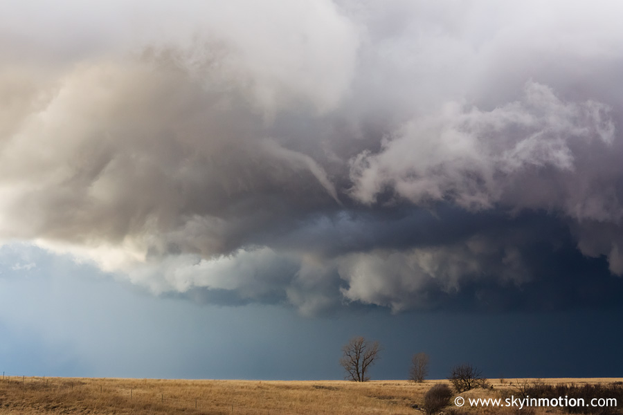
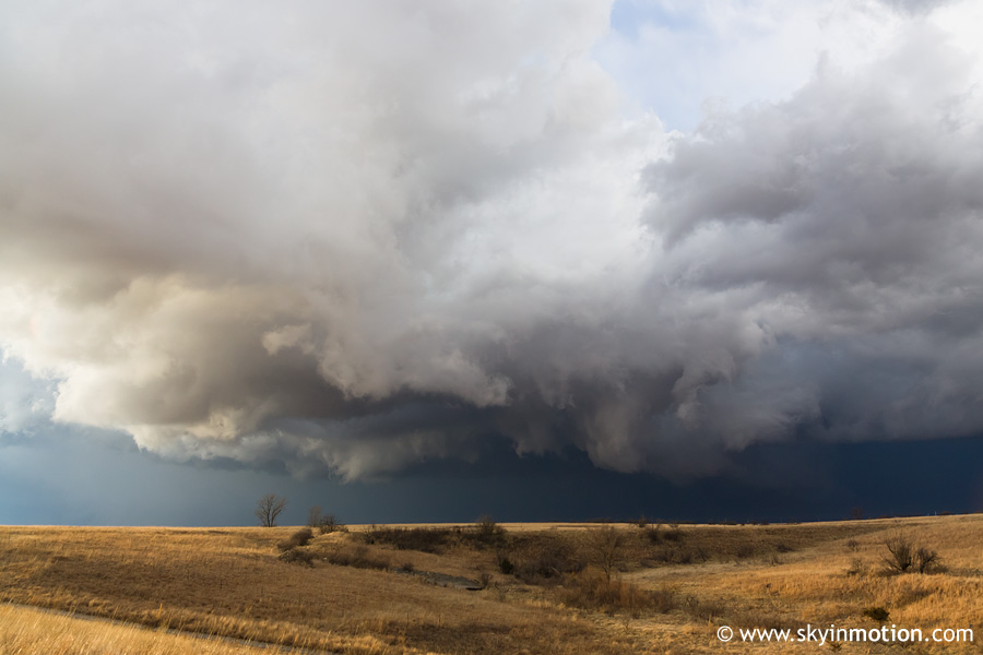
By late afternoon, widespread junk-vection was in progress across the northeast quadrant of OK. We moved W from Bartlesville to Pawhuska towards a low-topped cell W of there, then opted to head N into KS to pursue a different cell approaching Sedan from the S. By the time we made it up to US-166, this extremely low-topped cell actually had a few appendages on its rear flank. We waited along the highway, and as the updraft passed overhead, we observed a couple brief, tiny funnels. The first was the most impressive, but I wasn't able to capture it before it dissipated (in a matter of 10-15 seconds). Below is the second (smaller and even shorter-lived) funnel from about 5 W Sedan.
And here is a view of the back side of the storm as it raced off to the N:
We followed it a few miles N of town, then ran into Wes and talked to him for awhile. By the time we got back in our cars, the temperature was probably in the 40-45 F range. Pretty laughable, even for a cold-core day. We started home, but didn't make it far before running into issues with a power-tripping Sedan cop, the outcome of which made the day even less worth our effort than it had already been!