Capping throws a wrench in a nice early-season OFB setup, but some nice updrafts are observed.
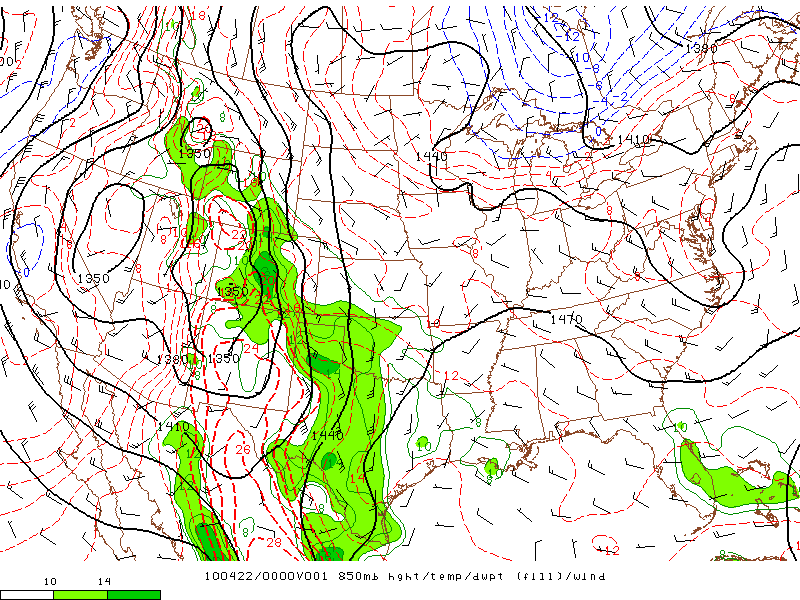
A major western U.S. trough with an attendant closed low was moving ashore, but the southern Plains remained under broad upper-level ridging ahead of this system. Still, diurnal heating and modest convergence along a few weak boundaries from the previous day's convection looked sufficient for convective initiation by late afternoon over the southern half or so of the TX Panhandle. Directional shear was excellent, and speed shear mediocre but sufficient for supercells. After all, a nice tornadic supercell had moved through the Amarillo metro area the previous evening with similar shear profiles and significantly less boundary-layer moisture.
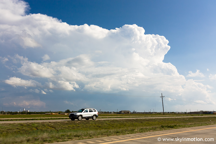
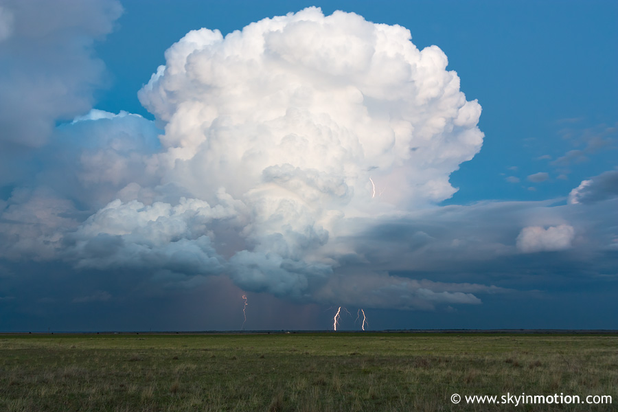
I left just before noon and arrived in Childress just after 3pm. High-resolution models and satellite imagery all pointed towards storms developing much farther W in the Panhandle, so I immediately pressed on towards Turkey, and eventually reached I-27 at Tulia. By then, around 5pm, several cells had been struggling to develop to the W and NW along the TX-NM border. As I reluctantly considered pursuing them despite poor moisture out there, another updraft showed explosive development (both on radar and visually) to my S, between Lubbock and Plainview. After waiting a few radar scans to make sure the intensification would continue, I blasted S on I-27 to Plainview, with this view to my immediate SSE:
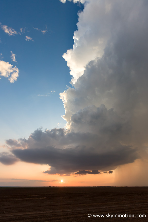
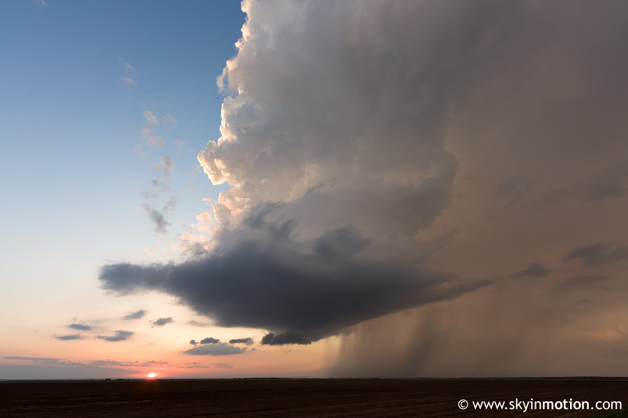
After battling Plainview "rush hour" traffic for 10 minutes or so, I hopped on US-70 eastbound for a few miles, then dropped S on TX-789 to Petersburg. During that drive, I gained full view of the fairly nice but high base of the supercell, but didn't stop for pictures. By the time I reached Petersburg, the base looked no more organized than before, and soon it started to look even worse. I meandered W on TX-54 until I encountered some very sporadic quarter or slightly larger stones, then turned back E and figured I may as well try to drop S to get better lighting for structure shots. The storm had other things in mind, though: namely, shriveling up and surrendering its fight for life to the cap within the next half hour. I ran into Wes at the intersection of TX-54 and TX-378, and we quickly decided to blast NE towards a northward-moving cell approaching the outflow boundary near Floydada. As we flew up that way, the backside of the updraft looked rather spectacular, and a pileus cloud appeared to envelop both the overshooting top and the entire backsheared anvil! Stupidly, I again neglected to stop for photography. By the time we approached the very messy base on TX-97 near Cedar Hill, it seemed shooting the updraft from 15 mi. away would have proved much more worthy of our time than what we were now seeing. We continued to the TX-97 intersection with US-70 a few miles E of Flomot, then spent at least an hour there with various other chasers watching the pathetic right split of the Floydada storm above the setting sun (first pic) and a photogenic lightning show with another weak supercell to our E (second pic).
As twilight approached we called it a day, and I followed Curtis McDonald and crew to Childress for Pizza Hut, arriving home by 1:45am.