Tornado outbreak across the southern High Plains yields a few tubes for us, one fairly respectable, plus a special "surprise" involving the rear windshield.
Observed 4 tornadoes.
A surprisingly active day, and more importantly, the beginning of a fairly decent streak for me that would continue through 2010 -- something I truly believed impossible by the end of my three year stint in chasing Hell (2007-09). Though the pattern was impressive and somewhat analagous to the big closed low setups of early-mid 2007, I was unconvinced that instability would be sufficient and correctly juxtaposed with low-level shear to produce tornadic supercells in the TX Panhandle. I had a decision to make: departing Norman early enough to ensure an on-time arrival to the action would require skipping my afternoon (Tue/Thu) class, a stunt I probably shouldn't have pulled at all, but certainly wouldn't be able to pull again no matter how good a setup came along later in the semester. Being my usual impatient and impulsive self, I met up with Brandon around 11am and took off for CDS, where boundary-layer moisture and instability was forecast to be notably better than N of I-40 (at the possible expensive of shear).
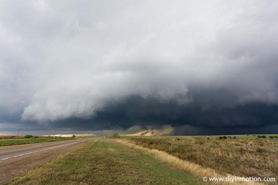
As we crossed the OK-TX line W of Hollis, the dryline was located just W of I-27 and surface-based convection was already initiating across southwest KS into the OK Panhandle. Fortunately, the cap was still holding throughout most of the TX Panhandle, as it was only 1:30pm or so. Noticing the apparent capping present so far N, we decided hedging towards I-40 rather than down near CDS was our best play, so we pressed on to Memphis, then Hedley after a short while. Not long after we arrived there, an updraft erupted to our WSW around Palo Duro Canyon, so we moved N to McLean to position ourselves ahead of it. After half an hour of development, it quickly became obvious this was the right choice, despite my worry that low-level shear was not yet "ready" for tornadic supercell development so early (~3:30pm).
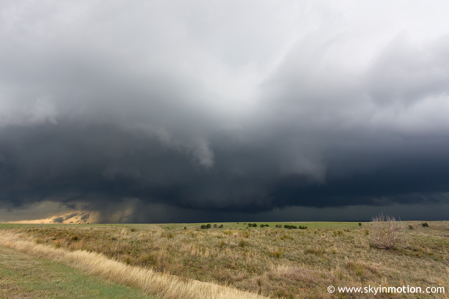
We sat in McLean for maybe 15 minutes debating whether we wanted to bite on a storm that would soon be crossing I-40 (well N of our original target), then started moving W to meet it. At Jericho, we exited S onto TX-70 and joined the hordes watching it approach from the SW on the only paved road for miles around. As it closed in on I-40 a few miles W of the highway, a substantial wall cloud took shape. I was still hard pressed to get excited given model forecasts for low-level flow to remain anemic until evening, but the visual evidence of imminent tornado potential was quickly enough to convince us to fly N to I-40, then W a few miles to Boydston where we ultimately met up with the mesocyclone.
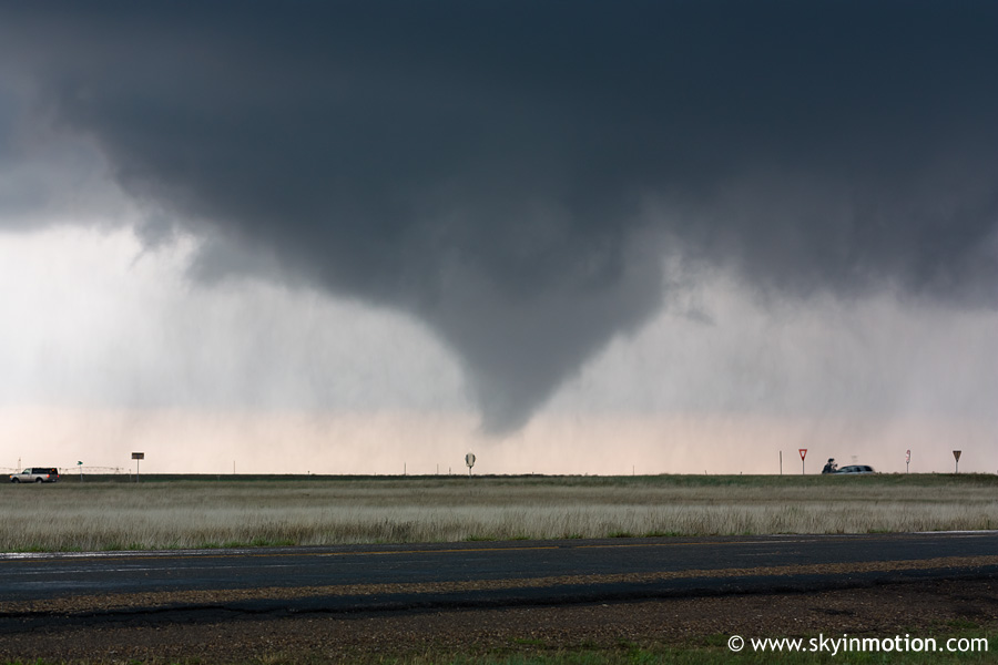
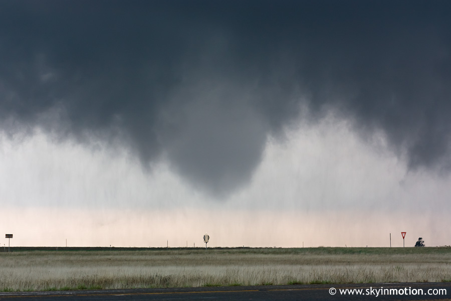
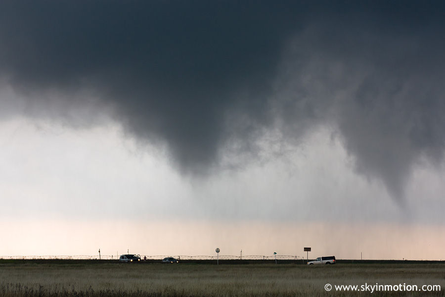
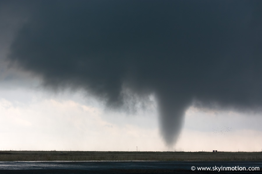
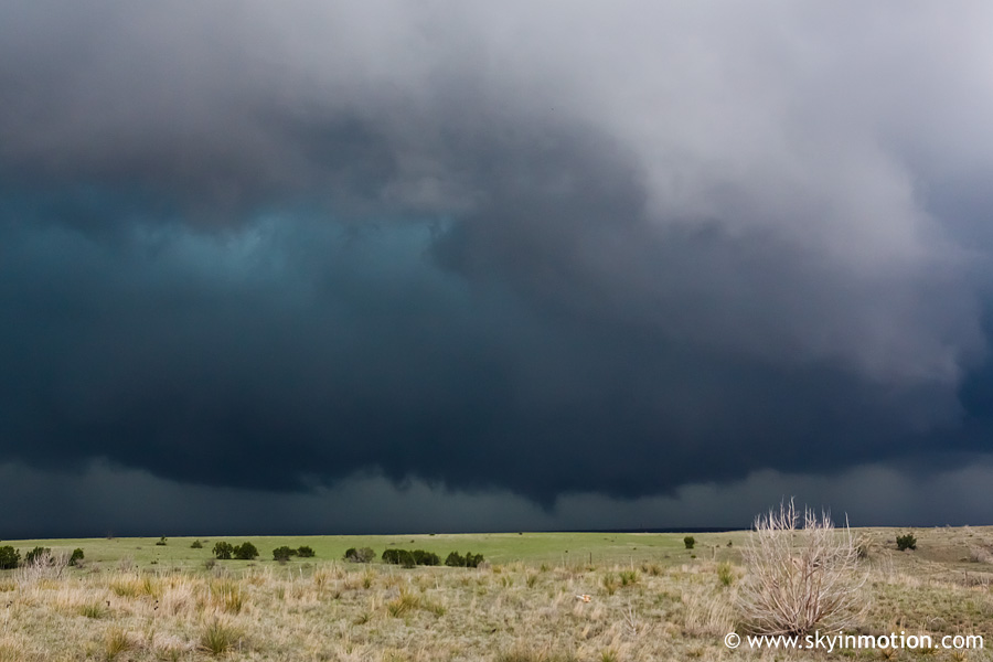
From the TX-70 northbound exit near Boydston, which would soon live in infamy, we watched the main show unfold. The first tornado developed quickly ~2 mi. to our SW.
After only a couple minutes, another appeared just to its NE, only about a mile to our SSW (in image below, intial tornado is on right, new tornado is on left).
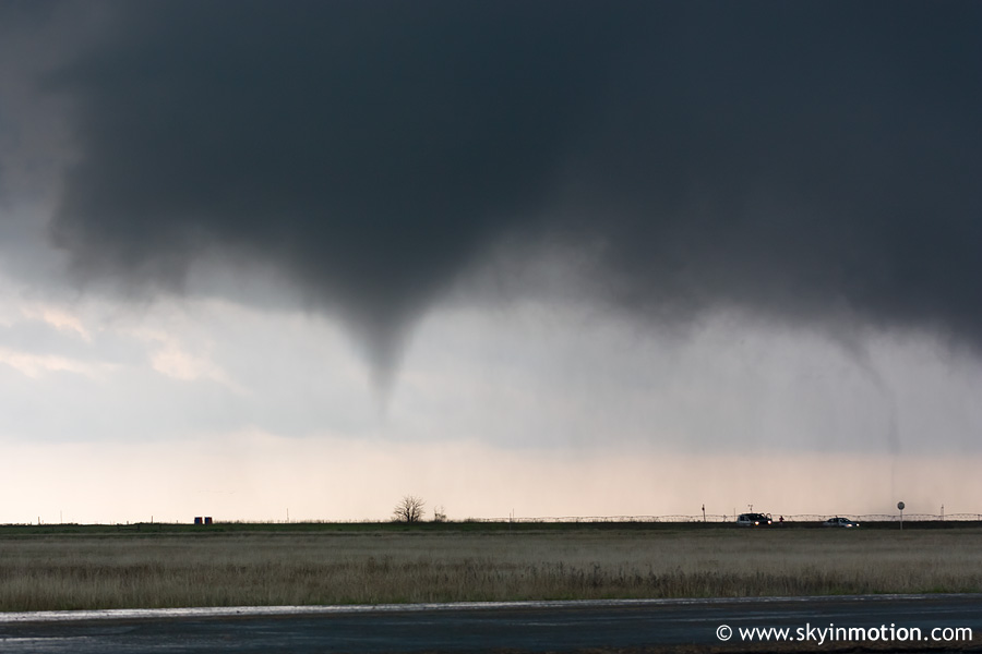
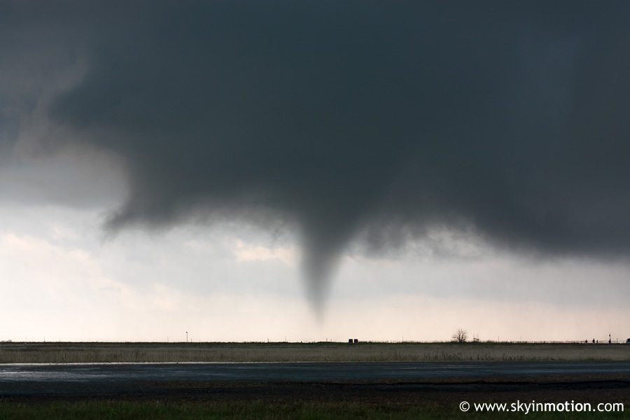
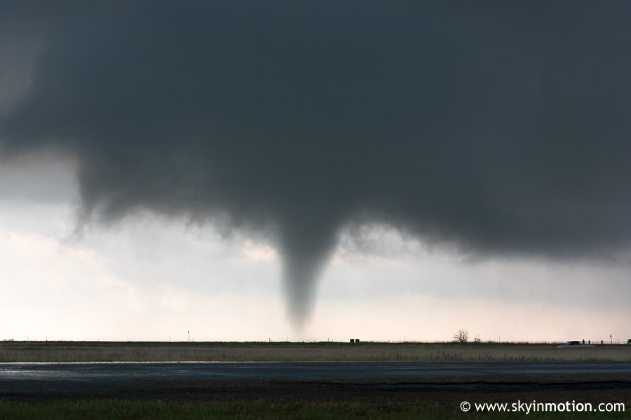
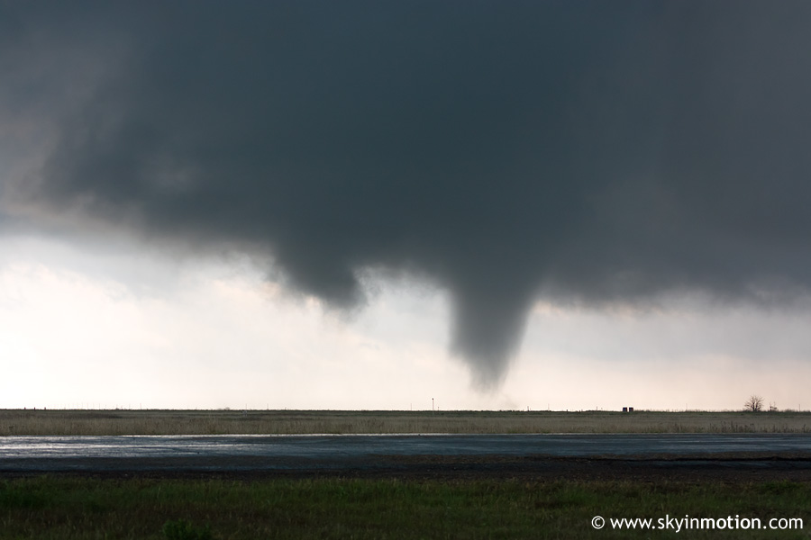
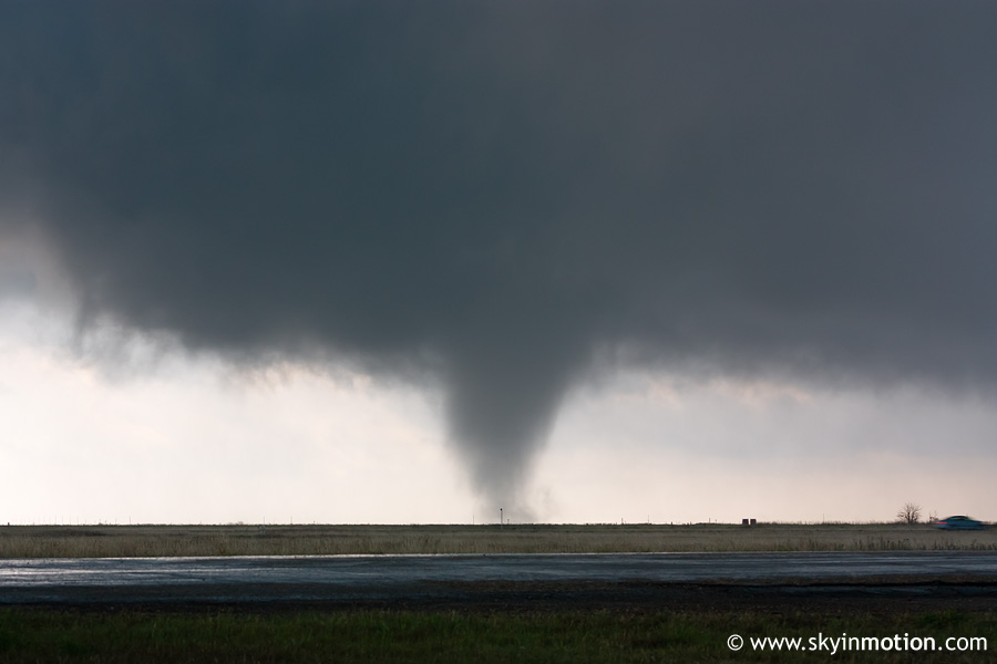
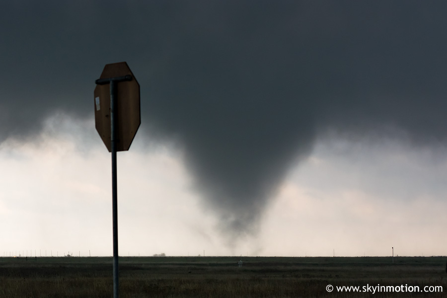
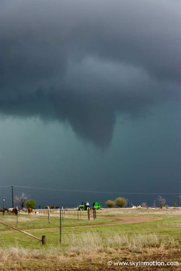
The initial, southwestern tube quickly dissipated while the new one turned into a substantial elephant trunk that persisted for about 6 min.
While not the largest or most photogenic tornado in history, it had some fairly impressive motion at ground level for a time, as seen in Curtis McDonald and Matt Van Every's footage from near our position. While watching the tornado approach I-40 only to dissipate at the last second, I immediately recalled the 2008-05-23 Quinter, KS episode on I-70, though that was a much larger and likely stronger circulation. The messy, HP nature of the storm was quite similar, unfortunately.
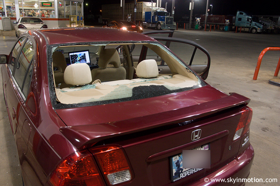
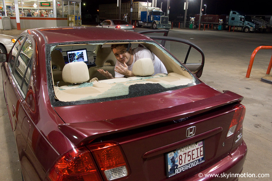
These two tornadoes would prove to be the best and closest of the day for us. Ah, but the real fun was only beginning! The storm had maintained a NNE heading for nearly an hour, such that I'd held onto the laughable hope that we might be able to follow it right up TX-70 to Pampa. Instead, it had taken a hard right as soon as it gained a low-level mesocyclone, and the core was closing in fast. Without any radar data for half an hour due to the overwhelming of towers by chasers streaming live video (a problem I'd experience on every single significant chase of the season), I did not see this, nor was I intelligent enough to anticipate it. We started to get onto the eastbound entrance ramp simply because the tornado itself was about to pass SE of our position, but it was utterly clogged with vehicles abandoned by gleeful chasers. Our collective glee was soon interrupted by baseballs falling from the sky, and Brandon (driver for the day, as usual) could do little but cringe as we waited for tripods and passengers to be loaded into the cars ahead. There must have been 40 vehicles in this line that crept out of the blast zone at the slowest driver's pace -- but wouldn't you know it, ours was the only one to have a grapefruit stone careen through the back windshield, instantly shattering the entire thing to small shards. It's hard to remember, but I think we were basically speechless for about a minute afterwards. I finally looked back to see thousands of shiny, pointy shards covering our camera bags, backpacks, and whatever else was in the back seat -- which thankfully did not include any of the multiple people who wanted to chase with us that morning but we'd left behind! We drove helplessly at around 50 mph for about a mile on the interstate as a steady flow of glass streamed back behind us, then pulled off in a frenzied attempt to brush all the pieces on the back of the car itself into the seat to mitigate the burden on whatever pour souls might end up behind us the rest of the day.
From there, we drove in circles between Jericho and Alanreed as multiple mesocyclones with two storms -- ours and one to its south that eventually crossed I-40 near the same area -- passed nearby. Here is a view from I-40 just E of Jericho as one passed to the NW, producing a brief tornado visible as a partially-condensed funnel in the center of the third shot.
A bit later, we observed a nice, laminar funnel (probable tornado, but cannot confirm) back near Jericho, but were unable to stop and photograph it before it became substantially less impressive.
By that point, the party was over, as linear mode began to dominate. An interesting aspect to this case is that low-level shear was never forecast to be supportive of tornadoes until around 00z, and by that time, there were no discrete supercells left in the TX Panhandle. We can only wonder what might have transpired had the cap held off initiation an extra hour or two. Still not much room for complaint on an April chase so far W, other than our missing the far more photogenic tornado associated with the southern storm near Goodnight, TX.
Oh, and of course... the account would not be complete without visual evidence of our battle scars: