
We intercept an unimpressive storm in a low-CAPE environment southeast of Wichita.
I guess it's just impossible for some of us to pass up chasing opportunities once it gets to be mid-autumn, knowing that any good setup could potentially be the last for a long while. That probably explains why Bryan and I ventured out this day despite a marginal setup that looked less promising with time.
A fairly potent storm system was taking shape over SW KS by this morning, resulting in a major snowstorm for eastern CO. Meanwhile, a cold front was moving through the Panhandles region, with a dryline taking shape a bit farther east across W OK. A warm front extended eastward from the triple point in NW OK/SW KS along the KS/OK border. After taking a look at outlooks and discussions from SPC, NWS OUN, and Stormtrack, it didn't appear any particular location had a high chance of seeing tornadic supercells. The best instability was over SE OK into NE TX, but initiation didn't appear likely there and shear was not as favorable. Meanwhile, instability was not impressive over north-central OK where shear and convergence were better, but it did appear that if any tornadoes at all were to occur, that area would probably be the best bet.
After Bryan and I got out of class at 3:00, we gathered our stuff and hit the road in his Jeep - I-35 northbound, specifically. Traffic through OKC made the first hour or so of the drive less than thrilling, but we made good time after stopping in Guthrie to check data again. By 5:00, we were approaching Ponca City in hopes of getting wifi again. The dry air and deep blue skies we'd experienced most of the way up had given way to a line of convection building along the warm front just to our north in S KS.
Long story short: we'll be sure to avoid Ponca City in the future if possible, not only because we couldn't find wifi anywhere in a town of over 20,000, but the drivers were about as bad as we've seen anywhere, and the road signs were retarded enough to cost us a good 15 or 20 minutes driving in circles.
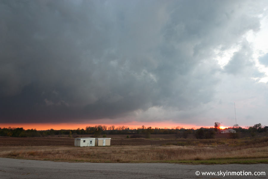
Eventually, we found our way onto US-77 northbound into KS. With the help of Kristina on the phone, we determined that a cell developing just to our northeast was probably the most worthy option to pursue given that sunset was less than an hour away. After a bit more madness with bonehead rural drivers who should probably stick to simple manual labor and leave such intellectual pursuits as operating a vehicle to the rest of us, we arrived in Arkansas City and took US-166 east. Within a few miles, we were coming under the back side of the fairly low-topped but potent-looking cell. We stopped 5-6 miles east of Arkansas City, observing a low cloud base that could be seen stretching for miles and miles, but very little evidence of severe weather. We experienced no notable wind gusts, and only light rain.
As this rather lackluster storm drifted east away from us, we continued eastward for 10 or 15 minutes just for the heck of it, then called it a day as the sun set and we felt cold air in the wake of the storm's passage. On the way home on I-35, we observed very frequent lightning to our northwest with low-topped thunderstorms occurring in SW KS. When we returned home, we learned that a respectable tornado outbreak had occurred in that area near the 500 mb low despite surface temperatures in the low 50s. Cold core strikes again! Nice catch for those who had the foresight to target that area - even SPC and the DDC NWS office were caught off guard.


