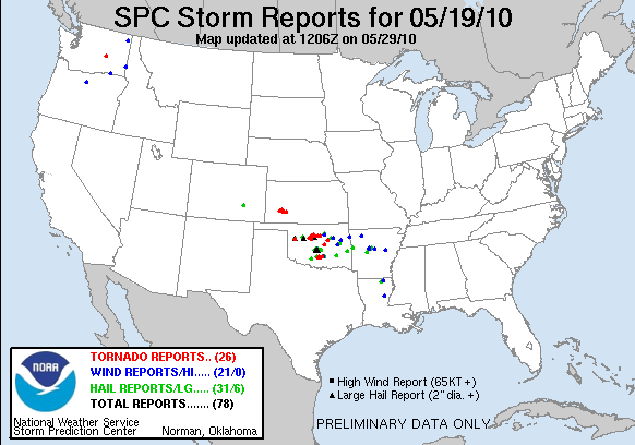
Another day, another cyclic tornadic HP beast.
Observed 2 tornadoes.
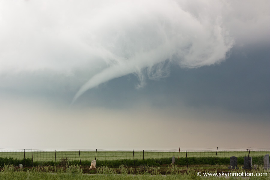
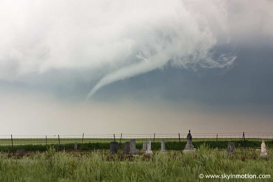
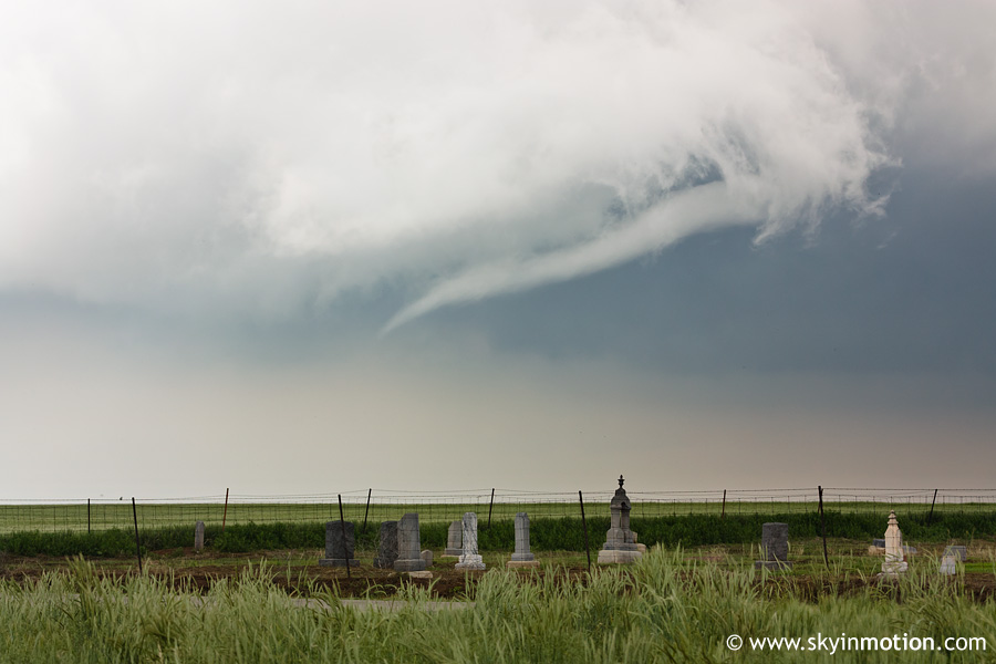
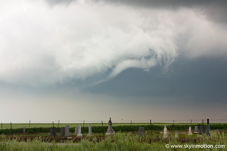
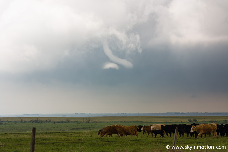
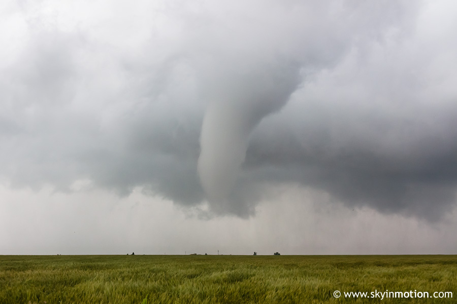
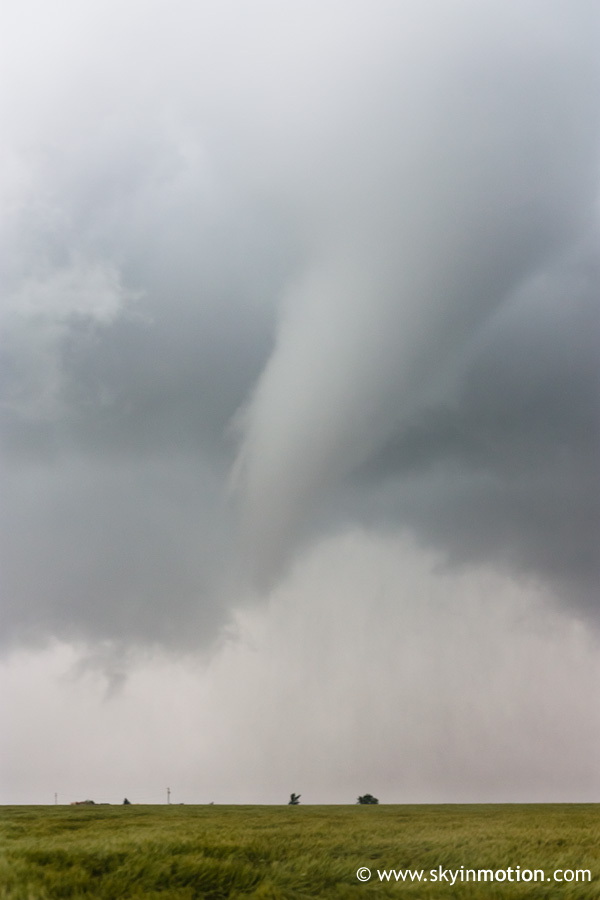
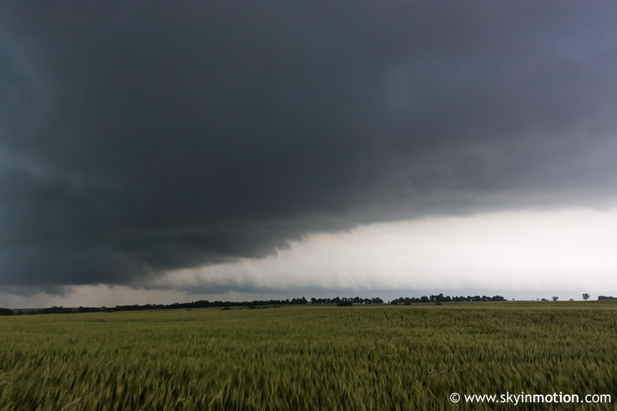
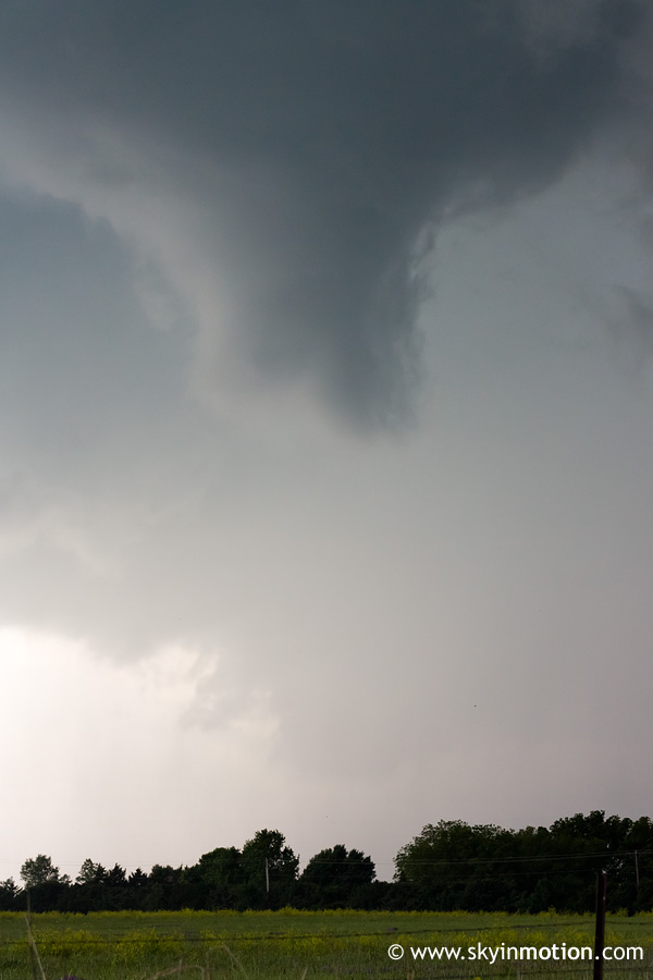
Brandon Lawson and I followed the storm which initiated just N of Watonga for several hours until it reached I-35 near Perry. Strangely, the storm exhibited ominous wall clouds as soon as we neared it in its formative stages near Hitchcock, even as radar indicated a small reflectivity maximum of 35-40 dBZ. Not long thereafter, around 3:20pm, we observed this nearly-horizontal funnel cloud:
It was unclear whether this touched down from our vantage point, though I believe someone on SN reported it as a tornado. The funnel lasted about five minutes and was quite a sight to behold as it snaked around.
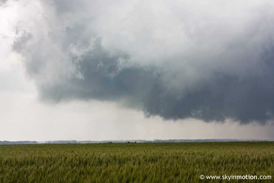
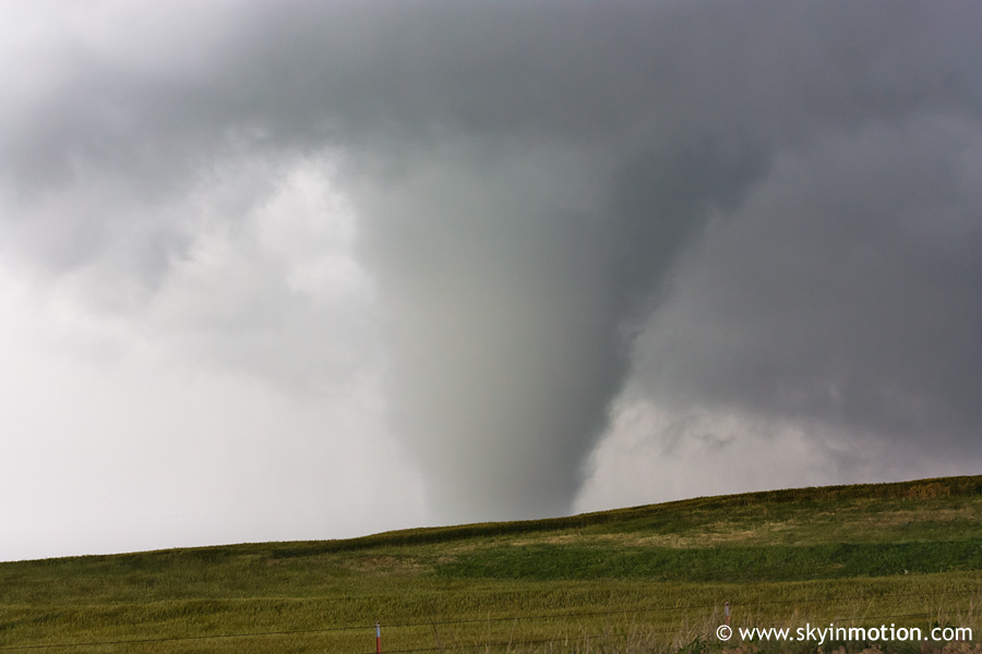
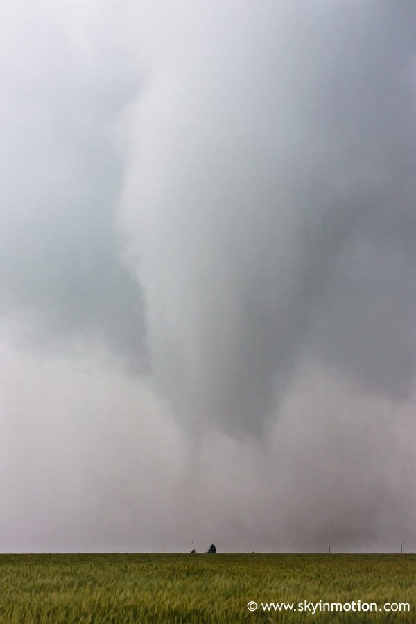
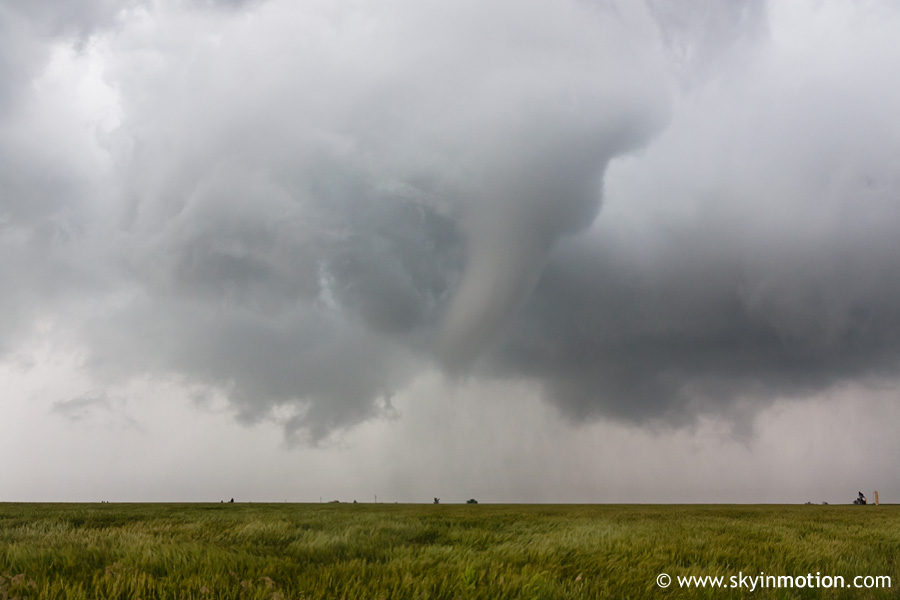
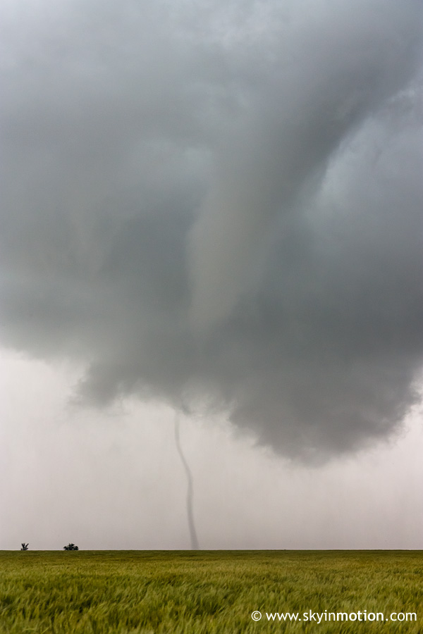
After much hesitation and wringing of hands on whether to follow our storm (which we feared would cross the boundary into more stable air, as it took quite awhile to turn right or produce any more lowerings) or abandon it for the Roger Mills/Dewey Co. beast, it finally showed a surge in reflectivity and echo tops on radar as it slowed down and took a more easterly course, so the decision was easier. Most of the next ~3 hours consisted of playing leapfrog with the 100+ other chasers (mainly local yahoos, it appeared) on OK-51 and squinting our eyes to look for any lowerings back in the massive core, but we were briefly rewarded just W of Hennessey with a large cone tornado a few miles to our NW.
By the time this HP beast reached I-35, we decided to call it good and drop S to the "southern" storm, missing the tornadoes which apparently occurred W of SWO shortly thereafter. We met the second storm near Crescent and followed it out to around Meridian, where we decided the nightmarish combination of terrain and chaser convergence was no longer worth the hassle, so were back in Norman by 9pm. Looks like C OK is officially back in the game after today and May 10 -- though it would sure be nice if we could get just one good non-HP storm this year!